

Utah is one of the best states in the entire country for scattered camping. Hundreds of Utah boondocking camping sites can be found throughout the state, the majority of which are free.
| These Boondocking & Camping Areas are concentrated in the South East part of Utah |
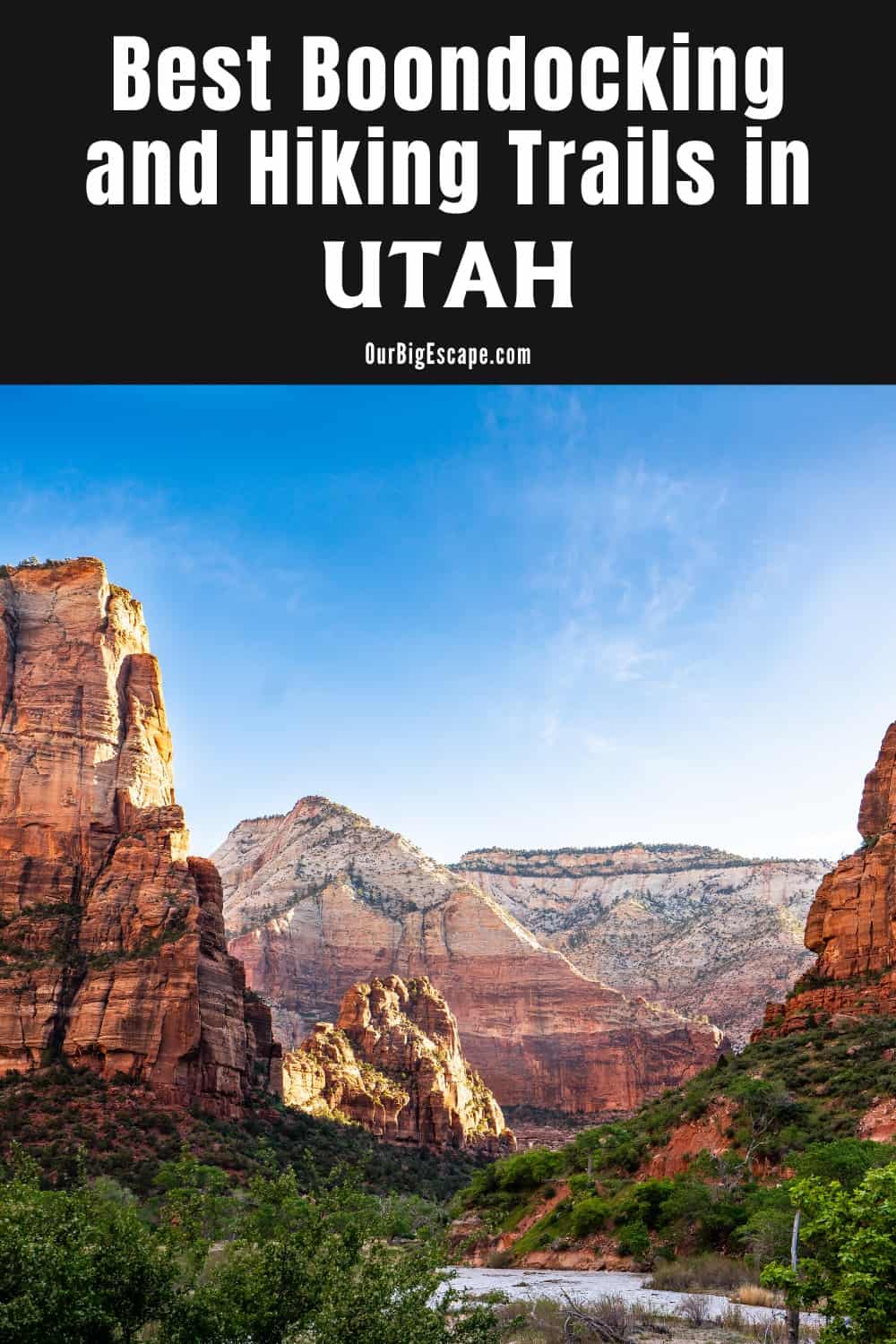
Utah Boondocking Camping Sites
You can pitch camp almost anyplace, however, it’s always better to choose a previously used area. A few of these open free Utah camping places can be found just off the side of the meandering gravel road.
Aside from a few washes, the route is unpaved but not too bad. Most Class C RVs and trailers can probably complete the loop and stay in one of the first few Utah boondocking camping sites, where the road is smoothest and there are the most turnarounds.
Want more ideas to round-out your trip to the South-Western States?
► Arizona, California, Colorado, New Mexico, Nevada, Utah ◄
- 249 Amazing Arizona Boondocking Locations With Maps
- 419 Awesome California Boondocking Campsites And Maps
- 351 Free Colorado Boondocking Locations Along With Maps
- 141 Best New Mexico Boondocking Spots Plus Maps
- 146 Top Nevada Boondocking Sites Including Maps
- 54 Top SW Utah Boondocking Camping Areas Including Maps
- 43 Amazing South-Central Utah Boondocking Campgrounds With Maps
- 36 Free SE Utah Boondocking Camping Sites And Maps
- 21 Favorite West-Central Utah Boondocking Camp Sites Plus Maps
- 33 Best Central Utah Boondocking Sites Also Maps
- 51 Amazing East-Central Utah Boondocking Campsites And Maps
- 24 Top NW Utah Boondocking Locations Including Map
- 32 Free North-Central Utah Boondocking Areas Along With Maps
- 19 Great NE Utah Boondocking Spots With Maps
36 Free SE Utah Boondocking Spots With Maps
check out our video
1. Clay Hills
Address
Clay Hills Road
Utah
GPS: 37.294158, -110.397671
Elevation: 3714′
Management: Public – Bureau of Land Management
Free Utah boondocking camping sites in the Bureau of Land Management: Monticello District. First come -> First Camped. Reservations not accepted.
2. Muley Point Overlook
Address
Muley Point Road
Bluff, Utah
GPS: 37.235187, -109.992233
Elevation: 6343′
Management: Public – National Park Service
The road in is Dirt. The maximum RV length at Muley Point Overlook is 15 feet. You may stay two weeks at Muley Point Overlook. Free Utah camping places within the Glen Canyon RA. This is a dispersed campsite and not a campground. No facilities (toilets, water, trash) provided. If that’s your kind of thing, prepare to be amazed!
3. Mexican Hat Boondocking
Address
Mexican Hat, Utah
GPS: 37.172547, -109.847076
Elevation: 4296′
Management: Public – Bureau of Land Management
The road in is Dirt. There are 1-5 Utah boondocking camping sites at this location and the maximum RV length is 25 feet. Free dispersed camping on BLM land near the Mexican Hat formation north of the ton of the same name. The BLM is bordered by private and native american land, so mind where you camp.
4. Valley of the Mortally Inspired
Address
Mexican Hat, Utah
GPS: 37.197993, -109.846705
Elevation: 4346′
Management: Public – Bureau of Land Management: (Unofficial)
The road in is Dirt and 1-2 miles from a paved road. Valley of the Mortally Inspired is open Year Round. There are 6-15 Free Utah camping places at this location and the maximum RV length is 15 feet. The name for this campsite was ‘inspired’ by the nearby Valley of the Gods, visible from some of these campsites.
5. Valley Of The Gods, Bluff & Mexican Hat, Utah
Address
Valley Of The Gods Road
Bluff, Utah
GPS: 37.316864, -109.850533
Elevation: 5034′
Management: Public – Bureau of Land Managment (Unofficial)
The road in is Gravel and 1 to 15 miles from a paved road. Utah boondocking camping sites at The Valley Of The Gods is a personal favorite. I am totally enamored by the stark, desert beauty!
6. Seven Sailors
Address
Mexican Hat, Utah
GPS: 37.241659, -109.816885
Elevation: 4491′
Management: Public – Bureau of Land Management: (Official)
The road in is Gravel. Seven Sailors is open year round. You may stay 14 days at Seven Sailors. Free Utah camping places on BLM land in the Valley of the Gods. It is .5 miles off highway 163. It I’d listed behind a hill and even though cars dive by it is still private.
7. Comb Ridge Crossing
Address
Mexican Hat, Utah
GPS: 37.263274, -109.658314
Elevation: 4514′
Management: Public – Utah Trust Land (SITLA) (Official)
The road in is Dirt and 1 miles from a paved road. Comb Ridge Crossing is open Year Round, HOT in summer. There are 16-29 Utah boondocking camping sites at this location and the maximum RV length is 25 feet. You may stay 14 Days at Comb Ridge Crossing.
8. San Juan River – Swinging Bridge
Address
Foot Bridge Road
Bluff, Utah
GPS: 37.279575, -109.492776
Elevation: 4341′
Management: Public – Bureau of Land Management
Free Utah camping places in the Bureau of Land Management: Monticello District. This campsite does not use a reservation systerm. First come, first served.
9. Hovenweep Boondocking CR203A
Address
Montezuma Creek, Utah
GPS: 37.43019, -109.06628
Elevation: 5453′
Management: Public – Bureau of Land Management
The road in is Dirt. There are 1-5 Utah boondocking camping sites at this location and the maximum RV length is 35 feet. You may stay 14 days at Hovenweep Boondocking CR203A. A nice, large pull out near Hovenweep National Monument. If you are in a large rig, this is your turn around point on this road. After this, it turns into a steep grade.
10. Central Montezuma Canyon
Address
Monticello, Utah
GPS: 37.601465, -109.251705
Elevation: 5177′
Management: Public – Bureau of Land Management: (Unofficial)
The road in is Dirt and 25 miles from a paved road. Central Montezuma Canyon is open Year Round Weather Permitting, Fall-Spring Best. There are 1-5 Free Utah camping places at this location and the maximum RV length is 35 feet.
11. Arch Canyon
Address
Comb Wash Rd.
Blanding, Utah
GPS: 37.50959, -109.654022
Elevation: 4840′
Management: Public – Bureau of Land Managment (Official)
Utah boondocking camping sites at Arch Canyon has Pit Toilets. Access through Comb Wash, 2 miles from UT-95. Directions to Arch Canyon (A) and from Comb Wash Road (B) at UT-95.
12. County Road 236 Boondock
Address
Blanding, Utah
GPS: 37.524635, -109.748459
Elevation: 6100′
Management: Public – Bureau of Land Managment (Unofficial)
The road in is Dirt and 1.5 miles from a paved road. There are 1-5 Free Utah camping places at this location and the maximum RV length is 30. You may stay 14 days at County Road 236 Boondock. Turn south off of Route 95 onto CR 236 (Balley S Lower Road). Travel through a juniper and pinyon pine forest for about a mile before coming to open range land.
13. Manti-Salal National Forest
Address
Utah
GPS: 37.5859, -109.785
Elevation: 6936′
Management: Public – Forest Service
You may stay 14 days in Utah boondocking camping sites at Manti-Salal National Forest. Lots of sites throughout the park, easily visible from road. This particular location shows several sites with fire rings overlooking the canyon. Very scenic.
14. Salvation Knoll
Address
Blanding, Utah
GPS: 37.561635, -109.813721
Elevation: 7021′
Management: Public – Bureau of Land Management: (Official)
The road in is Dirt and 1 miles from a paved road. There are 6-15 Free Utah camping places at this location and the maximum RV length is 35 feet. Will accommodate everything from tents, campers, and RVs. Good for a single night or a longer-term stay. Kane Gulch Ranger Station does send people up this way to camp.
15. Jct 95 – 261
Address
Unnamed Road
Blanding, Utah
GPS: 37.570671, -109.882549
Elevation: 6801′
Management: Public – Bureau of Land Management
Free Utah boondocking camping sites in the Bureau of Land Management: Monticello District. No reservations. First come, first served. About a half mile of the paved road. Downhill going in, not bad.
16. Grand Gulch
Address
Utah 95
Blanding, Utah
GPS: 37.582931, -109.893541
Elevation: 6772′
Management: Public – Bureau of Land Management
The road in is 4×4. Free Utah camping places in the Bureau of Land Management: Monticello District. No reservations. First come, first served. It is rcommended that you have 4×4 and high clearance to reach this free camping area.
17. Burch Canyon Road
Address
Road 254
Utah
GPS: 37.601438, -109.923472
Elevation: 6998′
Management: Public – Forest Service (Official)
You may stay 14 days in Utah boondocking camping sites at Burch Canyon Road. I drove in this site after dark in my 2 wheel drive van. Pretty easy drive on a hard packed dirt road. Woke up to absolutely gorgeous vista.
18. Human Panted Rocks in Burch Canyon
Address
Lake Powell, Utah
GPS: 37.610409, -109.929119
Elevation: 6811′
Management: Public – Bureau of Land Management: (Official)
The road in is Dirt and 6 miles from a paved road. There are 1-5 Free Utah camping places at this location. Cool little prepared spot on public lands great for tent camping (and you can pull your RV in Nearby)
19. Fry Mesa
Address
Lake Powell, Utah
GPS: 37.622705, -110.083528
Elevation: 5843′
Management: Public – Bureau of Land Management: (Unofficial)
The road in is Dirt and .2 miles from a paved road. There are 1-5 Utah boondocking camping sites at this location. Just off the 95 down a short dirt road, there were a few fire rings set up when we stayed there.
20. Recapture Reservoir
Address
Blanding, Utah
GPS: 37.66744, -109.44365
Elevation: 6066′
Management: Public – Bureau of Land Management: (Official)
The road in is Paved. There are 1-5 Free Utah camping places at this location and the maximum RV length is 45 feet. You may stay 14 days at Recapture Reservoir. Dispersed camping on BLM land around a small lake a few miles north of Blanding, Utah. Look for the sign “Recapture Recreation Area” and turn onto Radio Hill Road.
21. Devils Canyon
Address
Monticello, Utah
GPS: 37.746438, -109.413222
Elevation: 7234′
Management: Public – Forest Service (Official)
Free Utah boondocking camping sites in the Manti-Lasal National Forest just past the devils canyon campground. Very secluded, lots of previous sites with campfire vault toilet about 4 miles in.
22. Road Side
Address
Monticello, Utah
GPS: 37.78413, -109.40574
Elevation: 7464′
Management: Public – Forest Service (Unofficial)
The road in is Paved. There are 1-5 Free Utah camping places at this location and the maximum RV length is unlimited. This is 2 miles from Highway 191 on the right side at an area with a cattle loading ramp that appears in disrepair. Most of the area is green grass so please don’t make it a dirt patch.
23. South Creek Road
Address
Monticello, Utah
GPS: 37.82943, -109.40151
Elevation: 7887′
Management: Public – Forest Service
Free Utah boondocking camping sites along the road past Llyod’s Lake.
24. Blue Mt
Address
Forest Road 0086
Monticello, Utah
GPS: 37.86226, -109.433292
Elevation: 8780′
Management: Public – Forest Service
Free Utah camping places in the Manti-La Sal National Forest’s Monticello Ranger District. First come -> first served. No reservations accepted. This is a high elevation location.
25. Newspaper Rock
Address
Utah 211 Scenic
Monticello, Utah
GPS: 37.988538, -109.519169
Elevation: 6129′
Management: Public – Bureau of Land Management
The maximum RV length at Newspaper Rock is 25 feet. Free Utah boondocking camping sites in the Bureau of Land Management: Monticello District. This campsite does not use a reservation system. First come, first served.
26. Turner Water Canyon
Address
Monticello, Utah
GPS: 38.02581, -109.48304
Elevation: 6542′
Management: Public – Bureau of Land Management: (Unofficial)
The road in is Dirt and 1 miles from a paved road. There are 1-5 Free Utah camping places at this location and the maximum RV length is 25 feet. You may stay 14 at Turner Water Canyon. This dirt road leads to a spectacular panoramic view of the area. It’s about 2 mile or so from the more traveled dirt road which leads to county road 211.
27. Bridger Jack Mesa
Address
Beef Basin Road
Moab, Utah
GPS: 38.086149, -109.594346
Elevation: 5282′
Management: Public – Bureau of Land Management
Bridger Jack Mesa is open all year. Free Utah boondocking camping sites in the Bureau of Land Management: Monticello District. First come ->
28. BLM Dispersed Camping
Address
Monticello, Utah
GPS: 38.090756, -109.566584
Elevation: 5348′
Management: Public – Bureau of Land Management
The road in is Dirt. Free Utah camping places in the Bureau of Land Management: Monticello District. First come -> first camped. No reservations are accepted.
29. Lockhart Rd Needles Dist Canyonlands Natl. Park
Address
Lockhart Rd
Moab, Utah
GPS: 38.1795, -109.66695
Elevation: 4917′
Management: Public – Bureau of Land Managment (Official)
The road in is Gravel. There are 30 or more Utah boondocking camping sites at this location. A popular boondocking area near the Needles District of Canyonlands Natl Park. Get there early if you can, especially on weekends and holidays.
30. Hamburger Rock, Canyonlands UT
Address
Lock Hart Road
Moab, Utah
GPS: 38.199499, -109.671155
Elevation: 4797′
Management: Public – Bureau of Land Management: (Official)
The road in is Dirt and 1 miles from a paved road. Hamburger Rock, Canyonlands UT is open year round I believe. There are 6-15 Free Utah camping places at this location and the maximum RV length is 45 feet. You may stay 14 days at Hamburger Rock, Canyonlands UT.
31. Lockhart Basin Dispersed Camping
Address
Monticello, Utah
GPS: 38.21329, -109.678366
Elevation: 4662′
Management: Public – Bureau of Land Management
Free Utah boondocking camping sites in the Bureau of Land Management: Monticello District. First come -> first camped. No reservations are accepted. Restrooms are available at the (paid) BLM camping area right in the middle of the (free) distributed camping. Dozens of campsites along the road and at Indian Creek, where there is a nice swimming hole.
32. Jacob’s Chair
Address
Utah 95
Lake Powell, Utah
GPS: 37.706954, -110.23939
Elevation: 4849′
Management: Public – Bureau of Land Management
The site is close to the highway, but there is not much traffic. I had no cell service, and the nearest pit toilet is about 10 miles away. Free Utah camping places in the Bureau of Land Management: Monticello District. First come -> first camped. No reservations are accepted.
33. Blue Notch Road BLM Boondock
Address
Hanksville, Utah
GPS: 37.763397, -110.293869
Elevation: 4823′
Management: Public – Bureau of Land Managment (Unofficial)
The road in is Dirt and .5 miles from a paved road. There are 1-5 Utah boondocking camping sites at this location and the maximum RV length is 40+. You may stay 14 days at Blue Notch Road BLM Boondock. Free Dispersed camping in the Bureau of Land Management: Monticello District. First come -> first camped. No reservations are accepted.
34. White Canyon Overlook
Address
Lake Powell, Utah
GPS: 37.798324, -110.304595
Elevation: 4610′
Management: Public (Unofficial)
Free Utah camping places in the Bureau of Land Management: Monticello District. First come -> first camped. No reservations are accepted. West of Natural Bridges National Monument on Hwy 95, just a large pullover site at MP 62.5, but beautiful views of the canyon and not much traffic on Hwy 95 so pretty quiet.
35. Hite Marina Free Campground
Address
Lake Powell, Utah
GPS: 37.873752, -110.392578
Elevation: 3765′
Management: Public – Bureau of Land Management: (Official)
Free Dispersed camping in the Bureau of Land Management: Monticello District. First come -> first camped. No reservations are accepted. The road in is Paved. Hite Marina Free Campground is open Year Round. There are 6-15 Utah boondocking camping sites at this location.
36. Colorado River Bridge Campsite
Address
Lake Powell, Utah
GPS: 37.88889, -110.36625
Elevation: 3812′
Management
Public – National Park Service (Unofficial)
Free Utah camping places in the Bureau of Land Management: Monticello District. First come -> first camped. No reservations are accepted.I had a very nice stay at a great site just off Highway 95 on the south side of the Colorado River Bridge near Hite.
Utah Camping Places on BLM Land
Recreation.gov, which allows you to search for outdoor activities on public lands such as national parks, national forests, and army corps of engineer projects, is the easiest and most effective way to find BLM Utah boondocking camping sites around the state.
Bryce Canyon is a collection of beautiful, amphitheater-shaped canyons famed for their hoodoos. Because of its distant position, the park receives far less foot and car traffic than other National Parks. It is home to 1,000-year-old trees, endangered animals such as the Utah prairie dog, California condor, and southwestern willow flycatcher, as well as 400 native plant species. Seasonal hours for the Visitor Center can be found on the park’s website under the park information category.
Near Mexican Hat, on BLM land, is The Valley of the Gods. Free Utah camping places at Muley Point are within a short distance from the Valley of the Gods. It’s known for its towering rock formations, which are comparable to those seen in adjacent Monument Valley (it’s been dubbed “little Monument Valley”) and include reddish brown buttes, mesas, and towers galore.
Rules Covering Camping on Public Land
The Bureau of Acreage Management (BLM) is in charge of around 42 percent of Utah boondocking camping sites. Outside the bounds of national parks and monuments, state parks, and national recreation areas, these areas are sometimes referred to as “public lands.” Although the BLM manages constructed campgrounds and trails in these locations, the majority of Utah public land is free for Utah camping places with few developed recreation opportunities.
The great thing about public lands is that they belong to all Americans, so anyone can utilize them as long as they follow a few guidelines. Utah boondocking camping sites, or camping outside of approved campgrounds on public lands, is permitted on most public lands unless the location is marked as closed to camping. In general, camping on public lands in Utah is free, making it an excellent choice for budget tourists.
Utah camping places in public lands can be used for a total of 14 days in a 28-day period. After 14 days, the camper must transfer their camp outside of a 25-mile radius of their previous camp. This means you could spend a full season traveling from camp to camp across Utah’s mountains and deserts without paying a single cent.
You May Want to Join Our Boondocking Group on Facebook For More Information
You May Want to Join Our Campfire Recipes Group on Facebook For More Information
Check Out Our Pictures On Instagram – Our Big Escape.