
Finding Utah boondocking campgrounds is super easy, especially with 5 National Parks, 7 National Monuments, 43 State Parks, and endless public lands to explore. Each National Park beckons travelers to immerse themselves in not only the iconic National Parks, but the State Parks, National Monuments and small towns that weave texture into Utah.
| These Boondocking & Camping Areas are concentrated in the South-Central part of Utah |
Utah Boondocking Campgrounds
The National Parks of Arches and Canyonlands, as well as the bustling tourism basecamps of Moab and Green River, are all located in Utah. Further south, visitors can visit Bears Ears country, which includes active and ancient Native American communities as well as historic monuments such as Monument Valley and Hovenweep.
Utilizing Utah camping spots is one of the best ways to take advantage of the state’s many natural wonders. Hundreds of Utah boondocking campgrounds may be found around the state, as well as over 20 million acres of public property where you can pitch your tent.
From ultra-secluded backcountry sites to full-service glamping resorts and everything in between, there’s so
Want more ideas to round-out your trip to the South-Western States?
► Arizona, California, Colorado, New Mexico, Nevada, Utah ◄
- 249 Amazing Arizona Boondocking Locations With Maps
- 419 Awesome California Boondocking Campsites And Maps
- 351 Free Colorado Boondocking Locations Along With Maps
- 141 Best New Mexico Boondocking Spots Plus Maps
- 146 Top Nevada Boondocking Sites Including Maps
- 54 Top SW Utah Boondocking Camping Areas Including Maps
- 43 Amazing South-Central Utah Boondocking Campgrounds With Maps
- 36 Free SE Utah Boondocking Camping Sites And Maps
- 21 Favorite West-Central Utah Boondocking Camp Sites Plus Maps
- 33 Best Central Utah Boondocking Sites Also Maps
- 51 Amazing East-Central Utah Boondocking Campsites And Maps
- 24 Top NW Utah Boondocking Locations Including Map
- 32 Free North-Central Utah Boondocking Areas Along With Maps
- 19 Great NE Utah Boondocking Spots With Maps
43 Amazing South-Central Utah Boondocking Campgrounds
check out our video
1. Alstrom Point
Address
Utah
GPS: 37.05908, -111.36553
Elevation: 4685′
Management: Public – Forest Service
The road in is 4×4 and 25 miles from a paved road. There are 6-15 Utah boondocking campgrounds at this location. Alstrom Point, the most spectacular place I have ever camped. It is a fairly high elevation rock cliff, overlooking lake Powell.
2. Smoky Mountain – Grand Staircase-Escalante National Monument
Address
Utah
GPS: 37.1879, -111.4515
Elevation: 5656′
Management: Public – Bureau of Land Management: (Unofficial)
The road in is Dirt and 22 miles from a paved road. There are 1-5 Utah camping spots at this location. Unbelievable cliff views overlooking Utah, Arizona and Lake Powell. You’ll need a pretty capable SUV or 4×4 to get to this site…and you cannot access it during or after a rain.
3. Sooner Rocks Campsite
Address
40.1 miles from Highway 12 (just past Reference Marker 65) on the right (west) side of Hole-in-the-Rock Road.
Utah
GPS: 37.329007, -111.059914
Elevation: 4278′
Management: Public – Bureau of Land Management: (Official)
The road in is Dirt and 40 miles from a paved road. Sooner Rocks Campsite is open year round. There are 1-5 Utah boondocking campgrounds at this location. You may stay 14 days at Sooner Rocks Campsite.
4. Harris Wash Campsite
Address
Utah
GPS: 37.63078, -111.347213
Elevation: 5003′
Management: Public – Bureau of Land Management: (Official)
The road in is Dirt. Harris Wash Campsite is open year round. There are 1-5 Utah camping spots at this location. You may stay 14 days at Harris Wash Campsite.
5. Sandthrax Campground
Address
Utah 95
Hite, Utah
GPS: 38.016334, -110.532037
Elevation: 4446′
Management: Public – Bureau of Land Management
The road in is Dirt and <1 miles from a paved road. Sandthrax Campground is open all year. There are 6-15 Utah boondocking campgrounds at this location and the maximum RV length is 35 feet.
6. Starr Springs Dispersed Camping
Address
Starr Spring Campground Road
Hite, Utah
GPS: 37.848158, -110.656695
Elevation: 6070′
Management: Public – Bureau of Land Management
The road in is Dirt. You may stay 14 days in Utah camping spots at Starr Springs Dispersed Camping. No facilities. This is bring what you need, take it all out with you camping.
7. Halls Creek
Address
BLM 132220
Utah
GPS: 37.7178, -110.930143
Elevation: 5262′
Management: Public – Bureau of Land Management
Free Utah boondocking campgrounds in the Bureau of Land Management: Richfield District. First come -> first camped. No reservations are accepted.
8. Camp south of Capitol Reef NP off Burr Trail Road
Address
Torrey, Utah
GPS: 37.772808, -110.943015
Elevation: 5223′
Management: Public – Bureau of Land Management: (Unofficial)
The road in is Dirt and 40 miles from a paved road. There are 1-5 Utah camping spots at this location. Camping is scarce in Capitol Reef NP. This is a nice camp just over 4 miles south of where the Burr Trail road leaves the park.
9. Grand Staircase Escalante NM – Stud Horse Peaks
Address
Burr Trail Road
Boulder, Utah
GPS: 37.868208, -111.111686
Elevation: 6768′
Management: Public – Bureau of Land Management
Free Utah boondocking campgrounds in the Bureau of Land Management. No reservations. First come, first served.
10. Grand Staircase Escalante NM – Horse Canyon
Address
Burr Trail Road
Escalante, Utah
GPS: 37.92206, -111.204335
Elevation: 5935′
Management: Public – Bureau of Land Management
Free Utah camping spots in the Bureau of Land Management: N/A District. No reservations. First come, first served.
11. Hells Backbone Road
Address
Boulder, Utah
GPS: 37.900584, -111.481361
Elevation: 6776′
Management: Public – Forest Service
The road in is Dirt. There are 6-15 Utah boondocking campgrounds at this location. Small dirt road on the left off Hells Backbone Road. Numerous possibilities for campsites.
12. Dispersed Camping off Hell’s Backbone Road
Address
Boulder, Utah
GPS: 37.894285, -111.470232
Elevation: 6870′
Management: Public – Forest Service (Unofficial)
Utah camping spots at an easily accessible area with lots of different sites suitable for all sized vehicles. Some sites are smaller and a little harder to get to because of the windy road, but some sites are very easy, and most all of them are very flat.
13. North New Home Bench
Address
Forest Road 1431
Boulder, Utah
GPS: 37.890785, -111.461945
Elevation: 6814′
Management: Public – Forest Service (USDA) (Unofficial)
Free Utah boondocking campgrounds near highway 12, just outside of Boulder in the Dixie National Forest. This would probably work best as an overnight stop.
14. Calf Creek Overflow
Address
Boulder, Utah
GPS: 37.87515, -111.44858
Elevation: 6654′
Management: Public – Bureau of Land Management: (Official)
Look in trees for secluded sites. Utah camping spots on East side of road. North of upper calf Creek falls trailhead.
15. Grand Staircase Escalante NM – Durffey Mesa
Address
Burr Trail Road
Boulder, Utah
GPS: 37.86287, -111.342417
Elevation: 5932′
Management: Public – Bureau of Land Management
Free Utah boondocking campgrounds in the Bureau of Land Management: N/A District. First come -> first served. No reservations accepted.
16. Burr Trail Road Boondock
Address
Boulder, Utah
GPS: 37.848545, -111.370552
Elevation: 5839′
Management: Public – Bureau of Land Managment (Unofficial)
The road in is Paved. There are 1-5 Utah camping spots at this location and the maximum RV length is 40+. Dispersed camping spots are hard to find at the north end of Burr Trail. We had been planning to camp at Deer Creek but it’s too small for most RVs so we backtracked about a mile to this large pull out.
17. Harris Wash Campsite
Address
Utah
GPS: 37.63078, -111.347213
Elevation: 5003′
Management: Public – Bureau of Land Management: (Official)
Free Utah boondocking campgrounds in the Bureau of Land Management: N/A District. First come -> first served. No reservations accepted. The road in is Dirt. Harris Wash Campsite is open year round. There are 1-5 campsites at this location. You may stay 14 days at Harris Wash Campsite.
18. Old Sheffield Road
Address
Escalante, Utah
GPS: 37.722897, -111.437623
Elevation: 6020′
Management: Public – Bureau of Land Management: (Official)
Utah camping spots at Old Sheffield Road is open year round. You may stay 14 days at Old Sheffield Road. Easy access down all gravel road. I saw several marked sites along the road, and some unmarked. Made it back in a fwd sedan, no problem.
19. Grand Staircase Escalante NM – Spencer Flat
Address
Spencer Flat Road
Escalante, Utah
GPS: 37.726656, -111.443787
Elevation: 5935′
Management: Public – Bureau of Land Management
Free Utah boondocking campgrounds in the Bureau of Land Management: N/A District. Reservations are not accepted at this campsite.
20. Escalante Monument Area
Address
Escalante, Utah
GPS: 37.747888, -111.458359
Elevation: 6309′
Management: Public – Bureau of Land Management
Beautiful Utah camping spots right off hwy 12. There is a relay tower on top of the hill and camp spots for at least a half dozen campers with plenty of privacy. I was there for about a week and had no problems.
21. Tin Can Flat
Address
2.5 miles from Highway 12
Utah
GPS: 37.696603, -111.508203
Elevation: 5548′
Management: Public – Bureau of Land Management: (Official)
The road in is Dirt and 2.5 miles from a paved road. Tin Can Flat is open year round. There are 1-5 Utah boondocking campgrounds at this location. You may stay 14 days at Tin Can Flat.
22. Grand Staircase Escalante NM – Tin Can Flat
Address
Hole in the Rock Road
Escalante, Utah
GPS: 37.714627, -111.514861
Elevation: 5663′
Management: Public – Bureau of Land Management
Free Utah camping spots in the Bureau of Land Management: N/A District. First come -> first camped. No reservations are accepted. Tin can flats is a wide open field with a few trees scattered about. no services. take it out with you!!! good spot to boondock, but lots of dust from the road if the wind is blowing west.
23. HWY12/Hole in the Rock Road
Address
Escalante, Utah
GPS: 37.723522, -111.527199
Elevation: 5715′
Management: Public – Bureau of Land Managment (Official)
Utah boondocking campgrounds at BLM/Escalante National Monument. Overnight permits are required within the Monument for all overnight car camping or backpacking. Permits are free of charge and may be obtained at any of our visitor centers or at developed trailheads. The road in is Gravel and 0.2 miles from a paved road.
24. Dixie National Forest
Address
Utah
GPS: 37.682508, -111.833474
Management: Public – Forest Service (Official)
There are 1-5 Utah camping spots at this location. You may stay 14 days at Dixie National Forest. We looked for a place near Bryce Canyon and turned off north on 148 in the Dixie National Forest. There was a sign that said not to drive off the road except in the designated areas. We drove a couple miles down the road and found a site with a nice built up fire ring and stopped there.
25. Fremont River
Address
East Hartnet Road South
Torrey, Utah
GPS: 38.275325, -111.081501
Elevation: 4810′
Management: Public – Bureau of Land Management
Free Utah boondocking campgrounds in the Bureau of Land Management: Richfield District. Reservations are not accepted at this campsite.
26. Fremont Granarysite
Address
Torrey, Utah
GPS: 38.27537, -111.10799
Elevation: 4882′
Management: Public – National Park Service (Official)
Free Utah camping spots in the Bureau of Land Management: Richfield District. Reservations are not accepted at this campsite. The road in is Paved. Fremont Granarysite is open weather permitting.
27. East of Capitol Reef Boondock
Address
Hanksville, Utah
GPS: 38.277878, -111.130745
Elevation: 5171′
Management: Public – Bureau of Land Managment (Unofficial)
Free Utah boondocking campgrounds in the Bureau of Land Management: Richfield District. Reservations are not accepted at this campsite. The road in is Paved. You may stay 14 at East of Capitol Reef Boondock.
28. Capitol Reef BLM Back Road
Address
Torrey, Utah
GPS: 38.25632, -111.12543
Elevation: 5059′
Management: Public – Bureau of Land Management: (Unofficial)
Free Utah camping spots in the Bureau of Land Management: Richfield District. Reservations are not accepted at this campsite. Great spot for high/medium clearance. Out of view from road and private. 3 spo.ts
29. The Mix Pad
Address
Caneville Washington Road
Hanksville, Utah
GPS: 38.339514, -111.030855
Elevation: 4633′
Management: Public – Bureau of Land Management
Free Utah boondocking campgrounds in the Bureau of Land Management: Richfield District. Reservations are not accepted at this campsite.
30. West of Capitol Reef NP
Address
UT 24
Torrey, Utah
GPS: 38.326271, -111.364098
Elevation: 6486′
Management: Public – Forest Service (USDA) (Official)
The road in is Dirt. West of Capitol Reef NP is open Year-round. There are 6-15 Utah camping spots at this location and the maximum RV length is Any. On the north side of UT-24 just west of the Capitol Reef border between mile markers 73 and 74 are two gorgeous spots. Look for the dirt entrances and watch for rocks. Each can hold about 5 rigs.
31. Sand Creek
Address
Torrey, Utah
GPS: 38.316304, -111.440717
Elevation: 7054′
Management: Public – Forest Service
The road in is Dirt and 1/2mi miles from a paved road. There are 1-5 Utah boondocking campgrounds at this location. Free dispersed camping in Fishlake National Forest’s Loa District. Popular with OHV’s, passenger cars can easily make it the first 1/2mi or so to the water tanks (the point shown) before FR146 drops down to the creekbed.
32. Bea’s Lewis Flat Rd
Address
Torrey, Utah
GPS: 38.298299, -111.389288
Elevation: 6765′
Management: Public – Bureau of Land Management
The road in is Dirt and 0.5 miles from a paved road. Bea’s Lewis Flat Rd is open Year Round. There are 1-5 Utah camping spots at this location. You may stay 14 days at Bea’s Lewis Flat Rd.
33. Fish Creek Trail
Address
Teasdale, Utah
GPS: 38.193922, -111.401379
Elevation: 8698′
Management: Public – Forest Service (Official)
The road in is Dirt. There are 6-15 Utah boondocking campgrounds at this location. You may stay 14 days at Fish Creek Trail. A few campsites (with fire rings) just up the trail from the trailhead parking lot. Trail is mostly used for ATV/OHV. 4WD car can make it up right to the campsites, but road is pretty rough. Easiest is to park at the parking lot and walk ~5-10 minutes up to the campsites. Very beautiful and pea
34. Boulder Mountain
Address
Grover, Utah
GPS: 38.144817, -111.329269
Elevation: 8954′
Management: Public – Forest Service (USDA) (Official)
The road in is Dirt and 1/8 mile or less miles from a paved road. You may stay 16 Days at Boulder Mountain. Several possible boondock sites along Hwy 12 between Grover and Boulder. This is national forest land. A nice group of 3-5 potential Utah camping spots is located maybe 5 miles S. of Grover at about 8500 ft. elevation.
35. Lower Bowns Reservoir Boondock
Address
Grover, Utah
GPS: 38.104576, -111.275765
Elevation: 7415′
Management: Public – Forest Service (USDA) (Official)
The road in is Dirt. Located adjacent to Lower Bowns Campground. These Utah boondocking campgrounds are nothing more than a compacted dirt area w/o shade. There are vault toilets within walking distance at the campground. There were a lot of OHV in the area while we were there and numerous families enjoying the day use area on the lake.
36. Oak Creek Canyon Road
Address
Torrey, Utah
GPS: 38.0888, -111.106707
Elevation: 5801′
Management: Public – Bureau of Land Management: (Unofficial)
Utah camping spots on BLM lands. I stumbled across this nice little site late a night after not finding any other spots along Bullfrog/Notom Road (south of Sheets Gulch). A sign that says “Oak Creek Canyon” on the west side of Notom road leads to a small dirt road that leads uphill for 2 miles or so.
37. Cedar Mesa Campground
Address
Notom-Bullfrog Road
Capitol Reef National Park, Utah
GPS: 38.007356, -111.08464
Elevation: 5607′
Management: Public – National Park Service (Official)
Located within Capitol Reef National Park, this campground has 5 Utah boondocking campgrounds with picnic tables and fire pits (and grills). There is a pit toilet but no water. The road in is Gravel. Cedar Mesa Campground is open year-round. There are 1-5 campsites at this location.
38. Round Up Flat – Dixie NF
Address
Forest Road 180
Boulder, Utah
GPS: 38.041527, -111.323349
Elevation: 9530′
Management: Public – Forest Service (USDA) (Unofficial)
Utah camping spots is a large open area for free, dispersed camping. Dixie National Forest. About 13 miles north of Boulder, Utah on the east side of Highway 12. Turn right (east) onto forest road 180. If you see a sign on the left side of hwy12 that tells you to turn left to Bowns Point Trail, you just missed the turn off.
39. Lower Bowns Point Fork
Address
Forest Road 554
Boulder, Utah
GPS: 38.046104, -111.333382
Elevation: 9858′
Management: Public – Forest Service (USDA) (Unofficial)
The road in is Gravel. There are 1-5 Utah boondocking campgrounds at this location and the maximum RV length is 30′. You may stay 14 nights at Lower Bowns Point Fork.
40. Deer Creek Lake
Address
Boulder, Utah
GPS: 38.014376, -111.375742
Elevation: 9274′
Management: Public – Forest Service (Official)
The road in is Gravel and 1/4 miles from a paved road. There are 1-5 dispersed campgrounds in Utah at this location and the maximum RV length is 25 feet.
41. Deer Creek Lake – Dixie NF
Address
Forest Road 3302
Boulder, Utah
GPS: 38.007759, -111.39579
Elevation: 8790′
Management: Public – Forest Service (USDA) (Unofficial)
The road in is Dirt and 0.4 miles from a paved road. There are 1-5 Utah boondocking campgrounds at this location and the maximum RV length is medium. You may stay 14 nights at Deer Creek Lake – Dixie NF. Free, dispersed car (RV) camping near Deer Creek Lake Trail in Utah’s Dixie National Forest. This is primitive dispersed camping. You wont find any facilities here other than maybe a primitive fire ring and a small stream. No drinking water available.
42. Dixie National Forest Dispersed
Address
Boulder, Utah
GPS: 37.991682, -111.426425
Elevation: 7986′
Management: Public – Forest Service (Unofficial)
The road in is Dirt and Less than 1 miles from a paved road. Dixie National Forest Dispersed is open When Accessible. There are 1-5 dispersed campgrounds in Utah at this location. You may stay 14 days at Dixie National Forest Dispersed. After visiting Lower Calf Creek Falls in Escalate Grand Staircase NM we found this spot right off the road
43. Amazing Huge Meadow Off Hell’s Backbone Road
Address
Panguitch, Utah
GPS: 37.96643, -111.55272
Elevation: 8281′
Management: Public – Forest Service (Unofficial)
The road in is Gravel and Appx 5 miles from a paved road. There are 1-5 Utah boondocking campgrounds at this location. Huge flat area with an access road right down the middle of it. Probably 10 acres, couple of fire rings, and a view across a fence of another 15 acres and wooded hillside beyond. Not a lot of shade though the northwest corner of the meadow has some shade. Most appears to have been impacted.
Finding Utah Camping Spots
Free Utah boondocking campgrounds may be found east of Escalante and south of Highway 12 in chevalier. Within the Grand Staircase-Escalante National Monument, these dispersed campsites are located on BLM land.
The Grand Staircase-Escalante National Monument covers around 1.9 million acres of public land in the United States. The Monument’s size, resources, and remoteness provide extraordinary opportunities for geologists, paleontologists, archeologists, historians, and biologists in their scientific research, education, and exploration, from its spectacular Grand Staircase of cliffs and terraces to the wonders of the Escalante River Canyons.
Locations of Utah Boondocking Campgrounds
Zion National Park is one of the five most visited national parks in the United States. There are only two campgrounds on the property: the South Campground and the Watchman Campground. Lava Point, the park’s third campground, located about an hour and a half north of the region.
Pit toilets and trash cans are provided at these Utah boondocking campgrounds, but there is no drinking water and no showers. Lava Point is free, unlike other national park campgrounds, albeit it is only open from May to October.
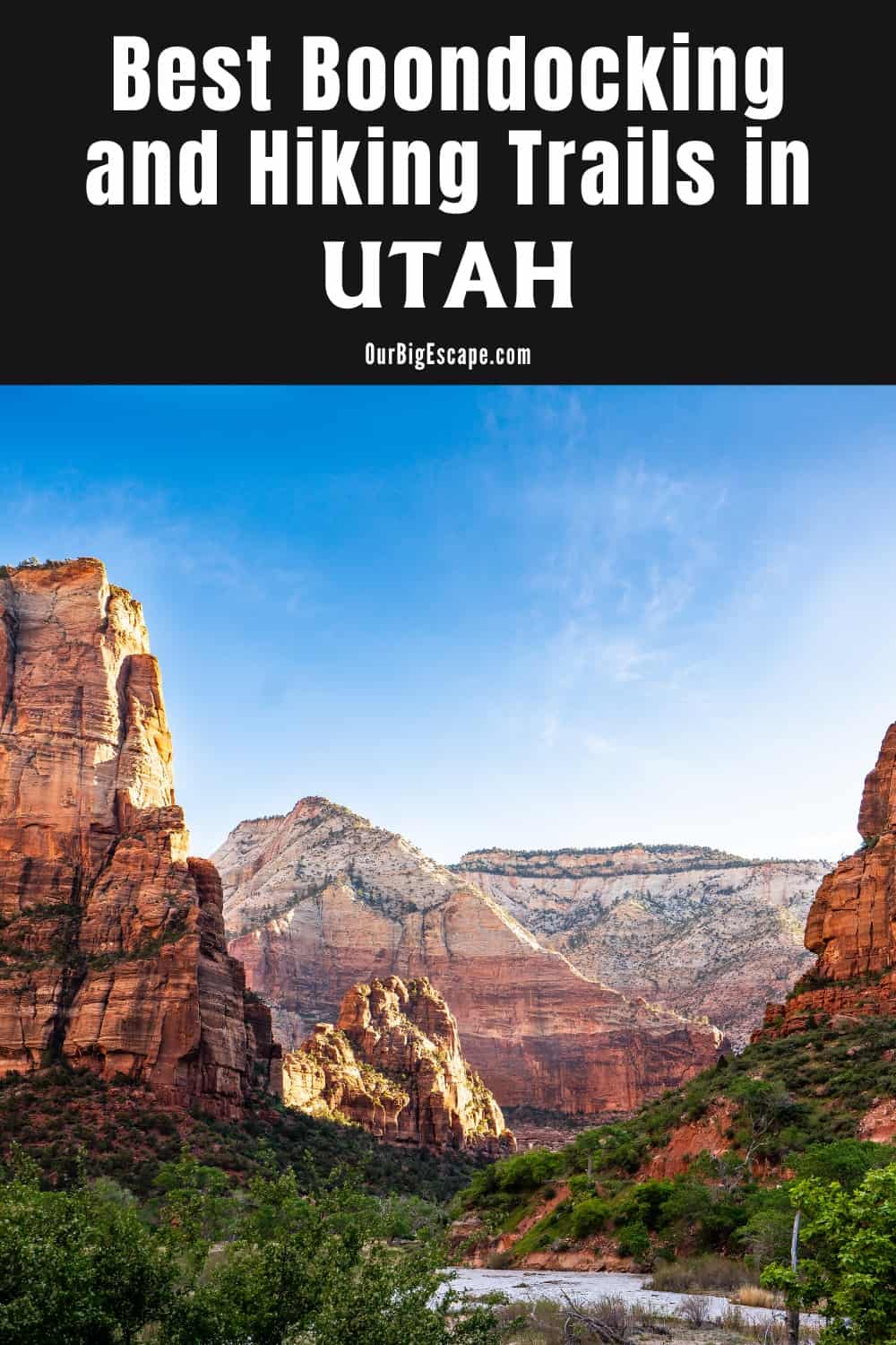
The primary attraction here is Zion. Angel’s Landing, for example, is famed for its vast views, which are ideal for Instagram pictures. The vibrant town of St. George is just over an hour away if you need some civility.
High cliffs, tight valleys, and a stunning outlook characterize Zion National Park. Many well-known walks can be found throughout the park. Angels Landing is a challenging switchback trail with breathtaking views from the canyon’s rim. The Narrows “Trail,” a long journey through a river that runs between two steep gorges, is another well-known hike. The East Rim Trail, which leads to the park’s highest point, the Slot Canyon Subway Trail, and the family-friendly but equally stunning Kayenta Trail are among the park’s other prominent routes. For trekkers, there’s also the paved Emerald Pools Trail and the more difficult West Rim Trail.
You May Want to Join Our Boondocking Group on Facebook For More Information
You May Want to Join Our Campfire Recipes Group on Facebook For More Information
Check Out Our Pictures On Instagram – Our Big Escape.