
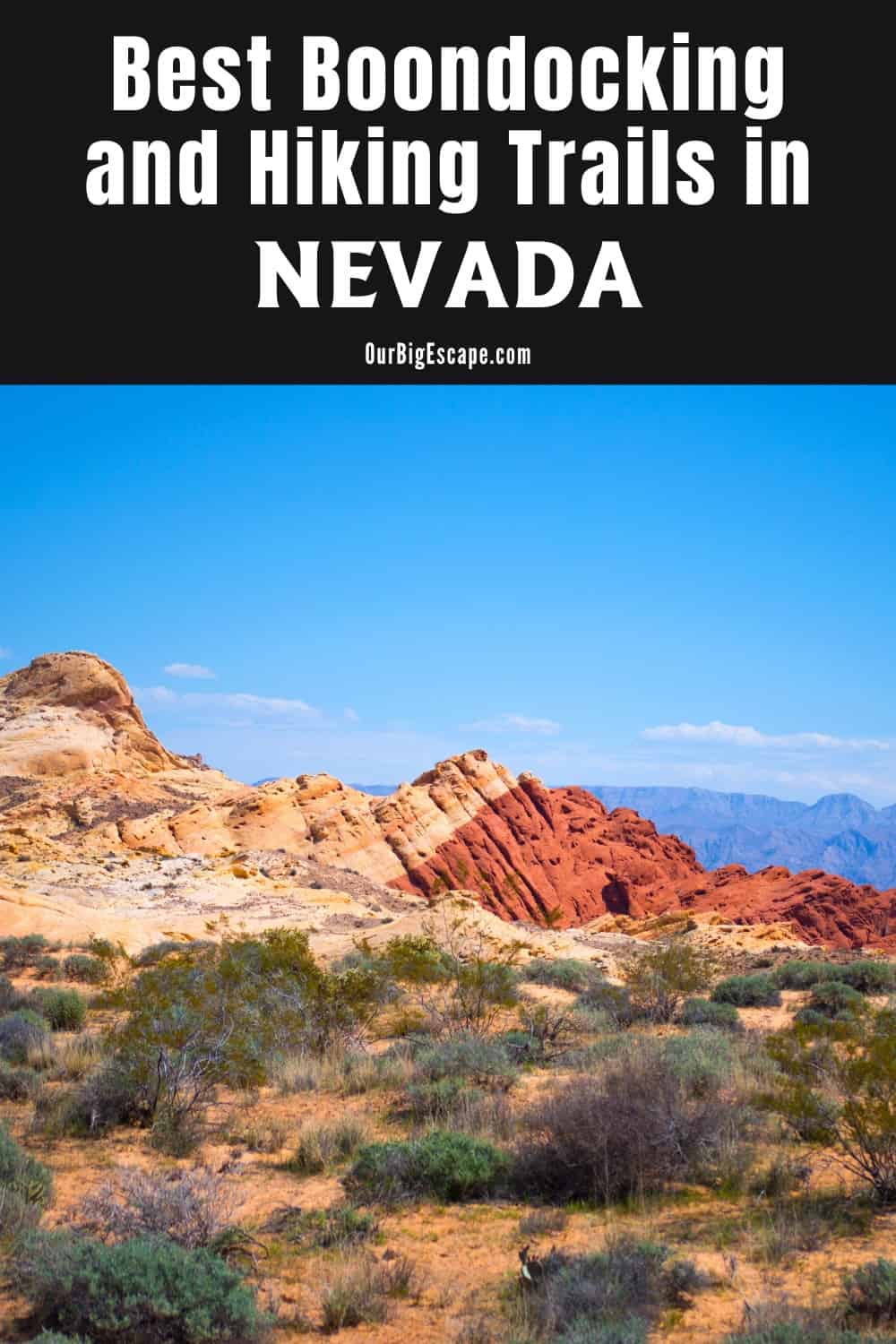
Extensive Nevada boondocking sites demonstrate why the Battle Born State is one of the most popular destinations for boondockers in the United States. On federally owned land (nearly 85% of the state), you can camp for free.
Jump directly to the 50 Northern Nevada Boondocking Sites
Jump directly to the 43 Central Nevada Dispersed Camping
Jump directly to the 53 Southern Nevada Booondocking Spots
Nevada Boondocking Sites
In the mountains surrounding Reno, visit gold-rush ghost towns, park your RV in red-rock canyons, or wake up next to lush lakes and valleys. Sleep deep in the mountains around Elko and learn about cowboy lifestyle. Summit mountain stands among the old bristlecone pines in Great Basin National Park. Enjoying Nevada boondocking sites is an unforgettable experience, with so much public land and natural beauty.
If you want to avoid the throng, head to the state’s central and northeastern regions. The population is minimal, and breathtaking mountains and high deserts may be seen around every corner. Contact the local BLM office for ideas if you’re not sure where to begin narrowing down your boondocking alternatives in Nevada. Camping is permitted on BLM property as long as you do not stay in one area for more than 14 days. Following that, you’ll have to relocate at least 25 miles away.
The benefits of boondocking in Nevada are numerous. It’s much better if you can find the proper camping!
50 Northern Nevada Boondocking Sites
Jump directly to the 43 Central Nevada Dispersed Camping
Jump directly to the 53 Southern Nevada Booondocking Spots
1. Blue Mass Scenic Area Dispersed
Address
Unnamed Road
Tippett, Nevada
GPS: 39.762963, -114.284811
Elevation: 5942′
Management: Public – Bureau of Land Management
Blue Mass Scenic Area Dispersed is open all year. Free Nevada boondocking sites in the Bureau of Land Management N/A District. No reservations. First come, first served.
2. Kalamazoo
Address
Kalamazoo Road
Ely, Nevada
GPS: 39.567273, -114.59584
Elevation: 7051′
Management: Public – Forest Service
Kalamazoo is open Jun-Sep. Nevada dispersed camping located within the Humboldt-Toiyabe National Forest’s Ely Ranger District. This is a high elevation location. Nice spots next to a stream with wild trout. Site has one “bomb drop” toilet but no water spigot. Trees provide shade along hillsides. Occasional local rancher or Hunter traffic passes through the road going through camp areas. Has fire rings too. Beautiful scenery with lots of deer around.
3. Goshute Canyon
Address
Unnamed Road
Ely, Nevada
GPS: 40.049022, -114.795978
Elevation: 6214′
Management: Public – Bureau of Land Management
Goshute Canyon is open all year. The maximum RV length at Goshute Canyon is 20 feet. Nevada booondocking spots located within the Bureau of Land Management N/A District.
4. Cold Creek Reservoir – N
Address
Strawberry Road
Nevada
GPS: 39.842791, -115.749253
Elevation: 6004′
Management: Public – State Park
Nevada boondocking sites. First come -> first served. No reservations accepted.
5. Humboldt State WMA
Address
Unnamed Road
Lovelock, Nevada
GPS: 40.04496, -118.59488
Elevation: 3894′
Management: Public – Fish and Wildlife Service (Official)
Nevada dispersed camping – Follow GPS coordinates on Google Maps until you reach the fork in the road with signs directing to the left for the camping area and boating dock. Take the left and follow the dirt road until you reach a large pullout and bathrooms to the right of the road with signs for campground.
6. Fernley WMA
Address
Unnamed Road
Fernley, Nevada
GPS: 39.620414, -119.129845
Elevation: 4065′
Management: Public – Fish and Wildlife
Nevada booondocking spots. Reservations are not accepted at this campsite.
7. Blm N of Sparks
Address
Spanish Springs, Nevada
GPS: 39.58841, -119.66657
Elevation: 4639′
Management: Public – Bureau of Land Management (Official)
Blm N of sparks is open year round. You may stay 14 days in Nevada boondocking sites at Blm N of Sparks. Blm land by Golden Eagle park. Popular with target shooters, but usually quite at night. Road in is rocky & frequent puddle-potholes. Very stark but pretty area.
8. BLM Hills Off Pyramid
Address
Spanish Springs, Nevada
GPS: 39.57537, -119.7523
Elevation: 4787′
Management: Public – Bureau of Land Management (Official)
Blm hills off Pyramid is open year round. You may stay 14 days in Nevada dispersed camping at BLM Hills Off Pyramid. Blm land, must be going S. bound on pyramid hyw (walmart, no overnight, is the closest turnaround if your going N.bound) network of steep & rocky dirt roads traversing hills, it can get muddy too. Use by locals as a dump, unfortunatly, but the views are still great.
9. Peavine Rd
Address
Reno, Nevada
GPS: 39.60253, -119.90315
Elevation: 5883′
Management: Public – Forest Service (Unofficial)
Peavine Rd is open year round. You may stay 14 days in Nevada booondocking spots at Peavine Rd. Toiyabe National Forest. Many places to pull off the road for the night with views of the mountain and town below. Seems popular with jeeps and skeet shooters.
10. Black Rock Desert NCA
Address
Gate Road
Gerlach, Nevada
GPS: 40.756511, -119.243161
Elevation: 3904′
Management: Public – Bureau of Land Management
Nevada boondocking sites. No reservations. First come, first served.
11. Rabbithole Spring
Address
Nevada
GPS: 40.758145, -118.757744
Elevation: 4409′
Management: Public – Bureau of Land Management (Unofficial)
The road in is 4×4 and lol miles from a paved road. There are 1-5 Nevada dispersed camping at this location. You may stay 14 days at Rabbithole Spring.
12. 7 Troughs Camp
Address
Nevada
GPS: 40.446914, -118.79478
Management: Public – Bureau of Land Management (Unofficial)
The road in is 4×4 and an hour to hwy 399 miles from a paved road. 7 Troughs Camp is open year round. There are 30 or more Nevada booondocking spots at this location. You may stay 14 days at 7 Troughs Camp. Rough 4×4 road an hour from hwy 399. No facilities.
13. Antelope Spring
Address
Nevada
GPS: 40.69411, -118.519821
Management: Public – Bureau of Land Management (Unofficial)
The road in is Dirt and lol miles from a paved road. Antelope spring is open 0. There are 1-5 Nevada boondocking sites at this location. You may stay 14 at Antelope Spring. Quiet, short walk from road, parked well off the side.
14. Star Point
Address
Imlay, Nevada
GPS: 40.549809, -118.115044
Elevation: 5416′
Management: Public – Bureau of Land Management (Official)
The road in is Dirt and 5 miles from a paved road. There are 1-5 Nevada dispersed camping at this location and the maximum RV length is 25 feet. Star Point primitive camping is nestled in the canyon underneath Star Peak, which is just West of Rye Patch, NV. Star point is on the opposite side of I80/Highway 95 than Rye Patch.
15. Sonoma Canyon Primitive
Address
Grass Valley Road
Winnemucca, Nevada
GPS: 40.576138, -117.616562
Elevation: 4967′
Management: Public – Bureau of Land Managment (Official)
The road in is Gravel and 5 miles from a paved road. Sonoma Canyon Primitive is open Year Round. There are 6-15 Nevada booondocking spots at this location and the maximum RV length is 30. You may stay 14 Days at Sonoma Canyon Primitive. Sites near creek with some shade. No services. 10 or so sites for RVs much more for tents. I wouldn’t take real big rigs back there. We tow a 22ft TT Turn arounds were limited, some sites are large pull throughs. The canyon is beautiful, but the campsites have a lot of garbage.
16. Sonoma Canyon
Address
Unnamed Road
Winnemucca, Nevada
GPS: 40.817714, -117.692669
Elevation: 5062′
Management: Public – Bureau of Land Management
Sonoma Canyon is open all year. Free Nevada boondocking sites in the Bureau of Land Management N/A District. No reservations. First come, first served.
17. Mill Creek
Address
Mill Creek
Battle Mountain, Nevada
GPS: 40.356233, -116.993842
Elevation: 5197′
Management: Public – Bureau of Land Management
Mill Creek is open all year. The maximum RV length at Mill Creek is 28 feet. Nevada dispersed camping located within the Bureau of Land Management N/A District.
18. Carlin Canyon
Address
Carlin, Nevada
GPS: 40.72676, -116.00898
Elevation: 4961′
Management: Public – Bureau of Reclamation (Unofficial)
The road in is Paved. There are 1-5 Nevada booondocking spots at this location and the maximum RV length is 45 feet. You may stay 14 days at Carlin Canyon. The Humboldt River makes a big loop and cuts through a mountain range to form Carlin Canyon. In 1841 the California Trail followed the riverbank through the canyon. Years later, in 1868, train tracks were laid.
19. Oasis Gravel Lot
Address
Wells, Nevada
GPS: 41.032252, -114.486687
Elevation: 5879′
Management: Public – Gravel pull off (Unofficial)
Gravel pull off big enough for many 18 wheelers. Nevada boondocking sites – Decent place to overnight middle of nowhere. Nearby gas station has been closed down for some time
20. Wildlife Crossing
Address
Wells, Nevada
GPS: 41.205892, -114.853887
Elevation: 6083′
Management: Public – Bureau of Land Management (Unofficial)
Nevada dispersed camping – Pull off next to highway near wildlife crossing. Access to trails through fence. Some highway noise.
21. Salmon Falls Creek RA
Address
Unnamed Road
Jackpot, Nevada
GPS: 41.946476, -114.692843
Elevation: 5174′
Management: Public – Bureau of Land Management
Salmon Falls Creek RA is open all year. Free Nevada booondocking spots in the Bureau of Land Management N/A District. No reservations. First come, first served.
22. Dorsey Reservoir – N
Address
Dorsey Resevoir Road
Elko, Nevada
GPS: 41.062819, -115.812306
Elevation: 6220′
Management: Public – State Park
Nevada boondocking sites. First come -> first served. No reservations accepted.
23. Willow Creek Reservoir – N
Address
Midas-Tuscarora County Road
Tuscarora, Nevada
GPS: 41.222731, -116.535806
Elevation: 5400′
Management: Public – State Park
Nevada dispersed camping. No reservations. First come, first served.
24. Water Canyon BLM
Address
Water canyon Rd
Winnemucca, Nevada
GPS: 40.930008, -117.674992
Elevation: 5119′
Management: Public – Bureau of Land Managment (Official)
The road in is Gravel. There are 16-29 Nevada booondocking spots at this location and the maximum RV length is any size. You may stay 3 nights at Water Canyon BLM. Secluded Water Canyon offers a rugged, picturesque setting along the canyon’s upper reaches and a lush riparian area of cottonwood and aspen trees along the stream at the canyon bottom.
25. Winnemucca Sand Dunes
Address
Winnemucca, Nevada
GPS: 41.08533, -117.70752
Elevation: 4380′
Management: Public – Bureau of Land Management
Winnemucca Sand Dunes is open year round. You may stay 14 days in Nevada boondocking sites at Winnemucca Sand Dunes. Small lot, find a level spot on the sand and park. It is an unmarked entrance, on the north side of 95 just past McRae road (coming from Winnemucca).
26. Sand Pass Road Camp
Address
Winnemucca, Nevada
GPS: 41.127022, -117.802708
Elevation: 4587′
Management: Public – Bureau of Land Management (Unofficial)
The road in is Gravel and 5 miles from a paved road. Nevada dispersed camping – Pull off with rock fire ring off of Sand Pass Road. Dunes are across the road in the distance, can be accessed by a trail 1.5 miles down the road crossing under the powerlines.
27. Soldier Meadow
Address
Unnamed Road
Gerlach, Nevada
GPS: 41.354148, -119.19409
Elevation: 4377′
Management: Public – Bureau of Land Management
Nevada booondocking spots located within the Bureau of Land Management N/A District.
28. High Rock Canyon
Address
Unnamed Road
Cedarville, Nevada
GPS: 41.340614, -119.352998
Elevation: 4993′
Management: Public – Bureau of Land Management
The road in is 4×4. Nevada boondocking sites located within the Bureau of Land Management Surprise District. Reservations are not accepted at this campsite.It is rcommended that you have 4×4 and high clearance to reach this free camping area.
29. Boulder Reservoir – N
Address
Boulder Reservoir Road
Gerlach, Nevada
GPS: 41.346466, -119.746149
Elevation: 5764′
Management: Public – State Park
Nevada dispersed camping. First come -> first camped. No reservations are accepted.
30. Stevens Camp
Address
Unnamed Road
Cedarville, Nevada
GPS: 41.490367, -119.491371
Elevation: 5774′
Management: Public – Bureau of Land Management
The maximum RV length at Stevens Camp is 27 feet. Nevada booondocking spots located within the Bureau of Land Management Surprise District.
31. Massacre Ranch
Address
Unnamed Road
Cedarville, Nevada
GPS: 41.56109, -119.58733
Elevation: 5896′
Management: Public – Bureau of Land Management
The maximum RV length at Massacre Ranch is 24 feet. Nevada boondocking sites located within the Bureau of Land Management Surprise District. Reservations are not accepted at this campsite.
32. Sheldon NWR – Bateman Spring
Address
Unnamed Road
Denio, Nevada
GPS: 41.607793, -119.245112
Elevation: 6047′
Management: Public – Fish and Wildlife
Nevada dispersed camping. Reservations are not accepted at this campsite.
33. Sheldon NWR – Cottonwood Creek
Address
Unnamed Road
Denio, Nevada
GPS: 41.592487, -119.304713
Elevation: 6050′
Management: Public – Fish and Wildlife
Nevada booondocking spots. First come -> first served. No reservations accepted.
34. Sheldon NWR – Wheeler Spring
Address
Unnamed Road
Denio, Nevada
GPS: 41.608842, -119.347602
Elevation: 6886′
Management: Public – Fish and Wildlife
Nevada boondocking sites. First come -> first camped. No reservations are accepted.
35. Sheldon NWR – Badger
Address
Unnamed Road
Denio, Nevada
GPS: 41.649029, -119.30786
Elevation: 6070′
Management: Public – Fish and Wildlife
Nevada dispersed camping. This campsite does not use a reservation system. First come, first served.
36. Sheldon NWR – Devaney
Address
Unnamed Road
Winnemucca, Nevada
GPS: 41.696876, -119.167406
Elevation: 5984′
Management: Public – Fish and Wildlife
Nevada booondocking spots. First come -> first camped. No reservations are accepted.
37. Sheldon NWR – North Hell Creek
Address
Unnamed Road
Denio, Nevada
GPS: 41.774909, -119.272224
Elevation: 6155′
Management: Public – Fish and Wildlife
Nevada boondocking sites. First come -> First Camped. Reservations not accepted.
38. Sheldon NWR – Fish Spring
Address
Nevada 8A
Denio, Nevada
GPS: 41.762609, -119.368909
Elevation: 6004′
Management: Public – Fish and Wildlife
Nevada dispersed camping. No reservations. First come, first served.
39. Sheldon NWR – Catnip Reservoir
Address
State Route 34A
Denio, Nevada
GPS: 41.912922, -119.459754
Elevation: 5791′
Management: Public – Fish and Wildlife
Nevada booondocking spots. Reservations are not accepted at this campsite.
40. Pine Creek Campground
Address
Jarbridge, Nevada
GPS: 41.837307, -115.426809
Elevation: 6568′
Management: Public – Forest Service (Official)
The road in is Gravel. Pine Creek Campground is open May – November. There are 1-5 Nevada boondocking sites at this location and the maximum RV length is 25 feet. You may stay 14 Day Stay Limit at Pine Creek Campground.
41. Sheldon NWR – Little Catnip Spring
Address
Unnamed Road
Denio, Nevada
GPS: 41.903303, -119.436002
Elevation: 5965′
Management: Public – Fish and Wildlife
Nevada dispersed camping. Reservations are not accepted at this campsite.
42. Sheldon NWR – West Rock Spring
Address
34A
Denio, Nevada
GPS: 41.896805, -119.365425
Elevation: 6381′
Management: Public – Fish and Wildlife
Nevada booondocking spots. Reservations are not accepted at this campsite.
43. Sheldon NWR – Gooch Spring
Address
Nevada 8A
Denio, Nevada
GPS: 41.867921, -119.282695
Elevation: 6043′
Management: Public – Fish and Wildlife
Nevada boondocking sites. Reservations are not accepted at this campsite.
44. Sheldon NWR – Big Spring Reservoir
Address
Unnamed Road
Denio, Nevada
GPS: 41.929005, -119.172702
Elevation: 5515′
Management: Public – Fish and Wildlife
Nevada dispersed camping. This campsite does not use a reservation system. First come, first served.
45. Bilk Creek Reservoir – N
Address
Unnamed Road
Humboldt County, Nevada
GPS: 41.631176, -118.391537
Elevation: 4321′
Management: Public – State Park
Nevada booondocking spots. First come -> first served. No reservations accepted.
46. Virgin Valley Campground
Address
Winnemucca, Nevada
GPS: 41.85213, -119.002465
Elevation: 4839′
Management: Public – Fish and Wildlife Service (Official)
Virgin Valley Campground is open year round. You may stay 14 days in Nevada boondocking sites at Virgin Valley Campground. There is no fee for camping and is on a first-come, first-served basis (no reservations). Virgin Valley campground is open year-round. There you will find pit toilets, picnic tables, drinking water, a warm springs pool and a rustic shower house.
47. Sheldon NWR – East Rock Spring
Address
Unnamed Road
Winnemucca, Nevada
GPS: 41.674369, -119.048717
Elevation: 6109′
Management: Public – Fish and Wildlife
Nevada dispersed camping. First come -> first camped. No reservations are accepted.
48. Pine Forest RMA – Knott Creek
Address
Unnamed Road
Winnemucca, Nevada
GPS: 41.670032, -118.788984
Elevation: 6493′
Management: Public – Bureau of Land Management
Free Nevada booondocking spots in the Bureau of Land Management N/A District. This campsite does not use a reservation system. First come, first served.
49. Pine Forest RMA – Onion Reservoir
Address
Unnamed Road
Winnemucca, Nevada
GPS: 41.690203, -118.745113
Elevation: 7083′
Management: Public – Bureau of Land Management
Pine Forest RMA – Onion Reservoir is open Jun-Oct. Nevada boondocking sites located within the Bureau of Land Management N/A District. This is a high elevation location.
50. Bruneau River – N
Address
National Forest Develop Road 067 Trail
Elko, Nevada
GPS: 41.709517, -115.543878
Elevation: 5988′
Management: Public – State Park
Nevada dispersed camping. Reservations are not accepted.
Nevada Dispersed Camping
In Nevada, you can go boondocking. Nevada dispersed camping may be the best in the country. The federal government owns 85 percent of the land in the state, including the free or low-cost national forests and national parks. There is no entrance fee to Great Basin National Park, Nevada’s only national park.
Camping in a dispersed manner is a more primitive method of camping. This may be the best alternative if you wish to connect with nature and receive some fresh air and quiet. Dispersed camping is permitted on much of Nevada’s BLM-managed territory. This form of camping has no costs, making it a good choice for individuals looking for free camping in Nevada.
When the weather is moderate, camping reduces the amount of fuel or electricity used for heating and cooling. Spring and fall are the most popular months for boondocking in Nevada because of these factors.
43 Central Nevada Dispersed Camping
Jump directly to the 50 Northern Nevada Boondocking Sites
Jump directly to the 53 Southern Nevada Booondocking Spots
1. Patterson Pass Campground
Address
Pioche, Nevada
GPS: 38.591411, -114.66978
Elevation: 6198′
Management: Public – Bureau of Land Management (Official)
The road in is Gravel and 2 miles from a paved road. There are 6-15 Nevada boondocking sites at this location. You may stay 14 at Patterson Pass Campground. Awesome and extremely remote campground located along route 93 between Pioche and Ely, Nevada. There’s a pit toilet and about ten or so campsites. Each site has a fire ring, picnic table, and gazebos. The views of the surrounding mountains and empty landscape around the site are incredibly beautiful! The gravel road to enter was well graded
2. Dave Deacon Campground
Address
Ely, Nevada
GPS: 38.388571, -115.13401
Elevation: 5207′
Management: Public – Fish and Wildlife Service (Official)
The road in is Gravel and 7 miles from a paved road. Dave Deacon Campground is open Year Round. There are 16-29 Nevada dispersed camping sites at this location and the maximum RV length is 30+. You may stay 8 Days at Dave Deacon Campground. Dave Deacon Campground (also called Hot Creek) is a free campground managed by Nevada Department of Wildlife within the Wayne E. Kirch WMA. 20 sites with little physical boundaries.
3. Gap Mountain
Address
Unnamed Road
Ely, Nevada
GPS: 38.328073, -115.05092
Elevation: 5456′
Management: Public – Bureau of Land Management
Gap Mountain is open all year. Nevada booondocking spots located within the Bureau of Land Management N/A District. No reservations. First come, first served.
4. Meadow Valley Campground
Address
Pioche, Nevada
GPS: 38.00913, -114.2066
Elevation: 5814′
Management: Public – Bureau of Land Management
Nevada boondocking sites located at the south end of the Mt. Wilson volcanic caldera, this scenic area offers a variety of camping and outdoor pleasures. A popular camping area for users of Eagle Valley Reservoir. Directions from Pioche – go 16 miles east on NV 322.
5. Stampede Campground
Address
Montgomery Cabin Road
Pioche, Nevada
GPS: 37.977598, -114.537135
Elevation: 6175′
Management: Public – Bureau of Land Management (Official)
The road in is Gravel and Two miles miles from a paved road. Stampede Campground is open All year round. There are 6-15 Nevada dispersed camping sites at this location and the maximum RV length is unlimited. You may stay 14 at Stampede Campground.
6. Belmont Camp
Address
Sparks, Nevada
GPS: 38.59197, -116.89037
Elevation: 7195′
Management: Private – City Park (Official)
The road in is Dirt. Nevada booondocking spots in nice quiet campground located just outside of Belmont, NV one of Nevada many ghost town.
7. Peavine Creek
Address
Round Mountain, Nevada
GPS: 38.615065, -117.302656
Elevation: 6244′
Management: Public (Official)
The road in is Gravel. Peavine Creek is open 05/01 – 10/30. There are 6-15 Nevada boondocking sites at this location and the maximum RV length is 35 feet. You may stay 14 days at Peavine Creek. West of Utah 376 about 9 miles, on Peavine Canyon Rd (NF-020). Good gravel roads for the first 7 miles, then less good, but adequate. Vault toilets. Heavily treed.
8. Boundary Peak View/route 264
Address
Nevada
GPS: 37.969272, -118.165915
Elevation: 5971′
Management: Public (Unofficial)
Long smooth dirt road parallel to the road with tracks leading to Boundary Peak. Nevada dispersed camping sites – Found some good sun here last winter and some wind.
9. Tamarack Beach
Address
U,S. Hwy 95
Hawthorne, Nevada
GPS: 38.738152, -118.765808
Elevation: 3999′
Management: Public – Bureau of Land Managment (Official)
The road in is Paved. Tamarack Beach is open Year Round. You may stay 14 Days in Nevada booondocking spots at Tamarack Beach. Ruins of an old campground located on shore of Walker Lake. Pit toilets and dumpster. Some paved parking slabs available for small rigs.
10. Boondocking Near Walker Lake
Address
Hawthorne, Nevada
GPS: 38.69161, -118.77339
Elevation: 4147′
Management: Public – Bureau of Land Management (Unofficial)
The road in is Dirt and 0.5+ miles from a paved road. There are 6-15 Nevada boondocking sites at this location and the maximum RV length is unlimited. You may stay 14 at Boondocking near Walker Lake. On the west side of the US-95, across the street from Sportsman’s Beach Campground on Walker Lake there is BLM land. There are dirt roads with lots of room for dispersed camping.
11. Desert Creek Campground
Address
Gardnerville, Nevada
GPS: 38.62139, -119.34
Elevation: 6269′
Management: Public – USDA Forest Service
The road in is Dirt. Nevada dispersed camping sites in Desert Creek Campground is a remote camping experience in Nevada, located on Desert Creek. Partial shade provided in campground by Jeffrey and Lodgepole pines. Fishing in Desert Creek for stocked rainbow, brown and brook trout.
12. Peavine Rd
Address
Reno, Nevada
GPS: 39.60253, -119.90315
Elevation: 5883′
Management: Public – Forest Service (Unofficial)
Peavine Rd is open year round. You may stay 14 days in Nevada booondocking spots at Peavine Rd. Toiyabe National Forest. Many places to pull off the road for the night with views of the mountain and town below. Seems popular with jeeps and skeet shooters.
13. Fernley WMA
Address
Unnamed Road
Fernley, Nevada
GPS: 39.620414, -119.129845
Elevation: 4065′
Management: Public – Fish and Wildlife
Nevada boondocking sites. Reservations are not accepted at this campsite.
14. BLM East of Fallon
Address
Fallon, Nevada
GPS: 39.408416, -118.610317
Elevation: 4075′
Management: Public – Bureau of Land Management
The road in is Gravel and 1-2 miles from a paved road. There are 1-5 Nevada dispersed camping sites at this location and the maximum RV length is unlimited. You may stay 14 days at BLM East of Fallon. Nice flat open campsite with a fire ring. Close to Fallon and supplies. Nearby caves, archeological site, Wonderstone mountains (rockhounding).
15. Johnson Lane OHV
Address
Johnson Lane, Nevada
GPS: 39.02878, -119.70146
Elevation: 5013′
Management: Public – Bureau of Land Management (Official)
Labeled as public lands, free to camp for 14 days in Nevada booondocking spots. Not much room on the lower “staging area” but you can head up to the 2nd landing and its very open. Atvs and dirt bikes all around, but still a beautiful place. We made it up in a 25′ TT but wouldn’t recommend it unless you are an experienced driver.
16. Stephanie Way Boondocking
Address
Steffenee st off 395
Minden, Nevada
GPS: 39.040756, -119.69413
Elevation: 5133′
Management: Public – Bureau of Land Management (Official)
The road in is Dirt and 0.1 tenth miles from a paved road. Stephanie Way Boondocking is open Summer. There are 6-15 Nevada boondocking sites at this location and the maximum RV length is 35 feet. You may stay Any at Stephanie Way Boondocking.
17. Free Camp 2020
Address
Carson City, Nevada
GPS: 39.160122, -119.661332
Elevation: 5197′
Management: Public – Bureau of Land Management (Unofficial)
The road in is Gravel and 2 miles from a paved road. Free camp 2020 is open Year round. There are 1-5 Nevada dispersed camping sites at this location and the maximum RV length is unlimited. You may stay 14 at Free camp 2020.
18. BLM Between Carson City, NV and Dayton, NV
Address
Carson City, Nevada
GPS: 39.223127, -119.639031
Elevation: 4718′
Management: Public – Bureau of Land Management (Official)
The road in is Gravel and 2/10 to 3 miles from a paved road. BLM between Carson City, NV and Dayton, NV is open year round. There are 6-15 Nevada booondocking spots at this location and the maximum RV length is unlimited. You may stay 14 days at BLM between Carson City, NV and Dayton, NV.
19. Scout Camp- Silver Springs
Address
Silver Springs, Nevada
GPS: 39.282664, -119.232284
Elevation: 4209′
Management: Public
The road in is Gravel. Nevada boondocking sites – Tons of space. Not a lot of signs. Just says campground at the Alt 95 road.
20. Sage Crest Drive In
Address
Yerington, Nevada
GPS: 39.003008, -119.183742
Elevation: 4390′
Management: Public – Bureau of Land Management (Official)
Nevada dispersed camping sites – Kind of an odd BLM location, a once privately owned 50’s era Drive in movie lot has since been abandoned (1980’s) and the land now shows as belonging to BLM. Old movie screen and buildings still stand, access for our 40ft class A and toad was no problem,
21. YBerry Creek
Address
National Forest Development Road 424
Ely, Nevada
GPS: 39.352205, -114.649077
Elevation: 8077′
Management: Public – Forest Service
Berry Creek is open May-Oct. Free Nevada booondocking spots in the Humboldt-Toiyabe National Forest’s Ely Ranger District. No reservations. First come, first served. This is a high elevation location.
22. Mason Valley WMA – Sandhill CG
Address
Unnamed Road
Yerington, Nevada
GPS: 39.083135, -119.109382
Elevation: 4331′
Management: Public – Fish and Wildlife Service
Have stayed many times. Nevada boondocking sites – Vault toilets and fire rings. Lots to do and see. Fish hatchery and several Osprey nesting decks throughout area.
23. Lee Hot Springs
Address
Unnamed Road
Fallon, Nevada
GPS: 39.20884, -118.724589
Elevation: 4026′
Management: Public – Bureau of Land Management
Free Nevada dispersed camping sites in the Bureau of Land Management N/A District. Reservations are not accepted at this campsite.
24. BLM East of Fallon
Address
Fallon, Nevada
GPS: 39.408416, -118.610317
Elevation: 4075′
Management: Public – Bureau of Land Management
The road in is Gravel and 1-2 miles from a paved road. There are 1-5 Nevada booondocking spots at this location and the maximum RV length is unlimited. You may stay 14 days at BLM East of Fallon. Nice flat open campsite with a fire ring. Close to Fallon and supplies. Nearby caves, archeological site, Wonderstone mountains (rockhounding).
25. Stillwater National Wildlife Refuge
Address
Fallon, Nevada
GPS: 39.600546, -118.429343
Elevation: 3888′
Management: Public – National Park Service (Official)
The road in is Gravel and 9 miles from a paved road. Stillwater National Wildlife Refuge is open Year round. There are 1-5 Nevada boondocking sites at this location and the maximum RV length is unlimited. You may stay 4 days at Stillwater National Wildlife Refuge. 12 miles from Fallon, there are 2 camping areas, one 6 miles in on Hunter road turn right on Division and drive another 3 miles, just a gravel lot with pit toilets and a garbage can with dumpsters in one location in the park,
26. Fairview Peak View – Churchill County Highway 50 Roadside
Address
Fallon, Nevada
GPS: 39.29092, -118.09692
Elevation: 4413′
Management: Public – Bureau of Land Management (Unofficial)
The road in is Dirt and 1 miles from a paved road. The maximum RV length at Fairview Peak View – Churchill County Highway 50 Roadside is 35 feet. Nevada dispersed camping sites – Dirt road off of highway 50 with a nice view of Fairview Peak in Churchill County, Nevada. Flat level. If you go fast enough down the dirt road, you can’t even hear the road noise.
27. Middlegate Station
Address
Fallon, Nevada
GPS: 39.287386, -118.025259
Elevation: 4606′
Management: Private – Bar (Official)
Free Nevada booondocking spots on Hwy 50 next to Historic Middlegate Station Bar. Electricity at some spots
28. Big Den Creek
Address
Unnamed Road
Fallon, Nevada
GPS: 39.318379, -117.78856
Elevation: 6627′
Management: Public – Bureau of Land Management
Free Nevada boondocking sites in the Bureau of Land Management N/A District. First come -> first served. No reservations accepted.
29. Columbine Campground
Address
South of Austin, NV
Austin, Nevada
GPS: 38.9475, -117.5694
Elevation: 7433′
Management: Public – USDA Forest Service (Official)
The road in is Dirt and about 50 miles but dirt road is good miles from a paved road. Columbine Campground is open May 1 – Nov 1. There are 1-5 Nevada dispersed camping sites at this location and the maximum RV length is 25 feet. You may stay 14 at Columbine Campground. Canyon setting on Stewart Creek. Trailhead access to Toiyabe Crest National Recreation Trail through the Arc Dome Wilderness. A stock loading ramp is available for campers with horses. The Toiyabe Crest Trail offers travelers over 70 miles of trail atop the ridge of the Toiyabe Mountain Range, 30 miles travel through the Arc Dome Wilderness. 5 units NO group.
30. Johnson Canyon FSR43246
Address
Austin, Nevada
GPS: 39.437046, -117.125896
Elevation: 5994′
Management: Public – Bureau of Land Management (Unofficial)
The turnoff for this dispersed campsite is about 1.5 miles West of Austin, NV, South of US50. Nevada booondocking spots – Turn South on County Road 002 (Also called Big Creek Road), which starts off paved and then turns to dirt. The road in is Dirt and 4 miles from a paved road. There are 1-5 campsites at this location.
31. Toquima Cave Campground
Address
NFR001
Austin, Nevada
GPS: 39.1877, -116.7905
Elevation: 7759′
Management: Public – USDA Forest Service (Official)
The road in is Dirt. Toquima Cave Campground is open 05/15 – 11/1. There are 1-5 Nevada boondocking sites at this location and the maximum RV length is 25 feet. The big attraction here is, of course, the caves. The half-mile Cave trail begins in the campground, with a series of stone steps leading to the rock shelter site. The red, yellow, black and white images (pictographs) here were painted by ancient Shoshones.
32. Spencer Hot Springs
Address
Austin, Nevada
GPS: 39.326794, -116.856339
Elevation: 5691′
Management: Public – Bureau of Land Managment (Unofficial)
The road in is Gravel and 6 miles from a paved road. There are 1-5 Nevada dispersed camping sites at this location and the maximum RV length is 40′. Take hwy 50 east out of Austin, Nevada. Turn right onto Hwy 376 then take first left turn onto a gravel road that leads to some caves and a free campground. There is signage at the beginning of this gravel road about the caves.
33. Hickison Petroglyph Campground
Address
Austin, Nevada
GPS: 39.445208, -116.75108
Elevation: 6729′
Management: Public – Bureau of Land Managment (Official)
The road in is Gravel and 1.5 miles from a paved road. There are 6-15 Nevada booondocking spots at this location and the maximum RV length is 20 feet. Hickison Petroglyph campground is operated by the BLM. It has campsites w/tables and fire rings; vault toilets are available. There is no water at Hickinson. Short trails to petroglyphs.
34. Bartine Hot Springs
Address
Nevada
GPS: 39.55791, -116.36049
Elevation: 6125′
Management: Public – Bureau of Land Management (Unofficial)
Nevada boondocking sites on BLM Land no facilities, except a nice hot bath. I could easily get there in a 25 foot Class C RV, however if it has rained recently be very careful because there are deep ruts from past people getting stuck the bonus that makes this better than the nearby Spencer Hot springs.
35. Illipah Reservoir
Address
Ely, Nevada
GPS: 39.333965, -115.392754
Elevation: 6881′
Management: Public – Bureau of Land Managment (Official)
The road in is Gravel and 1.5 miles from a paved road. Illipah Reservoir is open Year-round. There are 6-15 Nevada dispersed camping sites at this location and the maximum RV length is Any. You may stay 14 Nights at Illipah Reservoir. The road in is well graded gravel. Any RV should be able to make it. Some campsites are big enough for multiple rigs. You can visit several ghost towns and mining camps within a few miles of the camping area.
36. Snake Creek
Address
Baker, Nevada
GPS: 38.91941, -114.12679
Elevation: 6132′
Management: Public – Bureau of Land Management (Official)
The road in is Dirt and 5 miles from a paved road. Snake Creek is open Year round. There are 1-5 Nevada booondocking spots at this location and the maximum RV length is 15 feet. You may stay 14 days at Snake Creek. BLM campsite just outside Great Basin National Park. Accessible by car but not large trailers. Next to Snake Creek with large Cottonwood trees.38°55’09″N 114°07’36″W.
37. Great Basin NP – Shoshone
Address
National Forest Development Road 448
Baker, Nevada
GPS: 38.926027, -114.251598
Elevation: 8176′
Management: Public – National Park Service
Great Basin NP – Shoshone is open May-Oct. Nevada boondocking sites. No reservations. First come, first served. This is a high elevation location.
38. Great Basin NP – Strawberry Creek
Address
National Forest Development Road 456
Baker, Nevada
GPS: 39.059172, -114.283176
Elevation: 7421′
Management: Public – National Park Service
Nevada dispersed camping sites in Great Basin NP – Strawberry Creek is open all year. This is a high elevation location.
39. Sacramento Pass Rec Area
Address
Baker, Nevada
GPS: 39.120972, -114.304848
Elevation: 6715′
Management: Public – Bureau of Land Managment (Official)
The road in is Gravel and 0.1 mile miles from a paved road. There are 6-15 Nevada booondocking spots at this location and the maximum RV length is 60 feet. This BLM Recreation area is adjacent to Highway 50 roughly 48 miles east of Ely, NV. There are pit toilets and almost all of the campsites (about 15) have covered tables on concrete pads.
40. Cleve Creek
Address
National Forest Development Road 435
Ely, Nevada
GPS: 39.21387, -114.543439
Elevation: 6276′
Management: Public – Bureau of Land Management
Cleve Creek is open May-Sep. The maximum RV length at Cleve Creek is 24 feet. Nevada boondocking sites located within the Bureau of Land Management N/A District.
41. Berry Creek
Address
National Forest Development Road 424
Ely, Nevada
GPS: 39.352205, -114.649077
Elevation: 8077′
Management: Public – Forest Service
Berry Creek is open May-Oct. Free Nevada dispersed camping in the Humboldt-Toiyabe National Forest’s Ely Ranger District. No reservations. First come, first served. This is a high elevation location.
42. Garnet Hill
Address
39.282993, -114.949613
Ruth, Nevada
GPS: 39.282889, -114.949555
Elevation: 7290′
Management: Public – Bureau of Land Management (Official)
The road in is Gravel. There are 6-15 Nevada booondocking spots at this location and the maximum RV length is 25 feet. You may stay 14 at Garnet Hill. Great high altitude site for getting away from the heat in the Summer. Close to Ely, NV which has all services. Road to site is rather steep and narrow in some spots – would not recommend it for full size RVs. Great for van-based RVs and smaller trailers with decent tow vehicles or any car. There is a small parking lot at the end of the road with garbage cans, picnic tables, and vault toilet for people there to hunt for Garnets.
43. Garnet Hill Dispersed
Address
Lincoln Highway
Ely, Nevada
GPS: 39.262799, -114.927422
Elevation: 6841′
Management: Public – Bureau of Land Management
Nevada boondocking sites in Garnet Hill Dispersed is open all year. The maximum RV length at Garnet Hill Dispersed is 20 feet.
Nevada Booondocking Spots
Nevada is proof that the desert can be beautiful. This gorgeous state is a popular camping location because of its tumbling cliffs, dramatic red canyons, and wide-open skies. Nevada is significantly more than a bleak desert, as anyone who has gone free camping in the state will tell you. Mountains, lakes, canyons, and, yes, even deserts, beckon.
Nevada boondocking spots are not entirely made up of desert. Lake Tahoe and Lake Mead National Recreation Area are two renowned water-based recreation areas in the state that offer boating and fishing. Also, don’t forget that if you become tired of nature, you may visit Las Vegas, the world’s entertainment capital, which is located in southern Nevada.
Those on a tight budget may wonder if there is any free camping in Nevada. There is! If you’re looking for a place to camp for free in Nevada, you’ll want to check out the state’s BLM lands.
The Bureau of Land Management (BLM) is the department in charge of managing public land, and there is a lot of it. In fact, the BLM manages over 67 percent of the state’s public lands. This means there are about fifty million acres of land to explore, enjoy, and camp on.
53 Southern Nevada Booondocking Spots
Jump directly to the 50 Northern Nevada Boondocking Sites
Jump directly to the 43 Central Nevada Dispersed Camping
1. Cherry Creek Campground
Address
Alamo, Nevada
GPS: 38.15349, -115.62531
Management: Public – Forest Service (Official)
Cherry Creek Campground is open end of May thru September (pending snow and accessibility). The maximum RV length at Cherry Creek Campground is 25 feet. Nevada boondocking sites located at the foot of the Quinn Canyon Wilderness. It is a rustic and mostly undeveloped campground in the middle of a pinyon-juniper forest.
2. Pahroc Wash
Address
Little Boulder Road
Hiko, Nevada
GPS: 37.783887, -115.059307
Elevation: 4665′
Management: Public – Bureau of Land Management
The maximum RV length at Pahroc Wash is 18 feet. Nevada dispersed camping located within the Bureau of Land Management N/A District.
3. ET Highway Rest Area
Address
Crystal Springs, Nevada
GPS: 37.529718, -115.2243
Elevation: 3822′
ManagementPublic – Rest Area (Official)
The road in is Paved. ET Highway Rest Area is open year round. The maximum RV length at ET Highway Rest Area is unlimited. Nevada booondocking spots – You may stay overnight at ET Highway Rest Area. Room for 8 to 10 large pull through motorhomes. Has several picnic tables no fire rings. Drawbacks are, located on two highways so vehicle noise if a big factor. Also additional parking across highway for a few more rigs.
4. Hopkins Rest Area
Address
Alamo, Nevada
GPS: 37.43999, -115.378423
Elevation: 5476′
Management: Public – Bureau of Land Management (Official)
Nevada boondocking sites – Bigger Motorhomes might have a problem, but smaller trailers & cabovers ok. In a hilly area.
5. Little A’Le’Inn
Address
Old Mill Street
Alamo, Nevada
GPS: 37.6463, -115.7454
Elevation: 4824′
Management: Private (Official)
The road in is Gravel and 0.1 miles miles from a paved road. Little A’Le’Inn is open Year-Round. There are 30 or more Nevada dispersed camping at this location and the maximum RV length is unlimited. You may stay Few nights is fine. Ask at the Inn for more. at Little A’Le’Inn.
6. Area 51 – BLM Land Just Outside the Unofficial Backgate
Address
(37.594062282145764, -115.89873095741495)
Nevada
GPS: 37.594062, -115.898731
Elevation: 5089′
Management: Public – Bureau of Land Management (Official)
The road in is Gravel and 10 miles from a paved road. Area 51 – BLM Land Just Outside the Unofficial Backgate is open Year round. There are 1-5 Nevada booondocking spots at this location and the maximum RV length is 15 feet. You may stay 14 days at Area 51 – BLM Land Just Outside the Unofficial Backgate.
7. Palmetto Ghost Town
Address
Nevada highway 266
Lida, Nevada
GPS: 37.444592, -117.695755
Elevation: 6157′
Management: Public – Bureau of Land Managment (Unofficial)
The road in is Paved. You may stay 14 Days in Nevada boondocking sites at Palmetto Ghost Town. Historical marker/ghost town on the side of a not very busy highway.
8. Route 267
Address
123 Scotty’s Castle Road
Goldfield, Nevada
GPS: 37.07591, -117.267886
Elevation: 4140′
Management: Public – Bureau of Land Management
Free Nevada dispersed camping in the Bureau of Land Management N/A District. First come -> First Camped. Reservations not accepted.
9. Bonnie Claire Lakebed
Address
Scotty’s Castle Road
Las Vegas, Nevada
GPS: 37.167306, -117.155102
Elevation: 4019′
Management: Public – Bureau of Land Management
Free Nevada booondocking spots in the Bureau of Land Management N/A District. First come -> First Camped. Reservations not accepted.
10. Scotty’s Junction Dispersed Camping
Address
Scotty’s Junction, Nevada
GPS: 37.206268, -117.123871
Elevation: 4256′
Management (Unofficial)
Nevada boondocking sites available along 267 between Hwy 95 and Death Valley National Park. Large mostly level parking areas just off paved 267. Most are in the form of gravel “parking lots”. Typical high-desert camping with no shade and open, flat terrain. Lots of Apache Tears along both sides of 267.
11. Pahranagat NWR Campground
Address
Upper Lake Access Road
Alamo, Nevada
GPS: 37.298787, -115.120912
Elevation: 3373′
Management: Public – Fish and Wildlife Service (Official)
Pahranagat NWR Campground is open Year Round. There are 6-15 Nevada dispersed camping at this location and the maximum RV length is 30+. You may stay 14 days at Pahranagat NWR Campground.
12. Whitney Pockets
Address
Arizona Road
Bunkerville, Nevada
GPS: 36.524198, -114.133117
Elevation: 3144′
Management: Public – Bureau of Land Management (Official)
The road in is Gravel. There are 6-15 Nevada booondocking spots at this location and the maximum RV length is unlimited. Free boondocking on BLM owned desert land. Flat and open at the base of beautiful red rock. Dry camping in the middle of the desert. No facilities or utilities. No reservations taken.
13. Free spot close to Valley of Fire & Lake Mead
Address
Moapa Valley, Nevada
GPS: 36.441255, -114.439055
Elevation: 1624′
Management: Public – Bureau of Land Management (Official)
The road in is Dirt. You may stay 14 days in Nevada boondocking sites at Free spot close to Valley of Fire & Lake Mead. Dirt road to many potential spots. Careful, sandy spots could be tricky. Got stuck with my 21ft RV, with a hitch tray. Had to remove generator and hitch tray off the back to be able to get out of a sandy ditch. Didn’t look soft on foot.
14. Valley of Fire – BLM Land West
Address
Valley of Fire, Nevada
GPS: 36.444456, -114.675586
Elevation: 2275′
Management: Public – Bureau of Land Management (Official)
The road in is Gravel. Valley of Fire – BLM Land West is open any. There are 1-5 Nevada dispersed camping at this location and the maximum RV length is unlimited. You may stay no posting at Valley of Fire – BLM Land West. The state park itself mentions this place as the “overflow” camping if their campsites are full. It is about 6 Miles west of the western entry station.
15. Sand Mine Road
Address
Sand Mine Road
Overton, Nevada
GPS: 36.471602, -114.440813
Elevation: 1604′
Management: Public – Bureau of Land Management
The road in is Dirt. The maximum RV length at Sand Mine Road is unlimited. You may stay 14 days in Nevada booondocking spots at Sand Mine Road. Dispersed camping on BLM land near Valley of Fire State Park and Lake Mead. Level, quiet, and wide open. Full sun. Services and a dump station are 7 miles away in Overton. The road in is in great shape for the first few miles.
16. Snowbird Mesa aka Poverty Flats
Address
Sandmine Road (unmarked)
Overton, Nevada
GPS: 36.48497, -114.444626
Elevation: 1592′
Management: Public – Bureau of Reclamation (Official)
The road in is Dirt and 1 miles from a paved road. Nevada boondocking sites – According to the “residents” of the mesa it is free camping from October to June and managed by the bureau of reclamation. I found only 1 reference at the listed website. It listed no max stay. There were about 40 campers, some in boats, tents, trucktoppers big rigs.
17. Overton Wildlife Management Area
Address
Nevada
GPS: 36.5165, -114.4241
Elevation: 1243′
Management: Public – State Park (Official)
Overton Wildlife Management Area is open year round. There are 6-15 Nevada dispersed camping at this location. You may stay 8 days at Overton Wildlife Management Area. Overton Wildlife Management Area located 2 miles S of town. Unlimited RV size, 8-day limit. This area is managed by the Nevada Department of Wildlife. GPS approximate.
18. Logandale Trails System
Address
Nevada
GPS: 36.593724, -114.526805
Elevation: 1811′
Management: Public – Multi-Govt Agency (BLM, BOR, & VOF) (Official)
The road in is Dirt. Logandale Trails System is open Year round. There are 30 or more Nevada booondocking spots at this location and the maximum RV length is unlimited. The Logandale Trails System (LTS) contains over 200 miles of trails, suitable for a variety of OHV types, as well as hiking and horseback riding.
19. Desert NWR – Dispersed
Address
Corn Creek Road
Enterprise, Nevada
GPS: 36.43768, -115.35865
Elevation: 2917′
Management: Public – Fish and Wildlife Service (Official)
The road in is Dirt. There are 1-5 Nevada boondocking sites at this location.
20. Desert NWR – Dispersed
Address
Corn Creek Road
Enterprise, Nevada
GPS: 36.43768, -115.35865
Elevation: 2917′
Management: Public – Fish and Wildlife Service (Official)
The road in is Dirt. There are 1-5 Nevada dispersed camping at this location. This is a free, dispersed camping on a 4WD, high clearance road. First come -> first camped. Please use established sites. No reservations are accepted. Warning: there are few places to turn around an RV or trailer. No services or water.
21. Halfway Point
Address
Forest Trail 830
Las Vegas, Nevada
GPS: 36.40844, -115.56664
Elevation: 5440′
Management: Public – State Forest (Unofficial)
The road in is Dirt. Halfway point is open not allowed in winter. There are 1-5 Nevada booondocking spots at this location and the maximum RV length is 15 feet. You may stay 7 days at Halfway point.
22. Cold Creek Rd.
Address
Las Vegas, Nevada
GPS: 36.422111, -115.736734
Elevation: 6020′
Management: Public – Forest Service (Official)
Paved road south/southwest of hi way 95. Nevada boondocking sites – Several gravel side road on BLM land that allow 14 day camping or drive 14 miles up hill to Cold Creek ponds on forest service land allowing 14 day camping. Gravel sites slightly unlevel. Wild horses, elk and other wildlife roam area.
23. Amargosa Valley Rest Area
Address
Amargosa Valley, Nevada
GPS: 36.643101, -116.399582
Elevation: 2661′
Management: Public – Rest Area (Official)
Rest area at the intersection of US 95 and Highway 373. Nevada dispersed camping – There’s room on the edges of the rest area for RV parking. The rest area itself is very well maintained.
24. Wheeler Pass Road
Address
Pahrump, Nevada
GPS: 36.249052, -115.892829
Management: Public – Bureau of Land Management (Unofficial)
The road in is Gravel and 1/2 mile to many miles miles from a paved road. Wheeler Pass Road is open all year. There are 30 or more Nevada booondocking spots at this location and the maximum RV length is unlimited. You may stay unknown at Wheeler Pass Road. This road goes up to Mt Charleston out of Pahrump. One can camp starting just 1/2 miles out of town and all the way up.
25. 10 miles NE Pahrump – Boondocking
Address
Enterprise, Nevada
GPS: 36.27722, -115.84251
Elevation: 5240′
ManagementPublic – Bureau of Land Management (Unofficial)
The road in is Dirt and 8 miles from a paved road. 10 miles NE Pahrump – Boondocking is open year round. There are 1-5 Nevada boondocking sites at this location and the maximum RV length is 25 feet. You may stay 14 days at 10 miles NE Pahrump – Boondocking.
26. Mack’s Canyon Dispersed Camping
Address
FR 085 – Mack’s Canyon Road
Las Vegas, Nevada
GPS: 36.349721, -115.681065
Elevation: 8176′
Management: Public – Forest Service (Official)
The road in is Dirt. Mack’s Canyon Dispersed Camping is open year round. You may stay 14 days in Nevada dispersed camping at Mack’s Canyon Dispersed Camping. You need to be self-contained. No amenities are provided; such as water, restrooms or trash cans.
27. Sandy Valley Road Boondocking
Address
Las Vegas, Nevada
GPS: 35.9935, -115.60662
Elevation: 4140′
Management: Public – Bureau of Land Management (Unofficial)
The road in is Gravel and 1 mile miles from a paved road. There are 6-15 Nevada booondocking spots at this location and the maximum RV length is 45 feet. You may stay 14 days at Sandy Valley Road Boondocking. This is BLM land about 35 miles west of Las Vegas. Sandy Valley Road is a well maintained gravel road that runs from Route 160 to Sandy Valley. The first spots along Sandy Valley have been used as trash dumps.
28. Lovell Canyon, Pahrump NV
Address
Las Vegas, Nevada
GPS: 36.024154, -115.55927
Elevation: 4698′
Management: Public – Forest Service (Official)
Nevada boondocking sites – Great place to camp out for a night… Less than 1 mile on paved road from Highway 160 is the first spot I took. There are many more if you keep going on the road north. No shooting allowed here, compared to the other place on Sandy Wash RD just west of here. No Verizon signal whatsoever! And pay attention to low areas that could be a flash flood problem.
29. Rainbow Springs Dispersed Camping
Address
Mountain SPRG, Nevada
GPS: 36.024881, -115.503724
Elevation: 5528′
Management: Public – Forest Service (Unofficial)
Nevada dispersed camping along a rocky gravel road in USFS land. High clearance 4wd only. NOT for a camper or RV. Small firepits and trails nearby. Access from the end of William Ranch Road. Be careful not to turn onto one of the private lanes.
30. Lovell Canyon
Address
Mountain Springs, Nevada
GPS: 36.053123, -115.557918
Elevation: 5003′
Management: Public – Forest Service (Official)
Easy overnight in trees. Free Nevada booondocking spots in the Bureau of Land Management N/A District. Reservations are not accepted at this campsite.
31. Lovell Canyon Campground
Address
Las Vegas, Nevada
GPS: 36.059785, -115.561924
Elevation: 5085′
Management: Public – Bureau of Land Management (Official)
FREE Nevada boondocking sites, including group spaces. No amenities. There are camping spaces all along the Lovell Canyon road. Some are good for RVs as well as tents
32. Knob Hill
Address
Unnamed Road
Nelson, Nevada
GPS: 35.652302, -114.844645
Elevation: 4183′
Management: Public – Bureau of Land Management
Free Nevada dispersed camping in the Bureau of Land Management N/A District. Reservations are not accepted at this campsite.
33. Jean Roach Dry Lake Bed
Address
Las Vegas, Nevada
GPS: 35.78465, -115.25949
Elevation: 2782′
Management: Public – Bureau of Land Management (Official)
Nevada booondocking spots – BLM land off of Las Vegas Blvd, near the 7 magic mountains (brightly colored rock art exhibit that you can’t miss). The BLM land is a dry lake bed that is used as a popular off-road racing site, mainly on the weekends.
34. Christmas Tree Pass
Address
Christmas Tree Pass Road
Searchlight, Nevada
GPS: 35.264019, -114.778462
Elevation: 3553′
Management: Public – Bureau of Land Management
Free Nevada boondocking sites on BLM land near Bullhead City. Lots of room for any sized rig. OHV traffic is common here. Christmas Tree Pass Road is the southwestern border of the Spirit Mountain Wilderness. No motorized vehicles are allowed in the wilderness. You may only enter the wilderness on foot or via horseback.
35. Telephone Cove
Address
Searchlight, Nevada
GPS: 35.229776, -114.59444
Elevation: 680′
Management: Public – Nevada state?
The road in is Dirt and Aprox. 4 miles miles from a paved road. Telephone Cove is open year round. There are 30 or more Nevada dispersed camping at this location and the maximum RV length is unlimited. You may stay 7 days at Telephone Cove. Due North of Laughlin,Nevada.well maintained dirt road.From Laughlin take highway 122 west toward Searchlight. Pass the Needles highway on the left and the Telephone Cove road will be a couple thousand feet on the right. Nice beach, a few trees.
36. Kingman Wash
Address
TEMPL BAR MAR, Arizona
GPS: 36.001947, -114.71766
Elevation: 1417′
Management: Public – Bureau of Land Management (Official)
The road in is Dirt and .6 miles from a paved road. Kingman Wash is open Year Round. There are 1-5 Nevada booondocking spots at this location and the maximum RV length is 45 feet. You may stay 14 Days at Kingman Wash. Just off of the highway exit, there is room for 1, maybe 2 rigs in a pad about .3 miles down the dirt road. Great option for those wishing for a quick stop or those with rigs that can’t make it all the way down to the water. Any length trailer should be able to get in here, as long as you know how to back it in
37. Lake Mead NRA – Kingman Wash
Address
Kingman Washington Access Road
Temple Bar Marina, Arizona
GPS: 36.036007, -114.70769
Elevation: 1201′
Management: Public – National Park Service
The road in is 4×4. Nevada boondocking sites. No reservations. First come, first served. Vehicles with high clearance and 4WD are suggested.
38. Columbine Campground
Address
South of Austin, NV
Austin, Nevada
GPS: 38.9475, -117.5694
Elevation: 7433′
Management: Public – USDA Forest Service (Official)
The road in is Dirt and about 50 miles but dirt road is good miles from a paved road. Columbine Campground is open May 1 – Nov 1. There are 1-5 Nevada dispersed camping at this location and the maximum RV length is 25 feet. You may stay 14 at Columbine Campground. Canyon setting on Stewart Creek. Trailhead access to Toiyabe Crest National Recreation Trail through the Arc Dome Wilderness.
39. Mosquito Creek
Address
National Forest Development Road 173
Belmont, Nevada
GPS: 38.809388, -116.681218
Elevation: 7162′
Management: Public – Forest Service
Mosquito Creek is open May-Oct. Free Nevada booondocking spots in the Humboldt-Toiyabe National Forest’s Tonopah Ranger District. This campsite does not use a reservation system. First come, first served. This is a high elevation location.
40. Lunar Crater
Address
Tonopah, Nevada
GPS: 38.394516, -116.070744
Elevation: 5870′
Management: Public – Bureau of Land Management (Official)
The road in is Gravel and 9 miles from a paved road. There are 1-5 Nevada boondocking sites at this location and the maximum RV length is 35 feet. You may stay 14 at Lunar Crater. Road sign says 9 miles to crater but it was more like 7 miles. It is dirt and rock Washboard road. There are pull offs here and there along the way. There was no one around the whole time we were there. If you drive up to the crater go another mile and there is a little area to camp along the crater.
41. Willow Creek
Address
National Forest Development Road 006
Nevada
GPS: 38.633597, -116.586182
Elevation: 7687′
Free Nevada dispersed camping in the Humboldt-Toiyabe National Forest’s Tonopah Ranger District. First come -> First Camped. Reservations not accepted. This is a high elevation location.
42. Barley Creek
Address
National Forest Development Road 005
Round Mountain, Nevada
GPS: 38.653176, -116.63838
Elevation: 7684′
Management: Public – Forest Service
Barley Creek is open May-Oct. Free Nevada booondocking spots in the Humboldt-Toiyabe National Forest’s Tonopah Ranger District. First come -> first served. No reservations accepted. This is a high elevation location.
43. Belmont Camp
Address
Sparks, Nevada
GPS: 38.59197, -116.89037
Elevation: 7195′
Management: Private – City Park (Official)
Nevada boondocking sites – Nice quiet campground located just outside of Belmont, NV one of Nevada many ghost town.
44. Peavine Creek
Address
Round Mountain, Nevada
GPS: 38.615065, -117.302656
Elevation: 6244′
Management: Public (Official)
The road in is Gravel. Peavine Creek is open 05/01 – 10/30. There are 6-15 Nevada dispersed camping at this location and the maximum RV length is 35 feet. You may stay 14 days at Peavine Creek. West of Utah 376 about 9 miles, on Peavine Canyon Rd (NF-020). Good gravel roads for the first 7 miles, then less good, but adequate. Vault toilets. Heavily treed.
45. Boundary Peak View/Route 264
Address
Nevada
GPS: 37.969272, -118.165915
Elevation: 5971′
Management: Public (Unofficial)
Nevada booondocking spots – Long smooth dirt road parallel to the road with tracks leading to Boundary Peak. Found some good sun here last winter and some wind.
46. Fish Lake Valley Hot Well
Address
Dyer, Nevada
GPS: 37.867264, -117.974625
Elevation: 4721′
Management: Public – County Park (Official)
The road in is Gravel and 7 miles miles from a paved road. Fish Lake Valley Hot Well is open Year Round. The maximum RV length at Fish Lake Valley Hot Well is 30+. Nevada boondocking sites – Wonderful, lots of room for camping, trailers and motorhomes fine. Hot tub is small and would only fit 10 comfortably unless you are really fond of each other. Only one family when I arrived on Saturday in January, 2015, they stayed until Sunday and then I thought I might have to myself.
47. Tonopah Gravel Pit
Address
Tonopah, Nevada
GPS: 38.128912, -117.588529
Elevation: 4806′
Management: Public – State Gravel Pit (Unofficial)
Nevada dispersed camping – Great place for a quiet night. Well away from the highway noisedown in the pit. Was windy on top but not so much down where you camp. Will definitely use it again. And if you like rocks, look around, lots have been left. Drove the road past and saw wild horses.
48. Banc Club Tonopah
Address
Tonopah, Nevada
GPS: 38.072014, -117.233906
Elevation: 5984′
Management: Private – Casino (Official)
The road in is Paved. Banc Club Tonopah is open year round. There are 30 or more Nevada booondocking spots at this location and the maximum RV length is unlimited. You may stay overnight at Banc Club Tonopah. Huge dirt lot on north side of restaurant/casino. Sign on highway says Truck RV parking. Rarely used, can hold dozens but usually only a couple there
49. BLM Land Near Tonopah, NV
Address
Hwy 95, Tonopah, NV.
Tonopah, Nevada
GPS: 38.04951, -117.217898
Elevation: 6288′
Management: Public – Bureau of Land Management (Unofficial)
The road in is Gravel and 1/4 miles from a paved road. BLM land near Tonopah, NV is open Year round. There are 1-5 Nevada boondocking sites at this location and the maximum RV length is unlimited. You may stay not stated at BLM land near Tonopah, NV.
50. Alkali Hot Springs
Address
37.825088, -117.337375
Tonopah, Nevada
GPS: 37.82508, -117.337265
Elevation: 5009′
Management: Private (Unofficial)
The road in is Dirt and 1 miles from a paved road. There are 1-5 Nevada dispersed camping at this location and the maximum RV length is 15 feet. Small, primitive hot springs on private land just north of the town of Goldfield, NV. Springs are technically on private property, but I was told by the woman at the Visitors’ Center in Goldfield that camping is permitted there, so long as you clean up after yourself.
51. Tonopah US – 6 East
Address
Nevada 376
Tonopah, Nevada
GPS: 38.07159, -117.126835
Elevation: 5528′
Management: Public – Bureau of Land Management
Tonopah US – 6 East is open all year. Nevada booondocking spots located within the Bureau of Land Management N/A District.
52. McKinney Tanks Summit – Toiyabe NF
Address
Tonopah, Nevada
GPS: 38.124751, -116.907411
Elevation: 6325′
Management: Public – Forest Service (Official)
The road in is 4×4 and None miles from a paved road. The maximum RV length at McKinney Tanks Summit – Toiyabe NF is unlimited. Nevada boondocking sites – Abandoned mine area North of Hwy-6 in at McKinney Tanks Summit. Toiyabe National Forest land.
53. Salsbury Wash
Address
Route 6
Tonopah, Nevada
GPS: 38.125486, -116.813922
Elevation: 5876′
Management: Public – Bureau of Land Managment (Official)
The road in is Paved. Salsbury Wash is open all year. There are 16-29 Nevada dispersed camping at this location and the maximum RV length is big. You may stay 14 days? at Salsbury Wash. Nice Dark Sky’s for star gazing. Real quiet after dark.
You May Want to Join Our Boondocking Group on Facebook For More Information
You May Want to Join Our Campfire Recipes Group on Facebook For More Information
Check Out Our Pictures On Instagram – Our Big Escape.