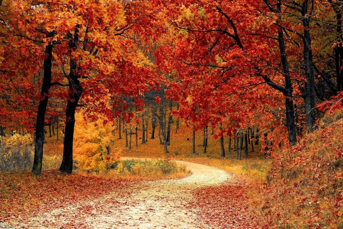
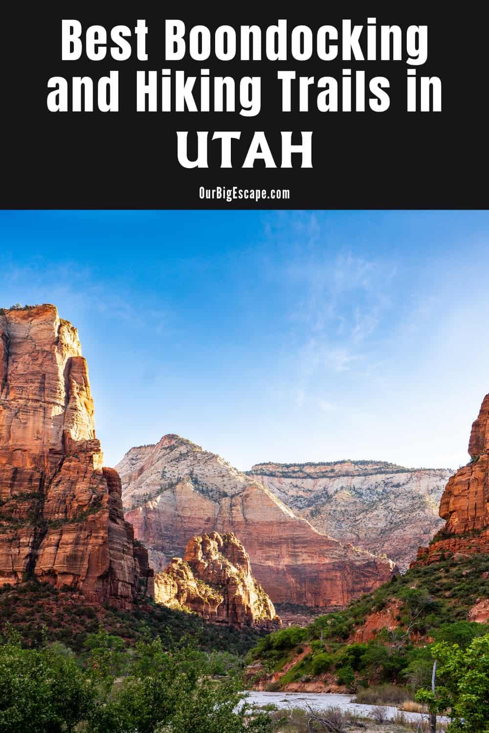
Utah boondocking campsites are fantastic camping destinations, with five national parks and over 30 state parks. Utah offers it all, from red sandstone slot canyons to snow-capped mountains. The majority of camping outings are enjoyable and safe.
| These Boondocking & Camping Areas are concentrated in the East-Central part of Utah |
Utah Boondocking Campsites in National Forests
On much of the National Forest area in Utah, the Forest Service offers free camping. Near Cedar City, in the southern portion of the state, there are numerous designated dispersed camping spots. East of Salt Lake City, the Uinta-Wasatch-Cache National Forest has plenty of dry camping locations, while the Ashley National Forest’s dispersed camping grounds are great for exploring Flaming Gorge. Fishlake National Forest is an excellent place to go rock climbing and fishing.
Sure, Utah’s State Parks and National Parks have lovely campsites, but if you truly want to live life to the fullest and experience all that Utah has to offer, these scattered campsites are sure to take your journey to the next level.
Want more ideas to round-out your trip to the South-Western States?
► Arizona, California, Colorado, New Mexico, Nevada, Utah ◄
- 249 Amazing Arizona Boondocking Locations With Maps
- 419 Awesome California Boondocking Campsites And Maps
- 351 Free Colorado Boondocking Locations Along With Maps
- 141 Best New Mexico Boondocking Spots Plus Maps
- 146 Top Nevada Boondocking Sites Including Maps
- 54 Top SW Utah Boondocking Camping Areas Including Maps
- 43 Amazing South-Central Utah Boondocking Campgrounds With Maps
- 36 Free SE Utah Boondocking Camping Sites And Maps
- 21 Favorite West-Central Utah Boondocking Camp Sites Plus Maps
- 33 Best Central Utah Boondocking Sites Also Maps
- 51 Amazing East-Central Utah Boondocking Campsites And Maps
- 24 Top NW Utah Boondocking Locations Including Map
- 32 Free North-Central Utah Boondocking Areas Along With Maps
- 19 Great NE Utah Boondocking Spots With Maps
51 Free East-Central Utah Boondocking Campsites With Maps
check out our video
1. Crystal Geyser
Address
Green River, Utah
GPS: 38.938344, -110.13542
Elevation: 4057′
Management: Public – National Park Service (Official)
The road in is Gravel and 1 miles from a paved road. Crystal Geyser is open year round . There are 6-15 Utah boondocking campsites at this location and the maximum RV length is unlimited. You may stay 15 days at Crystal Geyser.
2. Kokopelli’s Trail – Fish Ford
Address
Unnamed Road
Cisco, Utah
GPS: 38.923515, -109.247882
Elevation: 4131′
Management: Public – Bureau of Land Management: (Official)
Free Dispersed camping in Utah in the Bureau of Land Management: Monticello District. First come -> first camped. No reservations are accepted. The road in is Paved. There are 1-5 Utah camping areas at this location and the maximum RV length is 35 feet.
3. Canyonlands NP – Potato Bottom
Address
Potato Bottom Campground B
Moab, Utah
GPS: 38.431606, -110.010694
Elevation: 3967′
Management: Public – National Park Service
The road in is 4×4. Free Utah boondocking campsites in the Bureau of Land Management: Monticello District. First come -> first camped. No reservations are accepted.
4. Horseshoe Canyon
Address
Unnamed Road
Utah
GPS: 38.474081, -110.200243
Elevation: 5341′
Management: Public – Bureau of Land Management
The road in is 4×4. Free Dispersed camping in Utah in the Bureau of Land Management: Richfield District. No reservations. First come, first served. Vehicles with high clearance and 4WD are suggested.
5. Mineral Bottom
Address
BLM 129
Moab, Utah
GPS: 38.524748, -109.992977
Elevation: 3950′
Management: Public – Bureau of Land Management
Free Utah boondocking campsites in the Bureau of Land Management: Moab District. Reservations are not accepted at this campsite.
6. Horsethief Trail (Mineral Rd) Canyonlands, UT
Address
Moab, Utah
GPS: 38.590363, -109.840694
Elevation: 5741′
Management: Public – Bureau of Land Management: (Official)
The road in is Dirt and 2 miles from a paved road. Horsethief Trail (Mineral Rd) Canyonlands, UT is open year round I believe. There are 16-29 Utah camping areas at this location and the maximum RV length is 45 feet. You may stay 14 days at Horsethief Trail (Mineral Rd) Canyonlands, UT.
7. Dalton Wells Camping Area
Address
Moab, Utah
GPS: 38.717797, -109.689383
Elevation: 4396′
Management: Public – Bureau of Land Management
The road in is 4×4. Dalton Wells Camping Area is open year round. There are 6-15 Utah boondocking campsites at this location and the maximum RV length is unlimited. You may stay 14 days at Dalton Wells Camping Area.
8. Cotter Mine Campsites
Address
Moab, Utah
GPS: 38.698374, -109.708278
Elevation: 4688′
Management: Public – Bureau of Land Management: (Official)
The road in is Gravel. There are 6-15 Utah camping areas at this location and the maximum RV length is unlimited. You may stay 14 days at Cotter Mine Campsites.
9. Gemini Bridges Campsites 1-5
Address
Gemini Bridges Road
Moab, Utah
GPS: 38.612202, -109.665496
Elevation: 4669′
Management: Public – Bureau of Land Management: (Official)
The road in is 4×4. There are 1-5 Utah boondocking campsites at this location and the maximum RV length is 25 feet. You may stay 14 days at Gemini Bridges Campsites 1-5.
10. Spring Canyon Bottom Rd Dispersed Camping
Address
Moab, Utah
GPS: 38.63061, -109.8786
Elevation: 5138′
Management: Public – Bureau of Land Management: (Unofficial)
The road in is Dirt and 4 miles from a paved road. There are 30 or more Utah camping areas at this location and the maximum RV length is unlimited.
11. Small pullout off of BLM Rd 137
Address
Moab, Utah
GPS: 38.641008, -109.814553
Elevation: 5344′
Management: Public – Bureau of Land Management: (Unofficial)
Free Utah boondocking campsites in the Bureau of Land Management: Monticello District. First come -> first camped. No reservations are accepted. Small Pullout on left side of road if traveling North West down road in between both Lone Mesa campgrounds from highway 313. This is a small area with room for 3 or 4 sites.
12. BLM 137
Address
BLM 137, Utah
Moab, Utah
GPS: 38.644005, -109.819677
Elevation: 5290′
Management: Public – Bureau of Land Management: (Official)
Free Dispersed camping in Utah in the Bureau of Land Management: Monticello District. First come -> first camped. No reservations are accepted. The road in is Gravel. You may stay 14 days at BLM 137.
13. Bartlett Wash Camping
Address
Utah
GPS: 38.717671, -109.785491
Elevation: 4636′
Management: Public – Bureau of Land Management: (Official)
The road in is Dirt and 4 miles from a paved road. There are 30 or more Utah boondocking campsites at this location and the maximum RV length is unlimited. The road in is Gravel. There are 1-5 campsites at this location and the maximum RV length is 35 feet.
14. White Wash Sand Dunes
Address
Floy Wash Road (BLM 147)
Green River, Utah
GPS: 38.805522, -110.049722
Elevation: 4383′
Management: Public – Bureau of Land Management: (Official)
Free Dispersed camping in Utah in the Bureau of Land Management: Monticello District. First come -> first camped. No reservations are accepted. The road in is Dirt. White Wash Sand Dunes is open year-round. There are 30 or more Utah camping areas and the maximum RV length is unlimited. You may stay 14 days at White Wash Sand Dunes.
15. Klondike Bluffs Trail Rd
Address
38.74093452196912, -109.73388938084946
Moab, Utah
GPS: 38.75803, -109.7255
Elevation: 4636′
Management: Public – Bureau of Land Management: (Official)
Free Dispersed camping in the Bureau of Land Management: Monticello District. First come -> first camped. No reservations are accepted. The road in is Dirt. Klondike Bluffs Trail Rd is open Year round. There are 30 or more Utah boondocking campsites at this location and the maximum RV length is unlimited. You may stay 14 days at Klondike Bluffs Trail Rd.
16. US-191 and Copper Ridge JSR
Address
BLM 143
Moab, Utah
GPS: 38.82588, -109.78082
Elevation: 4662′
Management: Public – Bureau of Land Management
Free Dispersed camping in Utah in the Bureau of Land Management: Monticello District. First come -> first camped. No reservations are accepted. Less than 0.2mi off the highway. Despite being very close to the road and the nearby RR tracks, this is reputedly a convenient overnight spot for those on the way.
17. BLM 144
Address
Crescent Junction, Utah
GPS: 38.878568, -109.806973
Elevation: 4675′
Management: Public – Bureau of Land Management
Free Dispersed camping in the Bureau of Land Management: Monticello District. First come -> first camped. No reservations are accepted. The road in is Dirt. BLM 144 is open Year round. There are 6-15 Utah boondocking campsites at this location and the maximum RV length is unlimited. You may stay 14 days at BLM 144.
18. Kokopelli’s Trail – Cowskin
Address
Top of the World Safari Route (BLM 105)
Moab, Utah
GPS: 38.785006, -109.263323
Elevation: 4731′
Management: Public – Bureau of Land Management: (Official)
The road in is Dirt. There are 1-5 Utah camping areas at this location and the maximum RV length is 35 feet. This campsite is located within the Bureau of Land Management: Moab District. Spring fed horse water trough.
19. Capitol Reef Super Stash
Address
Moab, Utah
GPS: 38.72499, -109.30853
Elevation: 4747′
Management: Public – Bureau of Land Management: (Unofficial)
Our favorite place with incredible views of the valley. Depending on the time of the year 4×4 possible. I recommend a vehicle that has high clearance in case road is rutted out. Utah boondocking campsites where there is NO ONE around except the sounds of nature.
20. Castleton Tower’s Climbers Campsite.
Address
Moab, Utah
GPS: 38.642319, -109.376765
Elevation: 4915′
Management: Public – Utah Open Lands Conservation Association. (Official)
One of my favorite spots in the Moab area. Dispersed campsites in Utah located right off of La Sal loop road in Castle Valley. This is a climbers campsite for the Tower.
21. Kokopelli’s Trail – Hideout Canyon
Address
BLM 100
Moab, Utah
GPS: 38.691074, -109.190629
Elevation: 5564′
Management: Public – Bureau of Land Management: (Official)
Free Dispersed camping in the Bureau of Land Management: Monticello District. First come -> first camped. No reservations are accepted. The road in is 4×4. There are 1-5 Utah boondocking campsites at this location and the maximum RV length is 35 feet.
22. Bull Draw
Address
Moab, Utah
GPS: 38.61597, -109.22351
Elevation: 8514′
Management: Public – Forest Service
Free Utah camping areas in the Forest Service Land. First come -> first camped. No reservations are accepted. Free camping area. It is often used by hikers and bikers doing the Kokopelli trail (mile 116).
23. Manti – LaSal #1
Address
Dolores Triangle Safari Route
Moab, Utah
GPS: 38.610594, -109.242983
Elevation: 8058′
Management: Public – Forest Service
Free Utah boondocking campsites in the Manti-La Sal National Forest’s Moab Ranger District. No reservations. First come, first served. This is a high elevation location.
24. Castleton Tower’s Climbers Campsite.
Address
Moab, Utah
GPS: 38.642319, -109.376765
Elevation: 4915′
Management: Public – Utah Open Lands Conservation Association. (Official)
One of my favorite spots in the Moab area. Dispersed campsites in Utah located right off of La Sal loop road in Castle Valley. This is a climbers campsite for the Tower, but is technically open to everyone. You don’t have to be an expert climber to hike the trail that takes you right up to the base of the Tower
25. Kokopelli’s Trail – Porcupine Rim
7
Address
Forest Road 4632
Moab, Utah
GPS: 38.575105, -109.347077
Elevation: 7408′
Management: Public – Forest Service (Official)
This campsite is at high elevation and one of the notable camping location along the Kokopelli Trail. Free Utah boondocking campsites in the Bureau of Land Management: Monticello District. First come -> first camped. No reservations are accepted. The road in is Dirt. There are 1-5 campsites at this location and the maximum RV length is 35 feet.
26. La Sal East Landning
Address
La Sal Loop
Moab, Utah
GPS: 38.584198, -109.29527
Elevation: 7070′
Management: Public – Bureau of Land Management
The road in is Paved. Stunning views from Utah camping areas of Mt Waas and Castle Valley. The road up from Castle Valley is a paved but narrow and it gains elevation quickly. You’re not quite up in the alpine yet. This spot is a middle ground between the dessert below and the alpine above. It’s only a few degrees cooler than the valley but with shade. No real ATT signal. Decent verizon LTE.
27. Jimmy Keen Boondock
Address
La Sal Scenic Loop
Moab, Utah
GPS: 38.543507, -109.317529
Elevation: 8294′
Management: Public – Forest Service
The road in is Dirt and .1 miles from a paved road. Jimmy Keen Boondock is open weather permitting. There are 1-5 Utah boondocking campsites at this location and the maximum RV length is 25 feet. You may stay 14 days at Jimmy Keen Boondock.
28. Mt. Waas and Miners Basin Trailhead
Address
Moab, Utah
GPS: 38.538807, -109.259931
Elevation: 9705′
Management: Public – Forest Service (Unofficial)
The road in is 4×4 and 3 miles from a paved road. There are 1-5 Utah camping areas at this location. There is a pit latrine but no piped water. The 3 miles on FR 0065 from the paved La Sal Loop Road are steep, rocky, rutted and narrow with hairpin turns. So best for vehicles with 4WD low. But I think a determines SUV/AWD driver could make it.
29. Fr 4651
Address
Moab, Utah
GPS: 38.507814, -109.339406
Elevation: 7805′
Management: Public – Forest Service
The road in is Paved. Fr 4651 is open weather permitting. There are 1-5 Utah boondocking campsites at this location and the maximum RV length is 35 feet. You may stay 14 days at Fr 4651.
30. Forest Road 0063
Address
Moab, Utah
GPS: 38.508746, -109.309625
Elevation: 8799′
Management: Public – Forest Service (Official)
The road in is Dirt. There are 1-5 Utah camping areas at this location and the maximum RV length is 25 feet. There are several dispersed campsites along the road to Warner Campground. Great views and lots of wildlife.
31. FR 0076 near Oowah Lake
Address
Moab, Utah
GPS: 38.507744, -109.278066
Elevation: 8642′
Management: Public
The road in is Gravel. There are 6-15 Utah boondocking campsites at this location. You may stay 14 at FR 0076 near Oowah Lake. Available spots running along forest road 0076 leading up to Oowah Lake. Beautiful area and drive with creeks running near most of the camping areas. If these areas are full there is the pay area, Oowah Campground near the lake which looked really nice.
32. La Salle Loop Rd
Address
Moab, Utah
GPS: 38.476741, -109.343744
Management: Public – Forest Service (Official)
Moab in the summer is hot. Found a really nice primitive camping going up the rd to do the Whole Enchilada bike trail. Forest rd that takes you to the top of the mountain and you will see Utah camping areas all over the area.
33. Pack Creek Trailhead
Address
Forest Road 4173
Moab, Utah
GPS: 38.43514, -109.338871
Elevation: 6398′
Management: Public – Forest Service (Official)
Free Dispersed camping in the National Forest Land. First come -> first camped. No reservations are accepted. Free Utah boondocking campsites in the forest outside of Moab. 6 single site(s), 6 per unit. I group site (30 ppl).
34. Mt Peale
Address
Forest Road 4725
Moab, Utah
GPS: 38.432922, -109.243292
Elevation: 10594′
Management: Public – Forest Service
Free Dispersed camping in Utah in the Manti-La Sal National Forest’s Moab Ranger District. First come -> first camped. No reservations are accepted. This is a high elevation location. High clearance, 4WD Recommended.
35. Pack Creek Trailhead
Address
Forest Road 4173
Moab, Utah
GPS: 38.43514, -109.338871
Elevation: 6398′
Management: Public – Forest Service (Official)
Free Dispersed camping in the National Forest Land. First come -> first camped. No reservations are accepted. Free Utah boondocking campsites in the forest outside of Moab. 6 single site(s), 6 per unit. I group site (30 ppl).
36. Black Ridge Recreation Area
Address
Monticello, Utah
GPS: 38.400186, -109.400422
Elevation: 5771′
Management: Public – Bureau of Land Management
The road in is Dirt and 3.3 miles from a paved road. There are 1-5 Utah camping areas at this location and the maximum RV length is unlimited. You may stay 14 days at Black Ridge Recreation Area.
37. Yellow Circle Road
Address
191 and Yellow Circle Road
Moab, Utah
GPS: 38.435474, -109.427631
Elevation: 5299′
Management: Public – Bureau of Land Management: (Unofficial)
The road in is Dirt and 0 miles from a paved road. There are 30 or more Utah boondocking campsites at this location and the maximum RV length is unlimited. 11 miles south of Moab on 191 there is a large field between Yellow Circle Road and 191. The road is dirt and a little bumpy but we got our 32ft motorhome down it with no problems.
38. Spring Valley – Free Dispersed Camping
Address
Moab, Utah
GPS: 38.426718, -109.440227
Elevation: 5489′
Management: Public – Forest Service
Free Dispersed camping in Utah in the National Forest Service Land. First come -> first camped. No reservations are accepted.
39. Boondocking near Moab
Address
Moab, Utah
GPS: 38.416086, -109.46391
Elevation: 5325′
Management: Public – Bureau of Land Management
Free Utah boondocking campsites in the Bureau of Land Management: Monticello District. First come -> first camped. No reservations are accepted. This is a jeep trail but it doesn’t get scary until after this spot. A 42′ 5er camped here
40. Upper Kane Creek Springs
Address
Moab, Utah
GPS: 38.380018, -109.460993
Elevation: 5145′
Management: Public – Bureau of Land Management: (Unofficial)
Free Dispersed camping in the Bureau of Land Management: Monticello District. First come -> first camped. No reservations are accepted. The road in is Dirt and .5 miles from a paved road. Upper Kane Creek Springs is open Weather Permitting – almost always. There are 1-5 Utah camping areas at this location.
41. Picture Frame Arch
Address
Moab, Utah
GPS: 38.435963, -109.509295
Elevation: 5492′
Management: Public – Bureau of Land Management
Free Utah boondocking campsites near Moab. There are four designated sites located six miles from Highway 191. Camping is limited to officially marked campsites. Portable toilets are required.
42. Sego Canyon – Rock Art & Ghost Town
Address
Sego Canyon Rd
Thompson Springs, Utah
GPS: 39.019493, -109.71064
Elevation: 5496′
Management: Public – Bureau of Land Managment (Unofficial)
The road in is Gravel and 3 miles from a paved road. There are 1-5 Utah camping areas at this location. A short distance north of I 70 (4.2 miles) on an oil & gravel road, Sego Canyon is a great one-night, boondock!
43. Horse Canyon Road
Address
Price, Utah
GPS: 39.417078, -110.419824
Elevation: 5558′
Management: Public – Bureau of Land Management: (Unofficial)
Utah boondocking campsites on BLM land in Utah desert. There are a variety of dispersed sites up this road towards East Carbon. Some of the roads are rough, but there are quite a few spots you could easily put a trailer that’s 35′ or less.
44. Horse Canyon Road Dispersed Camping
Address
Horse Canyon Road
East Carbon, Utah
GPS: 39.42972, -110.40427
Elevation: 5745′
Management: Public – Bureau of Land Management
Free Utah camping areas in the Bureau of Land Management: Monticello District. First come -> first camped. No reservations are accepted. The road in is Paved. There are 1-5 Utah camping areas at this location and the maximum RV length is 35 feet. You may stay 14 days at Horse Canyon Road Dispersed Camping.
45. Winter Ridge
Address
BLM 206
Thompson, Utah
GPS: 39.465522, -109.458025
Elevation: 7510′
Management: Public – Bureau of Land Management
Free Utah boondocking campsites in the Bureau of Land Management: Vernal District. First come -> first camped. No reservations are accepted. This is a high elevation location.
46. Divide Ridge
Address
Book Cliffs Ridge Road
Thompson, Utah
GPS: 39.416939, -109.33288
Elevation: 8232′
Management: Public – Bureau of Land Management
Free Utah camping areas in the Bureau of Land Management: Moab District. No reservations. First come, first served. This is a high elevation location.
47. Seep Ridge
Address
Willow Canyon Ridge Road
Thompson, Utah
GPS: 39.46267, -109.283716
Elevation: 8035′
Management: Public – Bureau of Land Management
Free Utah boondocking campsites in the Bureau of Land Management: Vernal District. No reservations. First come, first served. This is a high elevation location.
48. Book Cliffs Ridge
Address
Book Cliffs Ridge Road
Thompson, Utah
GPS: 39.451048, -109.180468
Elevation: 8415′
Management: Public – Bureau of Land Management
Free Utah camping areas in the Bureau of Land Management: Moab District. No reservations. First come, first served. This is a high elevation location.
49. Dick Canyon
Address
County Road 4680
Thompson, Utah
GPS: 39.483801, -109.090455
Elevation: 8202′
Management: Public – Bureau of Land Management
Free Utah boondocking campsites in the Bureau of Land Management: Vernal District. First come -> first served. No reservations accepted. This is a high elevation location.
50. McCook Ridge 1
Address
McCook Ridge Road
Utah
GPS: 39.622226, -109.23061
Elevation: 7093′
Management: Public – Bureau of Land Management
Free Utah camping areas in the Bureau of Land Management: Vernal District. No reservations. First come, first served. This is a high elevation location.
51. McCook Ridge 2
Address
McCook Ridge Road
Utah
GPS: 39.601388, -109.204614
Elevation: 7300′
Management: Public – Bureau of Land Management
Free Utah boondocking campsites in the Bureau of Land Management: Vernal District. First come -> first camped. No reservations are accepted. This is a high elevation location.
Utah Boondocking Campsites
The desert regions on the state’s eastern, western, and southern boundaries have more BLM land. If you want a more alpine boondocking experience, there is abundance of Forest Service-owned area around the Wasatch Range.
The many dispersed campsites for free camping near Moab and Arches National Park in the Manti-La Sal National Forest near Moab. Hundreds of wonderful dispersed campsites are accessible via several dirt forest service routes.
Between La Sal Lookout Point and Porcupine Rim Campground are some of my personal favorites. Some are only a few hundred feet off the road, while others need several miles of fairly hard dirt roads to get. Many of them provide breathtaking views of the Porcupine Rim and the Castle Valley below.
Utah has thousands of campgrounds spread all over the state. With approximately 75% of the land open to the public, campers in Utah have an endless supply of free campsites! Yes, absolutely free!
Alternatively, for greater shade and quiet, travel up a forest service road higher into the highlands (rather than towards Porcupine Rim).
Tips on Dispersed Camping in Utah Boondocking Campsites
Always bring more water than you think you’ll need when traveling. When camping in the Utah desert, two gallons per person per day is a decent rule of thumb. Because not all Utah campgrounds supply drinking water, you’ll want to get a large water jug (7-10 gallons) to ensure you have enough wherever you go.
Having a large water jug with you will also allow you to stay at dispersed campgrounds where water may be scarce. Many visitor centers, parks, and campers include water containers that can be refilled.
You May Want to Join Our Boondocking Group on Facebook For More Information
You May Want to Join Our Campfire Recipes Group on Facebook For More Information
Check Out Our Pictures On Instagram – Our Big Escape.