It’s no secret that Colorado boondocking locations has some of the best camping in the West: the mountain views are virtually limitless, from Rocky Mountain National Park to the southern San Juans. If you’re on a budget, there’s plenty of free camping to be discovered in Colorado. If you venture beyond the confines of national and state parks, you’ll find campsites on National Forest or BLM territory with equally breathtaking Rocky Mountain views and, in many cases, more isolation.
Want more ideas to round-out your trip to the South-Western States?
► Arizona, California, Colorado, New Mexico, Nevada, Utah ◄
- 249 Amazing Arizona Boondocking Locations With Maps
- 419 Awesome California Boondocking Campsites And Maps
- 351 Free Colorado Boondocking Locations Along With Maps
- 141 Best New Mexico Boondocking Spots Plus Maps
- 146 Top Nevada Boondocking Sites Including Maps
- 54 Top SW Utah Boondocking Camping Areas Including Maps
- 43 Amazing South-Central Utah Boondocking Campgrounds With Maps
- 36 Free SE Utah Boondocking Camping Sites And Maps
- 21 Favorite West-Central Utah Boondocking Camp Sites Plus Maps
- 33 Best Central Utah Boondocking Sites Also Maps
- 51 Amazing East-Central Utah Boondocking Campsites And Maps
- 24 Top NW Utah Boondocking Locations Including Map
- 32 Free North-Central Utah Boondocking Areas Along With Maps
- 19 Great NE Utah Boondocking Spots With Maps
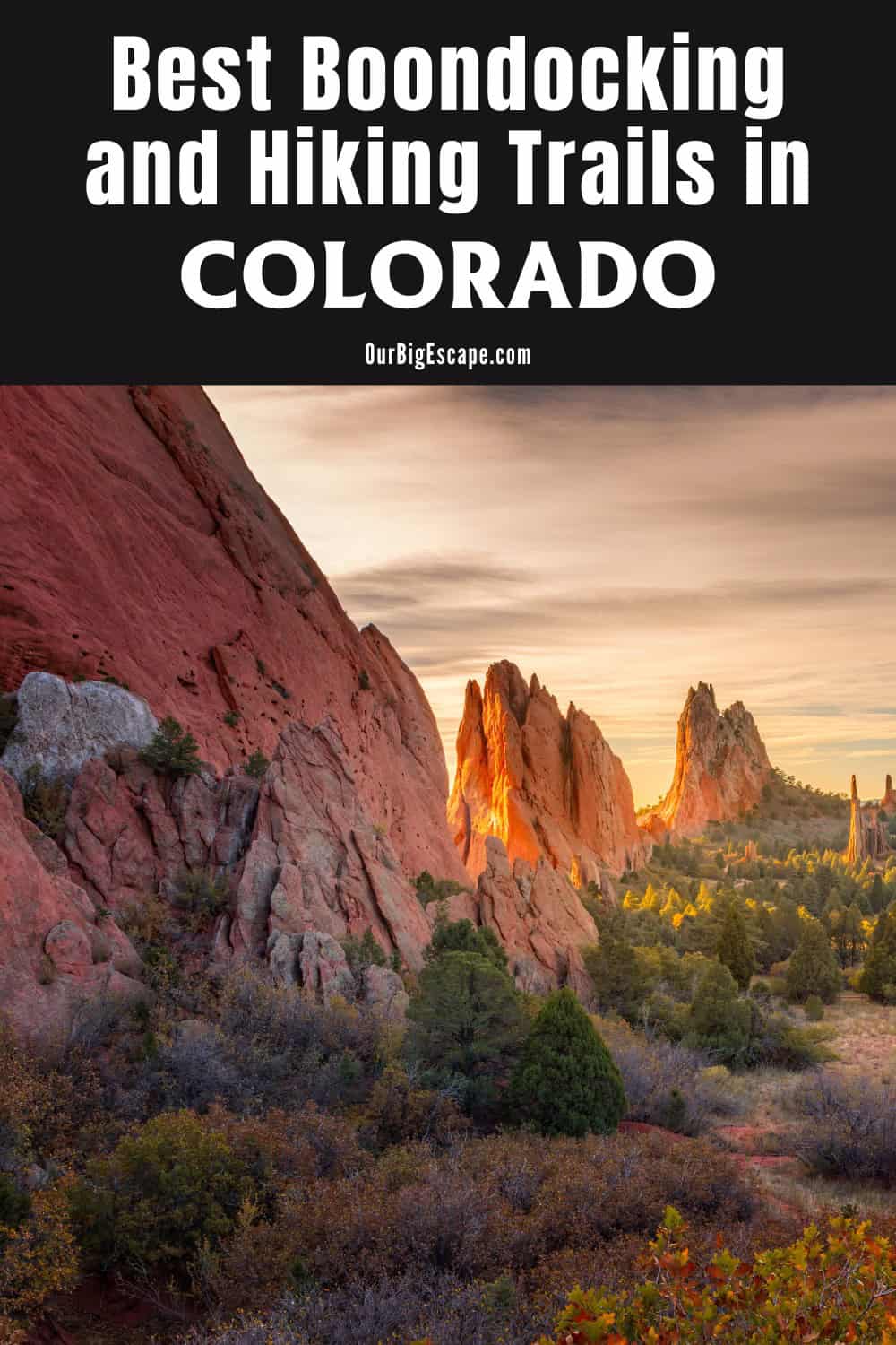
Colorado Boondocking Locations
Colorado boasts some of the world’s best wilderness and outdoor activities. The breathtaking Rocky Mountains will serve as your backdrop while you explore this amazing state and all it has to offer. Fortunately, much of the state has been maintained as public land, allowing for plenty of free, dispersed camping opportunities in Colorado.
Car camping outside of a licensed campsite but still within relevant regulations is known as dispersed camping, sometimes known as rustic camping. The majority of the best Colorado boondocking locations are on federally held properties, such as national forest and BLM holdings. There are usually no facilities or other amenities, but you can camp for free. (Plus, unlike backpacking, vehicle camping allows you to dress it up with cushions, steak, and a bottle – or two – of wine.)
There is likely to be a terrific alternative for you whether you want to camp in the high mountains, on the Western Slope, or even on the Eastern Plains.
check out our video
43 NE Colorado Boondocking Locations
Jump directly to the 78 NW Free Colorado Camping Spots
Jump directly to the 76 East-Central Colorado Boondocking Campgrounds
Jump directly to the 53 West-Central Colorado Dispersed Campsites
Jump directly to the 22 SE Colorado Boondocking Spaces
Jump directly to the 68 South-Central Colorado Camping Locations
Jump directly to the 87 SW Colorado Boondocking Sites
check out our video
1. Main Draw OHV Area
Address
Grassland Road #640
Nunn, Colorado
GPS: 40.90174, -104.62422
Elevation: 5505′
Management: Public – Forest Service
The road in is Dirt. Main Draw OHV Area is open November 1st through April 9th. Colorado boondocking locations – This two-mile long draw or gully is popular with dirt bike riders and others with vehicles under 50 inches wide and must have a spark arrester. Vehicles are required to stay within the draw, and not ride on roads or across the prairie.
2. Pawnee National Grassland Dispersed
Address
Ault, Colorado
GPS: 40.783434, -104.539247
Elevation: 5338′
Management: Public – Forest Service (Official)
The road in is Dirt and Varies miles from a paved road. Pawnee National Grassland Dispersed is open All year. Free Colorado camping spots – This is the western section of Pawnee National Grassland. The eastern section has Pawnee Buttes. This western section has Crow Valley Campground (small fee), the birding auto tour, an OHV use area,
3. Pawnee Buttes
Address
Pawnee Butte Trail Head
Grover, Colorado
GPS: 40.82449, -103.972995
Elevation: 5131′
Management: Public – Forest Service
Free Colorado dispersed campsites in the Arapaho and Roosevelt National Forests’s Pawnee Ranger District. Reservations are not accepted at this campsite.
4. Pawnee Buttes
Address
Grover, Colorado
GPS: 40.810299, -103.997023
Elevation: 5374′
Management: Public – Forest Service
The road in is Dirt and 5 miles from a paved road. Pawnee Buttes is open Year round. There are 1-5 Colorado boondocking locations at this site. You may stay 14 at Pawnee Buttes. In the Pawnee grasslands there are other sites nearby also.
5. Heffernan Gulch
Address
Hefferman Gulch Road
Evergreen, Colorado
GPS: 39.6654, -105.642888
Elevation: 10269′
Management: Public – Forest Service
Free Colorado camping spots in the Arapaho and Roosevelt National Forests’s Clear Creek Ranger District. Reservations are not accepted at this campsite. This is a high elevation location.
6. Leavenworth Creek Road – Argentine Pass
Address
Georgetown, Colorado
GPS: 39.68339, -105.70647
Elevation: 9741′
Management: Public – Bureau of Land Management (Official)
Arapaho National Forest/Clear Creek Ranger District There are multiple Colorado dispersed campsites located along Leavenworth Creek Road until the ghost town of Waldorf. The road up to Argentine Pass does not offer any sites. This road is extremely rough, and high clearance 4×4 vehicles are required
7. Jones Pass Dispersed Camping
Address
Jones Pass Road
Parshall, Colorado
GPS: 39.779583, -105.864592
Elevation: 10863′
Management: Public – Forest Service (Official)
Free camping (boondocking) in the aspens along Jones Pass Road in Colorado’s Arapaho National forest. Not too far outside of Denver. 2WD can make it for a bit but 4×4 is required for the highest campsites. Colorado boondocking locations. Pack it in, pack it out. No toilets, water, electricity. No reservations. Real camping
8. Arapaho NF Dispersed Camping
Address
Idaho Springs, Colorado
GPS: 39.73808, -105.509455
Elevation: 7822′
Management: Public – Forest Service (Official)
I have not been here, but the Forest Service shows Free Colorado camping spots along the road Southeast of this point. Steep road with sharp hairpins. No big rigs.
9. York Gulch Road
Address
Idaho Springs, Colorado
GPS: 39.80095, -105.56934
Elevation: 9485′
Management: Public – Forest Service (Unofficial)
I was looking for Colorado dispersed campsites to crash after a concert in Denver (at night), set out to find Forest Service land for free dispersed camping, and sort of happened upon this spot. Would’ve stopped not as far up York Gulch Rd, but this was the first solid spot I found to set up a tent.
10. Dispersed Camping on Mill Creek Rd Near Empire, CO
Address
Idaho Springs, Colorado
GPS: 39.78307, -105.6235
Management: Public – Forest Service (Official)
I have not been here but I have been to other dispersed campsites nearby on Fall River Rd. There are numerous Colorado boondocking locations (primitive) listed here by the Forest Service
11. Kingston Peak Road / Old Mining Camp
Address
Idaho Springs, Colorado
GPS: 39.86291, -105.63099
Elevation: 10610′
Management: Public – Forest Service (Official)
4×4/high clearance required! Free Colorado camping spots in the Arapaho National Forest. Not the easiest to get to, but great views. There are some remains of mining operations in the area. Multiple fire rings as well.
12. Mammoth Gulch Dispersed Camping
Address
Idaho Springs, Colorado
GPS: 39.88662, -105.61365
Elevation: 9682′
Management: Public – Forest Service
The road in is Dirt. You may stay 14 days in Colorado dispersed campsites at Mammoth Gulch Dispersed Camping. To reach these beautiful spots, head west out of Rollinsville on East Portal Road. After 5mi, you will see the village of Tollan. Just past it, on the south side, is the road for Mammoth Gulch. It will be signed.
13. Moffat Tunnel Dispersed Camping
Address
Eldora, Colorado
GPS: 39.90477, -105.6309
Elevation: 9190′
Management: Public – Forest Service (Official)
The road in is Dirt. There are 1-5 Colorado boondocking locations at this site and the maximum RV length is 15 feet. Small pull off road right before approaching the Crater Lakes Trail-head parking lot. There are a few dispersed campsites between two small roads. Easy road, no 4×4 needed, low clearance vehicles will do just fine. Sites are clearly marked by fire pits.
14. Buckingham CG
Address
3946-4020 4th of July Road
Nederland, Colorado
GPS: 39.994511, -105.634327
Elevation: 10089′
Management: Public – City Park
Buckingham CG is open May-Sep. Fourth of July Trailhead and Free Colorado camping spots located approximately 30 miles west of Boulder at an elevation of approximately 10,100 feet. There is no fee for camping, and sites are available on a first-come, first-served basis. Camping is limited to four consecutive days
15. Meadow Creek Reservoir
Address
Usfs129
Granby, Colorado
GPS: 40.059118, -105.745759
Elevation: 10039′
Management: Public – Forest Service
Free Colorado dispersed campsites in the Arapaho and Roosevelt National Forests’s Sulphur Ranger District. No reservations. First come, first served. This is a high elevation location.
16. Gross Reservoir
Address
Nederland, Colorado
GPS: 39.950527, -105.386978
Management: Public – Forest Service (Unofficial)
The road in is 4×4. Gross Reservoir is open June-September. There are 6-15 Colorado boondocking locations at this site. You may stay 14 Days at Gross Reservoir. Dispersed camping a few miles off the highway. It is reported that this is not good for RVs. Land to the west of the lake is part of the Roosevelt National Forest and is managed by the Boulder District.
17. Sugarloaf Mtn
Address
Boulder, Colorado
GPS: 40.025303, -105.425169
Elevation: 8445′
Management: Public – Forest Service (Official)
There are 30 or more Free Colorado camping spots at this location. 30 minutes outside Boulder. I suggest going on the week days, when kids are in school. Tons of places to camp. At the top, there’s 5 gallon water containers to put out your fires. I highly recommend you use them. Use pre-existing fire rings only.
18. Sugarloaf FR522.1
Address
Boulder, Colorado
GPS: 40.011857, -105.421027
Management: Public – Forest Service (Official)
Colorado dispersed campsites on this road before the second turn. There appears to be room for an RV. This area is packed with private land. You can only camp at the turn where the marker is. Make sure to use a MVUM when navigating this area, else you’ll end up on private land.
19. Free Camping off Sugarloaf Road
Address
Boulder, Colorado
GPS: 40.002418, -105.448023
Elevation: 8232′
Management: Public – Forest Service
Heard about this place from some locals. It is about 15 miles outside of boulder and maybe 30-40 minute drive. Colorado boondocking locations – Much less crowded than the nearby Upper dream Canyon and I think some trailers could make it by on this road as well.
20. Gordon Gulch
Address
901-905 Switzerland Trail
Boulder, Colorado
GPS: 40.015607, -105.494919
Elevation: 8750′
Management: Public – Forest Service
Free Free Colorado camping spots in the Arapaho and Roosevelt National Forests’s Boulder Ranger District. Reservations are not accepted at this campsite. This is a high elevation location.
21. Five Points (Corners) Dispersed Camp
Address
Nederland, Colorado
GPS: 39.981042, -105.578658
Elevation: 10000′
Management: Public – Forest Service (USDA) (Official)
Five Points (Corners) Dispersed Camp is open June-September. There are 6-15 Colorado dispersed campsites at this location. You may stay 14 days at Five Points (Corners) Dispersed Camp. 5 miles west of Nederland. Turn west from 72 onto hwy 128. Follow 5 miles camping is numbered along the road.
22. Manhattan Road Designated Campsites
Address
Red Feather Lakes, Colorado
GPS: 40.768184, -105.610537
Elevation: 8586′
Management: Public – Forest Service (Official)
The road in is 4×4 and 2 miles from a paved road. There are 16-29 Colorado boondocking locations at this site and the maximum RV length is 25 feet. You may stay 14 days at Manhattan Road Designated Campsites.
23. Rainbow Lakes Dispersed Camping
Address
Co Rd 116, Boulder CO
Nederland, Colorado
GPS: 40.012661, -105.545184
Elevation: 9737′
Management: Public – Forest Service (Official)
You may stay 14 days in Free Colorado camping spots at Rainbow Lakes Dispersed Camping. There is a 5 mile road (CO 116) off of Peak to Peak Hwy (CO 72), just 7 miles north of Nederland. The Rainbow Lakes Campground is at the end of the road, but there is plenty of space along the road (except the 2 mile section where camping is not allowed) where you can park your car on the side of the road and walk into the forest.
24. Forest Road 328
Address
Boulder, Colorado
GPS: 40.041, -105.5204
Elevation: 9094′
Management: Public – Forest Service
Free Colorado dispersed campsites just off of Peak to Peak Highways. RVs and tents.
25. Lefthand Canyon ORVA
Address
1540-4216 Lefthand Canyon Drive
Boulder, Colorado
GPS: 40.106852, -105.322566
Elevation: 6119′
Management: Public – Forest Service
Free Colorado boondocking locations in the Arapaho and Roosevelt National Forests’s Boulder Ranger District. No reservations. First come, first served. The Lefthand OHV Area is currently closed to motorized due to severe flood damage. Entry by foot or mountain bike is allowed. Target shooting within this area remains prohibited. Call before visiting.
26. Gold Lake Dispersed Camping
Address
Forest Road 372.1
Ward, Colorado
GPS: 40.083399, -105.457015
Elevation: 8635′
Management: Public – Forest Service (Official)
The road in is Dirt and 3 miles from a paved road. Gold Lake Dispersed Camping is open year round. There are 6-15 Free Colorado camping spots at this location and the maximum RV length is 25 feet. You may stay 14 at Gold Lake Dispersed Camping. Stayed here Sept 2015. The road in is some what dirt mixed with some rocks. There are many places to just pull off and some places that are private. Plenty of firewood. The terrain is a mixture of rocky mountain and meadows.
27. Peak to Peak at James Creek
Address
Ward, Colorado
GPS: 40.088926, -105.496237
Elevation: 9124′
Management: Public – Forest Service (Official)
You may stay 14 days in Colorado dispersed campsites at Peak to Peak at James Creek. Beautiful secluded spot up on the mountain.. 45 min drive from boulder.. there are multiple ways to get to this site… I suggest the main vein directly from boulder to get there..
28. Allenspark Dispersed Camping
Address
Road 1161
Lyons, Colorado
GPS: 40.175811, -105.526469
Elevation: 8645′
Management: Public – Forest Service (Unofficial)
The road in is Dirt and 2 miles from a paved road. There are 1-5 Colorado boondocking locations at this site and the maximum RV length is 15 feet. About 2 miles from Allenspark along the Ski Rd in the Roosevelt National Forest are a number of roadside (10-20m off the road) camping spots with lovely views of the surrounding forest/mountains. Access is straightforward for passenger cars.
29. Johnny Park Road Dispersed Camping
Address
Johnny Park Road (FR 118)
Allenspark, Colorado
GPS: 40.228339, -105.473236
Elevation: 8422′
Management: Public – Forest Service (Official)
The road in is Dirt. You may stay 14 days in Free Colorado camping spots at Johnny Park Road Dispersed Camping. Free Dispersed camping in the Arapaho and Roosevelt National Forests’s Canyon Lakes Ranger District. This is a seriously beautiful area not too far from Allens Park.
30. Button Rock Road Dispersed Camping
Address
Big Elk Meadow Drive
Lyons, Colorado
GPS: 40.248378, -105.403354
Elevation: 7782′
Management: Public – Forest Service
The road in is 4×4. Button Rock Road Dispersed Camping is open year round. There are 1-5 Colorado dispersed campsites at this location. You may stay 14 days at Button Rock Road Dispersed Camping.
31. Parachute Hill Rd.
Address
Allenspark, Colorado
GPS: 40.2373, -105.47993
Elevation: 8681′
Management: Public – Forest Service (Official)
The road in is 4×4. Parachute Hill Rd. is open Year Round. There are 1-5 Colorado boondocking locations at this site. You may stay 14 days at Parachute Hill Rd.
32. Dispersed Camping Along Coyote Hill Rd
Address
Estes Park, Colorado
GPS: 40.318012, -105.489219
Management: Public – Forest Service (Official)
Free Colorado camping spots – Very cool spot, but the road gets very messed up toward the top of the mountain. It isn’t maintained and would’ve been too much for my car. If you have a big car it’ll probably be ideal.
33. Dispersed Camping on Hell Canyon Rd
Address
Estes Park, Colorado
GPS: 40.343565, -105.428001
Elevation: 7933′
Management: Public – Forest Service (Official)
The drive up is pretty rutted an steep. I made it up in a 2wd Dodge Ram. I’d definitely recommend high clearance but a 4wd Subaru or something could probably make it too with some maneuvering. I didn’t see many Colorado dispersed campsites around and the views were nice but hidden behind trees.
34. Pole Hill Road
Address
Pole Hill Road
Drake, Colorado
GPS: 40.36632, -105.41992
Elevation: 8635′
Management: Public – Forest Service
The road in is 4×4. You may stay 14 days at Pole Hill Road. Free, Colorado boondocking locations in the Roosevelt National Forest’s Canyon Lakes Ranger District. A great place to get in touch with nature. 4×4 high clearance required! No services.
35. Pawnee National Grassland Dispersed
Address
Ault, Colorado
GPS: 40.783434, -104.539247
Elevation: 5338′
Management: Public – Forest Service (Official)
The road in is Dirt and Varies miles from a paved road. Pawnee National Grassland Dispersed is open All year. Free Colorado camping spots – This is the western section of Pawnee National Grassland. The eastern section has Pawnee Buttes. This western section has Crow Valley Campground (small fee), the birding auto tour, an OHV use area, Baker Draw Designated Shooting Area, and miles of free dispersed camping.
36. Cherokee SWA – Lone Pine Unit
Address
5832 Maxwell Ranch Road
Livermore, Colorado
GPS: 40.770235, -105.358346
Elevation: 6207′
Management: Public – State Park
Colorado dispersed campsites. This campsite does not use a reservation system. First come, first served. There is a parking lot here, you’ll have to walk a bit to get to the actually dispersed campground area.
37. Deadman Rd
Address
Red Feather Lakes, Colorado
GPS: 40.800454, -105.642256
Elevation: 8832′
Management: Public – Forest Service (Official)
The road in is Dirt and 2 miles from a paved road. Deadman Rd is open May-December. There are 6-15 Colorado boondocking locations at this site and the maximum RV length is unlimited. You may stay 14 at Deadman Rd. Gorgeous mountain meadow setting in the Redfeather Lakes District. Decent dirt road access. Unmarked trail nearby, foot access only, no ATVs. Numerous dispersed camping sites along Deadman Rd and spurs. Forest Service, 14 days max, free.
38. Buckhorn Road Dispersed Camping
Address
Buckhorn Road
Bellvue, Colorado
GPS: 40.577263, -105.512399
Elevation: 9144′
Management: Public – Forest Service (Official)
The road in is Dirt. Buckhorn Road Dispersed Camping is open weather permitted. You may stay 14 days in Free Colorado camping spots at Buckhorn Road Dispersed Camping. Relatively large site located right off the very untraveled road. This campsite may be inaccessible during winter months as it is classified as a “level 6” meaning it is not plowed ever.
39. Browns Lake / Pingree Park Road
Address
Pingree Park Road
Rustic, Colorado
GPS: 40.60667, -105.535468
Elevation: 8047′
Management: Public – Forest Service (Unofficial)
The road in is Gravel and 17 + depending how far in miles from a paved road. There are 30 or more Colorado dispersed campsites at this location and the maximum RV length is 25 feet. You may stay 14 days remote at Browns Lake / Pingree Park Road.
40. Crown Point Rd
Address
Bellvue, Colorado
GPS: 40.66116, -105.56974
Elevation: 8176′
Management: Public – Forest Service (Official)
The road in is Dirt and 5 miles from a paved road. Crown Point Rd is open year round. There are 16-29 Colorado boondocking locations at this site and the maximum RV length is unlimited. You may stay 14 days at Crown Point Rd. Numerous dispersed established camp sites along this road. Many under trees besides a small creek. Most sites are for tents, but there are also many pull-outs along the road for RVs and some off road RV sites.
41. Pingree Road #1
Address
Bellvue, Colorado
GPS: 40.68581, -105.49549
Elevation: 7119′
Management: Public – Forest Service
There are 1-5 Free Colorado camping spots at this location. You may stay 14 days at Pingree Road #1. Dispersed camping on either side of the road
42. Cherokee SWA – Lone Pine Unit
Address
5832 Maxwell Ranch Road
Livermore, Colorado
GPS: 40.770235, -105.358346
Elevation: 6207′
Management: Public – State Park
Colorado dispersed campsites. This campsite does not use a reservation system. First come, first served. There is a parking lot here, you’ll have to walk a bit to get to the actually dispersed campground area.
43. NF-171D Prime Spot
Address
Bellvue, Colorado
GPS: 40.74512, -105.63268
Elevation: 8976′
Management: Public – Forest Service (Official)
The road in is Dirt. There are 1-5 Colorado boondocking locations at this site. You may stay 14 days at NF-171D Prime Spot. This is a great dispersed campsite! I have camped here a couple of times and have enjoyed both times. Once it was a little snowy, but fine. There is plenty of room at this site and it has its own little meadow.
Free Colorado Camping Spots
Understanding where dispersed camping is permitted is the first step in locating free Colorado camping spots. Several government entities in Colorado allow dispersed camping on land they manage. The United States Forest Service (USFS) and the Bureau of Land Management (BLM) are the two largest of them (BLM).
In Colorado, the USFS oversees millions of acres across 11 different National Forests. Some of our favorite dispersed camping locations can be found here. Within their bounds, all of these national forests allow dispersed camping, and they all offer a wealth of recreational options. In Colorado, these forests are always our first choice for dispersed camping.
The other major public land owner in Colorado that allows dispersed camping is the Bureau of Land Management (BLM). The Bureau of Land Management (BLM) oversees 8.3 million acres in Colorado, the majority of which is on the Western Slope. Given that most of the BLM is leased for oil and gas, cattle grazing, and other uses, there is additional nuance to dispersed camping on the BLM. However, dispersed camping is permitted on wide expanses of BLM land in Colorado, making it a viable alternative when looking for a campsite.
78 NW Free Colorado Camping Spots
Jump directly to the 43 NE Colorado Boondocking Locations
Jump directly to the 76 East-Central Colorado Boondocking Campgrounds
Jump directly to the 53 West-Central Colorado Dispersed Campsites
Jump directly to the 22 SE Colorado Boondocking Spaces
Jump directly to the 68 South-Central Colorado Camping Locations
Jump directly to the 87 SW Colorado Boondocking Sites
1. Chambers Lake Dispersed Camping
Address
Bellvue, Colorado
GPS: 40.61186, -105.85406
Elevation: 9219′
Management: Public – Forest Service
Continue on 14-Poudre Canyon Road and then take a left Holhnholz Lakes Road – CR 103. Colorado boondocking locations on one side of the lake but if you keep going there’s several dispersed campsites on the Holhnholz side. Amazing views.
2. Long Draw Rd or 156
Address
Bellvue, Colorado
GPS: 40.575369, -105.852445
Management: Public – Forest Service (Official)
There are 16-29 Free Colorado camping spots at this location. You may stay 14 days at Long Draw Rd or 156.
3. Seymour Lake SWA
Address
5192-5832 Jcr 11A
Coalmont, Colorado
GPS: 40.480432, -106.391396
Elevation: 8353′
Management: Public – State Park
Colorado dispersed campsites. No reservations. First come, first served. This is a high elevation location.
4. Owl Mountain
Address
Walden, Colorado
GPS: 40.486126, -106.044867
Management: Public – Forest Service (Official)
This area has numerous free Colorado boondocking locations. Take the Forest Service Road at Gould, Colorado, and follow the dirt road for 1 mile south. You will cross a cattle guard as you enter USFS land.
5. Rt. 125 N of Granby
Address
Granby, Colorado
GPS: 40.290027, -106.079749
Elevation: 8727′
Management: Public – Forest Service (Official)
The road in is Gravel. There are 30 or more Free Colorado camping spots at this location and the maximum RV length is 35 feet. You may stay 14 days at Rt. 125 N of Granby. Many, many awesome pulloff and forest roads, all along rt. 125, heading north out of Granby, CO, in the Arapaho and Routt NFs. Most are situated along creeks and streams, and the scenery here is awesome (tho’ the bark beetle damage is quite evident in this area.) This is prime moose habitat, and if you’re lucky like I was, you might see some!
6. Stillwater Pass
Address
County Highway 4
Grand Lake, Colorado
GPS: 40.225518, -105.909384
Elevation: 8645′
Management: Public – Forest Service
Trailhead featuring access to extensive motorized trail system known as Stillwater Pass and Grand Lake trail system. Colorado dispersed campsites – Facilities include restrooms and information kiosk.
7. Arapaho NF – road 454 by Stillwater TH
Address
Grand Lake, Colorado
GPS: 40.216942, -105.882403
Elevation: 8563′
Management: Public – Forest Service (Official)
The road in is Gravel. There are 1-5 Colorado boondocking locations at this site. This submission is within 0.2614509877303501 miles of Site #51724 – stillwater-pass-dispersed. It’s been tricky to find sites that are not gated off, or cut thru private property, but this one is just right on the edge of the National Park.
8. Meadow Creek Reservoir
Address
Usfs129
Granby, Colorado
GPS: 40.059118, -105.745759
Elevation: 10039′
Management: Public – Forest Service
Free Colorado camping spots in the Arapaho and Roosevelt National Forests’s Sulphur Ranger District. No reservations. First come, first served. This is a high elevation location.
9. Kinney Creek Rd
Address
Hot Sulphur Springs, Colorado
GPS: 40.118121, -106.080583
Elevation: 8435′
Management: Public – Bureau of Land Management (Official)
The road in is Gravel and 2 miles from a paved road. There are 1-5 Colorado dispersed campsites at this location. Two beautiful spots about 2 miles off highway 40 near the town of Hot Sulfur springs. 1 large enough for vehicle and trailer, 1 large but better for a tripod van. Small Creek running by. GPS – N 40*06.773 W 106*04.815
10. Hot Sulphur Springs SWA – Joe Gerrans
Address
County Road 50
Parshall, Colorado
GPS: 40.050802, -106.130133
Elevation: 7566′
Management: Public – State Park
Colorado boondocking locations. Reservations are not accepted at this campsite. This is a high elevation location. The first few campsite areas were full going in on a Sunday evening in early July. I drove to the back half a secured a nice large campsite all to myself as day fishermen were leaving. Quiet and pretty although you can just about still hear the road which isn’t super busy.
11. Hot Sulphur Springs SWA – Lone Buck
Address
U.S. 40
Parshall, Colorado
GPS: 40.048983, -106.139767
Elevation: 7536′
Management: Public – State Park
Free Colorado camping spots. First come -> First Camped. Reservations not accepted. This is a high elevation location. The little road going in is very steep, with large loose stone. My car had to be dragged out of there by a guy in a 4X4 truck. I would definitely recommend 4X4 on this one.
12. Williams Fork Reservoir – West Ramp – DWB
Address
8301-11799 County Highway 33
Parshall, Colorado
GPS: 40.007124, -106.222269
Elevation: 7808′
Management: Private – Utility Company
Williams Fork Reservoir – West Ramp – DWB is open all year. This is a high elevation location. We stayed here for two weeks in the first part of August 2019. Colorado dispersed campsites – Beautiful water, quiet, serene and peaceful spot. However, the mosquitos were brutal. We would think twice about staying here only because of the mosquitos. Otherwise, it is a great spot.
13. Seymour Lake SWA
Address
5192-5832 Jcr 11A
Coalmont, Colorado
GPS: 40.480432, -106.391396
Elevation: 8353′
Management: Public – State Park
Colorado boondocking locations. No reservations. First come, first served. This is a high elevation location.
14. Winter Park Resort
Address
Winter Park, Colorado
GPS: 39.884203, -105.759979
Elevation: 9144′
Management: Private – Resort (Official)
Free Colorado camping spots in Winter Park Resort is open summer only. It is basically just parking lots but offers great access to Trestle Bike Park in the summer. Copied from Winter Park Resort website: RV PARKING (Summer Only) RV overnight camping is allowed in any of our Outlying Parking Lots. G Lot is recommended for its seclusion and access to hiking trails.
15. Vasquez Creek
Address
Winter Park, Colorado
GPS: 39.890759, -105.813427
Elevation: 9265′
Management: Public – Forest Service (Official)
There are 6-15 Colorado dispersed campsites at this location. Approximately a dozen dispersed camping sites next to Vasquez Creek. Keep driving up Vasquez Rd but once you reach the wilderness area there’s no camping.
16. Williams Fork
Address
Parshall, Colorado
GPS: 39.83256, -106.06104
Elevation: 8799′
Management: Public – Forest Service
Free Colorado boondocking locations. RVs and tents.
17. Williams Fork CR3
Address
Parshall, Colorado
GPS: 39.887118, -106.092165
Elevation: 8510′
Management: Public – Forest Service
Room for large RVs and tents. Free Free Colorado camping spots.
18. Horseshoe Campground
Address
Parshall, Colorado
GPS: 39.900272, -106.096151
Elevation: 8419′
Management: Public – Forest Service (Official)
The road in is Gravel. Horseshoe campground is open May through October (when road is clear). There are 6-15 Colorado dispersed campsites at this location and the maximum RV length is 25 feet. You may stay 14 days at Horseshoe campground. High Altitude Boondocks
19. Spring Creek Rd
Address
County Road 1830
Silverthorne, Colorado
GPS: 39.897547, -106.405869
Elevation: 9321′
Management: Public – Forest Service
Colorado boondocking locations. Reservations are not accepted at this campsite. This is a high elevation location. Few campsites up a dirt road. The higher up you get, the rougher the road. very quiet, with some ATVers roaming around in the morning.
20. Wolford Mountain Recreation Area
Address
Kremmling, Colorado
GPS: 40.07717, -106.3738
Elevation: 7362′
Management: Public – Bureau of Land Management (Official)
Free Colorado camping spots – Field with a few pull-offs for camping. Pretty dry and dirty, but a quite place to stay for a night or two.
21. Kremmling RMA – Cottonwood
Address
County Highway 11
Kremmling, Colorado
GPS: 39.95883, -106.549778
Elevation: 6880′
Management: Public – Bureau of Land Management
Free Colorado dispersed campsites in the Bureau of Land Management Kremmling District. First come -> first camped. No reservations are accepted. To reach this camping area, 4 wheel drive and high clearance are suggested.
22. Hwy 16 Dispersed
Address
Forest Road 206
Oak Creek, Colorado
GPS: 40.056878, -106.645637
Elevation: 8635′
Management: Public – Forest Service
Free Colorado boondocking locations in the Medicine Bow-Routt National Forest’s Yampa Ranger District. No reservations. First come, first served. This is a high elevation location.
23. Rock Creek (Lynx Pass)
Address
County Highway 147
Kremmling, Colorado
GPS: 40.081942, -106.622996
Elevation: 8773′
Management: Public – Forest Service
Free Colorado camping spots in the Medicine Bow-Routt National Forest’s Yampa Ranger District. First come -> First Camped. Reservations not accepted. This is a high elevation location.
24. Red Dirt Reservoir
Address
Forest Road 101
Kremmling, Colorado
GPS: 40.181003, -106.575441
Elevation: 9072′
Management: Public – Forest Service
Free Colorado dispersed campsites in the Medicine Bow-Routt National Forest’s Yampa Ranger District. Reservations are not accepted at this campsite. This is a high elevation location.
25. Pinball Point
Address
19778-20260 Colorado River Road
Gypsum, Colorado
GPS: 39.841894, -106.940885
Elevation: 6447′
Management: Public – Bureau of Land Management
Pinball Point is open all year. Colorado boondocking locations within the Bureau of Land Management Colorado River Valley District.
26. Rabbit Ears parking area
Address
Kremmling, Colorado
GPS: 40.391106, -106.636224
Elevation: 9547′
Management: Public – Forest Service (Unofficial)
Free Colorado camping spots – Large, but unlevel, parking area for winter sports. Not great, but a place to park when the campgrounds are full. No sign prohibiting parking.
27. Sarvis Creek SWA
Address
County Road 18D
Oak Creek, Colorado
GPS: 40.295871, -106.801914
Elevation: 7001′
Management: Public – State Park
Colorado dispersed campsites. First come -> first camped. No reservations are accepted. This is a high elevation location.
Tried to stay here but there are no camping signes at the entrance and the road coming from the north was very narrow and not very nice. We made it with our van but not fun. We decided to not stay there because of the signs.
28. 296 Gravel Road
Address
Steamboat Springs, Colorado
GPS: 40.376926, -106.730599
Elevation: 9295′
Management: Public – Forest Service (Official)
The road in is Gravel and 0.3 miles from a paved road. There are 6-15 Colorado boondocking locations at this site and the maximum RV length is unlimited. Great camping spot right of route 40 small gravel road 296 there is about 7-8 campsites. Gravel road is kinda rough but all cars should be fine.
29. Forest Road 302
Address
Steamboat Springs, Colorado
GPS: 40.36995, -106.67088
Elevation: 9669′
Management: Public (Official)
A couple of Free Colorado camping spots here all the way to the top.
30. Rabbit Ears Pass
Address
County Highway 19
Kremmling, Colorado
GPS: 40.341794, -106.627496
Elevation: 9327′
Management: Public – Forest Service
Rabbit Ears Pass is open Jun-Oct. Free Dispersed camping in the Medicine Bow-Routt National Forest’s Yampa Ranger District. Colorado dispersed campsites do not use a reservation system. First come, first served. This is a high elevation location.
31. Cherokee SWA – Lone Pine Unit
Address
5832 Maxwell Ranch Road
Livermore, Colorado
GPS: 40.770235, -105.358346
Elevation: 6207′
Management: Public – State Park
Colorado boondocking locations. This campsite does not use a reservation system. First come, first served. There is a parking lot here, you’ll have to walk a bit to get to the actually dispersed campground area.
32. Deadman Rd
Address
Red Feather Lakes, Colorado
GPS: 40.800454, -105.642256
Elevation: 8832′
Management: Public – Forest Service (Official)
The road in is Dirt and 2 miles from a paved road. Deadman Rd is open May-December. There are 6-15 Free Colorado camping spots at this location and the maximum RV length is unlimited. You may stay 14 at Deadman Rd. Gorgeous mountain meadow setting in the Redfeather Lakes District. Decent dirt road access. Unmarked trail nearby, foot access only, no ATVs. Numerous dispersed camping sites along Deadman Rd and spurs. Forest Service, 14 days max, free.
33. Manhattan Road Designated Campsites
Address
Red Feather Lakes, Colorado
GPS: 40.768184, -105.610537
Elevation: 8586′
Management: Public – Forest Service (Official)
The road in is 4×4 and 2 miles from a paved road. There are 16-29 Colorado dispersed campsites at this location and the maximum RV length is 25 feet. You may stay 14 days at Manhattan Road Designated Campsites. There are 7 numbered sites at the GPS location but there are at least two more spurs with another 5+ sites each along the same road. Most sites are not level and the roads are pretty rutted but I did ok with my 13ft travel trailer.
34. NF-171D Prime Spot
Address
Bellvue, Colorado
GPS: 40.74512, -105.63268
Elevation: 8976′
Management: Public – Forest Service (Official)
The road in is Dirt. There are 1-5 Colorado boondocking locations at this site. You may stay 14 days at NF-171D Prime Spot. This is a great dispersed campsite! I have camped here a couple of times and have enjoyed both times. Once it was a little snowy, but fine. There is plenty of room at this site and it has its own little meadow. There are a couple of fire rings. The road leading to the site can be rough, but not requiring 4WD except in deeper snow.
35. Crown Point Rd
Address
Bellvue, Colorado
GPS: 40.66116, -105.56974
Elevation: 8176′
Management: Public – Forest Service (Official)
The road in is Dirt and 5 miles from a paved road. Crown Point Rd is open year round. There are 16-29 Free Colorado camping spots at this location and the maximum RV length is unlimited. You may stay 14 days at Crown Point Rd.
36. Browns Lake / Pingree Park Road
Address
Pingree Park Road
Rustic, Colorado
GPS: 40.60667, -105.535468
Elevation: 8047′
Management: Public – Forest Service (Unofficial)
The road in is Gravel and 17 + depending how far in miles from a paved road. There are 30 or more Colorado dispersed campsites at this location and the maximum RV length is 25 feet. You may stay 14 days remote at Browns Lake / Pingree Park Road.
37. Buckhorn Road Dispersed Camping
Address
Buckhorn Road
Bellvue, Colorado
GPS: 40.577263, -105.512399
Elevation: 9144′
Management: Public – Forest Service (Official)
The road in is Dirt. Buckhorn Road Dispersed Camping is open weather permitted. You may stay 14 days in Colorado boondocking locations at Buckhorn Road Dispersed Camping. Relatively large site located right off the very untraveled road. This campsite may be inaccessible during winter months as it is classified as a “level 6” meaning it is not plowed ever. A decent sized campsite at around 8600 feet I believe. It could easily accommodate a large party of tent campers.
38. Owl Mountain
Address
Walden, Colorado
GPS: 40.486126, -106.044867
Management: Public – Forest Service (Official)
This area has numerous Free Colorado camping spots. Take the Forest Service Road at Gould, Colorado, and follow the dirt road for 1 mile south. You will cross a cattle guard as you enter USFS land.
39. Chambers Lake Dispersed Camping
Address
Bellvue, Colorado
GPS: 40.61186, -105.85406
Elevation: 9219′
Management: Public – Forest Service
Continue on 14-Poudre Canyon Road and then take a left Holhnholz Lakes Road – CR 103. Colorado dispersed campsites on one side of the lake but if you keep going there’s several dispersed campsites on the Holhnholz side. Amazing views.
40. Laramie River Rd.
Address
Bellvue, Colorado
GPS: 40.668998, -105.857009
Elevation: 8599′
Management: Public – Forest Service (Unofficial)
The road in is Dirt and 0 to 45 miles from a paved road. Laramie River Rd. is open Late May through Dec. There are 30 or more Colorado boondocking locations at this site and the maximum RV length is 35 feet. You may stay 14 days at Laramie River Rd..
41. Buff Pass
Address
Steamboat Springs, Colorado
GPS: 40.530774, -106.771188
Elevation: 8526′
Management: Public – Forest Service (Unofficial)
The road in is Gravel and 5 miles from a paved road. Buff Pass is open Spring – Fall. There are 1-5 Free Colorado camping spots at this location. You may stay 14 days at Buff Pass.
42. Seymour Lake SWA
Address
5192-5832 Jcr 11A
Coalmont, Colorado
GPS: 40.480432, -106.391396
Elevation: 8353′
Management: Public – State Park
Colorado dispersed campsites. No reservations. First come, first served. This is a high elevation location.
43. Hohnholz Lakes SWA
Address
861 Hohnholz Lakes Road
Colorado
GPS: 40.936215, -105.968162
Elevation: 7858′
Management: Public – State Park
Colorado boondocking locations. Reservations are not accepted at this campsite. This is a high elevation location.
44. Hohnholz Dispersed
Address
6479-6517 Hohnholz Lakes Road
Colorado
GPS: 40.930455, -106.065443
Elevation: 8914′
Management: Public – Forest Service
Free Colorado camping spots in the Arapaho and Roosevelt National Forests’s Canyon Lakes Ranger District. No reservations. First come, first served. This is a high elevation location.
45. North Sand Hills SRMA
Address
Cowdrey, Colorado
GPS: 40.87398, -106.222648
Elevation: 8281′
Management: Public – Bureau of Land Management (Official)
The road in is Dirt and 3.5 miles from a paved road. North Sand Hills SRMA is open year round. You may stay 14 days in Colorado dispersed campsites at North Sand Hills SRMA. The North Sand Hills SRMA is the only OHV sand recreation area in the State of Colorado! It is a non-fee, primitive OHV recreation and camping area with 300 acres of dunes, and 1400 acres total within the SRMA.
46. Cowdrey Lake SWA
Address
County Road 39
Cowdrey, Colorado
GPS: 40.8392, -106.311917
Elevation: 7949′
Management: Public – Fish and Wildlife Service
Colorado boondocking locations. First come -> first served. No reservations accepted. This is a high elevation location.
47. East Delaney SWA
Address
11000-11132 Jcr 5
Walden, Colorado
GPS: 40.70315, -106.454699
Elevation: 8127′
Management: Public – State Park
This is a high elevation location. Free Colorado camping spots. First come -> first served. No reservations accepted.
48. South Delaney Butte Lakes SWA
Address
Jcr 5a
Walden, Colorado
GPS: 40.702635, -106.470866
Elevation: 8379′
Management: Public – State Park
Many Colorado dispersed campsites right on the shores of the lake with fire rings. Put toilets. Many campsites easy to launch your small boat or kayak from the shores. Brown and rainbow trout stocked. Easy access for RVs. We stayed in a 27′ C class. Quiet and pristine with beautiful stargazing and mountain views.
49. Lake John SWA – South
Address
Jackson County Road 7A
Walden, Colorado
GPS: 40.765995, -106.470307
Elevation: 8074′
Management: Public – State Park
Colorado boondocking locations. First come -> first camped. No reservations are accepted. This is a high elevation location.
50. Lake John SWA – West
Address
2521 Jackson County Road 7A
Walden, Colorado
GPS: 40.780841, -106.477352
Elevation: 8068′
Management: Public – State Park
Free Colorado camping spots. This campsite does not use a reservation system. First come, first served. This is a high elevation location.
51. Buff Pass
Address
Steamboat Springs, Colorado
GPS: 40.530774, -106.771188
Elevation: 8526′
Management: Public – Forest Service (Unofficial)
The road in is Gravel and 5 miles from a paved road. Buff Pass is open Spring – Fall. There are 1-5 Colorado dispersed campsites at this location. You may stay 14 days at Buff Pass. Dispersed Camping North of Steamboat
52. Route 443 in Routt National Forest
Address
Walden, Colorado
GPS: 40.772417, -106.757826
Elevation: 8061′
Management: Public – Forest Service (Official)
The road in is Dirt. There are 6-15 Colorado boondocking locations at this site. You may stay 14 days at Route 443 in Routt National Forest. Beautiful dispersed camping locations along a dirt road with scenic overlooks.
53. Elk River #2
Address
Forest Road 4002C
Steamboat Springs, Colorado
GPS: 40.758195, -106.801286
Elevation: 7762′
Management: Public – Forest Service
Free Colorado camping spots in the Medicine Bow-Routt National Forest’s Hahns Peak-Bears Ears Ranger District. First come -> first served. No reservations accepted. This is a high elevation location.
54. Hinman Creek D
Address
Clark, Colorado
GPS: 40.761981, -106.81243
Management: Public – Forest Service
The road in is 4×4. There are 6-15 Colorado dispersed campsites at this location. Free Dispersed camping in the Medicine Bow-Routt National Forest’s Hahns Peak-Bears Ears Ranger District. First come -> first served. No reservations accepted. This is a high elevation location. About 8 sites. Best campsites are at the end of the road near the creek.
55. Coulton Creek Campground
Address
Forest Rd 429
Clark, Colorado
GPS: 40.749045, -106.845174
Elevation: 7618′
Management: Public – Forest Service (Official)
The road in is Gravel and 1 miles from a paved road. Coulton Creek Campground is open year round. There are 6-15 Colorado boondocking locations at this site and the maximum RV length is 25 feet. You may stay 14 days at Coulton Creek Campground. This campground is at the Coulton Creek Trailhead Trail # 1188 which is a non-motorized, multi-use trail. It is a popular mountain biking and horse back route that can be used in conjunction with other trails in the Seedhouse Corridor. This is strictly dispersed camping. Pack it in, pack it out. Directions from Steamboat Springs:
56. Hanh’s Peak Lake Dispersed
Address
Clark, Colorado
GPS: 40.844537, -107.00246
Elevation: 8435′
Management: Public – Forest Service
There are 1-5 Free Colorado camping spots at this location. You may stay 14 days at Hanh’s Peak Lake Dispersed. Follow the map to Hahn’s Peak Lake and instead of turning to the lake campground, just keep going. There are a hand full of spots up FS487. We had a very private spot at the end of short road off 487. Our main camp was by the road.
57. Jensen SWA – West Entrance
Address
1-961 County Road 30
Meeker, Colorado
GPS: 40.146349, -107.807639
Elevation: 7526′
Management: Public – State Park
Colorado dispersed campsites. First come -> first camped. No reservations are accepted. This is a high elevation location. I drove in 4 miles on the dirt road and did not see any designated camping areas as the signs require fo camping. Hopefully I won’t be bothered tonight.
58. Jensen SWA – Horse Camp 1
Address
1161 County Road 30
Meeker, Colorado
GPS: 40.146124, -107.793683
Elevation: 7631′
Management: Public – State Park
Colorado boondocking locations. First come -> First Camped. Reservations not accepted. This is a high elevation location. My research found that as of July 1, 2020, some sort of State hunting or fishing license is required to be on this SWA. A limited seasonal access starts in July.
59. Jensen SWA – Horse Camp 2
Address
3477 County Road 30
Meeker, Colorado
GPS: 40.130459, -107.765709
Elevation: 7175′
Management: Public – State Park
Free Colorado camping spots. This campsite does not use a reservation system. First come, first served. This is a high elevation location.
60. Oak Ridge SWA – Seeley Unit
Address
5849-5919 County Road 8
Meeker, Colorado
GPS: 39.987452, -107.810207
Elevation: 6604′
Management: Public – State Park
Oak Ridge SWA – Seeley Unit is open seasonally. Colorado dispersed campsites. First come -> first served. No reservations accepted. Overgrown pasture area with only 2-3 spots and very little shade. Does have some nice views of the valley though.
61. Oak Ridge SWA – Sleepy Cay Unit
Address
Unnamed Road
Meeker, Colorado
GPS: 39.966621, -107.695985
Elevation: 7326′
Management: Public – State Park
Colorado boondocking locations First come -> First Camped. Reservations not accepted. This is a high elevation location.
62. Big Beaver Reservoir
Address
County Road 82
Meeker, Colorado
GPS: 39.980298, -107.641278
Management: Public – State Park (Official)
This is a high elevation location. Free Colorado camping spots. First come -> First Camped. Reservations not accepted.
63. Mirror Lake Trailhead
Address
Meeker, Colorado
GPS: 40.065282, -107.322209
Elevation: 8589′
Management: Public – Forest Service (Official)
The road in is Gravel and 15 miles from a paved road. Mirror Lake Trailhead is open Closed in Winter. There are 1-5 Colorado dispersed campsites at this location and the maximum RV length is 35 feet. You may stay 16 Days at Mirror Lake Trailhead. The last free spot heading up to Trapper Lake in the Flattops appearing to be primarily a Hunter Camp. The area has been well developed, but the information about dispersed camping is a bit of a bait and switch encouraging you to drive up to the lake to look for spots where there are none – save the overpriced and underused campgrounds around the lake proper.
64. Piceance SWA – Square S Ranch Unit
Address
32001-32017 County Road 5
Rifle, Colorado
GPS: 39.964248, -108.266183
Elevation: 6030′
Management: Public – State Park
Colorado boondocking locations. First come -> first camped. No reservations are accepted. Plenty of room for big rigs. Very flat area between some hills. Not much to do but very quiet. Porta potty on site, dumpster on site.
65. Indian Run SWA – Beaver Creek
Address
County Road 67A
Meeker, Colorado
GPS: 40.253674, -107.410543
Elevation: 7152′
Management: Public – State Park
Free Colorado camping spots. First come -> First Camped. Reservations not accepted. This is a high elevation location.
66. Indian Run SWA – Horse Camp
Address
County Road 67A
Meeker, Colorado
GPS: 40.268312, -107.420883
Elevation: 6873′
Management: Public – State Park
Colorado dispersed campsites. First come -> first served. No reservations accepted.
67. Rio Blanco Lake SWA
Address
58848 Colorado 64
Meeker, Colorado
GPS: 40.092013, -108.209987
Elevation: 5764′
Management: Public – State Park
We parked a big rig in the lot by the boat ramp. Colorado boondocking locations – Plenty of space. Short walk to the lake. Went canoeing, very calm, no motor boats. No services. Several spots open during the week.
68. Piceance SWA – Little Hills Unit
Address
1886-2166 County Road 22
Meeker, Colorado
GPS: 40.008891, -108.209654
Elevation: 6037′
Management: Public – State Park
Free Colorado camping spots. First come -> first camped. No reservations are accepted.
69. Piceance SWA – Yellow Creek Unit
Address
24437-28589 County Road 122
Rangely, Colorado
GPS: 40.046, -108.338829
Elevation: 6010′
Management: Public – State Park
Colorado dispersed campsites. No reservations. First come, first served.
70. Free Southwest Colorado Boondocking – Douglas Mountain
Address
Dinosaur, Colorado
GPS: 40.588364, -108.668769
Elevation: 6906′
Management: Public – Forest Service
There are 6-15 Colorado boondocking locations at this site and the maximum RV length is 45 feet. Great boondocking. Lots of dispersed campsites hidden in juniper and ponderosa pines near Dinosaur National Park. This area is way out there and very peaceful. We saw turkeys and pronghorn.
71. BLM land north of Sunbeam
Address
Colorado
GPS: 40.576437, -108.284283
Elevation: 6243′
Management: Public – Bureau of Land Management (Unofficial)
The road in is Dirt and 0+ miles from a paved road. BLM land north of Sunbeam is open Year round. The maximum RV length at BLM land north of Sunbeam is unlimited. You may stay 14 days in Free Colorado camping spots at BLM land north of Sunbeam. BLM land north of Sunbeam, CO. Uphill, from town. On both sides of the road are dirt roads. You will need to open the gate as this is also grazing land.
72. Yampa River
Address
Craig, Colorado
GPS: 40.48769, -108.02579
Elevation: 6122′
Management: Public – Bureau of Land Management (Unofficial)
Easy acess to Colorado dispersed campsites blm land short walk to river
73. BLM North of Dinosaur (C-16S)
Address
Dinosaur, Colorado
GPS: 40.361538, -109.007134
Elevation: 7465′
Management: Public – Bureau of Land Managment (Unofficial)
BLM North of Dinosaur (C-16S) is open Year-round. You may stay 14 nights in Colorado dispersed campsites at BLM North of Dinosaur (C-16S). Free Colorado boondocking locations on BLM land south of Dinosaur National Monument. No facilities – true boondocking location. 14-day limit. There are three or four camping areas. Half of them are big rig friendly and level. Elev 7500′
74. BLM Campground near Dinosaur NP
Address
Dinosaur, Colorado
GPS: 40.282358, -108.983808
Elevation: 6579′
Management: Public – Bureau of Land Management (Official)
The road in is Dirt and 1 miles from a paved road. BLM Campground near Dinosaur NP is open All Year. There are 6-15 Free Colorado camping spots at this location and the maximum RV length is unlimited. You may stay 14 days at BLM Campground near Dinosaur NP. There is BLM grounds on the road to Dinosaur National Park from the Canyon Visitor Center. It is located before Plug Hat Butte on the east side of the road. There is a small sign and gate.
75. Brown’s Park SWA – Wiggins Unit 1
Address
Unnamed Road
Maybell, Colorado
GPS: 40.953042, -109.027575
Elevation: 8717′
Management: Public – State Park
This is a free Colorado dispersed campsites. First come -> First Camped. Reservations not accepted. This is a high elevation location.
76. Brown’s Park SWA – Wiggins Unit 2
Address
Unnamed Road
Maybell, Colorado
GPS: 40.974258, -109.011681
Elevation: 8615′
Management: Public – State Park
Colorado boondocking locations. Reservations are not accepted at this campsite. This is a high elevation location.
77. Irish Canyon
Address
County Road 10N
Colorado
GPS: 40.829446, -108.735568
Elevation: 6624′
Management: Public – Bureau of Land Management (Official)
The road in is Dirt. There are 6-15 Free Colorado camping spots at this location and the maximum RV length is 25 feet. You may stay 14 days at Irish Canyon. This campsite is located within the Bureau of Land Management Little Snake District. A nice little free campground with six campsites in a beautiful canyon. The road in and the campsite are well maintained. The low trees and small sites make it suitable for smaller rigs.
78. Dispersed near Dinosaur NP
Address
Colorado
GPS: 40.73959, -108.854901
Elevation: 5879′
Management: Public – Bureau of Land Management (Unofficial)
The road in is Gravel and 3.3 miles from a paved road. Dispersed near Dinosaur NP is open Year round. There are 1-5 Colorado dispersed campsites at this location and the maximum RV length is 35 feet. You may stay 14 days at Dispersed near Dinosaur NP. Several dispersed sites on the road to Gates of Lodore campground. Juniper and sage. At&t signal. No Verizon. Good gravel road. Sandy campsites.
Colorado Boondocking Campgrounds
A must-do Colorado activity is to spend the night under the stars. In contrast to other states, Colorado offers plenty of free camping opportunities. One advantage of Colorado dispersed campsites is the absence of permits, reservations, and other restrictions that are common in developed campgrounds. However, just because you’re dispersed camping doesn’t mean you can’t observe some basic guidelines.
If you know what you’re looking for, finding a free, dispersed campsite in Colorado is very simple. There are also a variety of tools accessible, including online apps, USFS resources, and, of course, our own website! You’ll also need to know how to traverse forest service roads and read USFS maps, which should be very simple.
Colorado has several excellent campgrounds with gorgeous views and amenities like drinking water, bathrooms, and picnic tables – all for a fraction of the price of a hotel. However, there are times when you just want to locate a peaceful area down a dirt road and relax. Please remember that no cost implies no cleaning or garbage removal, so please follow “Leave No Trace” principles by using existing campsites and campfire rings and packing out all of your rubbish for the sake of the forests.
76 East-Central Colorado Boondocking Campgrounds
Jump directly to the 43 NE Colorado Boondocking Locations
Jump directly to the 78 NW Free Colorado Camping Spots
Jump directly to the 53 West-Central Colorado Dispersed Campsites
Jump directly to the 22 SE Colorado Boondocking Spaces
Jump directly to the 68 South-Central Colorado Camping Locations
Jump directly to the 87 SW Colorado Boondocking Sites
1. Penrose Commons WSA
Address
County Road 127
Penrose, Colorado
GPS: 38.493385, -105.031551
Elevation: 5814′
Management: Public – Bureau of Land Management – Penrose Commons WSA
Penrose Commons WSA is open Sep-May. Free Colorado boondocking locations in the Bureau of Land Management Royal Gorge District. First come -> First Camped. Reservations not accepted.
This 4WD road passes the town site of Parkville, the main mining camp in Summit County during the gold rush of the 1860s. All that remains now of the once bustling town is the cemetery, which can be accessed via a short hike. From Parkville to the summit, stay on the main road because a number of the intersecting roads are dead-ends.
2. Georgia Pass Road (South Fork Swan) #355
Address
Blue River, Colorado
GPS: 39.49449, -105.94666
Elevation: 10036′
Management: Public – Forest Service (Unofficial)
This 4WD road passes the town site of Parkville, the main mining camp in Summit County during the gold rush of the 1860s. All that remains now of the once bustling town is the cemetery, which can be accessed via a short hike. Free Colorado camping spots – From Parkville to the summit, stay on the main road because a number of the intersecting roads are dead-ends.
3. Kirby Gulch Dispersed
Address
County Road 1038
Grant, Colorado
GPS: 39.542368, -105.745119
Elevation: 9875′
Management: Public – Forest Service
Free Colorado dispersed campsites in the Pike and San Isabel National Forests’s South Platte Ranger District. First come -> First Camped. Reservations not accepted. This is a high elevation location.
4. Boreas Pass Road
Address
Breckenridge, Colorado
GPS: 39.459675, -106.025764
Elevation: 10417′
Management: Public – Forest Service (Official)
Boreas Pass Road is open May-Oct. You may stay 14 days in Colorado boondocking locations at Boreas Pass Road. Roadside dispersed camping all along Boreas Pass Rd. Three major trailhead areas with multiple fire rings at each one, plus a couple dozen super scenic pull offs. Bumpy road but suitable for all rigs. Closed for winter. Potholes and sharp rocks are not maintained Nov-May. 😉
5. Tigiwon
Address
Tigiwon Cg
Minturn, Colorado
GPS: 39.522835, -106.422154
Elevation: 9997′
Management: Public – Forest Service
Free Free Colorado camping spots in the White River National Forest’s Holy Cross Ranger District. No reservations. First come, first served. This is a high elevation location.
6. Blodgett
Address
Blodgett C G
Leadville, Colorado
GPS: 39.472255, -106.366481
Elevation: 8812′
Management: Public – Forest Service (Official)
The maximum RV length at Blodgett is 30 feet. The fee station and the toilet have been removed. Colorado dispersed campsites – Definitely a free site. Has about 3 places you could get a small RV and another 3 or so parking spaces with access to tent sites. There is a printable Recreation Quicksheet on the official website for this trail which is complete with directions, a map, details, and other information about this trail.
7. Homestake Road Dispersed
Address
Homestake Reservoir Road
Minturn, Colorado
GPS: 39.467081, -106.37461
Elevation: 8835′
Management: Public – Forest Service
Free Colorado boondocking locations in the White River National Forest’s Holy Cross Ranger District. This campsite does not use a reservation system. First come, first served. This is a high elevation location.
8. Yoder Gulch Rd
Address
Forest Road 705
Leadville, Colorado
GPS: 39.427861, -106.379282
Elevation: 10512′
Management: Public – Forest Service
Free Free Colorado camping spots in the White River National Forest’s Holy Cross Ranger District. First come -> first camped. No reservations are accepted. This is a high elevation location.
9. Georgia Pass Road (South Fork Swan) #355
Address
Blue River, Colorado
GPS: 39.49449, -105.94666
Elevation: 10036′
Management: Public – Forest Service (Unofficial)
Colorado dispersed campsites – This 4WD road passes the town site of Parkville, the main mining camp in Summit County during the gold rush of the 1860s. All that remains now of the once bustling town is the cemetery, which can be accessed via a short hike.
10. Boreas Pass Road
Address
Breckenridge, Colorado
GPS: 39.459675, -106.025764
Elevation: 10417′
Management: Public – Forest Service (Official)
Boreas Pass Road is open May-Oct. You may stay 14 days in Colorado boondocking locations at Boreas Pass Road. Roadside dispersed camping all along Boreas Pass Rd. Three major trailhead areas with multiple fire rings at each one, plus a couple dozen super scenic pull offs. Bumpy road but suitable for all rigs. Closed for winter. Potholes and sharp rocks are not maintained Nov-May. 😉
11. Boreas Pass Road
Address
Breckenridge, Colorado
GPS: 39.459675, -106.025764
Elevation: 10417′
Management: Public – Forest Service (Official)
Boreas Pass Road is open May-Oct. You may stay 14 days in Free Colorado camping spots at Boreas Pass Road. Roadside dispersed camping all along Boreas Pass Rd. Three major trailhead areas with multiple fire rings at each one, plus a couple dozen super scenic pull offs. Bumpy road but suitable for all rigs. Closed for winter. Potholes and sharp rocks are not maintained Nov-May. 😉
12. Kirby Gulch Dispersed
Address
County Road 1038
Grant, Colorado
GPS: 39.542368, -105.745119
Elevation: 9875′
Management: Public – Forest Service
Free Colorado dispersed campsites in the Pike and San Isabel National Forests’s South Platte Ranger District. First come -> First Camped. Reservations not accepted. This is a high elevation location.
13. North Fork Fryingpan River Disbursed Camping
Address
Leadville, Colorado
GPS: 39.35066, -106.58422
Elevation: 9278′
Management: Public – Forest Service (Unofficial)
The road in is Dirt. There are 1-5 Colorado boondocking locations at this location. You may stay National Forest Guidelines at North Fork Fryingpan River Disbursed Camping. A couple of miles east of the Elk Wallow pay campsite, just past the Henderson Park/Tellurium Lake trailhead there are 2 large wooded sites on the south side of the road.
14. Lilly Lake
Address
Leadville North, Colorado
GPS: 39.35205, -106.36591
Elevation: 10571′
Management: Public – Forest Service (Official)
Rough road, quiet, poor T-Mobile signal. Free Colorado camping spots.
15. CO 91 BLM Land
Address
Leadville North, Colorado
GPS: 39.33752, -106.22377
Elevation: 10531′
Management: Public – Bureau of Land Management (Official)
Colorado dispersed campsites – Old mining camp near many gold and melibdinum mine shafts.the forest here is full of king bolete mushrooms,strawberries,a fresh water source and great cell reception.an 1880’s passenger train passes through the mountains above twice a day or so.incredible high altitude experience.
16. Alma SWA
Address
County Road 4
Alma, Colorado
GPS: 39.319262, -106.058026
Elevation: 10492′
Management: Public – State Park
Colorado boondocking locations. This campsite does not use a reservation system. First come, first served. This is a high elevation location. This “campsite” is nothing more than a pullout off County Rd 4 on mildly sloping ground with no trees, next to some willows and in full view of local homes.
17. Phantom Canyon #1
Address
3001-4561 Phantom Canyon Road
Cañon City, Colorado
GPS: 38.512897, -105.114351
Elevation: 5942′
Management: Public – Bureau of Land Management
The maximum RV length at Phantom Canyon #1 is 25 feet. Free Free Colorado camping spots in the Bureau of Land Management Royal Gorge District. First come -> first camped. No reservations are accepted.
18. Blue Lake
Address
Blue River, Colorado
GPS: 39.38573, -106.09327
Elevation: 11450′
Management
Drive south on CO-9 through Breckenridge and turn right onto Blue Lakes Road. Colorado dispersed campsites are tucked along the lower and upper lake. Some spots will only be accessible with 4wd.
19. French Creek
Address
Fairplay, Colorado
GPS: 39.42227, -105.90859
Elevation: 10502′
Management: Public – Forest Service (Official)
The road in is Gravel and 5 miles from a paved road. There are 6-15 Colorado boondocking locations at this location and the maximum RV length is 15 feet. Several dispersed campsites around the French Creek area. Big views, wildlife, and flora. High clearance required if you get off of the main road. RV no way. Obey Fire Bans. We received a $1,000 fine along with everyone else on the road once.
20. Jordan’s Site
Address
Jefferson, Colorado
GPS: 39.393059, -105.893303
Elevation: 10366′
Management: Public – Forest Service (USDA) (Unofficial)
The road in is 4×4 and 8 miles from a paved road. Jordan’s site is open June 1 – Oct, due to snow. There are 1-5 Free Colorado camping spots at this location and the maximum RV length is 15′ or less. You may stay 2 wks at Jordan’s site.
21. Alma SWA
Address
County Road 4
Alma, Colorado
GPS: 39.319262, -106.058026
Elevation: 10492′
Management: Public – State Park
Colorado dispersed campsites. This campsite does not use a reservation system. First come, first served. This is a high elevation location. This “campsite” is nothing more than a pullout off County Rd 4 on mildly sloping ground with no trees, next to some willows and in full view of local homes.
22. Lost Creek Road
Address
Jefferson, Colorado
GPS: 39.352492, -105.717165
Elevation: 9698′
Management: Public – Forest Service
Colorado boondocking locations with a view. Pike National Forest. Elevation ~9500′ Access is easy but the road from HWY 285 is extremely rough as in severe washboards.
23. Rock Creek Hills Road, Pike NF
Address
Forest Road 39
Jefferson, Colorado
GPS: 39.308483, -105.722572
Elevation: 9426′
Management: Public – Forest Service (USDA) (Official)
The road in is Dirt and 2 miles from a paved road. Rock Creek Hills Road, Pike NF is open All. There are 30 or more Free Colorado camping spots at this location and the maximum RV length is 40. Beautiful, vast boondocking area East of the town of Jefferson, CO, on the way to Tarryall Reservoir. The road is just fine for larger RVs and you can go pretty far back in the forest safely. We were there during a downpour and the roads were still fine.
24. South Rampart Range #29
Address
Sedalia, Colorado
GPS: 39.316685, -105.086622
Elevation: 8287′
Management: Public – Forest Service (Official)
The road in is Dirt and 7 miles from a paved road. South Rampart Range #29 is open May 12-Oct?. There are 30 or more Colorado dispersed campsites at this location and the maximum RV length is 25 feet. You may stay 14 days-enforced at South Rampart Range #29. Busy and dangerous rough dirt road. Heavy weekend traffic. 14 day stay limit. No privacy but good views. Weekdays less noise.
25. Leadville Dispersed Overlooking Turquoise Lake
Address
Leadville, Colorado
GPS: 39.26365, -106.438477
Elevation: 10955′
Management: Public – Forest Service (Official)
The road in is Dirt and 1 miles from a paved road. Leadville Dispersed Overlooking Turquoise Lake is open Year round. There are 1-5 Colorado boondocking locations at this location and the maximum RV length is 15 feet. You may stay 14 days at Leadville Dispersed Overlooking Turquoise Lake. Stayed here in this free, dispersed campsite the other day. You *should* use a 4WD to get up there.
26. Dunn Ditch
Address
Leadville, Colorado
GPS: 39.24549, -106.3789
Elevation: 9659′
Management: Public – Forest Service (Official)
You may stay 14 days in Free Colorado camping spots at Dunn Ditch.
27. Turquoise lake
Address
Leadville North, Colorado
GPS: 39.27293, -106.36449
Elevation: 9869′
Management: Public – Forest Service (Official)
You may stay 14 days in Colorado dispersed campsites at Turquoise lake.
28. County Road 48 Near Turquoise Lake
Address
Leadville, Colorado
GPS: 39.246763, -106.359833
Elevation: 9685′
Management: Public – Forest Service (Official)
The road in is Gravel and 1 miles from a paved road. There are 6-15 Colorado boondocking locations at this location and the maximum RV length is 25 feet. You may stay 14 at County Road 48 near Turquoise Lake. Max stay of 14 days. Said to get crowded, but there was no one on a Monday in August. Not sure if this is open year-round, but I believe so. Several rock fire rings, no other amenities. I would not recommend taking a trailer here.
29. Remote, high Group Site
Address
Fairplay, Colorado
GPS: 39.173229, -106.10598
Elevation: 11031′
Management: Public – Forest Service (USDA) (Unofficial)
The road in is 4×4 and 4 miles from a paved road. Remote, high group site is open June 1 – Oct, due to snow. There are 1-5 Free Colorado camping spots at this location and the maximum RV length is 15′. You may stay 2 wks at Remote, high group site. Way back from the crowds, your 4wd-enabled group can make as much noise as you want! Room for at least a half-dozen tents, you can also get high-clearance popups to this spot, if you have 4wd and plenty of clearance. You will be going through trees, so regular trailers aren’t recommended.
30. Rebecca’s Favorite
Address
Fairplay, Colorado
GPS: 39.185997, -106.077797
Elevation: 10673′
Management: Public – Forest Service (USDA) (Unofficial)
The road in is 4×4 and 3 miles from a paved road. Rebecca’s Favorite is open Depends on snow – late May – Oct.. There are 1-5 Colorado dispersed campsites at this location and the maximum RV length is 15′. You may stay 2 weeks at Rebecca’s Favorite. Pulled our popup to this site a few times. 4wd necessary, as last half-mile is uphill and rough. But, worth the effort, in my opinion (okay: IMO, for you young pups!). Tight squeeze between two trees at the start of the final hill, so don’t pull anything wider than 7′ to this site.
31. Laura’s Overlook
Address
Fairplay, Colorado
GPS: 39.169983, -106.065613
Elevation: 10250′
Management: Public – Forest Service (USDA) (Unofficial)
The road in is 4×4 and 1.5 miles from a paved road. Laura’s Overlook is open When snow is gone: late May to Oct. There are 1-5 Colorado boondocking locations at this location and the maximum RV length is 25′, good clearance. You may stay 2 wks at Laura’s Overlook. Nice views of the valley, no immediate neighbors. Can pull most campers with good ground clearance to this spot, but there is a creek to cross, which can be a bit rough.
32. Co Rd 18, Fairplay, CO
Address
Fairplay, Colorado
GPS: 39.173838, -106.0505
Elevation: 10101′
Management: Public – Forest Service (Unofficial)
The road in is Dirt and 1 miles from a paved road. Co Rd 18, Fairplay, CO is open Year round but may be difficult to access in winter.. There are 6-15 Free Colorado camping spots at this location and the maximum RV length is unlimited. You may stay 14 days at Co Rd 18, Fairplay, CO. Lots of great dispersed camping along Park County Rd 18 located about 1 mile south of Hwy 9 on 285.
33. Tarryall Reservoir
Address
Tarryall, Colorado
GPS: 39.229874, -105.61058
Elevation: 8865′
Management: Public – Forest Service (USDA) (Official)
The road in is Paved. There are 16-29 Colorado dispersed campsites at this location. Terryall Reservoir Is on 77 between 285 and 24. About 14 miles from Jefferson. It has 3 small dry campgrounds. There are fire rings and tables. a vault toilet for each cg. most sites are small but a few take bigger rigs.
34. Tarryall open camping
Address
Lake George, Colorado
GPS: 39.2224, -105.606
Elevation: 8868′
Management: Public – National Park Service (Official)
You may stay 14 days in Colorado boondocking locations at Tarryall open camping. Very spread out. Beautiful spot to relax and spend the night.
35. Wigwam Trailhead
Address
Pine, Colorado
GPS: 39.2461, -105.35403
Elevation: 8166′
Management: Public (Official)
The road in is Dirt and 8.5 miles from a paved road. There are 6-15 Free Colorado camping spots at this location. Various dispersed campsites on the dirt road to the Wigwam Trailhead in the Lost Creek Wilderness Aread. No toilets, no steady water, although there’s a stream a few hundred yards from some of the spots if you can traverse some of the areas.
36. Rebecca’s Favorite
Address Fairplay, Colorado
GPS: 39.185997, -106.077797
Elevation: 10673′
Management: Public – Forest Service (USDA) (Unofficial)
The road in is 4×4 and 3 miles from a paved road. Rebecca’s Favorite is open Depends on snow – late May – Oct.. There are 1-5 Colorado dispersed campsites at this location and the maximum RV length is 15′. You may stay 2 weeks at Rebecca’s Favorite. Remote, at end of 4wd road/trail. Good view of valley, and also Sheep Ridge (to west).
37. Co Rd 18, Fairplay, CO
Address
Fairplay, Colorado
GPS: 39.173838, -106.0505
Elevation: 10101′
Management: Public – Forest Service (Unofficial)
The road in is Dirt and 1 miles from a paved road. Co Rd 18, Fairplay, CO is open Year round but may be difficult to access in winter.. There are 6-15 Colorado boondocking locations at this location and the maximum RV length is unlimited. You may stay 14 days at Co Rd 18, Fairplay, CO. Lots of great dispersed camping along Park County Rd 18 located about 1 mile south of Hwy 9 on 285. The road starts paved and then turns turn to dirt.
38. Laura’s Overlook
Address
Fairplay, Colorado
GPS: 39.169983, -106.065613
Elevation: 10250′
Management: Public – Forest Service (USDA) (Unofficial)
The road in is 4×4 and 1.5 miles from a paved road. Laura’s Overlook is open When snow is gone: late May to Oct. There are 1-5 Free Colorado camping spots at this location and the maximum RV length is 25′, good clearance. You may stay 2 wks at Laura’s Overlook. Nice views of the valley, no immediate neighbors. Can pull most campers with good ground clearance to this spot, but there is a creek to cross, which can be a bit rough.
39. Portal Campground
Address
Lincoln Creek Road
Buena Vista, Colorado
GPS: 39.076355, -106.612578
Elevation: 10554′
Management: Public – Forest Service (Official)
Portal Campground is open Mid-June. There are 1-5 Colorado dispersed campsites at this location and the maximum RV length is 35 feet. You may stay 5 days at Portal Campground. Portal Campground is located eleven miles southeast of Aspen on Independence Pass Road and seven miles south on Lincoln Creek Road at an elevation of 9,400′. Portal Campground has 5 campsites with limited spurs. 5 day stay limit.
40. Sayres Gulch Dispersed Camping
Address
Buena Vista, Colorado
GPS: 39.040951, -106.536409
Elevation: 10568′
Management: Public – Forest Service (Unofficial)
There is a 4WD road at the La Plata Gulch trailhead off of 82 past the Twin Lakes that leads you 1.6 miles through private property to a ton of Colorado boondocking locations. 4WD REQUIRED. Camped here at the beginning of September and everything frosted over, make sure to dress appropriately.
41. US-82
Address
Twin Lakes, Colorado
GPS: 39.0675, -106.39997
Elevation: 9242′
Management (Unofficial)
Free Colorado camping spots – On the 82 between Leadville and Aspen after Twins Lake on the left (direction Aspen). There is a house on the right. 39.0675, -106.39997
42. Twin Lakes Area North
Address
Twin Lakes, Colorado
GPS: 39.098561, -106.354351
Elevation: 9490′
Management: Public – Bureau of Land Management
The road in is Dirt and 100 feet miles from a paved road. There are 1-5 Colorado dispersed campsites at this location and the maximum RV length is unlimited. Great View…maybe the best view in the entire area…best of all it is free
43. South Fork/Clear Creek Trail
Address
24404 County Road 390
Buena Vista, Colorado
GPS: 39.00518, -106.331807
Elevation: 9193′
Management: Public – Forest Service
Free Colorado boondocking locations in the Pike and San Isabel National Forests’s Leadville Ranger District. First come -> First Camped. Reservations not accepted. This is a high elevation location. Great dispersed campsites all along the river. There were many along this road and we had no problem finding a spot for the night. Only a couple are truly RV friendly, but the rest are great for car or rooftop tent camping. We stayed here on 8/29/21 in a Jeep/rooftop tent. No cell service in the canyon at all.
44. 398 Overlook
Address
Granite, Colorado
GPS: 39.0451, -106.31955
Elevation: 10138′
Management: Public – Forest Service
The road in is Gravel. There are 6-15 Free Colorado camping spots at this location. You may stay 14 days at 398 Overlook. About 6-8 sites available on 398. Some down in the forest looking up at mountains, then about 1 at each hairpin turn. The highest site is the best site. Road was very well maintained as of September 2021. Stayed in tent. Views are nice, and Colorado trail runs through area, but otherwise not much else to do.
45. Dispersed camping
Address
Twin Lakes, Colorado
GPS: 39.077422, -106.299377
Elevation: 9163′
Management: Public – Forest Service (Official)
Colorado dispersed campsites – A large parking area. Next to the resivor/dam Creek running through. 10 people were camped there while we were there. Lots of room. Can be private.
46. Clear Creek Reservoir
Address
Buena Vista, Colorado
GPS: 39.022441, -106.275668
Elevation: 8885′
Management: Public – Fish and Wildlife Service (Official)
There are 16-29 Colorado boondocking locations at this location. Nice campground In the San Isabel National Forest with roughly 20 sites in the trees and many more in the open. Most sites in the trees are right next to Clear Creek and the drive to Clear Creek Reservoir is about 5 minutes away
47. Bear Creek Cabin
Address
Buena Vista, Colorado
GPS: 39.019807, -106.240481
Elevation: 8864′
Management: Public – State Forest (Official)
The road in is 4×4 and 1.5-2.0 miles from a paved road. Bear Creek Cabin is open Year-round . There are 1-5 Free Colorado camping spots at this location and the maximum RV length is 15 feet. There is no road signs for this campsite but it is about a half mile after clear creek resivor turn off on your right hand side coming from the Leadville area and you will see a small dirt road on your left hand side.
48. Railroad Bridge Campsite / Arkansas River
Address
37171 U.S. 24, Buena Vista, CO 81211
Buena Vista, Colorado
GPS: 38.959209, -106.201916
Elevation: 8474′
Management: Public (Official)
The road in is Dirt. There are 1-5 Colorado dispersed campsites at this location. Campsites along CO 371 and the Arkansas River. Tent camping and fishing available. Fire rings in place. Porta Potty Required. Dirt Road access. No 4 x 4 necessary.
49. Buffalo Springs
Address
39.033385, -105.999777
Fairplay, Colorado
GPS: 39.033385, -105.999777
Elevation: 9283′
Management (Unofficial)
The road in is Dirt and 5 miles from a paved road. There are 16-29 Colorado boondocking locations at this location and the maximum RV length is 25 feet. Go past the Buffalo Springs CG on the right and follow Forest Road 431 back to a couple loops. Beautiful area…only open after late July due to elk mating.
50. Taylor Park
Address
Buena Vista, Colorado
GPS: 38.835548, -106.546417
Elevation: 9524′
Management: Public – Forest Service (USDA) (Unofficial)
The road in is 4×4 and 3-5 miles from a paved road. Taylor Park Resevoir in beautiful Gunnison National Forest offers both organized campsites as well as free camping. Free Colorado camping spots can be found by taking the road to Texas Creek on the south side of the lake.
51. Cottonwood Lake
Nathrop, Chaffee County, Colorado
GPS: 38.775312375944125, -106.30596726201475
Colorado dispersed campsites near Cottonwood Lake. There is a pay campground close to the lake with water and facilities, but many primitive sites available.
52. North Cottonwood Trail
https://www.google.com/maps/place/38%C2%B051’52.2%22N+106%C2%B014’19.1%22W/@38.8644972,-106.240835,744m/data=!3m2!1e3!4b1!4m5!3m4!1s0x0:0xbc467e6e4c0a1773!8m2!3d38.864493!4d-106.238641
Address
Colorado Trail
Buena Vista, Colorado
GPS: 38.864493, -106.238641
Elevation: 9423′
Management: Public – Forest Service
Free Colorado boondocking locations in the Pike and San Isabel National Forests’s Salida Ranger District. No reservations. First come, first served. This is a high elevation location.
53. North Cottonwood Trail
Address
Colorado Trail
Buena Vista, Colorado
GPS: 38.864493, -106.238641
Elevation: 9423′
Management: Public – Forest Service
Free Free Colorado camping spots in the Pike and San Isabel National Forests’s Salida Ranger District. No reservations. First come, first served. This is a high elevation location.
54. Forest Road 340A Near North Cottonwood
https://www.google.com/maps/place/38%C2%B050’13.0%22N+106%C2%B012’52.7%22W/@38.8369432,-106.21684,744m/data=!3m2!1e3!4b1!4m5!3m4!1s0x0:0xb080c08206f06990!8m2!3d38.836939!4d-106.214646
Address
Buena Vista, Colorado
GPS: 38.836939, -106.214646
Elevation: 8776′
Management: Public – Forest Service (Official)
The road in is Dirt and 4 miles from a paved road. There are 1-5 Colorado dispersed campsites at this location and the maximum RV length is 25 feet. You may stay 14 at Forest Road 340A Near North Cottonwood. A nice peaceful little spot just right inside the San Isabel National Forest. It was convenient for us because we were enjoying an all day soak at the Cottonwood Hot Springs that’s just a few more minutes down county road 306.
55. Dorman’s Delight
Address
Buena Vista, Colorado
GPS: 38.835409, -106.085004
Elevation: 8573′
Management: Public – Bureau of Land Management (Official)
The road in is Dirt. Dorman’s Delight is open Year Round. There are 1-5 Colorado boondocking locations at this location. You may stay 14 days at Dorman’s Delight. This is a great campsite to explore Buena Vista and the surrounding area. This is a good base camp for 4×4 adventures. Ok for smaller trailers with some clearance. Bring everything you need. Very good early season but can be hot in mid summer.
56. Shields Gulch camping area
Address
Buena Vista, Colorado
GPS: 38.852338, -106.050706
Elevation: 9291′
Management: Public – Bureau of Land Management (Official)
Free Colorado camping spots – Multiple great spots with amazing views of the Collegiate Peaks sitting high above Beuna Vista. It is a somewhat high traffic area, but if you dont mind hearing UTV’s and dirt bikes and occasional people driving up looking for a spot, this is a neat little place. It can get a little windy and dusty, but there are chipmunks and wildflowers everywhere.
57. East Castle Rock
Address
Hartsel, Colorado
GPS: 38.800286, -105.958096
Elevation: 9186′
Management: Public – Forest Service (Official)
The road in is Dirt and 3 miles from a paved road. There are 1-5 Colorado dispersed campsites at this location. You may stay 14 days at East Castle Rock. Less than 5 campsites along a tiny stream. Fire pits designate them. No bathrooms so bring a shovel. Lots of happy mountain cows. Across the stream are incredible rock formations.
58. Middle Quartz Campground – Gunnison RD
Address
Nathrop, Colorado
GPS: 38.622938, -106.424614
Elevation: 10233′
Management: Public – Forest Service
Colorado boondocking locations – The area is part of the mineral belt that extends into Leadville. Many of the 4-wheel drive roads were created by miners over 100 years ago which are now popular for four-wheel driving in the Summer and Fall months.
59. Pomeroy Lake
Address
14582 County Road 240
Nathrop, Colorado
GPS: 38.648399, -106.339636
Elevation: 12103′
Management: Public – Forest Service
Free Free Colorado camping spots in the Pike and San Isabel National Forests’s Salida Ranger District. This campsite does not use a reservation system. First come, first served. This is a high elevation location.
60. Mt. Antero Meadows
Address
county road 272, Nathrop, CO
Nathrop, Colorado
GPS: 38.69391, -106.133349
Elevation: 8337′
Management: Public – Forest Service
The road in is Dirt. There are 6-15 Colorado dispersed campsites at this location and the maximum RV length is unlimited. You may stay 14 days at Mt. Antero Meadows. Large tract of forest land open to dispersed camping. Once you enter forest land there are some camping sites in the pine trees. If you keep going in about 3 miles (on 274) the forest open up to a beautiful meadow. Great sun exposure for solar.
61. Fooses Creek Primitive Camping
Address
Salida, Colorado
GPS: 38.53912, -106.252661
Elevation: 9019′
Management: Public – Forest Service (Official)
The road in is Gravel. You may stay 14 days in Colorado boondocking locations at Fooses Creek Primitive Camping. Nice secluded primitive camping past Fooses lake. follow forest rd 225 all the way until past the small lake and you will be in primitive camping. Very nice.
62. Hecla Junction BLM
Address
CR 194 Nathrop, CO
Salida, Colorado
GPS: 38.651617, -106.073298
Elevation: 7817′
Management: Public – Bureau of Land Management
The road in is Gravel and 1.2 miles from a paved road. Hecla Junction BLM is open Year round. There are 1-5 Free Colorado camping spots at this location and the maximum RV length is 35 feet. You may stay 14 out of 30 at Hecla Junction BLM. Stunningly scenic 14 Day BLM free camping down the road from an Arkansas Headwaters Recreation Area campground. No facilities. Pure boondocking. If you need something, you’d have better brought it or you’ll do without (like a toilet).
63. Shavano Wildlife Area – NW Poncha Springs BLM
Address
Salida, Colorado
GPS: 38.554325, -106.116013
Elevation: 8202′
Management: Public – Bureau of Land Managment (Unofficial)
The road in is Dirt and 3 miles from a paved road. Shavano Wildlife Area – NW Poncha Springs BLM is open Summer. There are 16-29 Colorado dispersed campsites at this location and the maximum RV length is any. You may stay 14 nights at Shavano Wildlife Area – NW Poncha Springs BLM. Free, dispersed camping. Tons of room. Big views.
64. Pancha Springs rest stop
Address
Poncha Springs, Colorado
GPS: 38.521622, -106.080519
Elevation: 7516′
Management: Private – Truck Stop (Official)
The road in is Paved. Pancha Springs rest stop is open year round. You may stay overnight in Colorado boondocking locations at Pancha Springs rest stop. Rest stop visitor center. OK to overnight. Water, bathrooms, wifi. Noisy freeway intersection at a crossroads.
65. China Wall Road
Address
Lake George, Colorado
GPS: 39.11048, -105.47297
Management: Public – Forest Service (Official)
The road in is Dirt. There are 1-5 Free Colorado camping spots at this location and the maximum RV length is unlimited. You may stay 14 I Assume at China Wall Road. NFS area off newly paved CR-77 — 39.11048N -105.47297W Room for a few rv’s at turn off and many tent sites along China Wall Rd. Newly Paved CR-77 is a Wonderful drive .
66. Wilkerson Pass off Hwy-24
Address
Lake George, Colorado
GPS: 39.03082, -105.47411
Elevation: 8875′
Management: Public – Forest Service (Official)
The road in is Dirt. There are 6-15 Colorado dispersed campsites at this location and the maximum RV length is 15 feet. You may stay 14 days at Wilkerson Pass off Hwy-24. Nice tree area just off Hwy-24. Not really suitable for RV due to overhanging treed but van and tent would be fine. 39.03082 -105.47411
67. Badger Creek Saddle
Address
Forest Road 704
Lake George, Colorado
GPS: 39.043266, -105.473701
Elevation: 9111′
Management: Public – Forest Service
Free Colorado boondocking locations in the Pike and San Isabel National Forests’s South Park Ranger District. First come -> first camped. No reservations are accepted. This is a high elevation location. Extremely Hazardous access from Hwy-24 to FS-704. Deep ditch and extreme ruts.
68. Just North of Round Mountain Campground
Address
Lake George, Colorado
GPS: 39.03785, -105.42954
Elevation: 8550′
Management
Public – Forest Service (Official)
Free Colorado camping spots – Quiet campsites in Colorado pine forest, on relatively level ground and plenty of trees and some pre-made rock fire pits. (Though I don’t recommend having a fire when in drought due to forest fire danger. It could be safe if tightly controlled.) The sites are north of Round Mountain Campground along forest road 225.
69. Elevenmile Canyon
Address
Florissant, Colorado
GPS: 38.88687, -105.40928
Elevation: 8930′
Management: Public – Forest Service (Official)
You may stay 14 days in Colorado dispersed campsites at Elevenmile Canyon. Miles of dispersed camping along this road. Close to gold medal fishing, boating on Elevenmile Reservoir and tons of wildlife.
70. Rainbow Falls
Address
Rainbow Falls Road
Sedalia, Colorado
GPS: 39.15634, -105.11411
Elevation: 7497′
Management: Public – Forest Service (USDA) (Official)
The road in is Dirt and 1 miles from a paved road. Rainbow Falls is open year round. There are 16-29 Colorado boondocking locations at this location. You may stay 14 days at Rainbow Falls. Public forest service land just a few miles north of Woodland Park Colorado just inside the Douglas county line. A good number of pull offs available most of the year as the area is a bit remote and not well known.
71. Road 51, Divide, Co
Address
Lake George, Colorado
GPS: 39.036114, -105.274998
Elevation: 9236′
Management: Public – Bureau of Land Management (Official)
Free Colorado camping spots – Many campsites in the area. ATV riding is excellent!
72. Rampart Road Forest Land
Address
Woodland Park, Colorado
GPS: 39.06272, -105.02426
Elevation: 9255′
Management: Public – Forest Service (Unofficial)
Lots of dirt pull-offs along these roads in the National Forest. Quiet road. Colorado dispersed campsites -Ten minutes from Woodland. Watch out for private properties mixed in. Several dispersed campsites around also. Not big rig friendly.
73. Rainbow Falls
Address
Rainbow Falls Road
Sedalia, Colorado
GPS: 39.15634, -105.11411
Elevation: 7497′
Management: Public – Forest Service (USDA) (Official)
The road in is Dirt and 1 miles from a paved road. Rainbow Falls is open year round. There are 16-29 Colorado boondocking locations at this location. You may stay 14 days at Rainbow Falls. Public forest service land just a few miles north of Woodland Park Colorado just inside the Douglas county line. A good number of pull offs available most of the year as the area is a bit remote and not well known.
74. Off of Rampart Road
Address
Cascade-Chipita Park, Colorado
GPS: 39.049102, -105.025613
Elevation: 9291′
Management: Public – State Forest (Official)
The road in is 4×4. There are 1-5 Free Colorado camping spots at this location. Found a nice spot off Rampart Road. Should probably have 4 wheel drive to get to it because of the ruts on the trail/road to get to it. Nice tree coverage, but the campsite was nice and open. Couldn’t see Pikes Peak from where we were, but back towards the entrance there is a spot to see it and you can camp there too. There are probably 3 or 4 places to camp off this trail/road.
75. Middle Rampart Road
Address
Forest Road 300
Colorado Springs, Colorado
GPS: 38.96252, -104.99779
Elevation: 9423′
Management: Public – Forest Service (Official)
The road in is Gravel and 6 miles from a paved road. There are 30 or more Colorado dispersed campsites at this location and the maximum RV length is 35 feet. You may stay Any at Middle Rampart Road. Primitive mountain view campground with fire ring. Its secluded. Not marked. Only by firerings.
76. Little Rainbow Racetrack
Address
Salida, Colorado
GPS: 38.505311, -105.980883
Elevation: 7241′
Management: Public – Bureau of Land Management
Free Colorado boondocking locations on BLM land just outside of Salida. Very popular mountain bike area. The trails are highly used. This area is not suitable for RVs. The road isn’t too bad, but it’s best for high clearance vehicles.
Colorado Dispersed Campsites
Colorado, if there is a state that has it all, might be it. It contains the majority of the Lower 48’s tallest mountains, with 58 of them rising beyond 14,000 feet! It also features the Black Canyon of the Gunnison, one of America’s deepest gorges, and Great Sand Dunes National Park, which has sand dunes that appear like they belong in the Sahara.
With hundreds of acres of open space and free Colorado boondocking locations, the Centennial State is also a camper’s dream. Going without conveniences in this rough environment isn’t exactly a luxury adventure, but it is a fantastic opportunity to get a true sense of nature. On National Forest or BLM land, you may discover some of the best free camping in Colorado. Camping in national forests is free unless otherwise specified, and it can be done anywhere in the country. There are 11 national forests in Colorado, totaling 14.5 million acres.
In Colorado, there are plenty of fantastic boondocking chances if you know where to look. The federal government owns a considerable portion of the state’s territory, either through the National Forest Service or the Bureau of Land Management. In Colorado, both allow free boondocking as long as you don’t stay in one area for more than fourteen days.
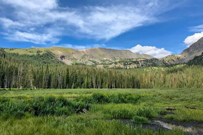
53 West-Central Colorado Dispersed Campsites
Jump directly to the 43 NE Colorado Boondocking Locations
Jump directly to the 78 NW Free Colorado Camping Spots
Jump directly to the 76 East-Central Colorado Boondocking Campgrounds
Jump directly to the 22 SE Colorado Boondocking Spaces
Jump directly to the 68 South-Central Colorado Camping Locations
Jump directly to the 87 SW Colorado Boondocking Sites
1. Upper Prince Creek
Address
El Jebel, Colorado
GPS: 39.332877, -107.152095
Elevation: 7461′
Management: Public – Bureau of Land Management (Official)
Free established BLM w pit toilet (this year 2021, closes nov) Colorado boondocking locations – There’s also a lower one as well as a bunch of dispersed as you make your way up the road to Dinkle Lake and Crown Mtn. Would take small RVs dinkle and only very capable overland vehicles to crown
2. De Beque CO River
Address
De Beque, Colorado
GPS: 39.34029, -108.19423
Elevation: 4915′
Management (Unofficial)
We stopped here during the day, so we did not stay overnight. There are maybe 5-7 Free Colorado camping spots no services. There were a couple cars there. Some nice spots near the river. The road is dirt and full of ruts.
3. OHV trails Near Debeque
Address
De Beque, Colorado
GPS: 39.316452, -108.273166
Elevation: 5197′
Management: Public – Bureau of Land Management (Official)
OHV trails near Debeque is open year round. You may stay 14 days in Colorado dispersed campsites at OHV trails near Debeque. Lots of flat places to pull off the road and park, many with fire pits. At this exact location T-Mobile is five bar but it’s a little sketchy service on the way up. No one here, totally quiet, pristine. No shade, no other
4. Overland Reservoir
Address
Gg65 Drive
Hotchkiss, Colorado
GPS: 39.085187, -107.639855
Elevation: 9888′
Management: Public – Forest Service
Overland Reservoir is open Jun-Oct. Free Colorado boondocking locations in the Grand Mesa, Uncompahgre and Gunnison National Forests’s Paonia Ranger District. First come -> first served. No reservations accepted. This is a high elevation location.
5. West Central Colorado Hiking – Grey Reservoir
Address
24108-24146 Forest Road 128
Hotchkiss, Colorado
GPS: 38.993736, -107.70825
Elevation: 9321′
Management: Public – Forest Service
Free Free Colorado camping spots in the Grand Mesa, Uncompahgre and Gunnison National Forests’s Grand Valley Ranger District. First come -> first camped. No reservations are accepted. This is a high elevation location.
6. J82 Crystal Creek
Address
Gunnison, Colorado
GPS: 38.558292, -107.501972
Elevation: 8192′
Management: Public – Bureau of Land Management
The road in is Dirt and 5.8 miles from a paved road. There are 1-5 Colorado dispersed campsites at this location and the maximum RV length is 45 feet. You may stay 14 at J82 Crystal Creek. It is one of the best campsite I have been. There is a pathway towards a river where you can see a resident marmot and her niche of piled branches and fallen trees, very close to a hidden campsite which is 5.8 miles from Hwy 92 in Gunnison.
7. Commissary Trailhead
Address
FR 721
Gunnison, Colorado
GPS: 38.570388, -107.33229
Elevation: 7929′
Management: Public – Forest Service
There are 6-15 Colorado boondocking locations at this site. Commissary Trailhead is a former campground area that provides parking for hikers and hunters during the summer and fall. 13 single site(s). Horse camping. OHV riding and camping. Vault toilet. No water or other services. Pack it in -> pack it out.
8. Soap Creek Corral / Coal Mesa Horse Camp
Address
Gunnison, Colorado
GPS: 38.543757, -107.314433
Elevation: 7696′
Management: Public – Forest Service (Official)
The road in is Dirt. There are 30 or more Free Colorado camping spots at this location. Dispersed camping is available at the horse corrals located adjacent to the Soap Creek Campground. This campground provides access to the southern trails of the West Elk Wilderness.
9. Soap Creek Road Dispersed
Address
Gunnison, Colorado
GPS: 38.53609, -107.316214
Elevation: 7938′
Management: Public – Forest Service (Official)
The road in is Dirt and 15 miles from a paved road. There are 1-5 Colorado dispersed campsites at this location and the maximum RV length is 35 feet.
Dispersed camping in this area. Follow Soap Creek Road up past the Curecanti National Recreation Area Ponderosa campground. Camping sites along the left hand side of the road. When the road forks and the old Soap Creek Road goes to the left, do not follow without high high clearance, great camping up that road though.
10. West Central Colorado Hiking – NFSR 721-1B
Address
NFSR 721-1B
Gunnison, Colorado
GPS: 38.518635, -107.314224
Elevation: 7993′
Management: Public – Forest Service
There are 1-5 Colorado boondocking locations at this site. You may stay 14 days at NFSR 721-1B. Free dispersed camping. Thre are only a couple of spots. The road might be a bit much for vehicles with low clearance. Scout it out. The first campsite is just lovely. It is open and flat with a few pine trees to provide shade. The hills block the cellular in this spot. To reach it, turn right at the first fork.
11. Rainbow Lake Dispersed Camping
Address
Gunnison, Colorado
GPS: 38.6339, -107.1787
Elevation: 10879′
Management: Public – Forest Service (Official)
The road in is Gravel and 13 miles from a paved road. Rainbow Lake Dispersed Camping is open 5/28 – 2/28. There are 6-15 Free Colorado camping spots at this location. You may stay 14 days at Rainbow Lake Dispersed Camping.
12. Mill Creek Road
Address
Gunnison, Colorado
GPS: 38.69481, -107.07172
Elevation: 9006′
Management: Public – Forest Service (Official)
The road in is Dirt and 4 miles from a paved road. Mill Creek Road is open Spring thru Fall. There are 1-5 Colorado dispersed campsites at this location and the maximum RV length is 25 feet. You may stay 14 days at Mill Creek Road. Dispersed camping on forest service land. Several campsites in pretty meadows before you get to the wilderness area gate. Camp next to Mill Creek.
13. Mill Creek Trailhead
Address
Gunnison, Colorado
GPS: 38.69611, -107.05031
Elevation: 8717′
Management: Public – Bureau of Land Management (Official)
The road in is Gravel. Mill Creek Trailhead is open year round. There are 6-15 Colorado boondocking locations at this site and the maximum RV length is 25 feet. You may stay 14 dasys at Mill Creek Trailhead. Parking for a couple dozen vehicles. Very popular during Fall hunting seasons. Lightly used during other times. Gate is closed in winter to allow people to park at this location and cross country ski from here.
14. Almont Triangle SWA
Address
Unnamed Road
Almont, Colorado
GPS: 38.700193, -106.837464
Elevation: 8688′
Management: Public – State Park
Free Colorado camping spots. Reservations are not accepted at this campsite. This is a high elevation location. The road is very rough and wouldn’t recommend it for camp trailers. It’s on the side of a mountain with zero cover. If your looking to just stop and sleep nothing else, stay at the bottom of the large steep hill. Free is free but agree would be nice.
15. West Central Colorado Hiking – Middle Brush Creek
Address
Unnamed Road
Crested Butte, Colorado
GPS: 38.886853, -106.900368
Elevation: 8960′
Management: Public – Forest Service
Free Colorado dispersed campsites in the Grand Mesa, Uncompahgre and Gunnison National Forests’s Gunnison Ranger District. First come -> First Camped. Reservations not accepted. This is a high elevation location.
16. Kebler Pass
Address
2408-4822 County Road 12
Crested Butte, Colorado
GPS: 38.860601, -107.048857
Elevation: 9488′
Management: Public – Forest Service
Free Colorado boondocking locations in the Grand Mesa, Uncompahgre and Gunnison National Forests’s Gunnison Ranger District. First come -> First Camped. Reservations not accepted. This is a high elevation location.
17. Horse Ranch Camp
Address
11862-11886 County Road 12
Somerset, Colorado
GPS: 38.86274, -107.161785
Elevation: 8852′
Management: Public – Forest Service
Free Free Colorado camping spots in the Grand Mesa, Uncompahgre and Gunnison National Forests’s Paonia Ranger District. No reservations. First come, first served. This is a high elevation location. No services except a pit toilet. Creek nearby for watering horses. The valley is mostly aspen and beautiful in the fall. Great horse trails. Access the campground via Co Rd 12 from the west. Do not go over Kebler pass with anything other than a small trailer, hairpin turns make it impossible with big rigs.
18. Middle Brush Creek
Address
Unnamed Road
Crested Butte, Colorado
GPS: 38.886853, -106.900368
Elevation: 8960′
Management: Public – Forest Service
Free Colorado dispersed campsites in the Grand Mesa, Uncompahgre and Gunnison National Forests’s Gunnison Ranger District. First come -> First Camped. Reservations not accepted. This is a high elevation location.
19. Washington Gulch
Address
Washington Gulch Road,
Crested Butte, Colorado
GPS: 38.93366, -107.01361
Elevation: 9662′
Management: Public – Forest Service (Official)
The road in is Dirt and 1 miles from a paved road. Washington Gulch is open when the roads are passable (summer). There are 30 or more Colorado boondocking locations at this site and the maximum RV length is unlimited. You may stay 14 days at Washington Gulch.
20. Paradise Divide
Address
Crested Butte, Colorado
GPS: 38.988404, -107.065817
Elevation: 11293′
Management: Public – Forest Service (Unofficial)
The road in is 4×4 and 15 miles from a paved road. There are 6-15 Free Colorado camping spots at this location. Unbelievable views from the 11,250 foot pass between Paradise Basin and the Slate River drainage. Reachable by AWD & 4WD vehicles. I’ve seen Subarus up there.
21. FR 279 Dispersed Camping
Address
Forest Road 279a
Collbran, Colorado
GPS: 39.127991, -107.875389
Elevation: 10248′
Management: Public – Forest Service (USDA) (Unofficial)
Colorado dispersed campsites in Colorado’s Grand Mesa National Forest. Free dispersed camping. Half shade/half sun.
22. Twin Lake Dispersed Area
Address
Cedaredge, Colorado
GPS: 39.064584, -107.842937
Elevation: 10406′
Management: Public – Forest Service (Official)
Twin Lake Dispersed Area is open in July. Free Colorado boondocking locations on the shores of Twin Lake. In the Grand Mesa National Forest. No Drinking Water, No Restroom – No facilities. Pure boondocking. Bring all needed supplies. No stores near by.
23. Twin lakes
Address
Cedaredge, Colorado
GPS: 39.069792, -107.870511
Elevation: 10184′
Management: Public – Forest Service (Unofficial)
You may stay 14 days in Free Colorado camping spots at Twin lakes. In Grand Mesa, off of hwy 121, exit Weir and Johnson Rd.
24. Surface Creek Area
Address
Surface Creek Rd.
Cedaredge, Colorado
GPS: 39.004893, -107.858065
Elevation: 8681′
Management: Public – Forest Service (Official)
The road in is Gravel and 4 miles from a paved road. There are 1-5 Colorado dispersed campsites at this location and the maximum RV length is 25 feet. You may stay 14 days at Surface Creek Area. Stayed here 8-1 thru 15-2016. Very secluded spot right past the gate into the forest. Drive north on Surface Creek Rd. (FR 125) from Cedaredge. You will come to the entrance gate to the forest and cross over a cattle guard. There is a huge parking lot for rigs and horse trailers.
25. West Central Colorado Hiking – Youngs Creek Reservoir Three
Address
2190 Lakeshore Dr
Cedaredge, Colorado
GPS: 39.044479, -107.918747
Elevation: 10226′
Management: Public – Forest Service (USDA) (Unofficial)
Free Colorado boondocking locations in Colorado’s Grand Mesa National Forest. No facilities, true wilderness boondocking location. If you catch any fish you must release them back into the reservoir.
26. Kiser Slough Reservoir
Address
25440-25526 Old Grand Mesa Road
Cedaredge, Colorado
GPS: 39.024023, -107.942442
Elevation: 9833′
Management: Public – Forest Service
Free Free Colorado camping spots in the Grand Mesa, Uncompahgre and Gunnison National Forests’s Grand Valley Ranger District. This campsite does not use a reservation system. First come, first served. This is a high elevation location.
27. Forest Turnout 1051B
Address
1051B
Grand Mesa, Colorado
GPS: 39.02742, -108.225066
Elevation: 9919′
Management: Public – Forest Service
Colorado dispersed campsites located right on the edge of the Grand Mesa, this free campsite has spectacular views. Lands End Road is long, winding and steep. The mesa is amazing and full of history and beauty. Boondocking. No facilities. Need it? Bring it. I had a cellular signal. Tent or small RVs.
28. Grand Mesa – Lands End Road
Address
Lands End Road
Grand Junction, Colorado
GPS: 38.999779, -108.254065
Elevation: 6877′
Management: Public – State Forest
Grand Mesa – Lands End Road is open seasonally. Colorado boondocking locations – Spent a week there, water near by, fire ring.
29. Cottonwood Grove Campground
Address
Delta, Colorado
GPS: 38.77872, -107.85281
Elevation: 5093′
Management: Public – Bureau of Land Management (Official)
The road in is Dirt. There are 6-15 Free Colorado camping spots at this location and the maximum RV length is 25 feet. You may stay one week (7 days) at Cottonwood Grove Campground.
30. West Central Colorado Hiking – Chukar Trailhead
Address
Montrose, Colorado
GPS: 38.613151, -107.835567
Elevation: 5979′
Management Bureau of Land Management (Official)
The road in is 4×4. There are 1-5 Colorado dispersed campsites at this location. You may stay 7 days at Chukar Trailhead. Although it requires a one-mile hike to the river, Chukar Trailhead is the main boater access for rafting the Gunnison Gorge section of the Gunnison River. It also provides four designated campsites with cabanas, picnic tables, and grills for a maximum of 25 people.
31. Peach Valley OHV
Address
Peach Valley Road
Montrose, Colorado
GPS: 38.594925, -107.8896
Elevation: 5629′
Management: Public – Bureau of Land Management (Official)
The road in is Gravel. Peach Valley OHV is open year-round. There are 1-5 Colorado boondocking locations at this site and the maximum RV length is unlimited. You may stay one week (7 days) at Peach Valley OHV. Flat Top-Peach Valley is an upland desert landscape within Gunnison Gorge National Conservation Area. It is most popular for mountain biking and off-highway vehicle use, and enthusiasts can enjoy a variety of thrilling adventures.
32. BLM Land near Black Canyon of the Gunnison
Address
Montrose, Colorado
GPS: 38.53065, -107.720228
Elevation: 7890′
Management: Public – Bureau of Land Management (Unofficial)
The road in is Dirt. You may stay 14 days in Free Colorado camping spots at BLM Land near Black Canyon of the Gunnison. BLM land just outside of Black Canyon on the Gunnison South Rim. It’s 1.7 miles south on CO-347 from the national park entrance, past 2 cattle guards.
33. Flat Top OHV Area
Address
Flat Top Road
Montrose, Colorado
GPS: 38.52195, -107.859444
Elevation: 5888′
Management: Public – Bureau of Land Managment (Official)
The road in is Dirt and 0.5 miles from a paved road. There are 1-5 Colorado dispersed campsites at this location and the maximum RV length is 40′. You may stay 6night /7days in 30 at Flat Top OHV Area. 7 day limit. Free camping. BLM. More of a parking lot than a camping area. There is a vault toilet. No shade, tables, bbqs, water or trash services. No open fires! Three miles from Montrose, Colorado. Full bars of Sprint Cellular and Verizon EVDO.
34. Pack Trail Point
Address
Delta, Colorado
GPS: 38.573603, -108.167631
Elevation: 6447′
Management: Public – Bureau of Land Management (Official)
Colorado boondocking locations – BLM has stated that the roads surrounding this marker are OK for disperesed camping as long as you stay wihtin 300 feet of the road and keep the area clean. This area is on a cliff overlooking a wilderness area. There area horse, bicycle, and foot trails that descend into it.
35. Roubideau Creek
Address
Roubideau Canyon Road
Delta, Colorado
GPS: 38.667708, -108.155306
Elevation: 5049′
Management: Public – Bureau of Land Management
Free Colorado camping spots – This is a BLM suggested camping area. Roubideau OHV area. Don’t be a pig. Pack your trash out with you. There are no services here.
36. Potholes Campground
Address
Delta, Colorado
GPS: 38.670086, -108.326094
Elevation: 5505′
Management: Public – Bureau of Land Management (Official)
The road in is Gravel. Potholes Campground is open year round. There are 1-5 Colorado dispersed campsites at this location and the maximum RV length is 45 feet. You may stay 14 days at Potholes Campground. Small campground in Escalante Canyon within the Dominguez-Escalante National Conservation Area. There are also dispersed campsites.
37. West Central Colorado Hiking – Escalante Canyon
Address
Delta, Colorado
GPS: 38.778627, -108.250701
Elevation: 5289′
Management: Public – Bureau of Land Management (Unofficial)
The road in is Dirt. There are 6-15 Colorado boondocking locations at this site. Dispersed campsites along the roads south west of highway 50. No services or amenities. The large parking lot at the turn off from 50 is for OHV unloading and parking, not camping. Please drive further in.
38. Gunnison River Overlook (BLM)
Address
Delta, Colorado
GPS: 38.77532, -108.28685
Elevation: 5607′
Management: Public – Bureau of Land Management (Official)
The road in is 4×4 and 2+ miles from a paved road. There are 6-15 Free Colorado camping spots at this location and the maximum RV length is 15 feet. You may stay 14 days at Gunnison River Overlook (BLM).
39. Dominguez-Escalante West
Address
Delta, Colorado
GPS: 38.8161, -108.30688
Elevation: 5341′
Management: Public – Bureau of Land Management (Official)
The road in is Gravel and 0.4 miles from a paved road. There are 16-29 Colorado dispersed campsites at this location and the maximum RV length is unlimited. BLM campground. Full AT&T bars and full Verizon. Broken glass, so watch out. Much better view than the other Dominguez-Escalante camp 5 minutes east. No signs. No services. 4×4 not need.
40. Nine Mile Hill
Address
Colorado
GPS: 38.927162, -108.491925
Elevation: 5371′
Management: Public – Bureau of Land Management
Free Colorado boondocking locations among some great climbing and bouldering routes. This area is mainly used for climbing. Be cool.
41. North Fruita Desert BLM
Address
Fruita, Colorado
GPS: 39.299472, -108.706203
Elevation: 4987′
Management: Public – Bureau of Land Management (Official)
The road in is Dirt and About 4 miles from a paved road. There are 16-29 Free Colorado camping spots at this location and the maximum RV length is unlimited. You may stay 14 Days at North Fruita Desert BLM. Dispersed camping on BLM land north of Fruita CO. There is a BLM pay site just up the road, but there is legal free camping in the area just south of the main mountain bike trail head parking lot.
42. 16 Road
Address
Loma, Colorado
GPS: 39.26331, -108.76213
Elevation: 4774′
Management: Public – Bureau of Land Management
The road in is Dirt. The maximum RV length at 16 Road is unlimited. You may stay 14 days in Colorado dispersed campsites at 16 Road. BLM Land northwest of grand junction. It looks like it receives quite a bit of OHV usage.
43. BLM North Fruita Desert
Address
Fruita, Colorado
GPS: 39.264312, -108.702145
Elevation: 4839′
Management: Public – Bureau of Land Management (Official)
The road in is Dirt and 3 miles from a paved road. Colorado boondocking locations – Off a road, found an established disbursed site. Dark, quiet. Dirt roads but easy to navigate in my small car. Too much trash/shot gun shells around.
44. West Central Colorado Hiking – Colorado Welcome Center Rest Stop
Address
Fruita, Colorado
GPS: 39.153233, -108.736292
Elevation: 4495′
Management: Private – State welcome center (Official)
The road in is Paved. Colorado Welcome Center Rest Stop is open year round. There are 6-15 Free Colorado camping spots at this location and the maximum RV length is unlimited. You may stay 8 hours at Colorado Welcome Center Rest Stop. Really nice clean rest stop at welcome center- welcome center had 24 hr restroom access.
45. Dominguez – Escalante NCA – Big Dominguez
Address
Divide Road
Grand Junction, Colorado
GPS: 38.745003, -108.549997
Elevation: 7106′
Management: Public – Bureau of Land Management
Dominguez – Escalante NCA – Big Dominguez is open May-Oct. Loved this area. Colorado dispersed campsites – Very open and spacious camp sites. Many all over. Theirs camp sites down at the bottom, half way, and farther down. No chance of someone not finding an area to camp regardless of the amount of luggage packed along. Fire rings only so plan ahead.
46. Divide Road
Address
Divide Road
Grand Junction, Colorado
GPS: 38.830188, -108.578436
Elevation: 7178′
Management: Public – Bureau of Land Management
Colorado boondocking locations. First come -> First Camped. Reservations not accepted. This is a high elevation location. Drive only on designated routes.
47. Grand Valley RD
Address
Divide Road
Colorado
GPS: 38.684413, -108.689644
Elevation: 8762′
Management: Public – USDA Forest Service (Official)
The maximum RV length at Divide Forks Campground – Grand Valley RD is 35 feet. You may stay two weeks (14 days) in Free Colorado camping spots at Divide Forks Campground – Grand Valley RD. This is a Forest Service operated campground located at 9200-foot elevation. There are 11 campsites and a toilet. No water. No fee. Maximum spur length is 20 feet.
48. Haypress Dispersed Campground
Address
16 5/10 Rd
Glade Park, Colorado
GPS: 38.854921, -108.78024
Elevation: 8951′
Management: Public – Forest Service (Official)
You may stay 14 days in Colorado dispersed campsites at Haypress Dispersed Campground. Free campsite near Fruita Reservoir #3. Little more han a restroom in a clearing on the right side of the road, this Grand Mesa National Forest camping area is utilized by folks fishing in the reservoir.
49. Miracle Rock
Address
Glade Park, Colorado
GPS: 38.980686, -108.871475
Elevation: 6571′
Management: Public – Bureau of Land Managment (Unofficial)
The road in is Dirt. There are 6-15 Colorado boondocking locations at this site. Great little spot to camp. Has restrooms, picnic tables and fire rings but no water and trash is carry out. There is a trailhead at the site that goes up to the “Miracle Rock” which is really neat. It is a nice little hike, pretty easy for all ages. If you are so inclined, there is a set of swimming holes a few miles up the dirt road,
50. McInnis Canyons NCA – RV Area
Address
Interstate 70
Mack, Colorado
GPS: 39.192952, -108.996312
Elevation: 4682′
Management: Public – Bureau of Land Management
Free Free Colorado camping spots in the Bureau of Land Management Grand Junction District. First come -> First Camped. Reservations not accepted.
51. Rabbit Valley North Campground
Address
Mack, Colorado
GPS: 39.19371, -109.02999
Elevation: 4967′
Management: Public – Bureau of Land Management (Official)
The road in is Dirt and 1.5 miles from a paved road. Rabbit Valley North Campground is open year round. There are 6-15 Colorado dispersed campsites at this location and the maximum RV length is unlimited. You may stay 7 days at Rabbit Valley North Campground. This is the North Campground. Beautiful views and scenery. No facilities in this campground.
52. Castle Rocks Campground
Address
Mack, Colorado
GPS: 39.159694, -109.034931
Elevation: 4514′
Management: Public – Bureau of Land Management (Official)
The road in is Dirt. There are 1-5 Colorado boondocking locations at this site and the maximum RV length is 25 feet. You may stay 7 days at Castle Rocks Campground. Small walk in campground
53. Kokopelli’s Trail – Knowles Canyon Campground
Address
Unnamed Road
Mack, Colorado
GPS: 39.136836, -109.026897
Elevation: 4675′
Management: Public – Bureau of Land Management (Official)
The road in is Dirt. There are 6-15 Free Colorado camping spots at this location and the maximum RV length is 15 feet. You may stay 7 days at Kokopelli’s Trail – Knowles Canyon Campground. Free camping in the Bureau of Land Management Grand Junction District. Reservations are not accepted at this campsite. This camping area is part of Rabbit Valley and McInnis Canyons National Conservation Area. The camping area requires a high clearance vehicle to access it.
Colorado Boondocking Spaces
While the Western United States appears to have an unlimited supply of lovely, free camping spots, few states do it quite like Colorado. Finding a free site to camp is not just about saving a buck; it’s about living amid the most magnificent landscape the state has to offer, from desert cliff-dwelling to the Rocky Mountains’ wealth of forests, and beyond to the Front Range, encompassing Denver and Fort Collins.
Colorado is full of surprises, including a surprising number of free camping opportunities. However, pinpointing the exact location of those places can be difficult. So, before you go driving around looking for a fee sign or a camp host, scroll down to view this list of the top free campgrounds in Colorado, compiled from all corners of the state.
Colorado has over 23 million acres of public property, so there are lots of opportunities for free camping. The state’s many features, including the Rocky Mountains, high desert, and wide grasslands, are covered in public property. The majority of free Colorado camping spots are located on National Forest or Bureau of Territory Management land.
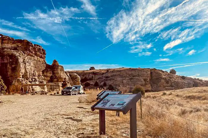
22 SE Colorado Boondocking Spaces
Jump directly to the 43 NE Colorado Boondocking Locations
Jump directly to the 78 NW Free Colorado Camping Spots
Jump directly to the 76 East-Central Colorado Boondocking Campgrounds
Jump directly to the 53 West-Central Colorado Dispersed Campsites
Jump directly to the 68 South-Central Colorado Camping Locations
Jump directly to the 87 SW Colorado Boondocking Sites
1. Cucharas Canyon – Kenner Ranch
Address
County Road 123
Walsenburg, Colorado
GPS: 37.844817, -104.550059
Elevation: 5971′
Management: Public – Bureau of Land Management
Free Colorado boondocking locations in the Bureau of Land Management Royal Gorge District. First come -> First Camped. Reservations not accepted. Nice view from the top of the canyon rim. Vertical Cliff dropoff, some cell service. Very remote.
2. Cucharas Canyon – Sheep’s Crossing
Address
Farista, Colorado
GPS: 37.80527, -104.5822
Elevation: 5837′
Management: Public – Bureau of Land Management
Free Colorado camping spots at Sheep’s Crossing on the west side of the area and at the Kenner Ranch area on the east side. Please camp only in existing sites and do not create new sites or fire rings. Contact the BLM office for information on current fire bans and please follow all fire restrictions.
3. Ordway Reservoir SWA
Address
Unnamed Road
Ordway, Colorado
GPS: 38.25079, -103.753442
Elevation: 4396′
Management: Public – State Park
Colorado dispersed campsites. First come -> First Camped. Reservations not accepted. We weren’t able to access the west side of this as we are a 13’6″ tall 5th wheel and the trees on the south side berm were too low per the directions. We stayed on the east side pull through that had access drives on the north and south end – easy clearance for us and beautiful at the edge of the water.
4. Lake Henry
Address
Ordway, Colorado
GPS: 38.26762, -103.708059
Management: Public (Official)
Free Colorado boondocking locations lake front camping. Dispersed camping.
5. Lake Meredith
Address
Sugar City, Colorado
GPS: 38.211996, -103.69245
Management: Public (Official)
The road in is Dirt. There are 1-5 Free Colorado camping spots at this location.Open, free camping on the shores of Lake Meredith. No designated campsites. No shade. Good fishing. Dispersed camping. Vault toilets. The parking area is slippery after a rain.
6. Adobe Creek Reservoir SWA (Blue Lake)
Address
Las Animas, Colorado
GPS: 38.234921, -103.240334
Elevation: 4137′
Management: Public – Fish and Wildlife Service (Official)
Adobe Creek Reservoir SWA (Blue Lake) is open Year-round. Colorado dispersed campsites on Adobe Reservoir. Primitive camping is available on the east, south and west sides of lake 4,128-foot elevation. Hunting for deer, antelope, rabbit, pheasant, scaled quail, dove, waterfowl. Fishing in Adobe Creek Reservoir (Blue Lake) for walleye, crappie, bass, bluegill, wiper, tiger muskie. Trotlines and jugs permitted.
7. Horse Creek Reservoir SWA
Address
Timber Lake Road
La Junta, Colorado
GPS: 38.19143, -103.405207
Elevation: 4111′
Management: Public – State Park
Colorado boondocking locations. Reservations are not accepted at this campsite.
8. Melon Valley SWA
Address
20840-21498 Rocky Ford Dyke Road
Rocky Ford, Colorado
GPS: 38.093419, -103.719269
Elevation: 4163′
Management: Public – State Park
Free Colorado camping spots. First come -> first served. No reservations accepted. Stayed here across the country from AZ to PA. Me and my secondary vehicle stayed in the parking lot. It is dirt and on a slope, but you can level up pretty easy. Beautiful view of the river and wild melons growing in the field.
9. Holbrook Reservoir SWA
Address
25133-25401 County Road FF
Rocky Ford, Colorado
GPS: 38.055964, -103.616858
Elevation: 4170′
Management: Public – Fish and Wildlife Service
Colorado dispersed campsites – Small irrigation reservoir near Swink Colorado with good cell service and restrooms.
10. Timpas Creek SWA
Address
20019 County Road Z
Rocky Ford, Colorado
GPS: 37.968267, -103.705528
Elevation: 4199′
Management: Public – State Park
Colorado boondocking locations. First come -> first camped. No reservations are accepted. It is near a landfill in an area that is not an attractive place. The drive is closed so you can only hike in.
11. Timpas
Address
Timpas, Colorado
GPS: 37.823888, -103.770811
Elevation: 4416′
Management: Public – Forest Service
The road in is Gravel. There are 1-5 Free Colorado camping spots at this location and the maximum RV length is unlimited. You may stay One night at Timpas. Large flat areas next to covered picnic tables and vault toilet.
12. Vogel Canyon
Address
Unnamed Road
La Junta, Colorado
GPS: 37.770405, -103.512694
Elevation: 4393′
Management: Public – Forest Service
Colorado dispersed campsites in the Pike and San Isabel National Forests’s Comanche Ranger District. Reservations are not accepted at this campsite. This is a really beautiful area with some nice hiking trails. It is about 3 miles from hwy 109 on an good dirt road. The road becomes impassable after rain. When we were here it started snowing after we settled in and we had to wait three days for the snow to melt and the road to dry up enough so we could leave.
13. Picket Wire Corrals
Address
23998 Rourke Road
La Junta, Colorado
GPS: 37.658972, -103.620042
Elevation: 4649′
Management: Public – Forest Service
Colorado boondocking locations – popular meeting spot, about 33 miles south of La Junta, offers wildlife interpretation and corrals for public equestrian use.
14. Picket Wire Canyon – Comanche National Grasslands
Address
Forest Service Road 500A
Kim, Colorado
GPS: 37.659885, -103.571121
Elevation: 4631′
Management: Public – Forest Service (USDA) (Official)
The road in is Dirt and 20+ miles from a paved road. Picket Wire Canyon – Comanche National Grasslands is open year-round. There are 1-5 Free Colorado camping spots at this location and the maximum RV length is 35′. You may stay 14 in 28 at Picket Wire Canyon – Comanche National Grasslands.
15. Picketwire Canyon Overlook
Address
La Junta, Colorado
GPS: 37.6437, -103.58051
Elevation: 4685′
Management: Public – Bureau of Land Management (Official)
The road in is Dirt and 17 miles miles from a paved road. Picketwire Canyon Overlook is open year round. There are 1-5 Colorado dispersed campsites at this location and the maximum RV length is 15 feet. You may stay 14 days at Picketwire Canyon Overlook.
16. Campo City Park
Address
Campo, Colorado
GPS: 37.105553, -102.57895
Elevation: 4344′
Management: Public – City park (Official)
The road in is Gravel. Campo City Park is open year round. There are 1-5 Colorado boondocking locations at this site and the maximum RV length is unlimited. You may stay any at Campo City Park. Camp on parking lot on north side of city park. Do not park on grass. No hookups. Three days free. Garbage receptacle. Sites are not real level. Fire grates nearby in the park. Playground equipment.
17. Burchfield SWA
Address
54742-54998 County Road DD
Walsh, Colorado
GPS: 37.383983, -102.074095
Elevation: 3688′
Management: Public – State Park
Free Colorado camping spots. First come -> first camped. No reservations are accepted.
18. Two Buttes Reservoir SWA
Address
Road West
Lamar, Colorado
GPS: 37.635653, -102.544467
Elevation: 4242′
Management: Public – State Park
Colorado dispersed campsites. First come -> First Camped. Reservations not accepted. Original post is correct but fails to mention how beautiful this place is!! There is camping both above and below the dam with a pit toilet for each. The one below the dam was missing the door and had some wasps living in it. Otherwise totally fine. We used our own, I didn’t check the other one.
19. Gobblers Knob Rest Area
Address
Lamar, Colorado
GPS: 37.764235, -102.605843
Elevation: 4262′
Management: Public – Rest Area (Official)
Colorado boondocking locations on the west side of 287/385 between mm 55 and mm 56 south of Lamar. Paved rest area, trash cans, pit toilets. No tent camping. No electricity. Wide open sky and farming community.
20. Thurston Reservoir SWA
Address
Road 7
Lamar, Colorado
GPS: 38.219848, -102.633378
Elevation: 3806′
Management: Public – State Park
Free Colorado camping spots. First come -> first served. No reservations accepted. DNR website says that camping is permissible, but when we arrived last night, the sign on-site said no camping. No fire rings or other signs of camping at this site. We crashed there anyway for the night and left early without any trouble.. Lots of migratory birds on the lake.
21. Mike Higbee SWA
Address
30478-31000 County Road 12
Lamar, Colorado
GPS: 38.09147, -102.52933
Elevation: 3596′
Management: Public – Fish and Wildlife Service (Official)
The road in is Gravel. There are 1-5 Colorado dispersed campsites at this location and the maximum RV length is unlimited. This is a free dispersed campsite. First come -> first camped. No reservations are accepted.
22. Arkansas River SWA
Address
Unnamed Road
Holly, Colorado
GPS: 38.035512, -102.048163
Elevation: 3369′
Management: Public – State Park
Colorado boondocking locations. This campsite does not use a reservation system. First come, first served. We drove by here today. There is a rest area on the south side of Hwy 50 pretty close to the state line on the Colorado side. It had a sign for a dump station and we did see a rest room building. The area has multiple picnic sites with older looking shelters. As plus there are some trees. In this area that is a rarity.
Free Colorado Camping Locations
In the Centennial State, there are a dozen or so national forests and grasslands inside the state’s borders that are ideal for dispersed camping. Are you looking for a place to camp close to Steamboat Springs? There are plenty of forest paths and mountain passes to explore. Idaho Springs is only a half-hour drive from Denver, but it’s packed with opportunities for mountain biking, tent camping, and exploring the national forest.
Locating Colorado dispersed campsites is almost always a matter of driving up a forest road (many of which also have official camping places) and finding an unoccupied previously established spot (look for a fire ring or stone fire pit). Despite the growing appeal of getting outside, finding a place to camp in Colorado is still pretty simple, and locating a free camping space is no exception.
Expect a shady area behind towering pines, frequently with a spectacular view, near a water source, and often within an easy drive of yet another lovely, small town in most of the state’s mountainous regions. Are you looking for a place to camp in a tent in Colorado? Camping in a car? All makes and models of campers can find free camping in Colorado; simply choose your national forest and begin exploring its routes.
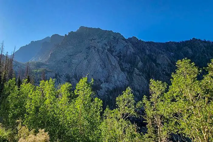
68 South-Central Colorado Camping Locations
Jump directly to the 43 NE Colorado Boondocking Locations
Jump directly to the 78 NW Free Colorado Camping Spots
Jump directly to the 76 East-Central Colorado Boondocking Campgrounds
Jump directly to the 53 West-Central Colorado Dispersed Campsites
Jump directly to the 22 SE Colorado Boondocking Spaces
Jump directly to the 87 SW Colorado Boondocking Sites
1. Hecla Junction BLM
Address
CR 194 Nathrop, CO
Salida, Colorado
GPS: 38.651617, -106.073298
Elevation: 7817′
Management: Public – Bureau of Land Management
The road in is Gravel and 1.2 miles from a paved road. Hecla Junction BLM is open Year round. There are 1-5 Colorado boondocking locations at this site and the maximum RV length is 35 feet. You may stay 14 out of 30 at Hecla Junction BLM. Stunningly scenic 14 Day BLM free camping down the road from an Arkansas Headwaters Recreation Area campground. No facilities. Pure boondocking. If you need something, you’d have better brought it or you’ll do without (like a toilet).
2. Middle Quartz Campground – Gunnison RD
Address
Nathrop, Colorado
GPS: 38.622938, -106.424614
Elevation: 10233′
Management: Public – Forest Service
The area is part of the mineral belt that extends into Leadville. Many of the 4-wheel drive roads were created by miners over 100 years ago which are now popular for four-wheel driving in the Summer and Fall months. Free Colorado camping spots – The campground is near the alpine Tunnel historic site
3. Pomeroy Lake
Address
14582 County Road 240
Nathrop, Colorado
GPS: 38.648399, -106.339636
Elevation: 12103′
Management: Public – Forest Service
Colorado dispersed campsites in the Pike and San Isabel National Forests’s Salida Ranger District. This campsite does not use a reservation system. First come, first served. This is a high elevation location.
4. Hecla Junction BLM
Address
CR 194 Nathrop, CO
Salida, Colorado
GPS: 38.651617, -106.073298
Elevation: 7817′
Management: Public – Bureau of Land Management
The road in is Gravel and 1.2 miles from a paved road. Hecla Junction BLM is open Year round. There are 1-5 Colorado boondocking locations at this site and the maximum RV length is 35 feet. You may stay 14 out of 30 at Hecla Junction BLM. Stunningly scenic 14 Day BLM free camping down the road from an Arkansas Headwaters Recreation Area campground. No facilities. Pure boondocking. If you need something, you’d have better brought it or you’ll do without (like a toilet).
5. Fooses Creek Primitive Camping
Address
Salida, Colorado
GPS: 38.53912, -106.252661
Elevation: 9019′
Management: Public – Forest Service (Official)
The road in is Gravel. You may stay 14 days in Free Colorado camping spots at Fooses Creek Primitive Camping. Nice secluded primitive camping past Fooses lake. follow forest rd 225 all the way until past the small lake and you will be in primitive camping. Very nice.
6. Shavano Wildlife Area – NW Poncha Springs BLM
Address
Salida, Colorado
GPS: 38.554325, -106.116013
Elevation: 8202′
Management: Public – Bureau of Land Managment (Unofficial)
The road in is Dirt and 3 miles from a paved road. Shavano Wildlife Area – NW Poncha Springs BLM is open Summer. There are 16-29 Colorado dispersed campsites at this location and the maximum RV length is any. You may stay 14 nights at Shavano Wildlife Area – NW Poncha Springs BLM.
7. Pancha Springs Rest Stop
Address
Poncha Springs, Colorado
GPS: 38.521622, -106.080519
Elevation: 7516′
Management: Private – Truck Stop (Official)
The road in is Paved. Pancha Springs rest stop is open year round. Colorado boondocking locations – stay overnight at Pancha Springs rest stop. Rest stop visitor center. OK to overnight. Water, bathrooms, wifi. Noisy freeway intersection at a crossroads.
8. Columbine Gulch
https://www.google.com/maps/place/38%C2%B027’38.6%22N+105%C2%B057’43.0%22W/@38.460734,-105.964139,732m/data=!3m2!1e3!4b1!4m5!3m4!1s0x0:0x26e44683185cbcb9!8m2!3d38.460734!4d-105.961945
Address
Salida, Colorado
GPS: 38.460734, -105.961945
Elevation: 7920′
Management: Public – Forest Service
The road in is Dirt. Columbine Gulch is open weather permitting. There are 1-5 Free Colorado camping spots at this location. You may stay 14 days at Columbine Gulch. Free, dispersed camping along CR101. You have to travel 3mi from highway 50 and travel over two cattle guards to reach forest land. Once you do, you will see parking for a trailhead on the right. Don’t camp there. Keep going and there will be a handful of locations.
9. Poncha Loop Road
Address
Villa Grove, Colorado
GPS: 38.412358, -106.088642
Elevation: 9077′
Management: Public – Bureau of Land Management
The road in is Dirt. Poncha Loop Road is open weather permitted. There are 1-5 Colorado dispersed campsites at this location and the maximum RV length is unlimited. You may stay two weeks at Poncha Loop Road. A nice sized, free campsites on BLM land just south of Poncha Pass.
10. Poncha Creek Dispersed Camping
Address
FR 200
Villa Grove, Colorado
GPS: 38.418473, -106.131003
Elevation: 8690′
Management: Public – Forest Service
The road in is Dirt. Poncha Creek Dispersed Camping is open May-November. There are 6-15 Colorado boondocking locations at this site and the maximum RV length is 35 feet. You may stay 14 days at Poncha Creek Dispersed Camping. Free, dispersed camping near the Shirley Townsite in Colorado’s San Isabel National Forest. You an find campsites along Poncha Creek, Silver Creek and Marshall Pass Roads.
11. County Rd 47
Address
Villa Grove, Colorado
GPS: 38.403604, -106.126881
Management: Public – Forest Service (Official)
The road in is Dirt and .1 miles from a paved road. There are 6-15 Free Colorado camping spots at this location and the maximum RV length is unlimited. You may stay 14 days at County Rd 47.
12. Daley Gulch – State Management Area
Address
Sargents, Colorado
GPS: 38.422053, -106.410201
Elevation: 8524′
Management: Public – State Trust
The road in is Dirt and 1/4 miles from a paved road. There are 1-5 Colorado dispersed campsites at this location and the maximum RV length is 35 feet. Open turn around area before crossing the “Gulch” which I would not recommend for RV. Road runs along side state maintenance facility. Just at the bottom of the big climb to Monarch Pass.
13. Mosquito Lake
Address
Villa Grove, Colorado
GPS: 38.336358, -106.179242
Elevation: 10801′
Management: Public – Forest Service
The road in is Dirt. There are 1-5 Colorado boondocking locations at this site and the maximum RV length is 15 feet. Free dispersed camping in the Rio Grande National Forest. You cannot drive to Lake itself, but you an get to a spot just a couple hundred feet from it. It’s not real level and certainly not for big rigs, but a truck camper, popup or class b should be fine.
14. Slaughter House Road
Address
Slaughterhouse Road
Villa Grove, Colorado
GPS: 38.309321, -106.178246
Elevation: 10385′
Management: Public – Forest Service
The road in is Dirt. There are 1-5 Free Colorado camping spots at this location and the maximum RV length is 25 feet. Free, dispersed camping in the Rio Grande National Forest of Colorado. There are numerous campsites all along this road. Most of them were very large with grassy, open space and trees. This is dispersed camping.
15. Rawley Mine
Address
Villa Grove, Colorado
GPS: 38.314166, -106.14344
Elevation: 9807′
Management: Public – Forest Service
There are 1-5 Colorado dispersed campsites at this location and the maximum RV length is 15 feet. A small staging area for the Bonzaza Off Highway Vehicle Tour. This would be a decent spot for a popup, class b or truck camper. The area is gravel and probably mine tailings, so it’s not good for tents.
16. FR 842 Dispersed
Address
Villa Grove, Colorado
GPS: 38.177661, -106.144044
Elevation: 9351′
Management: Public – Forest Service
The road in is Dirt. There are 1-5 Colorado boondocking locations at this site and the maximum RV length is 25 feet. There are a couple of free, dispersed campsites along this road after you cross the forest boundary. One is on the right just as you turn to climb the mountains and right before the marker.
17. Hayden Creek Dispersed Camping
Address
CR6
Coaldale, Colorado
GPS: 38.330078, -105.815765
Elevation: 7546′
Management: Public – Forest Service (USDA) (Unofficial)
You may stay 14 Days in Free Colorado camping spots at Hayden Creek Dispersed Camping. US 50 between Cañon City and Salida, at Coaldale, go south on CR6, Hayden Creek Road. There are 2 NFS campgrounds, Coaldale and Hayden Creek. Between the two are several unofficial camping areas.
18. Saguatche County Rd GG
Address
Moffat, Colorado
GPS: 38.18753, -105.840388
Elevation: 8104′
Management: Public – Bureau of Land Management (Unofficial)
The road in is Dirt and 6 miles from a paved road. There are 1-5 Colorado dispersed campsites at this location. Dispersed site off of Saguatche County Rd GG. Continue onto Rd GG for 5.5 miles from highway 17, past County Rd 61. You’ll see the OLT (Orient Land Trust) hydro plant on the right side.
19. Hot Water Springs and Garner Trailhead
Address
Moffat, Colorado
GPS: 38.179695, -105.812969
Elevation: 8566′
Management: Public – Forest Service (Official)
Colorado boondocking locations – Relatively flat space, dirt loop. Very nice views of the valley. Boondocking only. We did it in a 31 foot class C, no problems. At the intersection of 285 and 17 is County Road GG. Take CR-GG east all the way across the valley right up into the foothills. The road is hard pack dirt, few ruts, but easy.
20. Cotton Creek Trail
Address
County Road Cc64
Moffat, Colorado
GPS: 38.13164, -105.788689
Elevation: 8576′
Management: Public – Forest Service
Free Colorado camping spots in the Rio Grande National Forest’s Saguache Ranger District. Reservations are not accepted at this campsite. This is a high elevation location.
21. Wild Cherry Creek
Address
County Road AA
Moffat, Colorado
GPS: 38.100628, -105.770655
Elevation: 8524′
Management: Public – Forest Service
Colorado dispersed campsites in the Rio Grande National Forest’s Saguache Ranger District. No reservations. First come, first served. This is a high elevation location.
22. Middle Taylor Creek SWA
Address
Hermit Road
Westcliffe, Colorado
GPS: 38.1045, -105.604333
Elevation: 10000′
Management: Public – Fish and Wildlife Service (Official)
Colorado boondocking locations 8 miles west of the town of Westcliffe on Hermit Road (County Rd. 160) and Forest Service Rd 301.
23. South Colony Basin
Address
3205 South Colony Road
Westcliffe, Colorado
GPS: 37.976696, -105.505054
Elevation: 9885′
Management: Public – Forest Service
The road in is 4×4. You may stay 14 days in Free Colorado camping spots at South Colony Basin. South Colony Basin and the surrounding 14,000-foot peaks offer a broad range of recreational opportunities, including camping, hiking, backpacking, mountaineering, fishing and hunting.
24. Mine Road
Address
Westcliffe, Colorado
GPS: 38.012307, -105.697782
Elevation: 8278′
Management: Public – Forest Service
The road in is Dirt. There are 1-5 Colorado dispersed campsites at this location and the maximum RV length is 25 feet. Dispersed camping north of Crestone. Take the road towards North Crestone Creek Campground and swing a left before you get there. There is some private land in the area so but sure to use the public land’s layer and stay on public land. Be respectful in all you do.
25. Crestone
Address
Forest Road 949
Westcliffe, Colorado
GPS: 37.990148, -105.685411
Elevation: 8186′
Management: Public – Forest Service (Official)
Take East Galena Avenue until you clear private land. Colorado boondocking locations. The private land owner has made abundantly clear where public land starts. Great site. Wonderful town.
26. Seven Lakes Road
Address
Manitou Springs, Colorado
GPS: 38.75428, -105.01006
Elevation: 10354′
Management: Public – Forest Service (Official)
The road in is Gravel and +/-20 miles from a paved road. Seven Lakes Road is open year round. There are 6-15 Free Colorado camping spots at this location and the maximum RV length is 25 feet. You may stay 14 days at Seven Lakes Road.
27. Scenic overlook on Hwy 67
Address
Cripple Creek, Colorado
GPS: 38.725028, -105.168321
Get Directions
Public – Rest Area (Unofficial)
Not a campground, but a place to stay over night…this is important because there is NO OVERNIGHT PARKING in the Cripple Creek City limits… Colorado dispersed campsites – This is the 2nd overlook leaving the town of Victor on Hwy 67 NW of town; I asked the Sheriff if I could park in that town overnight… short answer “no”. So this spot is needed! Outstanding view!
28. Booger Red
Address
2204 High Park Road
Florissant, Colorado
GPS: 38.708996, -105.275711
Elevation: 7795′
Management: Public – Bureau of Land Management
Booger Red is open Apr-Nov. Colorado boondocking locations in the Bureau of Land Management Royal Gorge District. Reservations are not accepted at this campsite. This is a high elevation location.
29. Up on Cripple Creek
Address
Florissant, Colorado
GPS: 38.697028, -105.202064
Elevation: 8330′
Management: Public – Forest Service (Unofficial)
The road in is Gravel and 4 miles from a paved road. There are 1-5 Free Colorado camping spots at this location and the maximum RV length is 25 feet. One of many little pull-offs along Shelf Road. This one is right along Cripple Creek. Small fire pit. Room for a vehicle and tent. Decently maintained gravel road a few miles from Cripple Creek.
30. Skaguay Reservoir
Address
5050-5072 Skaguay Road
Penrose, Colorado
GPS: 38.689722, -105.054026
Elevation: 8927′
Management: Public – Bureau of Land Management
Camping might not be allowed anymore. As always, call ahead for the current conditions. Colorado dispersed campsites on the Skagway Reservoir. Excellent site for fishing! Please don’t block the boat ramp – there are plenty of areas to park that don’t take up boat-trailer parking!
31. Deer Haven
Address
Unnamed Road
Cañon City, Colorado
GPS: 38.623275, -105.38578
Elevation: 8212′
Management: Public – Bureau of Land Management
Deer Haven is open Apr-Oct. Colorado boondocking locations in the Bureau of Land Management Royal Gorge District. Reservations are not accepted at this campsite. This is a high elevation location.
32. Red Canyon Park
Address
County Road F24
Cañon City, Colorado
GPS: 38.592438, -105.253517
Elevation: 6451′
Management: Public – City Park (Official)
The road in is Dirt and 1.5 miles from a paved road. You may stay 72hrs at Red Canyon Park. 600 acres of pinon, sage, and red rock formations to explore. Free Colorado camping spots can only be done in the designated campground. No water nor trash services are provided. Bring what you need, take what you bring. There is a vault restroom and a couple of pavilions with picnic tables and fire pits.
33. Oil Well Flat
Address
FS Road 5940
Cañon City, Colorado
GPS: 38.535821, -105.215422
Elevation: 6007′
Management: Public – Bureau of Land Management
Oil Well Flat is open Oct-May. Colorado dispersed campsites in the Bureau of Land Management Royal Gorge District. This campsite does not use a reservation system. First come, first served.
34. Phantom Canyon #9
Address
Phantom Canyon Road
Cañon City, Colorado
GPS: 38.610138, -105.132568
Elevation: 8107′
Management: Public – Bureau of Land Management (Official)
The road in is Dirt. The maximum RV length at Phantom Canyon #9 is 25 feet. You may stay 14 days in Colorado boondocking locations at Phantom Canyon #9. Free Dispersed camping along Phantom Canton Road in the Bureau of Land Management Royal Gorge District.
35. Adelaide
Address
Cañon City, Colorado
GPS: 38.590053, -105.114136
Elevation: 7822′
Management: Public – Forest Service (Unofficial)
The road in is Gravel and 12 miles from a paved road. There are 1-5 Free Colorado camping spots at this location and the maximum RV length is 25 feet. There are numerous places to stop and camp along Phantom Canyon, but this one is my favorite. Plenty of room for more than one vehicle and a few tents. There’s a fire pit and lots of flat ground, a log, a rock, and a few stumps for sitting.
36. Phantom Canyon #6
Address
Phantom Canyon Road
Cañon City, Colorado
GPS: 38.55235, -105.09586
Elevation: 6844′
Management: Public – Bureau of Land Management
The maximum RV length at Phantom Canyon #6 is 25 feet. Colorado dispersed campsites in the Bureau of Land Management Royal Gorge District. First come -> first served. No reservations accepted.
37. Antonito Spray Park
Address
101, 199 E 3rd Ave, Antonito, CO 81120
Antonito, Colorado
GPS: 37.074183, -106.00804
Elevation: 7887′
Management: Public – County Park (Unofficial)
The road in is Paved. Antonito Spray Park is open Year Round. There are 6-15 Colorado boondocking locations at this site and the maximum RV length is unlimited. This is a small city park that allows parking behind it, on the dirt road 3rd ave. A short walk from downtown and Cano’s castle, but there isn’t much else to see around town.
38. Beaver Creek WSA
Address
9999 Upper Beaver Creek Road
Penrose, Colorado
GPS: 38.561487, -105.022042
Elevation: 6030′
Management: Public – Bureau of Land Management
Free Colorado camping spots throughout this area on BLM lands. Please camp only in existing sites and do not create new sites or fire rings. Camping or parking overnight in the parking lot is not allowed.
39. Penrose Commons WSA
Address
County Road 127
Penrose, Colorado
GPS: 38.493385, -105.031551
Elevation: 5814′
Management
Public – Bureau of Land Management
Penrose Commons WSA is open Sep-May. Colorado dispersed campsites in the Bureau of Land Management Royal Gorge District. First come -> First Camped. Reservations not accepted.
40. Phantom Canyon #5
Address
Phantom Canyon Road
Penrose, Colorado
GPS: 38.536642, -105.118095
Elevation: 6506′
Management: Public – Bureau of Land Management
The road in is 4×4. The maximum RV length at Phantom Canyon #5 is 25 feet. Colorado boondocking locations in the Bureau of Land Management Royal Gorge District. First come -> First Camped. Reservations not accepted.
41. Phantom Canyon Campsite For Trailers
Address
Penrose, Colorado
GPS: 38.531944, -105.127778
Elevation: 7005′
Management: Public – Bureau of Land Management (Official)
Free Colorado camping spots.
42. Phantom Canyon #1
Address
3001-4561 Phantom Canyon Road
Cañon City, Colorado
GPS: 38.512897, -105.114351
Elevation: 5942′
Management: Public – Bureau of Land Management
The maximum RV length at Phantom Canyon #1 is 25 feet. Free Colorado dispersed campsites in the Bureau of Land Management Royal Gorge District. First come -> first camped. No reservations are accepted.
43. 12 Mile Road
Address
8831-8833 Colorado Hwy 78
Beulah Valley, Colorado
GPS: 38.01635, -105.007156
Elevation: 8173′
Management: Public – Forest Service (Unofficial)
The road in is Dirt and aprox. 5 miles from a paved road. Colorado boondocking locations – Small loop of sites in San Isabel Nat. Forest just off of 12 Mile Rd./ Hwy 78 between Beulah & San Isabel (CO Hwy. 165)in a small meadow surrounded by forest, with some sites farther back from the road in the trees. 12 Mile has occasional traffic, but over all, very quiet.
44. Ophir Creek Rd
Address
Westcliffe, Colorado
GPS: 38.055678, -105.117584
Elevation: 9432′
Management: Public (Official)
Free Colorado camping spots all along the road that leads up to Greenhorn mountain.
45. Texas Creek OHV Area
Address
Cotopaxi, Colorado
GPS: 38.41462, -105.58495
Elevation: 6257′
Management: Public – Bureau of Land Management (Official)
Atv, dirtbike, and 4×4 off road area. Many Colorado dispersed campsites along the main trail and along the Arkansas River. Other camping available along side trails.
46. McIntyre Hills WSA
Address
801-4377 Colorado 69
Cotopaxi, Colorado
GPS: 38.392225, -105.576459
Elevation: 6539′
Management: Public – Bureau of Land Management
Colorado boondocking locations in the Bureau of Land Management Royal Gorge District. First come -> first camped. No reservations are accepted.
47. Temple Canyon Park
Address
Temple Canyon Road/CR-3
Cañon City, Colorado
GPS: 38.405945, -105.319184
Management: Public – City Park (Official)
The road in is Dirt. There are 1-5 Free Colorado camping spots at this location and the maximum RV length is 25 feet. You may stay 72hrs at Temple Canyon Park. Free camping near Grape Creek. It is about 6 miles south of Canon City. Two designated campgrounds. Dirt road with a “Limited Maintenance” sign but usually passable in a a passenger car. A rustic, out of the way place. No water or trash services are provided.
48. Grape Creek WSA
Address
Unnamed Road
Cañon City, Colorado
GPS: 38.323367, -105.345537
Elevation: 6804′
Management: Public – Bureau of Land Management
Free Colorado dispersed campsites in the Bureau of Land Management Royal Gorge District. Reservations are not accepted at this campsite. Can’t really say much as couldn’t get to the area because there are gates closing off the road or there are “no trespassing” signs at the open gate on the road!?
49. Oak Creek Campground and Lion Gulch Trailhead</h3
Address
Cañon City, Colorado
GPS: 38.296415, -105.265692
Elevation: 7601′
Management: Public – USDA Forest Service
Colorado boondocking locations – A developed campground with the following attractions: hiking, fishing, bicycling, motorcycling and ATV riding close by. Access to Lion Canyon multiuse trail at campground. East Bear Gulch, Stutz and Tanner trailheads are all within 6 miles and are multiuse trails.
50. Locke Park Dispersed Camping
Address
Cañon City, Colorado
GPS: 38.27524, -105.25361
Elevation: 9140′
Management: Public – Forest Service (Official)
The road in is 4×4 and 6 miles miles from a paved road. Locke Park dispersed camping is open 3-season. There are 6-15 Free Colorado camping spots at this location and the maximum RV length is 15 feet. You may stay 14 days at Locke Park dispersed camping. Free dispersed camping in San Isabel National Forest. Take US Forest Service road 274 until it tops out and breaks into open meadows surrounded by aspen groves and pine groves.
51. Natural Arch Dispersed
Address
County Road 35C
Del Norte, Colorado
GPS: 37.811546, -106.377422
Elevation: 8753′
Management: Public – Forest Service
Free Colorado dispersed campsites in the Rio Grande National Forest’s Divide Ranger District. No reservations. First come, first served. This is a high elevation location.
52. La Garita Rd NF Dispersed Camping
Address
Del Norte, Colorado
GPS: 37.794958, -106.354393
Elevation: 8396′
Management: Public – Forest Service (Official)
The road in is Gravel. There are 6-15 Colorado boondocking locations at this site and the maximum RV length is unlimited. You may stay 14 days at La Garita Rd NF Dispersed Camping. Rio Grande National Forest Dispersed Camping at the intersection and along La Garita Creek Rd.
53. Del Norte Park
Address
Del Norte, Colorado
GPS: 37.684304, -106.351666
Management: Public – County Park (Official)
The road in is Paved. Del Norte Park is open Year Round. There are 1-5 Free Colorado camping spots at this location and the maximum RV length is 35 feet. You may stay 1 Night at Del Norte Park. Del Norte Park is a small park on the Rio Grande. Right in the middle of downtown Del Norte, this spot is a short walk or bike from the main street. There are a few trails along the river, and a viewing area with seats to enjoy a nice sunset.
54. Limekiln Dispersed BLM
Address
Del Norte, Colorado
GPS: 37.619048, -106.271741
Elevation: 7969′
Management: Public – Bureau of Land Management
The road in is Dirt. There are 6-15 Colorado dispersed campsites at this location and the maximum RV length is unlimited. You may stay 14 days at Limekiln Dispersed BLM. Lots of space. Wide open views. Great internet lots of hiking, biking, and OHV fun. No shade, full sun. Good road. Any sized rig.
55. Mountain Home Reservoir SWA – North
Address
Icehouse Road
Fort Garland, Colorado
GPS: 37.398804, -105.386382
Elevation: 8205′
Management: Public – State Park
Colorado boondocking locations. First come -> first camped. No reservations are accepted. This is a high elevation location.
56. Mountain Home Reservoir SWA – South
Address
Unnamed Road
Fort Garland, Colorado
GPS: 37.388948, -105.384153
Elevation: 8179′
Management: Public – State Park
Free Colorado camping spots. This campsite does not use a reservation system. First come, first served. This is a high elevation location. Road was impassable in our truck! After about 1/2 mile, the ruts and boulders became unmanageable. Reversed for a perilous 20 minute downhill 1/2 mile.
57. Lake Como Road
Address
Lake Como Road
Blanca, Colorado
GPS: 37.526985, -105.593536
Elevation: 7680′
Management: Public – Bureau of Land Management (Official)
The road in is Dirt. Lake Como Road is open unless the road is impassable . There are 1-5 Colorado dispersed campsites at this location and the maximum RV length is unlimited. You may stay two weeks at Lake Como Road. A few flat, open areas along a dirt road. Most likely the were first used as staging areas for ohv and equestrian riders wanting to take on one of the roughest roads in Colorado, Lake Como Road. The road involves technical rock crawling and requires serious clearance. A stock jeep won’t make it.
58. Huerfano SWA – Site 2
Address
4800 County Road 580
Gardner, Colorado
GPS: 37.7013, -105.382901
Elevation: 8579′
Management: Public – State Park
Colorado boondocking locations. This campsite does not use a reservation system. First come, first served. This is a high elevation location.
59. Wiley Gulch
Address
Gardner, Colorado
GPS: 37.884293, -105.207739
Elevation: 7901′
Management: Public – Forest Service (Official)
The road in is Gravel and 7 miles from a paved road. There are 1-5 Free Colorado camping spots at this location and the maximum RV length is unlimited. You may stay 14 days at Wiley Gulch. National Forest dispersed. 4-5 camp sites. Undeveloped campsite with no facilities so you should be self contained. Pack it in pack it out. Mostly used by hunters but is open all year when snow in not present.
60. Exit 56, Walsenberg CO
Address
Exit 56
Walsenburg, Colorado
GPS: 37.719399, -104.820273
Elevation: 6154′
Management (Unofficial)
The road in is Dirt and 2 miles from a paved road. BLM land located on the East side of I-25. Colorado dispersed campsites – Exit highway, turn sharp left, then sharp right and you can camp anywhere from the freeway frontage up to about the cell tower. You can get a good ways off the interstate and the only company you might have are some cows and antelope.
61. Comstock Campground
Address
Del Norte, Colorado
GPS: 37.445464, -106.362718
Elevation: 9697′
Management: Public – USDA Forest Service
Comstock Campground is in the Rock Creek Drainage 18 miles southwest of Monte Vista. It was remodeled in 2010 and now has 7 Colorado boondocking locations. All sites are dead end spurs and vary from 35 to 40 feet in length. The South Fork of Rock Creek provides fishing.
62. La Jara Reservoir SWA
Address
Fdr 248 Road
Antonito, Colorado
GPS: 37.244702, -106.342381
Elevation: 9728′
Management: Public – State Park
Free Colorado camping spots. This campsite does not use a reservation system. First come, first served. This is a high elevation location.
63. Elk Creek Trail
Address
Forest Road 128
Antonito, Colorado
GPS: 37.119511, -106.377123
Elevation: 8812′
Management: Public – Forest Service
The road in is Dirt. The maximum RV length at Elk Creek Trail is unlimited. Free Colorado dispersed campsites in a big open area with lots of sun and room for any sized rig. No verizon service.
64. CR 34 (road to Purgatoire)
Address
Weston, Colorado
GPS: 37.244609, -105.100963
Elevation: 9408′
Management: Public – Forest Service (Official)
The road in is Dirt and 3.4 miles from a paved road. CR 34 (road to Purgatoire) is open Seasonal. Spring- Fall, weather dependent.. There are 1-5 Colorado boondocking locations at this site and the maximum RV length is 25 feet. You may stay unknown. (most likely 14 days) at CR 34 (road to Purgatoire).
65. San Luis Park at Sanchez Stabilizing Reservoir
Address
Sanford, Colorado
GPS: 37.169564, -105.516527
Elevation: 7825′
Management: Public
Free Colorado camping spots – A little park on the side of the road. Can accommodate multiple RVs. Good for a quick stop – overnight RV parking. Vault toilet.
66. Sanchez Reservoir East
Address
Unnamed Road
San Luis, Colorado
GPS: 37.097413, -105.394498
Elevation: 8314′
Management: Public – State Park
Colorado dispersed campsites – This was a beautiful area. Didn’t see any horses around here, but this area is probably fenced off to prevent interraction with people, the gate is open as well.
67. Sanchez Reservoir
Address
Wild Horse Dr. On Lake
San Pablo, Colorado
GPS: 37.093843, -105.424456
Elevation: 8343′
Management: Public – Fish and Wildlife Service (Official)
There are 1-5 Colorado boondocking locations at this site. Primitive tent camping only. Approx 5-6 tent sites. Camping prohibited in boat ramp parking area. Fenced in white corral to keep wild horses out! Nice tables and fire pits. No facilities. No water. Right on lake.
68. San Luis Park at Sanchez Stabilizing Reservoir
Address
Sanford, Colorado
GPS: 37.169564, -105.516527
Elevation: 7825′
Management: Public
Free Colorado camping spots – A little park on the side of the road. Can accommodate multiple RVs. Good for a quick stop – overnight RV parking. Vault toilet.
Colorado Boondocking Sites
Each of Colorado’s National Forests offers free, dispersed camping. Mountain biking, climbing, trekking, fishing, and paddling are just a few of the outdoor activities available.
Camping for free is sometimes referred to as dispersed camping, which refers to camping in regions other than campgrounds that have been allowed. Aside from the low cost, the best thing about primitive campgrounds is the privacy. In comparison to a campground, the campsites are frequently farther apart. It’s also ideal for car camping because the spots are usually directly adjacent to the road.
Colorado boondocking locations are usually identified by a fire ring and are found along county and forest access routes. If a pre-existing site is available, always use it and leave no trace. When travelling across Colorado, keep an eye out for signs indicating that you’ve entered a national forest. Any county/forest service roads might then be used for dispersed camping. Regulations differ from state to state and are sometimes clearly marked. BLM land is frequently identified as such.
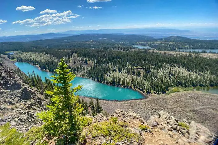
87 SW Colorado Boondocking Sites
Jump directly to the 43 NE Colorado Boondocking Locations
Jump directly to the 78 NW Free Colorado Camping Spots
Jump directly to the 76 East-Central Colorado Boondocking Campgrounds
Jump directly to the 53 West-Central Colorado Dispersed Campsites
Jump directly to the 22 SE Colorado Boondocking Spaces
Jump directly to the 68 South-Central Colorado Camping Locations
1. Park Creek Road
Address
South Fork, Colorado
GPS: 37.572406, -106.729782
Elevation: 8665′
Management: Public – Forest Service (Official)
The road in is Gravel and 2-18 miles from a paved road. Park Creek Road is open May – Nov. weather permitting. There are 16-29 Colorado boondocking locations at this site and the maximum RV length is unlimited. You may stay 14 Days at Park Creek Road.
2. Pass Creek Road
Address
South Fork, Colorado
GPS: 37.501985, -106.767478
Elevation: 9505′
Management: Public – Forest Service (Official)
Free Colorado camping spots. Boondocking – no facilities. Fires are prohibited.
3. Alberta Park Reservoir SWA
Address
South Fork, Colorado
GPS: 37.468086, -106.7687
Elevation: 10203′
Management: Public – Fish and Wildlife Service (Unofficial)
Free Colorado dispersed campsites. Boondocking – no facilities. Fires are prohibited. This mountain lake is surrounded by a grassy meadow lined with a spruce-fir forest. Area is rocky and rugged.
4. East Fork Road
Address
Pagosa Springs, Colorado
GPS: 37.390331, -106.841309
Elevation: 7975′
Management: Public – Forest Service (USDA) (Official)
The road in is Dirt and 4 miles from a paved road. You may stay 14 Days in Colorado boondocking locations at East Fork Road. Between Wolf Creek Pass and Pagosa Springs, turn east at the sign pointing to East Fork USFS campground. Pass the CG and continue east for about 4 miles. Numerous possible campsites along the river.
5. Jackson Mountain Rd
Address
Chimney Rock, Colorado
GPS: 37.3474, -106.9343
Elevation: 7720′
Management: Public – Forest Service
Free Colorado camping spots close to Pagosa Springs.
6. Turkey Springs Road
Address
Forest Service Road 923
Pagosa Springs, Colorado
GPS: 37.326096, -107.142554
Elevation: 8058′
Management: Public – Forest Service
Free Colorado dispersed campsites in the San Juan National Forest’s Pagosa Ranger District. First come -> first camped. No reservations are accepted. This is a high elevation location.
7. First Fork, Piedra Hunter Campground
Address
Pagosa Springs, Colorado
GPS: 37.352966, -107.323736
Elevation: 7169′
Management: Public – Forest Service
Colorado boondocking locations – a few spots and they fill up fast. There is a vault toilet and sites are right next to the Piedra River. It’s a long drive, maybe 12 miles on gravel from the highway but we’ll maintained.
8. Sheep Creek Trailhead
Address
Bayfield, Colorado
GPS: 37.30283, -107.336239
Elevation: 7451′
Management: Public – Forest Service (Unofficial)
The road in is Gravel and 10 miles from a paved road. There are 1-5 Free Colorado camping spots at this location and the maximum RV length is 35 feet. You may stay 14 at Sheep Creek Trailhead. Great spots right next to the Sheep Creek Trail Head. You can fit a small group here pretty easily. It requires a little high clearance in order drive back to the spot that’s down the small primitive road around back on the left.
9. FR135 Dispersed Campsite
Address
Beaver Creek Road (FR135)
Bayfield, Colorado
GPS: 37.294703, -107.492384
Elevation: 7494′
Management: Public – Forest Service (Official)
The road in is Dirt and 0.5 miles from a paved road. There are 1-5 Colorado dispersed campsites at this location and the maximum RV length is 15 feet. You may stay two weeks at FR135 Dispersed Campsite. In the San Juan National Forest. There\’s one primitive site about 1/2 miles down FR135 off Hwy 160 near mile marker 111. Beautiful site but quite a bit of traffic in the morning.
10. Beaver Meadows Boondocking
Address
Bayfield, Colorado
GPS: 37.361284, -107.457243
Elevation: 9454′
Management: Public – Forest Service
You may stay two weeks at Beaver Meadows Boondocking. Free, Colorado boondocking locations on Beaver Meadows Road, San Juan National Forest Rd #135, east of Bayfield and north of U.S. Highway 160. East of the Vallecito Reservior
11. Hansons Mill Dispersed Camping
Address
Forest Road 600
Creede, Colorado
GPS: 37.8131, -106.7369
Elevation: 10863′
Management: Public – Forest Service
The road in is Dirt. The maximum RV length at Hansons Mill Dispersed Camping is 35 feet. You may stay 14 days in Free Colorado camping spots at Hansons Mill Dispersed Camping. This small, isolated dispersed (HORSE FRIENDLY) campground is located 16.8 miles east of Creede on Forest Road 600. Campers will find this to be a good vantage point for viewing vistas of distant mountains. There are 3 camping units at this site with picnic tables and fire rings. There is a vault-type toilet, but no water or refuse receptacles.
12. Forest Road 600
Address
Forest Road 600
Creede, Colorado
GPS: 37.79317, -106.812425
Elevation: 9734′
Management: Public – Forest Service (Official)
The road in is Dirt. There are 6-15 Colorado dispersed campsites at this location. Free dispersed camping is allowed all along this road. Once up, any sized rig can fit. However, the 3-4mi of 4% grade to get here might deter many.
13. Rio Grande Campground
Address
CO 149
Creede, Colorado
GPS: 37.762512, -107.012251
Elevation: 8875′
Management: Public – USDA Forest Service (Official)
Rio Grande Campground is open May 15 – December 1. There are 6-15 Colorado boondocking locations at this site. You may stay two weeks at Rio Grande Campground.
14. Ivy Creek Campground
Address
Red Mountain Creek Road NFR526
Creede, Colorado
GPS: 37.683498, -107.001734
Elevation: 9187′
Management: Public – USDA Forest Service
The road in is Dirt. Ivy Creek Campground is open year round. There are 1-5 Free Colorado camping spots at this location and the maximum RV length is 15 feet. You may stay two weeks (14 days) at Ivy Creek Campground.
15. Road Canyon Campground
Address
FR 520
Creede, Colorado
GPS: 37.755047, -107.192678
Elevation: 9309′
Management: Public – USDA Forest Service (Official)
Road Canyon Campground is open until weather closes access. There are 6-15 Colorado dispersed campsites at this location. You may stay two weeks at Road Canyon Campground.
16. Crooked Creek
Address
Forest Road 520
Creede, Colorado
GPS: 37.791639, -107.162036
Elevation: 9091′
Management: Public – Forest Service
Crooked Creek is open all year. Colorado boondocking locations along Crooked Creek that offers camping space for 1 to 4 parties. It consists of 4 rough level dirt pull-outs where trailers and tents can be set up. A single pit toilet is available across the 520 Road from the sites.
17. Rito Hondo
Address
Forest Road 513
Creede, Colorado
GPS: 37.892374, -107.178358
Elevation: 10256′
Management: Public – Forest Service
Rito Hondo is open all year. Free Colorado camping spots – This site is a small reservior that is also a natural fishery for Brook Trout. Small boats are allowed but gasoline motors are prohibited, electric motors are OK. The site offers good parking and dispersed camping back away from the shore.
18. Hidden Valley Tent Campground- Gunnison Rd
Address
Road 50
Lake City, Colorado
GPS: 38.040839, -107.132875
Elevation: 9666′
Management: Public – USDA Forest Service (Official)
Hidden Valley Tent Campground- Gunnison Rd is open June – September. There are 1-5 Colorado dispersed campsites at this location. Hidden Valley Tent Campground is a primitive tent camping only area. This is a Forest Service operated campground financed by donations. The site is located between the Powderhorn and La Garita Wilderness areas. This tent camping site is great for folks interested in hiking and backpacking.
19. Spruce Campground – Gunnison RD
Address
Road 50
Lake City, Colorado
GPS: 38.047173, -107.116975
Elevation: 9332′
Management: Public – USDA Forest Service (Official)
Spruce Campground – Gunnison RD is open May – October. There are 6-15 Colorado boondocking locations at this site. Spruce Campground, located on Cebolla Creek, lies between the Powderhorn and La Garita Wilderness areas. This is a Forest Service operated campground financed by donations. This area is popular with hikers, backpackers and anglers. Several miles of trail exist in both wilderness areas. There are 9 campsites.
20. Nellie Creek Trailhead
Address
Lake City, Colorado
GPS: 38.06304, -107.4224
Elevation: 11447′
Management: Public – Forest Service (Official)
The road in is 4×4 and 3 miles from a paved road. There are 1-5 Free Colorado camping spots at this location. Campsites at the end of Nellie Creek Road just before the Nellie Creek Trailhead. There are a few fire rings available but is an absolutely gorgeous area.
21. Engineer Pass #4
Address
County Road 20
Lake City, Colorado
GPS: 38.021243, -107.383722
Elevation: 9203′
Management: Public – Forest Service
Free Colorado dispersed campsites. First come -> first camped. No reservations are accepted. This is a high elevation location.
22. Engineer Pass #3
Address
County Road 20
Lake City, Colorado
GPS: 38.020942, -107.396569
Elevation: 9262′
Management: Public – Forest Service
Colorado boondocking locations. This campsite does not use a reservation system. First come, first served. This is a high elevation location.
23. Cascade Creek
Address
County Road 35
Lake City, Colorado
GPS: 37.900482, -107.433834
Elevation: 9606′
Management: Public – Forest Service
Free Colorado camping spots. No reservations. First come, first served. This is a high elevation location. We stayed at this site for one night before hiking Handies Peak in the morning. It was a great choice!
24. Bent Creek Dispersed
Address
Hwy 30 Lake City, CO
Lake City, Colorado
GPS: 37.906485, -107.381507
Elevation: 9421′
Management: Public (Official)
The road in is Dirt and .1 miles from a paved road. There are 6-15 Colorado dispersed campsites at this location and the maximum RV length is 15 feet.
25. Co 520
Address
Creede, Colorado
GPS: 37.762679, -107.467879
Elevation: 10574′
Management: Public – Forest Service (Official)
The road in is Dirt and 15 miles from a paved road. There are 1-5 Colorado boondocking locations at this site and the maximum RV length is 15 feet. This is out pass Stoney Pass on the way to Kite Lake There are many other places to camp before this spot and a real nice spot before the next creek crossing heading to Kite Lake. Divide Ranger District – Creede Office 304 South Main St. PO Box 270 Creede, CO 81130
26. Stony Pass Trail
Address
Forest Road 506
Creede, Colorado
GPS: 37.763707, -107.388702
Elevation: 9820′
Management: Public – Forest Service
Free Colorado camping spots in the Rio Grande National Forest’s Divide Ranger District. This campsite does not use a reservation system. First come, first served.
27. Lost Trail Campground
Address
Creede, Colorado
GPS: 37.768368, -107.349649
Elevation: 9575′
Management: Public – Forest Service (Official)
The road in is Dirt. There are 6-15 Colorado dispersed campsites at this location and the maximum RV length is 35 feet. Free campground. No Water, No Trash Services. 9,500′ Open all year – this campground is usually physically closed by deep winter snows and closed access roads from November through May 15th of each year. Trailer limit 35′
28. Yute Creek Trailhead camp
Address
Creede, Colorado
GPS: 37.76053, -107.34258
Elevation: 9472′
Management: Public – Forest Service (Official)
The road in is Gravel and +/-16 miles miles from a paved road. Yute Creek Trailhead camp is open year round. There are 16-29 Colorado boondocking locations at this site and the maximum RV length is 45 feet. You may stay 14 days at Yute Creek Trailhead camp
29. Co RD 26 Silverton CO
Address
Silverton, Colorado
GPS: 37.921319, -107.562582
Elevation: 10833′
Management: Public – Bureau of Land Management (Official)
The road in is Dirt and 10 miles from a paved road. There are 6-15 Free Colorado camping spots at this location and the maximum RV length is 25 feet. You may stay 14 days at Co RD 26 Silverton CO. This is a dead end road that runs out into a field next to a small creek. We mapped it for our next trip out, there’s about 7 fire pits made of rocks.
30. Poughkeepsie Gulch Dispersed Site
Address
Ouray, Colorado
GPS: 37.966602, -107.626831
Elevation: 10144′
Management: Public – Forest Service (Official)
The road in is 4×4 and 3-5 miles from a paved road. Poughkeepsie Gulch dispersed site is open when the road is open. There are 1-5 Colorado dispersed campsites at this location. You may stay 14 days at Poughkeepsie Gulch dispersed site.
31. Million Dollar Highway
Address
Hwy 550
Silverton, Colorado
GPS: 37.937065, -107.675629
Elevation: 9739′
Management: Public – Forest Service (USDA) (Unofficial)
The road in is Dirt and .2 miles from a paved road. Hwy 550 between Silverton and Ouray, at high elevation. Colorado boondocking locations just east of highway, some visible from the road. The dirt road going east from here runs SE and then SW all the way back to Silverton, I was told. This is national forest land.
32. Eureka Dispersed and Primitive Camping
Address
Silverton, Colorado
GPS: 37.879133, -107.564034
Elevation: 9869′
Management: Public – Bureau of Land Management (Official)
You may stay two weeks at Eureka Dispersed and Primitive Camping. Free Colorado camping spots located at the Eureka Historic Site. This camping area also serves as a OHV staging area. Lots of big rigs parked here. Toilets, history, scenery, nature and not much else.
33. Maggie Gulch (Middleton Toilet)
Address
Silverton, Colorado
GPS: 37.855078, -107.572903
Elevation: 9774′
Management: Public – Forest Service
Free Colorado dispersed campsites. Any sized rig. Access to the Animas River. 14-day time limit. paved/oiled dirt access.
34. Maggie Gulch
Address
County Road 23
Silverton, Colorado
GPS: 37.844432, -107.557936
Elevation: 10404′
Management: Public – Bureau of Land Management
Free Colorado boondocking locations in the Bureau of Land Management Columbine District. First come -> first camped. No reservations are accepted. This is a high elevation location.
35. Cunningham Gulch
Address
Silverton, Colorado
GPS: 37.79665, -107.578433
Elevation: 10358′
Management: Public – Bureau of Land Management
There are a couple of Free Colorado camping spots along this road. Crowded!
36. Arista Gulch
Address
Silverton, Colorado
GPS: 37.822745, -107.621754
Elevation: 9786′
Management: Public – State Forest (Unofficial)
The road in is Gravel and 1 mile miles from a paved road. There are 1-5 Colorado dispersed campsites at this location and the maximum RV length is 25 feet. You may stay 14 days at Arista Gulch.
37. Hwy 550 – Silverton
Address
Million Dollar Highway
Silverton, Colorado
GPS: 37.808237, -107.678811
Elevation: 9281′
Management: Public – Forest Service
Colorado boondocking locations. First come -> First Camped. Reservations not accepted. This is a high elevation location.
38. Little Molas Lake Campground
Address
Forest Rd 584
Durango, Colorado
GPS: 37.745135, -107.708153
Elevation: 10963′
Management: Public – Forest Service (Official)
Little Molas Lake Campground is open when there is no snow. There are 6-15 Free Colorado camping spots at this location. You may stay two weeks at Little Molas Lake Campground.
39. Roadside Dispersed Campsite
Address
Silverton, Colorado
GPS: 37.732759, -107.719504
Elevation: 10482′
Management: Public – Forest Service (Official)
The road in is Dirt and .01 miles from a paved road. Roadside dispersed campsite is open year round. The maximum RV length at Roadside dispersed campsite is 25 feet. You may stay 14 days in Colorado dispersed campsites at Roadside dispersed campsite.
40. Ophir Road Boondocking
Address
Silverton, Colorado
GPS: 37.849875, -107.725927
Elevation: 10011′
Management: Public – Forest Service
Colorado boondocking locations – The forest service MVUM says that the entire length of this forest road (678) is OK for dispersed camping. There are a few spots within a 1/2 mile of 550. Small rigs suggested
41. Golden Horn Primitive Campground
Address
Forest Road 585
Durango, Colorado
GPS: 37.812733, -107.743933
Elevation: 9671′
Management: Public – Forest Service (Official)
Golden Horn Primitive Campground is open in the summer. The maximum RV length at Golden Horn Primitive Campground is unlimited. You may stay two weeks in Free Colorado camping spots at Golden Horn Primitive Campground.
42. Last Dollar Rd
Address
Last Dollar Road
Telluride, Colorado
GPS: 38.004718, -107.950721
Elevation: 10656′
Management: Public – Forest Service
Free Colorado dispersed campsites in the Grand Mesa, Uncompahgre and Gunnison National Forests’s Norwood Ranger District. Reservations are not accepted at this campsite. This is a high elevation location.
43. Fall Creek BLM Dispersed Camping
Address
Fall Creek Road (CR 57P)
Placerville, Colorado
GPS: 37.979384, -108.030594
Elevation: 7717′
Management: Public – Bureau of Land Management (Official)
The maximum RV length at Fall Creek BLM Dispersed Camping is 25 feet. You may stay one week (7 days) at Fall Creek BLM Dispersed Camping. Colorado boondocking locations in area that will accommodate 2 to 3 tents or small RVs. There is a picnic table, cabana and grill on-site. During the summer portable toilets are provided.
44. Silver Pick Road
Address
Telluride, Colorado
GPS: 37.967043, -107.970614
Elevation: 7746′
Management: Public – Forest Service (Unofficial)
The road in is Gravel. There are 1-5 Free Colorado camping spots at this location and the maximum RV length is 35 feet. There is a small lot that can accommodate a few vehicles and maybe a class b or c. It is plowed.
45. Mary E Campground
Address
Telluride, Colorado
GPS: 37.939872, -107.89721
Management: Public – Forest Service (Official)
The road in is Dirt. Mary E Campground is open July 1, 2018. There are 6-15 Colorado dispersed campsites at this location and the maximum RV length is 25 feet. You may stay 7 Days at Mary E Campground.
46. Fall Creek Road
Address
Forest Road #621
Placerville, Colorado
GPS: 37.90327, -108.05638
Elevation: 8885′
Management: Public – Forest Service
Colorado boondocking locations – A few miles south of the junction of Hwy 145 and Hwy 62 north of Telluride, CO is a Forest Service Road to Fall Creek that goes to the Woods Lake State Wildlife Area.
47. Hope Lake Road
Address
Ophir, Colorado
GPS: 37.80998, -107.85774
Elevation: 10548′
Management: Public – Forest Service (Official)
Several Free Colorado camping spots – pullout campsites off road just past National Forest sign before you get to hope lake trailhead.
48. Priest Lake Dispersed Camping Area
Address
Priest Lake Road
Ophir, Colorado
GPS: 37.834862, -107.880891
Elevation: 9609′
Management: Public – Forest Service (Official)
Priest Lake Dispersed Camping Area is open in the summer. There are 1-5 Colorado dispersed campsites at this location and the maximum RV length is 15 feet. You may stay two weeks at Priest Lake Dispersed Camping Area.
49. Lizard Head Pass Dispersed Camping
Address
Co 145 Lizard Head Pass
Telluride, Colorado
GPS: 37.810734, -107.905937
Elevation: 10250′
Management: Public – Forest Service (USDA) (Official)
The road in is Dirt and .01 miles from a paved road. There are 6-15 Colorado boondocking locations at this site. You may stay 7 days out of 30 at Lizard Head Pass Dispersed Camping. This is an opened meadow with gorgeous 360 degree views of forest and rocky mountain peaks. We didn’t drive around the whole area but from Google Earth it looks like there’s one big loop road.
50. Ewing Gulch Dispersed Camping
Address
Dolores, Colorado
GPS: 37.638727, -108.059517
Elevation: 8432′
Management: Public – Forest Service (Official)
Free Colorado camping spots – Going North pass Priest Gulch Campground and cross the Delores river bridge. 1.5 miles after the bridge, turn left and either go left on the fork through the woods and over a small bridge or turn right and camp in an open grass field. The first option was closed when we stayed here (it is a long forest road that hugs the river).
51. Dispersed Camping Near Delores River
Address
Dolores, Colorado
GPS: 37.650753, -108.047538
Elevation: 8540′
Management: Public – Forest Service (Unofficial)
Colorado dispersed campsites – 2.5 miles north of the Delores River bridge. This is a short dirt road (low clearance vehicles might get banged up) to some dispersed camping near the Delores River. Spots are available near a wooded patch or out in an open field. Established fire rings + 20ft to a water source.
52. Barlow Creek Road
Address
Barlow Creek Road – FR 578
Durango, Colorado
GPS: 37.667483, -107.93085
Elevation: 9325′
Management: Public – Forest Service (Official)
The road in is Dirt and 11 miles miles from a paved road. Barlow Creek Road is open in the summer. There are 6-15 Colorado boondocking locations at this site. You may stay 14 days at Barlow Creek Road.
53. Cascade Divide Road
Address
Cascade Divide Road (FR579)
Durango, Colorado
GPS: 37.671372, -107.848225
Elevation: 10255′
Management: Public – Forest Service
Cascade Divide Road is open When the road is passable. You may stay 14 days in Free Colorado camping spots at Cascade Divide Road. Dispersed camping and car camping outside of developed campgrounds is allowed within 300 feet of open forest roads, unless posted otherwise. Please observe all signs, pack out all of your trash and use caution with campfires. Try to use existing pull-offs and campsites that have obviously been used before to limit your impacts.
54. Lime Creek Road Dispersed
Address
Durango, Colorado
GPS: 37.654356, -107.803808
Elevation: 8788′
Management: Public – Forest Service (Official)
Colorado dispersed campsites anywhere on the entire five miles of Lime Creek Road. Free camping. The first spot on the south side is very easy to get to and has room for any sized rig. After that, take caution. The road is considered a 4×4 route though it is rarely used. High clearance is a must if you want to do the entire route.
55. Upper Hermosa Creek
Address
Durango, Colorado
GPS: 37.631619, -107.916006
Elevation: 8863′
Management
Public – Forest Service (Official)
Colorado boondocking locations are available at the trailhead, which has a toilet, picnic tables, fire grates, corral, and parking area.
56. Upper Hermosa Road
Address
Hermosa Road (FR 578)
Durango, Colorado
GPS: 37.631426, -107.865326
Elevation: 9318′
Management: Public – Forest Service (Official)
The road in is Dirt. Upper Hermosa Road is open in the summer. There are 16-29 Free Colorado camping spots at this location. You may stay two weeks at Upper Hermosa Road. Dispersed, free camping along forestry road 578 in the San Juan National forest of Colorado. There is a “campground” on this road on the same name.
57. Elbert Creek Road
Address
Elbert Creek Road
Durango, Colorado
GPS: 37.597128, -107.85545
Management: Public – Forest Service (Official)
The road in is Dirt and 5 or more miles from a paved road. Elbert Creek Road is open in the summer. There are 1-5 Colorado dispersed campsites at this location. You may stay two weeks at Elbert Creek Road.
58. San Juan NF Road 599
Address
County Road 246 (FR599)
Durango, Colorado
GPS: 37.346214, -107.737887
Elevation: 7741′
Management: Public – Forest Service (Official)
Colorado boondocking locations – a great way to enjoy the experience of camping away from developed campgrounds. Dispersed camping means there are none of the amenities you will find at a developed campground. There are no picnic tables, drinking water, or toilets available.
59. Missionary Ridge Road
Address
Forest Rd #682
Durango, Colorado
GPS: 37.425947, -107.786024
Elevation: 7355′
Management: Public – Forest Service (Official)
Free Colorado camping spots along this road begins at 3.6 miles in, the southern tip of the first switchback. Except for a small portion (mile 6.8 to 9) you are allowed to boondock the whole length of this road (Missionary Ridge Road/FR682. Probably not a wise camping area for RVs. Keep it small.
60. Miner’s Cabin
Address
Durango, Colorado
GPS: 37.371249, -108.07663
Elevation: 8836′
Management: Public – Forest Service (Official)
The road in is Gravel and Six miles from a paved road. Miner’s Cabin is open Three seasons. There are 1-5 Colorado dispersed campsites at this location and the maximum RV length is 35 feet. You may stay 14 days at Miner’s Cabin.
61. Bay City Campground
Address
La Plata Canyon Road
Durango, Colorado
GPS: 37.360975, -108.078145
Elevation: 8734′
Management: Public – Forest Service (Official)
The road in is Paved. There are 1-5 Colorado boondocking locations at this site and the maximum RV length is 15 feet. You may stay 14 days at Bay City Campground. Free boondocking along a creek. Small rigs only.
62. Forest Road 350
Address
Road 350
Mancos, Colorado
GPS: 37.473816, -108.15821
Elevation: 10023′
Management: Public – Forest Service
The road in is Dirt. Forest Road 350 is open seasoanlly. You may stay 14 days in Free Colorado camping spots at Forest Road 350.
63. Crystal Creek Ditch Area
Address
FR 561
Mancos, Colorado
GPS: 37.438442, -108.234663
Elevation: 8504′
Management: Public – Forest Service
The road in is Dirt. You may stay 14 days in Colorado dispersed campsites at Crystal Creek Ditch Area. Free camping in southwestern Colorado near Mancos and Cortez. These dispersed campsites can accommodate RVs.
64. Forest Road 556
Address
Forest Road 556
Mancos, Colorado
GPS: 37.41387, -108.19717
Management: Public – Forest Service
The road in is Dirt. You may stay 14 days in Colorado boondocking locations at Forest Road 556. Free dispersed camping in Colorado’s San Juan Nation Forest. Located in the Southwest Colorado near Cortez. These are first come -> first camped camping areas.
65. Madden Peak Road (Durango, CO)
Address
Durango, Colorado
GPS: 37.357742, -108.194218
Elevation: 8297′
Management: Public – Forest Service (USDA) (Unofficial)
The road in is Gravel and 2-6 miles from a paved road. Madden Peak Road (Durango, CO) is open When snow allows. There are 6-15 Free Colorado camping spots at this location. You may stay 16 days at Madden Peak Road (Durango, CO).
66. San Juan Dispersed Campsite
Address
Unnamed Road
Hesperus, Colorado
GPS: 37.373554, -108.134506
Elevation: 10213′
Management: Public – Forest Service
Free Colorado dispersed campsites in the San Juan National Forest’s Mancos/Dolores Ranger District. This campsite does not use a reservation system. First come, first served. This is a high elevation location.
67. Cherry Creek Gravel Pit
Address
Hesperus, Colorado
GPS: 37.328922, -108.119816
Elevation: 7989′
Management: Public – Forest Service
The road in is Dirt and 100 Yards miles from a paved road. Cherry Creek Gravel Pit is open Whenever not blocked by snow. There are 6-15 Colorado boondocking locations at this site and the maximum RV length is unlimited. You may stay 14 Days at Cherry Creek Gravel Pit. This is an easy to access spot just West of Durango. Look for the sign ‘Cherry Creek Forest Access’ just East of the Escalante Wayside – it does come up fast.
68. Miner’s Cabin
Address
Durango, Colorado
GPS: 37.371249, -108.07663
Elevation: 8836′
Management: Public – Forest Service (Official)
The road in is Gravel and Six miles from a paved road. Miner’s Cabin is open Three seasons. There are 1-5 Free Colorado camping spots at this location and the maximum RV length is 35 feet. You may stay 14 days at Miner’s Cabin. West of Durango on Hwy 160, 100 yds west of the Hesperus turnoff is a restaurant on the north side of the hwy. Turn north on that road and drive about six miles.
69. Bay City Campground
Address
La Plata Canyon Road
Durango, Colorado
GPS: 37.360975, -108.078145
Elevation: 8734′
Management: Public – Forest Service (Official)
The road in is Paved. There are 1-5 Colorado dispersed campsites at this location and the maximum RV length is 15 feet. You may stay 14 days at Bay City Campground. Take La Plata Canyon Rd 5 miles north into the National Forest. I have not stayed here, and I missed it while researching the campsites to the north. It is on the San Juan Forest’s Motor Vehicle Use Map. I can see campers there on google satellite maps.
70. Forest Road 526B
Address
Dolores, Colorado
GPS: 37.601244, -108.4276
Elevation: 7995′
Management: Public – Forest Service
The road in is Dirt. There are 1-5 Colorado boondocking locations at this site and the maximum RV length is 35 feet. You may stay 14 days at Forest Road 526B. Dispersed camping right off of the main road wide open spaces. room for any size rig getting in might be a little bit of an issue for large rigs. looks like people shoot here. Intermediate lte on shade
71. McPhee Park Road – FR531
Address
Forest Road 531
Dolores, Colorado
GPS: 37.626817, -108.402342
Elevation: 8084′
Management: Public – Forest Service
The road in is Dirt. McPhee Park Road – FR531 is open seasonally. There are 1-5 Free Colorado camping spots at this location. You may stay 14 Days at McPhee Park Road – FR531.
72. Boondocking Forest Road 249
Address
FR 249
Dolores, Colorado
GPS: 37.64612, -108.394809
Elevation: 8084′
Management: Public – Forest Service
The road in is Dirt and <1 miles from a paved road. Boondocking Forest Road 249 is open seasonally. There are 1-5 Colorado dispersed campsites at this location and the maximum RV length is 35 feet. You may stay 14 Days at Boondocking Forest Road 249.
73. Forest Road 524
Address
FR 524
Dolores, Colorado
GPS: 37.662382, -108.434584
Management: Public – Forest Service
The road in is Dirt. Forest Road 524 is open seasonally. There are 1-5 Colorado boondocking locations at this site. You may stay 14 days at Forest Road 524. Free camping in the San Juan National Forest of Colorado.
74. Buckles Lake Road (FR 633)
Address
Buckles Lake Road (FR633)
Pagosa Springs, Colorado
GPS: 37.078825, -106.839065
Elevation: 8013′
Management: Public – Forest Service (Official)
You may stay two weeks in Free Colorado camping spots at Buckles Lake Road (FR 633). Dispersed camping all along this road. Free. Boondocking. Pack it in -> pack it out. No one will pick up after you. At the end of San Juan National forest Road 663 (7.8 miles), you will find a trailhead for Buckles Lake Trail. There is a pit toilet there. The lake is just a short walk north from the trailhead.
75. Mountain Sheep Point
Address
Road 9.7
Dove Creek, Colorado
GPS: 37.794917, -108.826302
Elevation: 6093′
Management: Public – Bureau of Land Management
The maximum RV length at Mountain Sheep Point is 20 feet. Colorado dispersed campsites located within the Bureau of Land Management Dolores District. Follow signs for Dolores River public lands access, dirt roads for about 5 miles before reaching a couple big pull off points before the river with verizon cell access. I had no signal by the water. Great views!! Bathroom open and clean.
76. Dolores River Mesa
Address
Pleasant View, Colorado
GPS: 37.643869, -108.714403
Elevation: 7231′
Management: Public – Forest Service (Unofficial)
The maximum RV length at Dolores River Mesa is unlimited. You may stay 14 days in Colorado boondocking locations at Dolores River Mesa. On the Mesa above the Dolores River near Cahone, CO. Wide open, flat area about a mile drive from the river and fishing. There’s a BLM pay site at the river and a few dispersed site on the river but being here in October meant frigid cols air dropping into camp at night. Great views, excellent cell service, and far enough from the main road to avoid dust.
77. Dolores River Mesa
Address
Pleasant View, Colorado
GPS: 37.643869, -108.714403
Elevation: 7231′
Management: Public – Forest Service (Unofficial)
The maximum RV length at Dolores River Mesa is unlimited. You may stay 14 days in Free Colorado camping spots at Dolores River Mesa. On the Mesa above the Dolores River near Cahone, CO. Wide open, flat area about a mile drive from the river and fishing. There’s a BLM pay site at the river and a few dispersed site on the river but being here in October meant frigid cols air dropping into camp at night.
78. Hovenweep NM – Canyon of the Ancients
Address
Unnamed Road
Pleasant View, Colorado
GPS: 37.445668, -108.973277
Elevation: 6004′
Management: Public – Bureau of Land Management
Free Colorado dispersed campsites in the Bureau of Land Management Dolores District. First come -> first camped. No reservations are accepted.
79. Cannonball Mesa Canyons of the Ancients Access
Address
Cortez, Colorado
GPS: 37.343099, -108.932543
Elevation: 5354′
Management: Public – Bureau of Land Management (Unofficial)
The road in is Dirt and 3-5 miles from a paved road. Cannonball Mesa Canyons of the Ancients Access is open Best in Fall, Late Winter/Spring. There are 6-15 Colorado boondocking locations at this site and the maximum RV length is 25 feet. You may stay 14 Days at Cannonball Mesa Canyons of the Ancients Access.
80. Uranium Camp
Address
Cortez, Colorado
GPS: 37.390768, -108.868272
Elevation: 6335′
Management: Public – Bureau of Land Management (Unofficial)
The road in is Dirt and 1/4 to Good Gravel miles from a paved road. Uranium Camp is open Best Fall & Spring – Hot in Summer, Occasional Snow in Winter Caution advised when wet. The maximum RV length at Uranium Camp is 15 feet. You may stay 14 Days in Free Colorado camping spots at Uranium Camp.
81. McElmo Dome Sand Creek Overlook
Address
Cortez, Colorado
GPS: 37.383253, -108.803658
Elevation: 7047′
Management: Public – Bureau of Land Management
The road in is Dirt and 5 miles from a paved road. McElmo Dome Sand Creek Overlook is open Weather Permitting. There are 6-15 Colorado dispersed campsites at this location and the maximum RV length is 25 feet.
82. Mountain Sheep Point
Address
Road 9.7
Dove Creek, Colorado
GPS: 37.794917, -108.826302
Elevation: 6093′
Management: Public – Bureau of Land Management
The maximum RV length at Mountain Sheep Point is 20 feet. Colorado boondocking locations within the Bureau of Land Management Dolores District. Follow signs for Dolores River public lands access, dirt roads for about 5 miles before reaching a couple big pull off points before the river with verizon cell access. I had no signal by the water. Great views!! Bathroom open and clean.
83. Big Gypsum Valley
Address
Egnar, Colorado
GPS: 38.13476, -108.87914
Elevation: 5325′
Management: Public – Bureau of Land Management (Official)
The road in is Gravel and 13 miles from a paved road. Big Gypsum Valley is open Three season plus. There are 6-15 Free Colorado camping spots at this location and the maximum RV length is 35 feet. You may stay 14 Days at Big Gypsum Valley.
84. Buckeye Campground First Camp
Address
Paradox, Colorado
GPS: 38.439833, -109.044806
Elevation: 7615′
Management: Public – Forest Service (Official)
The road in is Gravel and 10 miles from a paved road. There are 1-5 Colorado dispersed campsites at this location. The info center map before entering the Buckeye Reservoir said this was free camping along with another around the reservoir and there was two fee sites. So I go in the boat launch area and a sign said ‘not suitable for trailers…” Well I found a spot that was suitable and stayed there a few days.
85. Lower Saucer Basin
Address
Paradox, Colorado
GPS: 38.367069, -108.803009
Elevation: 5075′
Management: Public – Bureau of Land Management (Unofficial)
The road in is Gravel and 5 miles from a paved road. Lower Saucer Basin is open Most of the Year. There are 6-15 Colorado boondocking locations at this site and the maximum RV length is 25 feet. You may stay 14 Days at Lower Saucer Basin.
86. Just Off the Road
Address
Bedrock, Colorado
GPS: 38.306524, -108.855007
Elevation: 5036′
Management: Private – Pull Offs
The road in is Gravel. There are 1-5 Free Colorado camping spots at this location and the maximum RV length is unlimited. Just some pull offs along the road. Amazing cliff views and tons of open space. The highway isn’t too traveled. No one will bother you. Just look for ones that you’re comfortable with.
87. Bedrock Campground
Address
CR Y9
Bedrock, Colorado
GPS: 38.30394, -108.89414
Elevation: 4959′
Management: Public – Bureau of Land Management
There are 1-5 Colorado dispersed campsites at this location and the maximum RV length is unlimited. You may stay 1 night at Bedrock Campground. The Bedrock site is adjacent to the Dolores River. There is a boat ramp and 4 cabanas with tables and grills plus a large flat area to accommodate additional tents and RVs.
You May Want to Join Our Boondocking Group on Facebook For More Information
You May Want to Join Our Campfire Recipes Group on Facebook For More Information
Check Out Our Pictures On Instagram – Our Big Escape.