
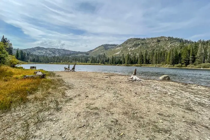
California boondocking campsites are free campsites. It’s essentially free camping. Typically, this form of camping takes place on BLM land or in National Forests. They are federally maintained places that have been set aside for you to appreciate nature.
Primitive camping, or dispersed camping, is another name for free camping. These camping places usually don’t have any conveniences, so you’ll have to pack everything you need. True relaxation in complete silence. There will be more nature and less people.
Jump directly to the 100 Northern Section of California Boondocking Campsites
Jump directly to the 58 North Central Section of California Camping Areas
Jump directly to the 98 Central Section of California Dispersed Campsites
Jump directly to the 94 South Central Section of California Boondockins Sites
Jump directly to the 69 Southern Section of California Camping Spots
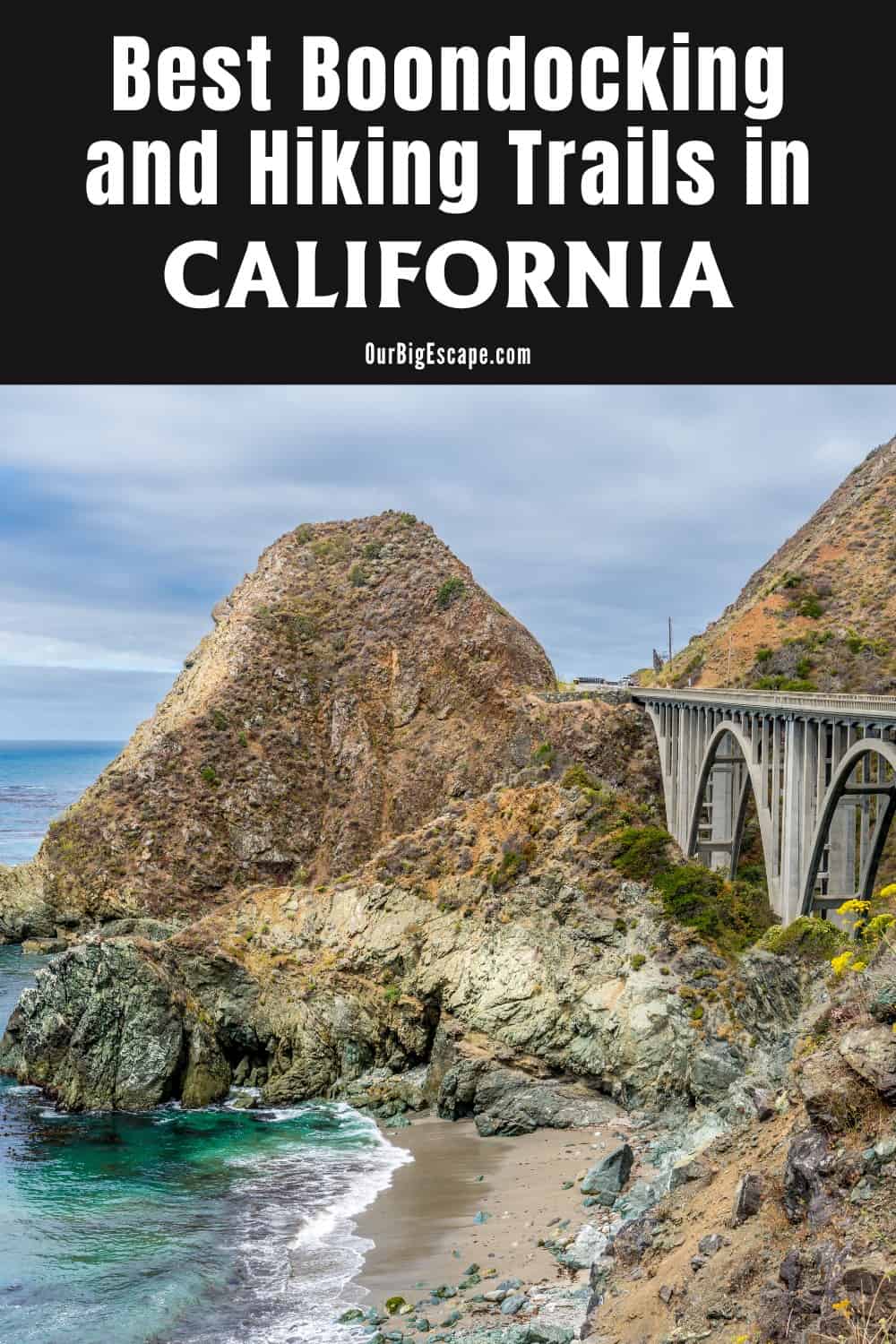
California Boondocking Campsites
Clear lakes, pine-filled forests, and lots of places to ride your mountain bike during the day and relax around the fire ring at night can be found in California boondocking campsites in the northern reaches. The national forest lands surrounding Lassen Volcanic National Park are a popular boondocking destination. A favorite is Rocky Point East in Susanville, which has a large lake with a boat launch for kayaks or paddleboards.
With expansive woods in the north and sunny beauty in the south, California is one of America’s most diversified states. Between the metropolis and the sparsely populated eastern half of the state, California is made up of stunning landscapes made for off-the-grid enjoyment.
check out our video
Want more ideas to round-out your trip to California?
A lot of great ideas are in these posts!
- 6 Top Pinnacles National Park Boondocking Locations
- 14 Redwood National Park Boondocking (Updated 2022)
- 18 Kings Canyon National Park Boondocking (Updated 2022)
- 15 Yosemite National Park Camping Spots (Updated 2022)
- 5 Death Valley Salt Flats Boondocking (Updated 2022)
- 419 Awesome California Boondocking Campsites And Maps
- Our Top 25 Yosemite Hikes For All Ages
- 5 Best Hiking Trail Bonita Falls Photos Hot Spots
- 8 Places to Visit in Sequoia National Park
100 Northern Section of California Boondocking Campsites
Jump directly to the 58 North Central Section of California Camping Areas
Jump directly to the 98 Central Section of California Dispersed Campsites
Jump directly to the 94 South Central Section of California Boondockins Sites
Jump directly to the 69 Southern Section of California Camping Spots
1. Little North Fork Campground
Address
FR 23N15
Berry Creek, California
GPS: 39.782, -121.259
Elevation: 3816′
Management: Public – Forest Service (Official)
Little North Fork Campground is open when Free of Snow.. There are 6-15 California boondocking campsites at this location.
2. Rogers Cow Camp
Address
Forest Road 23N15
Berry Creek, California
GPS: 39.768, -121.31
Elevation: 4124′
Management: Public – USDA Forest Service (Official)
Rogers Cow Camp is open weather permitting. There are 6-15 California camping locations at this site. You may stay 14 days at Rogers Cow Camp.
3. Cedar Camp
Address
Goat Mountain Road
Stonyford, California
GPS: 39.264338, -122.698619
Elevation: 4347′
Management: Public – Forest Service
California dispersed campsites in a timber area of mature fir and pine. Access up Trough Ridge or Little Stony Road is not recommended for trailers. Cedar Camp is open May-Nov.
4. Bear Creek Campground – Mendocino NF
Address
Mendocino National Forest
Upper Lake, California
GPS: 39.31984, -122.839859
Elevation: 2275′
Management: Public – Forest Service (USDA) (Official)
The road in is Dirt and 9 miles from a paved road. Bear Creek Campground – Mendocino NF is open open all year. There are 16-29 California boondocking sites at this location. You may stay 14 days at Bear Creek Campground – Mendocino NF.
5. Old Mill
Address
Trough Springs Ridge
Stonyford, California
GPS: 39.308354, -122.645496
Elevation: 3668′
Management: Public – Forest Service
California camping spots at Old Mill is open May-Sep. The maximum RV length at Old Mill is 20 feet.
6. West Crockett
Address
27597 North Ridge Trail
Upper Lake, California
GPS: 39.436234, -122.781851
Elevation: 5010′
Management: Public – Forest Service
Free California boondocking campsites in the Mendocino National Forest’s Grindstone Ranger District. First come -> First Camped. Reservations not accepted.
7. Lower Nye
Address
Forest Route 18N04
Upper Lake, California
GPS: 39.443062, -122.826541
Elevation: 3255′
Management: Public – Forest Service
California camping locations. Open year round but not accessible when creek is too high to ford. No tables, fire rings or services. Lower Nye is open May-Nov.
8. Houghton Ridge
Address
Paskenta, California
GPS: 39.82327, -122.67768
Elevation: 3514′
Management: Public – Forest Service (Unofficial)
The road in is Paved. There are 1-5 California dispersed campsites at this location. Decommissioned Forest Service site just off the M4. I think it used to be a day use site with tables but it didn’t show up on the latest Mendocino NF site census so I think they’ve walked away from it.
9. Boardman Camp
Address
Benson Lane
Covelo, California
GPS: 39.847124, -123.012844
Elevation: 4521′
Management: Public – Forest Service
California boondocking sites within the Mendocino National Forest’s Covelo Ranger District. This campsite does nuse a reservation systerm. First come, first served.
10. Simpson Camp
Address
22N20
Covelo, California
GPS: 39.766019, -122.900618
Elevation: 5968′
Management: Public – Forest Service
Free California camping spots in the Mendocino National Forest’s Grindstone Ranger District. First come -> first served. No reservations accepted.
11. Grizzly Flat Dispersed
Address
Forest Route 21N26
California
GPS: 39.714374, -123.000459
Elevation: 5341′
Management: Public – Forest Service
Free California boondocking campsites in the Mendocino National Forest’s Covelo Ranger District. First come -> first camped. No reservations are accepted. Grizzly Flat Dispersed is open May-Dec.
12. Benbow Drive
Address
Garberville, California
GPS: 40.033738, -123.784906
Elevation: 509′
Management: Public – Several pull-outs on a frontage road. (Unofficial)
There are several pull-outs along Benbow Dr, some more level than others. GPS coordinates point to the access point from Hwy 101 (Redwood Hwy). You may stay 14 days in California camping locations at Benbow Drive.
13. Horse Ridge Lookout
Address
Mad River, California
GPS: 40.356402, -123.388124
Elevation: 4865′
Management: Public – Forest Service (Unofficial)
California dispersed campsites wit No facilities, but an incredible view. The road in is Gravel.
14. Perry Riffle by Sacramento River
Address
Red Bluff, California
GPS: 40.2944, -122.17846
Elevation: 335′
Management: Public – Bureau of Land Management (Official)
Perry Riffle by Sacramento River is open year round. The maximum RV length at Perry Riffle by Sacramento River is unlimited. You may stay 14 days in California boondocking sites at Perry Riffle by Sacramento River.
15. Black Rock
Address
Ponderosa Way
Red Bluff, California
GPS: 40.183759, -121.713211
Elevation: 2116′
Management: Public – Forest Service
California camping spots within the Lassen National Forest’s Almanor Ranger District. 4-wheel drive and high clearance recommended. The road in is 4×4. Black Rock is open Mar-Nov.
16. South Antelope
Address
Ponderosa Way
Chester, California
GPS: 40.253052, -121.758409
Elevation: 2723′
Management: Public – Forest Service
California boondocking campsites located within the Lassen National Forest’s Almanor Ranger District.
17. Battle Creek Vista Point
Address
Paynes Creek, California
GPS: 40.351502, -121.779153
Elevation: 3297′
Management: Public – Vista Point (Unofficial)
This will do in a pinch. It’s only good for an overnight stop. The road in is Paved. Battle Creek Vista Point is open year-round. There are 1-5 California camping locations at this site.
18. Dog Valley
Address
Verdi, California
GPS: 39.564995, -120.065788
Elevation: 6329′
Management: Public – Forest Service (USDA) (Official)
The road in is Dirt and 5 miles from a paved road. Dog Valley is open April -October. You may stay 14 days in California dispersed campsites at Dog Valley.
19. Bear Valley Campground
Address
Cottonwood Creek Rd. 39.557381,-120.235736
Loyalton, California
GPS: 39.557662, -120.233088
Elevation: 6648′
Management: Public – Forest Service (Official)
The road in is Dirt. Bear Valley Campground is open all year. There are 6-15 California boondocking sites at this location and the maximum RV length is 35 feet. You may stay 14 days at Bear Valley Campground.
20. Davies Creek
Address
Henness Pass Road
California
GPS: 39.505561, -120.099778
Elevation: 5984′
Management: Public – Forest Service
Free California camping spots in the Tahoe National Forest’s Truckee Ranger District. No reservations. First come, first served.
21. White Rock Lake
Address
Pacific Crest Trail
California
GPS: 39.41612, -120.383628
Elevation: 7844′
Management: Private – Utility Company
The road in is 4×4. California boondocking campsites at White Rock Lake is open Jun-Oct. This is a high elevation location. Access is via a 4×4 recommended road.
22. Sagehen Creek Campground
Address
Sage Hen Road
Truckee, California
GPS: 39.43457, -120.256897
Elevation: 6485′
Management: Public – Forest Service (USDA) (Official)
The road in is dirt and 4 miles from a paved road. There are 6-15 California camping locations at this site.
23. Donner Lake Vista Point
Address
Truckee, California
GPS: 39.328682, -120.277762
Elevation: 6368′
Management: Public – Rest Area (Unofficial)
The road in is Paved. There are 1-5 California dispersed campsites at this location. You may stay overnight at Donner Lake Vista Point.
24. Chapman Saddle
Address
Sattley, California
GPS: 39.65858, -120.52169
Elevation: 6677′
Management: Public – Forest Service (Unofficial)
Forest road intersection with about 4-5 campsites that can fit full size RV’s. Dirt road approach The road in is Dirt. There are 6-15 California boondocking sites at this location and the maximum RV length is unlimited.
25. Snag Lake Campground
Address
Sierra City, California
GPS: 39.671066, -120.627029
Elevation: 6656′
Management: Public – Forest Service (Official)
There are 12 California camping spots with space for small trailer use- vault toilets and lake water source, purify before drinking. The road in is Paved. There are 6-15 campsites at this location.
26. Gold Lake 4×4 Campground
Address
Graeagle, California
GPS: 39.668, -120.661
Elevation: 6468′
Management: Public – USDA Forest Service (Official)
The road in is 4×4. There are 16-29 California boondocking campsites at this location.
27. Bowman Campground
Address
Nevada City, California
GPS: 39.459589, -120.612202
Elevation: 5608′
Management: Public – Forest Service (Official)
California camping locations in Bowman Lake Campground is a very remote campground with limited services. Road to access is very rough, rocky, and narrow. The road in is Dirt and 6 miles from a paved road.
28. Canyon Creek Campground
Address
Nevada City, California
GPS: 39.435464, -120.576968
Elevation: 5969′
Management: Public – Forest Service (Official)
Canyon Creek Campground is located on Canyon Creek in a mixed conifer forest. The road in is Dirt and 8 miles from a paved road. There are 16-29 California dispersed campsites at this location.
29. Grouse Ridge Campground
Address
Nevada City, California
GPS: 39.389717, -120.609636
Elevation: 7454′
Management: Public – USDA Forest Service
There are 9 California boondocking sites with tables and fire rings. 5 campsites have space for small trailers.There is a vault toilet, but no trash service; pack it in pack it out!
30. Cal-Ida
Address
Camptonville, California
GPS: 39.522179, -121.021191
Elevation: 3550′
Management: Public – Forest Service (Unofficial)
You may stay 14 days in California camping spots at Cal-Ida.
31. Stag Point OHV Camp
Address
Stag Point Trail
California
GPS: 39.792007, -121.079289
Elevation: 2835′
Management: Public – Forest Service
1 dispersed site at trail head with fire pit and table only. At Stag Point 5 California boondocking campsites. First come first serve. Pit toilet, fire rings, no water, no garbage services Pack in/Out.
32. Horse Linto
Address
Unnamed Road
Willow Creek, California
GPS: 41.005735, -123.606518
Elevation: 499′
Management: Public – Forest Service
Horse Linto is open May-Oct. Free California camping locations in the Six Rivers National Forest’s Lower Trinity Ranger District. First come -> first served. No reservations accepted.
33. Susanville BLM
Address
Susanville, California
GPS: 40.472759, -120.558897
Elevation: 5344′
Management: Public – Bureau of Land Management (Official)
The road in is Dirt and .01 miles from a paved road. There are 6-15 California dispersed campsites at this location. You may stay 14 at Susanville BLM.
34. Goumaz
Address
Bizz Johnson Trail
Susanville, California
GPS: 40.413965, -120.861976
Elevation: 5203′
Management: Public – Forest Service
Goumaz campground is between Highway 36 and 44 at the South end of Eagle Lake. There are 5 California boondocking sites located along Susan River and adjacent to the Bizz Johnson Trail. Goumaz is open May-Sep. The maximum RV length at Goumaz is 18 feet.
35. Fredonyer Sno-Park
Address
Susanville, California
GPS: 40.35553, -120.87211
Elevation: 5656′
Management: Public – Forest Service (Official)
The road in is Paved. There are 1-5 California camping spots at this location and the maximum RV length is unlimited. You may stay 14 ? at Fredonyer Sno-Park.
36. Fredonyer Campsite
Address
Volcanic Legacy Scenic Byway
Susanville, California
GPS: 40.372565, -120.830779
Elevation: 5161′
Management: Public – Forest Service
Free California boondocking campsites in the Lassen National Forest’s Eagle Lake Ranger District. Reservations are not accepted at this campsite. Fredonyer Campsite is open all year.
37. Hwy 36 Pull-Off Qrea
Address
Susanville, California
GPS: 40.37515, -120.8139
Elevation: 4826′
Management: Public – Forest Service (Unofficial)
The road in is Gravel. There are 1-5 California camping locations at this site and the maximum RV length is unlimited. You may stay 14 ? at Hwy 36 pull-off area.
38. Roxie Peconom Campground (walk in)
Address
Susanville, California
GPS: 40.355496, -120.810255
Elevation: 4938′
Management: Public – Forest Service (Official)
Roxie Peconom Campground (walk in) is open in may through the fall. There are 6-15 California dispersed campsites at this location. You may stay 14 days at Roxie Peconom Campground (walk in).
39. East Eagle Lake
Address
California 139
Susanville, California
GPS: 40.706682, -120.672459
Elevation: 5121′
Management: Public – Bureau of Land Management
North Eagle Campground is 30 miles north of Susanville on Highway 139 and a half-mile west on Lassen County Road A-1. It is open mid May to the end of October. There are 20 California boondocking sites in a pine and juniper forest. Vault toilets and drinking water are available. Some campsites can accommodate RV’s up to 35 feet long.
40. Rocky Point West
Address
Unnamed Road
Susanville, California
GPS: 40.682646, -120.757544
Elevation: 5118′
Management: Public – Bureau of Land Management
Free California camping spots in the Bureau of Land Management Eagle Lake District. First come -> First Camped. Reservations not accepted.
41. Rocky Point East
Address
Unnamed Road
Susanville, California
GPS: 40.673576, -120.745548
Elevation: 5115′
Management: Public – Bureau of Land Management
Free California boondocking campsites in the Bureau of Land Management Eagle Lake District. No reservations. First come, first served.
42. Eagle Lake BLM – Primitive
Address
Susanville, California
GPS: 40.64642, -120.740746
Elevation: 5112′
Management (Official)
The road in is Dirt and 4 miles from a paved road. There are 6-15 California camping locations at this site. You may stay 14 days at Eagle Lake BLM – primitive.
43. Hwy 36 Pull-Off Area
Address
Susanville, California
GPS: 40.37515, -120.8139
Elevation: 4826′
Management: Public – Forest Service (Unofficial)
The road in is Gravel. There are 1-5 California dispersed campsites at this location and the maximum RV length is unlimited. You may stay 14 ? at Hwy 36 pull-off area.
44. Lake Almanor Sno-Park
Address
Westwood, California
GPS: 40.30597, -121.143
Elevation: 4882′
Management: Public – Forest Service (Official)
The road in is Paved. There are 6-15 California boondocking sites at this location and the maximum RV length is unlimited. You may stay 14 ? at Lake Almanor Sno-Park.
45. Butte Creek
Address
Forest Route 32N21
Susanville, California
GPS: 40.615054, -121.297687
Elevation: 5554′
Management: Public – Forest Service
10 California camping spots. No water available. Vault toilets located on both ends of campground. Quiet and off the beaten path, Butte Creek campground is located 4 miles off Highway 44. No fee. Butte Creek is open year round if accessible..
46. Twin Bridges
Address
Forest Route 32N12
Old Station, California
GPS: 40.616149, -121.469387
Elevation: 4810′
Management: Public – Forest Service
Free California boondocking campsites in the Lassen National Forest’s Hat Creek Ranger District. First come -> First Camped. Reservations not accepted. Twin Bridges is open Apr-Oct.
47. Hwy 44 Dispersed
Address
Volcanic Legacy Scenic Byway
Redding, California
GPS: 40.59949, -121.52773
Elevation: 5210′
Management: Public – Forest Service
Free California camping locations in the Lassen National Forest’s Hat Creek Ranger District. This campsite does not use a reservation system. First come, first served.
48. 32N16
Address
Old Station, California
GPS: 40.589191, -121.539539
Elevation: 5413′
Management: Public – Forest Service (Official)
The road in is Gravel and 0.1 miles from a paved road. There are 1-5 California dispersed campsites at this location and the maximum RV length is unlimited. You may stay 14 at 32N16. Clearing along Forest Road 32N16 a few 100 feet south of the highway. Big enough for even large rigs. Traffic is audible but quiet at night. Trees are hide you from the road.
49. Eskimo Hill
Address
Shingletown, California
GPS: 40.563537, -121.576295
Elevation: 5922′
Management: Public – Forest Service (Official)
The road in is Paved. There are 6-15 California boondocking sites at this location and the maximum RV length is unlimited. You may stay 14 at Eskimo Hill. There are many camping spots in the Lassen NF north of Lassen Volcanic NP. This one is paved and has restrooms. It looks like a rest area but has no such signs
50. Lassen Forest – Manzanita Chute Road
Address
Shingletown, California
GPS: 40.53396, -121.6225
Elevation: 5079′
Management: Public – Forest Service (Unofficial)
California camping spots across from Park. Many spots in the national forest with large dirt roads. Could host a bunch of large rigs.
51. Kings Creek
Address
Volcanic Legacy Scenic Byway
California
GPS: 40.460052, -121.474332
Elevation: 7379′
Management: Public – Forest Service
California boondocking campsites. This campsite does not use a reservation system. First come, first served. This is a high elevation location.
52. FS Road
Address
Mineral, California
GPS: 40.39136, -121.52795
Elevation: 6198′
Management: Public – Forest Service (Unofficial)
The road coming in is gravel and easy for any vehicle to access. However, the California camping locations are probably too small for a trailer. Very close to Lassen Volcanic NP.
53. Plantation Gulch
Address
Mineral, California
GPS: 40.368342, -121.561556
Elevation: 5138′
Management: Public – Forest Service
Nice campsite in Lassen National Forest near Nanny Creek. The road in is Gravel and 1/4 mile miles from a paved road. There are 1-5 California dispersed campsites at this location.
54. Morgan Summit Sno-Park
Address
Mineral, California
GPS: 40.36306, -121.53629
Elevation: 5755′
Management: Public – Forest Service (Official)
The road in is Paved. There are 1-5 California boondocking sites at this location and the maximum RV length is unlimited. You may stay 14 ? at Morgan Summit Sno-Park.
55. Lassen Forest Camp
Address
CA, HW 89
Mill Creek, California
GPS: 40.35304, -121.528573
Elevation: 5107′
Management: Public – Forest Service (Unofficial)
The road in is Gravel and 0.1 miles from a paved road. There are 1-5 California camping spots at this location and the maximum RV length is 15 feet. You may stay 14 at Lassen Forest Camp.
56. Willow Lake
Address
Unnamed Road
Chester, California
GPS: 40.402918, -121.352755
Elevation: 5502′
Management: Public – Forest Service
Willow Lake is open May-Oct. Free California boondocking campsites in the Lassen National Forest’s Almanor Ranger District. Reservations are not accepted at this campsite.
57. Willow Springs
Address
Lost Creek Road
Chester, California
GPS: 40.306336, -121.377484
Elevation: 5131′
Management: Public – Forest Service
California camping locations within the Lassen National Forest’s Almanor Ranger District. Willow Springs is open Apr-Oct.
58. Little Grizzly
Address
Humbug Road
California
GPS: 40.128759, -121.332122
Elevation: 5768′
Management: Public – Forest Service
Free California dispersed campsites in the Lassen National Forest’s Almanor Ranger District. First come -> First Camped. Reservations not accepted.
59. Poison Springs
Address
Pacific Crest Trail
California
GPS: 40.051583, -121.395773
Elevation: 6890′
Management: Public – Forest Service
Free California boondocking sites in the Lassen National Forest’s Almanor Ranger District. First come -> First Camped. Reservations not accepted.
60. Horse Ridge Lookout
Address
Mad River, California
GPS: 40.356402, -123.388124
Elevation: 4865′
Management: Public – Forest Service (Unofficial)
Beautiful California camping spots overlooking Ruth Lake. Not easy to get to. Recommended for smaller vehicles or capable motorcycles. The road in is Gravel
61. Benbow Drive
Address
Garberville, California
GPS: 40.033738, -123.784906
Elevation: 509′
Management: Public – Several pull-outs on a frontage road. (Unofficial)
You may stay at Benbow Drive. California boondocking campsites.
62. Shivley Flat Riverbed
Address
Scotia, California
GPS: 40.44309, -123.98543
Elevation: 115′
Management: Public – State Park (Unofficial)
Tons of room for California camping locations all along the river bed just north of Avenue of the Giants. 4WD recommend for the river rock, but not necessarily required.
63. Happy Camp
Address
Unnamed Road
Arcata, California
GPS: 40.919886, -123.487644
Elevation: 4272′
Management: Public – Forest Service
Free California dispersed campsites in the Six Rivers National Forest’s Lower Trinity Ranger District. First come -> First Camped. Reservations not accepted. Happy Camp is open May-Oct.
64. Lacks Creek Dispersed Camping
Address
Blue Lake, California
GPS: 40.99145, -123.79182
Elevation: 3281′
Management: Public – Bureau of Land Management (Official)
There are about 10 California boondocking sites around this area with restrooms about 1.5 miles in either direction from the main landing. The road in is Gravel and 10 miles from a paved road. There are 6-15 campsites at this location.
65. Gumboot Campground
Address
FR 40N37- Gumboot Lake
Dunsmuir, California
GPS: 41.212997, -122.509087
Management: Public – Forest Service (Official)
There are 6-15 California camping spots at this location.
66. Pollard Flat
Address
Eagles roost rd.
Lakehead, California
GPS: 40.995394, -122.418955
Elevation: 1510′
ManagementPrivate – Truck Stop (Official)
The road in is Paved. There are 16-29 California boondocking campsites at this location and the maximum RV length is unlimited. Large gravel parking lot. Restaurant & Gas. Stayed here in my truck before & now my RV. Good food at the restaurant. 6am-10pm closed Sunday.
67. Lower Salt Creek Shoreline Campground
Address
Lower Salt Creek Rd
Lakehead, California
GPS: 40.842892, -122.35421
Elevation: 1079′
Management: Public – Forest Service (USDA) (Official)
Lower Salt Creek Shoreline Campground is open Year-round. California camping locations free w/o facilities from Sept 16th – April 14th
68. Centimudi Boat Launch
Address
Shasta Lake, California
GPS: 40.714932, -122.40517
Elevation: 1106′
Management: Public – National Park Service (Unofficial)
This is a 24 hour boat ramp. Lots of people car camp and party all night at the bottom section. I slept in my bus at the top section and never got bothered. It gets really busy early in the morning. The road in is Paved. There are 6-15 California dispersed campsites at this location and the maximum RV length is unlimited.
69. Ash Camp
Address
Pacific Crest Trail
Big Bend, California
GPS: 41.117064, -122.059976
Elevation: 2402′
Management: Public – Forest Service
Free California boondocking sites in the Shasta-Trinity National Forest’s McCloud Ranger District. First come -> first camped. No reservations are accepted.
70. Camp Ducky
Address
Unnamed Road
Big Bend, California
GPS: 41.050162, -122.003929
Elevation: 2710′
Management: Public – Forest Service
Free California camping spots in the Shasta-Trinity National Forest’s Shasta Lake Ranger District. First come -> first camped. No reservations are accepted.
71. Madrone Campground
Address
Round Mountain, California
GPS: 40.924456, -122.09443
Elevation: 1535′
Management: Public – Bureau of Land Management (Official)
The road in is Dirt and 18 miles from a paved road. Madrone Campground is open Year round. There are 1-5 California boondocking campsites at this location and the maximum RV length is 15 feet. You may stay 7 days at Madrone Campground.
72. Ash Creek Campground
Address
Alturas, California
GPS: 41.161389, -120.828056
Elevation: 4881′
Management: Public – USDA Forest Service
The low elevation for the Ash Creek Campground allows it to open earlier in the season than others at higher elevations. Fishing is always good in California camping locations at Ash Creek as it is stocked by the California Department of Fish and Wildlife.
73. Dan’s Place
Address
Unnamed Road
California
GPS: 41.141059, -120.805431
Elevation: 4872′
Management: Public – Forest Service
California dispersed campsites within the Modoc National Forest’s Big Valley Ranger District.
74. Near Williams Reservoir – Modoc NF
Address
Adin, California
GPS: 41.011463, -120.802223
Elevation: 5246′
Management: Public – Forest Service (USDA) (Unofficial)
California boondocking sites in a National Forest. Picture and more info at http://techno-viking.com/posts/modoc/ Beside a dry creek-bed. The road in is Gravel. You may stay 14 Days at Near Williams Reservoir – Modoc NF.
75. Rocky Point West
Address
Unnamed Road
Susanville, California
GPS: 40.682646, -120.757544
Elevation: 5118′
Management: Public – Bureau of Land Management
Free California camping spots in the Bureau of Land Management Eagle Lake District. First come -> First Camped. Reservations not accepted.
76. Patrick Creek/Shelly Creek
Address
Gasquet, California
GPS: 41.88483, -123.85355
Management: Public – Forest Service (Official)
The road in is Paved. There are 6-15 California boondocking campsites at this location and the maximum RV length is 25 feet. You may stay 14 at Patrick Creek/Shelly Creek.
77. Forest Road 17N05
Address
Gasquet, California
GPS: 41.879576, -123.823617
Elevation: 1417′
Management: Public – Forest Service (Official)
The road in is Dirt and .25 miles from a paved road. There are 1-5 California camping locations at this site and the maximum RV length is 25 feet.
78. Ramhorn
Address
Litchfield, California
GPS: 40.710731, -120.240215
Elevation: 5854′
Management: Public – Bureau of Land Management
The road in is Dirt and 3 miles from a paved road. There are 6-15 California dispersed campsites at this location. You may stay 2 weeks at Ramhorn.
79. Dodge Reservoir
Address
Tuledad Road
Susanville, California
GPS: 40.974158, -120.132948
Elevation: 5755′
Management: Public – Bureau of Land Management
California boondocking sites within the Bureau of Land Management Eagle Lake District. Dodge Reservoir is open all year.
80. East Creek Horse Camp
Address
South Warner Road
Likely, California
GPS: 41.196221, -120.195551
Elevation: 7047′
Management: Public – Forest Service
East Creek Horse Camp is open May-Oct. The maximum RV length at East Creek Horse Camp is 22 feet. This is an ideal site to begin one’s hike of the Summit Trail. Patterson is a family camp with only 6 California camping spots for tents and small campers and trailers.
81. Fee Reservoir
Address
Fee Reservoir Road
Fort Bidwell, California
GPS: 41.835141, -120.028742
Elevation: 5266′
Management: Public – Bureau of Land Management
California boondocking campsites located within the Bureau of Land Management Surprise District. Fee Reservoir is open all year. The maximum RV length at Fee Reservoir is 24 feet.
82. Plum Valley
Address
County Road 11
Davis Creek, California
GPS: 41.711844, -120.325765
Elevation: 5650′
Management: Public – Forest Service
Plum Valley is open Jun-Oct. The maximum RV length at Plum Valley is 16 feet. California camping locations within the Modoc National Forest’s Warner Mountain Ranger District.
83. Cedar Pass
Address
California 299
Alturas, California
GPS: 41.560678, -120.293838
Elevation: 5886′
Management: Public – Forest Service
California dispersed campsites within the Modoc National Forest’s Warner Mountain Ranger District. Cedar Pass is open May-Oct. The maximum RV length at Cedar Pass is 17 feet.
84. Cottonwood Flat
Address
42N35 Road
Canby, California
GPS: 41.430002, -121.062913
Elevation: 4701′
Management: Public – Forest Service
Free California boondocking sites in the Modoc National Forest’s Devils Garden Ranger District. This campsite does nuse a reservation systerm. First come, first served. Cottonwood Flat is open May-Oct.
85. FR 42N15
Address
Forest Route 42N15
Weed, California
GPS: 41.481574, -122.337065
Elevation: 3675′
Management: Public – Forest Service
Free California camping spots in the Shasta-Trinity National Forest’s Mt. Shasta Ranger District. Reservations are not accepted at this campsite.
86. Goosenest TH
Address
Ball Mountain Little Shasta Road
Montague, California
GPS: 41.710711, -122.206897
Elevation: 7047′
Management: Public – Forest Service
Free California boondocking campsites in the Klamath National Forest’s Goosenest Ranger District. First come -> first camped. No reservations are accepted. This is a high elevation location.
87. Forest Road 44N Dispersed Camping
Address
Tulelake, California
GPS: 41.64294, -121.26956
Elevation: 4203′
Management: Public – Forest Service (Unofficial)
The road in is Dirt and 1.4 miles from a paved road. There are 6-15 California camping locations at this site and the maximum RV length is 45 feet. You may stay 14 days at Forest Road 44N Dispersed Camping.
88. Lava Beds National Monument Road Dispersed Camping
Address
Tulelake, California
GPS: 41.651052, -121.302632
Elevation: 4245′
Management: Public – Forest Service (Unofficial)
Plenty of dirt pull-offs. Some California dispersed campsites are wooded and some are in the open. Quiet area with little traffic at night The road in is Paved.
89. Dispersed Forest Service Land
Address
Tulelake, California
GPS: 41.65876, -121.41173
Elevation: 4298′
Management: Public – Forest Service (Official)
California boondocking sites No hookups and cell reception in the area is variable. Verizon and Sprint work best. The road in is Dirt and 1 miles from a paved road.
90. Frog Pond
Address
Forest Route 13N13
Happy Camp, California
GPS: 41.487486, -123.541747
Elevation: 1946′
Management: Public – Forest Service
California camping spots within the Klamath National Forest’s Ukonom Ranger District. Frog Pond is open May-Oct.
91. Wingate Bar River Access
Address
Happy Camp, California
GPS: 41.72222, -123.43816
Elevation: 984′
Management: Public – Forest Service (Official)
There are a couple rough, semi-steep entry points to the California boondocking campsites on the lower level, closer to the river. RV’s might want to stay on the upper level, closer to the road. Very quiet at night.
92. Keaton Cove
Address
18700-19532 Ager Beswick Road
Montague, California
GPS: 41.97356, -122.298928
Elevation: 2615′
Management: Public – Bureau of Land Management
California camping locations within the Bureau of Land Management Redding District.
93. Camp Creek CG
Address
Copco & Camp Creek Rd
Hornbrook, California
GPS: 41.972813, -122.399864
Elevation: 2365′
Management: Public – Bureau of Reclamation (Unofficial)
Great Spots, FREE, water, dump station, pit toilet, trash pickup, water access, wild horses, good fishing, paved roads to camp ground. The road in is Paved. Camp Creek CG is open year round. There are 6-15 California dispersed campsites at this location and the maximum RV length is 40 +.
94. Beaver Creek Campground
Address
Beaver Creek Rd. (FR 48N01)
Klamath River, California
GPS: 41.927132, -122.831139
Elevation: 2266′
Management: Public – Forest Service (USDA)
2,400 elevation. 10 campsites (Total Capacity: 40) next to meadows lush with spring wildflowers. Dirt/Gravel parking, but several nice flat spaces. Pit toilet. Beaver Creek Campground is open May – Oct. There are 6-15 California boondocking sites at this location and the maximum RV length is 30′.
95. FR 42N15
Address
Forest Route 42N15
Weed, California
GPS: 41.481574, -122.337065
Elevation: 3675′
Management: Public – Forest Service
Free California camping spots in the Shasta-Trinity National Forest’s Mt. Shasta Ranger District. Reservations are not accepted at this campsite.
96. Blue Creek
Address
Unnamed Road
California
GPS: 41.445931, -123.90557
Elevation: 138′
Management: Public – Forest Service
California boondocking campsites. First come -> first served. No reservations accepted. This location is at low elevation. The maximum RV length at Blue Creek is 20 feet.
97. Smith River Recreation Area
Address
Crescent City, California
GPS: 41.780077, -124.018191
Management: Public – Forest Service
California camping locations, primitive camping, sometimes called rustic, dispersed, or undeveloped camping, is for those who prefer to rough it.
98. Sand Camp
Address
South Fork Road
Crescent City, California
GPS: 41.7416, -123.9808
Elevation: 404′
Management: Public – Forest Service
California dispersed campsites in the Redwoods. Room for tents only.
99. Madrona River Access
Address
Gasquet, California
GPS: 41.856968, -123.884457
Management: Public – Forest Service (Official)
The road in is Paved. There are 1-5 California boondocking sites at this location and the maximum RV length is 35 feet. You may stay 7 at Madrona River Access.
100. Doe Flat Trailhead
Address
Forest Road 16N02
Gasquet, California
GPS: 41.814176, -123.707303
Elevation: 4475′
Management: Public – Forest Service (Official)
3 California camping spots and a vault toilet are at the trailhead. No water at trailhead. Camping along the trail. Trail leads to Devil’s Punchbowl Trail and Trout. Camp near the intersection with Clear Creek Trail. Buck Lake Trail branches off 1.5 mile from trail-head; wilderness hunting and fishing areas may also be accessed from this trail.
California Camping Areas
You’ll want to go boondocking in California camping areas as soon as possible because there are so many gorgeous places to visit. Yosemite and Joshua Tree National Parks, for example, have some fantastic sites in or around them.
Because of California’s varied landscape, you can go boondocking in a variety of locations, including forests, beaches, and mountains. Popular tourist destinations including as Disneyland, Balboa Park, and Universal Studios Hollywood are also close by.
Because of the different heights and temperatures, you can nearly always find a warm sunny area to go camping.
California’s boondocking regulations are a mix of federal, state, and local laws. Boondocking is permissible on federal lands, at least those owned by the Bureau of Land Management or the Forest Service, as a general rule.
58 North Central Section of California Camping Areas
Jump directly to the 100 Northern Section of California Boondocking Campsites
Jump directly to the 98 Central Section of California Dispersed Campsites
Jump directly to the 94 South Central Section of California Boondockins Sites
Jump directly to the 69 Southern Section of California Camping Spots
1. West Point Campground
Address
Pollock Pines, California
GPS: 38.871327, -120.440058
Elevation: 5000′
Management: Public – USDA Forest Service
8 California boondocking campsites. No fee. Vault toilet, fire rings. No grills, no picnic tables, no water. Located on northwest shore of Union Valley Reservoir.
2. Camino Cove
Address
Raffetto, California
GPS: 38.877249, -120.429729
Elevation: 4895′
Management: Public – Forest Service (Official)
The road in is Gravel and 1.5 miles from a paved road. Camino Cove is open Memorial Day Weekend until October. There are 16-29 California camping locations at this site.
3. Azalea Cove Campground (hike in)
Address
Pollock Pines, California
GPS: 38.884012, -120.369558
Elevation: 4869′
Management: Public – Forest Service (Official)
The road in is Dirt. There are 6-15 California dispersed campsites at this location. You may stay 14 days at Azalea Cove Campground (hike in).
4. Big Hill Lookout Road
Address
Jones Place, California
GPS: 38.831396, -120.383523
Management: Public – Forest Service (Unofficial)
There are a number of California boondocking sites in this area. No facilities.
5. Hornets Nest
Address
Placerville, California
GPS: 38.73047, -120.24241
Elevation: 4895′
Management: Public – Forest Service (Unofficial)
There are four large California camping spots on the west side of the river here. No fire rings, water or toilet but all are on the river. I have seen large trailers in some of these sites.
6. Caples Creek Trailhead Campground
Address
Kyburz, California
GPS: 38.69513, -120.19972
Elevation: 5584′
Management: Public – Forest Service (Official)
The road in is Paved. Caples Creek Trailhead Campground is open Open year round but no snow plowing.. There are 6-15 California boondocking campsites at this location and the maximum RV length is 25 feet. You may stay 14 days at Caples Creek Trailhead Campground.
7. Iron Mountain Sno-Park
Address
Mormon Emigrant Trail
Kyburz, California
GPS: 38.628667, -120.208863
Elevation: 7415′
Management: Public – State Park
California camping locations. This campsite does not use a reservation system. First come, first served. This is a high elevation location. Iron Mountain Sno-Park is open all year.
8. Cole Creek Area
Address
W of Kirkwood, California
GPS: 38.524601, -120.209053
Elevation: 6028′
Management: Public – Forest Service (USDA) (Unofficial)
The road in is Paved. California dispersed campsites in Cole Creek Area is open Summer to Fall.
9. Logging Road With Multiple Sites
Address
Big Meadow, California
GPS: 38.413527, -120.130648
Elevation: 6627′
Management: Public – Forest Service (Official)
You may stay 14 days in California boondocking sites at Logging Road multiple Sites.
10. Spicer Sno-Park
Address
Spicer Meadow Road
Arnold, California
GPS: 38.428567, -120.077233
Elevation: 6726′
Management: Public – State Park
Free California camping spots. This campsite does not use a reservation system. First come, first served. Spicer Sno-Park is open all year.
11. Utica Reservoir Dispersed Camping
Address
Arnold, California
GPS: 38.43098, -120.01303
Elevation: 6873′
Management: Public – Forest Service (Unofficial)
Lots of room for free California boondocking campsites on the shores of Utica Reservoir. Not technically legal due to proximity to lake, but tons of people doing it in summer months, and rangers drive by and don’t mind.
12. Pacific Valley
Address
Pacific Valley Road
Arnold, California
GPS: 38.518558, -119.902252
Elevation: 7552′
Management: Public – Forest Service
California camping locations within the Stanislaus National Forest’s Calaveras Ranger District. This is a high elevation location. Pacific Valley is open Jun-Oct.
13. Hermit Valley
Address
1937 Alpine State Highway
Bear Valley, California
GPS: 38.538294, -119.899527
Elevation: 7096′
Management: Public – Forest Service
California dispersed campsites located within the Stanislaus National Forest’s Calaveras Ranger District. This is a high elevation location. Hermit Valley is open Jun-Oct.
14. Mill Canyon
Address
Mill Canyon Road
Coleville, California
GPS: 38.436045, -119.484463
Elevation: 7264′
Management: Public – Forest Service
Free California boondocking sites in the Humboldt-Toiyabe National Forest’s Bridgeport Ranger District. First come -> First Camped. Reservations not accepted. This is a high elevation location.
15. Wild Horse Mountain Campsite
Address
Coleville, California
GPS: 38.478225, -119.459366
Management: Public – National Park Service (Unofficial)
At least 3-5 Free California camping spots some with fire pits. No amentaties. 3.5 miles to the nearest gas station and Walker store.
16. PG&E Access Road
Address
Coleville, California
GPS: 38.578665, -119.511956
Elevation: 5154′
Management: Public – Unknown
Unmarked road with a turnaround big enough to fit at least a 24′ RV with room to spare. Highway noise. The road in is Dirt and <1 miles from a paved road. PG&E Access Road is open year round. There are 1-5 California boondocking campsites at this location and the maximum RV length is 25 feet. You may stay 14 days at PG&E Access Road.
17. Wolf Creek Road
Address
Wolf Creek Road
Markleeville, California
GPS: 38.577511, -119.697107
Elevation: 6532′
Management Forest Service
California camping locations in the Toiyabe National Forest. The road in is Dirt.
18. Centerville Flat
Address
1986 Alpine State Highway
California
GPS: 38.631551, -119.722134
Elevation: 5932′
Management: Public – Forest Service
The road in is Dirt and .5 miles from a paved road. There are 6-15 California dispersed campsites at this location.
19. Silver Lake Overflow Site
Address
El Dorado, California
GPS: 38.706677, -120.113869
Elevation: 7840′
Management: Public – Forest Service (USDA) (Unofficial)
The road in is Dirt and .5 miles from a paved road. There are 6-15 California boondocking sites at this location.
20. Lake Margaret
Address South Lake Tahoe, California
GPS: 38.723601, -120.086928
Elevation: 7543′
Management: Public – Forest Service (Unofficial)
It’s a hike to get in there you have too leave your car on the road. Free California camping spots, pack in everything you need there are no facilitys of any kind for miles. Stacked rocks lead the way to the most beautiful campground ever. The weekend I stayed there I saw about 10 people.
21. Schneider Cow Camp
Address
Strawberry Creek Road
South Lake Tahoe, California
GPS: 38.725319, -120.049262
Elevation: 8317′
Management: Public – Forest Service
Free California boondocking campsites in the Eldorado National Forest’s Amador Ranger District. This campsite does not use a reservation system. First come, first served. The road in is 4×4.
22. Luther Pass Dispersed Camping Area
Address
South Lake Tahoe, California
GPS: 38.789616, -119.999474
Elevation: 7316′
Management: Public – Forest Service (USDA) (Official)
The road in is Paved. Luther Pass Dispersed Camping Area is open May 25 through Nov. 15. There are 6-15 California camping locations at this site and the maximum RV length is 25 feet. You may stay 7days at Luther Pass Dispersed Camping Area.
23. Woods Lake/Carson Pass Hwy
Address
Markleeville, California
GPS: 38.69344, -120.005852
Elevation: 8241′
Management: Public – Forest Service (USDA) (Unofficial)
Woods Lake TH has a campground–but it also has some nice free California dispersed campsites nearby. It’s in the Eldorado National Forest, just south of Hwy 88, just west of Carson Pass and the Pacific Crest Trail. The road in is Dirt and 1 miles from a paved road.
24. Bear Lake
Address
Unnamed Road
Tahoe City, California
GPS: 39.048652, -120.224892
Elevation: 7595′
Management: Public – Forest Service
California boondocking sites located within the Tahoe National Forest’s Truckee Ranger District. This is a high elevation location. Bear Lake is open Jun-Oct.
25. Forestdale Creek
Address
Forestdale Road
Markleeville, California
GPS: 38.678823, -119.960713
Elevation: 7949′
Management: Public – Forest Service
Free California camping spots in the Humboldt-Toiyabe National Forest’s Carson Ranger District. First come -> First Camped. Reservations not accepted. This is a high elevation location.
26. Lake Tahoe Area
Address
Meyers, California
GPS: 38.732124, -119.930878
Elevation: 7124′
Management: Public – Forest Service (USDA) (Unofficial)
The road in is Paved. California boondocking campsites (not a developed campground, USFS) south of Lake Tahoe, CA. 2.5 mi SW of the hwy 88/89 jct and 4.5 mi S of hwy 88 on Blue Lakes Rd. 7500 ft.
27. Meiss Meadow Sno-Park
Address
801 Blue Lakes Road
Markleeville, California
GPS: 38.748223, -119.939422
Elevation: 7133′
Management: Public – State Park
California camping locations. This campsite does not use a reservation system. First come, first served. This is a high elevation location. Meiss Meadow Sno-Park is open all year.
28. Scott’s Lake Area
Address
Hope Valley, California
GPS: 38.765404, -119.940048
Management: Public – Forest Service (USDA) (Unofficial)
Toiyabe National Forest. California dispersed campsites. Haven’t explored too much, but definitely good r.v. camping right off Hwy 88 and a big network of roads. The road in is Dirt.
29. Knoxville RA – Cement Creek
Address
26753 Jerusalem Grade
Lower Lake, California
GPS: 38.772064, -122.411922
Elevation: 794′
Management: Public – Bureau of Land Management
Free California boondocking sites in the Bureau of Land Management Ukiah District. No reservations. First come, first served.
30. Knoxville RA – Pocock Creek
Address
27997 Jerusalem Grade
Lower Lake, California
GPS: 38.794913, -122.407776
Elevation: 928′
Management: Public – Bureau of Land Management
Free California camping spots in the Bureau of Land Management Ukiah District. Reservations are not accepted at this campsite.
31. Knoxville RA – Lower Hunting Creek
Address
Unnamed Road
Napa, California
GPS: 38.808862, -122.374863
Elevation: 1076′
Management: Public – Bureau of Land Management
California boondocking campsites located within the Bureau of Land Management Ukiah District. No reservations. First come, first served.
32. Calso Camp
Address
11075 Forestry Rd., Cobb, CA 95426
Middletown, California
GPS: 38.83023, -122.696514
Elevation: 3294′
Management: Public – State Forest (Official)
The road in is Dirt and 1.5 miles from a paved road. Calso Camp (Temporarily Closed) is open year round. There are 1-5 California camping locations at this site and the maximum RV length is unlimited.
33. Red Mountain CG
Address
Ukiah, California
GPS: 39.079235, -123.090302
Elevation: 3043′
Management: Public – Bureau of Land Managment (Official)
The road in is Dirt. Red Mountain CG is open Year-round. You may stay 14 Nights in California dispersed campsites at Red Mountain CG.
34. Cow Mt RA – Mayacmas
Address
Unnamed Road
Ukiah, California
GPS: 39.157148, -123.092243
Elevation: 2949′
Management: Public – Bureau of Land Management (Official)
Cow Mt RA – Mayacmas is open all year. There are 6-15 California boondocking sites at this location.
35. Cedar Camp
Address
Goat Mountain Road
Stonyford, California
GPS: 39.264338, -122.698619
Elevation: 4347′
Management: Public – Forest Service
Free California camping spots located in a timber area of mature fir and pine. Access up Trough Ridge or Little Stony Road is not recommended for trailers. Cedar Camp is open May-Nov.
36. Red Mountain CG
Address
Ukiah, California
GPS: 39.079235, -123.090302
Elevation: 3043′
Management: Public – Bureau of Land Managment (Official)
The road in is Dirt. Red Mountain CG is open Year-round. You may stay 14 Nights in California boondocking campsites at Red Mountain CG
37. Cow Mt RA – Bushy
Address
Old Road
Ukiah, California
GPS: 39.05609, -123.050164
Elevation: 3035′
Management: Public – Bureau of Land Management
Free California camping locations in the Bureau of Land Management Ukiah District. No reservations. First come, first served.
38. Cow Mt RA – Buckhorn
Address
Buckhorn Road
Ukiah, California
GPS: 39.038434, -123.039226
Elevation: 2881′
Management
Public – Bureau of Land Management
California dispersed campsites located within the Bureau of Land Management Ukiah District.
39. Cow Mt RA – Sheldon Creek
Address
Old Toll Road
Hopland, California
GPS: 38.937094, -122.986195
Elevation: 2165′
Management: Public – Bureau of Land Management (Official)
Named for the longhorn cattle that once roamed wild, the 52,000-acre Cow Mountain Recreation Area offers a variety of recreational opportunities. The terrain is rugged, consisting mostly of steep, chaparral-covered slopes with scattered stands of fir, pine and oak. California boondocking sites in Cow Mt RA – Sheldon Creek is open all year.
40. Pinnacle Rock
Address
CLEARLAKE OKS, California
GPS: 39.14776, -122.76577
Elevation: 4511′
Management: Public – Forest Service (Official)
The road in is Dirt and ~5 miles from a paved road. There are 1-5 Free California camping spots at this location and the maximum RV length is 25 feet.
41. Lakeview
Address
7097 High Valley Road
Lucerne, California
GPS: 39.104074, -122.760585
Elevation: 3169′
Management: Public – Forest Service
California boondocking campsites located within the Mendocino National Forest’s Upper Lake Ranger District. Reservations are not accepted at this campsite. Lakeview is open all year.
42. Indian Valley Reservoir – North Ramp
Address
19639 Bartlett Springs Road
Lucerne, California
GPS: 39.153937, -122.548135
Elevation: 1519′
Management: Public – State Park
California dispersed campsites. This campsite does not use a reservation system. First come, first served.
43. Wintun
Address
5365 Walker Ridge
Clearlake Oaks, California
GPS: 39.099768, -122.497741
Elevation: 3025′
Management: Public – Bureau of Land Management (Unofficial)
California camping locations within the Bureau of Land Management Ukiah District. The road in is Dirt and 10 miles from a paved road. There are 1-5 campsites at this location. You may stay 14 at Wintun
44. Blue Oaks BLM
Address
Indian valley reservoir road
Clearlake, California
GPS: 39.072304, -122.516141
Elevation: 1735′
Management: Public – Bureau of Land Management (Official)
The road in is Gravel and 5 miles from a paved road. There are 6-15 California boondocking sites at this location and the maximum RV length is 25 feet. You may stay 14 at Blue Oaks BLM.
45. Walker Ridgetop
Address
Walker Ridge road
Clearlake Oaks, California
GPS: 39.065021, -122.511833
Elevation: 2302′
Management: Public – Bureau of Land Management (Unofficial)
A small improvised roadside campsite on BLM land. On a high knoll with a true 360 degree view!! The road in is Gravel and 5 miles from a paved road. Walker Ridgetop is open Year Round. There are 1-5 Free California camping spots at this location and the maximum RV length is unlimited. You may stay 14 Days at Walker Ridgetop.
46. Cowboy Camp Horse Campground
Address
Clearlake Oaks, California
GPS: 38.997403, -122.354865
Elevation: 1037′
Management: Public – Bureau of Land Management (Official)
The road in is Gravel and 0.25 miles from a paved road. California boondocking campsites in Cowboy Camp Horse Campground is open Open from the third Saturday in April through the third Saturday in November.
47. Knoxville RA – Cement Creek
Address
26753 Jerusalem Grade
Lower Lake, California
GPS: 38.772064, -122.411922
Elevation: 794′
Management: Public – Bureau of Land Management
4×4 is a must for this spot. Free California camping locations in the Bureau of Land Management Ukiah District. No reservations. First come, first served.
48. Knoxville RA – Pocock Creek
Address
27997 Jerusalem Grade
Lower Lake, California
GPS: 38.794913, -122.407776
Elevation: 928′
Management: Public – Bureau of Land Management
Free California dispersed campsites in the Bureau of Land Management Ukiah District. Reservations are not accepted at this campsite.
49. Knoxville RA – Lower Hunting Creek
Address
Unnamed Road
Napa, California
GPS: 38.808862, -122.374863
Elevation: 1076′
Management: Public – Bureau of Land Management
California boondocking sites located within the Bureau of Land Management Ukiah District. No reservations. First come, first served.
50. Meiss Meadow Sno-Park
Address
801 Blue Lakes Road
Markleeville, California
GPS: 38.748223, -119.939422
Elevation: 7133′
Management: Public – State Park
Free California camping spots. This campsite does not use a reservation system. First come, first served. This is a high elevation location. Meiss Meadow Sno-Park is open all year.
51. Luther Pass Dispersed Camping Area
Address
South Lake Tahoe, California
GPS: 38.789616, -119.999474
Elevation: 7316′
Management: Public – Forest Service (USDA) (Official)
The road in is Paved. Luther Pass Dispersed Camping Area is open May 25 through Nov. 15. There are 6-15 California boondocking campsites at this location and the maximum RV length is 25 feet. You may stay 7days at Luther Pass Dispersed Camping Area.
52. Willow Creek Dispersed Camping
Address
Markleeville, California
GPS: 38.83509, -119.89478
Elevation: 8442′
Management
Public – Forest Service (Official)
FS California dispersed campsites along both sides of High clearance road. Creek. Mature tall pines. Views.
53. Big Hill Lookout Road
Address
Jones Place, California
GPS: 38.831396, -120.383523
Management: Public – Forest Service (Unofficial)
There are a number of California camping locations in this area. No facilities.
54. West Point Campground
Address
Pollock Pines, California
GPS: 38.871327, -120.440058
Elevation: 5000′
Management: Public – USDA Forest Service
8 California boondocking sites. No fee. Vault toilet, fire rings. No grills, no picnic tables, no water. Located on northwest shore of Union Valley Reservoir, 15 miles from Highway 50.
55. Camino Cove
Address
Raffetto, California
GPS: 38.877249, -120.429729
Elevation: 4895′
Management: Public – Forest Service (Official)
The road in is Gravel and 1.5 miles from a paved road. Camino Cove is open Memorial Day Weekend until October. There are 16-29 Free California camping spots at this location.
56. Azalea Cove Campground (hike in)
Address
Pollock Pines, California
GPS: 38.884012, -120.369558
Elevation: 4869′
Management: Public – Forest Service (Official)
This is a walk-in, bike-in or boat-in campground. The road in is Dirt. There are 6-15 California boondocking campsites at this location. You may stay 14 days at Azalea Cove Campground (hike in).
57. Airport Flat Campground
Address
Forest Road 33
Pollock Pines, California
GPS: 38.985241, -120.379464
Elevation: 5384′
Management: Public – Forest Service (Official)
The road in is Dirt. There are 6-15 California camping locations at this site. You may stay 14 days in all of this district per year at Airport Flat Campground.
58. Loon Lake Dispersed Camping
Address
Pollock Pines, California
GPS: 38.998876, -120.322892
Elevation: 6411′
Management: Public – Forest Service (Unofficial)
Loon Lake Dispersed Camping is open Year Round. There are 16-29 California dispersed campsites at this location. You may stay None at Loon Lake Dispersed Camping.
California Dispersed Campsites
California is at the top of many people’s trip lists, thanks to its 840 miles of coastline, stunning mountains, and exciting towns. California dispersed campsites are full of magnificent sites and sunny days, from the Sierra Nevada Mountains to Joshua Tree National Park. If you know where to look, California has plenty of dispersed camping.
Many boondocking spots can be found in the national forests of California. Others are on Bureau of Land Management-controlled land. Locations can be found around the Pacific Ocean, particularly in the Big Sur area. Depending on the time of year and your interests, this state’s enormous diversity with its mountains, coast, and desert makes it a terrific area to explore.
98 Central Section of California Dispersed Campsites
Jump directly to the 100 Northern Section of California Boondocking Campsites
Jump directly to the 58 North Central Section of California Camping Areas
Jump directly to the 94 South Central Section of California Boondockins Sites
Jump directly to the 69 Southern Section of California Camping Spots
1. Ballarat Ghosttown
Address
Ballarat, California
GPS: 36.047621, -117.225842
Elevation: 1066′
Management: Unknown
California boondocking campsites in privately owned ghost town with a rich history. It has a small general store and a couple of permanent residents that live out of RVs but the majority of the town is composed of falling apart buildings of decades and even centuries past. Private – privte land with a few residents that welcome travelers, artists, and partier alike (Official).
2. Shoshone/Pahrump Overnight
Address
Pahrump, California
GPS: 36.16296, -116.13197
Elevation: 2484′
Management: Public – Bureau of Land Management
California camping locations on the south side of Highway 372, just before the ‘Your Public Lands’ sign when coming up from Shoshone is a nice pull out with a short gravel road in and an open gravel area with two level spots.
3. Death Valley – Campsites
Address
Death Valley, California
GPS: 36.25518, -116.65477
Elevation: 3333′
Management: Public – National Park Service (Official)
Free California dispersed campsites. A park ranger told me that you can camp anywhere on this dirt road, but it must be at least 1 mile away from the main road. Good views 🙂 She asked to not make fires tho please.
4. The Pads
Address
Ryan, California
GPS: 36.339178, -116.600926
Elevation: 3037′
Management: Unknown
California boondocking sites – Known as “The Pads”, this location’s ownership is in question. It is said that the police patrol it and boondockers are not hassled. It was possibly a company town belonging to the 20-mule team people, Rio Tinto Borax.
5. Bliss
Address
Ryan, California
GPS: 36.358184, -116.652909
Elevation: 2766′
Management: Public – Bureau of Land Management (Unofficial)
The road in is 4×4. Bliss is open year round. You may stay 14 days in Free California camping spots at Bliss. Just east of death Valley and before the “pad” The site is off the dirt road far enough that headlights don’t hate your campground. With stunning views of the surrounding mountains and a fire ring, there are hills to back your car up against to reduce the wind.
6. Death Valley NP – Trail Canyon (backcountry)
Address
Furnace Creek, California
GPS: 36.3062, -116.93821
Elevation: 679′
Management: Public – National Park Service (Official)
The road in is Dirt and It’s about 5 miles off the main road, then then 3 miles off the gravel road miles from a paved road. This is probably my favorite California boondocking campsites – ever! Accessible by high-clearance vehicles only (I have a Jeep Wrangler), this gem will be my go-to anytime I’m in DVNP. No cost except for park entrance fees.
7. Mahogany Flats Campground
Address
California
GPS: 36.229886, -117.067978
Elevation: 8133′
Management: Public – National Park Service (Official)
The road in is 4×4. Mahogany Flats Campground is open Nov-Mar. There are 6-15 California camping locations at this site. You may stay 14 Days at Mahogany Flats Campground.
8. Death Valley NP – Wildrose
Address
24 Wood Canyon Road
California
GPS: 36.265895, -117.188276
Elevation: 4134′
Management: Public – National Park Service
Death Valley NP – Wildrose is open all year. California dispersed campsites.
9. Death Valley NP – Emigrant
Address
California 190
Death Valley, California
GPS: 36.496587, -117.227489
Elevation: 2169′
Management: Public – National Park Service
California boondocking sites – Death Valley NP – Emigrant is open all year.
10. Big Rock
Address
Camp Nelson, California
GPS: 36.02468, -118.561294
Elevation: 6381′
Management: Public – Fores Service (Official)
The road in is Dirt and .1 miles from a paved road. There are 1-5 Free California camping spots at this location.
11. Upper Peppermint Creek
Address
2750 W. Yowlumne Ave
Springville, California
GPS: 36.08152, -118.527134
Elevation: 7013′
Management: Public – Forest Service (Official)
The road in is Paved. There are 30 or more California boondocking campsites at this location and the maximum RV length is 25 feet. Upper Peppermint Creek.
12. Kern Plateau – Bonita Meadow
Address
Forest Route 22S41
California
GPS: 36.039768, -118.336712
Elevation: 8425′
Management: Public – Forest Service
Free California camping locations in the Sequoia National Forest’s Kern River Ranger District. First come -> first camped. No reservations are accepted. This is a high elevation location.
13. Kern Plateau – Paloma Meadows
Address
Forest Route 22S20
California
GPS: 36.017353, -118.32719
Elevation: 8468′
Management: Public – Forest Service
Free California dispersed campsites in the Sequoia National Forest’s Kern River Ranger District. Reservations are not accepted at this campsite. This is a high elevation location.
14. Kern Plateau – Osa Meadows
Address
Forest Route 20S25
Inyokern, California
GPS: 36.180981, -118.301175
Elevation: 8560′
Management: Public – Forest Service
Free California boondocking sites in the Sequoia National Forest’s Kern River Ranger District. Reservations are not accepted at this campsite. This is a high elevation location.
15. Blackrock Trailhead Golden Trout
Address
Kennedy Meadows, California
GPS: 36.117333, -118.267305
Elevation: 8504′
Management: Public – Forest Service (Official)
There are 30 or more Free California camping spots at this location. You may stay 1 night at Blackrock Trailhead Golden Trout. Sequoia National Forest. The Blackrock Trailhead is a beautiful and easily accessible gateway into the Golden Trout Wilderness. This trailhead is used for camping, hiking, and staging for backpacking trips in the wilderness.
16. Kennedy Meadows Campground
Address
Inyokern, California
GPS: 36.053439, -118.129385
Elevation: 6168′
Management: Public – Forest Service (Official)
California boondocking campsites in Sequoia National Forest campground with plenty of space for recreation opportunities. The forest service wanted to shut down the site but has kept it available due to a deal with the nearby Kennedy Meadows general store.
17. Haiwee Canyon Road
Address
Olancha, California
GPS: 36.138515, -118.019756
Elevation: 4948′
Management: Private – Utility Company (Unofficial)
California camping locations – Follow Haiwee Canyon Road until it dead ends, there is a turn around there. Better to follow it all the way in, turn around and park where you want along the creek bed.
18. Tumey Hills
Address
Panoche Road
Firebaugh, California
GPS: 36.62479, -120.65913
Elevation: 659′
Management: Public – Bureau of Land Management
Free California dispersed campsites in the Bureau of Land Management Hollister District. First come -> first camped. No reservations are accepted. Tumey Hills is open Oct-Apr.
19. Griswold Hills
Address
1415-1473 New Idria Road
Paicines, California
GPS: 36.56198, -120.835013
Elevation: 1283′
Management: Public – Bureau of Land Management
Free California boondocking sites in the Bureau of Land Management Hollister District. This campsite does nuse a reservation systerm. First come, first served.
20. Upper Sweetwater Recreation Area
Address
Coalinga Road
King City, California
GPS: 36.359753, -120.850045
Elevation: 2883′
Management: Public – Bureau of Land Management (Official)
The road in is Paved. Upper Sweetwater Recreation Area is open all year. There are 6-15 Free California camping spots at this location and the maximum RV length is unlimited. You may stay 14 days at Upper Sweetwater Recreation Area.
21. Laguna Mountain Recreation Area
Address
Coalinga Road
King City, California
GPS: 36.368169, -120.83103
Elevation: 2861′
Management: Public – Bureau of Land Management (Official)
The road in is Paved. Laguna Mountain Recreation Area is open all year. There are 1-5 California boondocking campsites at this location and the maximum RV length is unlimited. You may stay 14 days at Laguna Mountain Recreation Area.
22. Oak Flat
Address
Clear Creek Road
Paicines, California
GPS: 36.361532, -120.760709
Elevation: 2585′
Management: Public – Forest Service
California camping locations in Oak Flat is open all year. Welcome to a rugged and remote area of Central California!
23. Coalinga Dispersed
Address
35001-35227 California 198
Coalinga, California
GPS: 36.308134, -120.634117
Elevation: 4039′
Management: Public – Bureau of Land Management
Free California dispersed campsites in the Bureau of Land Management Hollister District. This campsite does not use a reservation system. First come, first served.
24. Prewitt Ridge
Address
Big Sur, California
GPS: 35.970278, -121.450784
Elevation: 3196′
Management: Public – Forest Service (Official)
Prewitt Ridge is open year round. You may stay 14 days in California boondocking sites at Prewitt Ridge. Beautiful primitive campsite at 3200 feet overlooking the ocean. A bit sketch but doable in a compact sedan. One of the best campsites in North America in my opinion!
25. Williams Hill RA
Address
Lockwood San Ardo Road
Bradley, California
GPS: 35.983625, -121.012812
Elevation: 2277′
Management: Public – Bureau of Land Management
Williams Hill RA is open all year. Free California camping spots located within the Bureau of Land Management Hollister District.
26. Panoche Hills BLM
Address
firebaugh, California
GPS: 36.699326, -120.802231
Elevation: 2137′
Management: Public – Bureau of Land Managment (Official)
The road in is Gravel and 5 miles from a paved road. Panoche Hills BLM is open october to april. You may stay 14 days in California boondocking campsites at Panoche Hills BLM.
27. Redinger
Address
Redinger Lake Road
North Fork, California
GPS: 37.145072, -119.454472
Management: Public – Forest Service
Free California camping locations in the Sierra National Forest’s High Sierra Ranger District. First come -> first served. No reservations accepted.. Redinger is open all year No fires. The maximum RV length at Redinger is 25 feet.
28. Jose Basin Bridge Site
Address
Auberry, California
GPS: 37.12614, -119.37117
Elevation: 3087′
Management: Public – Bureau of Land Management (Unofficial)
The road in is Dirt. Jose Basin Bridge site is open all year. There are 1-5 California dispersed campsites at this location and the maximum RV length is 15 feet.
29. PGE Parking
Address
Bass Lake, California
GPS: 37.293835, -119.531886
Elevation: 3383′
Management: Public – Forest Service (Unofficial)
The road in is Paved. PGE parking is open All year. There are 6-15 California boondocking sites at this location and the maximum RV length is unlimited. You may stay 30+ at PGE parking.
30. Alabama Hills – Movie Road
Address
Movie Road
Lone Pine, California
GPS: 36.627712, -118.126411
Elevation: 4789′
Management: Public – Bureau of Land Managment (Unofficial)
The road in is Dirt and 1.5mi or more miles from a paved road. There are 16-29 Free California camping spots at this location and the maximum RV length is Any. You may stay 14 nights at Alabama Hills – Movie Road.
31. Symmes Creek
Address
Symmes Creek Road
Independence, California
GPS: 36.754357, -118.253467
Elevation: 5135′
Management: Public – Bureau of Land Management
Free California boondocking campsites in the Bureau of Land Management Bishop District. Reservations are not accepted at this campsite.
32. Convict Flat
Address
King’s Canyon National Park, California
GPS: 36.801003, -118.695335
Elevation: 4567′
Management: Public – Forest Service (USDA) (Official)
The road in is Gravel and 0.25 miles from a paved road. There are 6-15 California camping locations at this site. Here is a way to get free camping when you go visit King’s Canyon National Park! Enter the park after dark when the kiosk is closed, so you don’t have to pay the entrance fee.
33. CA-180
Address
California
GPS: 36.810134, -118.757409
Elevation: 4058′
Management: Public – Forest Service (Official)
The road in is Paved. There are 1-5 California dispersed campsites at this location. Just before you reenter kings canyon past borden caves there are about 6 pull outs which have signs saying camping is allowed. The loud river helps drown out the traffic noise but it’s not terribly private.
34. Convict Flat Campground
Address
California
GPS: 36.818865, -118.832959
Elevation: 3097′
Management: Public – National Park Service (Official)
California boondocking sites in Kings Canyon National Park, only a 30 min drive to the end of the road. There is a pit toilet and fire pits. No water though.
35. Horse Camp Campground
Address
Big Meadow Road (Road 14S11)
Grant Grove, California
GPS: 36.717527, -118.848972
Elevation: 7648′
Management: Public – Forest Service (Official)
Horse Camp Campground is open June – October, depending on snowmelt. There are 1-5 Free California camping spots at this location and the maximum RV length is 35 feet. Located in Sequoia National Forest. This horse camp is open to all campers. It has Five (5) units, horse corrals and vaulted toilet.
36. Rocky Outcrop
Address
Hume, California
GPS: 36.710764, -118.865855
Elevation: 7726′
Management: Public – Forest Service
When driving to Big Meadows Campsite, there are 15-20 California boondocking campsites to the right.
37. Dispersed Camping in the Forrest
Address
Hume, California
GPS: 36.75762, -118.88817
Elevation: 5961′
Management: Public – Forest Service (Official)
Beautiful California camping locations with a lot of flattened out areas, although these campsites are not patrolled. No bathrooms, no tables, no fire pits (unless someone has come before you and built one) but there is a dumpster to put your trash.
38. Grouse Meadow
Address
Forest Route 14S43
Miramonte, California
GPS: 36.697604, -118.971998
Elevation: 4872′
Management: Public – Forest Service
Free California dispersed campsites in the Sequoia National Forest’s Hume Lake Ranger District. No reservations. First come, first served.
39. Sequoia NF Pullout
Address
Dunlap, California
GPS: 36.742673, -119.058442
Management: Public – Forest Service
California boondocking sites – The maximum RV length at Sequoia NF pullout is unlimited. We camped overnight here after visiting Kings Canyon NP rather than driving back down the hill.
40. Ohv Area
Address
Miramonte, California
GPS: 36.73202, -119.00143
Elevation: 5449′
Management: Public – Forest Service (Unofficial)
Free California camping spots – Shortly after leaving Sequoia national park, there is a road that says ohv staging area and YMCA camp Sequoia. The road in is Gravel and 1 miles from a paved road.
41. Millwood OHV
Address
US Frst Service Road 13597
Miramonte, California
GPS: 36.745055, -119.004564
Elevation: 5095′
Management: Public – Forest Service
Millwood OHV is open May-Oct. Free Dispersed camping in the Sequoia National Forest’s Hume Lake Ranger District. First come -> first camped. California boondocking campsites – No reservations are accepted.
42. Cherry Gap Road
Address
Hume, California
GPS: 36.78076, -118.96502
Elevation: 6850′
Management: Public – Forest Service (Official)
Forest service road north of the Grant Grove area of Kings Canyon National Park in the Sequoia National Forest. California camping locations – Turn left off of 180 E where it says Cherry Gap/Abbott Creek.
43. Converse Mountain
Address
Miramonte, California
GPS: 36.80346, -118.93472
Elevation: 5919′
Management: Public – Forest Service (Unofficial)
California dispersed campsites – Just off 180 at the intersection of Hume Lake. Looks like a dirt trail but isn’t bad to drive, Subaru towing a trailer had no problem. Opens up to a decent campsite for a tent or two. Rock fire pit.
44. Hermit’s Hole – Sequoia National Forest
Address
Clovis, California
GPS: 36.862408, -119.048126
Elevation: 1274′
Management: Public – Forest Service (USDA) (Official)
Hermit’s Hole – Sequoia National Forest is open Year Round. You may stay 14 Nights in California boondocking sites at Hermit’s Hole – Sequoia National Forest. Free Camping on the King’s River in the Sequoia National Forest. Fire permits are required. No garbage service, pack out what you bring in.
45. Bear Wallow Camping Area
Address
Garnet Dike
Shaver Lake, California
GPS: 36.85758, -119.09101
Elevation: 1089′
Management: Public – Forest Service (Official)
Bear Wallow Camping Area is open year round. There are 1-5 Free California camping spots at this location and the maximum RV length is 25 feet. You may stay 14 at Bear Wallow Camping Area.
46. Pirate Cove – Sequoia National Forest
Address
Clovis, California
GPS: 36.859112, -119.104172
Elevation: 1080′
Management: Public – Forest Service (USDA) (Unofficial)
The road in is Dirt and 2 miles from a paved road. Pirate Cove – Sequoia National Forest is open Year Round. You may stay 14 Nights in California boondocking campsites at Pirate Cove – Sequoia National Forest.
47. Gravel Flat Campground – Sierra National Forest
Address
Clovis, California
GPS: 36.86049, -119.11884
Elevation: 1278′
Management: Public – Forest Service (USDA) (Official)
The road in is Dirt and 1 miles from a paved road. Gravel Flat Campground – Sierra National Forest is open Year Round. There are 1-5 California camping locations at this site and the maximum RV length is 25′. You may stay 14 Nights at Gravel Flat Campground – Sierra National Forest.
48. North Fork Confluence
Address
Fresno, California
GPS: 36.873207, -119.134056
Elevation: 975′
Management: Public – Forest Service (USDA) (Unofficial)
California dispersed campsites at the confluence of the North Fork Kings River and Kings River. Fishing, camping and whitewater rafting are popular in this area. You may stay 14 Nights at North Fork Confluence.
49. Kirch Flat Campground – Sierra National Forest
Address
Clovis, California
GPS: 36.882134, -119.149674
Elevation: 1026′
Management: Public – Forest Service (USDA) (Official)
The road in is Paved. Kirch Flat Campground – Sierra National Forest is open Year Round. There are 16-29 California boondocking sites at this location and the maximum RV length is 30′. You may stay 14 Nights at Kirch Flat Campground – Sierra National Forest.
50. Ross Crossing Camping Area
Address
Auberry, California
GPS: 36.987453, -119.124327
Elevation: 4232′
Management: Public – Forest Service (Official)
The road in is Paved. Ross Crossing Camping Area is open year round. There are 6-15 Free California camping spots at this location and the maximum RV length is 15 feet. You may stay 16 at Ross Crossing Camping Area.
51. Fence Meadow Camping Area
Address
Auberry, California
GPS: 36.979158, -119.178844
Elevation: 4685′
Management: Public – Forest Service (Official)
The road in is Gravel and Way Far miles from a paved road. Fence Meadow Camping Area is open Year round. There are 6-15 California boondocking campsites at this location and the maximum RV length is 15 feet. You may stay 14 at Fence Meadow Camping Area.
52. Summit
Address
50725-50741 Dinkey Creek Road
Shaver Lake, California
GPS: 37.082028, -119.198972
Elevation: 6532′
Management: Public – Forest Service
California camping locations in Summit is open Jun-Oct.
53. Dinky Creek Road
Address
Dinkey Creek Road
Shaver Lake, California
GPS: 37.096035, -119.296593
Elevation: 5743′
Management: Public – Forest Service (USDA) (Unofficial)
Free California dispersed campsites in the tress alongside Dinky Creek Road. This area is packed during the height of the season. Rangers visit regularly and will enforce the 14 day rule. The road in is Paved.
54. Jose Basin Bridge Site
Address
Auberry, California
GPS: 37.12614, -119.37117
Elevation: 3087′
Management: Public – Bureau of Land Management (Unofficial)
The road in is Dirt. Jose Basin Bridge site is open all year. There are 1-5 California boondocking sites at this location and the maximum RV length is 15 feet. Small but awesome spot next to a creek. Ideal for 1 group. Great base camp for riding up to Big Creek or into upper Jose Basin.
55. Redinger
Address
Redinger Lake Road
North Fork, California
GPS: 37.145072, -119.454472
Management: Public – Forest Service
Free California camping spots in the Sierra National Forest’s High Sierra Ranger District. First come -> first served. No reservations accepted. Redinger is open all year No fires. The maximum RV length at Redinger is 25 feet.
56. Off Hwy 1 South of Pressidio
Address
Davenport, California
GPS: 37.09736, -122.278379
Elevation: 10′
Management: Public – Federal coastline (Official)
California boondocking campsites – Several pull-ups between Davenport and Pressidio both sides of the road. Only where there are no, no parking signs.
57. Haypress Campground
Address
Sausalito, California
GPS: 37.86078, -122.545591
Elevation: 269′
Management: Public – National Park Service (Official)
The road in is Dirt and 0.8 miles from a paved road. There are 1-5 California camping locations at this site and the maximum RV length is unlimited. You may stay 3 at Haypress Campground.
58. Hawk Campground (hike-in)
Address
Sausalito, California
GPS: 37.854095, -122.520417
Elevation: 820′
Management: Public – National Park Service (Official)
California dispersed campsites – One must reserve a site–by calling (415) 331-1540 between the hours of 9:30 AM and 4:30 PM–in order to stay at Hawk Campground (up to three registered nights per year). No RVs or campervans.
59. Green Creek Road
Address
Lee Vining, California
GPS: 38.12017, -119.24934
Elevation: 7858′
Management: Public – Forest Service (Unofficial)
California boondocking sites all the way up Green Creek Road. The road in is Dirt.
60. Virginia Lakes Road
Address
Lee Vining, California
GPS: 38.063738, -119.227238
Management: Public – Forest Service
The road in is Gravel and 2.3 miles from a paved road. There are 1-5 Free California camping spots at this location and the maximum RV length is 25 feet. This site is on a gravel forest road off Virginia Lakes Road. From route 395 it is 2.3 miles on your left. Suitable for smaller class c’s (ours is 25 but we managed to get in) and other smaller vehicles (in width and length).
61. Warren Fork Trail Head
Address
Tioga Road
Lee Vining, California
GPS: 37.953181, -119.226883
Elevation: 9049′
Management: Public – Forest Service
Free California boondocking campsites in the Inyo National Forest’s Mono Lake Ranger District. This campsite does not use a reservation system. First come, first served. This is a high elevation location.
62. P/C Road
Address
Groveland, California
GPS: 37.8235, -120.258
Elevation: 2844′
Management: Private – Private owner. (Unofficial)
Private land. Owner welcomes overnight parking, but must email in advance to verify availability. Must be self-contained. California camping locations. 20-30 mins. to Yosemite entrance.
63. Joe Walt Run
Address
Forest Route 3N01
Groveland, California
GPS: 37.929636, -119.991002
Elevation: 3740′
Management: Public – Forest Service
Free California dispersed campsites in the Stanislaus National Forest’s Groveland Ranger District. No reservations. First come, first served.
64. Lumsden Bridge Campground – Stanislaus National Forest
Address
Groveland, California
GPS: 37.848259, -120.03112
Elevation: 1616′
Management: Public – Forest Service (USDA) (Official)
Lumsden Bridge Campground – Stanislaus National Forest is open Road closes in bad weather. There are 6-15 California boondocking sites at this location and the maximum RV length is Not recommended for trailers. You may stay 14 Nights at Lumsden Bridge Campground – Stanislaus National Forest.
65. Lumsden Campground – Stanislaus National Forest
Address
Forest Route 1N10
Groveland, California
GPS: 37.838203, -120.047417
Elevation: 1478′
Management: Public – Forest Service (USDA) (Official)
Lumsden Campground – Stanislaus National Forest is open Road closes in bad weather. There are 6-15 Free California camping spots at this location and the maximum RV length is Not recommended for trailers. You may stay 14 Nights at Lumsden Campground – Stanislaus National Forest.
66. Moore Creek (Jawbone Ridge)
Address
Buck Meadows Road
Coulterville, California
GPS: 37.787165, -120.065935
Elevation: 2782′
Management: Public – Forest Service
Free California boondocking campsites in the Stanislaus National Forest’s Groveland Ranger District. First come -> first served. No reservations accepted.
67. Harden Flat Road Dispersed
Address
31605 Hardin Flat Road
Groveland, California
GPS: 37.813243, -119.93447
Elevation: 3570′
Management: Public – Forest Service
Free California camping locations in the Stanislaus National Forest’s Groveland Ranger District. First come -> First Camped. Reservations not accepted.
68. Indian Flat Put In – Merced River, Sierra National Forest
Address
Yosemite All-Year 140 Hwy
Mariposa, California
GPS: 37.661762, -119.845718
Elevation: 1543′
Management: Public – Forest Service (USDA) (Unofficial)
Indian Flat Put In – Merced River, Sierra National Forest is open Year Round. You may stay 14 Nights in California dispersed campsites at Indian Flat Put In – Merced River, Sierra National Forest.
69. Summit Camp
Address
7214 Chowchilla Mountain Road
Fish Camp, California
GPS: 37.508785, -119.694757
Elevation: 5541′
Management: Public – Forest Service
California boondocking sites located within the Sierra National Forest’s Bass Lake Ranger District. Summit Camp is open Jun-Oct
70. FS 5s09
Address
Fish Camp, California
GPS: 37.499083, -119.670139
Management: Public – Forest Service (Official)
Free California camping spots n the National Forest just outside the South entrance of Yosemite National Park. Very quiet. Easy 1 lane road.
71. Summit Rd Dispersed
Address
Fish Camp, California
GPS: 37.47922, -119.65925
Elevation: 5719′
Management: Public – Forest Service (Official)
California boondocking campsites along Summit Rd just before Fish Camp. A couple of spots few and far between but it’s close to the park entrance.
72. Goat Meadow Trailhead and Snow Play Area
Address
Fish Camp, California
GPS: 37.491268, -119.623491
Elevation: 5285′
Management: Public – Forest Service (Official)
Parking lot available for boondocking 1/2 mile from Yosemite Gate. California camping locations – Turn onto Mt Raymond Road which is about a mile past Summerdale Campground.
73. Iron Lakes
Address
6S10
Bass Lake, California
GPS: 37.489747, -119.501977
Elevation: 8478′
Management: Public – Forest Service
Free California dispersed campsites in the Sierra National Forest’s Bass Lake Ranger District. This campsite does not use a reservation system. First come, first served. This is a high elevation location.
74. Granite Creek Campground
Address
California
GPS: 37.538208, -119.264557
Elevation: 6972′
Management: Public – Forest Service (Official)
California boondocking sites located along Granite Creek, Granite Creek Campground has two loops containing 20 campsites. Fir trees provide a good amount of shade at campsites. The road in is Dirt. The maximum RV length at Granite Creek Campground is 20 feet.
75. Green Creek Road
Address
Lee Vining, California
GPS: 38.12017, -119.24934
Elevation: 7858′
Management: Public – Forest Service (Unofficial)
Free California camping spots all the way up Green Creek Road. The road in is Dirt
76. Virginia Creek Camping Area
Address
Lee Vining, California
GPS: 38.057125, -119.241878
Elevation: 9412′
Management: Public – Forest Service
California boondocking campsites – Great place to camp. They have outhouses. The actual campground closer to the trailhead is $18 per night (concessioned forest campground). This spot was way better and right on the creek. You may stay 14 Days at Virginia Creek Camping Area.
77. Warren Fork Trail Head
Address
Tioga Road
Lee Vining, California
GPS: 37.953181, -119.226883
Elevation: 9049′
Management: Public – Forest Service
Free California camping locations in the Inyo National Forest’s Mono Lake Ranger District. This campsite does not use a reservation system. First come, first served. This is a high elevation location.
78. Sawmill Meadow Campground
Address
Mammoth Lakes, California
GPS: 37.767906, -118.677834
Elevation: 9160′
Management: Public – Forest Service (USDA) (Unofficial)
Free California dispersed campsites in the Inyo National Forest. At about 9200′ elevation. Just after the Glass Mountain Trailhead on Sawmill Meadows Road. Primitive camping in the boondocks. No services or reservations.
79. Bloody Canyon Trailhead Campground
Address
June Lake Loop
June Lake, California
GPS: 37.872517, -119.158775
Elevation: 8351′
Management: Public – Forest Service (USDA) (Official)
Four free California boondocking sites at trail head for Bloody Canyon Trail. No services at all – no water, no toilets, etc. Pets are OK if leashed. Elevation: 8,400′ You may stay 14 days at Bloody Canyon Trailhead Campground.
80. Bloody Canyon
Address
Sawmill Canyon Road
Lee Vining, California
GPS: 37.874087, -119.1473
Elevation: 7808′
Management: Public – Forest Service
Free California camping spots located within the Inyo National Forest’s Mono Lake Ranger District. This is a high elevation location. Bloody Canyon is open Jun-Oct.
81. Hwy 120 Boondocking
Address
Lee Vining, California
GPS: 37.923805, -119.018334
Elevation: 6617′
Management: Public (Unofficial)
California boondocking campsites – Right off 120. Large gravel pull out. Big enough for any RV. Have boondocked here in the past. Road not traveled often, quiet at night.
82. Granite Mountain
Address
Benton, California
GPS: 37.90535, -118.7568
Elevation: 7300′
Management: Public – Bureau of Land Management (Unofficial)
The road in is Dirt and .5 miles miles from a paved road. Granite mountain is open year round. There are 1-5 California camping locations at this site and the maximum RV length is 25 feet. You may stay 14 days at Granite mountain.
83. Sagehen Meadow Campground
Address
Mammoth Lakes, California
GPS: 37.865707, -118.860664
Elevation: 8384′
Management: Public – Forest Service (USDA) (Unofficial)
Free California dispersed campsites – No services. Dry camping in the boondocks. Lightly used. Elevation around 8140′. No reservations. First come – first camped. The road in is Dirt.
84. Crooked Meadows Campground
Address
Crooked Meadow Road
Mammoth Lakes, California
GPS: 37.819401, -118.8507
Elevation: 8823′
Management: Public – Forest Service (USDA) (Unofficial)
Free California boondocking sites. Moderate-high use campground with at least two obvious sites, toilet facilities, signs, and fire rings. The road in is Dirt.
85. Bald Mountain Spring Campground
Address
Bald Mountain Spring Road
Mammoth Lakes, California
GPS: 37.792599, -118.881302
Elevation: 8233′
Management: Public – Forest Service (USDA) (Unofficial)
Free California camping spots. There are no designated campsites, tho the way things are scattered, it looks like there is one big group site and one smaller camping circle. No amenities other than some scattered picnic tables, a few rock free rings and one vault toilet. Bald Mountain Spring Campground is open summer. You may stay 28 days at Bald Mountain Spring Campground.
86. Taylor Canyon Campground
Address
Taylor Canyon Road – FR 1S17
Mammoth Lakes, California
GPS: 37.831299, -118.732697
Elevation: 7357′
Management: Public – Forest Service (USDA) (Unofficial)
Free California boondocking campsites and a vault toilet. Dry camping in the boondocks. 6.5 miles from Highway 120. 7354′ elevation.
87. Sawmill Meadow Campground
Address
Mammoth Lakes, California
GPS: 37.767906, -118.677834
Elevation: 9160′
Management: Public – Forest Service (USDA) (Unofficial)
Free California camping locations in the Inyo National Forest. At about 9200′ elevation. Just after the Glass Mountain Trailhead on Sawmill Meadows Road. Primitive camping in the boondocks. No services or reservations.
88. Hartley Springs Campground
Address
Forest Road 2S48
June Lake, California
GPS: 37.771568, -119.037842
Elevation: 8434′
Management: Public – Forest Service (USDA) (Official)
The road in is Dirt. Hartley Springs Campground is open summer-fall. There are 16-29 California dispersed campsites at this location and the maximum RV length is 45′. You may stay 21 day stay limit at Hartley Springs Campground.
89. Glass Creek Campground
Address
Glass Creek Road
June Lake, California
GPS: 37.75341, -118.997894
Elevation: 7659′
Management: Public – Forest Service (USDA) (Official)
The road in is Dirt. Glass Creek Campground is open summer-fall. There are 30 or more California boondocking sites at this location and the maximum RV length is 45′. You may stay 21 day stay limit at Glass Creek Campground.
90. Big Springs Campground
Address
Owens River Road
June Lake, California
GPS: 37.749119, -118.939407
Elevation: 7280′
Management: Public – Forest Service (USDA) (Official)
Picnic tables, fire rings, four pit toilets but no other services (water, elec, dump, etc.) There are 16-29 Free California camping spots at this location.
91. Inyo National Forest
Address
Mammoth Lakes, California
GPS: 37.736105, -118.962852
Management: Public – Forest Service (Official)
Free California boondocking campsites in this area along 395 and Owens Creek rd . Im here on Owens Creek road first pull off east of 395 . Beautiful weather forest scenery OHV trails everywhere .
92. Lower Deadman Campground
Address
Deadman Creek Road
June Lake, California
GPS: 37.720322, -119.009445
Elevation: 7796′
Management: Public – Forest Service (USDA) (Official)
The road in is Gravel and 3 miles from a paved road. Lower Deadman Campground is open Summer. There are 6-15 California camping locations at this site and the maximum RV length is 45′. You may stay 21 day stay limit at Lower Deadman Campground.
93. Mammoth Scenic Loop
Address
Mammoth Lakes, California
GPS: 37.688711, -118.989347
Elevation: 7927′
Management: Public – Forest Service (Unofficial)
The road in is Gravel. There are 30 or more California dispersed campsites at this location and the maximum RV length is unlimited. A boondockers buffett. There is dispersed camping all along this road. It is Forest Service land. It does turn into City of Mammoth as you get closer to town. I spent a few nights this winter in a plowed turn out. Works well if they are not plowing.
94. Dry Creek Mammoth Lakes
Address
Bishop, California
GPS: 37.70184, -118.96181
Elevation: 7644′
Management: Public – Forest Service (Official)
The road in is Dirt and .5 miles from a paved road. Dry Creek Mammoth Lakes is open October 2018. There are 1-5 California boondocking sites at this location and the maximum RV length is 25 feet. You may stay Unknown at Dry Creek Mammoth Lakes.
95. Laurel Springs Camping Area
Address
Mammoth Lakes, California
GPS: 37.617283, -118.895828
Elevation: 7202′
Management: Public – Forest Service (USDA) (Official)
A couple of well spaced, Free California camping spots. Some are adjacent to a nice little creek. Located about 8 miles from the town of Mammoth Lakes
96. Free Forest Service Camping and Hot Springs
Address
Mammoth Lakes, California
GPS: 37.690602, -118.843028
Elevation: 6998′
Management: Public – Forest Service (Official)
The road in is Gravel. Tons of free Forest Service camping and hot springs is open year round. You may stay 14 days in California boondocking campsites at Tons of free Forest Service camping and hot springs.
97. Pulkey’s Pool
Address
Mammoth Lakes, California
GPS: 37.660382, -118.789437
Elevation: 6874′
Management: Public – Forest Service
A nice little parking area for small RVs or truck campers near the hot spring pool. The road in is Dirt and .5 miles from a paved road. There are 1-5 California camping locations at this site and the maximum RV length is 15 feet.
98. Wild Willy’s Area
Address
Mammoth Lakes, California
GPS: 37.656689, -118.76872
Elevation: 6864′
Management: Public – Bureau of Land Management (Unofficial)
The road in is Dirt and 1.5 miles from a paved road. There are 1-5 California dispersed campsites at this location.
California Boondocking Sites
Free California boondocking sites, especially in a woodland or beachside environment, is the only thing better than just camping. There’s enough free camping in California, a state noted for its natural beauty, to keep you bouncing around for months or perhaps years.
California is known as the Golden State for a reason other than the fact that it was a major gold rush location. California has it all: the ocean, the desert, and the trees. California also has a lot of free camping opportunities.
Fortunately, the interior of California is rich in public areas, including BLM, National Forest, and National Park Service holdings, where you may settle in for a week of activity and leisure in a stunning setting.
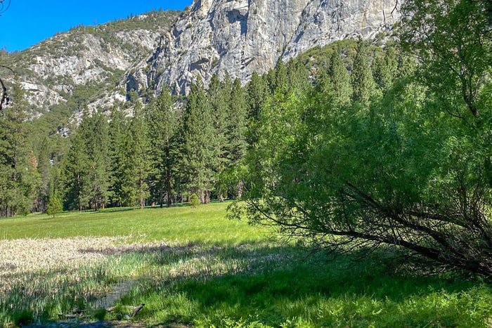
94 South Central Section of California Boondocking Sites
Jump directly to the 100 Northern Section of California Boondocking Campsites
Jump directly to the 58 North Central Section of California Camping Areas
Jump directly to the 98 Central Section of California Dispersed Campsites
Jump directly to the 69 Southern Section of California Camping Spots
1. Turtle Mt Wilderness – Lisa Dawn Camp
Address
Carsons Well Road
Needles, California
GPS: 34.427161, -114.824458
Elevation: 1923′
Management: Public – Bureau of Land Management
Free California boondocking campsites in the Bureau of Land Management Needles District. First come -> first served. No reservations accepted. It is rcommended that you have 4×4 and high clearance to reach this free camping area. The road in is 4×4.
2. Turtle Mt Wilderness – Brown’s Camp
Address
Unnamed Road
Needles, California
GPS: 34.43576, -114.824205
Elevation: 1831′
Management: Public – Bureau of Land Management
The road in is 4×4. Free California camping locations in the Bureau of Land Management Needles District. First come -> First Camped. Reservations not accepted. 4×4 and high clearance are recommended.
3. Mojave National Preserve – Kelso Dunes
Address
Kelso-Dunes Road
Kelso, California
GPS: 34.888236, -115.716743
Elevation: 2523′
Management: Public – National Park Service
Mojave National Preserve – Kelso Dunes is open all year. California dispersed campsites. Reservations are not accepted at this campsite.
4. Mojave National Preserve – Granite Pass
Address
Kelbaker Road
Kelso, California
GPS: 34.81561, -115.61887
Elevation: 3986′
Management: Public – National Park Service
Mojave National Preserve – Granite Pass is open all year. California boondocking sites. First come -> first camped. No reservations are accepted.
5. Mojave Preserve – Kelbaker Rd
Address
Kelbaker Road
Needles, California
GPS: 34.745708, -115.651952
Elevation: 3540′
Management: Public – Bureau of Land Management
Mojave Preserve – Kelbaker Rd is open all year. Free California camping spots located within the Bureau of Land Management Needles District. Reservations are not accepted at this campsite.
6. Kelbaker Strip
Address
California
GPS: 34.72668, -115.67876
Elevation: 3068′
Management: Public – Fish and Wildlife Service (Unofficial)
The road in is Dirt. There are 1-5 California boondocking campsites at this location. About a quarter mile of left over pavement which would accommodate any size vehicle. It is in the Mojave Desert and it be a challenge to set up a tent. Stunning sunsets and sunrises. Close enough to hear the traffic on I 40.
7. Heart of Mojave Dispersed Campsite
Address
Kelbaker Road
Amboy, California
GPS: 34.70131, -115.67627
Elevation: 2625′
Management: Public – Bureau of Land Management
The road in is Paved. Heart of Mojave Dispersed Campsite is open year round. There are 1-5 California camping locations at this site and the maximum RV length is unlimited. You may stay 14 days at Heart of Mojave Dispersed Campsite.
8. Old Route 66 Rest Area #1–Cadiz Summit
Address
Route 66, not long after Cadiz Summit
Cadiz Summit, California
GPS: 34.589832, -115.452881
Elevation: 1272′
Management: Public – Rest Area (Unofficial)
An actual genuine 1950s rest area–really just a concrete turnout–where you can legally pull over for a night. Having spoken to the ranger, you can probably take a full 14 nights in California dispersed campsites, though you probably wouldn’t want to; it’s roadside.
9. Camp Ground for Marble Mountain T634
Address
T634
Amboy, California
GPS: 34.524089, -115.491858
Elevation: 833′
Management: Public – Bureau of Land Management
The road in is Dirt and < 1 miles from a paved road. The maximum RV length at Camp Ground for Marble Mountain T634 is unlimited. California boondocking sites.
10. Mojave Trails National Monument
Address
TWENTYNIN PLM, California
GPS: 34.26001, -115.71578
Elevation: 2087′
Management: Public – Bureau of Land Management
The ranger is okay with camping here as long as you use existing campsites and don’t ruin the land. Free California camping spots.
11. Amboy Crater Overflow
Address
Amboy, California
GPS: 34.557708, -115.776845
Elevation: 664′
Management: Public – Bureau of Land Managment (Unofficial)
California boondocking campsites in BLM land west of Amboy. A big open paved area. The main parking area is the trailhead to an extinct volcano and is day use only. The maximum RV length at Amboy Crater Overflow is Any. You may stay 14 Nights at Amboy Crater Overflow.
12. Means Dry Lake
Address
Landers, California
GPS: 34.412128, -116.513539
Elevation: 2572′
Management: Public – Bureau of Land Management (Official)
California camping locations in High desert dry lake. Can be busy on weekends with the atv crowd. Sadly nearby areas damaged by idiots driving anywhere off-road they please. No water or facilities.
13. Bighorn Mountain Wilderness – Barnes Rd
Address
Landers, California
GPS: 34.393719, -116.526207
Elevation: 2698′
Management: Public – Bureau of Land Managment (Unofficial)
The road in is Gravel and 2.4 miles from a paved road. Bighorn Mountain Wilderness – Barnes Rd is open Year Round. There are 30 or more California dispersed campsites at this location and the maximum RV length is Any. You may stay 14 Nights at Bighorn Mountain Wilderness – Barnes Rd.
14. Soggy Dry Lake
Address
Lucerne Valley, California
GPS: 34.445135, -116.687933
Elevation: 2881′
Management: Public – Bureau of Land Management (Official)
The road in is Dirt. There are 30 or more California boondocking sites at this location and the maximum RV length is unlimited. A staging area within Johnson Valley OHV. Free dry camping. No facilities at all. True desert boondocking. Bring your toys!
15. Stoddard Valley OHV
Address
Outlet Center Drive
Barstow, California
GPS: 34.81275, -117.083354
Elevation: 2612′
Management: Public – Bureau of Land Management
Free California camping spots in the Bureau of Land Management Barstow District. First come -> first camped. No reservations are accepted.
16. Stoddard Wells Road BLM
Address
Barstow, California
GPS: 34.670502, -117.110001
Elevation: 3419′
Management: Public – Bureau of Land Managment (Unofficial)
The road in is Dirt and 7 miles from a paved road. Stoddard Wells Road BLM is open Year Round. There are 30 or more California boondocking campsites at this location and the maximum RV length is Unlimited. You may stay 14 Days at Stoddard Wells Road BLM.
17. Sawtooth Canyon – New Jack City
Address
Lucerne Valley, California
GPS: 34.670395, -116.98423
Elevation: 3588′
Management: Public – Bureau of Land Managment (Official)
The road in is Dirt and 1.5 miles miles from a paved road. Sawtooth Canyon – New Jack City is open year round. There are 6-15 California camping locations at this site. You may stay 14 days at Sawtooth Canyon – New Jack City.
18. Johnson Valley OHV
Address
Unnamed Road
Lucerne Valley, California
GPS: 34.561167, -116.780602
Elevation: 3261′
Management: Public – Bureau of Land Management
Free California dispersed campsites in the Bureau of Land Management Barstow District. First come -> first served. No reservations accepted.
19. Rabbit Ranch
Address
HIgh Road
Lucerne Valley, California
GPS: 34.468052, -117.036285
Elevation: 2953′
Management: Public – Bureau of Land Managment (Unofficial)
The road in is Dirt. There are 6-15 California boondocking sites at this location and the maximum RV length is any. You may stay 14 days at Rabbit Ranch.
20. Cougar Buttes – Johnson Valley OHV
Address
Granite Road
Lucerne Valley, California
GPS: 34.49427, -116.82462
Elevation: 3287′
Management: Public – Bureau of Land Management (Official)
The road in is Dirt. Cougar Buttes – Johnson Valley OHV is open year round. There are 16-29 Free California camping spots at this location and the maximum RV length is unlimited. You may stay 14 days at Cougar Buttes – Johnson Valley OHV.
21. Keller Peak Yellow Post Campsites
Address
Keller Peak Road
Running Springs, California
GPS: 34.209881, -117.065155
Elevation: 6565′
Management: Public – Forest Service (USDA) (Official)
he road in is Paved. There are 6-15 California boondocking campsites at this location and the maximum RV length is small. You may stay 14 nights at Keller Peak Yellow Post Campsites. Nine marked, dispersed campsites in the San Bernardino National Forest. This is a paved road but is very narrow and not recommended for trailers or RV’s.
22. Holcomb Valley 3NO9
Address
Big Bear, California
GPS: 34.27944, -116.8561
Elevation: 7005′
Management: Public – State Forest (Unofficial)
Holcomb Valley 3NO9 is open year round. You may stay 14 days in California camping locations at Holcomb Valley 3NO9. This is a dirt road called Van Dusen Canyon Road, which is accessible and easily traversible in a 2wd car. There are several areas to park right off the road and a few have level ground for Boondocking or undeveloped camping.
23. Soggy Dry Lake
Address
Lucerne Valley, California
GPS: 34.445135, -116.687933
Elevation: 2881′
Management: Public – Bureau of Land Management (Official)
The road in is Dirt. There are 30 or more California dispersed campsites at this location and the maximum RV length is unlimited. Open desert, dry lake beds, some sand dunes & extreme rock crawling trails. Camping is allowed anywhere within the OHV area. This is one of the areas that are most suitable to camping.
24. Murrietta Trail – Matilija Creek Upper North Fork
Address
Ojai, California
GPS: 34.500757, -119.349705
Elevation: 1332′
Management: Public – Forest Service
There are four California boondocking sites along the trail. Murietta Camp is east of Matilija creek approximately .5 mile up Murietta Canyon. Matilija Camp, Middle Matilija, and Maple Camp are approximately .5, 3, and 6 miles up the Upper North Fork.
25. Camp Scheideck
Address
Camp Scheideck Road (FR7N11)
Maricopa, California
GPS: 34.69044, -119.30417
Elevation: 3770′
Management: Public – State Forest (Official)
The road in is Dirt. There are 1-5 Free California camping spots at this location and the maximum RV length is unlimited. You may stay 14 at Camp Scheideck. About a mile before the big “Reyes Creek Campsite”, (half mile before the little town)there is a big old wooden sign that says CAMP Scheideck. There is a dirt road that is easy to miss right next to that sign. That is the road to a small campground. Beautiful area, very private
26. The Place
Address
Maricopa, California
GPS: 34.831454, -119.469817
Management: Private
Free California boondocking campsites overnight if you have a beer or two and maybe a bite to eat. Lots of space. Very friendly. Great spot on the 33.
27. Painted Rock
Address
27 Wo 4
California
GPS: 34.835495, -119.753869
Elevation: 4610′
Management: Public – Forest Service
Free California camping locations in the Los Padres National Forest’s Mt. Pinos Ranger District. This campsite does not use a reservation system. First come, first served.
28. Mission Pine Basin
Address
Mission Pine Trail
California
GPS: 34.708266, -119.746085
Elevation: 5338′
Management: Public – Forest Service
Free California dispersed campsites in the Los Padres National Forest’s Santa Barbara Ranger District. First come -> First Camped. Reservations not accepted.
29. Don Victor
Address
Don Victor Fire Road
California
GPS: 34.671439, -119.519138
Elevation: 3488′
Management
Public – Forest Service
Free California boondocking sites in the Los Padres National Forest’s Santa Barbara Ranger District. This campsite does not use a reservation system. First come, first served.
30. Lower Camuesa
Address
Camuesa Road
Santa Barbara, California
GPS: 34.542172, -119.668515
Elevation: 1526′
Management: Public – Forest Service
Free California camping spots in the Los Padres National Forest’s Santa Barbara Ranger District. First come -> First Camped. Reservations not accepted.
31. Gaviota 101 @ CA1
Address
Las Cruces, California
GPS: 34.50964, -120.22438
Elevation: 367′
Management: Public – Dead end road along 101 (Unofficial)
A dead end road starting from the 101 freeway north band ramp. Dead end sign. No sign about parking. California boondocking campsites – A lot of space to park along the rd. Some distant noise from the freeway. Quiet. Stayed with another rig.
32. TTB Tower Road
Address
TV Tower Road
Santa Margarita, California
GPS: 35.347188, -120.646255
Elevation: 1962′
Management: Public – Forest Service (Official)
The road in is Dirt. TV TOWER ROAD is open year round. You may stay 14 days in California camping locations at TV TOWER ROAD.
33. Lazy
Address
Unnamed Road
Santa Maria, California
GPS: 34.962493, -120.087523
Elevation: 1516′
Management: Public – Forest Service
California dispersed campsites located within the Los Padres National Forest’s Santa Lucia Ranger District.
34. Baja
Address
Forest Route 30S02
Santa Maria, California
GPS: 35.139228, -120.137785
Elevation: 1362′
Management: Public – Forest Service
California boondocking sites located within the Los Padres National Forest’s Santa Lucia Ranger District.
35. Sierra Madre
Address
Old Sierra Madre Road
Santa Maria, California
GPS: 35.101021, -120.083301
Elevation: 1677′
Management: Public – Forest Service
Free California camping spots in the Los Padres National Forest’s Santa Lucia Ranger District. First come -> First Camped. Reservations not accepted.
36. Selby Campground
Address
SANTA MARGAR, California
GPS: 35.128136, -119.840904
Elevation: 2503′
Management: Public – Bureau of Land Managment (Official)
California boondocking campsites with 5 picnic tables, 4 fire pits, no shade. Fire Permit needed, but there is no fee for campfire permits and they may be obtained at the Goodwin Education Center, the Bakersfield BLM office and from any BLM Ranger in the area.
37. KCL campground
Address
Santa Margar, California
GPS: 35.090584, -119.734886
Elevation: 2287′
Management: Public – Bureau of Land Managment (Official)
California camping locations with 8 picnic tables and 8 fire pits There is no fee for campfire permits and they may be obtained at the Goodwin Education Center, the Bakersfield BLM office and from any BLM Ranger in the area.
38. Holcomb Valley 3NO9
Address
Big Bear, California
GPS: 34.27944, -116.8561
Elevation: 7005′
Management: Public – State Forest (Unofficial)
This is a dirt road called Van Dusen Canyon Road, which is accessible and easily traversible in a 2wd car. There are several California dispersed campsites right off the road and a few have level ground for Boondocking or undeveloped camping. Holcomb Valley 3NO9 is open year round. You may stay 14 days at Holcomb Valley 3NO9.
39. RT66-Cajon Pass
Address
Arrowhead Farm, California
GPS: 34.26689, -117.46308
Elevation: 2651′
Management: Public – Forest Service (Unofficial)
California boondocking sites.
40. Alpine Canyon YP
Address
Unnamed Road
Lytle Creek, California
GPS: 34.313517, -117.608837
Elevation: 6243′
Management: Public – Forest Service
Free California camping spots in the San Bernardino National Forest’s Cajon Ranger District. Reservations are not accepted at this campsite.
41. Paiute Camp YP
Address
Unnamed Road
Lytle Creek, California
GPS: 34.309889, -117.598742
Elevation: 5955′
Management: Public – Forest Service
Free California boondocking campsites in the San Bernardino National Forest’s Cajon Ranger District. Reservations are not accepted at this campsite.
42. Lone/Cold Camps YP
Address
Lytle Creek Road
Lytle Creek, California
GPS: 34.297333, -117.572039
Elevation: 5138′
Management: Public – Forest Service
Free California camping locations in the San Bernardino National Forest’s Cajon Ranger District. First come -> first served. No reservations accepted.
43. Cabin Flat
Address
Forest Service Road 3N39
Azusa, California
GPS: 34.344236, -117.700366
Elevation: 5338′
Management: Public – Forest Service
California dispersed campsites located within the Angeles National Forest’s San Gabriel River Ranger District. Cabin Flat is open May-Oct.
44. Ballflat Rd
Address
Ballflat road
Pearblossom, California
GPS: 34.40383, -117.726
Elevation: 6148′
Management: Public – Forest Service (Unofficial)
The road in is 4×4 and Dirt road miles from a paved road. Ballflat Rd is open Always. There are 1-5 California boondocking sites at this location. You may stay 1-14 days at Ballflat Rd.
45. Sulphur Springs TC
Address
Sulphur Springs Road
Pearblossom, California
GPS: 34.367659, -117.988243
Elevation: 5194′
Management: Public – Forest Service
Free California camping spots in the Angeles National Forest’s Santa Clara/Mojave Rivers Ranger District. Reservations are not accepted at this campsite.
46. Little Cedars
Address
Forest Service Road 5N04
Pearblossom, California
GPS: 34.398012, -117.96933
Elevation: 4252′
Management: Public – Forest Service
Free California boondocking campsites in the Angeles National Forest’s Santa Clara/Mojave Rivers Ranger District. No reservations. First come, first served.
47. Sycamore
Address
Forest Service Road 5N04
Pearblossom, California
GPS: 34.417993, -117.974211
Elevation: 3875′
Management: Public – Forest Service
Free California camping locations in the Angeles National Forest’s Santa Clara/Mojave Rivers Ranger District. First come -> first camped. No reservations are accepted.
48. Helendale Road BLM
Address
Helendale Road
Helendale, California
GPS: 34.688896, -117.373894
Elevation: 2702′
Management: Public – Bureau of Land Managment (Unofficial)
The road in is Dirt and 3 miles from a paved road. You may stay 14 days in California dispersed campsites at Helendale Road BLM. Boondocking in the high desert near a well-maintained dirt road. Pictures and more details at http://techno-viking.com/posts/helendale/
49. Calico Early Man
Address
Unnamed Road
Newberry Springs, California
GPS: 34.943077, -116.761106
Elevation: 2083′
Management: Public – Bureau of Land Management
Free California boondocking sites in the Bureau of Land Management Barstow District. No reservations. First come, first served.
50. Rowher Flats OHV Area
Address
13845 Rowher Canyon Road
Santa Clarita, California
GPS: 34.526376, -118.383085
Elevation: 2546′
Management: Public – Forest Service
The road in is Dirt. Rowher Flats OHV Area is open year round. There are 1-5 Free California camping spots at this location and the maximum RV length is unlimited. You may stay 14 days at Rowher Flats OHV Area.
51. Twin Pines
Address
Forest Route 8N01
Maricopa, California
GPS: 34.669313, -118.951107
Elevation: 6644′
Management: Public – Forest Service
Free California boondocking campsites in the Los Padres National Forest’s Mt. Pinos Ranger District. First come -> First Camped. Reservations not accepted.
52. Cottonwood
Address
Unnamed Road
Frazier Park, California
GPS: 34.715959, -119.016656
Elevation: 4551′
Management: Public – Forest Service
Free California camping locations in the Los Padres National Forest’s Mt. Pinos Ranger District. First come -> first served. No reservations accepted.
53. Lockwood
Address
Lockwood Creek
Frazier Park, California
GPS: 34.728714, -119.03078
Elevation: 4724′
Management: Public – Forest Service
Free California dispersed campsites in the Los Padres National Forest’s Mt. Pinos Ranger District. First come -> first camped. No reservations are accepted.
54. Mojave Desert
35.019432, -118.050394
Address
Mojave, California
GPS: 35.019432, -118.050394
Elevation: 2533′
Management: Public – Not sure if BLM (Unofficial)
California boondocking sites – Mojave desert close to highway, large level site accessible via dirt road. No problem for any size camper.
55. Jawbone Canyon OHV
Address
25503-25505 Jawbone Canyon Road
Cantil, California
GPS: 35.315183, -118.044357
Elevation: 2428′
Management: Public – Bureau of Land Management
Free California camping spots in the Bureau of Land Management Ridgecrest District. First come -> first served. No reservations accepted. Jawbone Canyon OHV is open all year.
56. Dove Springs OHV
Address
Los Angeles Aqueduct Road
Mohave, California
GPS: 35.423889, -118.011419
Elevation: 3255′
Management: Public – Bureau of Land Management
Free California boondocking campsites in the Bureau of Land Management Ridgecrest District. First come -> first camped. No reservations are accepted.
57. Sequoia National Forest
Address
Havilah, California
GPS: 35.566426, -118.578244
Elevation: 2395′
Management: Public – Forest Service (Unofficial)
California camping locations about a hundred feet off the road in more like a driveway than a pull out approximately two to three miles west of the hot springs. This was a quiet night.
58. Remington Hot Springs
Address
Old Kern Canyon Road
Lake Isabella, California
GPS: 35.576386, -118.552872
Elevation: 2465′
Management: Public – Forest Service (USDA) (Unofficial)
You may stay 14 days in California dispersed campsites at Remington Hot Springs. Free camping in a parking lot near a hot spring in the Sequoia National Forest for up to 14 days. Limit is enforced by local sheriff. No facilities at all.
59. Black Gulch – Sequoia National Forest
Address
Lake Isabella, California
GPS: 35.595806, -118.523628
Elevation: 2331′
Management: Public – Forest Service (USDA) (Official)
The road in is Dirt. Black Gulch – Sequoia National Forest is open May – October. You may stay 14 Nights in California boondocking sites at Black Gulch – Sequoia National Forest. For health and safety reasons there is no overnight camping allowed in the lower canyon except for Black Gulch dispersed area, and Hobo and Sandy Flat Campgrounds.
60. Owls Nest Overlook
Address
Kernville, California
GPS: 35.59018, -118.50397
Elevation: 2638′
Management: Public – Forest Service
The road in is Paved. Owls Nest Overlook is open Always. There are 1-5 Free California camping spots at this location and the maximum RV length is 25 feet. Just inside the entrance to the forest is a beautiful wide pull out that looks over the village. There was some light local traffic going into the forest but at night it was idyllic. Boondocking with plenty of water and a pretty fair cell signal.
61. Davis
Address
Forest Route 25S15
Bakersfield, California
GPS: 35.615317, -118.617098
Elevation: 5423′
ManagementPublic – Forest Service
Free California boondocking campsites in the Sequoia National Forest’s Kern River Ranger District. First come -> first served. No reservations accepted.
62. Evans Flat
Address
Forest Route 25S15
Bakersfield, California
GPS: 35.642809, -118.58945
Elevation: 6079′
Management: Public – Forest Service
6100-foot elevation. 20 California camping locations with fenced pastures and corrals for horses. A network of roads and trails covers the area. Access from Rancheria Rd. in the Greenhorn Mtns. The maximum RV length at Evans Flat is 20 feet.
63. Lake Isabella</h3
Address
Mountain Mesa, California
GPS: 35.630346, -118.499336
Elevation: 2589′
Management: Public – Bureau of Land Management
California dispersed campsites in BLM lands off of Route 155 West of Lake Isabella in California. You will see the north side of the Kern River. This paved road takes you into several pull out spots.
64. Keyesville SRMA
Address
Lake Isabella, California
GPS: 35.641125, -118.48391
Elevation: 2480′
Management: Public – Bureau of Land Managment (Official)
Keyesville SRMA is open Year Round. There are 30 or more California boondocking sites at this location. You may stay 14 Nights at Keyesville SRMA.
65. Lake Isabella Auxiliary Dam Dispersed Camping
Address
Lake Isabella, California
GPS: 35.647419, -118.459483
Elevation: 2579′
Management: Public – Bureau of Land Management
It cost to camp at Auxiliary Dam, 10 bucks a night to dry camp. Most pass’s get you in for free but if you drive east once on site, between the aux dam and old Isabella road, there’s a piece of BLM land – Free California camping spots.
66. Stine Cove
Address
6651 Sierra Way
Kernville, California
GPS: 35.679037, -118.409049
Elevation: 2602′
Management: Public – Forest Service
Stine Cove is open all year. California boondocking campsites. No reservations. First come, first served.
67. Hanning Flat
Address
Patterson Lane
Weldon, California
GPS: 35.67798, -118.371065
Elevation: 2612′
Management: Public – Forest Service
Free California camping locations in the Sequoia National Forest’s Kern River Ranger District. This campsite does not use a reservation system. First come, first served.
68. Alder Creek (Alta Sierra)
Address
Forest Route 25S04
California
GPS: 35.719841, -118.611855
Elevation: 3888′
Management: Public – Forest Service
Paved and dirt road; no water; fishing seasonal. Maximum RV length 20 feet. California dispersed campsites – Please pack out your trash. Not on reservation system. The maximum RV length at Alder Creek (Alta Sierra) is 20 feet.
69. Dispersed Campsite – Evans Road – Sequoia National Forest
Address
Glennville, California
GPS: 35.744483, -118.596544
Elevation: 4872′
Management: Public – Forest Service (Unofficial)
The road in is Dirt and .1 miles from a paved road. Dispersed Campsite – Evans Road – Sequoia National Forest is open weather permitted. There are 1-5 California boondocking sites at this location. You may stay 14 days at Dispersed Campsite – Evans Road – Sequoia National Forest. Pull off the road, slightly uphill, pull around the circle. A bit sketchy, but I made it in a front wheel drive hatchback.
70. Multiple Dispersed sites
Address
Wofford Heights, California
GPS: 35.747751, -118.560942
Elevation: 5577′
Management: Public – Forest Service (Unofficial)
Multiple Free California camping spots on forest service land. There is an old unmaintained dirt road that comes off the main road. Immediately there is one little site, that could fit a 20′ camper.
71. Panorama
Address
Forest Route 23S16
Posey, California
GPS: 35.808549, -118.571461
Elevation: 7349′
Management: Public – Forest Service
California boondocking campsites located within the Sequoia National Forest’s Western Divide Ranger District. This is a high elevation location. Panorama is open Jun-Oct.
72. Chico Flat Campground
Address
Mountain Road 99
Kernville, California
GPS: 35.8235, -118.462
Elevation: 2935′
Management: Public – Forest Service (Official)
Free California camping locations on Upper Kern River in the Sequoia National Forest. Camping and campfires (fire permit required) within 25 feet of the water’s edge is prohibited due to the Wild and Scenic Designation. Chico Flat Campground is open year round.
73. Frog Meadow
Address
Forest Route 24S50
California Hot Springs, California
GPS: 35.874131, -118.575252
Elevation: 7582′
Management: Public – Forest Service
Frog Meadow Guard Station sits at a meadows edge at an elevation of 7,760 feet in the heart of the the Sequoia National Forest and Sequoia National Monument. California dispersed campsites in Frog Meadow is open Jun-Oct. The maximum RV length at Frog Meadow is 16 feet.
74. Ant Canyon Dispersed Camping – Upper Kern River – Sequoia National Forest
Address
Kern River Rd / Mountain Hwy 99
Kernville, California
GPS: 35.88595, -118.45757
Elevation: 3274′
Management: Public – Forest Service (Official)
The road in is Paved. You may stay 14 Nights in California boondocking sites at Ant Canyon Dispersed Camping – Upper Kern River – Sequoia National Forest. Dispersed camping along the Upper Kern River. Multiple sites along the Kern River Rd / Mountain Highway 99. Fishing, boating and hiking are popular activities in the area.
75. Walker Pass Campground
Address
Hwy 178
Onyx, California
GPS: 35.664082, -118.040299
Elevation: 4993′
Management: Public – Bureau of Land Management (Official)
The road in is Gravel. There are 1-5 Free California camping spots at this location. You may stay 14 Nights at Walker Pass Campground. Free camping in California. BLM. Elevation: 5043′ Small rigs only! Donations are appreciated and go directly to campground upkeep. 13 sites total but nine of them are tent only. Pack it in, pack it out! No trash collection on site. Dry toilets.
76. Bert’s Canyon Roadside Park
Address
HWY 178
Onyx, California
GPS: 35.723782, -118.07563
Elevation: 4031′
Management: Public – Bureau of Land Managment (Unofficial)
The road in is Paved. Bert’s Canyon Roadside Park is open year-round. The maximum RV length at Bert’s Canyon Roadside Park is 40. You may stay one or two nights at Bert’s Canyon Roadside Park. A circular park on the side of the road. California boondocking campsites – Picnic tables and grills are in the center of the circle. No other facilities. Take your everything that you brought with you when you leave. Good for a night or two. There’s room for a couple of small rigs.
77. Chimney Creek Campground
Address
Inyokern, California
GPS: 35.83952, -118.043015
Elevation: 5649′
Management: Public – Bureau of Land Managment (Official)
The road in is Dirt. There are 6-15 California camping locations at this site. You may stay 14 Nights at Chimney Creek Campground.
78. Long Valley Campground
Address
Long Valley Rd.
Inyokern, California
GPS: 35.844894, -118.15152
Elevation: 5363′
Management: Public – Bureau of Land Managment (Official)
Free camping in California. Long Valley Campground is located in a semi -wooded setting at 5,200 feet in elevation. Containing 13 California dispersed campsites, this area is the trailhead for a 3-mile trail down to the South Fork of the Kern River within the Dome Land Wilderness. The road in is Dirt. You may stay 14 Nights at Long Valley Campground.
79. Spangler Hills – Diggers Camp
Address
unnamed road
Ridgecrest, California
GPS: 35.517459, -117.661117
Elevation: 3176′
Management: Public – Bureau of Land Management (Official)
The road in is Dirt. Spangler Hills – Diggers Camp is open year round. There are 30 or more California boondocking sites at this location and the maximum RV length is unlimited. You may stay 14 days at Spangler Hills – Diggers Camp.
80. Spangler Hills OHVA – Searles Station
Address
Searles Station Road
Ridgecrest, California
GPS: 35.484906, -117.626722
Elevation: 3196′
Management: Public – Bureau of Land Management
Free California camping spots in the Bureau of Land Management Ridgecrest District. This campsite does not use a reservation system. First come, first served.
81. Red Mountain
Address
Johannesburg, California
GPS: 35.357554, -117.610553
Elevation: 3678′
Management: Public – Bureau of Land Management (Unofficial)
California boondocking campsites – BLM land in the high desert. Some off road activity apparently but it was very quiet when I was there.
82. Wagon Wheel OHV
Address
Trona Road
California
GPS: 35.572552, -117.552429
Elevation: 3258′
Management: Public – Bureau of Land Management (Official)
The road in is Dirt. There are 30 or more California camping locations at this site and the maximum RV length is any. You may stay 14 nights at Wagon Wheel OHV.
83. Spangler Hills OHV Area
Address
Trona-Red Mountain Road
Ridgecrest, California
GPS: 35.563931, -117.563866
Elevation: 3233′
Management: Public – Bureau of Land Managment (Unofficial)
California dispersed campsites anywhere in the open area, but is limited to a maximum of 14 days. The draining of holding tanks is prohibited. Coordinates are approximate.
84. Spangler Hills OHVA – Teagle Wash
Address
Teagle Washington Road
Ridgecrest, California
GPS: 35.513518, -117.55322
Elevation: 2608′
Management: Public – Bureau of Land Management
Free California boondocking sites in the Bureau of Land Management Ridgecrest District. First come -> first camped. No reservations are accepted.
85. Trona Pinnacles
Address
Pinnacle Rd
Trona, California
GPS: 35.617893, -117.371925
Elevation: 1797′
Management: Public – Bureau of Land Managment (Official)
Primitive camping is permitted at Trona Pinnacles and campers are encouraged to use existing campsites and fire rings and to pack out all trash. If you plan on having a campfire, bring your own firewood. Free California camping spots is limited to 14 days. The road in is Dirt. You may stay 14 nights at Trona Pinnacles.
86. Tecopa Dispersed Camping
Address
Tecopa, California
GPS: 35.893158, -116.253571
Elevation: 1342′
Management: Public – Bureau of Land Managment (Unofficial)
California boondocking campsites available close to Tecopa Hot Springs. Best areas are located off of Furnace Creek Rd (well graded dirt) on the west side of Hwy 127. Typical open desert camping. No shade. Flat parking spots, some with fire rings. The road in is Dirt. You may stay 14 Days at Tecopa Dispersed Camping.
87. Coming or Going to Death Valley
Address
Shoshone, California
GPS: 35.992234, -116.323591
Elevation: 2064′
Management: Public – Bureau of Land Management (Unofficial)
The road in is Gravel. There are 1-5 California camping locations at this site and the maximum RV length is unlimited. You may stay quick stop at Coming or going to Death Valley.
88. Shoshone Dispersed
Address
Furnace Creek Washington Road
Shoshone, California
GPS: 35.912011, -116.312943
Elevation: 1693′
Management: Public – Bureau of Land Management
California dispersed campsites located within the Bureau of Land Management Barstow District.
89. Old Spanish Trails Alkaline Flats
Address
Old Spanish Trail
Tecopa, California
GPS: 35.8614, -116.26741
Elevation: 1332′
Management: Public – Bureau of Land Management (Official)
The road in is Dirt and 100 yards miles from a paved road. Old Spanish Trails Alkaline Flats is open All year. There are 6-15 California boondocking sites at this location and the maximum RV length is unlimited. You may stay 14 days at Old Spanish Trails Alkaline Flats.
90. Amargosa Scenic Water and Riverway
Address
Old Spanish Trail Highway
Tecopa, California
GPS: 35.848361, -116.231277
Elevation: 1335′
Management: Public – Bureau of Land Management (Official)
The road in is Dirt and 0.2 miles from a paved road. There are 1-5 Free California camping spots at this location. You may stay 14 days at Amargosa Scenic Water and Riverway.
91. Silurian Lake
Address
Renoville, California
GPS: 35.517113, -116.168335
Elevation: 677′
Management: Public – Bureau of Land Managment (Unofficial)
Free California boondocking campsites. BLM boondocking on dry lake bed. Hard, flat, natural gravel and sparse vegetation. The road in is Dirt. There are 30 or more campsites at this location and the maximum RV length is Any.
92. Horse Thief
Address
Excelsior Mine Road
California
GPS: 35.773127, -115.888275
Elevation: 4600′
Management: Public – Bureau of Land Management
California camping locations located within the Bureau of Land Management Needles District.
93. Horsethief Camp
Address
Excelsior Mine Road
California
GPS: 35.776658, -115.863226
Elevation: 4045′
Management: Public – Bureau of Land Management (Official)
The road in is Dirt and 24 miles from a paved road. There are 1-5 California dispersed campsites at this location. You may stay 14 days at Horsethief Camp. BLM campground, located about 25 miles East of I15 on Cima Rd. Small, 6 site campground in the foothills of the Mojave Preserve.
94. Ivanpah Dispersed
Address
Unnamed Road
Primm, California
GPS: 35.57267, -115.39243
Elevation: 2605′
Management: Public – Bureau of Land Management
Free California boondocking sites in the Bureau of Land Management Needles District. No reservations. First come, first served.
Free California Camping Spots
While most national parks do not allow free camping, check for Bureau of Land Management (BLM) or United States Forest Service (USFS) land on the outskirts to find the ideal free California camping spots. In southern California, free camping is concentrated in three areas: Anza Borrego Desert State Park, Joshua Tree National Park, and the Mojave Desert.
Blair Valley, in Anza Borrego, less than two hours from San Diego, takes the cake with panoramic vistas, calm places, and hiking opportunities. At Joshua Tree North and Joshua Tree South, both a stone’s throw from park entrances, you’ll find excellent phone coverage and enough of sun for your solar panels, making it a popular vacation from Los Angeles.
Last but not least, the Mojave Desert’s exquisite seclusion is best experienced in the winter or early spring. The Kelbaker Boulders are a great place for a single campsite, or travel to Kelso Dunes Mine for extra space and dune access.
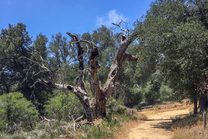
69 Southern Section of California Camping Spots
Jump directly to the 100 Northern Section of California Boondocking Campsites
Jump directly to the 58 North Central Section of California Camping Areas
Jump directly to the 98 Central Section of California Dispersed Campsites
Jump directly to the 94 South Central Section of California Boondockins Sites
1. LTVA Free Area
Address
Winterhaven, California
GPS: 32.861524, -114.497687
Elevation: 203′
Management: Public – Bureau of Land Management (Unofficial)
California boondocking campsites – When staying a day or so and don’t want to buy a permit, go thru the area at the end of Furguson Rd.(rt just before the circle) and go further south on the dirt Rd. You enter a free area on Blm land. Very open but scenic and you can visit friends in the LTVA. It’s a little rough but doable by most MH’s
2. Phil Swing Park
Address
Imperial Dam, California
GPS: 32.884632, -114.46904
Elevation: 185′
Management: Public – County Park (Official)
The road in is Paved. The maximum RV length at Phil Swing Park is 12′. Free California camping locations on the west side of the Imperial Dam, but only suitable for vans, car campers, and tent campers. Small parking lot with a large grassy area for camping. Picnic tables, trees and upright BBQ grills spread throughout. Vault toilets. No drinking water.
3. Fergusen Lake BLM
Address
Ferguson Road
Picacho, California
GPS: 32.969666, -114.497139
Elevation: 188′
Management: Public – Bureau of Land Managment (Unofficial)
The road in is Dirt and 10 miles from a paved road. Fergusen Lake BLM is open year-round. There are 1-5 California dispersed campsites at this location and the maximum RV length is 35′. You may stay 14 nights at Fergusen Lake BLM.
4. Picacho Power BLM 14-day
Address
Winterhaven, California
GPS: 32.83796, -114.64039
Elevation: 420′
Management: Public – Bureau of Land Management (Official)
Numerous areas of flat desert pavement. Best area is just past powerline on right side. Intermittent 4G cell service throughout the area. California boondocking sites – close to water & dump stations in Yuma. Good fishing nearby in canal. From Winterhaven take Picacho Road North to power line.
5. Pilot Knob 14 day Area
Address
felicity, California
GPS: 32.743561, -114.773483
Elevation: 260′
Management: Public – Bureau of Land Managment (Official)
The road in is Dirt and 1.2 miles from a paved road. Pilot Knob 14 day Area is open year round. There are 30 or more Free California camping spots at this location. You may stay 14 at Pilot Knob 14 day Area.
6. Sidewinder Road
Address
Winterhaven, California
GPS: 32.781116, -114.75409
Management: Public – Bureau of Land Management (Official)
The road in is Gravel and 1 miles from a paved road. There are 30 or more California boondocking campsites at this location and the maximum RV length is unlimited. I believe it is BLM land. Head North on Sidewinder road and pick a spot. We stayed near where Sidewinder Road N and Barney Oldfield RD meet. We were only there overnight, I think next time we will head all the way up Barney Oldfield RD up to the base of the mountains.
7. Sidewinder Road (northwest side)
Address
Sidewinder Road at Ogilby Road
Ogilby, California
GPS: 32.81662, -114.837341
Elevation: 366′
Management: Public – Bureau of Land Managment (Official)
There are 30 or more California camping locations at this site and the maximum RV length is All. You may stay 14 days at Sidewinder Road (northwest side). 1 1/2 car-width to 2-car width dirt road just south of American Girl Mine Road and north of the railroad. Multiple wide, flat areas both sides of the road. Obey posted signs as this is a “restricted” area where you can only camp off numbered BLM roads on a brown marker (they remove those markers when they don’t want the roads to be used).
8. American Girl Mine
Address
American Girl Mine Road
Winterhaven, California
GPS: 32.826726, -114.822265
Management: Public – Bureau of Land Management (Official)
The road in is Gravel and 1 miles from a paved road. The maximum RV length at American Girl Mine is Any. You may stay 14 Days in California dispersed campsites at American Girl Mine.
9. Tumco Ghost Town
Address
Olgilby Road
Winterhaven, California
GPS: 32.882061, -114.831947
Elevation: 607′
Management: Public – National Park Service (Official)
The road in is Dirt and as far as you want miles from a paved road. Tumco Ghost Town is open Year round. The maximum RV length at Tumco Ghost Town is Any. You may stay 14 days in California boondocking sites at Tumco Ghost Town.
10. Fergusen Lake BLM
Address
Ferguson Road
Picacho, California
GPS: 32.969666, -114.497139
Elevation: 188′
Management: Public – Bureau of Land Managment (Unofficial)
The road in is Dirt and 10 miles from a paved road. Fergusen Lake BLM is open year-round. There are 1-5 Free California camping spots at this location and the maximum RV length is 35′. You may stay 14 nights at Fergusen Lake BLM.
11. Picacho Peak
Address
Unnamed Road
Winterhaven, California
GPS: 32.977488, -114.67237
Elevation: 919′
Management: Public – Bureau of Land Management
Free California boondocking campsites in the Bureau of Land Management El Centro District. First come -> first camped. No reservations are accepted.
12. Indian Pass Wilderness
Address
Indian Pass Road
Winterhaven, California
GPS: 33.025626, -114.76984
Elevation: 850′
Management: Public – Bureau of Land Management
Free California camping locations in the Bureau of Land Management El Centro District. Reservations are not accepted at this campsite.
13. Glamis Dispersed
Address
34 Ben Hulse Highway
Brawley, California
GPS: 33.01853, -115.05707
Elevation: 423′
Management: Public – Bureau of Land Management
Free California dispersed campsites in the Bureau of Land Management El Centro District. First come -> first camped. No reservations are accepted.
14. Black Mountain BLM
Address
Black Mountain Road
Palo Verde, California
GPS: 33.107552, -114.857742
Elevation: 1169′
Management: Public – Bureau of Land Managment (Unofficial)
The road in is Dirt and 2 miles from a paved road. You may stay 14 days in California boondocking sites at Black Mountain BLM. BLM desert land halfway between Blythe and Brawley on highway 78. Isolated and only a few good parking places.
15. Hwy 78 Boondock
Address
Hwy 78
Palo Verde, California
GPS: 33.284931, -114.77681
Elevation: 445′
Management: Public – Bureau of Land Managment (Unofficial)
Free camping on BLM land. The road in is Gravel and <1 miles from a paved road. There are 6-15 Free California camping spots at this location.
16. Niland Boat Ramp
Address
Frink, California
GPS: 33.339745, -115.666512
Elevation: -228′
Management: Public – County Park (Unofficial)
The road in is Dirt and 1.5 miles from a paved road. Niland Boat Ramp is open Year-round. There are 30 or more California boondocking campsites at this location. An abandoned Imperial County park on the Salton Sea. Plenty of room to boondock. There are a few campers and a shack that look pretty permanent. There are old buildings that have been used as restrooms for both birds and people.
17. Wister Unit
Address
Niland, California
GPS: 33.283691, -115.579796
Elevation: -200′
Management: Public – Fish and Wildlife Service (Official)
Free California camping locations in Imperial Wildlife Area. Facilities at the area include roads, parking areas, portable restrooms, flat hiking trails, public phones, primitive camping, maps, bird check lists, and a special viewing platform is available
18. Slab City – The Last Free Place
Address
3 miles east
Niland, California
GPS: 33.257065, -115.463562
Elevation: 71′
Management: Public – State Forest (Unofficial)
The road in is Paved. Slab City – The Last Free Place is open year round if you can take the heat. There are 30 or more California dispersed campsites at this location and the maximum RV length is any. You may stay as long as you want at Slab City – The Last Free Place. Slab City may be the most wonderful, weird and disturbing campsite in the country. Go with an open mind or don’t go at all.
19. Finney Lake
Address
Rockwood, California
GPS: 33.062832, -115.499573
Elevation: -164′
Management: Public – Fish and Wildlife Service (Official)
Free dry Boondocamping in Finney-Ramer Unit of Imperial Wildlife Area. California boondocking sites – Pit toilet, vandalized portajohns, trash barrels, stone fire rings. Bird watching. Feedlot stench if the wind is blowing in the wrong direction.
20. Superstition Mtn- The Dip Area
Address
Imperial, California
GPS: 32.900013, -115.720409
Elevation: 43′
Management: Public – OHV area (Official)
The road in is Dirt and 1/4 miles from a paved road. Superstition Mtn- The Dip Area is open year round. There are 30 or more Free California camping spots at this location and the maximum RV length is unlimited. You may stay 14 days at Superstition Mtn- The Dip Area.
21. Superstition Mt – Wheeler Rd OHV
Address
Wheeler Road
Imperial, California
GPS: 32.892424, -115.783881
Elevation: 33′
Management: Public – Bureau of Land Management
Free California boondocking campsites in the Bureau of Land Management El Centro District. This campsite does not use a reservation system. First come, first served. This location is at low elevation.
22. Dulzura / Donohoe Mountain Otay Mountain Wilderness area BLM Land
Address
Dulzura, California
GPS: 32.61697, -116.78311
Elevation: 1660′
Management: Public – Bureau of Land Management
California camping locations – approx 4 square miles of land located east of the Otay Mountain Wildlife Area. This small area is popular due its proximity to the city. The road in is Dirt.
23. Jacumba Hot Springs
Address
Jacumba Hot Springs, California
GPS: 32.635139, -116.164791
Elevation: 2848′
Management: Private – Truck Stop (Official)
The road in is Gravel. Jacumba Hot Springs is open All year. There are 16-29 California dispersed campsites at this location and the maximum RV length is unlimited. You may stay 7 Days at Jacumba Hot Springs. Semi-improved gravel parking area across from the Chevron gas station. Just a few yards from I-8. This area is popular with truckers but campers are welcome for up to seven (7) days.
24. Elliot Mine Area
Address
Unnamed Road
Ocotillo, California
GPS: 32.625234, -116.081862
Elevation: 3809′
Management: Public – Bureau of Land Management
California boondocking sites – wonderful desert area, but it’s hike-in only. Being a wilderness area, all roads are closed (unless you work for the Border Patrol, that is).
25. Jacumba Mountains Wilderness
Address
Unnamed Road
Ocotillo, California
GPS: 32.679722, -116.017672
Elevation: 1188′
Management: Public – Bureau of Land Management
Free Free California camping spots in the Bureau of Land Management El Centro District. No reservations. First come, first served.
26. Plaster City West OHV
Address
1510 Painted Gorge Road
Ocotillo, California
GPS: 32.764657, -115.932804
Elevation: 269′
Management: Public – Bureau of Land Management
Free California boondocking campsites in the Bureau of Land Management El Centro District. First come -> first camped. No reservations are accepted.
27. Plaster City OHV Area
Address
County Highway S80
Plaster City, California
GPS: 32.793659, -115.8293
Elevation: 43′
Management: Public – Bureau of Land Managment (Official)
The road in is Dirt and 0 to 10 miles from a paved road. There are 30 or more California camping locations at this site and the maximum RV length is unlimited. You may stay 14 days at Plaster City OHV Area.
28. Plaster City East OHV
Address
Old Overland Stage Route
Imperial, California
GPS: 32.815499, -115.851189
Elevation: 66′
Management: Public – Bureau of Land Management
Free California dispersed campsites in the Bureau of Land Management El Centro District. No reservations. First come, first served. This location is at low elevation.
29. Cottonwood Falls
Address
Pine Valley, California
GPS: 32.826634, -116.496404
Elevation: 4413′
Management: Public – Forest Service (Unofficial)
The road in is Paved. Cottonwood Falls is open year round. There are 1-5 California boondocking sites at this location and the maximum RV length is unlimited. You may stay 14 days at Cottonwood Falls.
30. Kitchen Creek Road Campsite
Address
Pine Valley, California
GPS: 32.84091, -116.45098
Elevation: 5748′
Management: Public – Forest Service
The road in is Paved. There are 1-5 Free California camping spots at this location. You may stay 14 days at Kitchen Creek Road Campsite. Free dispersed camping off of Kitchen Creek Rd. about 1 mile from Sunrise Highway. You can boondock at any of the sites past the “Leaving Mt. Laguna Recreation” sign. The road there is paved and easy to find.
31. Desert View – Cleveland National Forest
Address
8798 Desert View Rd
Mt Laguna, California
GPS: 32.856537, -116.422188
Elevation: 5944′
Management: Public – Forest Service (USDA) (Unofficial)
The road in is Dirt. There are 1-5 California boondocking campsites at this location. You may stay 14 in 60 at Desert View – Cleveland National Forest. A few spurs provide free, dispersed camping along this rough, dirt road in the Cleveland National Forest outside of Mt Laguna, CA.
32. Mountain Palm Primitive Campground
Address
Mountain Palm Road
Ocotillo, California
GPS: 32.862434, -116.215294
Elevation: 736′
Management: Public – State Park (Official)
The road in is Dirt and <1 miles from a paved road. There are 1-5 California camping locations at this site and the maximum RV length is 35′. Free designated campground. Had a vault toilet and nothing else. Pretty small, not much room – best suited for tent and car campers. A few rigs could camp here.
33. South Carizzo Creek
Address
Mesquite Oasis, California
GPS: 32.8611, -116.1675
Elevation: 577′
Management: Public – State Park (Unofficial)
California dispersed campsites – great place to stay. I have seen from small campers to the big motorhomes. The dirt road is easy on any vehicle. This is a primitive camp area, so pack it in, pack it out!
34. Carrizo Badlands Overlook
Address
Ocotillo, California
GPS: 32.828735, -116.16713
Elevation: 1237′
Management: Public – State Park (Unofficial)
The road in is Dirt and .1 miles from a paved road. There are 1-5 California boondocking sites at this location and the maximum RV length is 45. Located in Anza-Borrego Desert State Park this is a signed overlook pull out from the main road. A single track dirt road runs for a half mile or so generally paralleling Sweeny Pass Rd. There are a few available pull outs along the road, the largest of which easily will fit a 40 ft motorhome with toad.
35. Plaster City West OHV
Address
1510 Painted Gorge Road
Ocotillo, California
GPS: 32.764657, -115.932804
Elevation: 269′
Management: Public – Bureau of Land Management
Free Free California camping spots in the Bureau of Land Management El Centro District. First come -> first camped. No reservations are accepted.
36. Plaster City East OHV
Address
Old Overland Stage Route
Imperial, California
GPS: 32.815499, -115.851189
Elevation: 66′
Management: Public – Bureau of Land Management
Free California boondocking campsites in the Bureau of Land Management El Centro District. No reservations. First come, first served. This location is at low elevation.
37. Plaster City OHV Area
Address
County Highway S80
Plaster City, California
GPS: 32.793659, -115.8293
Elevation: 43′
Management: Public – Bureau of Land Managment (Official)
The road in is Dirt and 0 to 10 miles from a paved road. There are 30 or more California camping locations at this site and the maximum RV length is unlimited. You may stay 14 days at Plaster City OHV Area.
38. Pine Creek Road
Address
Julian, California
GPS: 32.92095, -116.49532
Elevation: 5604′
Management: Public – Forest Service (Official)
Found this via coordinates from a review on the Desert View site. It’s a long narrow road in but worth the drive! California dispersed campsites – views are incredible. There was a large 5th wheel RV back there so just about anyone can make the trek.
39. Blythe-Vidal BLM
Address
US 95
Vidal, California
GPS: 33.930035, -114.541756
Elevation: 408′
Management: Public – Bureau of Land Managment (Unofficial)
The road in is Dirt and < 1 miles from a paved road. You may stay 14 days in California boondocking sites at Blythe-Vidal BLM. Boondocking off of US95 25 miles north of Blythe.
40. Sandstone Canyon in Anza-Borrego Desert State Park
Address
California
GPS: 32.9803, -116.21885
Management: Public – National Park Service (Official)
The road in is 4×4 and 15 miles from a paved road. Free California camping spots in the Anza-Borrego Desert State Park on the road to Sandstone Canyon off the Fish Creek Wash Road. I traveled approximately 15 miles of dirt roads to get to this site. High-clearance needed and 4WD highly recommended!
41. Fish Creek
Address
Off Split Mountain Road
Borrego, California
GPS: 33.036297, -116.106949
Elevation: 270′
Management: Public – State Park (Official)
The road in is Dirt and 2-3 miles from a paved road. Fish Creek is open Year Round. There are 6-15 California boondocking campsites at this location and the maximum RV length is 25 feet. You may stay 30 days at Fish Creek.
42. Ocotillo Dispersed
Address
7848-7898 Split Mountain Road
Borrego Springs, California
GPS: 33.071299, -116.107805
Elevation: 135′
Management: Public – Bureau of Land Management
California camping locations within the Bureau of Land Management El Centro District. This location is at low elevation.
43. Anza Borrego PCT Access
Address
S3/San Felipe Rd
Julian, California
GPS: 33.101196, -116.474487
Elevation: 2284′
Management: Public – State Park (Unofficial)
The road in is Paved. There are 16-29 California dispersed campsites at this location and the maximum RV length is 35′. You may stay 14 nights at Anza Borrego PCT Access. Would make a decent overnight parking spot. Large flat paved area at the junction of 78 and S2 North. No dumping sign. Any sized rig (though there are length restrictions on the road of 30′ kingpin to axle).
44. Grapevine Canyon Road Boondocking
Address
Grapevine Canyon Road
Borrego Springs, California
GPS: 33.128845, -116.426224
Elevation: 1678′
Management: Public – State Park (Unofficial)
The road in is Dirt. The maximum RV length at Grapevine Canyon Road Boondocking is 35′. California boondocking sites – Sandy road. Looked like a flash flood area/wash. Didn’t go very far in and explore. No verizon signal/internet. Only saw a couple of spots for small rigs or car campers.
45. Yaqui Well Camping Area
Address
S3
Borrego Springs, California
GPS: 33.136814, -116.380066
Elevation: 1418′
Management: Public – State Park (Official)
The maximum RV length at Yaqui Well Camping Area is 35 Feet. Free California camping spots along a hard-packed dirt road. This area is part of Anza Borrego State Park. Most sites are loose sand. No cellular signals with non-amplified sprint and verizon phones.
46. Yaqui Pass Campground
Address
Yaqui Pass Rd
Borrego Springs, California
GPS: 33.14875, -116.349823
Elevation: 1680′
Management: Public – State Park (Official)
The maximum RV length at Yaqui Pass Campground is no limit. Free California boondocking campsites in a gravel parking lot with no amenities. In Anza-Borrego State Park.
47. Culp Valley Primitive Campground
Address
Ranchita, California
GPS: 33.223106, -116.455299
Elevation: 3315′
Management: Public – State Park (Official)
The road in is Dirt. Free, primitive camping just inside the west entrance of Aza Borrego Desert State Park. Pit toilet, no water, several California camping locations. At 3,300ft. A great area for early fall or late spring camping. First-come first-served – No reservations!
48. Borrego Springs South
Address
Borrego Springs, California
GPS: 33.208233, -116.360611
Elevation: 709′
Management: Public – Bureau of Land Management (Unofficial)
This site is near the southern sculptures. The dirt road goes up the gentle climb toward a canyon that many find great fauna a flora. There are several California dispersed campsites along the road that provide adequate boon-docking.
49. Ocotillo Dispersed
Address
7848-7898 Split Mountain Road
Borrego Springs, California
GPS: 33.071299, -116.107805
Elevation: 135′
Management: Public – Bureau of Land Management
California boondocking sites located within the Bureau of Land Management El Centro District. This location is at low elevation.
50. Ocotillo Wells SVRA
Address
Borrego Springs, California
GPS: 33.149632, -116.150337
Elevation: 288′
Management: Public – State Park (Official)
Ocotillo Wells SVRA is open 10/1 – 5/31. You may stay 14 days in Free California camping spots at Ocotillo Wells SVRA. Adjacent to Anza-Borrego Desert State Park, this area has desert terrain, from below sea level to 400 foot elevations. It is a motorcycle, four-wheel drive, all-terrain vehicle, and dune buggy use area.
51. Coachwhip Canyon
Address
Borrego Springs, California
GPS: 33.29174, -116.14828
Elevation: 1007′
Management: Public – State Park (Official)
The road in is Dirt. Coachwhip Canyon is open Year-round, but it is a wash so be careful if there’s storms nearby!. There are 6-15 California boondocking campsites at this location. Just a short side canyon right off the main road with several good spots to park. Canyon splits half way in. I explored up the right fork and the canyon starts to get very tight and winding which made for a nice secluded campsite. Many other people camped up in this canyon too.
52. Arroyo Salado Primitive Campground
Address
Borrego Salton Seaway
Salton City, California
GPS: 33.279865, -116.145386
Elevation: 827′
Management: Public – State Park (Official)
The road in is Dirt and 0.2 miles from a paved road. This free, primitive camping area is located on HWY S22 near the Northeastern entrance to Anza Borrego Desert State Park (about 19 miles east of the Visitor Center. ). California camping locations – Pit toilet. No garbage services – Pack it in, pack it out! No ground fires. All fires must be in an enclosed metal container that you bring.
53. Anza Borego Desert – Truckhaven Hills
Address
Borrego Salton Sea Way
Thermal, California
GPS: 33.278973, -116.058337
Elevation: 397′
Management: Public – Bureau of Land Management
Free California dispersed campsites in the Bureau of Land Management El Centro District. Reservations are not accepted at this campsite.
54. Truckhaven Wash SVRA
Address
Thermal, California
GPS: 33.30716, -115.98565
Elevation: -56′
Management: Public – State Park (Official)
The road in is Dirt. Truckhaven Wash SVRA is open 365. There are 30 or more California boondocking sites at this location and the maximum RV length is unlimited. You may stay 30/yr at Truckhaven Wash SVRA. This is part of the Ocotillo Wells State Vehicle Recreation Area. Free camping for 30 days per year. Open desert, no services. Good antenna TV, and Sensorly says 4G ATT, Sprint, T-Mobile, & Verizon.
55. Palm Beach Dry Camp
Address
2880 Crystal Lake Ave
Salton City, California
GPS: 33.332247, -115.950422
Elevation: -223′
Management: Public – City Park (Official)
Free California camping spots – It has been reported that this is not an established campground with fees. If you visit this location, please leave a review with the price and details.
56. Thomas Hunting Grounds Yellow Post Campites
Address
1N12
Big Bear Lake, California
GPS: 34.128422, -117.005478
Elevation: 5890′
Management: Public – Forest Service (USDA) (Official)
The road in is Dirt. There are 1-5 California boondocking campsites at this location and the maximum RV length is small. You may stay 14 nights at Thomas Hunting Grounds Yellow Post Campites. Five free, remote camping sites in the San Bernardino National Forest locations for tent and car camping. There are some mature shade trees near the sites, but other than a metal fire ring for campfires, these sites do NOT contain the amenities found at developed campgrounds.
57. Mission Creek Preserve
Address
Whitewater, California
GPS: 34.00044, -116.6122
Elevation: 2106′
Management: Public – Wildlands Conservancy (Official)
California camping locations – very secluded and quiet wildlife area. be sure to contact the ranger ahead of time to let them know you’ll be camping there and also to get the gate code.
58. Side Road Scamper
Address
Whitewater, California
GPS: 33.995995, -116.594035
Elevation: 1867′
Management: Public – County land (Unofficial)
Great place. California dispersed campsites – driving to the place is a bit uneven und unpaved but the view is incredible.
59. Snow Creek Canyon Rd Highway 111
Address
Whitewater, California
GPS: 33.9106, -116.6666
Elevation: 1165′
Management: Public – Bureau of Land Management (Unofficial)
Off highway 111 east. California boondocking sites – Snow creek canyon rd gravel pull off. Large flat area but very soft sand. Would only recommend 4wd vehicle.
60. Tool Box Springs Campground
Address
Forest Road 6S13
Anza, California
GPS: 33.611843, -116.661423
Elevation: 6125′
Management: Public – Forest Service (USDA) (Official)
Tool Box Springs Campground is open year-round. There are 6-15 Free California camping spots at this location. Campground with six campsites near Thomas Mountain in California’s San Bernardino National Forest.
61. Santa Rosa Yellow Post Sites
Address
Forest Road 7S02
Palm Desert, California
GPS: 33.537651, -116.459053
Elevation: 7902′
Management: Public – Forest Service (USDA) (Official)
There are 6-15 California boondocking campsites at this location. You may stay 14 nights at Santa Rosa Yellow Post Sites. Free, primitive in isolated scenic locations ideal for tent and car camping or a relaxing picnic far from the crowds. Fourteen sites that are no more than a clearing with a fire ring near Idyllwild in the San Bernardino National Forest.
62. Painted Canyon
Address
Mecca, California
GPS: 33.619301, -116.000076
Elevation: 593′
Management: Public – Bureau of Land Managment (Unofficial)
The road in is Dirt and <5 miles from a paved road. Painted Canyon is open All Seasons, Use caution during and after rains, as this road is a wash.. There are 30 or more California camping locations at this site and the maximum RV length is Any. You may stay 14 Days at Painted Canyon. Do not visit the area if there is any threat of rain. This is a flash flood area. The roads wash out and get closed.
63. Box Canyon West
Address
Box Canyon Rd
Mecca, California
GPS: 33.586845, -115.977158
Elevation: 256′
Management: Public – Bureau of Land Managment (Unofficial)
The road in is Paved. Box Canyon West is open year-round. There are 30 or more California dispersed campsites at this location and the maximum RV length is Any. You may stay 14 at Box Canyon West. Lots of room for boondocking all along Box Canyon Rd. Very neat area. We parked in the shade of a cliff. Looks kind of like you are on the moon.
64. Colorado Desert (overland near Box Canyon)
Address
Desert Camp, California
GPS: 33.57944, -115.97251
Elevation: 315′
Management: Public – Bureau of Land Management (Official)
The road in is 4×4 and .75 miles from a paved road. Colorado Desert (overland near Box Canyon) is open Year round!. There are 1-5 California boondocking sites at this location. You may stay 14 at Colorado Desert (overland near Box Canyon).
65. Drop 31 Boondocking
Address
Mecca, California
GPS: 33.534068, -115.91114
Elevation: 75′
Management: Public – Bureau of Land Management (Official)
The road in is 4×4. There are 1-5 Free California camping spots at this location. Free dispersed camping on BLM land. I was told about this area by a BLM ranger. 4×4 may be required.
66. Bradshaw Trail Palo
Address
California
GPS: 33.558964, -115.604996
Elevation: 1414′
Management: Public – Bureau of Land Management
More nice free California boondocking campsites along the Bradshaw Trail.
67. South Entrance of Joshua Tree N.P.
Address
Cottonwood Springs Road
Indio, California
GPS: 33.674534, -115.802651
Elevation: 1781′
Management: Public – Bureau of Land Management (Unofficial)
The road in is Gravel and <1mile miles from a paved road. South Entrance of Joshua Tree N.P. is open Year Round. There are 6-15 California camping locations at this site and the maximum RV length is Unlimited. You may stay 14 days at South Entrance of Joshua Tree N.P..
68. Chiriaco Summit
Address
Chiriaco Summit, California
GPS: 33.663864, -115.723976
Elevation: 1716′
Management: Private – Privately Owned Campground (Official)
The road in is Dirt and <1 miles from a paved road. There are 16-29 California dispersed campsites at this location.
69. Red Cloud
Address
Desert Center, California
GPS: 33.676528, -115.562132
Elevation: 1404′
Management: Public – Bureau of Land Management (Official)
Flat. Off I-10, BLM land . No Water Easy access. Boondocking. The road in is Dirt. There are 16-29 California boondocking sites at this location and the maximum RV length is unlimited.
You May Want to Join Our Boondocking Group on Facebook For More Information
You May Want to Join Our Campfire Recipes Group on Facebook For More Information
Check Out Our Pictures On Instagram – Our Big Escape.