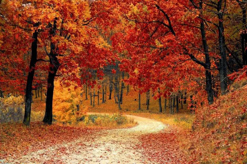
You don’t have to schedule your journey around the campsites because there are so many possibilities for locating fabulous New Mexico Boondocking Spots. There are breathtaking views, historical mysteries, and a diverse range of landscapes to discover. Throughout the state, there are numerous boondocking opportunities.
Jump directly to the 28 NE New Mexico Boondocking Spots
Jump directly to the 25 NW Free New Mexico Campsites
Jump directly to the 55 SE New Mexico Booondocking Sites
Jump directly to the 33 SW Free New Mexico Camping Spots
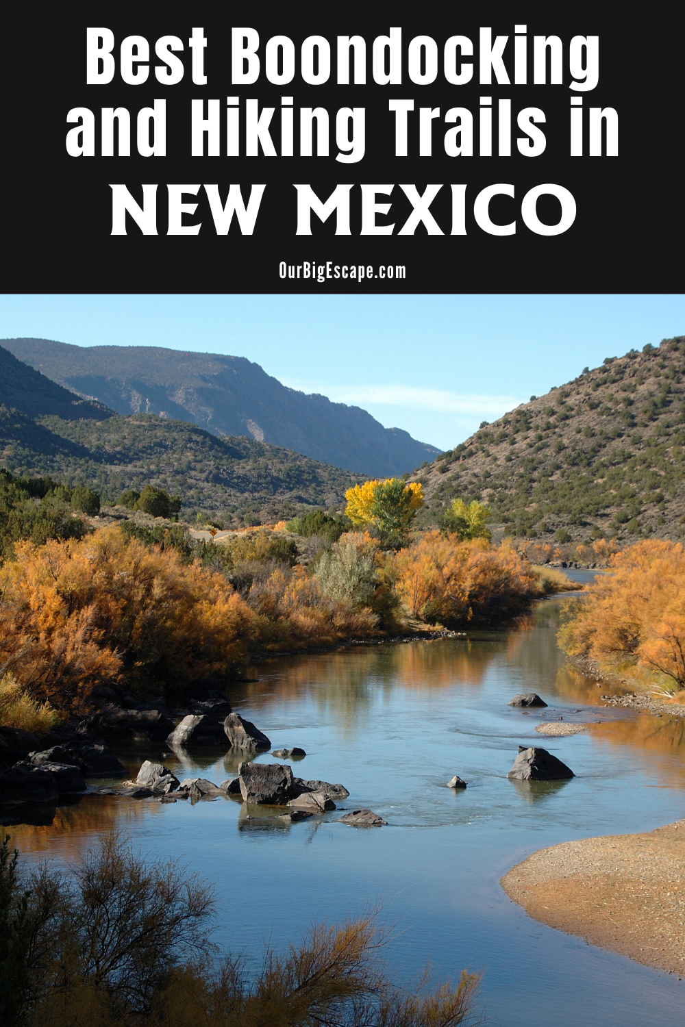
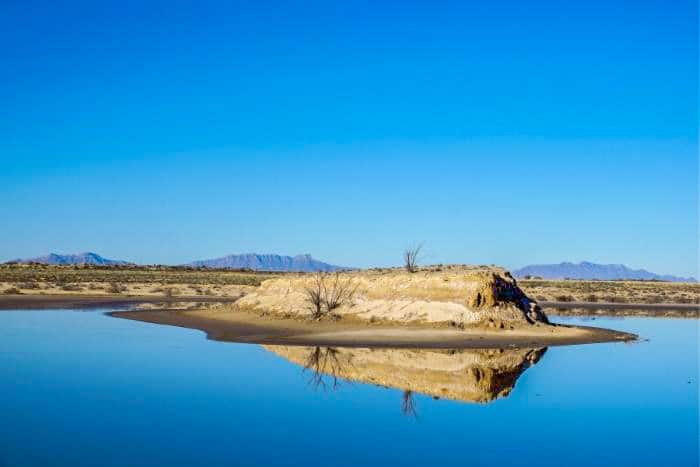
New Mexico Boondocking Spots
New Mexico lacks the well-known national parks of Arizona and the popular tourist destinations of neighboring Colorado. However, depending on the type of traveler you are, New Mexico should be at the top of your RV travel bucket list!
Natural treasures abound in the Land of Enchantment. New Mexico Boondocking Spots are available from Carlsbad Caverns’ vast tunnels to White Sands National Park’s otherworldly dunes to Chaco Canyon’s historic cave dwellings. Fortunately, there are many free or nearly free campsites in this state for tourists like you.
Over two million acres of BLM land, 9 National Monuments, 2 National Parks, and 5 National Forests (Carson, Cibola, Lincoln, Gila, and Santa Fe) make up New Mexico. Many of which are free to camp in! The majority of them are on a first-come, first-served basis. A few dozen state parks, on the other hand, offer free dispersed camping or reserved sites with a few amenities for a small price.
Want more ideas to round-out your trip to New Mexico?
A lot of great ideas are in these posts!
- 9 Carlsbad Caverns Boondocking Locations (Updated 2022)
- 9 Top Boondocking Bandelier National Monument (Updated 2022)
- 12 Petrified Forest National Park Boondocking (Updated 2022)
- 11 Aztec Ruins National Monument Boondocking (Updated 2002)
- 10 El Malpais Monument Boondocking (Updated 2022)
- 13 Capulin Volcano National Monument Boondocking (Updated 2022)
28 NE New Mexico Boondocking Spots
Jump directly to the 25 NW Free New Mexico Campsites
Jump directly to the 55 SE New Mexico Booondocking Sites
Jump directly to the 33 SW Free New Mexico Camping Spots
check out our video
1. San Jon Municipal Park
Address
San Jon, New Mexico
GPS: 35.107224, -103.331796
Elevation: 4029′
Management: Public – city park (Official)
The road in is Paved. San Jon Municipal Park is open Year Round. There are 6-15 New Mexico boondocking spots at this location. You may stay overnight at San Jon Municipal Park.
2. Aspen Basin Campground
Address
Tesuque, New Mexico
GPS: 35.795018, -105.803442
Elevation: 10285′
Management: Public – Forest Service (USDA) (Official)
Aspen Basin Campground is open Year round. There are 1-5 Free New Mexico campsites at this location.
3. Dalton Canyon Road
Address
Glorieta, New Mexico
GPS: 35.668518, -105.70892
Management: Public – Forest Service (Official)
The road in is Gravel and 4 miles from a paved road. Dalton Canyon Road is open Year round. There are 1-5 New Mexico booondocking sites at this location and the maximum RV length is 25 feet. You may stay 14 days at Dalton Canyon Road.
4. Links Tract Campground (Davis Willlow)
Address
Forest Road 646 (Davis-Willow Road)
Pecos, New Mexico
GPS: 35.756697, -105.661353
Elevation: 8179′
Management: Public – Forest Service (Official)
The road in is Paved. There are 30 or more New Mexico boondocking spots at this location. You may stay 14 day at Links Tract Campground (Davis Willlow).
5. Tres Piedras
Address
Tres Piedras, New Mexico
GPS: 36.655331, -105.977997
Elevation: 8240′
Management: Public – Forest Service (USDA) (Unofficial)
The road in is Dirt and 0.25 miles from a paved road. Tres Piedras is open Year Round. There are 6-15 Free New Mexico campsites at this location. You may stay 14 at Tres Piedras.
6. Cebolla Mesa
Address
Forest Road #9
Questa, New Mexico
GPS: 36.640555, -105.684872
Elevation: 7382′
Management: Public – Forest Service (Official)
The road in is Dirt and 3.4 miles from a paved road. Cebolla Mesa is open May – October. There are 1-5 New Mexico booondocking sites at this location and the maximum RV length is 35 feet.
7. Mesa Public Access near Taos, NM
Address
Tres Piedras, New Mexico
GPS: 36.55611, -105.77014
Elevation: 7169′
Management: Public – Bureau of Land Management
The road in is Dirt. Mesa Public Access near Taos, NM is open year round. You may stay 14 days in New Mexico boondocking spots at Mesa Public Access near Taos, NM.
8. Rio Grande Overlook
Address
Arroyo Hondo, New Mexico
GPS: 36.544014, -105.706167
Management: Public – Bureau of Land Management (Unofficial)
The road in is Dirt and 5 miles from a paved road. Rio Grande Overlook is open Year round. There are 1-5 Free New Mexico campsites at this location. You may stay 14 days at Rio Grande Overlook.
9. Rio Grande Gorge Bridge Rest Area
Address
Rest Area Rd
El Prado, New Mexico
GPS: 36.47498, -105.736819
Elevation: 6985′
Management: Public – State Park (Official)
The road in is Paved. Rio Grande Gorge Bridge Rest Area is open all year. There are 6-15 New Mexico booondocking sites at this location and the maximum RV length is unlimited. You may stay 1 Night at Rio Grande Gorge Bridge Rest Area.
10. Taos Junction, Carson NF
Address
New Mexico
GPS: 36.360353, -105.893974
Elevation: 7300′
Management: Public – Forest Service (Official)
Taos Junction, Carson NF is open when the road is open. There are 1-5 New Mexico boondocking spots at this location. You may stay 14 days at Taos Junction, Carson NF.
11. Taos Ski Valley
Address
Taos Ski Valley, New Mexico
GPS: 36.594306, -105.47596
Elevation: 9060′
Management: Public – Forest Service (Unofficial)
The road in is Dirt and less than one miles from a paved road. Taos Ski Valley is open Year Round. There are 1-5 Free New Mexico campsites at this location. You may stay 14 days at Taos Ski Valley.
12. Twining
Address
103 Sutton Place
Taos Ski Valley, New Mexico
GPS: 36.59594, -105.450511
Elevation: 9409′
Management: Public – Forest Service
New Mexico booondocking sites at Twining is open May-Oct. The maximum RV length at Twining is 22 feet.
13. Twining Campground
Address
Taos Ski Valley, New Mexico
GPS: 36.5621, -105.43887
Elevation: 11158′
Management: Public – USDA Forest Service (Official)
Twining Campground is open Ma. There are 1-5 New Mexico boondocking spots at this location and the maximum RV length is 25 feet. You may stay 14 days at Twining Campground.
14. Carson National Forest
Address
Tres Piedras, New Mexico
GPS: 36.465424, -105.893705
Elevation: 7569′
Management: Public – Forest Service (Official)
The road in is Dirt and 2 miles from a paved road. There are 6-15 Free New Mexico campsites at this location.
15. Maxwell National Wildlife Refuge
Address
Maxwell, New Mexico
GPS: 36.573319, -104.580399
Elevation: 6014′
Management: Public – Fish and Wildlife Service (Official)
Maxwell National Wildlife Refuge is open May to October. You may stay 3 days in New Mexico booondocking sites at Maxwell National Wildlife Refuge.
16. Springer Lake Wildlife Area
Address
C 17
Springer, New Mexico
GPS: 36.407448, -104.649962
Elevation: 5938′
Management: Public – State Park
New Mexico boondocking spots – Primarily a lake for anglers, Springer Lake also offers primitive camping facilities.
17. Rio Grande del Rancho
Address
Rancho de Taos, New Mexico
GPS: 36.250941, -105.579742
Elevation: 7592′
Management: Public – Forest Service (Official)
Dispersed camping off FS 439 in the Carson National Forest about 6 miles south of Taos, NM. The first and largest camping area is about 1/2 mile from the paved road. Free New Mexico camping spots – some shaded some not.
18. FR 441 near Pot Creek
Address
Taos, New Mexico
GPS: 36.27473, -105.56712
Elevation: 7530′
Management: Public – Forest Service
New Mexico booondocking sites – This road isn’t as rutted or bumpy as 438. Drove out with no issues after a light overnight snow that melted away.
19. FSR 437
Address
F R 437
Taos, New Mexico
GPS: 36.331796, -105.393221
Elevation: 9941′
Management: Public – Forest Service
Free New Mexico boondocking spots in the Carson National Forest’s Camino Real Ranger District. First come -> First Camped. Reservations not accepted. This is a high elevation location.
20. Goose Creek Canyon
Address
Goose Lake Road
Taos Ski Valley, New Mexico
GPS: 36.6364, -105.448973
Elevation: 11650′
Management: Public – Forest Service
The road in is 4×4. Free New Mexico camping spots in the Carson National Forest’s Questa Ranger District. First come -> first served. No reservations accepted. This is a high elevation location. 4×4 and high clearance are recommended.
21. Mallette Upper
Address
Red River, New Mexico
GPS: 36.7267, -105.39648
Elevation: 9009′
Management: Public – Forest Service (Official)
Free New Mexico booondocking sites. No water. Primitive only. Haul your own trash out,
22. Charrette Lakes
Address
Wagon Mound, New Mexico
GPS: 36.18744, -104.81098
Elevation: 6663′
Management: Public – State Park (Official)
New Mexico boondocking spots – Lake is atop butte with toilets, fishing, and camping.Almost no shade, but pic-nic tables and primitive fire spots.Signs at entry, no trash , no water, several acres of lake.
23. Trampas Trailhead
Address
Forest Road 207
Chamisal, New Mexico
GPS: 36.044605, -105.67304
Elevation: 8950′
Management: Public – Forest Service
Free New Mexico camping spots – Rio Trampas Fishing. Trampas Trailhead is open all year.
24. Big Tesuque Campground
Address
Santa Fe, New Mexico
GPS: 35.76917, -105.80861
Elevation: 9724′
Management: Public – Forest Service (Official)
Big Tesuque is a walk in campground not conducive to trailer or RV campoing. There are 10 New Mexico booondocking sites, Picnic tables and grills, and Vaulted toilets in the parking lot.
25. Cow Creek Campground
Address
FR 92
Pecos, New Mexico
GPS: 35.660832, -105.636673
Elevation: 8172′
Management: Public – Forest Service (USDA)
Free New Mexico boondocking spots in the Santa Fe National Forest. Cow Creek Campground is open Year-round.
26. Manzanares
Address
Forest 86 Road
Pecos, New Mexico
GPS: 35.659738, -105.583503
Elevation: 8573′
Management: Public – Forest Service
Free New Mexico camping spots located within the Santa Fe National Forest’s Pecos-Las Vegas Ranger District. This is a high elevation location.
27. Johnson Mesa Campground
Address
Forest Road 156
Las Vegas, New Mexico
GPS: 35.703784, -105.469463
Elevation: 9491′
Management: Public – Forest Service
Johnson’s Mesa is a dispersed camping area located east of Las Vegas on NM 65 and FR 153. Facilities: vaulted toilets, tables and grills. There are 16-29 New Mexico booondocking sites at this location.
28. Garrapata Ridge
Address
San Cristobal, New Mexico
GPS: 36.630885, -105.651919
Elevation: 7641′
Management: Public – Forest Service
Small pullouts along the road. Facilities: vaulted toilets, tables and grills. There are 16-29 New Mexico boondocking spots at this location.
Free New Mexico Campsites
New Mexico, dubbed the “Land of Enchantment” for its wonderful sweeping deserts, stunning mountains, and abundant of fresh air, lives up to its name. It has plenty of beautiful places to pitch your tent or park your camper, as well as cultural events, world-class spas, and Southwestern art galleries.
To top it off, Free New Mexico Campsites and public lands camping in New Mexico allow you to take in all the beauty while staying within your budget. Campers in New Mexico, like other places, are unable to simply set up camp anywhere they like. Private land, national public lands, and state public lands are all present in the state. If you’re looking for free camping in New Mexico, keep in mind the sort of land you’re on and any laws or regulations that may apply.
New Mexico is a big state with a wide range of climate and geography. The state’s northern region is dominated by massive mountains, with numerous peaks over 10,000 feet. To keep warm on chilly nights, carry a properly functional heater, some blankets, and a supply of hot cocoa.
25 NW Free New Mexico Campsites
Jump directly to the 28 NE New Mexico Boondocking Spots
Jump directly to the 55 SE New Mexico Booondocking Sites
Jump directly to the 33 SW Free New Mexico Camping Spots
1. Aspen Basin Campground
Address
Tesuque, New Mexico
GPS: 35.795018, -105.803442
Elevation: 10285′
Management: Public – Forest Service (USDA) (Official)
Aspen Basin Campground is open Year round. There are 1-5 New Mexico boondocking spots at this location. Take Bishop’s Lodge Road to Artist Road, which will turn into NM 475, also known as Hyde Park Road. No potable water.
2. Big Tesuque Campground
Address
Santa Fe, New Mexico
GPS: 35.76917, -105.80861
Elevation: 9724′
Management: Public – Forest Service (Official)
Free New Mexico campsites – There is no potable water and no Campground Host.
3. Caja Del Rio – Santa Fe National Forest
Address
Santa Fe, New Mexico
GPS: 35.68954, -106.09418
Elevation: 6440′
Management: Public – Forest Service (Official)
Caja Del Rio – Santa Fe National Forest is open year round. The maximum RV length at Caja Del Rio – Santa Fe National Forest is unlimited. You may stay 14 days in New Mexico booondocking sites at Caja Del Rio – Santa Fe National Forest.
4. Diablo Canyon
Address
Santa Fe, New Mexico
GPS: 35.804642, -106.136192
Elevation: 5845′
Management: Public – Bureau of Land Managment (Unofficial)
The road in is Dirt and 10 miles from a paved road. Diablo Canyon is open Year Round. You may stay 14 day in New Mexico boondocking spots standard BLM at Diablo Canyon.
5. Caja del Rio Plateau
Address
Santa Fe, New Mexico
GPS: 35.691879, -106.21582
Elevation: 6692′
Management: Public – Forest Service (USDA) (Official)
The road in is 4×4 and 10Miles miles from a paved road. Caja del Rio Plateau is open Year Round. There are 30 or more Free New Mexico campsites at this location and the maximum RV length is N/A. You may stay 14 Days at Caja del Rio Plateau.
6. Camp May Road
Address
Los Alamos, New Mexico
GPS: 35.87844, -106.344898
Elevation: 7953′
Management: Public – Forest Service
Dispersed camping locations along Camp May Road. I stayed several nights a various locations close to town with great views and hiking The road in is Paved. There are 16-29 New Mexico booondocking sites at this location and the maximum RV length is 35 feet. You may stay 14 at Camp May Road.
7. Pajarito Spring
Address
Los Alamos, New Mexico
GPS: 35.845222, -106.381406
Elevation: 8249′
Management: Public – Forest Service (Unofficial)
The road in is Dirt and 1.4 miles from a paved road. There are 6-15 New Mexico boondocking spots at this location. Pajarito Spring is a series of free, open campgrounds 3 miles east on Highway 4.
8. American Spring
Address
Los Alamos, New Mexico
GPS: 35.837497, -106.381919
Elevation: 8258′
Management: Public – Forest Service (Unofficial)
Free New Mexico campsites – There are also several places you can find fire rings made from rocks if you turn down any of the dirt roads. In particular, if you hang an immediate right after getting onto the dirt road off NM 4. The road in is Dirt and 0.5 miles from a paved road.
9. Gilman Tunnels Dispersed Camping
Address
Jemez Pueblo, New Mexico
GPS: 35.72994, -106.75855
Elevation: 6056′
Management: Public – Forest Service
New Mexico booondocking sites – The road in is paved, but it’s narrow and there’s a pretty big dip at one point so bigger RVs should check it out first. It’s a beautiful spot, pretty popular during the day but we were the only ones there overnight.
10. San Diego Canyon Overloook
Address
Jemez Springs, New Mexico
GPS: 35.8547, -106.6249
Elevation: 8166′
Management: Public – Forest Service (Official)
The road in is Dirt. There’s a bunch of nice, dispersed campsites off NM 4, along an unmarked forest road. San Diego Canyon Overloook is open year round. There are 6-15 New Mexico boondocking spots at this location and the maximum RV length is 25 feet. You may stay 14 days at San Diego Canyon Overloook.
11. Dispersed Camping- Hot Rock Road
Address
Jemez Springs, New Mexico
GPS: 35.87619, -106.69321
Elevation: 8537′
Management: Public – Forest Service
The road in is Dirt and 0.3 miles from a paved road. There are 1-5 Free New Mexico campsites at this location. A couple of good RV spots about a 5min drive from Antonio Creek rec areas (with fishing, swimming, picnic shelters, etc.) There are better sites nearby but those are more popular and fill up fast.
12. Coyote Canyon Campground
Address
Coyote, New Mexico
GPS: 36.072, -106.6302
Elevation: 7976′
Management: Public – Forest Service (Official)
The road in is Dirt and 14 miles from a paved road. There are 6-15 New Mexico booondocking sites at this location. You may stay 7 at Coyote Canyon Campground.
13. Mesa de Cuba
Address
Cuba, New Mexico
GPS: 36.023074, -107.01115
Elevation: 7549′
Management: Public – Forest Service (Official)
The road in is Dirt. Mesa de Cuba is open year round. There are 30 or more New Mexico boondocking spots at this location. You may stay 14 days at Mesa de Cuba.
14. Resumidero Camping Area
Address
Coyote, New Mexico
GPS: 36.111742, -106.748667
Management: Public – Forest Service (Official)
The road in is Gravel and 9 miles from a paved road. Resumidero Camping Area is open Year round. The maximum RV length at Resumidero Camping Area is unlimited. You may stay 14 days in Free New Mexico camping spots at Resumidero Camping Area.
15. Angel Peak Scenic Area
Address
Off state rd 550 about 20 miles south of Bloomfield NE
Aztec, New Mexico
GPS: 36.545225, -107.862155
Elevation: 6643′
Management: Public – Bureau of Land Management (Official)
The road in is Gravel and 1-6 miles from a paved road. There are 6-15 New Mexico booondocking sites at this location and the maximum RV length is unlimited. You may stay 14 Days at Angel Peak Scenic Area.
16. Beyond the Well
Address
Navajo Dam, New Mexico
GPS: 36.812921, -107.543115
Elevation: 6260′
Management: Public – Bureau of Land Management
The road in is Dirt. Beyond the well is open Weather permitting. There are 1-5 New Mexico boondocking spots at this location and the maximum RV length is 25 feet. You may stay 14 days at Beyond the well.
17. Buzzard Park Campground
Address
Navajo Dam, New Mexico
GPS: 36.880868, -107.217557
Elevation: 6959′
Management: Public – USDA Forest Service
4 sites for dispersed camping at 7300\’ in ponderosa forest west of Jicarilla Apache Reservation. Vault toilet. No reservations accepted. The road in is Dirt. Buzzard Park Campground is open May through November. There are 1-5 Free New Mexico camping spots at this location.
18. Cedar Springs Campground
Address
Blanco, New Mexico
GPS: 36.6727, -107.2591
Elevation: 7288′
Management: Public – USDA Forest Service (Official)
This Carson National Forest campground sees light usage. Cedar Springs Campground is open May-November. There are 1-5 New Mexico booondocking sites at this location.
19. Enbom Lake – Jicarilla Apache
Address
County Highway J8
Dulce, New Mexico
GPS: 36.793602, -106.879055
Elevation: 7690′
Management: Public – Other
New Mexico boondocking spots – This is a high elevation location. Enbom Lake – Jicarilla Apache is open all year.
20. Simon Canyon RA Dispersed
Address
Road 4280
Navajo Dam, New Mexico
GPS: 36.82337, -107.660298
Elevation: 5702′
Management: Public – Bureau of Land Management
Free New Mexico camping spots – Simon Canyon Area of Critical Environmental Concern (ACEC) is about 3,900 acres in size and is managed for semi-primitive forms of recreation including fishing, hiking, and backpacking.
21. Alien Run
Address
Aztec, New Mexico
GPS: 36.87804, -107.89841
Elevation: 6129′
Management: Public – Bureau of Land Management (Official)
The road in is Dirt. New Mexico booondocking sites in Alien Run Mountain Bike Trail consists of two looped mountain bike trails that cover over 26 miles. The original loop and the OuterLimits trail circle around a rumored UFO crash site.
22. Canada del Guardia
Address
Unnamed Road
Coyote, New Mexico
GPS: 36.063889, -106.662341
Elevation: 8652′
Management: Public – Forest Service
Free New Mexico boondocking spots in the Santa Fe National Forest’s Coyote Ranger District. First come -> first served. No reservations accepted. This is a high elevation location. Canada del Guardia is open May-Sep.
23. Forest Road 88
Address
Cuba, New Mexico
GPS: 36.0711, -107.0096
Elevation: 7159′
Management: Public
Free New Mexico camping spots not far from the highway.
24. Bisti Badlands
Address
Farmington, New Mexico
GPS: 36.259249, -108.25165
Elevation: 5771′
Management: Public – Bureau of Land Management
New Mexico booondocking sites in and near the parking lots. Formations are a 1mi or more hike away.
25. Dunes Vehicle RA
Address
Road 6000
Farmington, New Mexico
GPS: 36.707255, -108.24087
Elevation: 5361′
Management: Public – Bureau of Land Management
New Mexico boondocking spots – A vault toilet is provided for public use and is located in the bottom of the recreation area. Please help keep the dunes free of dangerous obstacles by hauling out your trash.
New Mexico Booondocking Sites
The Bureau of Land Management (BLM) is in charge of managing approximately 2 million acres of public land for New Mexico Booondocking Sites. This includes national monuments as well as vast swaths of public territory ripe for discovery.
New Mexico has some of the best free national forest camping, affordable state park camping, and plenty of BLM land for dispersed camping. Two-lane roads that twist forever away from the hustle and bustle of civilisation are dotted with charming tiny towns full of artists and the rich history of the people who have lived here for thousands of years.
The US Forest Service manages millions of acres of forestland, from pinyon pine deserts to huge ponderosa pine forests, and there are enough campgrounds and wild camping spots to last a lifetime.
New Mexico, unlike many other states, does not prohibit boondockers from sleeping on private parking lots. Walmarts, casinos, and a few restaurants and retailers will allow you to do so as long as you spend money with them.
55 SE New Mexico Booondocking Sites
Jump directly to the 28 NE New Mexico Boondocking Spots
Jump directly to the 25 NW Free New Mexico Campsites
Jump directly to the 33 SW Free New Mexico Camping Spots
1. Jal Lake Park
Address
Jal, New Mexico
GPS: 32.10207, -103.190175
Elevation: 3012′
Management: Public – city park (Official)
The road in is Paved. Jal Lake Park is open all. There are 6-15 New Mexico boondocking spots at this location and the maximum RV length is unlimited. You may stay 3 at Jal Lake Park.
2. Eunice Municipal RA
Address
New Mexico 176
Eunice, New Mexico
GPS: 32.464503, -103.228372
Elevation: 3524′
Management: Public – City Park
Free New Mexico campsites – You may stay 3 days without a permit at Eunice Municipal RA. The town of Eunice maintains this free camping area. Nice spots near the lake with free water and electric. Some spots have picnic tables.
3. BLM Land at MM 10 on HWY 62
Address
Mile Marker 10 Hwy 62
Carlsbad, New Mexico
GPS: 32.096839, -104.4172
Elevation: 3652′
Management: Public – Bureau of Land Management (Official)
The road in is Gravel and 1 miles from a paved road. BLM Land at MM 10 on HWY 62 is open All Year. There are 6-15 New Mexico booondocking sites at this location and the maximum RV length is unlimited. You may stay 14 days at BLM Land at MM 10 on HWY 62.
4. Parks Ranch
Address
White’s City, New Mexico
GPS: 32.110352, -104.406509
Elevation: 3566′
Management: Public – Bureau of Land Managment (Official)
The road in is Dirt and <5 miles from a paved road. You may stay 14 Nights in New Mexico boondocking spots at Parks Ranch. This is a primitive BLM campground down a dirt/gravel road near Carlsbad Caverns National Park. There aren’t any facilities here
5. Public Lands near Carlsbad Caverns
Address
Carlsbad, New Mexico
GPS: 32.204698, -104.334665
Elevation: 3650′
Management: Public – Bureau of Land Management (Unofficial)
Free New Mexico campsites – Public land campsites. Directly across 62 from 772. Coarse gravel and rock road takes you up into primitive spots — look for fire rings. The road in is Gravel.
6. Dark Canyon
Address
Carlsbad, New Mexico
GPS: 32.290279, -104.348104
Elevation: 3455′
Management: Public – Bureau of Land Managment (Unofficial)
The road in is Paved. Dark Canyon is open Year-round. There are 1-5 New Mexico booondocking sites at this location and the maximum RV length is 80′. You may stay 14 Nights at Dark Canyon.
7. Avalon Reservoir
Address
Carlsbad, New Mexico
GPS: 32.493567, -104.248978
Elevation: 3203′
Management: Public – Bureau of Reclamation (Official)
New Mexico boondocking spots in Avalon Reservoir is open Year-round.
8. Alkali Lake OHV
Address
Unnamed Road
Carlsbad, New Mexico
GPS: 32.498938, -104.211417
Elevation: 3297′
Management: Public – Bureau of Land Management
Free New Mexico campsites in the Bureau of Land Management Carlsbad District. First come -> first camped. No reservations are accepted. Alkali Lake OHV is open all year.
9. Hackberry Lake OHV
Address
Crazy Horse Road
Artesia, New Mexico
GPS: 32.570285, -103.968682
Elevation: 3202′
Management: Public – Bureau of Land Management
Free New Mexico booondocking sites in the Bureau of Land Management Carlsbad District. This campsite does not use a reservation system. First come, first served. Hackberry Lake OHV is open all year.
10. Hackberry Lake
Address
Artesia, New Mexico
GPS: 32.538905, -103.989107
Elevation: 3385′
Management: Public – Bureau of Land Management (Official)
The road in is Paved. Hackberry Lake is open Year Round. You may stay 14 Days in New Mexico boondocking spots at Hackberry Lake. The area is open for intensive use of motorcycles, sand dune buggies and other OHVs.
11. Carlsbad Caverns BLM boondocking
Address
Carlsbad, New Mexico
GPS: 32.040596, -104.457909
Elevation: 3840′
Management: Public – Bureau of Land Managment (Official)
The road in is Gravel and 1 miles from a paved road. Carlsbad Caverns BLM boondocking is open Year Round. The maximum RV length at Carlsbad Caverns BLM boondocking is big rig. You may stay 14 Days in Free New Mexico campsites at Carlsbad Caverns BLM boondocking.
12. Picnic Stop by Sitting Bull Falls
Address
Carlsbad, New Mexico
GPS: 32.287559, -104.610908
Elevation: 4182′
Management: Public – Rest Area (Official)
The road in is Paved. There are 1-5 New Mexico booondocking sites at this location and the maximum RV length is unlimited. You may stay 1 night at Picnic Stop by Sitting Bull Falls.
13. Sunset Reef Campground
Address
Carlsbad, New Mexico
GPS: 32.114678, -104.425641
Elevation: 3622′
Management: Public – Bureau of Land Management (Official)
The road in is Gravel. There are 6-15 New Mexico boondocking spots at this location. You may stay 5 at Sunset Reef Campground.
14. Carlsbad Caverns BLM boondocking
Address
Carlsbad, New Mexico
GPS: 32.040596, -104.457909
Elevation: 3840′
Management: Public – Bureau of Land Managment (Official)
The road in is Gravel and 1 miles from a paved road. Carlsbad Caverns BLM boondocking is open Year Round. The maximum RV length at Carlsbad Caverns BLM boondocking is big rig. You may stay 14 Days in Free New Mexico campsites at Carlsbad Caverns BLM boondocking.
15. Dry Canyon
Address
U.S. 82
Alamogordo, New Mexico
GPS: 32.945999, -105.882152
Elevation: 5630′
Management: Public – Forest Service
The road in is 4×4. Free New Mexico booondocking sites in the Lincoln National Forest’s Sacramento Ranger District. First come -> first camped. No reservations are accepted. It is rcommended that you have 4×4 and high clearance to reach this free camping area.
16. Bailey Canyon
Address
Bailey Canyon Road
Cloudcroft, New Mexico
GPS: 32.978634, -105.7564
Elevation: 8235′
Management: Public – Forest Service
Free New Mexico boondocking spots in the Lincoln National Forest’s Sacramento Ranger District. This campsite does not use a reservation system. First come, first served. This is a high elevation location. Bailey Canyon is open all year.
17. Dispersed Camping FR568
Address
Forest Service Road #568
Cloudcroft, New Mexico
GPS: 32.972182, -105.736017
Management: Public – Forest Service
The road in is Gravel and < 1 miles from a paved road. There are 1-5 Free New Mexico campsites at this location.
18. Peacock Lane / FR 623
Address
Cloudcroft, New Mexico
GPS: 32.910645, -105.750734
Management: Public – Forest Service (Unofficial)
The road in is Gravel and 5 miles from a paved road. Peacock Lane / FR 623 is open Year round. There are 1-5 New Mexico booondocking sites at this location and the maximum RV length is 25 feet. You may stay 14 days at Peacock Lane / FR 623.
19. Lower Karr Canyon
Address
Karr Canyon Road
Cloudcroft, New Mexico
GPS: 32.89795, -105.812851
Elevation: 7818′
Management: Public – Forest Service (Official)
New Mexico boondocking spots – No RV’s within the campground, tents only. Lower Karr Canyon Campground has undeveloped campsites scattered above and below the Karr Canyon Picnic Area. Forest Road 63 is gravel and can be rough. Lower Karr Canyon is open May-Sep.
20. Upper Karr Recreation Area
Address
Cloudcroft, New Mexico
GPS: 32.880346, -105.77956
Elevation: 9331′
Management: Public – Forest Service (Official)
The road in is Paved. Upper Karr Recreation Area is open Year Round. There are 1-5 Free New Mexico campsites at this location and the maximum RV length is unlimited. You may stay 14 days at Upper Karr Recreation Area.
21. Prestridge Hill / Hay Canyon
Address
Prestridge Hill Road
Mayhill, New Mexico
GPS: 32.821001, -105.626559
Elevation: 8376′
Management: Public – Forest Service
Free New Mexico booondocking sites in the Lincoln National Forest’s Sacramento Ranger District. Reservations are not accepted at this campsite. This is a high elevation location. Prestridge Hill / Hay Canyon is open all year. The maximum RV length at Prestridge Hill / Hay Canyon is 16 feet.
22. James Canyon Campground
Address
US-82 Latitude : 32.904688 Longitude : 105.505055
Mayhill, New Mexico
GPS: 32.90469, -105.505058
Management: Public – Forest Service (USDA) (Official)
The road in is Gravel and 0 miles from a paved road. James Canyon Campground is open from April thru November. There are 6-15 New Mexico boondocking spots at this location and the maximum RV length is 16. You may stay 7 Days at James Canyon Campground.
23. Monjeau Campground
Address
Forest Road 117
Alto, New Mexico
GPS: 33.430833, -105.732432
Elevation: 9455′
Management: Public – Forest Service (Official)
The road in is Dirt and 4 miles from a paved road. Monjeau Campground is open May. There are 1-5 Free New Mexico camping spots at this location. You may stay 14 days at Monjeau Campground.
24. Fort Stanton-Snowy River Cave National Conservation Area (BLM land)
Address
Ruidoso, New Mexico
GPS: 33.524517, -105.509164
Elevation: 6207′
Management: Public – Bureau of Land Management (Official)
Fort Stanton-Snowy River Cave National Conservation Area (BLM land) is open year round. You may stay 14 days in New Mexico booondocking sites at Fort Stanton-Snowy River Cave National Conservation Area (BLM land).
25. Rob Jaggers Camping Area
Address
Capitan NM, New Mexico
GPS: 33.514504, -105.510742
Elevation: 6213′
Management: Public – State Park (Official)
The road in is Paved. Rob Jaggers Camping Area is open year round. There are 6-15 New Mexico boondocking spots at this location and the maximum RV length is any. You may stay 14 days at Rob Jaggers
26. Primitive Campground
Address
Lincoln, New Mexico
GPS: 33.503106, -105.495067
Elevation: 6230′
Management: Public – Bureau of Land Management (Official)
The road in is Gravel and 2 miles from a paved road. Primitive wilderness camp is open Year round. There are 6-15 Free New Mexico camping spots at this location and the maximum RV length is unlimited.
27. Baca Camp
Address
Lincoln, New Mexico
GPS: 33.539463, -105.359276
Elevation: 6406′
Management: Public – Forest Service (USDA) (Official)
The road in is Dirt and 5.7 miles from a paved road. Baca Camp is open year-round. There are 6-15 New Mexico booondocking sites at this location. You may stay 14 days at Baca Camp.
28. Capitan Canyon Road
Address
Tinnie, New Mexico
GPS: 33.54597, -105.18092
Elevation: 5440′
Management: Public – Public Road leading into National Forest (Unofficial)
The road in is Gravel and 2-3 miles from a paved road. There are 1-5 New Mexico boondocking spots at this location and the maximum RV length is 35 feet.
29. Gallinas Group Site
Address
Red Cloud Road
Corona, New Mexico
GPS: 34.21994, -105.65016
Elevation: 6870′
Management: Public – Forest Service (Official)
The road in is Gravel and 0.5 miles miles from a paved road. Gallinas Group Site is open Open year round. There are 1-5 Free New Mexico camping spots at this location and the maximum RV length is unlimited. You may stay 14 days at Gallinas Group Site.
30. Bosque Redondo Lake
Address
Realwind Drive
Fort Sumner, New Mexico
GPS: 34.431311, -104.212666
Elevation: 3976′
Management: Public – State Park
New Mexico booondocking sites. First come -> first camped. No reservations are accepted. Bosque Redondo Lake is open all year.
31. Red Cloud
Address
County Road A023
Corona, New Mexico
GPS: 34.208941, -105.752795
Elevation: 7618′
Management: Public – Forest Service
New Mexico boondocking spots located within the Cibola National Forest’s Mountainair Ranger District. First come -> first camped. No reservations are accepted.This is a high elevation location.
32. Billy The Kid Roadside Park
Address
380/70 split
Hondo Valley, New Mexico
GPS: 33.390728, -105.273911
Elevation: 5247′
Management: Public – State Park (Unofficial)
The road in is Paved. Billy the Kid Trail roadside park at the 380/70 split in the Hondo Valley New Mexico. Free New Mexico camping spots – Trash Cans on site. No water, sewer or electric.
33. Top of Capitan’s
Address
County Road C001
Capitan, New Mexico
GPS: 33.631972, -105.459978
Elevation: 7116′
Management: Public – Forest Service
Free New Mexico booondocking sites. First come -> first camped. No reservations are accepted. This is a high elevation location. Vehicles with high clearance and 4WD are suggested. The road in is 4×4
34. Ft. Stanton – Snowy River Cave NM
Address
Capitan, New Mexico
GPS: 33.516925, -105.536983
Elevation: 6440′
Management: Public – Bureau of Land Management (Official)
Free New Mexico boondocking spots. First come -> first camped. No reservations are accepted. This is a high elevation location. Vehicles with high clearance and 4WD are suggested. The road in is 4×4
35. Guebara Tank / C0103 / FS Road 105
Address
Capitan, New Mexico
GPS: 33.57705, -105.66348
Elevation: 7110′
Management: Public – Forest Service (Official)
From 380, C013 or 105 is a well-maintained gravel road that ascends to the top of a ridge. Free New Mexico camping spots – Several spurs and loops from this road provide primitive sites, some with great views of surrounding mountains.
36. Tanbark Canyon
Address
Nogal, New Mexico
GPS: 33.483093, -105.784957
Management: Public – Forest Service (Official)
Several New Mexico booondocking sites along FR 108 going north toward the Crest Trail Head. Spacious and open with dear and Turkey. Almost any vehicle will due except for motor homes.
37. Argentina/Bonito TH
Address
Unnamed Road
Nogal, New Mexico
GPS: 33.463657, -105.804183
Elevation: 7818′
Management: Public – Forest Service
Free New Mexico boondocking spots in the Lincoln National Forest’s Smokey Bear Ranger District. No reservations. First come, first served. This is a high elevation location.
38. 127a Ski Apache
Address
Alto, New Mexico
GPS: 33.393552, -105.726513
Elevation: 7674′
Management: Public – Forest Service
The road in is Gravel. You may stay 14 days in Free New Mexico camping spots at 127a Ski Apache.
39. Cedar Creek
Address
599 Cedar Creek Road
Ruidoso, New Mexico
GPS: 33.367632, -105.720039
Elevation: 7467′
Management: Public – Forest Service
The maximum RV length at Cedar Creek is 15 feet. Free New Mexico booondocking sites in the Lincoln National Forest’s Smokey Bear Ranger District. This campsite does not use a reservation system. First come, first served. This is a high elevation location.
40. Burnt Canyon
Address
Carr Gap Road
Mayhill, New Mexico
GPS: 32.949428, -105.469216
Elevation: 6929′
Management
Public – Forest Service
Free New Mexico boondocking spots in the Lincoln National Forest’s Sacramento Ranger District. No reservations. First come, first served. Burnt Canyon is open all year.
41. Forest Creek
Address
349-399 Miller Flats Road
Mayhill, New Mexico
GPS: 32.865803, -105.464947
Elevation: 6795′
Management: Public – Forest Service
Free New Mexico camping spots in the Lincoln National Forest’s Sacramento Ranger District. First come -> first served. No reservations accepted.
42. Denny Hill
Address
130-188 New Mexico 24
Mayhill, New Mexico
GPS: 32.839872, -105.530134
Elevation: 7516′
Management: Public – Forest Service
Denny Hill is open all year. Free New Mexico booondocking sites in the Lincoln National Forest’s Sacramento Ranger District. First come -> first served. No reservations accepted. This is a high elevation location.
43. Bear Canyon
Address
167-289 Bear Canyon Road
Mayhill, New Mexico
GPS: 32.843285, -105.566286
Elevation: 7290′
Management: Public – Forest Service
Free New Mexico boondocking spots in the Lincoln National Forest’s Sacramento Ranger District. First come -> first camped. No reservations are accepted. This is a high elevation location.
44. Hoosier Canyon
Address
Forest Road 265
Mayhill, New Mexico
GPS: 32.761785, -105.625483
Elevation: 7785′
Management: Public – Forest Service
Free Free New Mexico camping spots in the Lincoln National Forest’s Sacramento Ranger District. No reservations. First come, first served. This is a high elevation location. Hoosier Canyon is open all year.
45. Barrel Spring/Sand Spring
Address
Agua Chiquita Road
Timberon, New Mexico
GPS: 32.710895, -105.679884
Elevation: 8533′
Management: Public – Forest Service
Free New Mexico booondocking sites in the Lincoln National Forest’s Sacramento Ranger District. First come -> first served. No reservations accepted. This is a high elevation location.
46. Mill Ridge
Address
283 U.S. 82
La Luz, New Mexico
GPS: 32.958174, -105.905814
Elevation: 5860′
Management: Public – Forest Service
The road in is 4×4. Free New Mexico boondocking spots in the Lincoln National Forest’s Sacramento Ranger District. First come -> First Camped. Reservations not accepted.
47. Hornbuckle Hill
Address
Fs 91
Cloudcroft, New Mexico
GPS: 32.711091, -105.769456
Elevation: 8140′
Management: Public – Forest Service
Free Free New Mexico camping spots in the Lincoln National Forest’s Sacramento Ranger District. No reservations. First come, first served. This is a high elevation location.
48. Sacramento Lake
Address
Sacramento Canyon Road
New Mexico
GPS: 32.746561, -105.775477
Elevation: 8304′
Management: Public – Forest Service
Free New Mexico booondocking sites in the Lincoln National Forest’s Sacramento Ranger District. This campsite does not use a reservation system. First come, first served. This is a high elevation location. The maximum RV length at Sacramento Lake is 16 feet.
49. Davis Drive Dispersed Camping
Address
Cloudcroft, New Mexico
GPS: 32.78824, -105.78599
Elevation: 9383′
Management: Public – Forest Service (Official)
New Mexico boondocking spots in the Lincoln National Forest. It is busy on the weekends, arrived on a Sunday afternoon, and was able to get the valley to ourselves.
50. Grapevine Canyon
Address
Unnamed Road
Alamogordo, New Mexico
GPS: 32.627249, -105.842126
Elevation: 4751′
Management: Public – Forest Service
Free Free New Mexico camping spots in the Lincoln National Forest’s Sacramento Ranger District. First come -> first camped. No reservations are accepted.
51. Wills Canyon
Address
159-285 Wills Canyon Road
Cloudcroft, New Mexico
GPS: 32.801436, -105.731968
Elevation: 8514′
Management: Public – Forest Service
Free New Mexico booondocking sites in the Lincoln National Forest’s Sacramento Ranger District. Reservations are not accepted at this campsite. This is a high elevation location. Wills Canyon is open all year.
52. Bluff Springs
Address
777-999 Upper Rio Penasco Road
Cloudcroft, New Mexico
GPS: 32.831112, -105.737568
Elevation: 8123′
Management: Public – Forest Service
Free New Mexico boondocking spots in the Lincoln National Forest’s Sacramento Ranger District. No reservations. First come, first served. This is a high elevation location. Bluff Springs is open all year.
53. Benson Ridge
Address
Dark Canyon Road
Cloudcroft, New Mexico
GPS: 32.858212, -105.711097
Elevation: 9206′
Management: Public – Forest Service
Free Free New Mexico camping spots in the Lincoln National Forest’s Sacramento Ranger District. First come -> first served. No reservations accepted. This is a high elevation location. Benson Ridge is open all year.
54. Alamo Peak Road
Address
Alamo Peak Road
Cloudcroft, New Mexico
GPS: 32.87325, -105.812037
Elevation: 9209′
Management: Public – Forest Service
Free New Mexico booondocking sites in the Lincoln National Forest’s Sacramento Ranger District. First come -> First Camped. Reservations not accepted. This is a high elevation location.
55. Dog Canyon Disbursed Campground
Address
Boles Acres, New Mexico
GPS: 32.7442, -105.9306
Elevation: 4144′
Management: Public – State Forest (Official)
New Mexico boondocking spots – The road leading up to the site may make you think is it worth paying to go somewhere more secure but after getting to the site I had no worries. It did not seem like there were any people that were set up here long term.
Free New Mexico Camping Spots
The boondocking lifestyle is one of the best reasons to look for the best Free New Mexico Camping Spots. In addition, many individuals go to New Mexico in RVs to escape the severe northern winters.
Free camping is available on BLM (Bureau of Land Management) and National Forest Service land throughout the state, which is a liberating experience. If you want an off-the-grid existence while yet being close to the amenities of a city, New Mexico has a variety of places where you can spread your snowbird wings.
The majority of New Mexico’s nicest free campsites are on BLM land, where you can remain for up to 14 days. But make careful to double-check, as limits can change.
New Mexico, on the other hand, is a big state with a wide range of climate and geography. Prepare for desert conditions by bringing plenty of water, fans, and your own shade down south (trees can be in short supply).
33 SW Free New Mexico Camping Spots
Jump directly to the 28 NE New Mexico Boondocking Spots
Jump directly to the 25 NW Free New Mexico Campsites
Jump directly to the 55 SE New Mexico Booondocking Sites
1. Water Canyon
Address
Unnamed Road
Alamogordo, New Mexico
GPS: 32.467269, -106.095689
Elevation: 4268′
Management: Public – Bureau of Land Management
New Mexico boondocking spots. First come -> first served. No reservations accepted.
2. Aguirre Springs Rd (next to White Sands Missile Range)
Address
Las Cruces, New Mexico
GPS: 32.430732, -106.548929
Elevation: 5295′
Management: Public – National Park Service (Unofficial)
Free New Mexico campsites – Turnout on the way up to the campground, where the road is too steep for trailers. About 1/2 mi. odd Hwy. 70. Very quiet! Can be very windy.
3. Baylor Pass West Trailhead parking lot
Address
Las Cruces, New Mexico
GPS: 32.391105, -106.613916
Elevation: 4885′
Management: Public – Bureau of Land Management (Official)
The road in is Paved. Baylor Pass West Trailhead parking lot is open all year. There are 1-5 New Mexico booondocking sites at this location and the maximum RV length is 45 feet. You may stay 14 at Baylor Pass West Trailhead parking lot.
4. Organ Mountain NM-Baylor Canyon Road
Address
Las Cruces, New Mexico
GPS: 32.3424, -106.613429
Elevation: 5151′
Management: Public – Bureau of Land Management (Unofficial)
The road in is 4×4. Organ Mountain NM-Baylor Canyon Road is open year round. There are 1-5 New Mexico boondocking spots at this location. You may stay 14 days at Organ Mountain NM-Baylor Canyon Road.
5. Sonoma Ranch South
Address
Las Cruces, New Mexico
GPS: 32.318915, -106.709594
Elevation: 4285′
Management: Public – Bureau of Land Management (Official)
Free New Mexico campsites on BLM land. Off Sonoma Ranch near the city landfill.
6. Box Canyon Rd
Address
Las Cruces District Office, 1800 Marquess Street Las Cruces, NM 88005-3370
Las Cruces, New Mexico
GPS: 32.323049, -106.904829
Management: Public – Bureau of Land Management (Official)
The road in is Dirt and 3.5 miles from a paved road. Box Canyon Rd is open year round. You may stay 14 days in New Mexico booondocking sites at Box Canyon Rd.
7. BLM Dispersed Camping – Near Gage NM
Address
Deming, New Mexico
GPS: 32.188065, -108.086085
Elevation: 4455′
Management: Public – Bureau of Land Management
The road in is Gravel. BLM Dispersed Camping – near Gage NM is open year round. There are 30 or more New Mexico boondocking spots at this location and the maximum RV length is unlimited. You may stay 14 days at BLM Dispersed Camping – near Gage NM.
8. Cattlemen Trail Gila National Forest
Address
Silver City, New Mexico
GPS: 32.549447, -108.426998
Elevation: 6381′
Management: Public – Forest Service (Official)
The road in is Gravel and 0.4 mi miles from a paved road. There are 6-15 Free New Mexico campsites at this location and the maximum RV length is 35 feet. You may stay 14 days at Cattlemen Trail Gila National Forest.
9. Granite Gap (BLM)
Address
Lordsburg, New Mexico
GPS: 32.102936, -108.959824
Elevation: 4489′
Management (Unofficial)
The road in is Dirt and 1 miles from a paved road. Granite Gap (BLM) is open year-round. The maximum RV length at Granite Gap (BLM) is small. You may stay 14 in New Mexico booondocking sites at Granite Gap (BLM).
10. Ben Lilly Campground
The price is Free
Address
Snow Lake, New Mexico
GPS: 33.397289, -108.592842
Elevation: 8017′
Management (Official)
The road in is Gravel. Ben Lilly Campground is open May-Nov. There are 6-15 New Mexico boondocking spots at this location. You may stay 15 days at Ben Lilly Campground.
11. Bighorn
The price is Free
Address
Glenwood, New Mexico
GPS: 33.323135, -108.882637
Elevation: 4779′
Management: Public – Forest Service (USDA) (Official)
The road in is Paved. Bighorn is open Year-round. There are 1-5 Free New Mexico campsites at this location. You may stay 14 Nights at Bighorn.
12. Bear Mountain Road
Address
Silver City, New Mexico
GPS: 32.828444, -108.358611
Elevation: 7116′
Management: Public – Forest Service (Official)
The road in is Gravel. Bear Mountain Road is open all year. There are 1-5 New Mexico booondocking sites at this location and the maximum RV length is 25 feet.
13. Cherry Creek Campground
Address
Highway 15
Gila, New Mexico
GPS: 32.91425, -108.22527
Elevation: 6801′
Management: Public – Forest Service
Cherry Creek Campground is open April 1 – October 31. There are 6-15 New Mexico boondocking spots at this location and the maximum RV length is 15 feet. You may stay 15 days at Cherry Creek Campground.
14. Scorpion Campground – Lower
Address
Highway 15
Gila Cliff Dwellings National Monument, New Mexico
GPS: 33.23018, -108.25759
Elevation: 5683′
Management: Public – Forest Service (Official)
The road in is Paved. There are 6-15 Free New Mexico campsites at this location and the maximum RV length is 35 feet.
15. Grapevine Campground
Address
The campground is located 40 miles north of Silver City on NM Hwy 15.
Gila Hot Springs, New Mexico
GPS: 33.178993, -108.204735
Elevation: 5578′
Management: Public – Forest Service (USDA) (Official)
The road in is Gravel and 0.1 miles from a paved road. Grapevine Campground is open Year round. There are 16-29 New Mexico booondocking sites at this location and the maximum RV length is none. You may stay 15 days at Grapevine Campground.
16. Black Canyon – Lower
Address
Mimbres, New Mexico
GPS: 33.182571, -108.034767
Elevation: 6810′
Management: Public – Forest Service (USDA) (Official)
The road in is Dirt. Black Canyon – Lower is open Year-round. There are 30 or more New Mexico boondocking spots at this location.
17. Truth or Consequences south
Address
Williamsburg, New Mexico
GPS: 33.103726, -107.295311
Elevation: 4226′
Management: Public – Bureau of Reclamation (Official)
The road in is Dirt and 1 miles from a paved road. There are 1-5 Free New Mexico campsites at this location and the maximum RV length is unlimited. You may stay 14 day at Truth or Consequences south.
18. BLM on Monticello Point Road
Address
Monticello Point Road
Truth Or Consequences, New Mexico
GPS: 33.328053, -107.282875
Elevation: 4973′
Management: Public – Bureau of Land Managment (Unofficial)
The road in is Paved. BLM on Monticello Point Road is open year-round. The maximum RV length at BLM on Monticello Point Road is any. You may stay 14 nights in New Mexico booondocking sites at BLM on Monticello Point Road
19. Gallinas Group Site
Address
Red Cloud Road
Corona, New Mexico
GPS: 34.21994, -105.65016
Elevation: 6870′
Management: Public – Forest Service (Official)
The road in is Gravel and 0.5 miles miles from a paved road. Gallinas Group Site is open Open year round. There are 1-5 New Mexico boondocking spots at this location and the maximum RV length is unlimited. You may stay 14 days at Gallinas Group Site.
20. Red Cloud
Address
County Road A023
Corona, New Mexico
GPS: 34.208941, -105.752795
Elevation: 7618′
Management: Public – Forest Service
Free New Mexico campsites located within the Cibola National Forest’s Mountainair Ranger District. First come -> first camped. No reservations are accepted.This is a high elevation location.
21. Williamsburg Riverside
Address
Truth or Consequences, New Mexico
GPS: 33.11238, -107.28646
Elevation: 4229′
Management: Public – Bureau of Reclamation (Official)
New Mexico booondocking sites – There is Bureau of Reclamation (USBR) land right alongside the river, Williamsburg is just south of Truth or Consequences
22. Kingston Campground
Address
Hillsboro, New Mexico
GPS: 32.918485, -107.70117
Elevation: 6173′
Management: Public – USDA Forest Service
New Mexico boondocking spots – Small campground located along the north side of New Mexico Highway 152, near mile marker 40, near Middle Percha Creek, on the eastern edge of the small town of Kingston, NM.
23. FSR 150
Address
North Star Road
Silver City, New Mexico
GPS: 33.073843, -108.00899
Elevation: 7569′
Management: Public – Forest Service
Free New Mexico camping spots in the Gila National Forest’s Wilderness Ranger District. No reservations. First come, first served. This is a high elevation location.
24. Pine Flats Campground
Address
Silver City, New Mexico
GPS: 32.97285, -108.21483
Elevation: 7182′
Management: Public (Official)
New Mexico booondocking sites – There are a few spots in this area to camp along the road, with T-Mobile LTE. The views are amazing.
25. Meadow Creek Rd
Address
Silver City, New Mexico
GPS: 32.94659, -108.19692
Elevation: 7474′
Management: Public
New Mexico boondocking spots – This is a great spot with at least a few areas to camp. It has cell service and is fairly pretty in the woods.
26. Bill Evans Lake
Address
Silver City, New Mexico
GPS: 32.86661, -108.57804
Elevation: 4708′
Management: Public – Fish and Wildlife Service (Unofficial)
Free New Mexico camping spots – Beautiful lake with flat a RV parking area. Downside here is suspected drug activity and the area was frequented by the local sheriff.
27. Bursum
Address
Bursum Road
New Mexico
GPS: 33.369704, -108.676183
Elevation: 9259′
Management: Public – Forest Service
Free New Mexico booondocking sites in the Gila National Forest’s Glenwood Ranger District. This campsite does not use a reservation system. First come, first served. This is a high elevation location.
28. Silver City Dispersed
Address
New Mexico 90
Silver City, New Mexico
GPS: 32.492357, -108.482292
Elevation: 6109′
Management: Public – Forest Service
New Mexico boondocking spots located within the Gila National Forest’s Silver City Ranger District.
29. Gold Gulch Road Gila NF
Address
Gold Gulch Road
Silver City, New Mexico
GPS: 32.522606, -108.451279
Elevation: 6086′
Management: Public – Forest Service (USDA) (Unofficial)
Free New Mexico camping spots – An easily accessible boondocking location in the Gila National Forest close to Silver City. About 8 miles south of White Signal on highway90, turn west onto Gold Gulch Rd.
30. High Desert Camp
Address
Las Cruces, New Mexico
GPS: 32.213561, -107.091511
Elevation: 4505′
Management: Public – Bureau of Land Management (Unofficial)
New Mexico booondocking sites – A large turnout about 300 yards north of the Aden Hill ORV station on county road B5. Can fit a large class A rig. Road is dirt not well maintained. BLM Ranger and Border Patrol came by and did not disturb us for the duration of our 14 day stay.
31. Baylor Canyon
Address
Baylor Canyon Road
Las Cruces, New Mexico
GPS: 32.34961, -106.61269
Elevation: 5102′
Management: Public – Bureau of Land Management
Free New Mexico boondocking spots on BLM land. Look for pull offs along the road.
32. Organ Mountain-Desert Peaks National Monument
Address
Las Cruces, New Mexico
GPS: 32.320287, -106.630977
Elevation: 4856′
Management: Public – Bureau of Land Management (Official)
The road in is Dirt. There are 1-5 Free New Mexico camping spots at this location. There are at least 3 sites counting the one immediately at the pull in. I’d re comes driving a little back and using one of the side pull offs. The road is used as a trail head access and had some traffic in the morning but was really quiet at night. Fire rings at the site and a beautiful view of Las Cruces.
33. Organ Mountain National Monument NW of Las Cruces
Address
Las Cruces, New Mexico
GPS: 32.430744, -107.140048
Elevation: 4741′
Management: Public – Bureau of Land Management (Unofficial)
New Mexico booondocking sites – Several small pulloff areas along the gravel roads that traverse BLM lands in the Monument.
You May Want to Join Our Boondocking Group on Facebook For More Information
You May Want to Join Our Campfire Recipes Group on Facebook For More Information
Check Out Our Pictures On Instagram – Our Big Escape.