

In a world where people are always busy, leisure is always a privilege that comes at a cost. Nonetheless, physical activities such as backpacking and hiking beg to differ. Not only are they fun, they are a thrifty way for someone to get closer to their loved ones. While some people put hiking and backpacking in the same bracket, they are slightly different. Whereas hiking is the act of walking amid nature on a well-laid trail in a single day, backpacking is walking on nature paths over quite a few days.
Unlike most parks present in the United States, Rocky Mountain National Park is the best pick. The park is dramatic, soaring, and serenely beautiful that it leaves visitors picking their jaws up off the floor. Another benefit of Rocky Mountain National Park is that it is best experienced on foot thanks to its scenic and rewarding trails, making it the perfect choice for those willing to have the best hiking and backpacking experience.
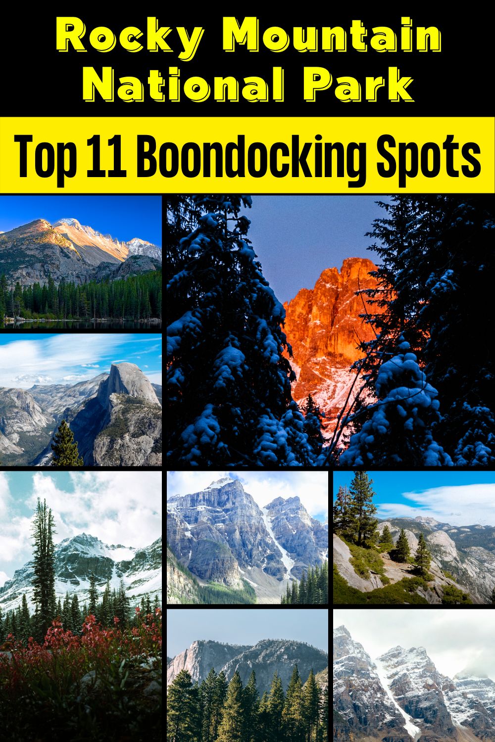
Want more ideas to round-out your trip to the South-Western States?
► Arizona, California, Colorado, New Mexico, Nevada, Utah ◄
- 249 Amazing Arizona Boondocking Locations With Maps
- 419 Awesome California Boondocking Campsites And Maps
- 351 Free Colorado Boondocking Locations Along With Maps
- 141 Best New Mexico Boondocking Spots Plus Maps
- 146 Top Nevada Boondocking Sites Including Maps
- 54 Top SW Utah Boondocking Camping Areas Including Maps
- 43 Amazing South-Central Utah Boondocking Campgrounds With Maps
- 36 Free SE Utah Boondocking Camping Sites And Maps
- 21 Favorite West-Central Utah Boondocking Camp Sites Plus Maps
- 33 Best Central Utah Boondocking Sites Also Maps
- 51 Amazing East-Central Utah Boondocking Campsites And Maps
- 24 Top NW Utah Boondocking Locations Including Map
- 32 Free North-Central Utah Boondocking Areas Along With Maps
- 19 Great NE Utah Boondocking Spots With Maps
check out our video
Be sure and drive the Trail Ridge Road, Rocky Mountain National Park’s heavily traveled highway to the sky, inspired awe before the first motorist ever traveled it. “It is hard to describe what a sensation this new road is going to make,” predicted Horace Albright, director of the National Park Service, in 1931 during the road’s construction. “You will have the whole sweep of the Rockies before you in all directions.”
On the road you will enjoy great views of alpine lakes, alpine tundra, and so many of the beautiful places and great view that the Rocky Mountain National Park has to offer.
The part we want to share is the best hikes, popular destinations in Estes Park, Colorado as well as the spectacular offered by Rocky Mountain National Park. Rocky Mountain National Park is truly one of the best National Parks in the U.S.
Our 15 Best Rocky Mountain National Park Hikes
1. Bear Lake Loop Trail
For our first Rocky Mountain National Park hike we suggest visiting the Bear Creek Trailhead. Use one of the parking area that are provided. Visitors will experience more solitude the further they travel from the Trailhead. Individuals seeking all-day hikes will find connecting trails to Bear Lake, as well, Glacier Gorge is a great ending destination to a multi-day backpacking trip from Longs Peak, but get there early during the summer months.
The park is full all summer long and parking is at a premium in any parking lot. This little day hike is less than 1 mile long and a great hike for beginners or families. It is not at a higher elevation so it is quite easy. You will also get some great photos of flattop mountain without having to make the 9 mile strenuous hike.
The Bear Lake Loop in Rocky Mountain National Park is located at the end of Bear Lake Road, 9 miles from the turn-off at Highway 36. Due to the extreme popularity of the area, you may want to consider using the free park shuttle to reach the trailhead during peak tourist season.
Since this is a nature trail the park recommends hiking the loop in a counter-clockwise direction in order to follow along with an interpretative guide, published by the Rocky Mountain Conservancy. I highly recommend picking-up a copy of this small booklet, which can be purchased at the trailhead. It provides natural, geological and historical information for the 30 marked spots along the 0.8-mile route.
Length: 2.1 mi
Elevation gain: 1,092 ft
Route type: Out & back
Along the Trail: Dogs on leash, Kid friendly, Camping, Hiking, Horseback riding, Rock climbing, Snowshoeing, Walking, Running, Forest, River, Views, Waterfall, Wildflowers, Wildlife, Bugs, Rocky, Snow,

2. Glacier Gorge Trail
We decided to add the Glacier Gorge hike to our list. The trail is actually 3 miles round trip and is rated as a glacier gorge. Start at the Glacier Gorge Trailhead parking lot. Once again get there early or you can always take one of the free shuttle busses.
Glacier Gorge is one of the most popular trailheads in Rocky Mountain National Park. Rightfully so, as this region hosts a multitude of trails ranging in difficulty. It is the jumping point to view cascading waterfalls, alpine lakes, and stunning granite cliffs. Wintertime offers phenomenal opportunities for snowshoeing.
The Glacier Gorge Trailhead hosts numerous out and back hikes. Visitors will experience more solitude the further they travel from the Trailhead. Individuals seeking all-day hikes will find connecting trails to Bear Lake, as well Glacier Gorge is a great ending destination to a multi-day backpacking trip from Longs Peak.
Length: 3.3 mi
Elevation gain: 646 ft
Route type: Loop
Along the Trail: Camping, Hiking, Snowshoeing, Walking, Bird watching, Forest, Lake, River, Views, Waterfall, Wildflowers, Wildlife, Fee required, required, No dogs
3. Nymph Lake Trail
The Nymph Lake Trail hike begins from the Bear Lake Trailhead, located at the end of Bear Lake Road, nine miles from the turn-off at Highway 36. Due to the extreme popularity of the area you may want to consider using the free park shuttle to reach the trailhead during peak tourist season.
Just beyond the trailhead the Bear Lake Loop splits off towards the right, while the trail to Nymph Lake branches off to the left. Most hikers will stop at Bear Lake to check out the beautiful scenes from the east shore before proceeding to their ultimate destination. If starting in the early morning you might have an opportunity to go home with some great photos of Hallett Peak reflecting off the water. If wishing to avoid the crowds that flock to this extremely popular area, I highly recommend starting in the early morning anyway.
Length: 1.2 mi
Elevation gain: 262 ft
Route type: Out & back
Along the Trail: Kid friendly, Cross-country skiing, Hiking, Walking, Forest, Lake, Partially paved, Views, Wildlife, Fee required, required, No dogs
4. Sprague Lake Trail
At Sprague Lake you’ll find an easy loop hike with some stunning views of the mountains that make Rocky Mountain National Park famous. It’s a perfect hike in Rocky Mountain National Park for young families because the trail is short and has no real elevation gain. With diverse wildlife and a beautiful, peaceful lake, this is one of those spots you should not miss in Rocky Mountain National Park. Sprague Lake is a 13-acre lake named after Abner Sprague, an early resident of the Estes Park area who ran a game lodge on the this property which is now part of Rocky Mountain National Park.
To access the 1/2 mile loop hike around Sprague Lake, cross the bridge near the parking area. Be sure to pause at the bridge to look for trout. We’ve spotted an enormous brown trout motoring in these waters near the bridge. It’s a regular spawning area in the autumn, so this little segment of water can become quite crowded with fish.
After the bridge, the trail can be hiked to either the left or the right around the perimeter of Sprague Lake. Keep your eyes peeled for Beaver and Moose, both residents of the area. You will be more likely to spot wildlife in the early morning hours.
Length: 0.8 mi
Elevation gain: 36 ft
Route type: Loop
Along the Trail: Wheelchair friendly, Kid friendly, stroller friendly, Fishing, Hiking, Snowshoeing, Walking, Running, Forest, Lake, Views, Wildlife, Fee required, required, No dogs
5. Adams Falls Trail
Adams Falls is a short .6-mile round-trip hike near Grand Lake, Colorado. The Rocky Mountain National Park hiking trail is one of the most popular in the national park. The waterfall borders Rocky Mountain National Park and its trail begins at the same trailhead for the East Inlet Trail. Explore the full Adams Falls hike profile below for trail map, driving directions, and all the details you need for this short waterfall Hike in Rocky Mountain National Park.
The hike to Adams Falls is perfect for families with young children who may not be able to hike as far. As with all streams and waterfalls, have children exercise caution and stay away from the streambank. Rocks are slippery and the hydraulic force of the creek can be incredibly powerful. About 1/4 mile beyond Adams Falls, there are spectacular views of the East Meadows, making the short distance a worth addition to this easy waterfall hike.
Length: 0.8 mi
Elevation gain: 104 ft
Route type: Out & back
Along the Trail: Kid friendly, Hiking, Horseback riding, Forest, River, Views, Waterfall, Wildflowers, Wildlife, Fee required, required, No dogs
6. Lily Lake Trail
The Lily Lake Loop in Rocky Mountain National Park is an excellent hike for the entire family. This level, fully accessible trail, circles around the lake and nearby wetlands for just over three-quarters of a mile, and is conveniently located near Estes Park.
To reach the trailhead from Estes Park, drive 6.3 miles south on Colorado Highway 7 to the Lily Lake parking area. You can park at the lake or across the highway at the old Lily Lake Visitor Center (now closed).
In 1992 the Lily Lake area was purchased by Rocky Mountain National Park. Five years later, with funding from the Rocky Mountain Conservancy, the popular handicapped accessible trail was constructed using hard packed gravel. Although you can start in either direction, this description follows the loop in a clockwise direction.
Roughly one-quarter of a mile from the trailhead hikers will reach a side trail that provides access to the Storm Pass Trail. Hikers now have the choice of using this route to reach Estes Cone, in addition to the route starting from the Longs Peak Trailhead.
Length: 0.8 mi
Elevation gain: 29 ft
Route type: Loop
Along the Trail: Wheelchair friendly, Kid friendly, stroller friendly, Fishing, Hiking, Walking, Bird watching, Running, Forest, Lake, Views, Wildflowers, Wildlife, Fee required, required, No dogs
7. Alluvial Fan East Trail
The 42 acre Alluvial Fan in Rocky Mountain National Park was created in July 1982 when Lawn Lake broke through its terminal moraine and sent 300 million gallons of water surging down the Roaring River, forming water-walls up to 30 feet high.
The flood carried trees, car-sized boulders weighing up to 450 tons, lighter rocks, gravel, sand, and other debris to the valley floor where it spread out and slowed down, leaving behind a large alluvial fan that measures 44 feet deep in some places. The powerful flood waters continued down Fall River and hit the Cascade Dam, which failed and added more water to the flood. It then flowed to the town of Estes Park, Colorado, flooding it with six feet of mud and water.
This natural phenomena makes for an interesting spectacle and features various veins of the Roaring River as it cascades down the rocks.
There are parking areas on both sides of this short trail, making it a quick and easy diversion during a drive through the park.
Length: 0.5 mi
Elevation gain: 157 ft
Route type: Out & back
Along the Trail: Wheelchair friendly, Kid friendly, stroller friendly, Hiking, Walking, Bird watching, Partially paved, River, Views, Waterfall, Wildflowers, Wildlife, Rocky, Fee required, No dogs
8. Alpine Ridge Trail
The Alpine Visitor Center is perched precariously on a ridge between two deep valleys just a few miles from the Continental Divide. The wind is often brutal up here, and most visitors don’t venture far from the store, cafe, and main visitor center, opting to view the surrounding alpine tundra through the windows. For the slightly more adventurous, there is a short, steep trail up to a small peak just north of the parking lot that offers even more spectacular views and a tangible experience of the brutality of this harsh environment.
This Rocky Mountain National Park hiking trail is wide and has many steps leading up to a false summit and the realization that there is still half the hike to go. Many displays offer the visitor information about the climate, plant and animal life, geology, and fragility of the tundra. Plants here must grow and bloom in a three-month growing season, and some tiny plants have 6-foot root systems. At the top, which sits at just over 12,000 feet, the hardy hiker will get a 360-degree view of the Never Summer Range, the Cache la Poudre River Valley, and the main park highway as it winds down into the west side of the park.
Length: 0.7 mi
Elevation gain: 147 ft
Route type: Out & back
Along the Trail: Kid friendly, Hiking, Walking, Bird watching, Paved, Views, Wildflowers, Wildlife, Fee required, No dogs
9. Forest Canyon Overlook
Make the most of the majestic Trail Ridge Road in Rocky Mountain National Park by lingering on the mountainside until sunset to watch the tundra turn sunlit orange and the distant snowy peaks fade into night.
Trail Ridge Road is an incredible highway that crosses the mountains between Grand Lake and Estes Park, one of the most famous parts of Rocky Mountain National Park. It features incredible views of the Rockies and the Front Range, as well as the unforgettable experience of being immersed in the tundra of Sundance Mountain.
Forest Canyon Overlook in Rocky Mountain National Park is located halfway between the Alpine Visitor Centre and Many Parks Curve. The parking lot is just on the side of the road, with an easy quarter-mile trail to the viewpoint. Stay off the fragile tundra. Grab a camera and a warm sweater and go take in the glacier-etched vista. You’ll be treated to views of Terra Tomah Mountain and Stones Peak, with the vast expanse of Forest Canyon in between.
Length: 0.3 mi
Elevation gain: 19 ft
Route type: Out & back
Along the Trail: Wheelchair friendly, Kid friendly, stroller friendly, Walking, Forest, Paved, Views, Wildflowers, Wildlife, Fee required, Fee required, No dogs
10. Bear Lake South Trail
The Bear Lake South Trail is an easy, well-maintained trail in the Rocky Mountain National Park. This extremely popular destination is often quite crowded, so if you hope to avoid the crowds consider an early morning weekday excursion. We don’t blame you if you don’t feel like waking up early, but we urge you to consider taking the Rocky Mountain National Park free shuttle to avoid the annoyance of trying to find a parking spot in the packed lot. Remember, park passes are required to access the trails.
Embark on your nature adventure from the Bear Lake Trailhead. From here, track right along the Bear Lake Trail. Hike along the shoreline, keeping an eye out for Tiger Salamanders swimming in the waters. Follow this path to the intersection with Bierstadt Trail, and turn around. Retrace your steps along the path back to the trailhead, reveling in the views of Longs Peak.
Length: 0.5 mi
Elevation gain: 39 ft
Route type: Out & back
Wheelchair friendly, Kid friendly, stroller friendly, Hiking, Snowshoeing, Walking, Bird watching, Forest, Lake, Waterfall, Wildflowers, Wildlife, Rocky, Fee required, No dogs
11. Lake Irene Trail
Lake Irene is ideal for sunrise and sunset compositions, as the loop trail in its entirety is 0.5 miles. It has an elevation of 10,600 feet above sea level. A popular picnic area adorns the far end of the parking lot. This evening we were fortunate to witness a colorful sunset as a backdrop to the calm waters of Lake Irene.
Located right off Trail Ridge Road, about 4.5 miles south of the Alpine Visitor Center, on the west side of Rocky Mountain National Park.
Due to its location and proximity to the parking area, this is a great destination to bring kids for a short hike. There are restrooms and picnic tables located at the parking lot. Lots of families may choose this spot for an afternoon picnic if it’s not too crowded.
The short Rocky Mountain National Park hiking trail is around Lake Irene and offers a good chance to see some nice reflections on the lake. Continue on the trail past Lake Irene to an overlook of some meadows.
Length: 0.8 mi
Elevation gain: 85 ft
Route type: Out & back
Along the Trail: Kid friendly, Hiking, Walking, Bird watching
12. Marmot Point Trail
Travel among the clouds at this Rocky Mountain National Park hiking trail as you ascend the exposed path to the summit of Marmot Point. Though this path is relatively easy, the high altitude of the area presents its challenges. Make sure you are acclimated to the area’s elevation and check the weather forecast for summit storms prior to your journey. Though incredibly picturesque, the exposed terrain warrants windy and cold conditions, so make sure you wear plenty of layers! Lastly, visitors are required to purchase a Rocky Mountain National Park pass to access the trails.
From the Marmot Point Trailhead, the Marmot Point Hike treks northeastward. Hike the well-marked terrain through the alpine tundra and keep your eyes peeled for marmots! The further you hike the more impressive the view! Ascend the exposed path to the summit of Marmot Point let the beautiful scenery take your breath away.
Length: 0.8 mi
Elevation gain: 328 ft
Route type: Out & back
Along the Trail: Kid friendly, Hiking, Bird watching, Forest, Views, Wildflowers, Wildlife, Fee required, No dogs
13. Twin Owls Loop
The Rocky Mountain National Park Twin Owls trail is one of the more famous and prominent rock formations on Rocky Mountain National Park’s Lumpy Ridge. Lumpy Ridge is the dryer, lower elevation portion of the park located just north of Estes Park. The rock formations are intricate and the trail are easily accessible during the winter and shoulder seasons.
The Rocky Mountain National Park hiking trails to the Twin Owls, or at least to a good view of them, starts at the Lumpy Ridge Trailhead and follows the signs to the Black Canyon Trail. The turn around point is the junction with the Black Canyon Trail which lies just below the Twin Owls. The trail is easy hiking, rolling over the hills, with views of the Twin Owls and other rock formations in this area. This is a great hike for kids, hikers, and rock climbers alike.
Length: 0.8 mi
Elevation gain: 715 ft
Route type: Loop
Along the Trail: Kid friendly, Hiking, Horseback riding, Forest, Views, Wildflowers, Wildlife, Rocky, Scramble, Off trail, Fee required, No dogs
14. Medicine Bow Trail
The Medicine Bow Rail Trail snakes through the Medicine Bow-Routt National Forest from the Wyoming-Colorado border in the south to near the forest boundary at SR 11. The trail is some of the best Rocky Mountain National Park hiking and is open to non-motorized use only, but occasionally dirt bike riders break the rules.
Along the 21-mile gravel trail you’ll get a glimpse of the Old West—and a portal into the New West—while winding through rugged national forest land of southeastern Wyoming. But come prepared; even though parts of the West are no longer so wild, the trail corridor is far from tame. The nearest city, Laramie, is 30 miles away, and moose on the trail may outnumber the people using it on any given day.
Length: 0.7 mi
Elevation gain: 98 ft
Route type: Out & back
Along the Trail: Kid friendly, Hiking, Views, Wildflowers, Wildlife
15. Thunder Lake Loop
From the Wild Basin Trailhead in Rocky Mountain National Park, follow the trail to a junction with the Bluebird Lake Trail and Thunder Lake Trail – keep right to start up the Thunder Lake Trail.
The trail climbs up the North Saint Vrain Creek drainage between Mount Orton and Mahana Peak. The initial grade is manageable, but it steepens significantly after about one mile. As you continue paralleling the North St. Vrain, the trail ascends higher up the drainages northern wall flank.
At about 1.75 miles in, the Lion Lake Trail will branch off to the right (north). Continue on the Thunder Lake Trail for roughly one more mile and you’ll crest a ridge before descending slightly to the shores of Thunder Lake.
Enjoy the views of the lake and decide whether to continue on, or turn around. The next portion of trail leading to the Lake of Many Winds is certainly the most difficult. However, this beautiful alpine lake is a fraction of the size of Thunder Lake and sits directly below Boulder-Grand Pass – beautiful.
Length: 0.9 mi
Elevation gain: 29 ft
Route type: Loop
Backpacking, Camping, Hiking, Lake, Views, Fee required, No dogs
Our Favorite Longer Hikes
Some of the longer hikes you may want to try with some of the most spectacular views in the park are the 3.8 mile long Emerald Lake Trail, the 7.5 mile long Fern Lake trail, the Black Lake, Chasm Lake and Odessa Lake trails all about 8 to 9 miles long and all are moderate to strenuous to complete.
There is the ultimate (over 9 miles long) hike — the Sky Pond Trail. Situated above Timberline Falls in Rocky Mountain National Park are two spectacular lakes. The highest of the two is Sky Pond, and the lower is called The Lake of Glass. This demanding hike begins at the Glacier Gorge trailhead and takes you past at least three waterfalls and a beautiful set of cascades. Rewards await those who hike all the way up to Sky Pond.
5 Campgrounds Closest to Rock Mountain
1. Timber Creek Campground
Timber Creek is ideal for travelers headed to the park from the West and close to Grand Lake. It is home to 98 campsites, including recreational vehicles (RVs) and tent sites. The campground contains plenty of amenities, such as an RV dump station and running water restrooms. It charges an average price of $ 26 a night.
2. Longs Peak Campground
This campground is found at Rocky’s tallest mountain, Longs Peak. The campground is popular for hikers wanting to make the trek up the impressive peak. Longs Peak Campground also charges a minimum price of $ 20 a night.
3. Manor RV Park
Manor has everything someone needs to set up their RV or a trailer for days. The campground is close to Estes Park and provides spectacular scenery of Rocky Mountain National Park for $ 90 a night.
4. Spruce Lake Campground
Spruce Lake is an excellent location that has its trout pond. It is a fully equipped campground with a modern RV park. Spruce is close to Estes Park, only two miles away, while the highway is roughly 1.5 miles away. Spruce Lake charges an average price of $ 60 a night.
5. Moraine Park Campground
Moraine offers camping sports all year round. It is spacious, has frequent wildlife sightings, and provides a stunning view of the grassy meadows of Moraine Park at an average price of $ 40 a night.
Questions for Hiking in Rocky Mountain National Park
1. How do I get a Rocky Mountain Trail Map?
You can buy the National Geographic Trails Illustrated Map for Rocky Mountain at REI.com.
2. Can I Take a Dog Hiking in Rocky Mountain?
No. Rocky Mountain prohibits dogs and pets on all trails and backcountry.
3. Which Rocky Mountain Entrance is Best?
Beaver Meadows entrance because it is accessible from Estes Park and is open all year.
4. What is the Best Time of The Year to Hike Rocky Mountain?
When the snow and ice are melted, from June to September, hiking trails are accessible, making it the best time to hike.
5. Do I Need Hiking Shoes for Rocky Mountain?
Yes, you do. It is recommended that hikers use trail shoes or hiking boots instead of sneakers or sandals.
6. When Does Rocky Mountain Open?
Rocky Mountain is open daily all through the year.
7. Are There Stores or Restaurants Inside the Park?
Restaurants and stores are only found in the local communities of Grand Lake and Estes Park.
8. How Many Hiking Trails are in Rocky Mountain National Park?
Rocky Mountain has 252 great hiking trails.
9. Is It Safe to Hike in Rocky Mountain?
Yes, it is. However, don’t hike alone, and ensure your children are protected from accidental encounters.
10. Are There Bears at Rocky Mountain?
Yes, there are. However, you can only find the black bear in the Rocky Mountains. As a precaution, never provoke bears because you cannot predict its reaction.
For complete photos and videos of our trip visit our photos on our page Instagram Page
You May Want to Join Our Boondocking Facebook Group Boondocking Group on Facebook For More Information