

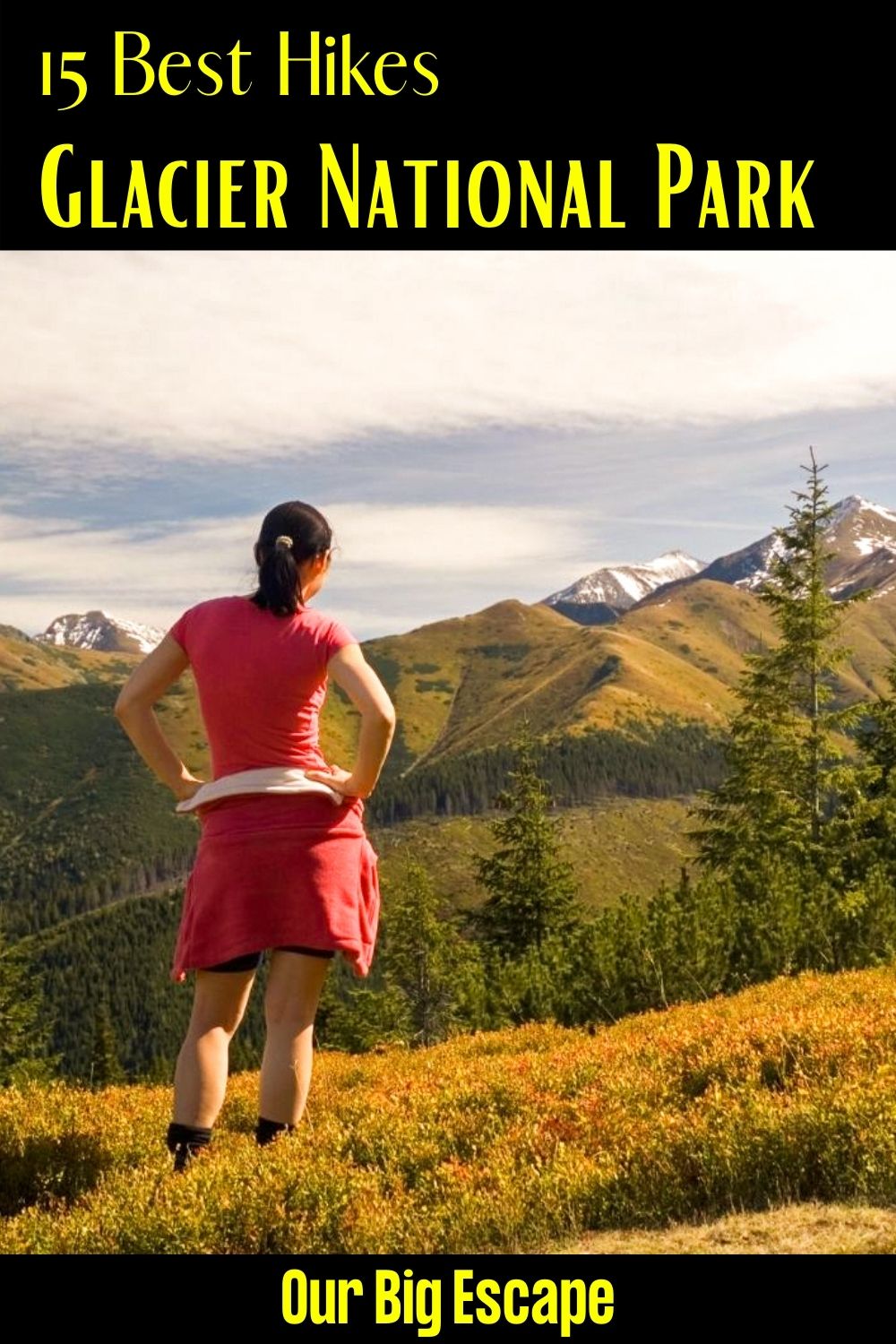
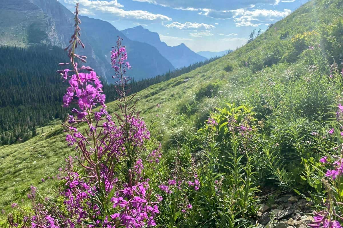
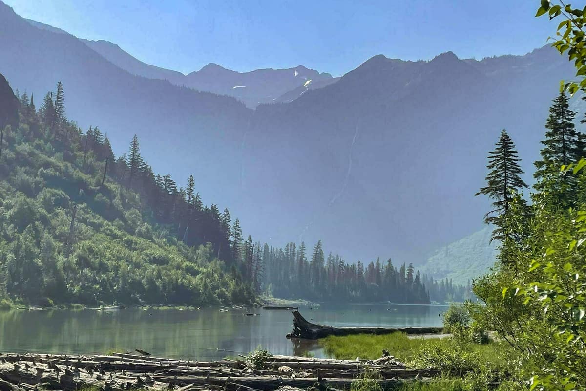
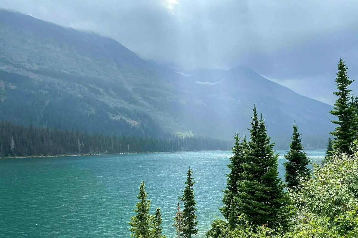
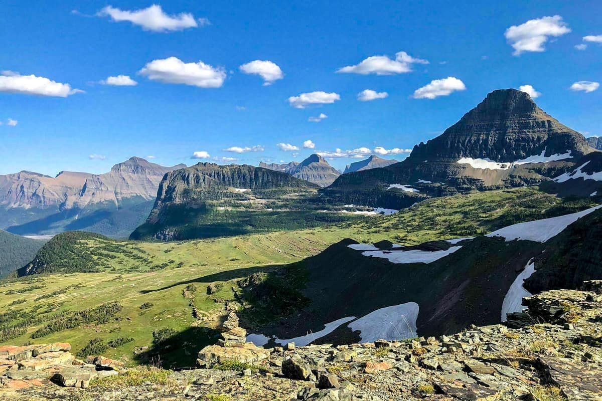
Glacier National Park is a beautiful national park located in Montana, United States. This Park is home to some of the beautiful attractions and stunning peaks in the United States and the world. This national park was established in 1910, and it covers an estimated area of 4,102 square kilometers.
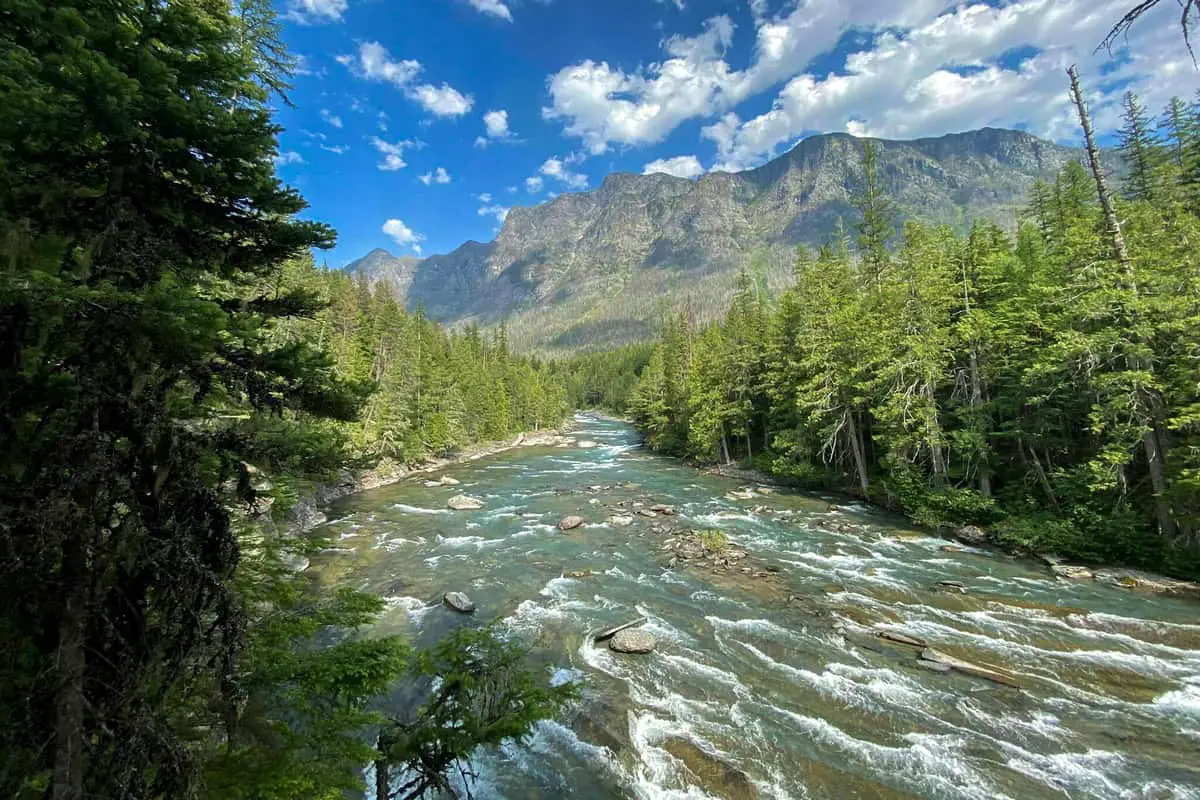
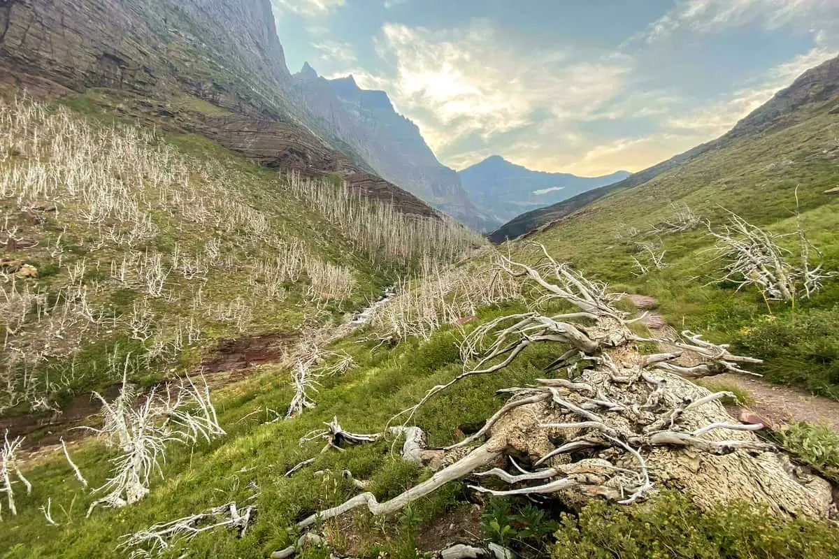
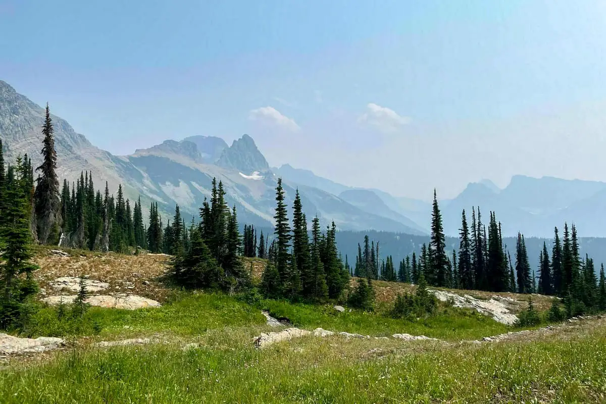
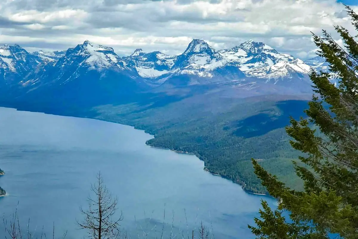
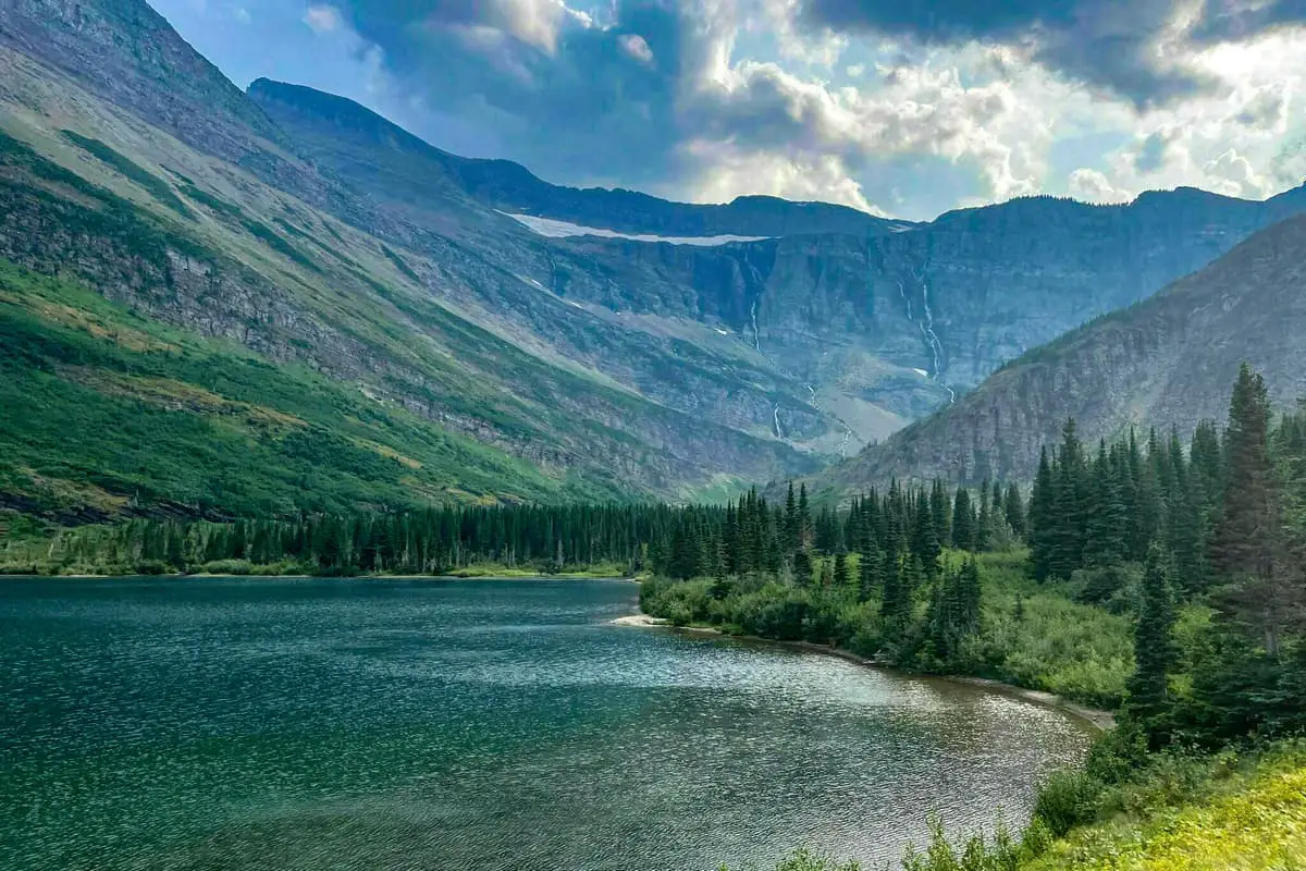
This beautiful park is home to more than 700 miles of trails that you can use to hike and do other activities. There is abundant plants and wildlife such as mountain goats, mountain sheep, bears, marmots, and moose, plus many more. This park is home to the Rocky Mountains, with glacier-carved peaks and valleys. There are beautiful lakes in this park and gorgeous sceneries in this national park.
Want more ideas to round-out your trip to the North-Western States?
► Idaho, Montana, Oregon, Washington, Wyoming ◄
- 66 Free Central Idaho Boondocking – RV Parking & Camping Spots
- 78 Free Northern Idaho Boondocking – Camping & RV Parking
- 60 Free SE Idaho Boondocking – RV Parking & Camping Sites
- 40 Free SW Idaho Boondocking – RV Parking & Camping
- 198 Amazing Montana Boondocking Sites Including Maps
- 54 Free NE Oregon Boondocking Locations With Maps – North East Section
- 104 Free Boondocking Spots in NW Oregon With Maps – North West Section
- 308 Awesome Washington Boondocking Spaces With Maps
- 38 Free Boondocking Locations in Wyoming With Maps – North East Section
- 49 Free Wyoming Boondocking Campsites With Maps – North West Section
- 44 Free Boondocking Campsites In Wyoming With Maps – South East Section
- 66 Free Boondocking Spots in Wyoming With Maps – South West Section
Native Americans around 10,000 years ago occupied this beautiful park. The earliest occupants of this national park were Flathead (Salish) and Kootenai, Shoshone, and Cheyenne. In 1910, on May 10th, President William Taft signed a bill into law establishing the Glacier National Park as the 10th national park in the United States.
This Park is located at the United States and Canada border, and in 1932, this park became a part of the world’s first international peace park. This was after Glacier and Waterton Lakes National Park in Alberton, Canada, were designated the Waterton-Glacier International Peace Park.
25 Top Glacier National Park Trails (Updated 2022)
check out our video
#1. Avalanche Lake via the Trail of the Cedars Hiking Areas in Glacier Park
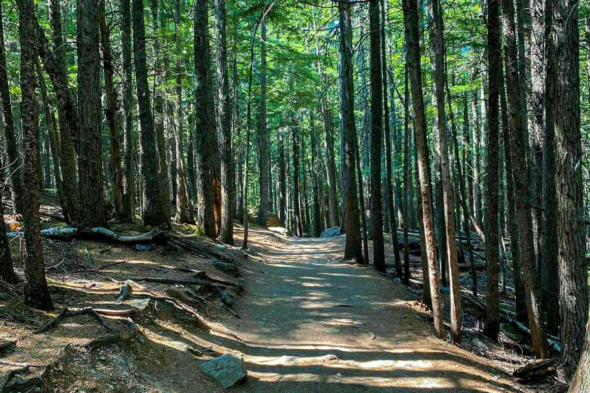
During my trip to Glacier National Park in Montana, I decided to go hiking on this trail in the early hours during the summer. The distance from my starting point to my destination was 5.9 miles using an out and back route type with an elevation gain of 757 feet. The trail is a bit moderate, and therefore I did not have any difficulty hiking there. While hiking on this trail, I was able old-growth cedars and had stunning views of the blue waters. Additionally, I had fantastic views of the beautiful glacial melt fed by waterfalls from the nearby alpine bowl. There was a variety of fauna, birds, and wildlife that I was able to see while hiking along this trail. I was also able to dee the creek rush through the gorge during my hike on this trail.
Length: 5.9 mi
Elevation gain: 757 ft
Route type: Out & back
Kid friendly, Hiking, Forest, Lake, River, Views, Waterfall, Wildflowers, Wildlife, Fee, No dogs

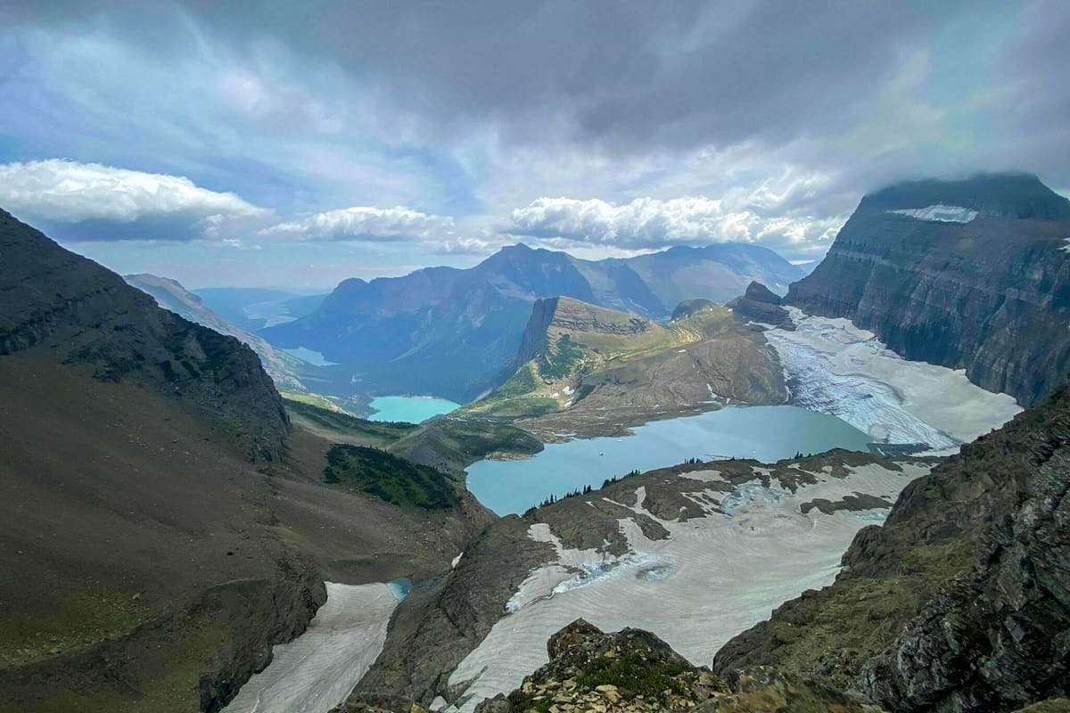
#2. Grinnell Glacier Hiking Trails at Glacier Park
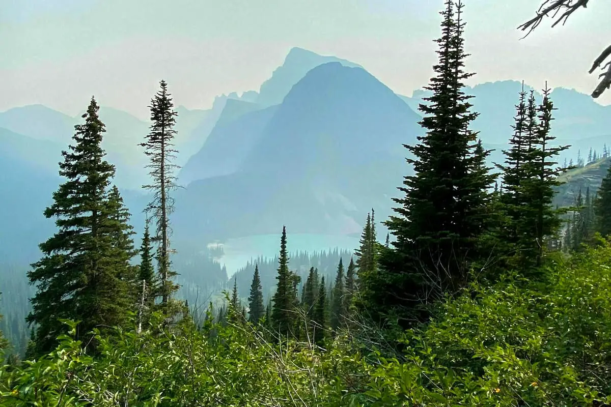
This is one of the most challenging trails in Glacier National Park that I was able to hike on during my visit. I hiked for a distance of 11.2 miles using an out and back route type with an elevation of 2,181 feet. I started my adventure along the shores of two lakes. During my hike, I had excellent views of the lakes from above. Additionally, I had stunning views of the beautiful Grinnell Falls while hiking along this trail. During the summer, I was hungry, so I stooped at the Grinnell Glacier Viewpoint to catch a bite, and I even maned to go for a dip in the lake.
Length: 11.2 mi
Elevation gain: 2,181 ft
Route type: Out & back
Hiking, Forest, Lake, River, Views, Wildflowers, Wildlife, Rocky, Fee, No dogs
#3. Highline Trail: Logan Pass to Granite Park Chalet Nature Trails in Glacier Park
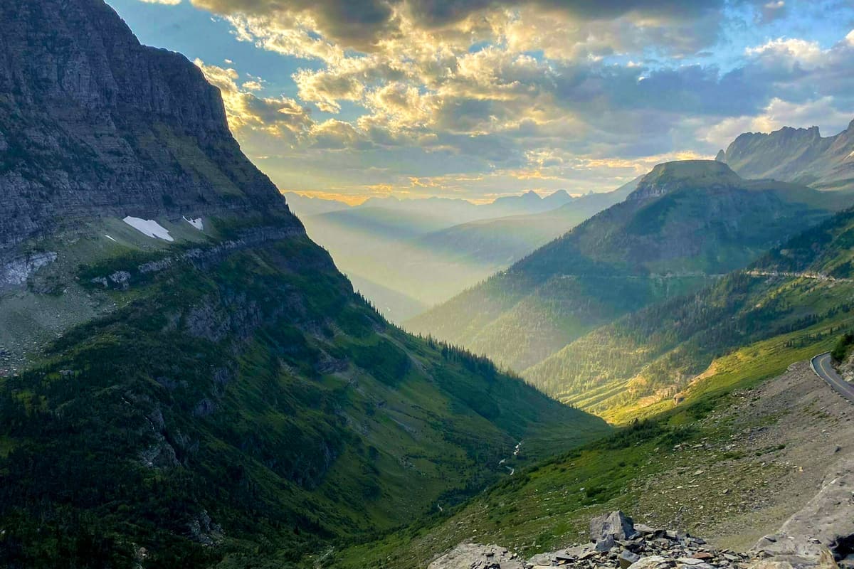
I was lucky to hike on this trail during my visit to Glacier National Park in the summer. I covered a distance of 14.9 miles using an out and back route-type with an elevation gain of 2,578 feet. While hiking along this trail that early morning, I was able to see goats and bears from a distance. Additionally, I was able to have excellent views of the gorgeous park from above. There are great spots along this trail for camping plus this trail is suitable for backpacking that I was able to see during my hike as I could see tents and backpackers.
Length: 14.9 mi
Elevation gain: 2,578 ft
Route type: Out & back
Glacier National Park Backpacking, Glacier National Park Camping, Hiking, Forest, River, Views, Wildflowers, Wildlife,
Rocky, Fee, No dogs
#4. Hidden Lake Hiking Areas at Glacier National Park
This is a moderate rated trail, and it is heavily trafficked. I started hiking on this trail early in the morning before it became crowded since it is always crowded in the mid-morning. While hiking on this trail, I used an out and back route type with an elevation gain of 1,374 ft and covered a distance of 5.3 mi. While hiking, I was able to have fantastic views of the Garden Wall and the 810-foot Mt. Oberlin. Additionally, I was able to have panoramic views of the lake and other surrounding mountains while hiking along this trail during my visit. I was given a heads up to watch out for Grizzly bears. I was lucky to see mountain goats, bighorn sheep, and marmot from a distance during my hike.
Length: 5.3 mi
Elevation gain: 1,374 ft
Route type: Out & back
Kid friendly, Hiking, Forest, Lake, ViewsWildflowers, Wildlife, Fee, No dogs
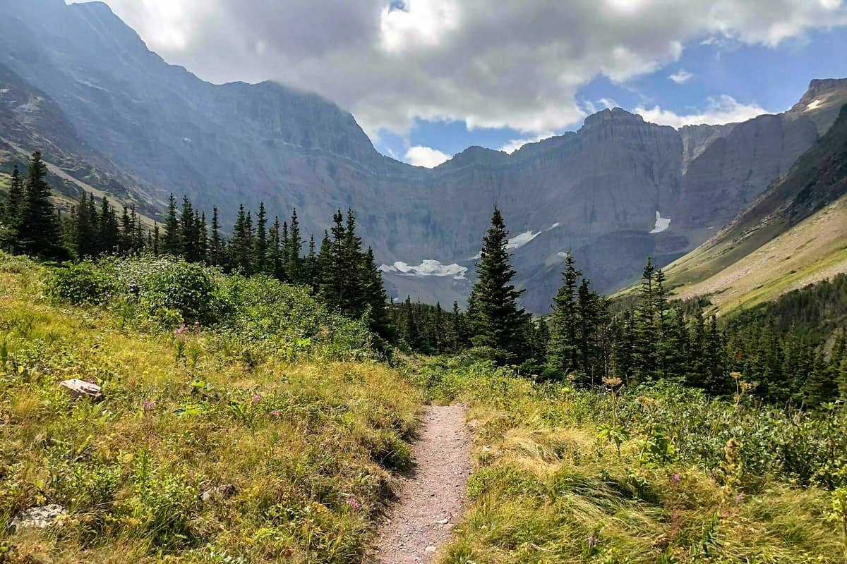
#5. Iceberg Lake Hiking Trails in Glacier Park
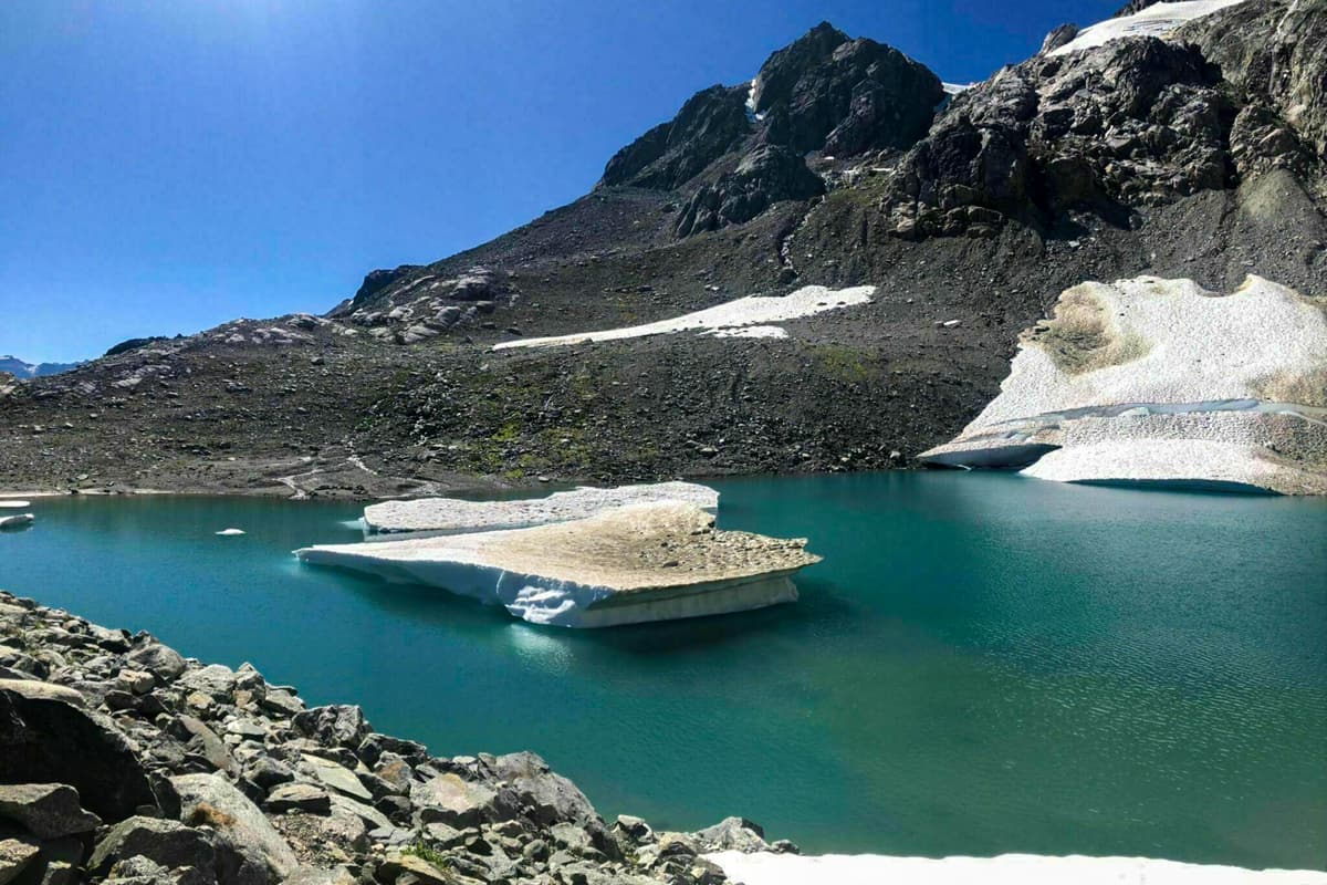
This is another moderate trail in Glacier National Park that I had a great experience hiking on during my visit. I able to hike for a distance of 9.3 miles using an out and back route-type with an elevation gain of 1,450 ft.. I had panoramic views of the Ptarmigan Falls during my hike along this trail. At the end of the hike, I have the chance to admire Iceberg Lake. I was able to view the bear using the binoculars that I carried from a distance while hiking on this trail.
Length: 9.3 mi
Elevation gain: 1,450 ft
Route type: Out & back
Hiking, Forest, Lake, River, Views, Waterfall, Wildflowers, Wildlife, Rocky, Fee, No dogs
#6. St. Mary and Virginia Falls Nature Trails at Glacier Park
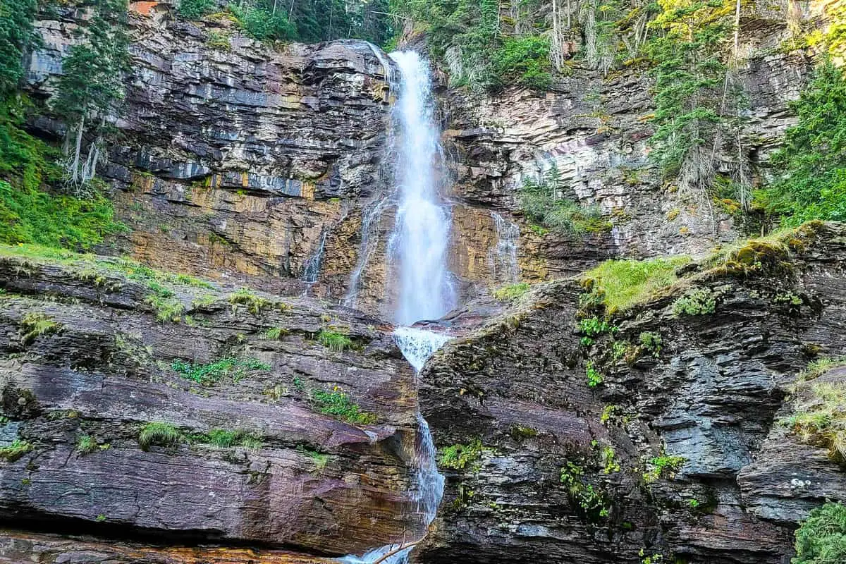
This is one of the family-friendly trails in this park that I got a chance to hike on during my visit. Due to the easy nature of this trail and its suitability for all hiking skill levels, I found it heavily trafficked. The total distance that I covered hiking on this trail was 2.9 miles. I used an out and back route with an elevation gain of 452 feet during my hike on this trail. While hiking on this trail, I had spectacular views of the beautiful St. Marry falls, and stunning Virginia Falls as I was hiking along this trail. Since I was hiking during the summer, I decided to dip in one of the multiple spots along this trail.
Length: 2.9 mi
Elevation gain: 452 ft
Route type: Out & back
Kid friendly, Hiking, Nature trips, Walking, Bird watching, Running, Forest, River, Views, Waterfall, Wildflowers, Wildlife, Rocky, Fee, No dogs
#7. Hidden Lake Overlook Hiking Areas in Glacier Park
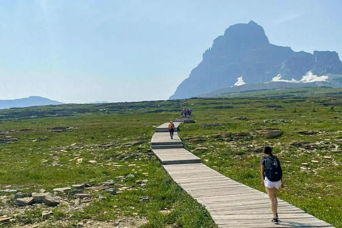
Hidden Lake Overlook trail is one of the moderate trails I took my chance hiking on during my summer visit to this national park. Most of the area was closed due to grizzly bear activity during the summer season. The total hike covered a total distance of 5.3 mi, and I was using an out and back trail with an elevation gain of 1,374 ft. While hiking along this trail, I was able to have stunning views of open grasslands and mountains along the entire trail. The trail was a bit rocky so
I had to put on my hiking boots for this one.
Length: 5.3 mi
Elevation gain: 1,374 ft
Route type: Out & back
Kid friendly, Hiking, Forest, Lake, Views, Wildflowers, Wildlife, Fee, No dogs
#8. Trail of the Cedars Hiking Trails at Glacier Park
This is one of the wheelchair and stroller-friendly trails I hiked on during my visit to this national park. This trail was leading through a beautiful cedar forest. While hiking on this trail, I covered a distance of 9 miles using a loop route-type with an elevation gain of 49 feet. There were a variety of birds and wildlife along this trail that I spotted during my hike. Additionally, there was a lot of flora along the trail, plus the fantastic smell of cedar that I enjoyed during my hike.
Length: 0.9 mi
Elevation gain: 49 ft
Route type: Loop
Wheelchair friendly, Kid friendly, Stroller friendly, Glacier National Park Backpacking, Glacier National Park Camping, Hiking, Nature trips, Walking, Bird watching, Running, Forest, Paved, River, Views, Wildflowers, Wildlife, Fee, No dogs
#9. McDonald Creek Nature Trails in Glacier Park
This is one of the trails in Glacier National Park suitable for hiking all skill levels. While hiking on this trail, I found it moderately trafficked, and most of the people hiking there were kids. The total distance that I covered hiking on this trail was 5.6 miles using an out and back route with an elevation gain of 278 feet. There were gorgeous waterfalls along this trail with unique scenic places for taking photos. Additionally, there were a variety of bird species along this trail. I was able to see beautiful wildflowers during my hike on this trail.
Length: 5.6 mi
Elevation gain: 278 ft
Route type: Out & back
Kid friendly, Hiking, Horseback riding, Nature trips, Walking, Bird watching, Running, Forest, River, Views, Waterfall, Wildflowers, Wildlife, Fee, No dogs
#10. Grinnell Overlook via Granite Park Hiking Areas at Glacier Park
Hiking on this trail was among the challenging tasks I encountered during my visit to this park. However, I had stunning views along the hie. From my starting point, I hiked for a distance of 11.4 mi using an out and back route-type with an elevation gain of 3,710 ft. While hiking, I passed gorgeous wooded areas, steep and narrow climbs, and huge meadows. Additionally, I was able to spot beautiful wildflowers, deer, and friendly marmots while hiking along this trail. I managed to climb on top of a rock along this trail, and I had a 360-degree view of the park’s surrounding areas.
Length: 11.4 mi
Elevation gain: 3,710 ft
Route type: Out & back
Hiking, Forest, Lake, Views, Wildflowers, Wildlife, Rocky, Fee, No dogs
#11. The Garden Wall Hiking Trails in Glacier Park
The Garden Wall is one of the most challenging trails in this national park. I found this trail lightly trafficked; I guessed it was due to its difficulty, and only experienced hikers use it. I hiked for a distance of 14.7 mi using an out and back route with an elevation gain of 3,507 ft. There were beautiful wildflowers along this trail that I was able to see during my hike. Additionally, there were tents and backpackers along this trail during my visit.
Length: 14.7 mi
Elevation gain: 3,507 ft
Route type: Out & back
Glacier National Park Backpacking, Glacier National Park Camping, Hiking, Forest, Views, Wildflowers, Wildlife, Fee, No dogs
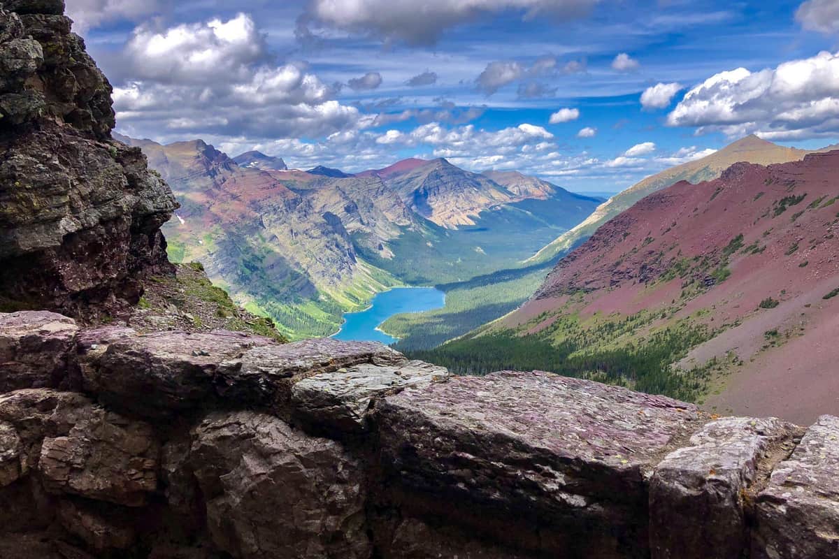
#12. Cracker Lake Nature Trails at Glacier Park
This is one of the beautiful moderate trails in Glacier. I hiked for 12 miles using an out and back trail with an elevation gain of 1,650 feet. During my hiking on this trail, I found it fairly trafficked. While hiking on this trail, I was able to see wildflowers, crossed a stream, passed through a forest, and had the chance to see the stunning turquoise lake. Additionally, I was able to see bears and moose from a distance using my binoculars. There were people horseback riding on this trail too, and I was able to see multiple pitched tents at a distant spot.
Length: 12.0 mi
Elevation gain: 1,650 ft
Route type: Out & back
Glacier National Park Backpacking, Glacier National Park Camping, Hiking, Horseback riding, Walking, Forest, Lake, River, Views, Waterfall, Wildflowers, Wildlife,
Rocky, Fee, No dogs
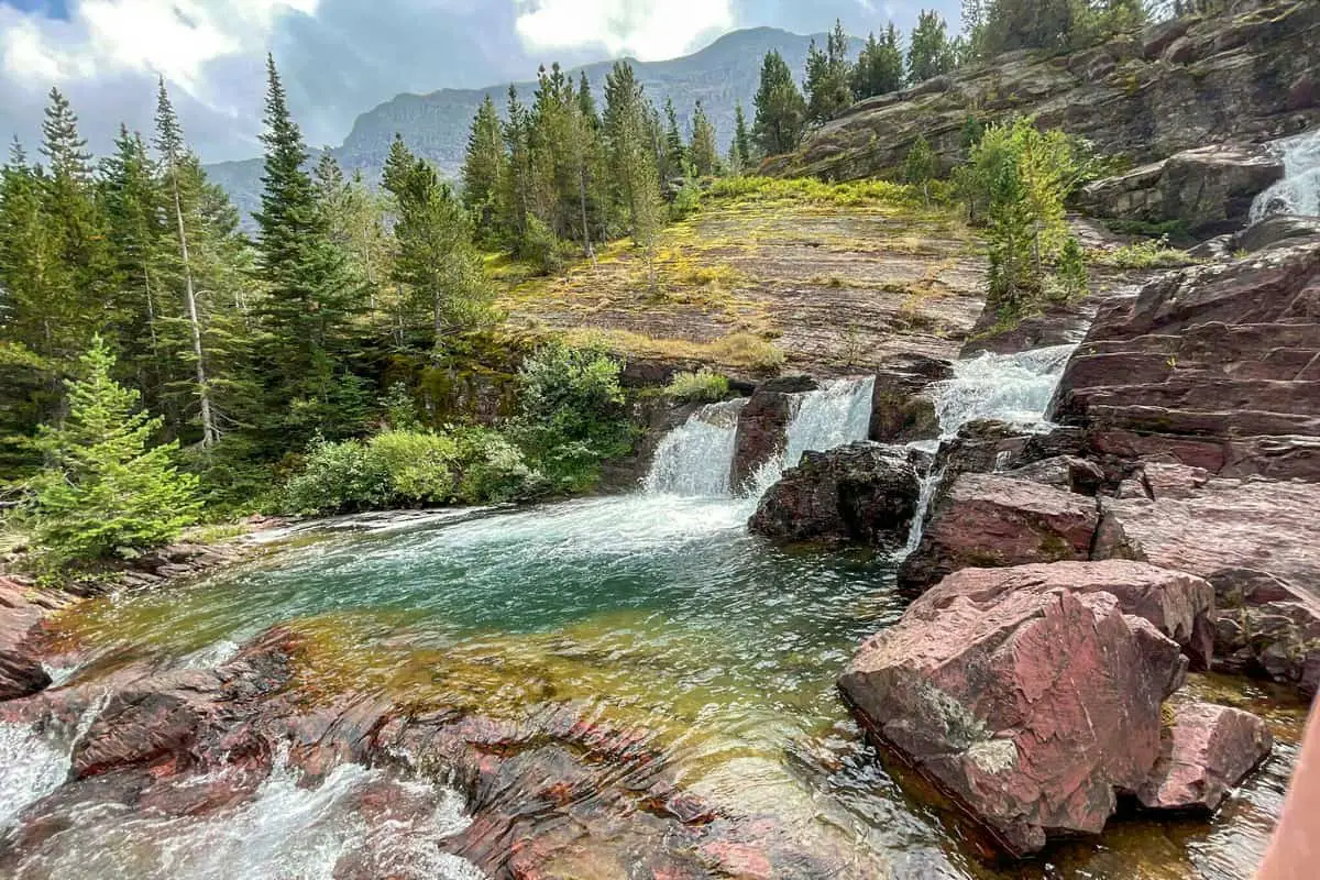
#13. Johns Lake Loop Hiking Areas in Glacier Park
I had a hassle-free experience hiking along this trail. It was easy, and there were young kids among the crowd that was hiking on that day. While hiking along this trail, people horseback riding and others were taking a walk. Additionally, I was able to see a waterfall and had scenic mountain views after crossing over a river during my hike. There were a variety of birds along this trail too.
Length: 1.9 mi
Elevation gain: 183 ft
Route type: Loop
Kid friendly, Hiking, Horseback riding, Walking, Bird watching, Lake, River, Waterfall, Wildflowers, Wildlife, Fee, No dogs
#14. Redrock Falls via Swiftcurrent Pass Hiking Trail at Glacier Park
This is one of the best kid-friendly hiking trails in Glacier National Park that I hiked on one morning during my visit in the summer. The distance of this trail was 3.6 miles, and I used an out and back route with an elevation gain of 236 feet. While hiking on this trail, I found it heavily trafficked since most people were hiking with kids, and it is easy terrain. There was abundant wildlife such as deer, marmots, and moose that I was able to see. Additionally, I was able to see foxes and bears from a distance using the binocular I brought with me. I was also able to have amazing views of the gorgeous falls from this trail during my hike.
Length: 3.6 mi
Elevation gain: 236 ft
Route type: Out & back
Kid friendly, Fishing, Hiking, Walking, Bird watching, Running, Forest, Lake, Views, Waterfall, Wildflowers, Wildlife, Fee, No dogs
#15. Granite Park via Highline Nature Trails in Glacier Park
Granite Park via Highline Trail is one of the popular but challenging hikes in this fantastic national park. I started to hike at the Logan Pass Visitor Center and ended at The Loop, covering 11.2 miles using a point-to-point route-type with an elevation gain of 1,466 feet. While hiking along with this, I found breathtaking vantage points and rolling hills. Additionally, I spot mountain goats and marmots from around 25 yards from the trail during my hike. After a strenuous hike up the Garden Wall trail, I was able to have a fantastic overlook of the McDonald Valley and Grinnell Glacier.
Length: 11.2 mi
Elevation gain: 1,466 ft
Route type: Point to point
Glacier National Park Backpacking, Glacier National Park Camping, Hiking, Forest, Views, Waterfall, Wildflowers, Wildlife, Rocky, Fee, No dogs
#16. Grinnell Lake Hiking Areas at Glacier Park
This was among the most used trail during my visit to this national park. We were a group, and we did not have any difficulty hiking on this trail since it was easy. We started hiking at Glacier Hotel before winding along two lakes and reaching Grinnell Lake. We covered a total distance of 7.1 miles with an elevation gain of 60 feet using an out and back route type. We were able to have spectacular views of the crystal blue waters formed from glacier runoff during our hike along this trail. It was in the afternoon hours, and we found some people paddling around the lake. Additionally, there were people with horses along the trail and a variety of birds around the lake.
Length: 7.1 mi
Elevation gain: 351 ft
Route type: Loop
Kid friendly, Fishing, Hiking, Horseback riding, Nature trips, Walking, Bird watching, Running, Forest, Lake, River, Views, Waterfall, Wildflowers, Wildlife, Fee, No dogs
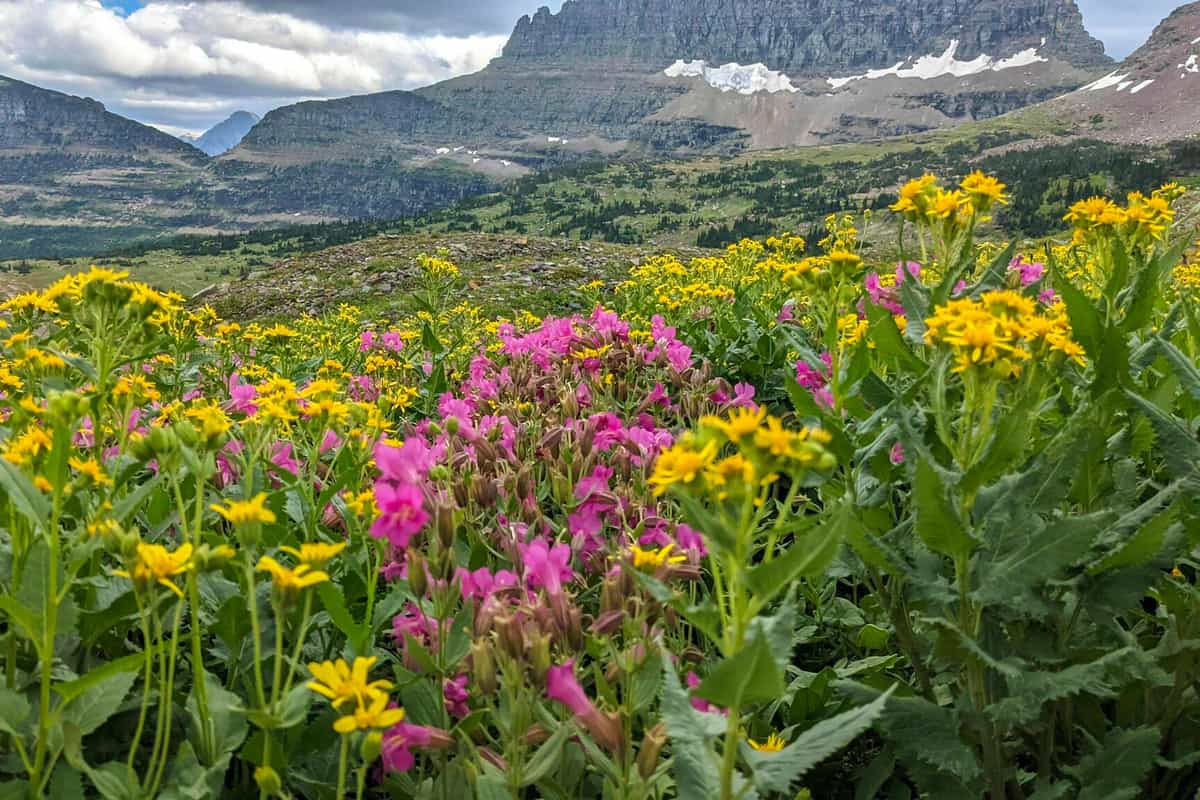
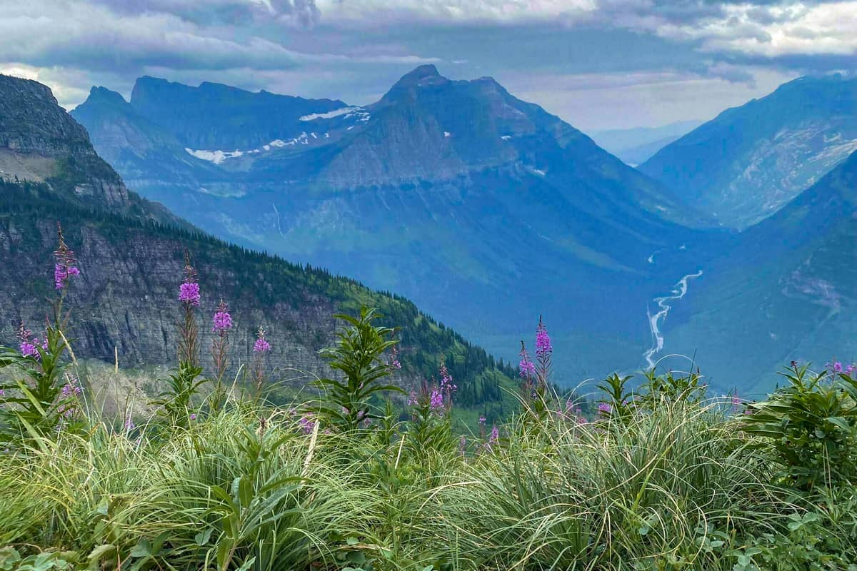
#17. Siyeh Pass Hiking Trails in Glacier Park
Siyeh Pass Trail is a fantastic trail in Glacier National Park, Montana, that I hiked on during my visit to the park. I covered a total distance of 4.6 miles using a point-to-point route-type with an elevation gain of 2,240 feet. While hiking on this trail, I traversed beautiful alpine meadows with fantastic mountain views. Additionally, there were abundant beautiful wildflowers along this trail during my visit. Compared to the Highline Trail, this trail was fairly trafficked. I think it is an excellent alternative to the Highline Trail if you want to avoid crowds during your visit.
Length: 9.7 mi
Elevation gain: 2,234 ft
Route type: Point to point
Glacier National Park Backpacking, Hiking, Nature trips, Forest, Lake, River, Views, Wildflowers, Wildlife, Rocky, Fee, No dogs
#18. The Loop and Garden Wall Nature Trails at Glacier Park
I managed to hike on this difficult-rated trail near West Glacier during my visit to Glacier National Park. During my hike on this trail, I started at The Loop and covered a total distance of 14.2 mi kilometers using a point-to-point route type with an elevation gain of 5,177 ft. Along this trail, I found a great spot where people pitched their tents and were backpackers. I was able to have incredible views of beautiful wildflowers and a lake while hiking along this trail.
Length: 14.2 mi
Elevation gain: 5,177 ft
Route type: Point to point
Glacier National Park Backpacking, Glacier National Park Camping, Hiking, Forest, Lake, Views, Wildflowers, Wildlife, Rocky, Fee, No dogs
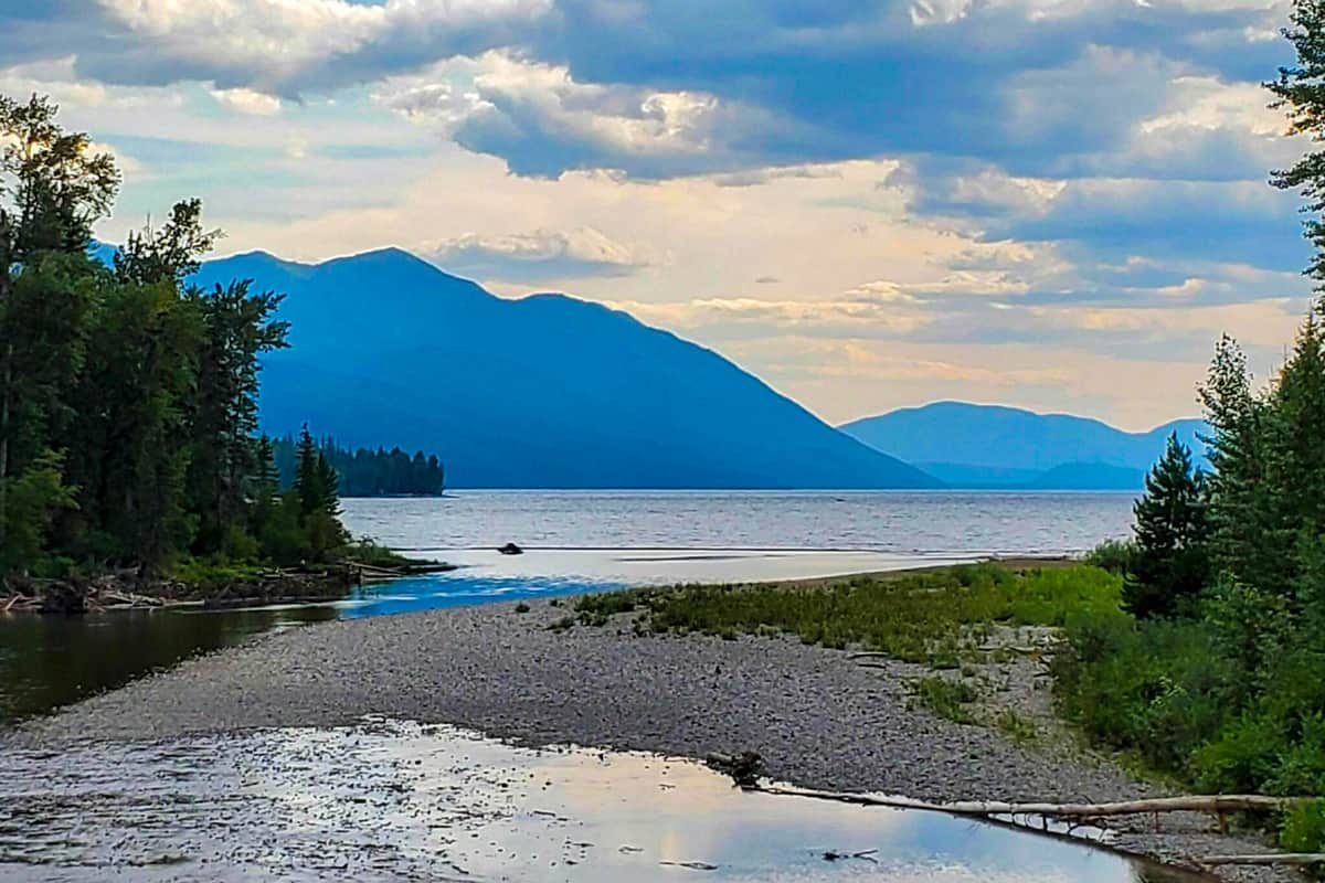
#19. Rocky Point via Lake McDonald Hiking Areas in Glacier Park
I had a great time hiking along this trail during my visit to Glacier National Park, Montana. It was not a long hike since I only covered a distance of 2.2 mi using an out and back route type with an elevation gain of 262 ft. I can say it was moderate. While hiking along this trail, I spotted a variety of birds and wildflowers. Additionally, I found people swimming at the lake on that mid-morning since it was during warm days. The sun was high, and I had to wear sunglasses and a hat to avoid the direct sunlight. I had water to keep myself hydrated since I was sweating a lot.
Length: 2.2 mi
Elevation gain: 262 ft
Route type: Out & back
Kid friendly, Hiking, Nature trips, Walking, Bird watching, Forest, Lake, River, Views, Wildflowers, Wildlife, Rocky, Fee,
No dogs
#20. Mount Oberlin Hiking Trails at Glacier Park
This is one of the moderate trails that I hiked on during my visit to this national park. It was quite challenging though hiking on this trail. I covered a distance of 4 miles using an out and back route type with an elevation gain of 1500 feet. Despite this trail not being well-maintained, it was marked, and therefore I had no problem making it to the top. While at the summit, I had excellent views of Mount Gould and the Garden Wall. Additionally, I was able to have incredible views of the Livingston Range and the Lewis Range while at the summit. There were beautiful wildflowers along this trail too.
Length: 3.5 mi
Elevation gain: 1,519 ft
Route type: Out & back
Hiking, Views, Wildflowers, Wildlife, Rocky, Scramble, Fee, No dogs
#21. Apgar Lookout Nature Trails in Glacier Park in Glacier Park
During my visit to the Glacier National Park, I decided to go hiking on this trail one late afternoon. Despite this trail being rated as complex, I found it heavily trafficked but mainly with experienced adventurers. During the hike, I covered a distance of 7.1 mi, and I used an out and back route with an elevation gain of 1,860 ft. Upon reaching the Apgar Lookout, I was able to have incredible views of the Livingston Range and a portion of Lake McDonald. Additionally, I was able to have spectacular views of the Flathead Range and the Stanton Glacier, plus the Swan Range. I had to carry water to keep myself hydrated.
Length: 7.1 mi
Elevation gain: 1,860 ft
Route type: Out & back
Hiking, Forest, River, Views, Wildflowers, Wildlife, No shade, Fee, No dogs
#22. Bullhead Lake Hiking Areas at Glacier Park
This is one of the beautiful routes that I visited while in Glacier National Park to hike. While hiking along this trail, I covered a total distance of 6.9 mi using an out and back route with an elevation gain of 449 ft. I was able to spot abundant moose and bears from a distance using binoculars. Additionally, I was able to have great views of Swiftcurrent Mountain, Swiftcurrent Glacier, and many other attractions while hiking on this trail.
Length: 6.9 mi
Elevation gain: 449 ft
Route type: Out & back
Hiking, Nature trips, Walking, Bird watching, Running, Forest, Lake, Views, Waterfall, Wildflowers, Wildlife, Fee, No dogs
#23. Ptarmigan Lake Hiking Trails in Glacier Park
This was one of the more strenuous trails in this national park that I hiked on during my visit. While hiking on this trail, I covered a total distance of 8.6 miles using an out and back route-type with an elevation gain of 1,896 feet. While hiking on this trail, I was able to have stunning views of the Ptarmigan Tunnel. Additionally, I was able to have views of the Belly River and Many Glacier Valley. I was also able to spot bears from a distance during my hike on this trail. There were a variety of birds along this trail, and there were people birdwatching.
Length: 8.6 mi
Elevation gain: 1,896 ft
Route type: Out & back
Hiking, Nature trips, Bird watching, Forest, Lake, Views, Waterfall, Wildflowers, Wildlife, Fee, No dogs
#24. Mount Brown Lookout Nature Trails Glacier Park at Glacier Park
This was another trail in Glacier National Park that I had a difficult time hiking on during my time at the park. While hiking, I found this trail moderately trafficked, and most of the hikers there were experienced adventurers. I covered 10.0 mi using an out and back route type with an elevation gain of 4,209 ft. During my hike, I came across people horseback riding along this trail. Additionally, I was able to spot a variety of birds in the nearby trees and a variety of wildlife grazing from a distance. Beautiful wildflowers were making good scenery for taking photos.
Length: 10.0 mi
Elevation gain: 4,209 ft
Route type: Out & back
Hiking, Horseback riding, Nature trips, Bird watching, Forest, Views, Wildflowers, Wildlife, Fee, No dogs
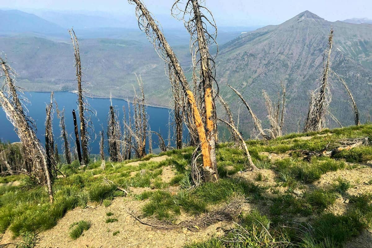
#25. Dawson Pass and Pitamakan Pass Loop Hiking Areas in Glacier Park
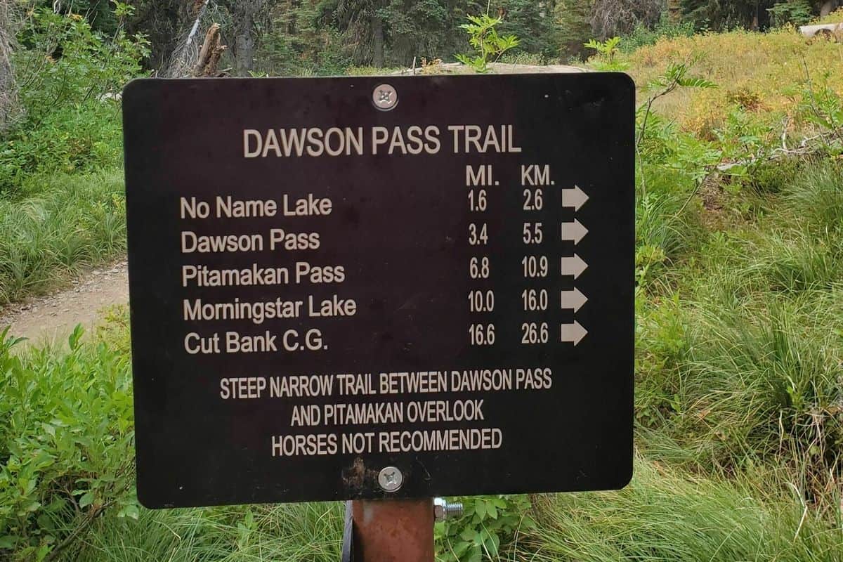
This is one of the best hiking trails in Two Medicine that I hiked on during my visit to this national park. The total trail distance was 17.2 miles, and it was a bit challenging hiking on this trail. I used a loop route-type with an elevation gain of 3,641 feet. During my hike, I was able to pass lakes, alpine meadows, avalanche chutes, and mountain peaks. Additionally, along this trail, I was able to have spectacular views of Mount Stimson and Mount Phillips. I was also able to see a variety of flora and fauna along this trail while hiking. Further, I came across multiple pitched tents and several backpackers.
Length: 18.8 mi
Elevation gain: 3,779 ft
Route type: Loop
Backpacking, Camping, Hiking, Forest, Lake, River, Views, Wildflowers, Wildlife, Fee, No dogs
You May Want to Join Our Boondocking Group on Facebook For More Information
You May Want to Join Our Campfire Recipes Group on Facebook For More Information