
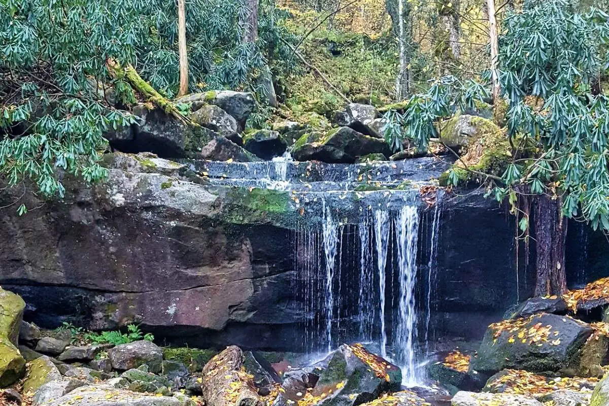
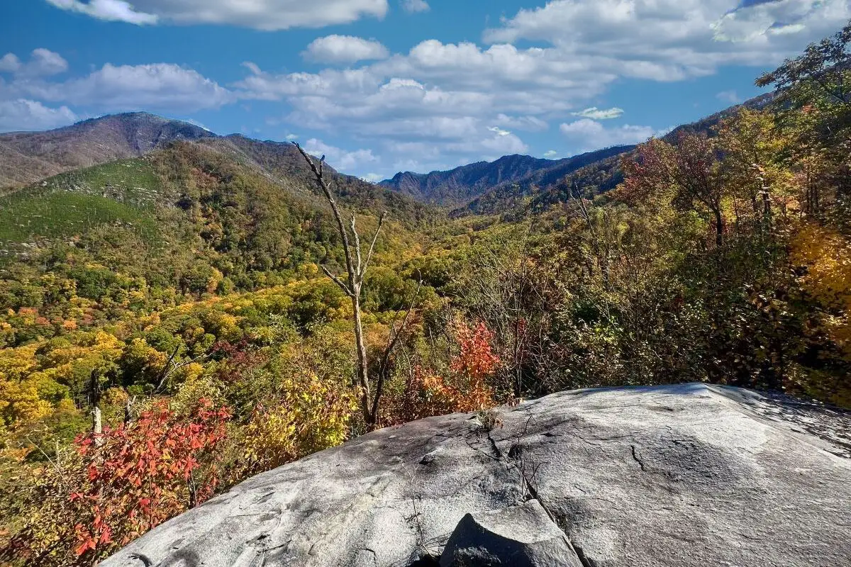
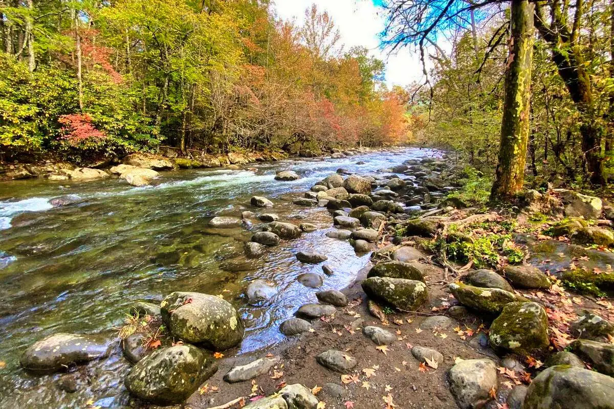
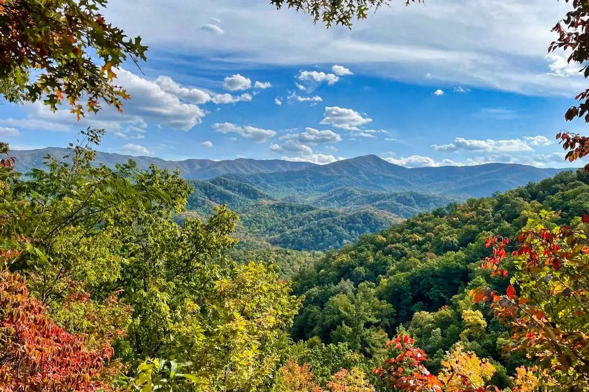
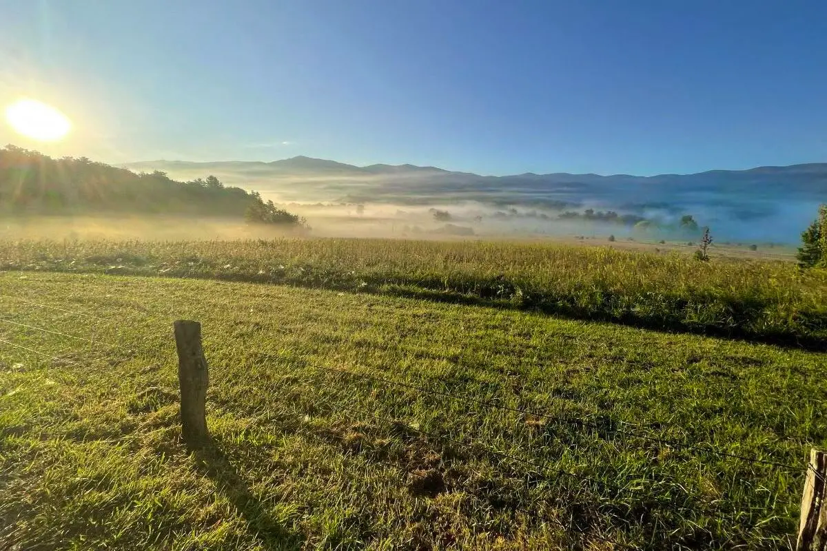
It is a fantastic experience to hike through the top trails in best hikes in Smoky Mountain National Park since you are surrounded by the sights and sounds of nature. Plan to explore a few or all of the park’s waterfalls throughout your trekking excursion. On a hot, sunny day, hiking to the waterfalls is good because the tree cover will keep you cool.
In Great Smoky Mountains National Park, the National Park Service maintains more than 800 miles of trails. The Smoky Mountains have a trail for everyone, whether you are a beginner with little to no hiking experience or a 900-miler on the Appalachian Trail. You can choose the trails that are right for you with our list of the 38 Most Popular Day Hikes.
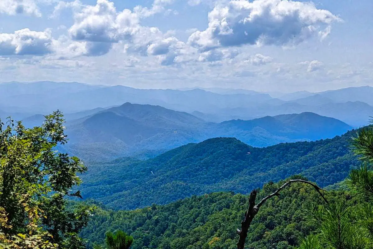
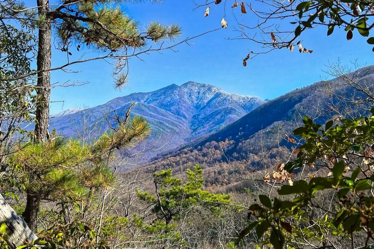
Beautiful scenery is created by craggy mountain peaks, gushing rivers, and dense vegetation. The park spans 500,000 acres of the Southern Appalachian mountain range. Watch out for animals like black bears and fireflies, among others.
You are surrounded by the beautiful geological formations as you progress through the top trails in best hikes in Smoky Mountain National Park. Plan to explore a few or all of the park’s waterfalls throughout your trekking excursion. On a hot, sunny day, hiking to the waterfalls is good because the tree cover will keep you cool.
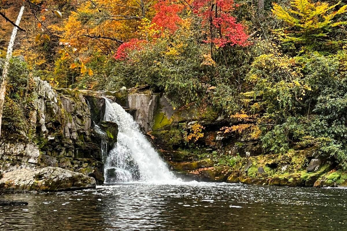
Bring your camera so you can take pictures of all the locations you want to keep. While hiking, take a little spritz from the cooling mountain springs. A waterfall trek is enjoyable for everyone, regardless of the season—spring, summer, or fall.
Want more ideas to round-out your trip to Smoky Mountain National Park?
A lot of great ideas are in these posts!
- 13 Great Smoky Mountains Free Campsites (Updated 2022)
- 34 Free Tennessee Boondocking – Camping Spots & RV Parking
- OBE Great Smoky Mountains National Park Visitors Guide
- 4 Great Reasons to Visit the Smoky Mountain National Park Visitors Center
- 35 Best Smoky Mountain National Park Campgrounds & RV Parks
- 19 Very Best Smoky Mountain National Park Waterfalls
- 17 Spots for Great Smoky Mountains National Park Photos
- 12 Top Things To Do In Smoky Mountain National Park
- Our 9 Favorite Smoky Mountains National Park Cabin Rentals
- 27 Best Great Smoky Mountains National Park Hotels By Entrance
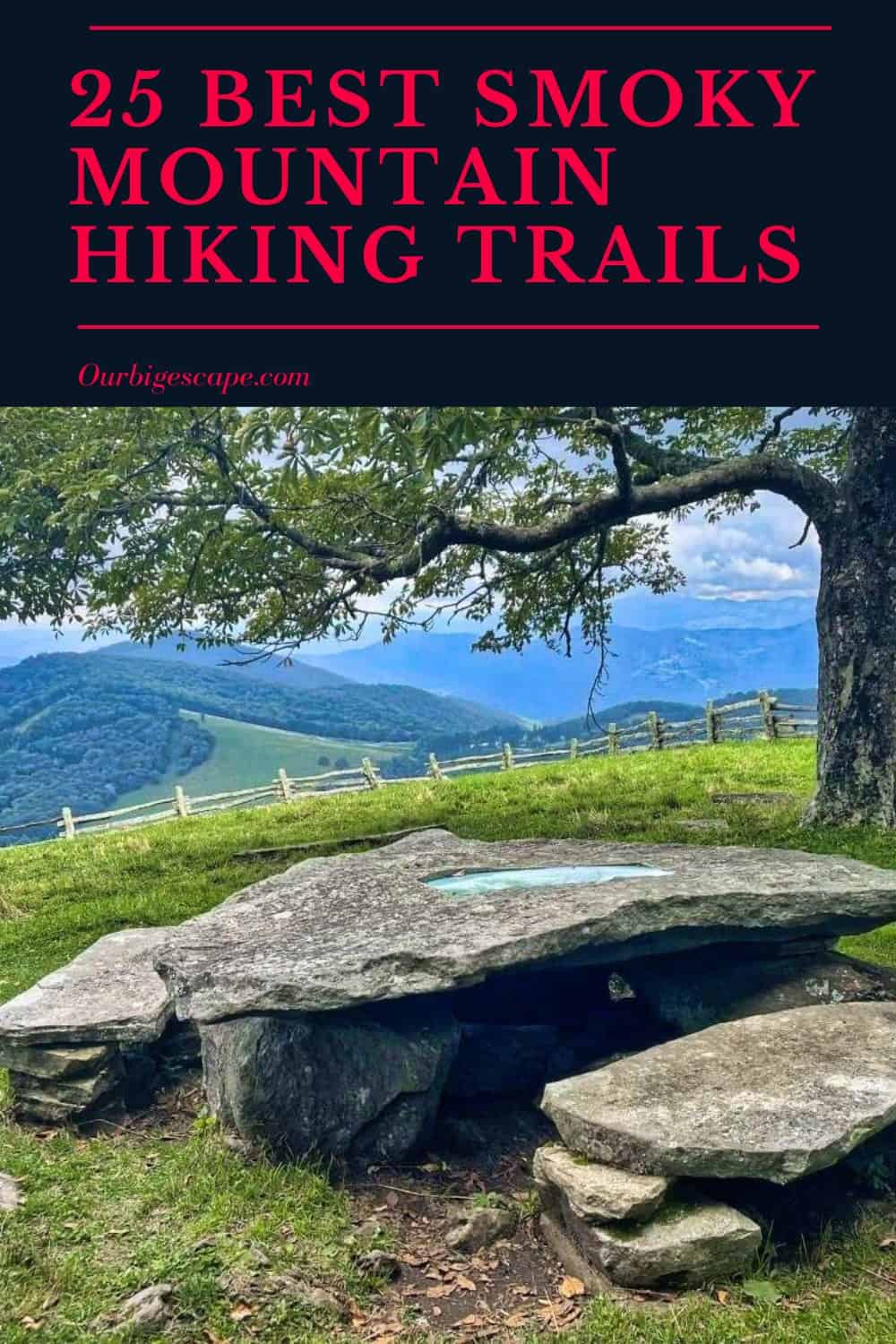
25 Best Hikes In Smoky Mountain National Park
check out our video
1. Chimney Tops Trail
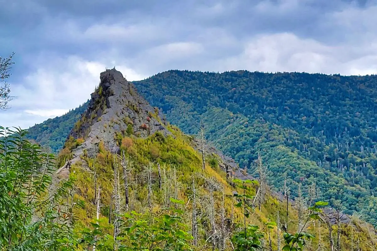 Chimney Tops Trail – Hiking Smoky Mountain National Park
Difficulty: Hard
Length: 3.6 mi
Elevation gain: 1,286 ft
Route type: Out & back
Hiking, Forest, River, Views, Wildflowers, Wildlife, Rocky, Scramble, No dogs
Description:
One of the best hikes in Smoky Mountain National Park begins by following the cascading waters of Road Prong Creek, which hikers cross over a few footbridges before reaching Beech Flats. At the Beech Flats junction, which marks the halfway point of the hike, hikers should turn right to continue on the Chimney Tops trail.
After a further 2.5 miles of hiking, near Indian Gap on Clingmans Dome Road, the Road Prong Trail, which is on the left, connects to the Appalachian Trail. The Road Prong Trail is unique because it is one of the Smoky Mountains’ oldest trails, having been used as a through-road in the 18th century under the name Indian Gap Trail.
Again, from Beech Flats, continue to the right to stay on the Chimney Tops trail. The second part of the trek is where things start to become challenging since the trail makes a western turn and climbs 730 feet in height over roughly two-thirds of a mile.
The trail then turns north and ascends the ridge to the summit, providing a pleasant view of the mountains to the east. The ridge can be climbed further for a 50-foot ascent to the summit of the pinnacles. Injury is a possibility, therefore wear the appropriate gear, and refrain from climbing if the rocks are too damp.
One of the rare Smoky Mountain summits with a summit of bare rock is The Chimneys. This summit was known as a forked antler when the Cherokee people lived in the mountains because it resembles a deer’s antlers.
In addition to the breathtaking view at the top, where you’ll be at an elevation of 4,724 feet, you’ll want to make sure to have a camera close at hand so you can pause and take some pictures of the fantastic sights throughout the way. Have fun exploring Chimney Tops Trail!
Directions to Trailhead:
The hike to Chimney Tops in the Great Smoky Mountains begins from the Chimney Tops Trailhead, located roughly 6.9 miles south of the Sugarlands Visitor Center (near Gatlinburg), between the lower tunnel and “the loop” on Newfound Gap Road.
Review:
It was a wonderful hike! To be really honest, I like to think that I’m in good form, and although my spouse is on the bigger side and in good shape, we both died on the way up. Wear comfortable shoes, bring a snack, and bring water!

2. Brushy Mountain Trail
 Brushy Mountain Trail – Best Trails in Smoky Mountains National Park
Difficulty: Hard
Length: 6.3 mi
Elevation gain: 1,735 ft
Route type: Out & back
Hiking, Running, Forest, Views, Waterfall, Wildlife, Rocky, No dogs
Description:
Porters Creek and Trillium Gap Trails are two of the Great Smoky Mountains National Park best hikes and are connected by the Brushy Mountain Trail. The trail itself is 9.1 miles long, but using this route requires an additional 4.9 miles of hiking, making it the longest one-way trip to Le Conte Lodge.
One mile into Porters Creek Hike, the trail starts. Before coming to the junction with Trillium Gap Trail (8.9 miles away) and the heath bald Brushy Mountain, you must ascend the Brushy Mountain Trail for 4.5 miles. Take a right and continue for about 0.4 miles through the rhododendron tunnels for the best views. At this intersection, turn left to continue on Trillium Gap Trail for another 3.6 miles to Le Conte Lodge.
Alternately, you can go up Trillium Gap Trail, which is a more pleasurable route, and turn left onto the heath bald after the intersection. This will allow you to see the best of Brushy Mountain. The distance to the location with the best views is only 0.4 miles. A breathtaking view of Mount Le Conte is offered by the Brushy Mountain heath bald. Le Conte’s neighboring peaks to the left include Mount Kephart, the Sawteeth, the Jumpoff, and even the distant Mount Guyot.
Directions to Trailhead:
This hike to Brushy Mountain in the Smokies begins at one of the best hikes in Smoky Mountain National Park from the Porters Creek Trailhead in the Greenbrier area. To reach the trailhead from the junction of 441 and 321 in Gatlinburg (Light 3), turn to travel eastbound on 321. Drive 6 miles and turn right into Greenbrier (look for the Great Smoky Mountains
National Park entrance sign on the right). This road turns into a gravel road after a short distance. From Route 321 drive 3.1 miles to a fork in the road. Continue driving straight ahead here. The parking area will be almost another mile from this junction.
Review:
The trail is well-maintained and clearly marked. There are many people in the grotto, but if you keep walking, you won’t see many of them. There aren’t many vistas, but the one atop Brushy Mountain is breathtaking. Trail is simple to difficult. Over the course of the 3 miles, there was mostly flat terrain. The final.2 miles are very cool. moving through a river’s drainage.
3. Lonesome Pine Overlook
 Lonesome Pine Overlook – Great Smoky Mountains National Park Trails
Difficulty: Hard
Length: 6.6 mi
Elevation gain: 2,273 ft
Route type: Out & back
Hiking, Walking, Forest, River, Views, Wildlife, No dogs
Description:
Just inside the southern border of the Great Smoky Mountains National Park, the Deep Creek Campground is located across from the southern trailhead of the Noland Divide Trail. The trail quickly enters a hardwood forest, passes Durham Branch, and starts ascending Beaugard Ridge’s flanks via switchbacks.
The Noland Divide is one of the best Best Trails in Smoky Mountains National Park, a long crest separating the Noland and Deep Creek drainages, is split by Beaugard Ridge in the southeast. Near Clingmans Dome, the Divide connects to the main spine of the Smokies at its northernmost point.
Three miles into the journey, Beaugard Ridge becomes a razorback. From its arid pine-oak woods, the views here rapidly widen. You’ll have some exciting views as you get closer to your destination, looking east over the Deep Creek basin to Thomas Ridge and west toward the Nantahalas. Some of the views from this section of ridge are even more spectacular than those from Lonesome Pine Overlook itself.
Along the spine of the ridge, you’ll notice Lonesome Pine Overlook’s knob approaching. A wooden signage points out a spur trail that leads to the promontory. With the magnificent views looking west across the lowlands of Fontana Lake to the Nantahala skyline and south to Bryson City in the Tuckasegee Valley, there is no finer place to have lunch.
Directions to Trailhead:
The hike to the Lonesome Pine Overlook begins from the Noland Divide Trailhead in the Deep Creek area of the Smokies, located just north of Bryson City, North Carolina. To reach the trailhead from the intersection of Rt. 441 and Rt. 19 in Cherokee, drive 10 miles south on Route 19 to Everett Street in Bryson City.
Turn right onto Everett and drive for 0.2 miles, and then turn right onto Depot Street. After a short distance, take a left onto Ramseur Street, and then make an immediate right onto Deep Creek Road and drive another 2.3 miles to the park entrance. The Noland Divide Trailhead will be located on the left, across from the bridge that leads into the Deep Creek Campground
Review:
One of the best hikes in Smoky Mountain National Park. awesome hike The entire way out was a steady ascent (I stopped frequently), but it wasn’t particularly steep. enough hints of the vista along the route to make the climb enjoyable! The views from the amazing ridge near the top were breathtaking. On the trek, I was the lone traveler. Exited at precisely 8AM and arrived back at the car just before 12PM.
4. Hemphill Bald Trail
 Hemphill Bald Trail – Great Smoky Mountains National Park Best Hikes
Difficulty: Hard
Length: 13.3 mi
Elevation gain: 2,913 ft
Route type: Loop
Backpacking, Camping, Hiking, Forest, Views, Rocky, No dogs
Description:
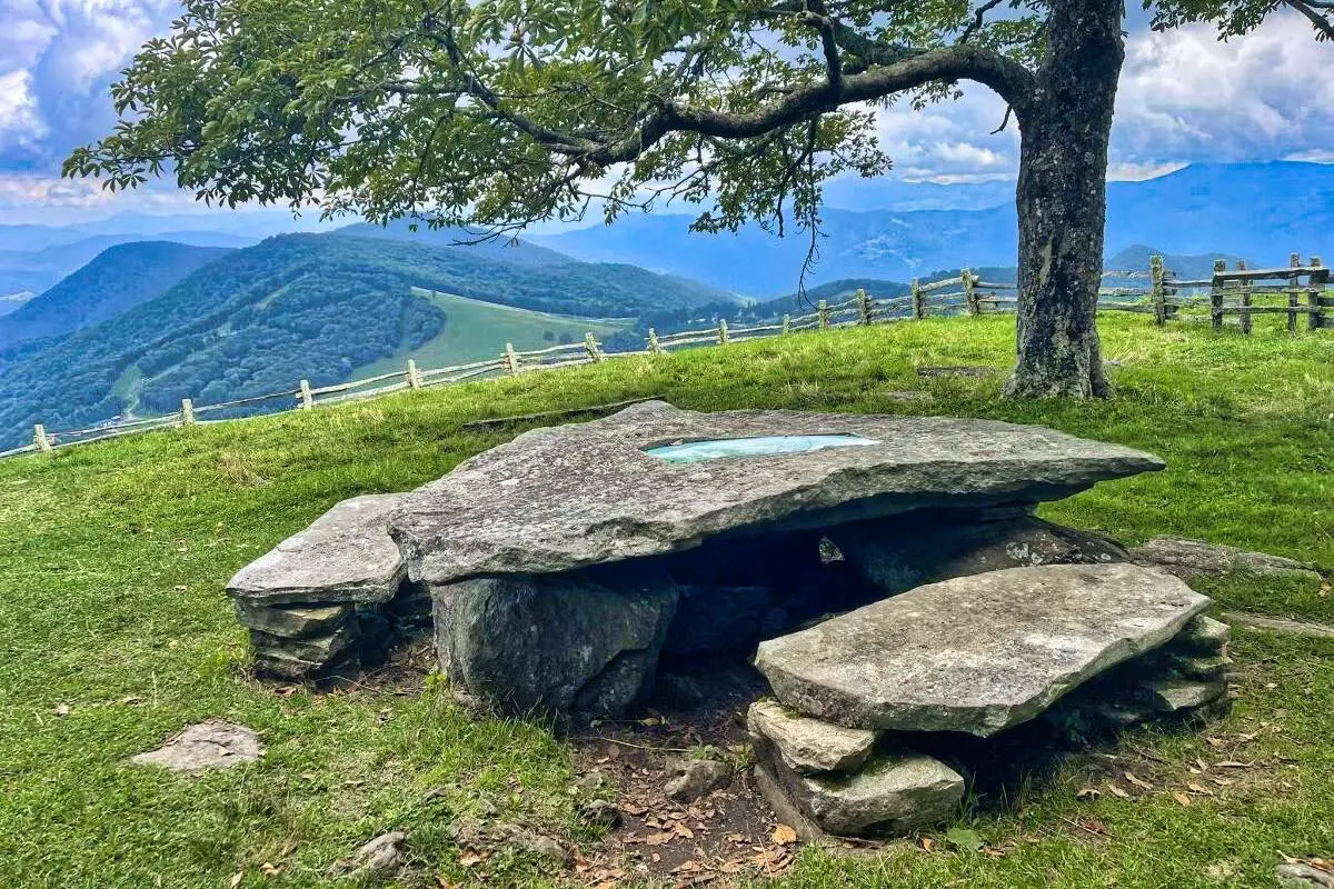
Hemphill Bald is one of the Best Trails in Smoky Mountains National Park and best vantage points in the Great Smoky Mountains This grassy summit, which is situated on the park’s easternmost frontier along the difficult Cataloochee Divide, provides breathtaking 270° views of nearby North Carolina mountain ranges. On the 5,556-foot summit, which is adorned by an outstanding old buckeye tree, is a stone picnic table.
Despite only having a few minor ascents and only 9.6 miles roundtrip, it is one of the best hikes in Smoky Mountain National Park. You will pass through gorgeous hardwood forests and sporadic cow grazing fields as you follow the north side of the split. The drawback of this excursion is that Heintooga Ridge Road is only open for a short period of time due to its high elevation and separation from the Blue Ridge Parkway.
Winter is not a possibility. The harder hikes will start at Cove Creek Gap or Cataloochee Valley. The trek is less busy than other well-known hikes in the Smokies, but the views make up for the difficult trailhead access.
Directions to Trailhead:
To reach the trailhead, take the Blue Ridge Parkway and follow the signs to the Balsam Mountain Campground. Once you reach the campground, park at the Polls Gap area. You can actually hike the Hemphill Bald Trail as one part of a 13.6 mile loop and comes back around to Poles Gap, which many people do.
Review:
I began this out-and-back run from the Blue Ridge Parkway’s Hemphill Bald trailhead. The vistas from the summit made the difficult-to-maneuver, overgrown last hike to the bald worthwhile. The distance is roughly 5.59 miles one way from the trailhead. I only noticed one elk at the trailhead on a Wednesday night.
5. Boogerman Trail
 Boogerman Trail – Best Hikes In Smoky Mountain National Park
Difficulty: Hard
Length: 7.3 mi
Elevation gain: 1,128 ft
Route type: Loop
Hiking, Running, Forest, River, Views, Wildflowers, Wildlife, Rocky, No dogs
Description:
A 7.4-mile (round-trip) hike that is moderately difficult. There are remains of early settlers’ homesites, beautiful streams and falls, and old growth woodland. Depending on your degree of expertise, allow three hours.
One of the best hikes in Smoky Mountain National Park is the Boogerman Trail, a seven-mile loop on the North Carolina side of the Smokies that has the name of the man whose homestead was close to the trail. Just before you reach the halfway point of the walk, you may still see the foundations and other remnants of this homestead.
It is best to schedule a whole day for one of the Best Trails in Smoky Mountains National Park if you intend to hike this trek. It will take some time to get to the trailhead from the road. If traveling from the Tennessee side of the mountains, allow plenty of time for travel time. However, if you enjoy hiking, the effort will be well worth it. It’s a fantastic track to trek because of the large trees, streams, and waterfalls.
Directions to Trailhead:
From Exit 20 off I-40 in North Carolina, almost immediately after turning onto Rt. 276, turn right to head west on Cove Creek Road. Roughly 4.7 miles from the turn-off the paved road ends and you’ll begin driving on a gravel/dirt road. The road is passable for low clearance, two-wheel drive passenger cars; however, you should expect some rough, washboard sections. You’ll just have to drive slowly.
At 5.9 miles you’ll reach the national park entrance gate, and at 7.6 miles you’ll arrive at the paved turn-off to Cataloochee. Turn left at this junction. At 10.7 miles you’ll pass the Cataloochee Campground. Just past the campground, on the left, is the trailhead for the Caldwell Fork Trail which leads to the Boogerman Trail.
Review:
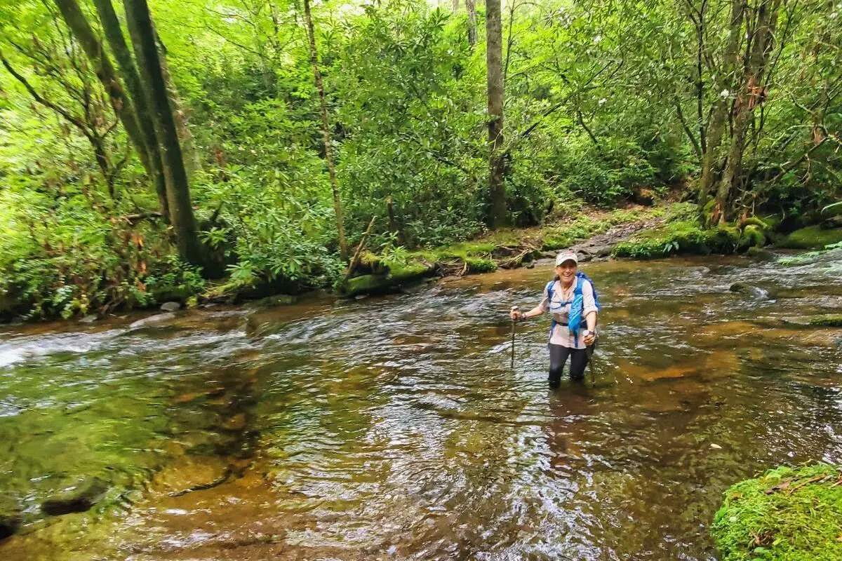
The trail involves wading through multiple unbridged streams that are knee-deep. On summer days, it also thunders regularly, so be prepared to hide. If you want to complete the circle, start early. It took me 4.5 hours to do it in the pouring rain. Ahead of time, download the AllTrails map. The pathway is without signage. The woodland is quite lovely.
6. Cataloochee Divide Trail
 Cataloochee Divide Trail – Hiking Smoky Mountain National Park
Difficulty: Hard
Length: 13.8 mi
Elevation gain: 2,791 ft
Route type: Out & back
Hiking, Horseback riding, Running, Forest, Views, Wildflowers, No dogs
Description:
Old N.C. 284 enters the Smokies park near Cove Creek Gap, where the Cataloochee Divide Trail begins. The trail first follows the park’s perimeter, which is marked by barbed wire and a dilapidated split-rail fence in certain spots. The path itself has few rough or muddy spots, making it generally comfortable on the feet.
There is also not much climbing or lowering until the fourth mile of hiking, with route elevations varying from roughly 4,000 feet to just beyond 5,000 feet.
From the gap, it takes around 30 minutes of delightful walking before you arrive at a little clearing to the right of the trail, which offers one of the East’s best wilderness views. The majestic Balsam Mountain Range’s 5,647-foot Spruce Mountain and the imposing Mount Sterling Ridge stand out in particular.
A little portion of Cataloochee Valley, which is located more than 1,500 feet below than this lookout, is also visible. There were well over 1,000 people living in the valley before the park was created in 1934.
The waves and waves of mountains visible from the overlook were known to the Cherokee as “standing in a row,” or Ga-da-lu-tsi. Cataloochee is the result of the name being changed throughout time by European-American settlers. You soon start a long descent to the next big landmark on the trail. A private dirt road runs parallel to the border at Panther Spring Gap, which is located a little more than two miles away. This hike in Smoky Mountain National Park is among our top picks.
Directions to Trailhead:
To get there, travel Interstate 40 to North Carolina 276, exit 20, and drive west to Cove Creek Road. From there, you’ll turn north and travel 3 miles to the Cove Creek Gap where you find the trailhead. Climb through the white pine grove as you begin on the trail, pass a rock outcropping, and walk along the fence line
Review:
Yesterday, my four-year-old and seven-year-old sons hiked one of the Great Smoky Mountains National Park trails from Cove Creek Gap to the Science Center. The vegetation was at its maximum height and the track was mostly hidden when we first set out. It was only a reminder that we needed to look for ticks. The first two miles’ worth of scenery were breathtaking. Throughout the trek, we frequently came across bear scat, but we didn’t see any bears.
7. Noland Divide Trail
 Noland Divide Trail – Best Trails in Smoky Mountains National Park
Difficulty: Hard
Length: 11.1 mi
Elevation gain: 4,783 ft
Route type: Point to point
Backpacking, Camping, Hiking, Horseback riding, Forest
Description:
Not for the faint of heart is this Great Smoky Mountains National Park trails arduous 29.8 mile round trip hike from the foot of Tennessee’s tallest mountain in Smoky Mountain National Park. Although it is one of the best hikes in the Great Smoky Mountains National Park, the terrain is challenging and frequently harsh. 4,863 feet of elevation are gained over 14.9 miles from the base to the top.
Most people consider this to be a longer hike. It is strongly advised to do this across two days. Along the trail, there are various locations to set up camp. Before entering the backcountry of Smoky Mountains National Park, don’t forget to get a backcountry permission from the ranger station.
For 12.9 miles, stick to the Noland Divide Trail’s exceedingly difficult terrain. The Noland Creek Trail and Clingmans Dome Road meet at a distance of 12.9 miles. Turn left onto the Clingmans Dome road, and continue on this road for approximately 1.5 miles to reach the tourist route. To reach the summit, travel 0.5 miles on the tourist trail.
The over-scented, giddy auto tourists with newly manicured nails will smell you coming. Even some of the curious “gapers” might wish to photograph a “genuine hiker.” After this hike, you will unquestionably feel and smell like one.
Directions to Trailhead:
The hike starts at the Noland Divide Trail. To access the Noland Divide Trail > from Bryson City, N.C. follow SR 1364 (Lakeview Drive). The trailhead is located just before the end of SR 1364 (on the right-hand side). You will see Noland Creek.
Review:
I started this Great Smoky Mountains National Park trails hike in the Cherokee area, close to the dome. It appears to be a tiny, old logging road. My dog and I went for about 2 miles on a half-day hike before turning around. It was all uphill on the way back and downhill going forward. You’ll get your aerobic fix with a good workout. I visited in the fall, but based on how much moss was everywhere, the summer must be fantastic.
8. Sugarland Mountain Trail
 Sugarland Mountain Trail – Great Smoky Mountains National Park Trails
Difficulty: Hard
Length: 11.7 mi
Elevation gain: 4,422 ft
Route type: Point to point
Backpacking, Camping, Hiking, Running, Forest, River, Views, Wildflowers, Wildlife, No dogs
Description:
The Sugarland Mountain Trail is situated on the Tennessee side of the Smokies, between the Clingmans Dome Road and the Little River Road. Sugarland Mountain is a short ridge that runs perpendicular to the main spine of the Smokies.
The lower section of the Sugarland Mountain Hiking Trail is situated in the Elkmont Area off of Little River Road and is 6 miles long roundtrip with a rise in height of 1500′. It is rated as being of moderate difficulty for hikers and requires a certain level of fitness.
The best hikes in Great Smoky Mountains National Park are available here. Begins with a moderate ascent that leads to multiple steep drops-offs and offers great views of Gatlinburg, Mount Le Conte, Brushy Mountain, and of course the named Sugarland Mountain.
Directions to Trailhead:
From the Sugarland Visitor Center near Gatlinburg, drive 3.8 miles west along Little River Road to the top of Fighting Creek Gap. The main parking area for the Sugarland Mountain Trail will be on your left, with additional parking across the street.
From the Townsend “Y” intersection near Cades Cove, the Sugarland Mountain Trailhead is located 13.7 miles away.
Review:
Although initially rather tight and steep, it provided us with some great vistas. Not the most family-friendly hike we’ve ever taken, perhaps. After witnessing some wildlife, we went back. Additionally, there were a few minor muddy patches left over from the last rain. They will likely get worse following today’s rain.
https://goo.gl/maps/x2WuE1WVpQhJ2QJX6
9. Rainbow Falls Trail
 Rainbow Falls Trail – Great Smoky Mountains National Park Best Hikes
Difficulty: Moderate
Length: 5.1 mi
Elevation gain: 1,617 ft
Route type: Out & back
Hiking, Forest, River, Views, Waterfall, Wildflowers, Wildlife, Rocky, No dogs
Description:
The first mile of this Great Smoky Mountains National Park best hikes strenuous trail follows Le Conte Creek, later passing through an area full of rosebay rhododendron, teaberry, and mountain pepper-bush grow. Also found here are pink lady’s slippers. About two miles from the trailhead, a log footbridge spans the creek; after that, the route traverses a Le Conte Creek branch without the aid of a bridge.
The falls, so named because of the rainbows that may be seen in the mist due to the afternoon sun, are visible after two more bridges. On rare occasions during the winter, the 80-foot drop would freeze into an hourglass form.
Directions to Trailhead:
The hike to Rainbow Falls use the Great Smoky Mountains National Park trails section from the Rainbow Falls Trailhead, located just outside of Gatlinburg. Starting from Light 8 in Gatlinburg, turn onto Historic Nature Trail / Airport Road. After driving 0.7 miles veer right onto Cherokee Orchard Road, upon which you’ll enter into Great Smoky Mountain National Park.
After driving another 2.2 miles you’ll enter the one-way Cherokee Orchard Loop Road. After driving roughly 0.6 miles on the loop, the Rainbow Falls Trailhead will be located on your right. If this lot is full, there’s an auxiliary parking area about a tenth-of-a-mile further down the road.
Review:
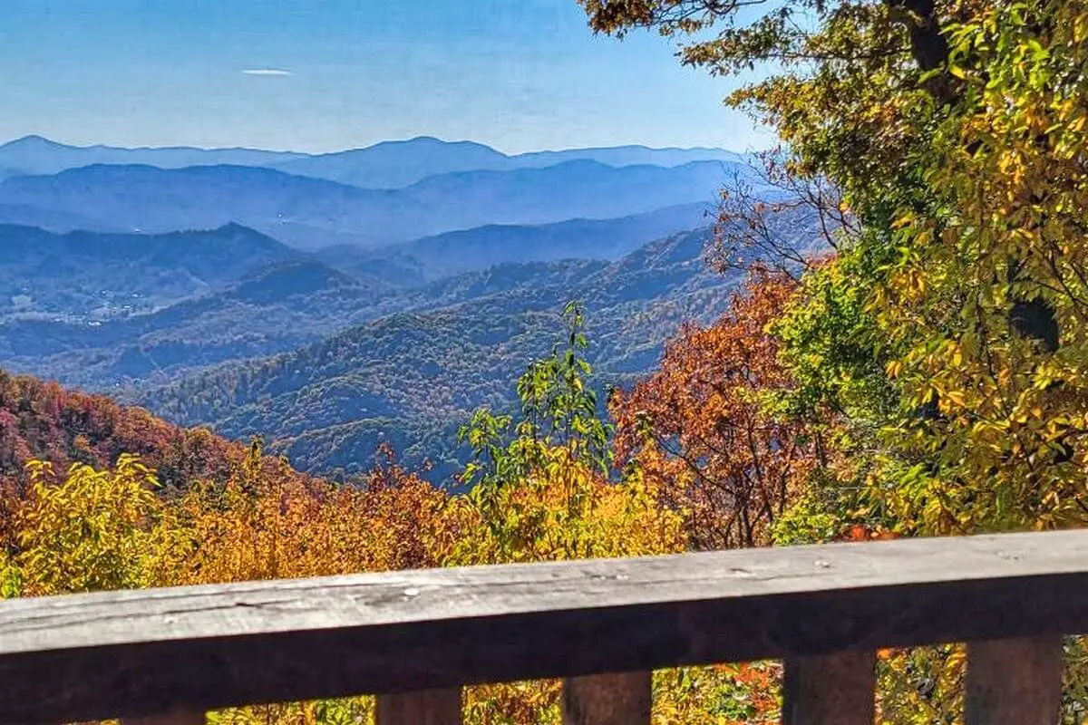
Beautiful fall hues at the moment. For the first half of the walk to the falls, there is a constant ascent. As a retired, moderately active person, I could complete this trail with only a few breaks on the way up. The trail overall was lovely, but the falls themselves are alright. This one is one I endorse!
10. Abrams Falls Trail
 Abrams Falls Trail – Best Hikes In Smoky Mountain National Park
Difficulty: Moderate
Length: 5.5 mi
Elevation gain: 629 ft
Route type: Out & back
Hiking, Forest, River, Views, Waterfall, Wildflowers, Wildlife, Rocky, No dogs,
Description:
The Abrams Falls trail is considered to have one of the most voluminous waterfalls in Great Smoky Mountains National Park and the main reason it made this best hikes in Smoky Mountain National Park best hikes list. The fall’s 20-foot height is compensated for by the volume of rushing water that pours into the pool below.
Due to the unexpectedly strong currents, swimming in the water below the falls is incredibly risky. Even though it’s one of the best hikes in the Great Smoky Mountains National Park, it’s not a great spot to swim. Although it may be difficult to ignore the allure of the pool and waterfall behind it, park officials advise trekkers to exercise caution for their own safety.
Despite the short length and moderate difficulty of the Abrams Falls trail, hikers favor it during the busy hiking season. The walk starts at a substantial wooden bridge that spans Abrams Creek. Hikers can access the waterfall from Cades Cove by following a trail that winds through a pine-oak forest on the ridge tops.
Near the creek’s edge, there are also hemlock and rhododendron thickets can be seen. By the 2.5-mile mark, the trail crosses over Wilson Creek, another river that leads to the 20-foot drop of Abrams Falls.
Directions to Trailhead:
The hike to Abrams Falls starts on of the Great Smoky Mountains National Park trails from the Abrams Falls Trailhead, located at the far western end of Cades Cove. To reach the trailhead drive 4.8 miles along the one-way Cades Cove Loop Road. Just after crossing Abrams Creek turn right onto a gravel road.
After driving another four-tenths of a mile through a grassy field you’ll reach a large parking area where you’ll find signs and a wooden footbridge that mark the trailhead.
Hikers should note that the park closes the Cades Cove Loop Road to motor vehicle traffic on Wednesday and Saturday mornings until 10:00 a.m., between early May and late September of each year, to allow cyclists and pedestrians to enjoy the cove.
Review:
This track is among the best hikes in the Great Smoky Mountains National Park and is generally an easy climb with some inclines. It is extremely manageable because to the well-maintained trail and periods of minimal incline to level pathways. One of the park’s falls that I like best so far. It did take approximately an hour to drive from the Cades Cove entrance to the trailhead this morning at 7:30. You do have to drive via Cades Cove loop to a sizable parking lot at the trailhead. It’s nearly filled by 11 A.M every day.
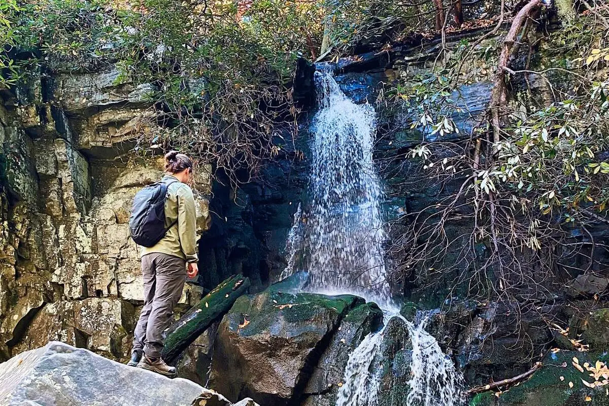
11. Spruce Flats Falls Trail
 Spruce Flats Falls Trail – Hiking Smoky Mountain National Park
Difficulty: Moderate
Length: 1.8 mi
Elevation gain: 413 ft
Route type: Out & back
Hiking, Forest, River, Views, Waterfall, Wildflowers, Wildlife, Rocky, Scramble, Off trail, No dogs
Description:
The 1.9 miles that make up the trail to Spruce Flat Falls. You shouldn’t have to travel the journey in more than one hour. Why is it challenging? With a “moderate” rating, it is already more challenging than “easy,” so if you have young children or mobility issues, you might want to pass on this one.
It’s a rocky, narrow trail with tree roots to navigate, and it might be treacherous after it rains. Although we don’t want to deter you from using the path because of the steep drop-off, we do want to warn you that if you’re not careful, it is possible to slip down the trail; this has happened, and the hiker needed professional assistance.
However, if the weather is clear, your group is physically fit, and you’re serious about exploring the outdoors, go ahead and embark on this ideal half-day adventure and reap the benefits of Spruce Flat Falls.
Directions to Trailhead:
Spruce Flats Falls in the Great Smoky Mountains National Park trails all begins from the Lumber Ridge Trailhead in Tremont. To reach the trailhead from the Townsend “Y” intersection, drive west on Laurel Creek Road towards Cades Cove. Roughly two-tenths of a mile from the “Y”, turn left to proceed towards the Great Smoky Mountains Institute at Tremont.
Drive another two miles and turn left into the Great Smoky Mountains Institute. After driving across the narrow bridge, look for a small parking area on the right. The Lumber Ridge Trailhead is located along the gravel road just beyond the parking area.
Review:
This was a wonderful hike for my family. My 9 and 11 year old boys did great but my 6 year old did slip and slide a bit at times. The trail was dry today, a decent amount of people but not crowded like visiting Laurel falls. The hornets are marked with yellow caution tape and we did not have any trouble with them. The falls are beautiful and definitely worth the walk.
12. Andrews Bald Trail
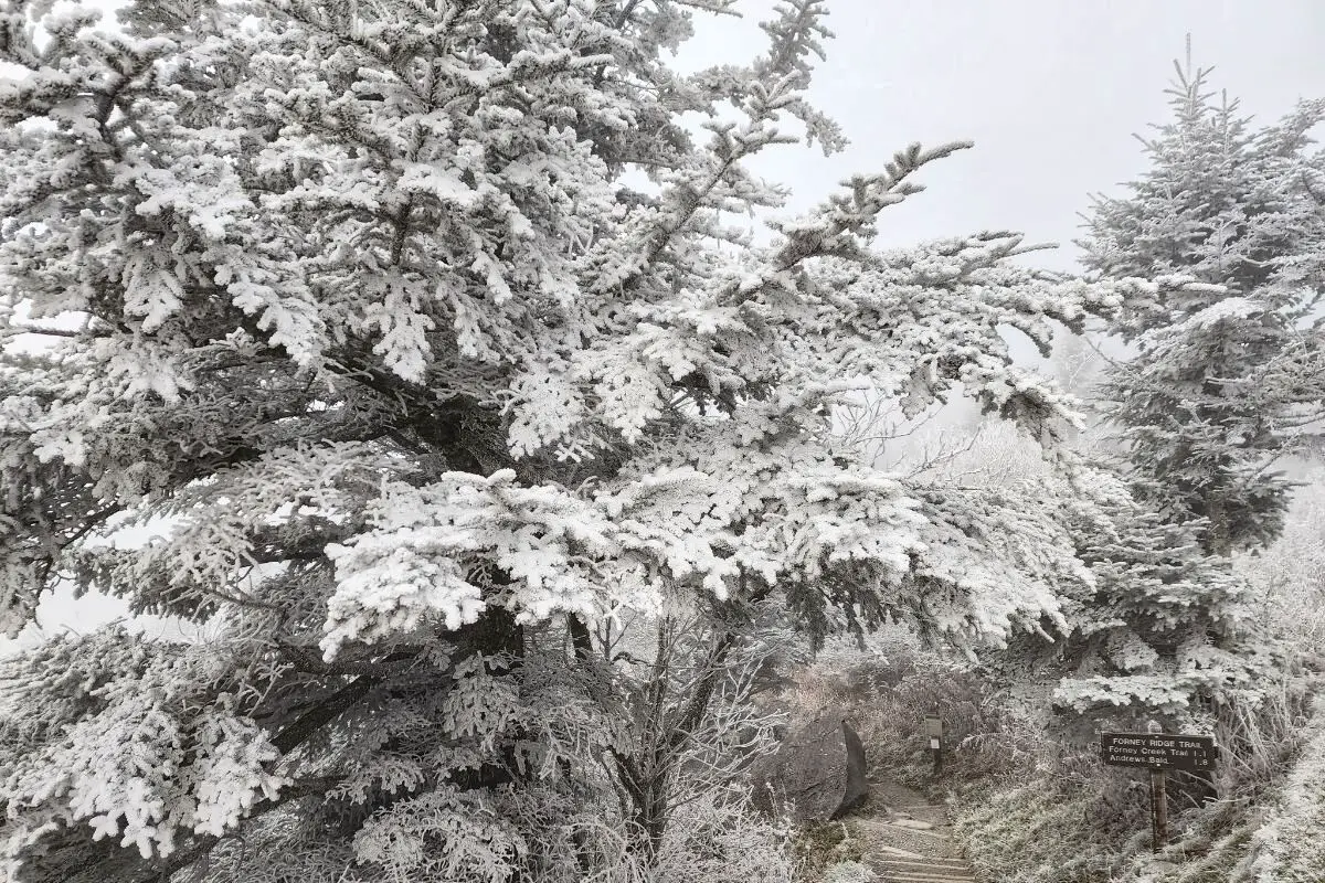 Andrews Bald Trail – Best Trails in Smoky Mountains National Park
Difficulty: Moderate
Length: 3.6 mi
Elevation gain: 875 ft
Route type: Out & back
Kid friendly, Hiking, Forest, Views, Wildflowers, Wildlife, Rocky, No dogs
Description:
This Great Smoky Mountains National Park best hikes begins down the southern edge of Clingmans Dome, known as Forney Ridge. This part of the trail takes hikers into a spruce-fir forest. You might notice that there are a lot of dead spruce trees during this portion of the hike. This is brought on by the balsam woolly adelgid, an insect that attacks Fraser Firs.
The Clingmans Dome Bypass Trail begins to diverge to the right after hiking at least a tenth of a mile from the trailhead. However, the path will continue up to the Andrews Bald trail if you turn left at this intersection.
You will reach a grassy meadow, or “bald,” on the borders of Andrews Bald at about 1.7 miles, which is a great location for a picnic. With sweeping views of Fontana Lake, the southern Smokies, and the highlands, the sights aren’t bad either.
Directions to Trailhead:
The hike to Andrews Bald in the Great Smoky Mountains begins from Clingmans Dome. From the Sugarlands Visitor Center near Gatlinburg, drive 13.2 miles south along Newfound Gap Road to Clingmans Dome Road. Turn right onto Clingmans Dome Road and drive another 7 miles to the end of the road.
Due to its popularity it made the best hikes in Smoky Mountain National Park list, the parking area for the highest point in the Smokies is quite large. Andrews Bald is accessed via the Forney Ridge Trail, which is located at the far end of the parking lot.
From Cherokee, drive 20 miles north on Newfound Gap Road to reach Clingmans Dome Road.
Review:
This trail has received a good amount of trail restoration. Trail is muddy and rough. Layer up because the weather can change suddenly and it is at least ten degrees cooler than base level.
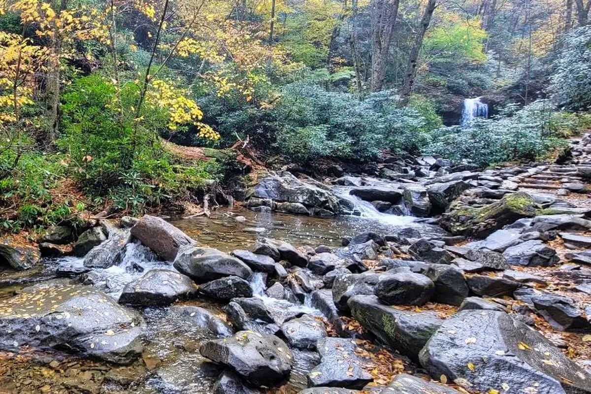
13. Deep Creek Loop Trail
 Deep Creek Loop Trail – Great Smoky Mountains National Park Trails
Difficulty: Moderate
Length: 4.9 mi
Elevation gain: 895 ft
Route type: Loop
Kid friendly, Hiking, Forest, River, Views, Waterfall, Wildflowers, Wildlife, Rocky, No dogs
Description:
Even though the Deep Creek Trail is merely an old dirt road, it is on the list of top hikes in Smoky Mountain National Park because of the waterfalls. It is broad, flat, and devoid of rocks, roots, and other obstructions. Even still, there are instances when it diverts from Deep Creek’s path. This trail is as simple as it gets for hiking in the Smokies, so you’ll see all kinds of people taking leisurely strolls on it.
Since this is one of just four paths in the entire Great Smoky Mountains National Park that permit bikes, you might also meet bikers. The Oconaluftee River Trail, the Gatlinburg Trail next to the Sugarlands Visitor Center, and the Indian Creek Trail, which this hike follows, are the others.
Directions to Trailhead:
The trailhead for the Deep Creek Loop in the Great Smoky Mountains best hikes list is located just north of Bryson City, North Carolina. To reach the trailhead from the intersection of Rt. 441 and Rt. 19 in Cherokee, drive 10 miles south on Route 19 to Everett Street in Bryson City. Turn right onto Everett and drive for 0.2 miles, and then turn right onto Depot Street.
After a short distance turn left onto Ramseur Street, and then make an immediate right onto Deep Creek Road. Drive another 2.3 miles to the park entrance, and then from there another half-mile to the parking lot for the Deep Creek Trailhead.
Review:
The trail had excellent upkeep. First, it’s flat and simple, then there are two substantial ascents that are followed by a descent. My favorite waterfall, Tom Branch Falls, was the first one we saw as we traveled counterclockwise. It appeared lovely and wonderful because of the fall leaves and the lighting. I went with my hiking group, and we made a lot of stops.
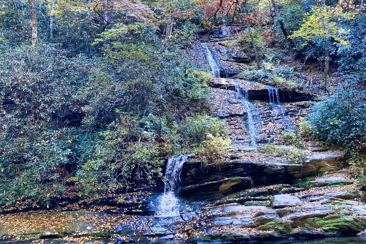
14. Baskin Creek Falls Trail
 Baskin Creek Falls Trail – Great Smoky Mountains National Park Best Hikes
Difficulty: Moderate
Length: 3.1 mi
Elevation gain: 912 ft
Route type: Out & back
Hiking, Forest, River, Views, Waterfall, Wildflowers, Wildlife, Rocky, No dogs
Description:
The 40-foot, two-tiered Baskins Creek Falls are the ideal location for a picnic in the middle of the day. The walk to the falls has a short ascent and a long drop. If there are two trailheads, take care to enter and exit from the same trailhead unless you intend to hike in separate groups.
Give yourself enough time to get back up from the falls. One of the best kept secrets in the Great Smoky Mountains, this hike is stunning and isolated even in the height of summer.
Baskins Creek Falls is still “off the beaten path” in comparison to the more well-known waterfall hikes in the park (such Abraham Falls and Grotto Falls), making it a great option if you’re trying to avoid the crowds. Just be mindful of the steep incline on the way back from the falls!
On the one-way Roaring Fork Motor Nature Trail loop, you’ll find the main trailhead for Baskins Creek Falls. (This loop may be closed in the winter. However, Cherokee Orchard Road is a short stroll away.) After parking at the Baskins Creek trailhead, get ready for a brief ascent and then a protracted descent to the falls.
Directions to Trailhead:
The hike to Baskins Creek Falls in the Great Smoky Mountains begins from the Baskins Creek Trailhead just outside of Gatlinburg. Starting from Light 8 in Gatlinburg, turn onto Historic Nature Trail / Airport Road. After driving 0.7 miles veer right onto Cherokee Orchard Road, upon which you’ll enter into Great Smoky Mountain National Park.
After driving another 2.2 miles you’ll enter the one-way Cherokee Orchard Loop. Drive 0.9 miles on this loop before turning right onto the Roaring Fork Motor Nature Trail. The trailhead for the falls will be on your left after driving roughly 0.2 miles on this one-way loop road.
Review:
Hiked it twice in a week and made my best hikes in Smoky Mountain National Park list. The best option is to park in the second Rainbow Falls parking lot and cross across to Baskins Creek using the Trillum Gap route. Gorgeous views of the falls, Gatlinburg, and mountains. Evidence of the 2016 flames. It’s mostly downhill on the way in, making the return trip harder.
On Friday, we started around 9:30 am and had the falls to ourselves. On the way back, we passed a lot of people, though. We went at a leisurely pace and finished in 3 hours.
15. Huskey Branch Falls Trail
 Huskey Branch Falls Trail – Best Hikes In Smoky Mountain National Park
Difficulty: Moderate
Length: 4.7 mi
Elevation gain: 383 ft
Route type: Out & back
Kid friendly, Hiking, Forest, River, Views, Waterfall, Wildflowers, Wildlife, Historic site, No dogs
Description:
From Newfound Gap Road, the Huskey Gap Trail ascends to the pass that bears its name on Sugarland Mountain. It’s a great place to spend some time away from the traffic and working in a highland ramble only a short distance from the Sugarlands Visitor Center.
The Huskey Gap Trail will be highlighted in its out-and-back configuration, which uses Huskey Gap as the trail’s turnaround. In reality, the Huskey Gap Trail continues for a few more miles below the pass, descending a slope to connect with the Little River Trail. This best hikes in Smoky Mountain National Park is a 4.2-mile round-trip route involves some 1,270 feet of total elevation gain, rewards include some mountain views, potential homestead locations, and (depending on the season) an abundance of wildflowers.
Directions to Trailhead:
From the Sugarlands Visitor Center near Gatlinburg, drive 1.6 miles south along Newfound Gap Road to reach the Huskey Gap Trailhead. The parking lot for the Huskey Gap Trail will be on your left, while the trailhead is located across the street. The parking lot has room for only 6 vehicles.
Review:
A lovely trail that is well-marked and simple to follow follows a pleasant creek with easy access to the water. I’d classify this as being more easy than moderate. Good trek for little children. It was strange to see so many dogs on this walk. I didn’t find it bothersome, but if you do, note it. This path must be renowned for its tolerance of the restriction. I’m glad I went on this hike, but I doubt I’ll need to do it again. but worth the journey.
16. Courthouse Rock Trail
 Courthouse Rock Trail – Hiking Smoky Mountain National Park
Difficulty: Moderate
Length: 2.3 mi
Elevation gain: 738 ft
Route type: Out & back
Kid friendly, Hiking, Forest, River, Views, Waterfall, Wildflowers, Wildlife, Rocky, No dogs
Description:
Hiking is one of the most well-liked pastimes in the Smoky Mountains! The majority of hikers go for the well-used trails, while other hikers who do it for recreation prefer to find less traveled paths. There are many routes to select from, but we’d like to introduce you to the Courthouse Rock Trail, which is a well-kept hiking secret! Learn more about this undiscovered route in the Smoky Mountains by reading on.
The first thing you should know about this best hikes in Smoky Mountain National Park hidden gem is it is not on the official Great Smoky Mountains National Park map. Experienced hikers use the trail all year long even though it is not a designated trail and is not maintained by the park administration.
Only hikers who take all essential safety procedures and trek as a pastime should explore this trail because it is thought to be challenging.
Directions to Trailhead:
To find the trailhead for Courthouse Rock Trail, you should use exact GPS coordinates. This is how most people hike the trail and stay on the correct path. The trailhead is across the street from the small parking area the GPS coordinates take you to.
As you’re on the trail, there are several areas where you must cross creeks and come to junctions in the trail. At most of the junctions, you will find stacks of rocks called cairns that point you towards the correct path.
Review:
Fun “off the beaten path” walk; it was wonderful that it was less crowded. Just take care at the hike’s conclusion in the region with the three turnoffs. When we finally had service at the mountain’s crest and realized we had taken the incorrect turn, it was too late to turn back.
When you see three separate trails, take the middle one. The two lookouts near the start are lovely, but I never did see the courthouse rock.
17. Rhododendron Creek Trail
 Rhododendron Creek Trail – Best Trails in Smoky Mountains National Park
Difficulty: Moderate
Length: 6.9 mi
Elevation gain: 1,194 ft
Route type: Loop
Backpacking, Camping, Hiking, Forest, River, Views, Waterfall, Wildflowers, No dogs
Description:
This trail is no longer marked and maintained by the National Park Service, but is still a spectacular best hikes in Smoky Mountain National Park hidden gem in the Greenbrier area of the Great Smoky Mountains National Park.
I’ve climbed Rhododendron Creek several times over the years, but this hike was a little more significant. It had been some time since I had traveled the once-named Big Laurel Creek. Although I never had the chance to trek the trail, I learned that one of the parks favorite waterfalls was found there.
One of numerous falls along a mile and a half stretch of Rhododendron Creek is Mike’s Falls. Rhododendron Creek Falls is the only waypoint Rhododendron Creek Falls is identified in Tennessee Landforms, along with 13 cataracts that make up the stretch of falls and cascades.
Directions to Trailhead:
The best way to find this trail is the use the nearest landmark along Greenbrier Road. There is a part of the trail which is too narrow, and so only one vehicle can pass at a time. At this spot on the road there is a stop sign. Rhododendron Creek is just after this stop sign, and has a small parking area.
Review:
Pleasant 7-mile hike. Definitely not suitable for kids. Part of the track is a little washed out and can be challenging to follow, as another user pointed out. To avoid getting lost, you should download a map and pay attention to the position of the sun. Because it was fairly isolated, we liked it. We don’t like crowded pathways.
18. Laurel Falls Trail
 Laurel Falls Trail – Great Smoky Mountains National Park Trails
Difficulty: Easy
Length: 2.4 mi
Elevation gain: 396 ft
Route type: Out & back
Kid friendly, Hiking, Walking, Forest, Paved, River, Views, Waterfall, Wildlife, No dogs
Description:
The Laurel Falls route leads to an 80-foot spectacular cascade and is named for the mountain-laurel (flowering shrub) that grows abundantly in this region of the Great Smoky Mountains National Park. This best hikes in Smoky Mountain National Park takes you to a beautiful place to visit.
The longest of the four paved pathways in the national park, this one is 2.6 miles long. The hike’s elevation increase is a moderate 314 feet, or a simple 273 feet per mile. The Laurel Falls Trail was initially constructed in the 1930s as a fire crew access trail in case a fire broke out in the Cove Mountain region.
It is still a popular trail in the park today and is considered a moderate hiking track. It takes roughly two hours to get from the trailhead to the waterfall and back, or a little more if you take extra time to take pictures and soak in the beautiful scenery.
Directions to Trailhead:
The hike to Laurel Falls in the Great Smoky Mountains begins from Fighting Creek Gap on Little River Road, located 3.8 miles west of the Sugarlands Visitor Center near Gatlinburg. The main parking lot for Laurel Falls will be on your right, with additional parking across the street.
From the Townsend “Y” intersection near Cades Cove, the Laurel Falls is 13.7 miles away.
Review:
A Smokies hike that is “must do.” Be there early. When we got there at 7:25 a.m., there weren’t many people in the parking lot. Left at 7:40 a.m. for a tranquil hike, but encountered several people on the way back. Right now, the colors are just stunning. At 8:45, the parking lot was filled.
19. Gatlinburg Trail
 Gatlinburg Trail – Great Smoky Mountains National Park Best Hikes
Difficulty: Easy
Length: 3.9 mi
Elevation gain: 164 ft
Route type: Out & back
Dogs on leash, Wheelchair friendly, Kid friendly, Stroller friendly, Hiking, Mountain biking, Walking, Running, Forest, Partially paved, River, Views, Waterfall, Wildflowers, Wildlife
Description:
The Gatlinburg Trail is a well-liked hiking route that connects Gatlinburg with the Great Smoky Mountains National Park. It is appropriate for hikers of all ages and experience levels, and it allows bicycles and pets. To learn more about what makes this trail special, continue reading.
The Great Smoky Mountains National Park’s hiking and walking routes are brimming with breathtaking views of everything from rolling peaks to lush woods and clear mountain streams. The West Prong of the Little Pigeon River forms the path of the Gatlinburg Trail, which is similarly a rather level trail.
You’ll be able to admire the river’s beauty as it meanders through a wooded area, and in the warmer months, you might even see some unique wildflowers along the trail and have a chance to dip your toes in some cool mountain water.
Directions to Trailhead:
The hike along the Gatlinburg Trail in the Great Smoky Mountains begins from either Gatlinburg or the Sugarlands Visitor Center. This hike description follows the trail for those wishing to start their hike in Gatlinburg. This trailhead is located near Light 10 at the edge of town, on the border of the national park.
There are a couple of small parking areas along River Road that offer free parking. There’s also a large paid parking lot near the corner of US 441 and Ski Mountain Road. If you prefer, you can also begin your hike from the Sugarlands Visitor Center, and then use this guide in reverse.
Review:
One of the best hikes in Smoky Mountain National Park it is easy, beautiful, generally clean/clear walking paths, surrounded by golden & red fall colors along a pretty good size creek. Our small white dog, Peanut, behaved great on the out-and-back trail when we brought him along.
I would not really call it a legitimate hike, but it was an easy wonderful, stunning, gorgeously fall-colored wooded/nature walk. A very beautiful, simple trail stroll to experience Gatlinburg. Not a trek up a mountain. Fantastic for what it is.
20. Cataract Falls Trail
 Cataract Falls Trail – Best Hikes In Smoky Mountain National Park
Difficulty: Easy
Length: 1.1 mi
Elevation gain: 29 ft
Route type: Out & back
Kid friendly, Hiking, Walking, Forest, Partially paved, River, Views, Waterfall, Wildflowers, Wildlife, No dogs
Description:
The trail to Cataract Falls is one of the best hikes in Smoky Mountain National Park and one of its best-kept secrets. This trail is only 3/4 mile (roundtrip) and is accessible to families with young children. It is located less than 10 minutes from the center of Gatlinburg.
When viewed from the parking area, the trailhead is immediately to the left of the visitor center. It begins as a paved path but soon changes to gravel. Fighting Creek’s peaceful flow, the surrounding area’s lush greenery, and the lovely tree canopy overhead are sure to please you and your company.
The crowds will seem worlds away despite the path being less than two miles from downtown Gatlinburg.
Directions to Trailhead:
The trailhead, which is directly to the left of the visitor center (looking at it from the parking area), starts off paved but quickly turns to gravel. You and your group are sure to enjoy the calmly flowing Fighting Creek, dense vegetation, and the beautiful canopy of trees overhead. Even though the trail is less than two miles from downtown Gatlinburg, the crowds will seem a million miles away!
Review:
We had a pleasant, simple hike here. (Group of over 60.) Beware of tree roots. My granddaughter and I would have gone on this hike together. For her, that would have been ideal. In comparison to the trip to Laurel Falls, this hike is significantly safer for families with young children. I wouldn’t bring small kids to Laurel Falls.
21. Cades Cove Loop Road
 Cades Cove Loop Road – Hiking Smoky Mountain National Park
Difficulty: Easy
Length: 10.5 mi
Elevation gain: 734 ft
Route type: Loop
Wheelchair friendly, Kid friendly, Stroller friendly, Camping, Road biking, Scenic driving, Walking, Bird watching, Running, Forest, Paved, River, Views, Wildflowers, Wildlife, Historic site, No dogs
Description:
This is a hike, you can do it by bike but made our list of Great Smoky Mountains National Park best hikes simply because there is so much to see and do there plus the great wildlife to see.
Watch out for all the park’s wildlife on your trip to Cade’s Cove. With such a wide variety of creatures, including raccoons, white-tailed deer, and black bears, you are certain to see one. Always keep in mind that getting too close to animals can harm their surroundings and jeopardize your safety.
Driving leisurely along the Cades Cove Loop Road is the best way to really appreciate the splendor Cade’s Cove offers. The Great Smoky Mountains National Park is traversed by an 11-mile paved, one-way road that provides picturesque views of the mountain peaks, wildflower meadows, and rolling greens. You can drive the complete loop in two to four hours, but you’ll wish it would never end.
Directions to Trailhead:
Keep in mind: there is only one driving entrance into the Cades Cove Loop, from Laurel Creek Road. Although you may see many online maps that may appear to show multiple entrances, this is the only one leading directly into the Loop.
Review:
The autumnal hues were breathtaking! Use the pullouts to look about and take pictures because the traffic was terrible. Deer are abundant in the fields. Trail to Abrams Falls was great. The trailhead at Abrams Falls has restrooms.
We saw a Bear, Turkey, and Deer! We biked the trail, it was great! A great way to experience the park. I felt safe with my kids, there were park rangers often, and riding the trails too. We enjoyed it a lot.
22. Oconaluftee River Trail
 Oconaluftee River Trail – Best Trails in Smoky Mountains National Park
Difficulty: Easy
Length: 3.1 mi
Elevation gain: 52 ft
Route type: Out & back
Dogs on leash, Wheelchair friendly, Kid friendly, Stroller friendly, Hiking, Road biking, Walking, Running, Forest, Partially paved, River, Views, Wildflowers, Wildlife
Description:
The Great Smoky Mountains National Park best hikes trail along the Oconaluftee River lets you stroll from the Oconaluftee Visitor Center southeast to the edge of Cherokee, North Carolina. You travel in close proximity to the Great Oconaluftee (not to mention US 441). Of course, you can begin at either end, but we’ll talk about it from north to south.
Spend some time visiting the Mountain Farm Museum, which is located at the Oconaluftee trailhead. Vintage wooden homesteader buildings, including an applehouse, a blacksmith shop, and the John E. Davis House, a cabin made of local chestnut wood that previously located along Indian Creek near Bryson City, have been painstakingly brought to this location by the Park Service.
Museum exhibits and living-history demonstrations here fill you in on local history.
Directions to Trailhead:
The hike along the Oconaluftee River Trail in the Great Smoky Mountains begins just behind the Oconaluftee Visitor Center, located roughly 2 miles north of Cherokee, North Carolina on Newfound Gap Road (U.S. 441).
Review:
It was a short hike alongside a lovely river. Really nice, and it was great to bring our greyhound. The trail was heavily populated and fairly near a highway. Other than that, we thought it was fun! Even though it was beautiful, this was more of a walk than a hike. The restrooms in the visitor center were spotless.
23. Metcalf Bottoms Trail
 Metcalf Bottoms Trail – Great Smoky Mountains National Park Trails
Difficulty: Easy
Length: 1.5 mi
Elevation gain: 187 ft
Route type: Out & back
Kid friendly, Hiking, Walking, Running, Forest, Wildflowers, Wildlife, No dogs
Description:
The Metcalf Bottoms Trail surface is a typical Great Smoky Mountains National Park best hikes mountain trail, packed dirt with occasional roots and rocks. Just over half a mile is required to hike to the Little Greenbrier Schoolhouse. You can get there in 15 or 20 minutes, depending on how quickly you walk. We utilized each minute, possibly a few more.
We debated whether to label this path as “moderate,” but we ultimately decided against it. The trail is relatively straightforward in the beginning, but just before the schoolhouse, a part demands a little more work. Anyone who isn’t used to exercising might need to stop twice or even three times to collect their breath. Although this route is only a half-mile long, it does have a slight elevation change over a short distance.
Directions to Trailhead:
The trailhead for Metcalf Bottoms Trail is located on Wear Cove Gap Road just off Little River Road. From the Sugarlands Visitor Center turn onto Fighting Creek Gap Road and drive about 9.7 miles to Wear Cove Gap Road.
Turn right and park at one of the Metcalf Bottoms Picnic Areas. The trailhead is located on the other side of the wooden bridge on the right.
Review:
5 youngsters, ages 4 to 12, on a simple small train. I liked that the schoolhouse provided a unique destination for the walk. At the trailhead, there are restrooms, enough parking, picnic tables, and a lovely brook. This is a great, simple trail that begins at a lovely picnic area by the creek where children can run around. Our four young children, who went with us, comfortably completed the hike. The school was intriguing to us as well.
24. Twin Creeks Trail
 Twin Creeks Trail – Great Smoky Mountains National Park Best Hikes
Difficulty: Easy
Length: 4.5 mi
Elevation gain: 790 ft
Route type: Out & back
Kid friendly, Hiking, Walking, Running, Forest, River, Views, Wildflowers, Wildlife, No dogs
Description:
All things considered, the Twin Creeks Trail is a lower-tier hiking choice in the Great Smoky Mountains National Park because it lacks the park’s other standout features, such as waterfalls, old-growth cove forest, and breathtaking mountain views.
However, considering its proximity to Gatlinburg and relative shortness, it might be a sensible option for individuals with limited time and for those traveling with children, provided that the latter can withstand the mild harshness of the route (in the form of creek crossings, overgrowth, and frequent deadfall, not hard grades). And it’s not like there isn’t any natural beauty here—this is the Smoky Mountain region, after all!
Directions to Trailhead:
The trailhead is very hard to find. The lettering on the signs is hard to read. The trailhead is right before the gates on the right and the closest parking has room for only one car. This area has been heavily damaged by the fires and downed trees are everywhere.
Review:
We did this one of the Great Smoky Mountains National Park best hikes in two trips. The first was shortened because of the weather and the tedious terrain. The beginning, prior to the loop, is just awful. There is nothing exciting; it is all uphill. Although you cannot see the creek, you can hear the passing vehicles. after saying that. The “loop” portion is the most thrilling. Park at the home of Ben Ogle.
25. Juney Whank Falls Trail
 Juney Whank Falls Trail – Best Hikes In Smoky Mountain National Park
Difficulty: Easy
Length: 0.6 mi
Elevation gain: 170 ft
Route type: Loop
Kid friendly, Hiking, Horseback riding, Walking, Forest, River, Views, Waterfall, Wildflowers, Wildlife, No dogs
Description:
Only a quarter of a mile separates the parking area from Juney Whank Falls. The 194-foot ascent to the viewing location is very steep, while being a short trip. The footbridge that the walk leads to offers a close-up view of the falls. Just beyond the footbridge, the 80-foot cascade starts to descend; it then passes beneath it and ultimately empties into Deep Creek at the trail’s terminus.
More than likely, Junaluska “Juney” Whank, a man who is reported to be buried nearby, gave the stream and the falls their names. Some individuals, meanwhile, think Juney Whank is a Cherokee expression that means “where the bear passes.” Because it is so accessible, this one is among the best hikes in the Great Smoky Mountains National Park.
There are a few choices available to those interested in doing further hiking while in the Deep Creek region. The parking lot where the Juney Whank Falls Trail begins also serves as the starting point for the short, simple hikes to Toms Branch Falls and Indian Creek Falls. The same trail can be followed further by hikers to make a loop that passes by all three of the nearby waterfalls.
Directions to Trailhead:
The Juney Whank Falls Trailhead is located just north of Bryson City in North Carolina. To reach the trailhead from the intersection of Rt. 441 and Rt. 19 in Cherokee, drive 10 miles south on Route 19 to Everett Street in Bryson City. Turn right onto Everett and drive for 0.2 miles, and then turn right onto Depot Street.
After a short distance turn left onto Ramseur Street, and then make an immediate right onto Deep Creek Road. Drive another 2.3 miles to the Great Smoky Mountains National Park entrance, and then from there another half-mile to the parking lot for the Deep Creek Trailhead.
Review:
One of best hikes in Smoky Mountain National Park, nice little waterfall. Took our 2 year old, and he was able to walk a lot of it. At the end of the loop we stopped in the river and let our 2 year old play in the water. We only saw one other person, but we started at 8:30, before the rain started, when we left at 9:30 there were a lot more cars in the parking lot.
You May Want to Join Our Boondocking Group on Facebook For More Information
You May Want to Join Our Campfire Recipes Group on Facebook For More Information