

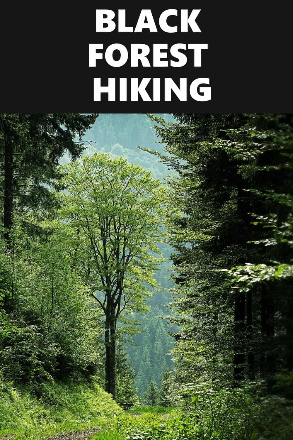
Schwarzwald is regarded as one of Germany’s most beautiful hiking areas in the Black Forest. On every Black Forest hiking trail you’ll be fascinated by spectacular panoramas, deep-blue alpine lakes, and deep valleys. The first leg of our favorite Black Forest hike takes you from Titisee to the Feldberg, the highest peak in the Schwarzwald. Then you go to Todtnauberg, a ski resort, and then to Bernau, a lovely valley. The lake Schluchsee, the tour’s final feature, is reached by small Black Forest trails. You ramble around its banks till you reach the final halt, a peak with a breathtaking view over Schwarzwald’s gentle valleys.
A Few Black Forest Hiking Legends
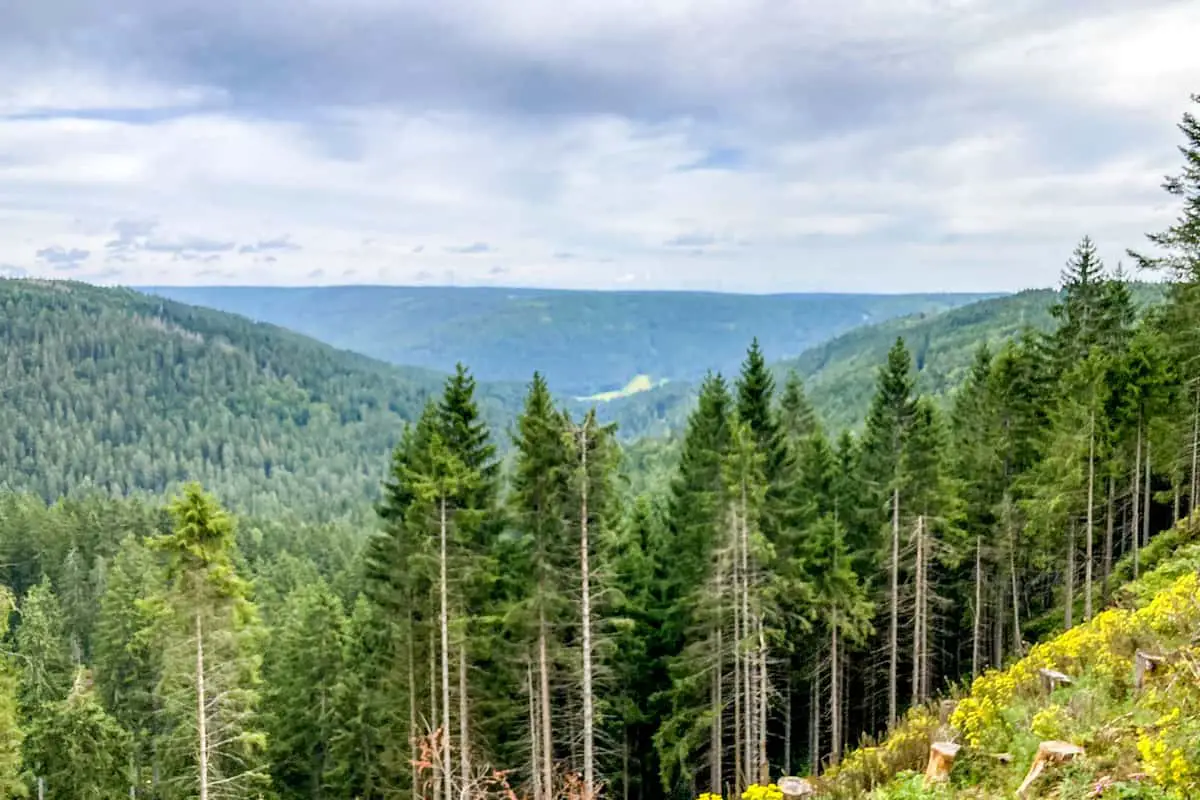
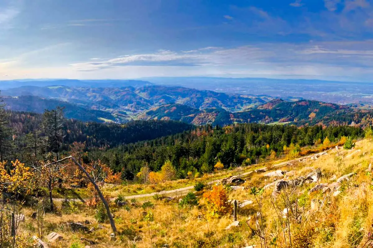
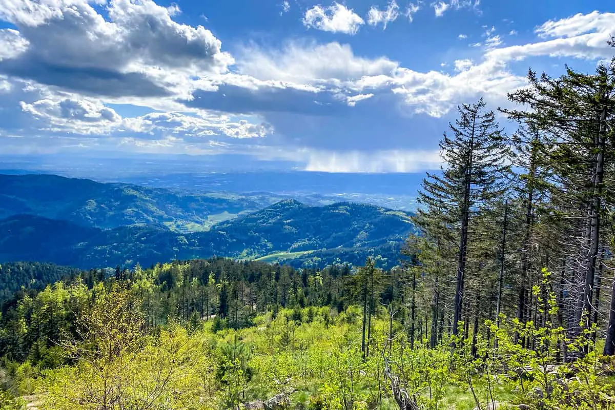
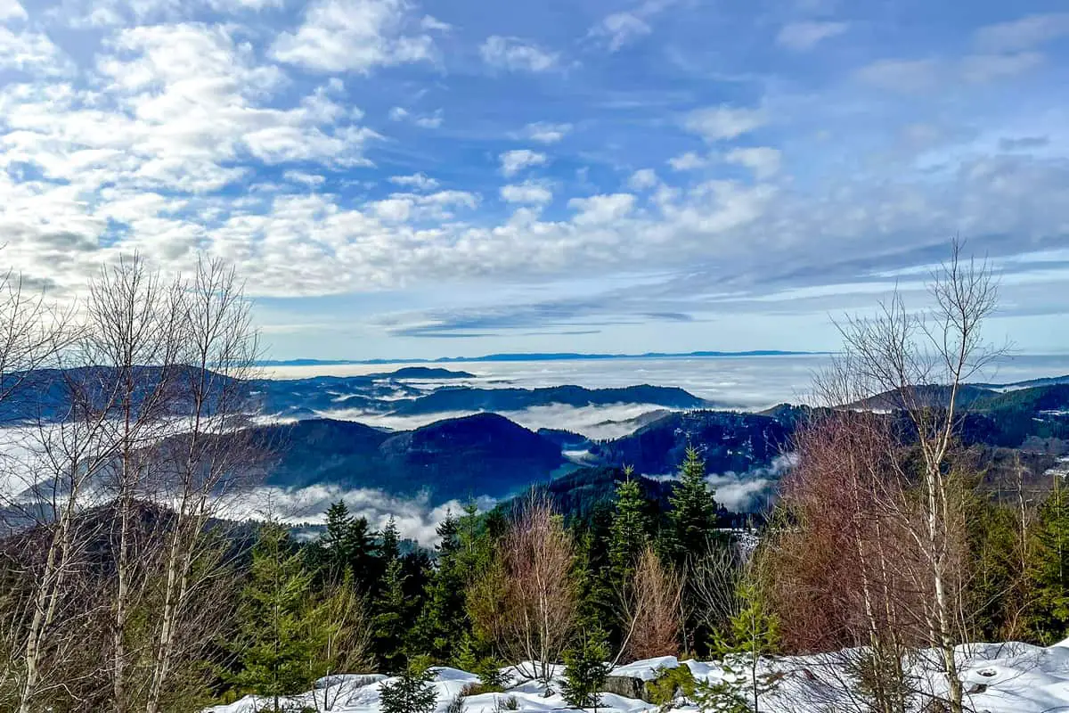
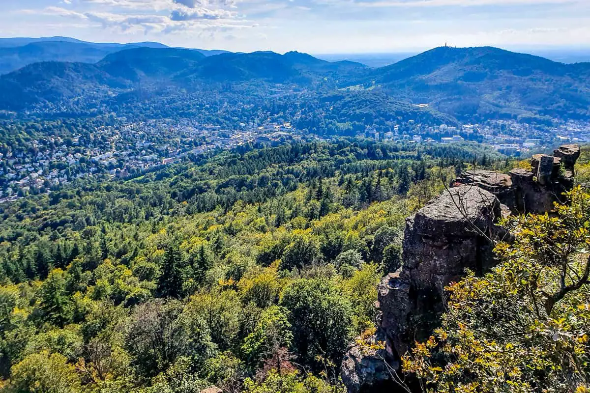
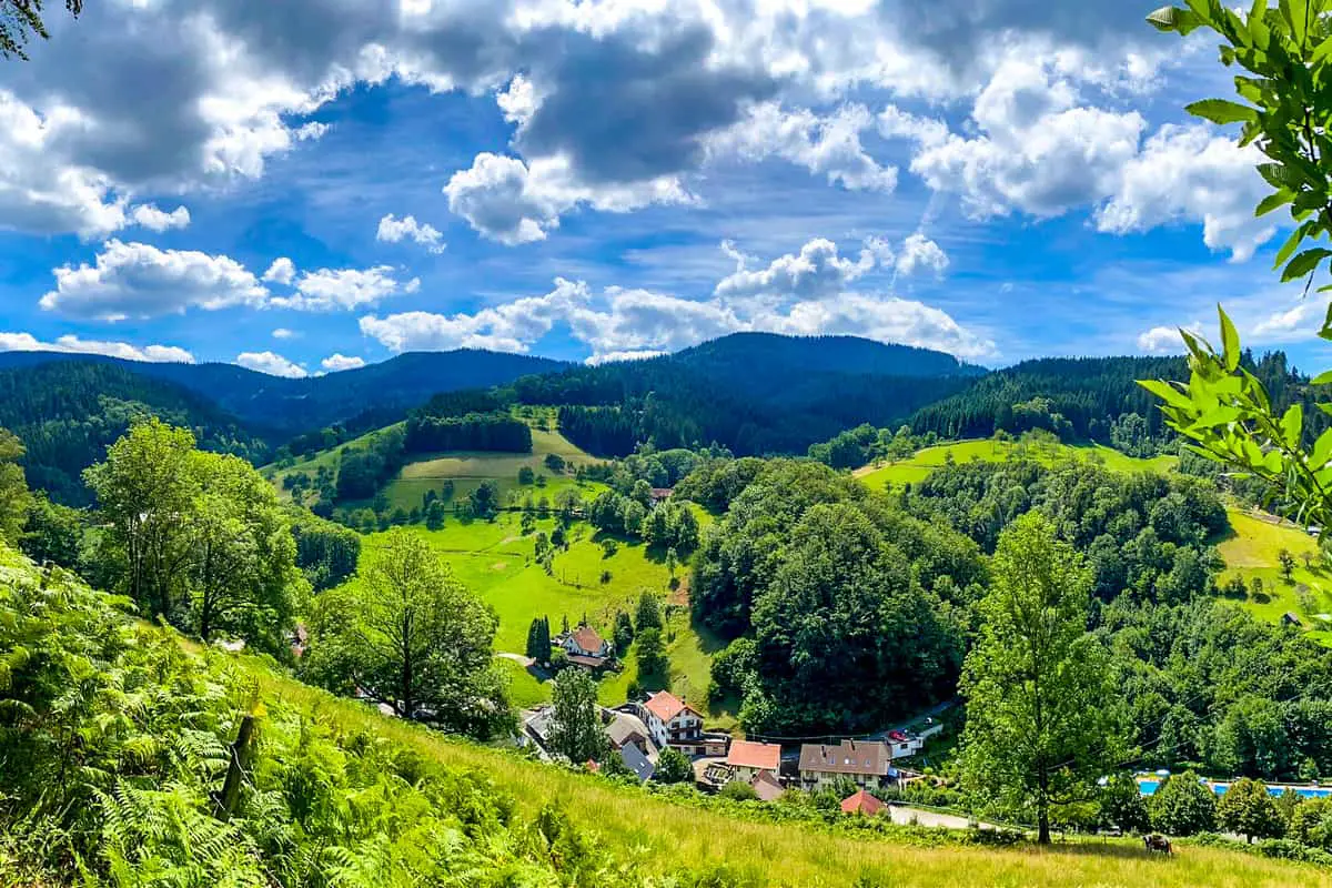
The thick, dark, forested hills of the Black Forest are eternally enchanting, dripping with legends of monsters and witches. Walks in the Black Forest transport you to the mystical heart of this picturesque, fairy-tale region, where trails wind their way through a majestic panorama of high hills, evocative lakes, and gorgeous woodland.
Traditional medieval towns and villages provide as wonderful starting points for your explorations. Stride out into ancient walkways under the gloomy, evergreen canopy to the sound of the cuckoo clock in an iconic half-timbered guesthouse. The captivating white wonderland will entice you onwards in the summer, while the shadow will entice you onwards in the winter.
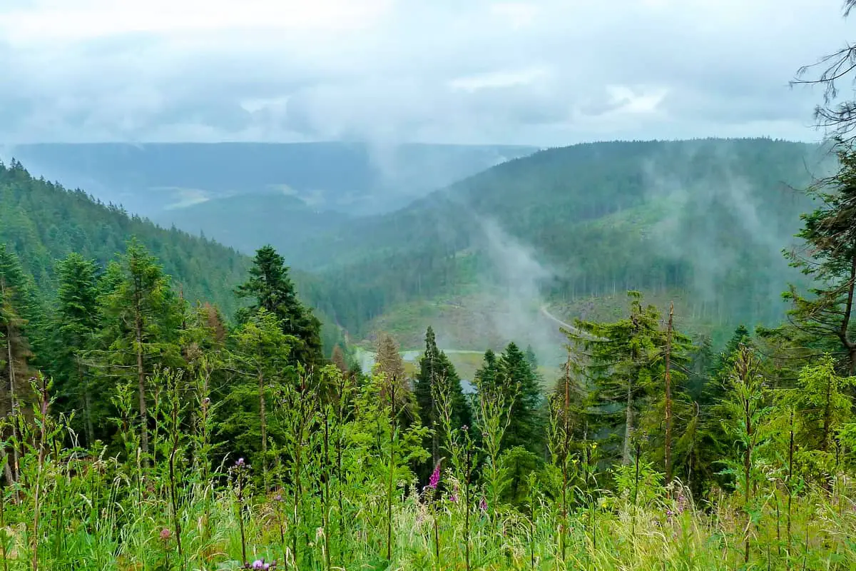
Deep, overgrown gorges, majestic, flowing waterfalls, and breathtaking vistas of the Rhine Valley and distant Alps await you. Hikes in the Black Forest lead to incredibly spectacular and unforgettable locations. It’s a hiker’s paradise, and you’d be a fool to pass it up.
The Black Forest Hiking Culture
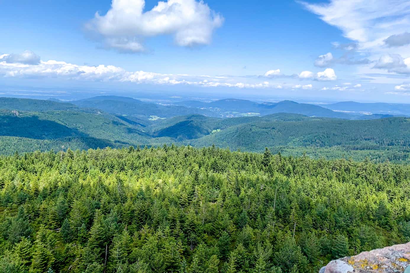
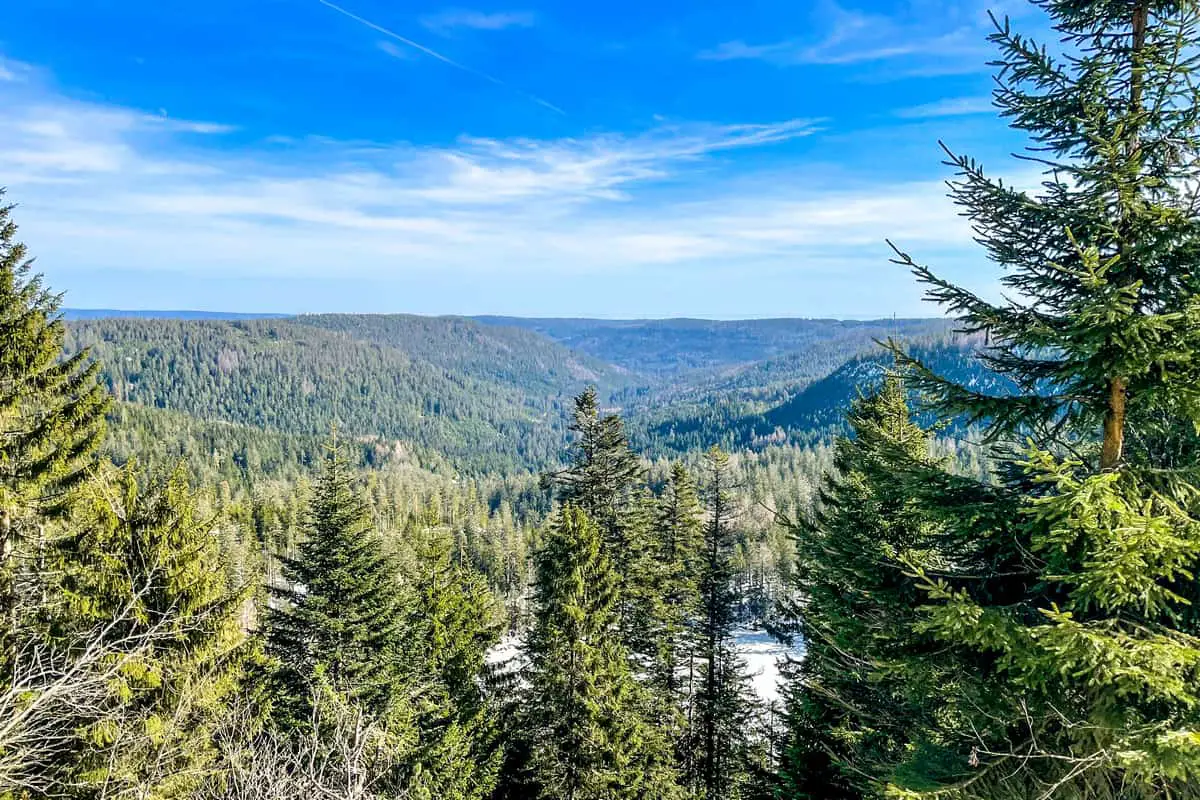
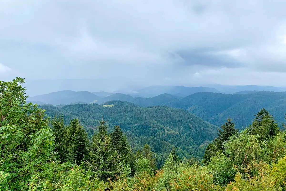
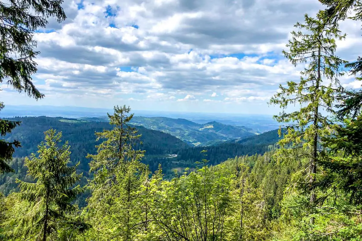
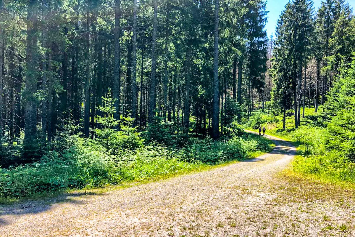
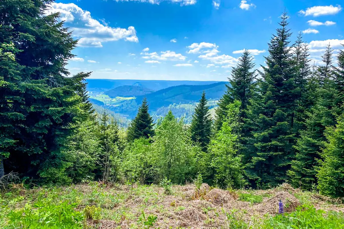
The Black Woodland is a feast for the senses, with breathtaking views, fresh forest air, babbling brooks, and delicious food. The unspoiled beauty of Germany’s greatest low mountain range is crisscrossed by a variety of hiking trails and roads. Hiking through lush forests to sunny vista spots or walking along narrow rivers through mysterious gorges are both options. You may cool yourself in a crystal-clear lake while taking in the panoramic vistas of craggy peaks all the way to the Alps. For good reason, the Black Forest is known across Germany and beyond for its surreal environment.
We’ve included 30 Black Forest path options in this collection, all of which have been certified as quality hiking trails. You hike along soft, natural routes away from the traffic. The beautiful scenery isn’t the only thing to look forward to here. Traditional inns, charming cafes, little farm shops, and ‘Schnapsbrünnele’ across the Black Forest serve delicious gastronomic delights. Hike across beautiful landscapes to cultural attractions such as spectacular castle ruins, well-known health spas, and flower-filled half-timbered villages.
The majority of the Genießerpfade is designed in a circular pattern. If not, public transportation is an easy way to get back to your starting place. Each of the 46 walks is well-marked and varies in length and difficulty, so you’ll have no trouble finding your own favorite.
More and more people are visiting the Black Forest to explore and enjoy its stunning natural beauty – whether on foot, by bike, or by mountain bike. However, we are merely visitors in the Black Forest as humans. Our hosts are the animals and plants. Only by having #respectfornature among nature enthusiasts will we be able to maintain the Black Forest’s splendor for future generations.
The Black Forest’s appeal to English-speaking tourists is mostly concentrated on the coach tour segment, with trips focusing on seeing traditional farmhouses, observing a cuckoo clock being produced, and sampling Black Forest gateau along the way. This is all well and good, but it fails to capture the actual essence of the Black Forest.
The location attracts visitors from all around Europe because of the area’s well-known hiking opportunities. It is also historically significant for Germans as the birthplace of long-distance hiking paths and the local outdoor organization, the Black Forest Club, which was founded a few years before the German Alpine Club.
check out our video
10 Simple Black Forest Trails for Families With Children
Easy Black Forest Trail Map #1. Herrenwiesersee, Badener Höhe und Seekopf Rundweg
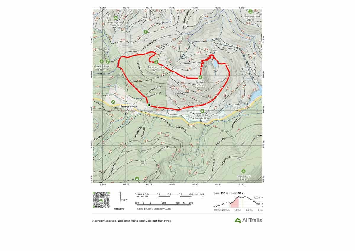
A popular and varied hike in Baden-Black Württemberg’s Black Forest National Park. The Black Forest High Road runs through the center of the Black Forest National Park on this route. The tour leads to the Herrenwieser See natural reserve via dense spruce forests and limited pathways to the Badener Höhe and the Seekopf summit at 1002 meters. You may get a great view of the Black Forest from here.
Highlights of this Black Forest Trail:
Length: 8.4 km
Elevation gain: 328 m
Route type: Loop
Easy Black Forest Trail Map #2. All Saints Waterfall
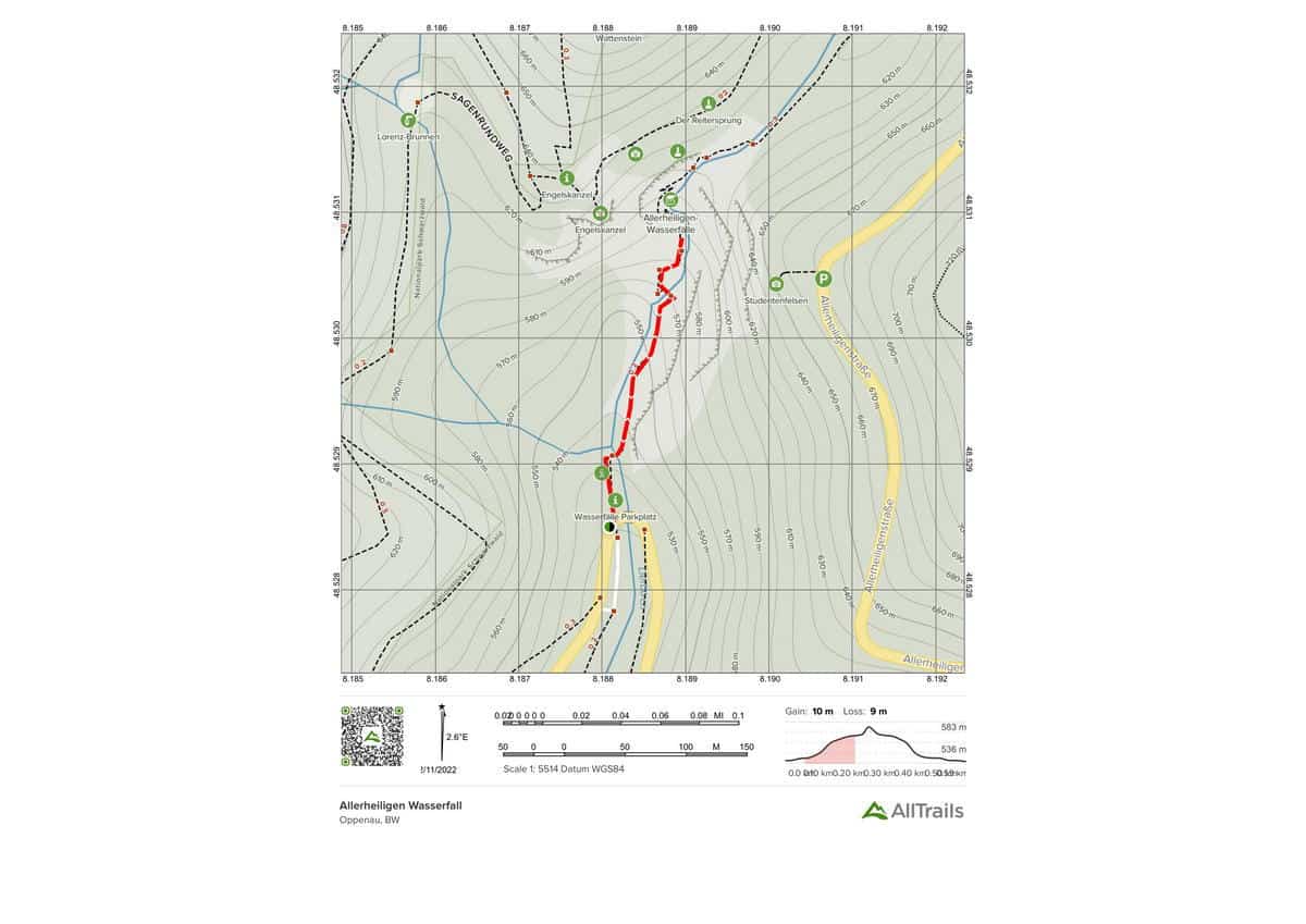
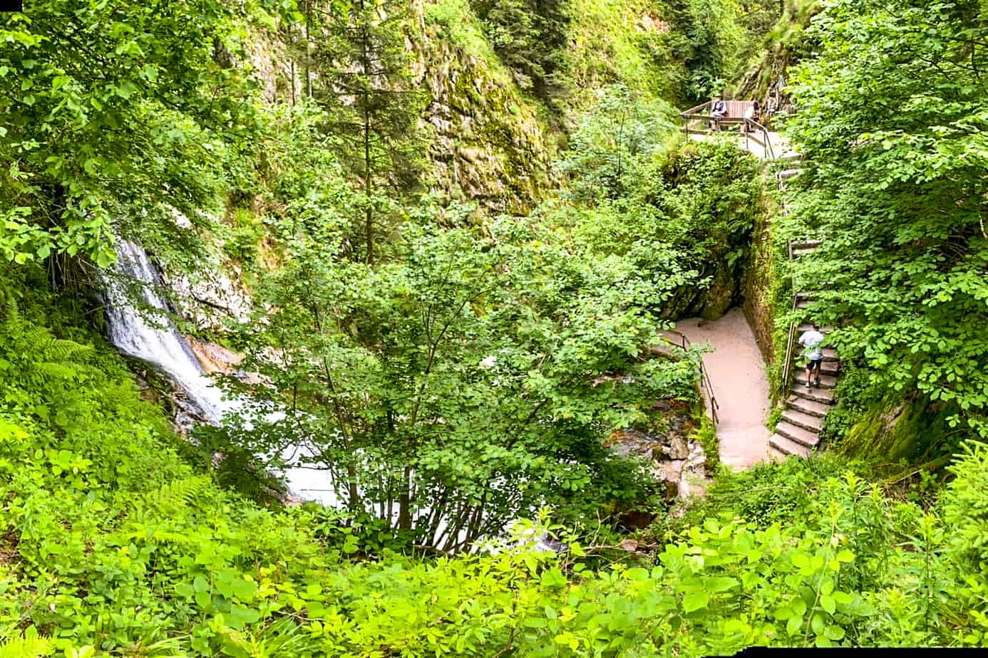
A varied and attractive circular climb in Baden-Black Württemberg’s Forest. The waterfalls in the Black Forest are among the most spectacular. Hike across the spectacular scenery on near-natural trails and footbridges, passing through gorges and impressive rock formations. The hike’s highlights include: – All Saints’ Waterfalls – All Saints’ Monastery
Highlights of this Black Forest Trail:
Length: 0.6 km
Elevation gain: 33 m
Route type: Out & back
Easy Black Forest Trail Map #3. Lotharpfad
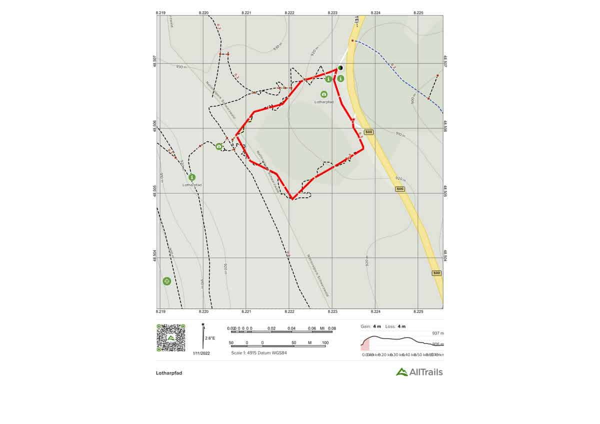
In Baden-Black Württemberg’s Forest, a short, popular tour is offered. The Lothar Trail is a thrilling adventure trail named after the hurricane “Lothar” that hit the area in 1999. On the Schliffkopf in the Black Woodland, a storm at the turn of the 2000 brought down significant tracts of forest. On a nearly 900-meter-long adventure route, visitors have been able to watch how nature heals and flourishes after such an occurrence. This walk has no entrance fee, but there is a donation box at the end. The following are some of the path’s highlights: – An unforgettable natural experience – Flora and fauna development
Highlights of this Black Forest Trail:
Length: 0.6 km
Elevation gain: 14 m
Route type: Loop
Easy Black Forest Trail Map #4. Ruhestein to Lake Wildsee
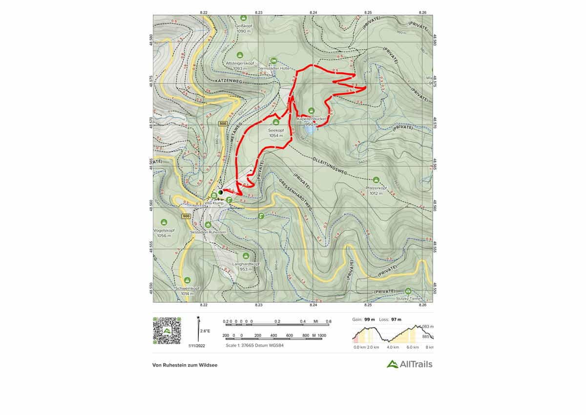
Beautiful, enchanting circular hike in Baden-Black Württemberg’s Forest. This wonderful circular trail is inspired by the Black Forest’s untamed and romantic idyll of the forest, and it always provides stunning views of the scenery. Hike from Ruhestein along natural woodland pathways along the Wildsee, around the church hump, and back to the starting point via Seekopf. The round’s highlights include: – A view of the Wildsee – A Black Forest idyll – Beautiful views
Highlights of this Black Forest Trail:
Length: 8.2 km
Elevation gain: 325 m
Route type: Loop
Easy Black Forest Trail Map #5. Panoramaweg Baden-Baden Stage 1
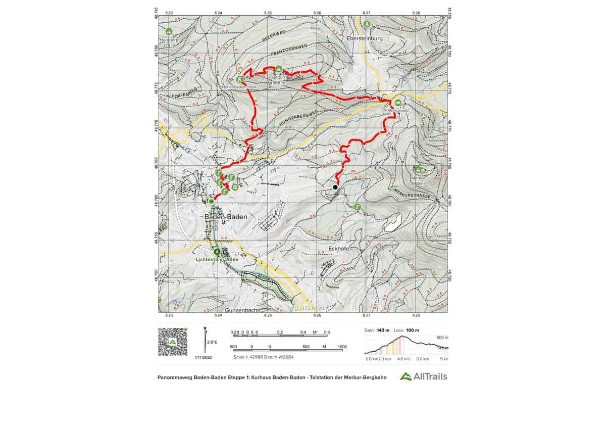
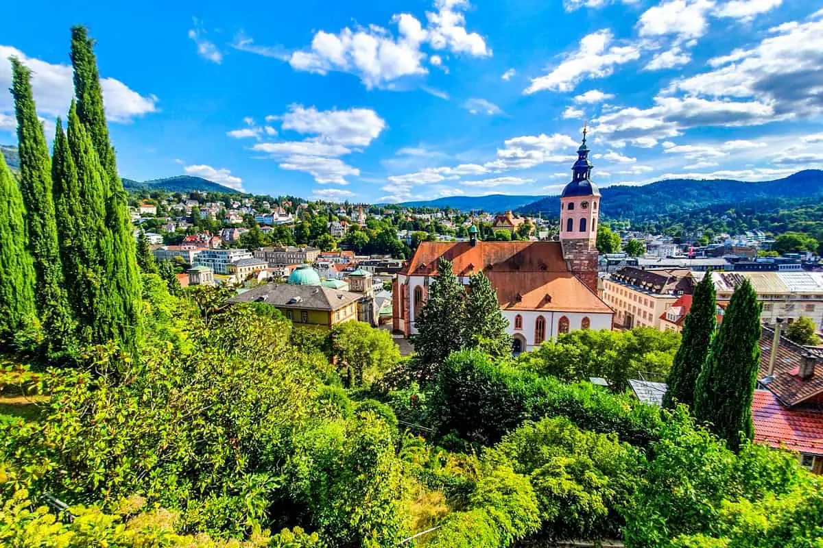
A section of Baden-premium Württemberg’s long-distance hiking trail “Panoramaweg Baden-Baden,” which is rich in culture and scenery. A hike with a variety of cultural and historical landmarks. It is possible to enter from any location, and the running direction can be chosen at will. The hike’s highlights include: – Kurhaus colonnades – Collegiate Church – New Castle Terrace – Baden-Baden Views – Battertfelsen – Ritterplatte – Castle Ruins of the Old Castle
Highlights of this Black Forest Trail:
Length: 8.9 km
Elevation gain: 469 m
Route type: Point to point
Easy Black Forest Trail Map #6. 1000 Meter Weg Schwarzwald

The 1000 Meter Weg Schwarzwald is a 6.3-kilometer point-to-point trail in Baiersbronn, Baden-Württemberg, Germany that features beautiful wildflowers and is suitable for hikers of all abilities. Hiking is the primary activity on the trail. The trail features Hiking, Forest, Views, Wildflowers, and beautiful panoramas.
Highlights of this Black Forest Trail:
Length: 6.3 km
Elevation gain: 170 m
Route type: Point to point
Easy Black Forest Trail Map #7. Luchspfad
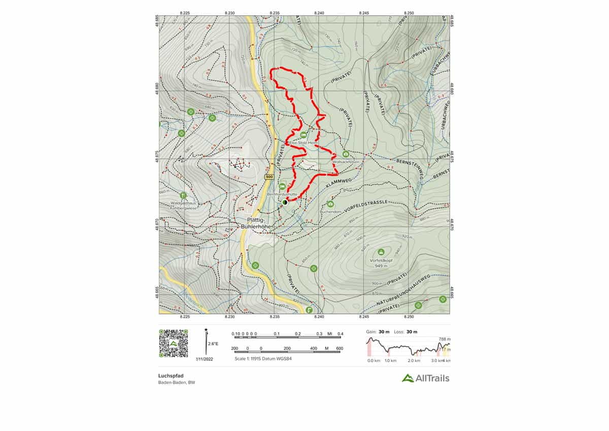
Luchspfad is a 3.5-kilometer lightly trafficked loop path with a river that is suitable for all ability levels and is located near Baden-Baden, Baden-Württemberg, Germany. Hiking is the primary activity on the trail.
Highlights of this Black Forest Trail:
Length: 3.5 km
Elevation gain: 97 m
Route type: Loop
Easy Black Forest Trail Map #8. Genießerpfad Wolfacher Schlossblick
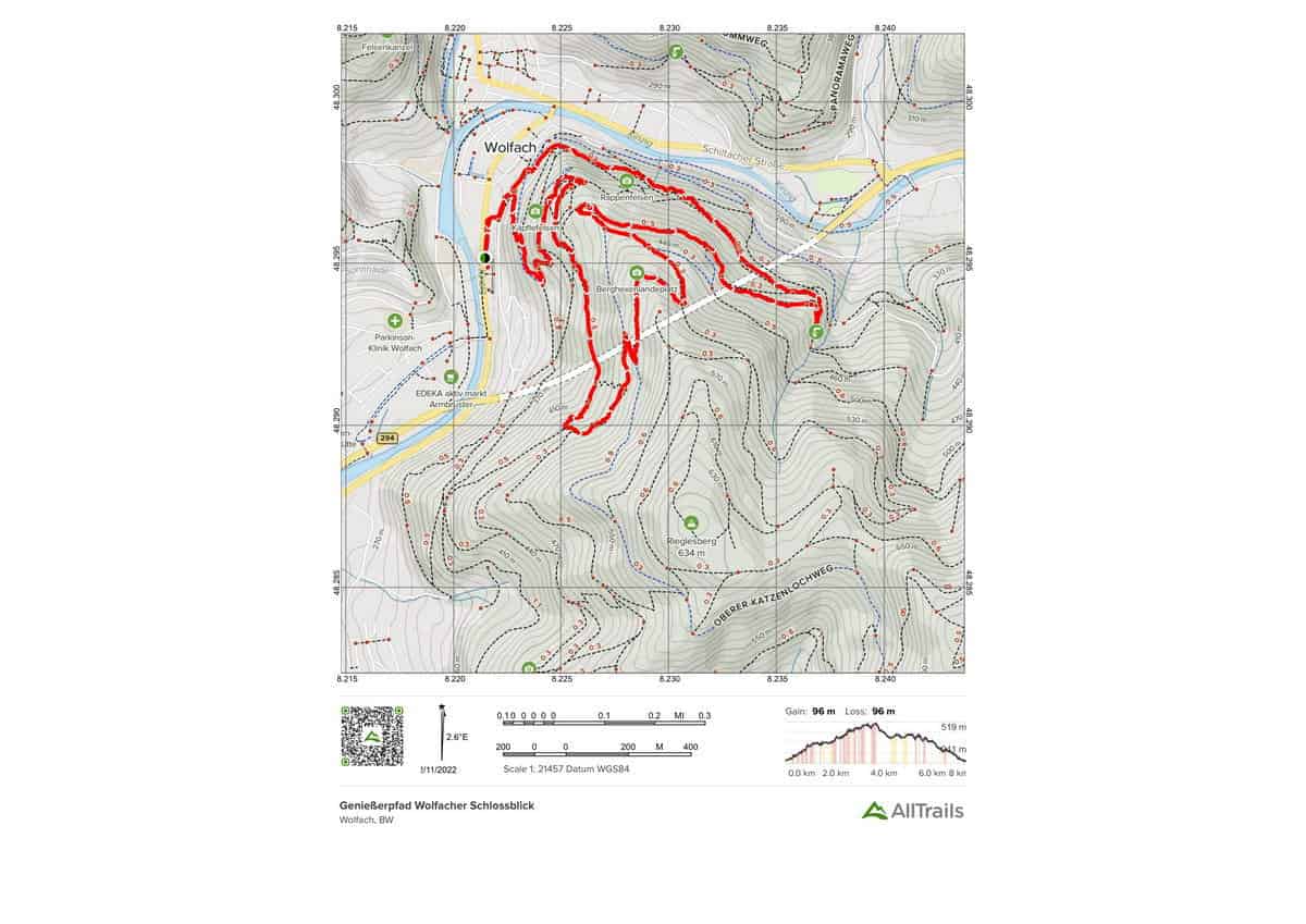
Genießerpfad Wolfacher Schlossblick is a 7.4-kilometer moderately trafficked circular path in Wolfach, Baden-Württemberg, Germany that offers a beautiful woodland backdrop and is suitable for hikers of all abilities. The trail is best used from March to December and is generally used for hiking. This trail is also suitable for dogs.
Beautiful views of Wolfach and the Wolftal from short steep climbs. The historic St. James pilgrimage chapel is a feature. As a premier path, it has been awarded the German Hiking Seal.
Highlights of this Black Forest Trail:
Length: 7.4 km
Elevation gain: 316 m
Route type: Loop
Easy Black Forest Trail Map #9. Seibelseckle – Brandwegle
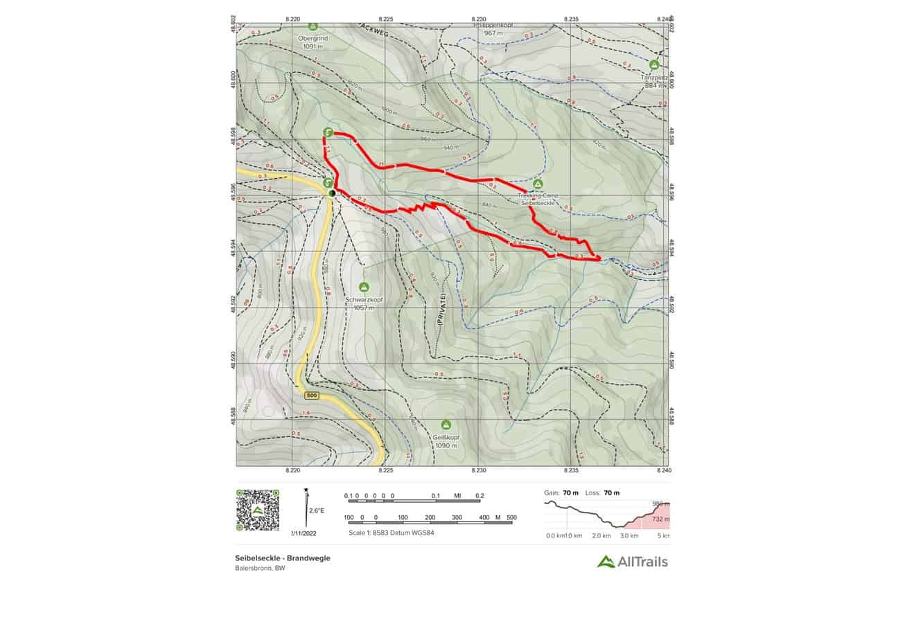
Seibelseckle – Brandwegle is a 4.5-kilometer circular trail in Baden-Württemberg, Germany, that contains lovely wildflowers and is suitable for hikers of all abilities. Hiking is the primary activity on the trail.
Highlights of this Black Forest Trail:
Length: 4.5 km
Elevation gain: 229 m
Route type: Loop
Easy Black Forest Trail Map #10. Rund um den Schliffkop
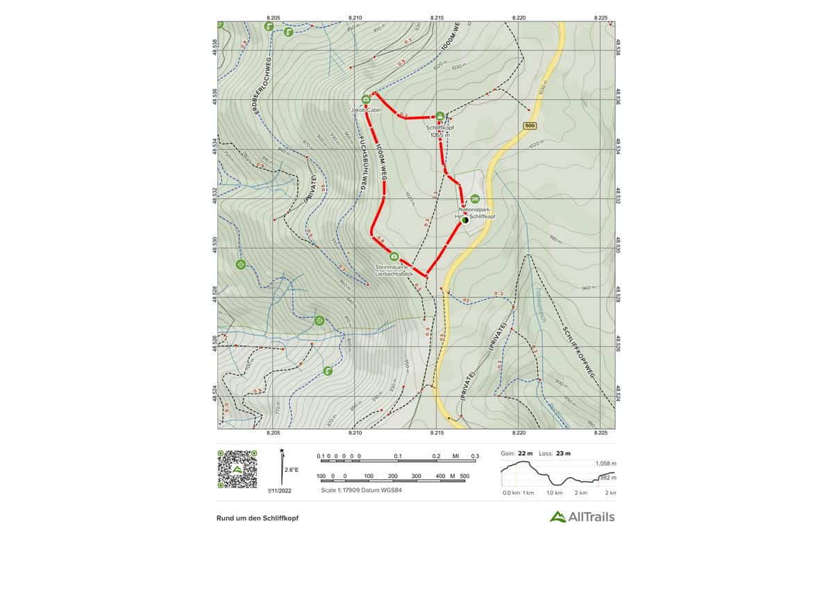
Rund um den Schliffkopf is a 2.1-kilometer lightly trafficked circular route in Baiersbronn, Baden-Württemberg, Germany that offers a beautiful forest backdrop and is suitable for hikers of all abilities. The trail is open all year and is largely utilized for walking and running.
Highlights of this Black Forest Trail:
Length: 2.1 km
Elevation gain: 73 m
Route type: Loop
10 Moderate Black Forest Trails
Moderate Black Forest Trail Map #1. Baden-Black Württemberg’s Forest
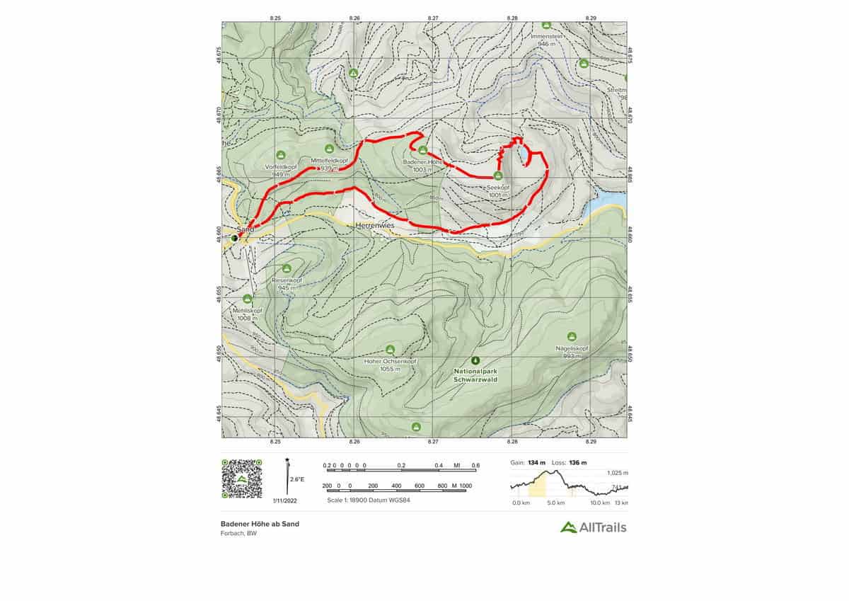
In Baden-Black Württemberg’s Forest, there is a scenic circular hiking track. This path passes through the Baden Alps. You will leave Sand and trek to the Seekopf from here. The vista Zweiseenblick is not far away. You get at the viewpoint “Blick zur Schwarzbachtalsperre” after circumnavigating the Herrenwieser See. The hike’s highlights include: – Schwarzbachtalsperre -views of the forest.
Highlights of this Black Forest Trail:
Length: 13.4 km
Elevation gain: 439 m
Route type: Loop

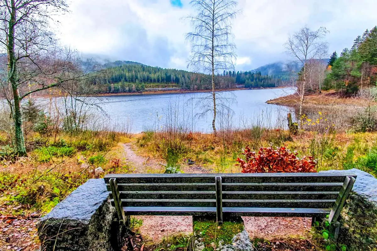
Moderate Black Forest Trail Map #2. Rund um die Schwarzenbachtalsperre
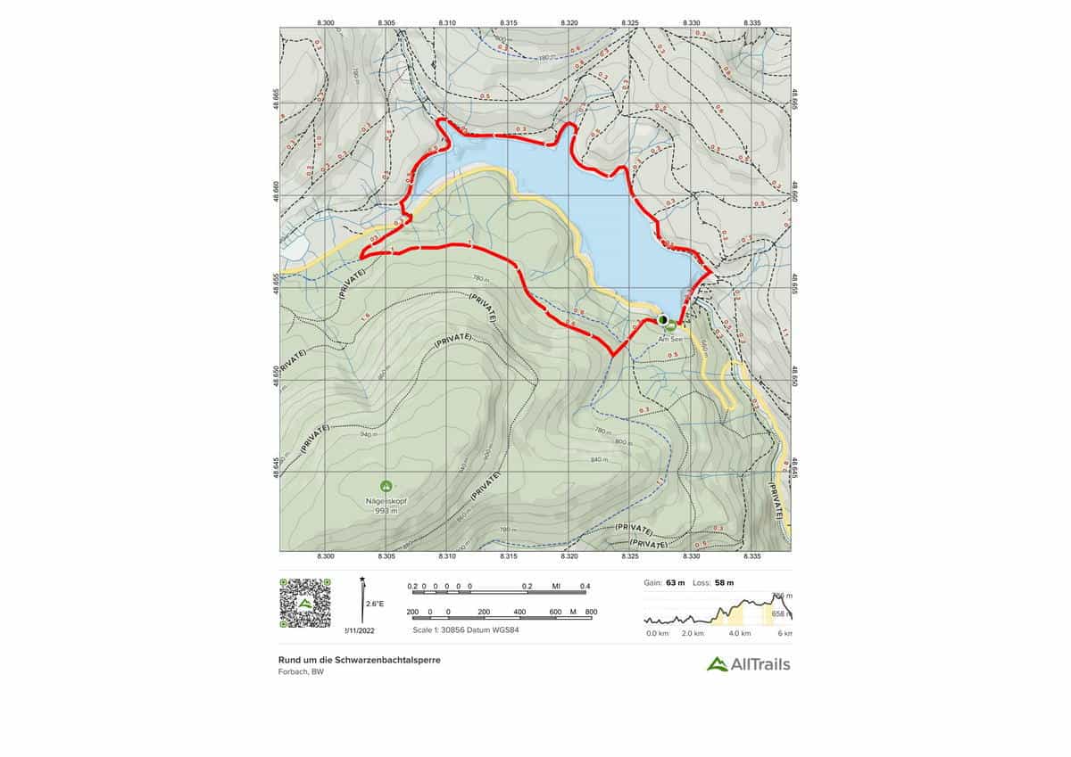
In the Black Forest Central/North Nature Park, there is a beautiful and varied circular hiking trail. This route circles the Schwarzenbachtalsperre, the Black Forest’s largest reservoir in the north and center. A lovely stroll along the water’s edge with spectacular views of the lake and the Karwand. Highlights include: – Fauna and flora – A panoramic view of the Schwarzenbachtalsperre
Highlights of this Black Forest Trail:
Length: 6.3 km
Elevation gain: 208 m
Route type: Loop
Moderate Black Forest Trail Map #3. Zum Röterkopf und Huzenbachersee
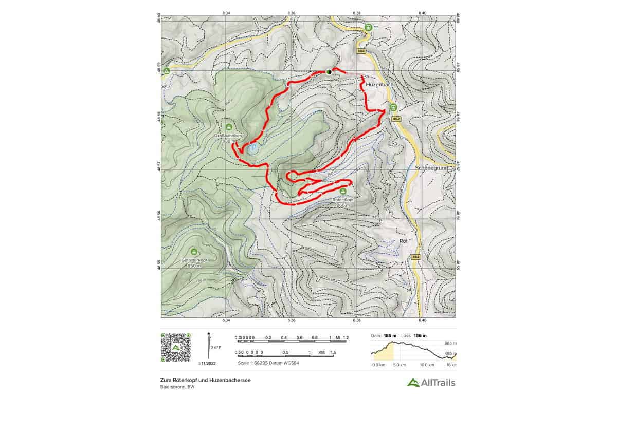
A popular, promising circular climb in Baden-Black Württemberg’s Forest. This natural path goes to the Hutzenbacher See and the Röter Kopf. You may take in the breathtaking vistas of the Black Forest and the wild and romantic nature along the way. Highlights of the circular hike: – Hutzenbachersee – Seltenbacher Wasserfall – View from the Röter Kopf
Highlights of this Black Forest Trail:
Length: 15.6 km
Elevation gain: 608 m
Route type: Loop
Moderate Black Forest Trail Map #4. Mummelsee to Ochsenstall via Hornisgrinde
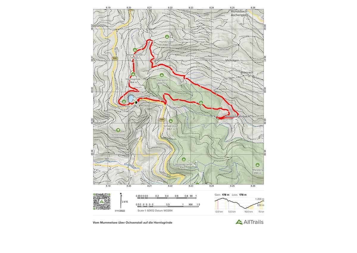
In Baden-Black Württemberg’s Forest, a popular picturesque hiking track. It goes from the Mummelsee to the Ochsenstall via Seibelseckle, Dreifürstenstein, and Biberkessel. Then it’s on to the Hornisgrinde and then the Langenbach to the same-named settlement. It then returns to the Mummelsee.
If you want to cut the distance between the Hornisgrinde and Mummelsee, you can hike directly from the Hornisgrinde to Mummelsee. This circular route impresses with a variety of breathtaking sights. On a clear day, you can see deep into the Rhine plain, especially from the Hornisgrinde. The round hike’s highlights include: – Mummelseeblick – Skihütte am Ochsenstall
Highlights of this Black Forest Trail:
Length: 14.8 km
Elevation gain: 584 m
Route type: Loop
Moderate Black Forest Trail Map #5. Huzenbachsee
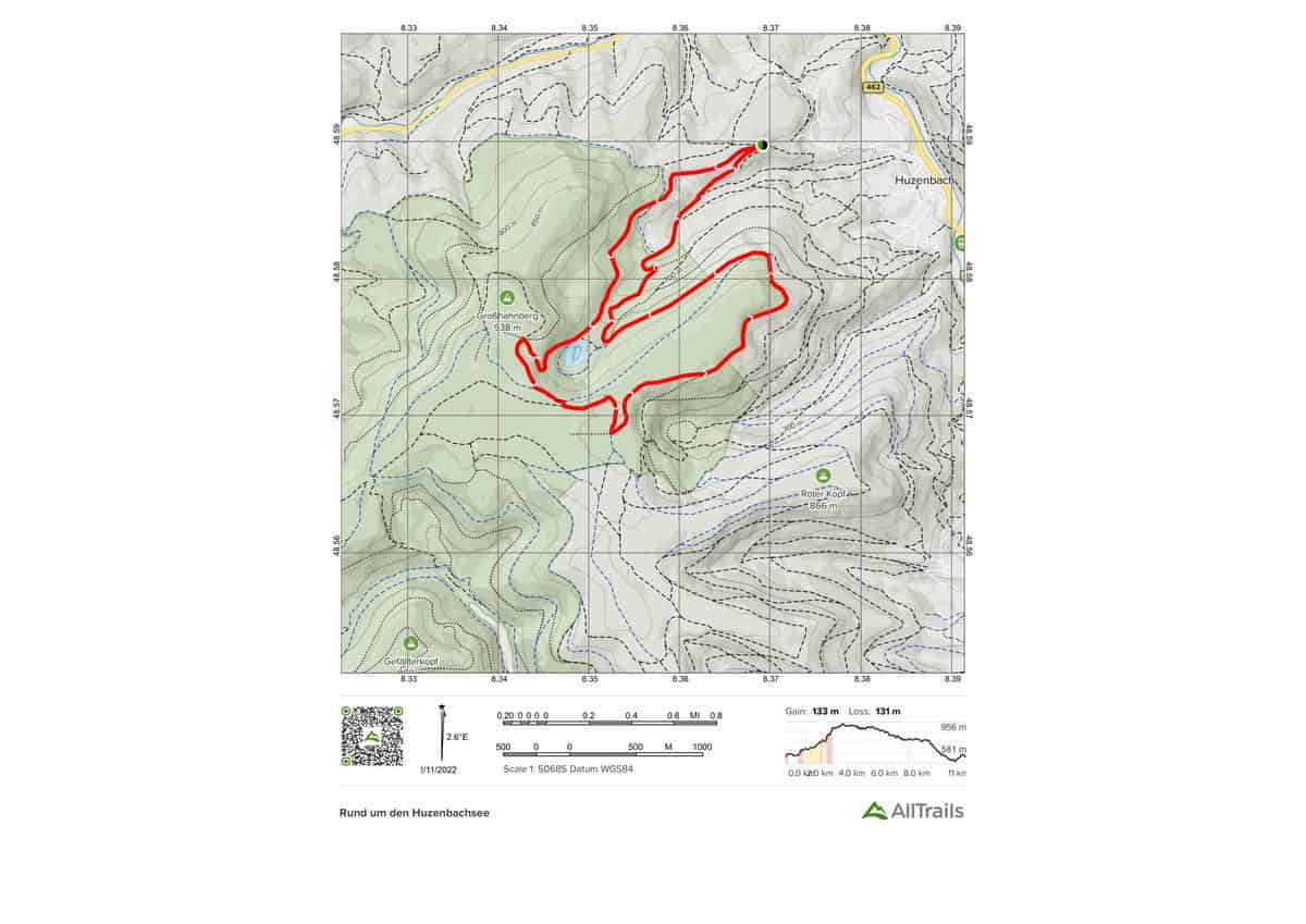
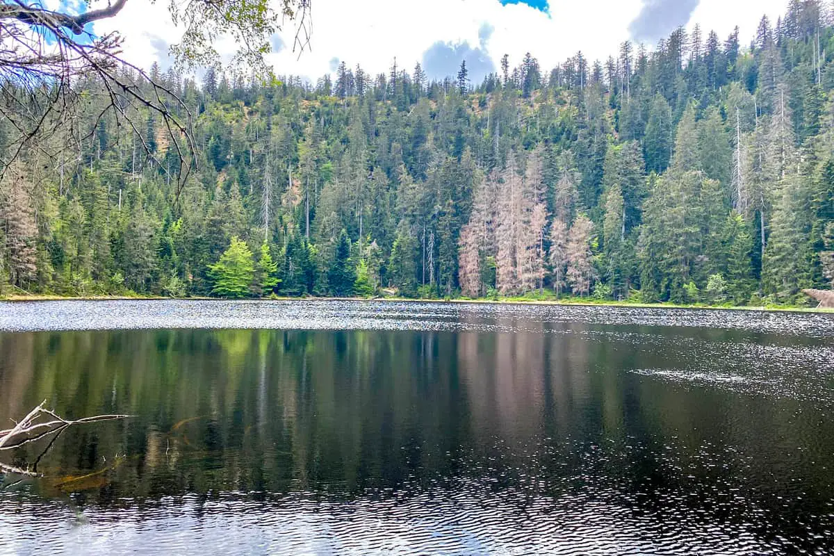
A beautiful, lovely circular hike in Baden-Black Württemberg’s Forest. The Huzenbachsee is circled on this hike. The lake was formed during the last ice age and is one of three karsts in the Black Forest National Park. The lake is a maximum of 7.5 meters deep, with a water surface area of 2.7 hectares, a length of 250 meters, and a width of 145 meters. The spectacular cirque walls soar above the lake, with their impressive rock formations. The hike’s highlights include: – Huzenbachsee panorama – The Seitenbach Falls
Highlights of this Black Forest Trail:
Length: 11.3 km
Elevation gain: 436 m
Route type: Loop
Moderate Black Forest Trail Map #6. Mummelsee-Hornisgrindepfad
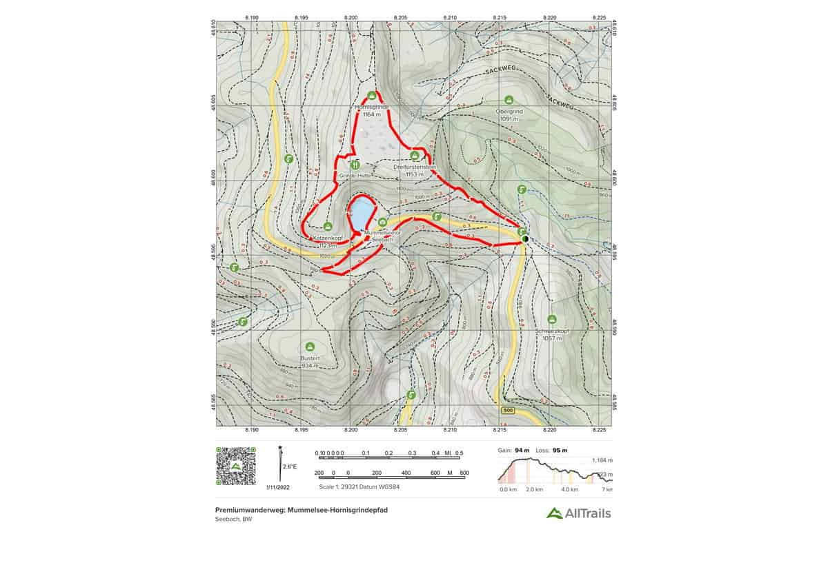
Baden-popular Württemberg’s Black Forest trail In the Central Black Forest, this route is a recognized premium hiking track. On this hike, nature enthusiasts will get their money’s worth. The path begins at the Seibelseckle hiking car park and takes you through deep woodlands, heathland, and a protected high moor before arriving to the breathtakingly picturesque Mummelsee.
The stunning Black Forest views, as well as panoramic views of Seebach and the Rhine Valley, are not to be overlooked. The hike’s highlights include: – Hornisgrinde High Moor – Mummelsee – Bismarck Tower and Dreifürstenstein – Bismarck Tower and Dreifürstenstein –
Highlights of this Black Forest Trail:
Length: 6.6 km
Elevation gain: 310 m
Route type: Loop
Moderate Black Forest Trail Map #7. Rund um Buhlbachsee und Lotharpad
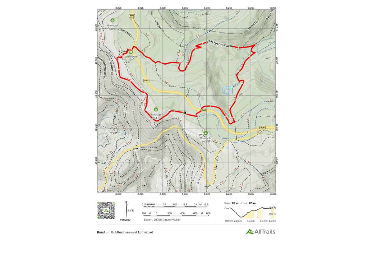
Beautiful and interesting circular climb in Baden-Black Württemberg’s Forest. The Black Forest National Park’s stunning landscape is traversed on this lovely circular route. You can also hike along the Buhlbachsee and parts of the Lothar Trail, which are both educational. The natural round is appropriate for both children and adults. Highlights of the tour include: – Beautiful views – Idyllic nature – Picturesque landscape
Highlights of this Black Forest Trail:
Length: 8.0 km
Elevation gain: 288 m
Route type: Loop
Moderate Black Forest Trail Map #8. Bosensteiner Almpfad
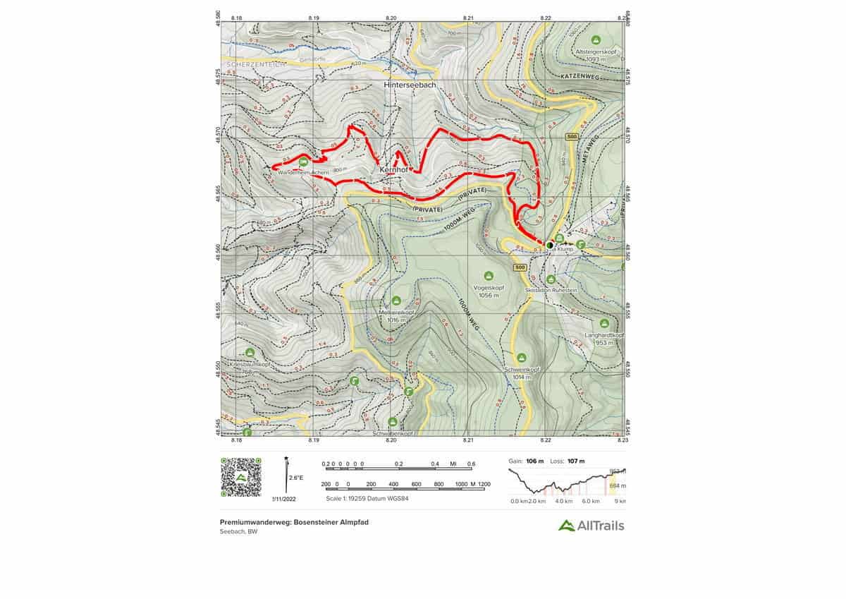
In Baden-Central Württemberg’s Black Forest, there is a popular, certified quality hiking trail. Between Freudenstadt and Baden-Baden, this route is a Black Forest gourmet trail. The path begins at the Ruhestein hiking car park, which is close to the Ruhestein environmental protection facility. The Bosensteiner Almpfad is set in a natural setting with breathtaking views of lush alpine meadows.
Hikers can expect a varied route past groups of boulders, mountain hay fields, and through exquisite spruce forests on the alpine path. On the hike, the Kernhof-Bosenstein area, which is a cultural landscape surrounded by forest, presents itself as a lovely high alpine environment. Climb highlights include: – A multifaceted hike – A breathtaking panorama – A mountainous landscape
Highlights of this Black Forest Trail:
Length: 8.7 km
Elevation gain: 347 m
Route type: Loop
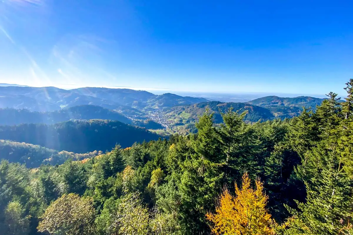
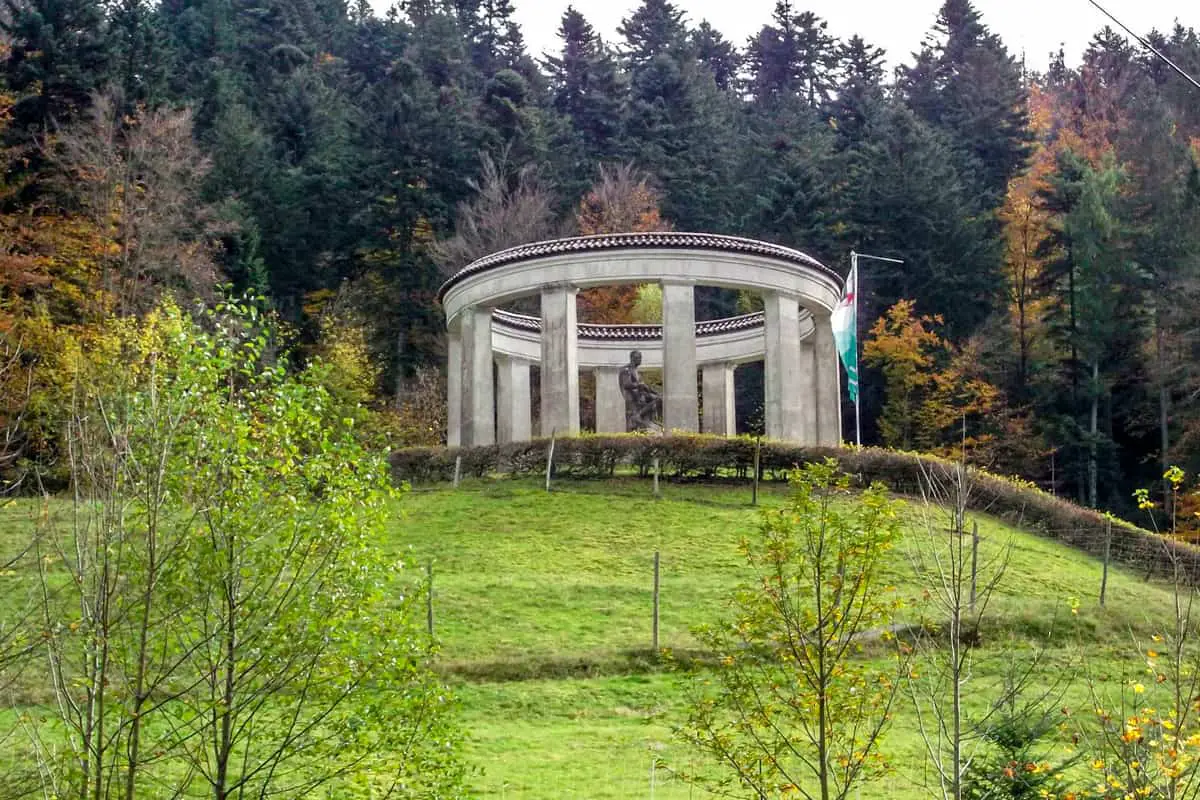
Moderate Black Forest Trail Map #9. Rund um Allerheiligen Wasserfälle und Schliffkopf
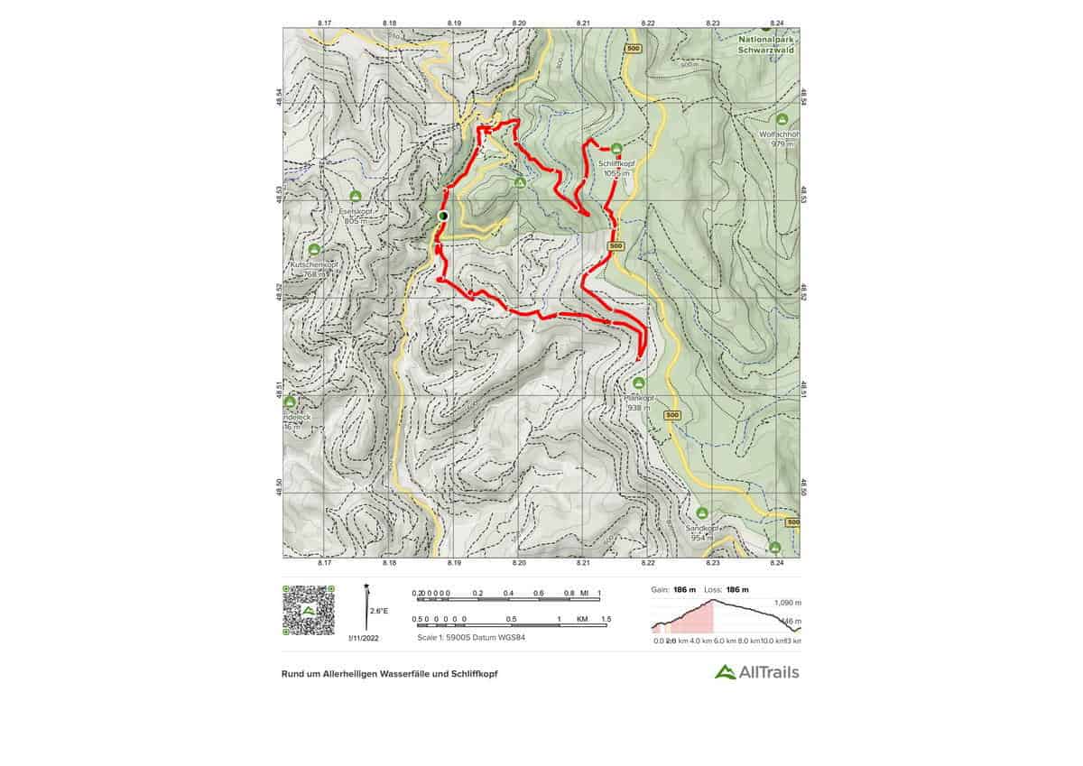
A thrilling and adventurous circular hike in Baden-Black Württemberg’s Forest. This action-packed round includes a variety of thrilling natural views and experiences. You may visit the historic Allerheiligen monastery and see the beautiful Allerheiligen waterfalls right from the start. It continues through the picturesque Black Forest terrain, culminating in the Schliffkopf’s breathtaking panoramic vistas. Round highlights include: – Waterfalls of All Saints – All Saints Monastery – Awe-inspiring vistas
Highlights of this Black Forest Trail:
Length: 12.6 km
Elevation gain: 610 m
Route type: Loop
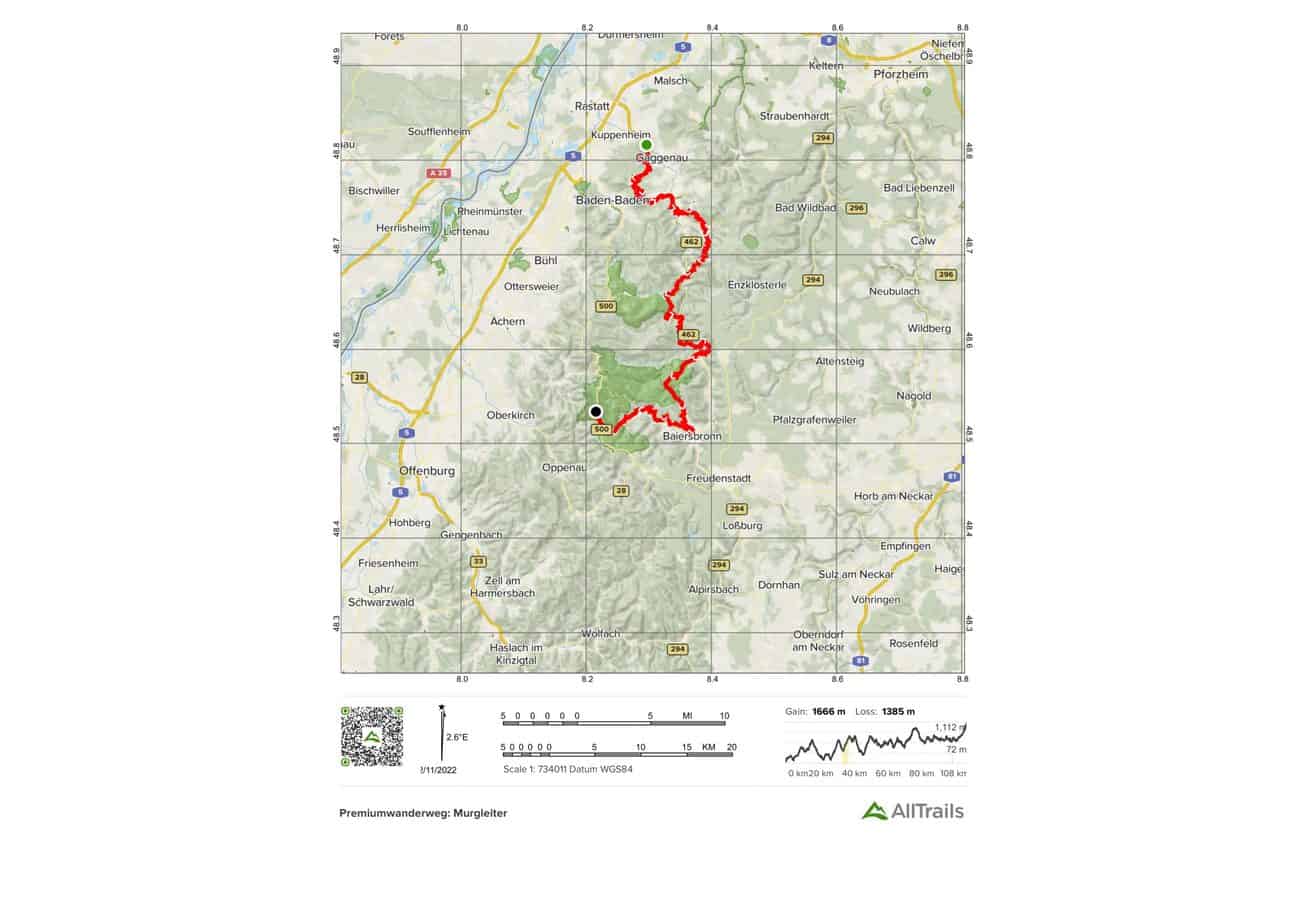
Moderate Black Forest Trail Map #10. Murgleiter Etappe 4: Schönmünzach – Baiersbronn
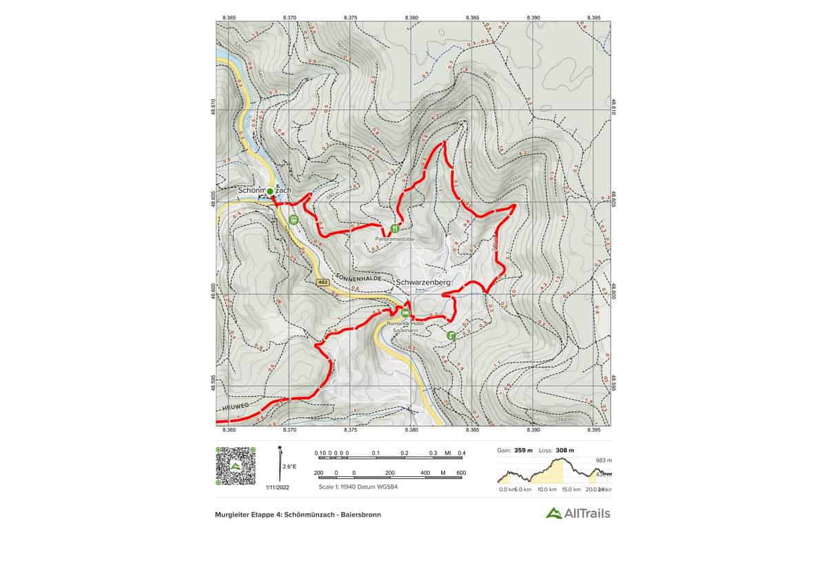
The Murgleiter long-distance hiking trail has a panoramic part. This natural trail takes hikers past all historical sites while passing by beautiful rock formations. This stage is accessible by train and bus. -View of the “Murgtal” valleys -Roten Rain -Mäderbrunnen -Schlossberg -Huzenbacher See -Seltenbach waterfall
Highlights of this Black Forest Trail:
Length
23.7 km
Elevation gain
1,177 m
Route type
Point to point
10 Black Forest Trail Choice for Aggressive Hikers
Hikers looking for a challenging Black Forest trail might like to try one of the 10 listed below. They are are not the only multi-day hiking routes in the region but they are possibly the best-known.
Agressive Black Forest Trail Map #1. Panoramaweg Baden-Baden
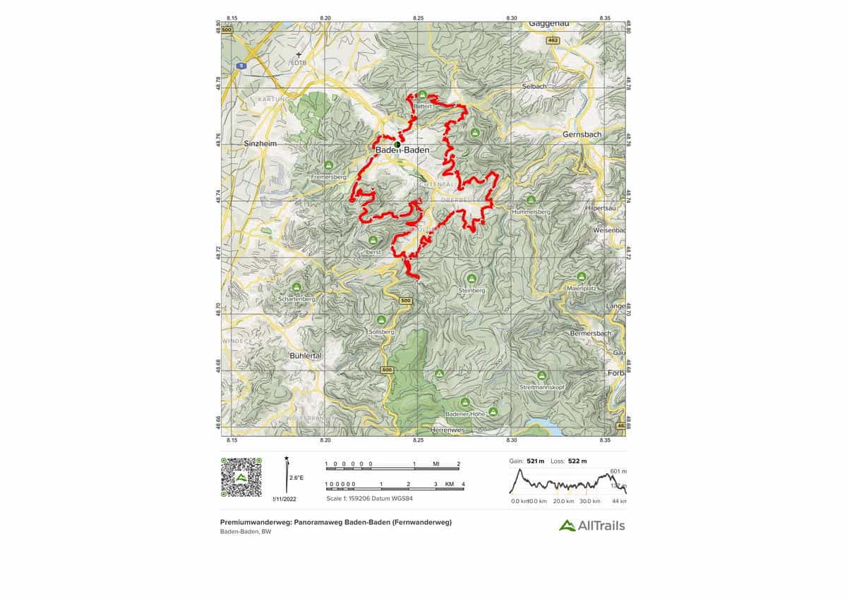
In Baden-northern Württemberg’s Black Forest, a quality hiking trail has been certified. This lovely circular hiking track winds its way around Baden-Baden. The Geroldsau valley, with its tight canyons and flowing streams, is passed here. This trail is usually done in 4-5 days. There are areas where you can take a break. The hike’s highlights include: – Colonnades of the Kurhaus – Teufelskanzel – Marienkapelle – The Geroldsau Falls – Korbmattfelsen – Stourdza church – pump room
Highlights of this Black Forest Trail:
Length: 44.4 km
Elevation gain: 1,709 m
Route type: Loop
Agressive Black Forest Trail Map #2. Westweg Etappe 3
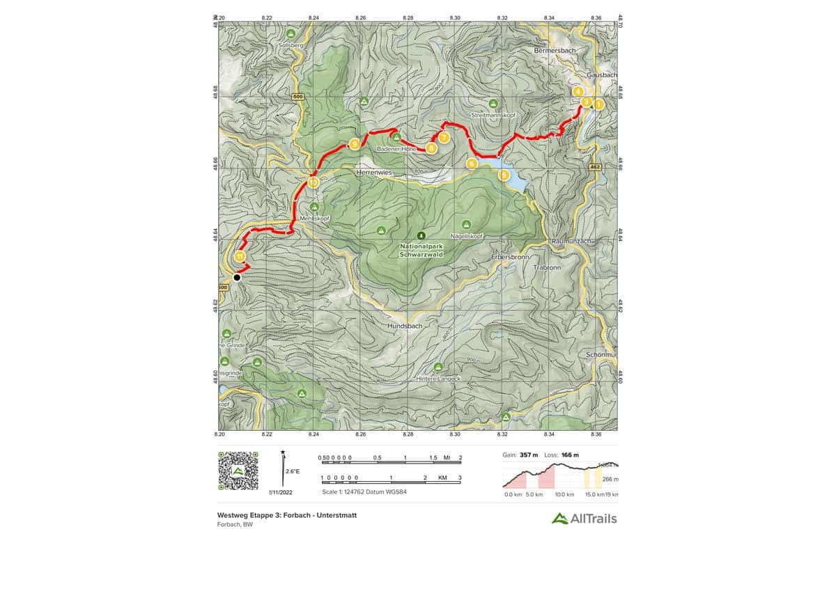
A section of the Westweg long-distance hiking trail in Baden-Black Württemberg’s Forest National Park. The third leg of the western route, with a length of 18.9 kilometers, is the most attractive. The walk leads you through a diverse natural setting and rewards you with breathtaking panoramic vistas. The hike’s highlights include: – Herrenwieser See – Badener Höhe Naturfreundehaus – Dam Schwarenbach
Highlights of this Black Forest Trail:
Length: 19.2 km
Elevation gain:
1,171 m
Route type: Point to point
Agressive Black Forest Trail Map #3. Tonbachsteig
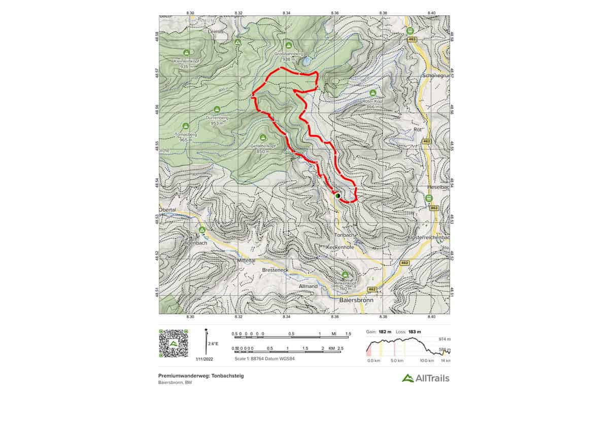
In the center Black Forest, Baden-Württemberg, there is a culinary trail steeped in history. This trail has been designated as a quality hiking trail. In certain locations, old wood-cutting pathways lead uphill. The route’s numerous features include rafting remnants and the majestic deer that may be seen in the Tonbachtal’s wildlife reserve. It is possible to arrive by bus or train, and there are places to stop for refreshments along the journey. The hike’s highlights include: – antique wood -path cutting – breathtaking views from the “Oberer Zinken” rest area – Tonbach Valley game reserve – ointment ovens and rafting.
Highlights of this Black Forest Trail:
Length: 14.2 km
Elevation gain: 598 m
Route type: Loop
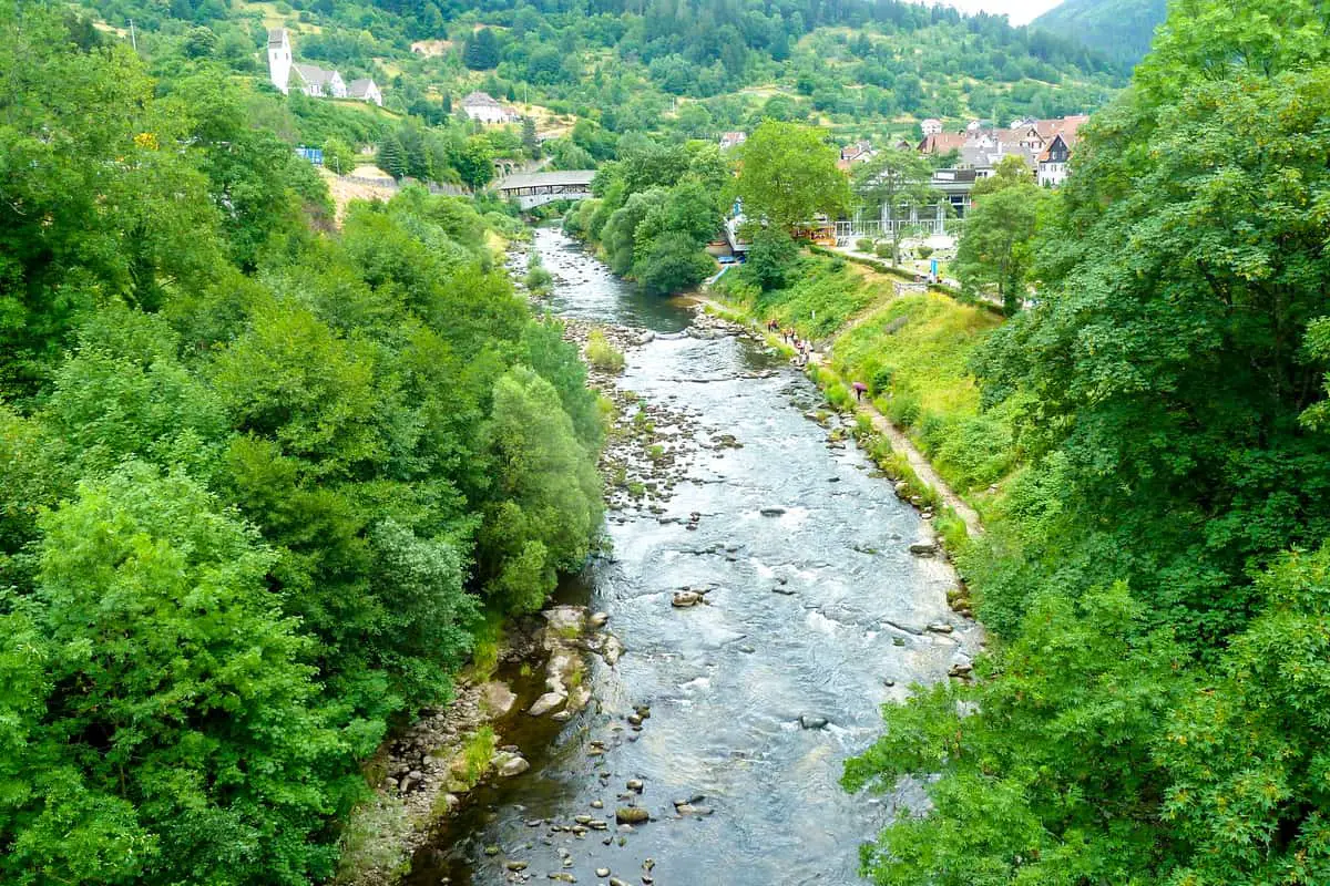
Agressive Black Forest Trail Map #4. Murgleiter
A challenging long-distance route across Baden-Black Württemberg’s Forest National Park. This is a recognized quality hiking trail that starts in the Black Forest National Park and continues north to the Schliffkop via the Murg Valley. Because you’ll be hiking up and down steep forest slopes on a variety of pathways, this route requires a decent degree of fitness.
The seemingly endless, amazing vistas of the neighboring valleys, the northern Black Forest, gently flowing rivers, and lovely meadows provide a pleasant break from the arduous stretches. Follow the blue diamond-marked path. You can trek individual segments of the Murgleiter if you prefer a day trip. The trip is accessible by bus and train, and there are rest stops along the way.
Highlights of this Black Forest Trail:
Length: 108.5 km
Elevation gain: 5,466 m
Route type: Point to point
Agressive Black Forest Trail Map #5. Renchtalsteig – Etappe
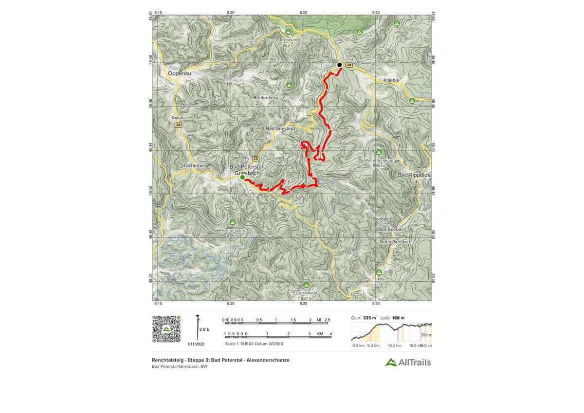
Renchtalsteig is a multifaceted portion of the excellent hiking trail Renchtalsteig (stage 3). This lovely segment is the third of a five-stage circuit that begins in Bad Peterstal and runs for 19.4 kilometers. The walk takes you through a variety of natural landscapes and is well-marked. Along the way, there are also opportunities to stop for refreshments. The hike’s highlights include: – Glaswaldsee – Sexauer Hütte – Hildahütte – Alexanderschanze – Bad Peterstal – Holchen waterfall on the Himmelssteig – Glaswaldsee – Sexauer Hütte – Hildahütte – Alexanderschanze TIME: 8:12 a.m.
Highlights of this Black Forest Trail:
Length: 19.0 km
Elevation gain: 1,098 m
Route type: Point to point
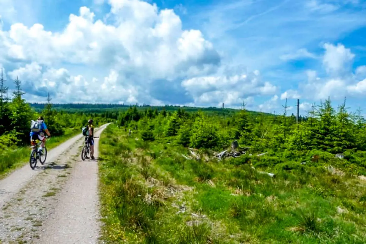
Agressive Black Forest Trail Map #6. Westweg Neuenbürg – Schliffkopf
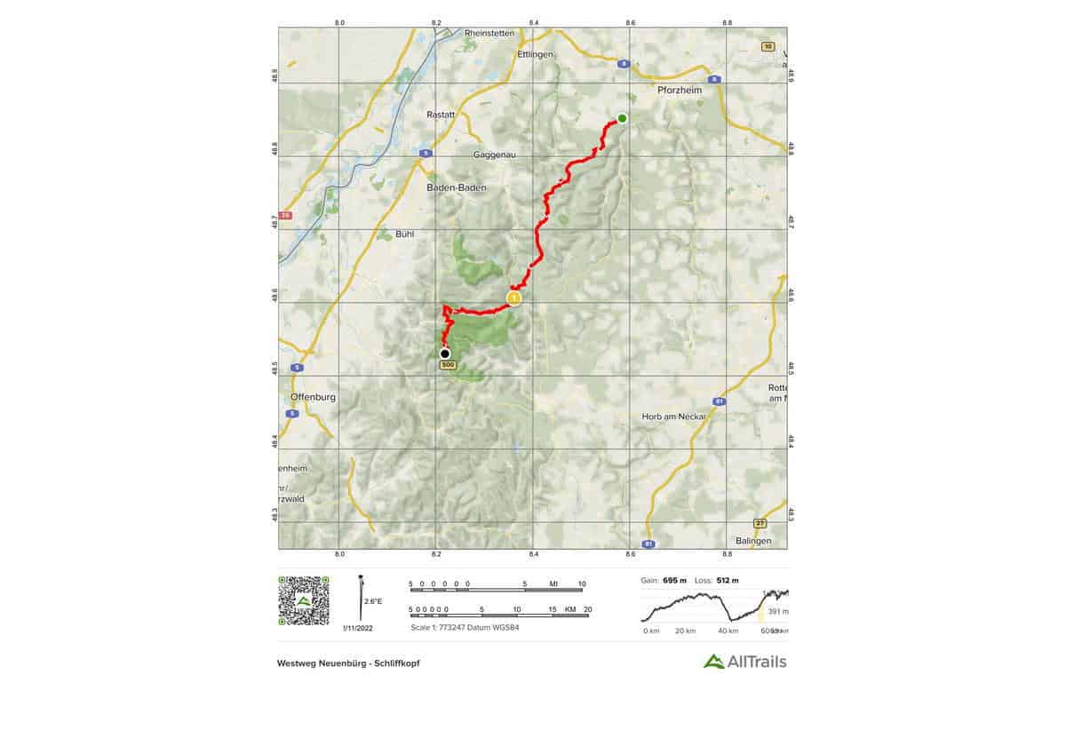
Day 1 of our 2-day mountain bike excursion through the Black Forest, from Neuenbürg to the Schliffkopf (= day 1), and then to Hausach the day after. Many of the approximately 130 km of the Westweg provide spectacular views and challenging single trails. On the second day, take the Black Forest Railway back to Pforzheim from Hausach.
Highlights of this Black Forest Trail:
Length: 69.4 km
Elevation gain: 2,279 m
Route type: Point to point
Agressive Black Forest Trail Map #7. Baiersbronner Himmelsweg
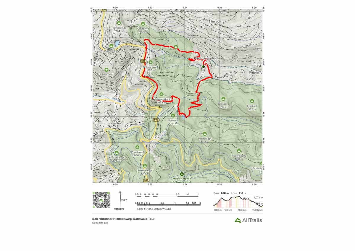
Baiersbronner Himmelsweg: Bannwald Tour is a 17.4-kilometer lightly trafficked circular trail with lovely wild flowers located near Baiersbronn, Baden-Württemberg, Germany. It is classed as strenuous. The trail is best used from May to October and is generally used for hiking and nature visits. Accessible by bus and train. There are places to stop.
Highlights of this Black Forest Trail:
Length: 17.4 km
Elevation gain: 683 m
Route type: Loop
Agressive Black Forest Trail Map #8. Von der Alexanderschanze zum Mummelsee
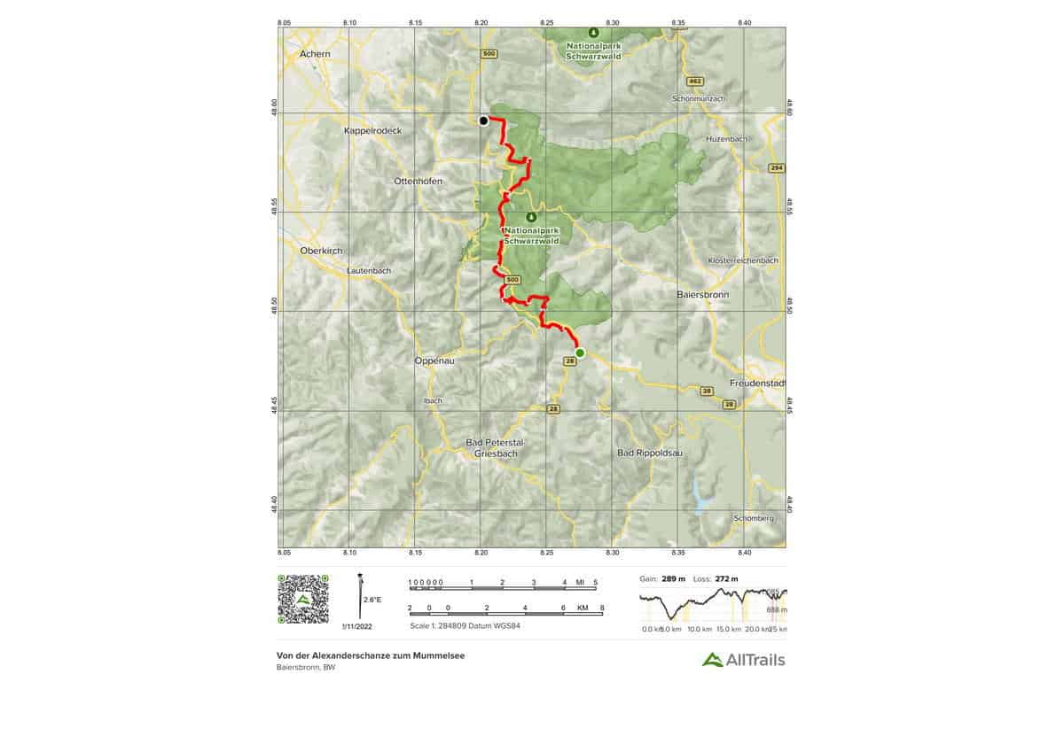
Von der Alexanderschanze zum Mummelsee is a 25.3-kilometer modestly trafficked point-to-point trail with a lake that is rated as tough and is located near Freudenstadt, Baden-Württemberg, Germany. Hiking is the primary activity on the trail.
Highlights of this Black Forest Trail:
Length: 25.3 km
Elevation gain: 949 m
Route type: Point to point
Agressive Black Forest Trail Map #9. Zwickgabel zum Wildsee
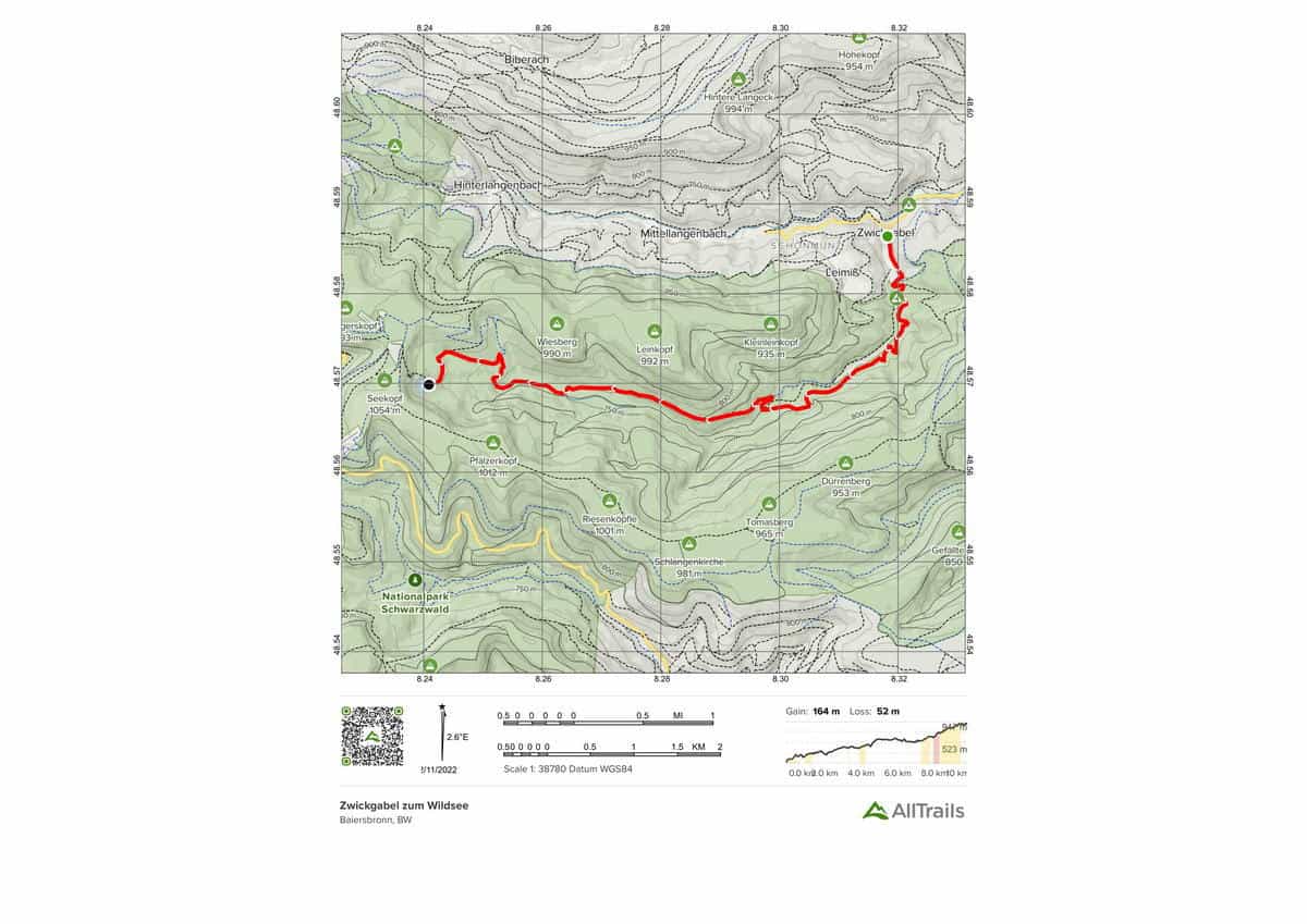
Zwickgabel zum Wildsee is a 10.0 kilometer modestly traveled point-to-point path with a lake that is rated as tough and is located near Baiersbronn, Baden-Württemberg, Germany. Hiking is the primary activity on the trail. The trail also offers Hiking, Forest, Lakes, River and Spectacular Views.
Highlights of this Black Forest Trail:
Length: 10.0 km
Elevation gain: 538 m
Route type: Point to point
Agressive Black Forest Trail Map #10. Lierbachtalweg von Oppenau nach Allerheiligen
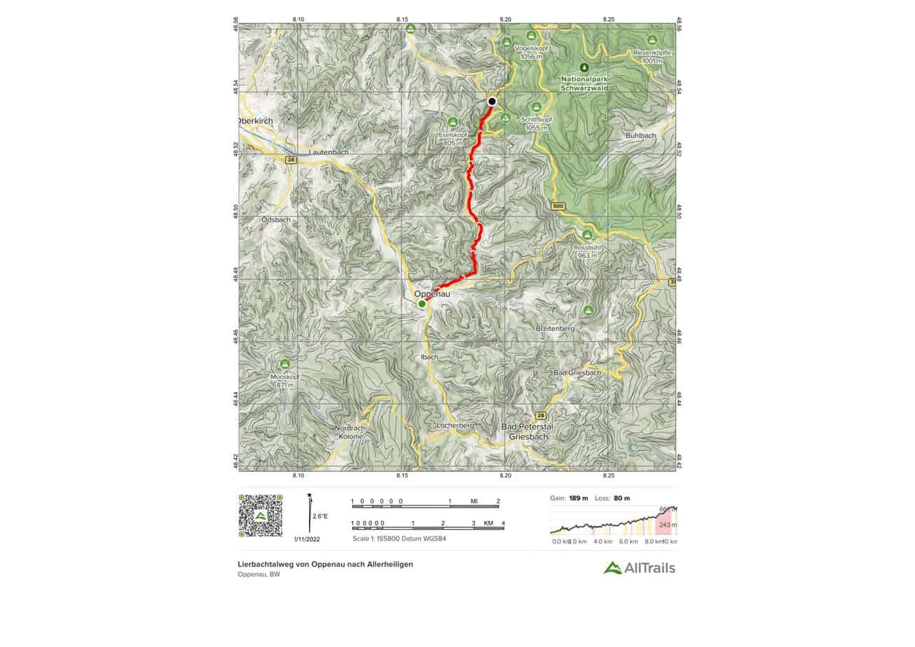
Lierbachtalweg von Oppenau nach Allerheiligen is a 10.0 kilometer moderately trafficked point-to-point route with a waterfall near Oppenau, Baden-Württemberg, Germany. It is rated as tough. Hiking is the primary activity on the trail. The trail offers Forests, Views, a Waterfall, and Historic Sites.
Highlights of this Black Forest Trail:
Length: 10.0 km
Elevation gain: 619 m
Route type: Point to point
You May Want to Join Our Boondocking Group on Facebook For More Information
You May Want to Join Our Campfire Recipes Group on Facebook For More Information
Check Out Our Pictures On Instagram – Our Big Escape.