
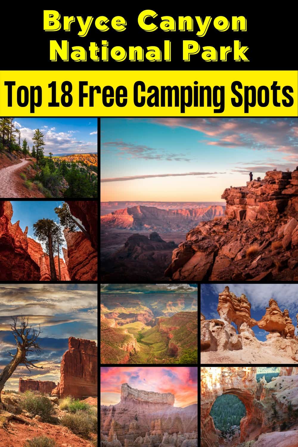
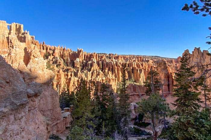
18 Favorite Bryce Canyon National Park Free Campsites hoodoos (irregular columns of rock) exist on every continent, but here is the largest concentration found anywhere on Earth. Situated along a high plateau at the top of the Grand Staircase, the park’s high elevations include numerous life communities, fantastic dark skies, and geological wonders that defy description.
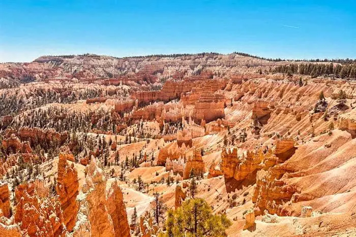
Bryce Canyon National Park receives millions of visitors each year. Among the mighty 5 Utah’s national parks, it is considered to be the second most popular. It is popular because of its stunning sunrises and unique geology. Add it to your bucket list and spend a few days stargazing at the incredible rock formations known as hoodoos.
Want more ideas to round-out your trip to Utah?
A lot of great ideas are in these posts!
- 18 Capitol Reef National Park Boondocking (Updated 2022)
- 21 Grand Staircase-Escalante National Monument Boondocking (Updated 2022)
- 12 Bear Ears Monument Boondocking Spots (Updated 2022)
- 15 Arches National Park Boondocking (Updated2022)
- 23 Free Canyonlands National Park Campsites (Updated 2022)
- 18 Bryce Canyon National Park Free Campsites (Updated 2022)
- 16 Free Natural Bridges Monument Boondocking (Updated 2022)
- 15 Arches National Park Boondocking (Updated2022)
- 15 Top Boondocking Location In Moab Options (Updated 2022)
- 9 Top Tips to Hike Wall Street In Zion National Park
Join the millions of visitors who come to see the hoodoos glowing in the rising sun each morning at Bryce Canyon National Park. Alternatively, you can go for hikes into Bryce’s amphitheater and observe it up close. There are also popular parks such as the Grand Staircase-Escalante National Monument or Zion National Park, making a beautiful combination for your trip.
History of the Bryce Canyon National Park
Mormon pioneers settled within the Bryce Canyon area in the 1850s. Ebenezer Bryce who was a resident of the area in 1874 is where the name of the area came from. President Warren G Harding, in 1928 designated the area as a national monument. On June 8, 1923, the U.S. Forest Service established the Bryce Canyon National Monument.
The monument’s name was changed on June 17, 1924, to Utah National Park and transferred to the National Park service. On 25 1928, it changed from Utah National Park to Bryce Canyon National Park. The Park is in a remote area and covers 35,835 acres.
18 Bryce Canyon National Park Free Camping Locations
check out our video
1. Bryce Canyon National Park Free Camping Locations – East Fork of Sevier River Dispersed Area
Address
East Fork Road (FR 087)
Bryce, Utah
GPS: 37.584426, -112.25899
Elevation: 7894′
Management: Forest Service
The road in is Dirt and 7 or more miles from a paved road. There are 6-15 campsites at this location and the maximum RV length is Any. You may stay 16 in 30 nights at East Fork of Sevier River Dispersed Area.
Best Review:
Great location near Bryce Canyon. Dispersed campsites that are well spread out from each other. Plenty of trees for shade. Water nearby. Dirt road in good condition. Would definitely camp here again. No service.

2. Bryce Canyon National Park Free Campsites – FR088 South – Near Bryce Canyon
Address
Forest Road 088
Bryce Canyon, Utah
GPS: 37.626331, -112.228073
Elevation: 7969′
Management: Forest Service (USDA)
The road in is Dirt and 6 miles from a paved road. There are 1-5 campsites at this location. You may stay 16 in 30 nights at FR088 South – Near Bryce Canyon. Free, dispersed camping among the pine trees near Bryce Canyon in Utah’s Dixie National Forest. Campsites are along Forest Road 088. Road might not be suitable for all rigs.
Best Review:
Site was easy to find, beautiful setting. Good cell coverage. Only a few ATVs went by on the road.
3. Bryce Canyon National Park Free Camping Locations – Virgin River
Four miles of washboard roads leading up to the coordinates. The coordinates don’t lead to a pull out or an obvious spot to pull into. The location is quiet and Verizon service is weak the further you drive on FR 087. As a full-timer in a truck camper, I need more than one bar of 4G data and Im not a fan of taking my pavement princess on washboard roads. I had to make due in a stronger reception section of the forest road and got out as early as I could.
Address
East Fork Road
Bryce, Utah
GPS: 37.641856, -112.22897
Elevation: 7825′
Management: Bureau of Land Management
Free Dispersed camping in the Bureau of Land Management Kanab District. Reservations are not accepted at this campsite. This is a high elevation location.
Best Review:
We drove only 2 miles in from 12, made a left at Dave’s Hollow. I’ve explored only a half mile in and I’ve seen 5 or 6 sites, several for any size rig. Verizon 4g is slow.
4. Bryce Canyon National Park Free Campsites – Pines Rest Area
Address
Bryce Canyon, Utah
GPS: 37.708304, -112.205794
Management: Rest Area
Utah rest area.
Best Review:
Saw a few folks parked overnight. From UT website: “All rest areas are posted for no overnight camping. However, extended stays are permitted and are monitored by the on-site staff and the Highway Patrol. There are no RV hookups or dumps or camping facilities at any site.” So basically if you’re not causing trouble then you should be OK.
5. Bryce Canyon National Park Free Camping Locations – Tom’s Best Spring Road Dispersed Camping
Address
Tom’s Best Spring Rd, Escalante, UT
Bryce Canyon, Utah
GPS: 37.721502, -112.254688
Elevation: 7816′
Management: Forest Service
The road in is Dirt and 0.5 miles from a paved road. There are 6-15 campsites at this location and the maximum RV length is 35 feet. You may stay 16 days, after which you must move at least 10 miles. at Tom’s Best Spring Road Dispersed Camping.
Best Review:
This is one of my favorite camping spots in the entire country, and certainly in the state of Utah. Great road conditions, great location for Bryce Canyon or other nearby recreation areas. Many fine spots available and many excellent hammock spots. The forest has a sense of sleepy peace. I definitely felt the past presence of some happy hippy-nomads in my campsite. The trees are almost entirely pines, spread out but comfortably present, so you can see all around you and far into the distance yet you don’t feel exposed.
6. Bryce Canyon National Park Free Campsites – FR121 – Near Red Canyon
Address
Forest Road 121
Panguitch, Utah
GPS: 37.734466, -112.268171
Elevation: 7681′
Management: Forest Service
The road in is Dirt. There are 1-5 campsites at this location. You may stay 16 days at FR121 – Near Red Canyon.
Best Review:
Pretty great! A small area with about 4-5 camp fire pits (sites). Close to each other – probably 30-50ft apart. Maybe I was lucky but I got here on a Saturday night at 8.45pm, thought it would be packed but only one camper.
7. Bryce Canyon National Park Free Camping Locations – Hw 22 near Bryce Natl Park
Address
Highway 22
Bryce Natl Pk, Utah
GPS: 37.731735, -112.094475
Elevation: 7566′
Management: State Trust
The road in is Dirt and .5 miles from a paved road. There are 1-5 campsites at this location.
Best Review:
This place saved my butt! Campsite I’d originally planned was blocked off, next campsite I tried was also blocked off, then I found this one which is perfect! Three fire rings just off the paved road, although there’s no one else here (and no road traffic either as far as I can tell). Perfectly easy to access even in my dinky Altima. Great cell service too, I was able to watch YouTube on data.
8. Bryce Canyon National Park Free Campsites – Rock Springs Bench Campsite – Grand Staircase Escalante NM
Address
Cannonville, Utah
GPS: 37.496975, -111.97821
Elevation: 5793′
Management: Bureau of Land Management
The road in is Dirt and 1 miles from a paved road. Rock Springs Bench Campsite- Grand Staircase Escalante NM is open all year. There are 1-5 campsites at this location. You may stay 14 at Rock Springs Bench Campsite- Grand Staircase Escalante NM.
Best Review:
The scenery was beautiful!! Not too crowded, easy to find, and so close to Kodachrome basin state park. We camped in mid June and the biting gnats were AWFUL!!! I’d go back for sure but you’ll need to pay close attention to biting gnat season in the area.
9. Bryce Canyon National Park Free Camping Locations – Gravel Pit
Address
Panguitch, Utah
GPS: 37.755223, -112.338574
Elevation: 7123′
Management: Bureau of Land Management
The road in is Dirt and 2 miles from a paved road. There are 1-5 campsites at this location and the maximum RV length is unlimited.
Best Review:
Highway 12 to the Losee Canyon turn off. Highway 1700. Around the first Bend you will find a gravel pit. We were able to park there along with another camper one night with no issues. Not sure if it is public or private. On the map it looks like it is BLM land. There is a large turnout at the entrance where several rigs could park. We parked Slightly further up the road with a 30 ft 5th wheel. The exit is very steep but there is one place you can turn around.
10. Bryce Canyon National Park Free Campsites – Cottonwood Canyon Road
Address
Henrieville, Utah
GPS: 37.480583, -111.922343
Elevation: 6112′
Management: Bureau of Land Management
The road in is Dirt and 46 miles from a paved road. There are 16-29 campsites at this location.
Free dispersed camping along Cottonwood Canyon Road between Big Water and Kodachrome State Park located inside BLM land under Grand Staircase-Escalante National Monument. Better sites north, closer to Kodachrome. No fires unless in stove/pan. Many possible sites right off of main road. Main road is unpaved and very rough at times and definitely impassable when wet.
11. Bryce Canyon National Park Free Camping Locations – Losee Canyon Area
Address
Casto Canyon Road
Panguitch, Utah
GPS: 37.768002, -112.336418
Elevation: 7105′
Management: Forest Service (USDA)
The road in is Dirt. There are 1-5 campsites at this location and the maximum RV length is 45′. You may stay 16 in 30 nights at Losee Canyon Area.
Best Review:
Stayed off the BLM dirt road that heads west just before the Losee Canyon Trailhead in mid September. Several level sites adjacent to the road can accommodate large rigs (with no toad). BLM side road a little rough but most rigs can handle-just go slow. Sites are surrounded by Pinyon/Juniper. Please use the established rock fire rings. Don’t build new ones. Decent Verizon and ATT cell service.
12. Bryce Canyon National Park Free Campsites – Henrieville Creek – Escalante NM Grand Staircase
Address
Henrieville, Utah
GPS: 37.616936, -111.896866
Elevation: 6656′
Management: Bureau of Land Management
The road in is Gravel and .01 miles from a paved road. Henrieville Creek – Escalante NM Grand Staircase is open all year. There are 1-5 campsites at this location and the maximum RV length is 25′. You may stay 14 days at Henrieville Creek – Escalante NM Grand Staircase.
Best Review:
A flat area along Henrieville Creek (a dry wash most of the time)with small trees,sagebrush and white cliffs. This is part of the Escalante National Monument. A free permit, which can be obtained at a visitor center, is required for dispersed camping. From Henrieville travel east on Route 12 for about 8 miles. After crossing the bridge, just past mile marker 37, turn left onto a gravel road. Pass the gravel pit, go down a short hill and the campsites are under the trees.
13. Bryce Canyon National Park Free Camping Locations – My Place
Address
Lakeshore Drive
Panguitch, Utah
GPS: 37.74963, -112.37672
Elevation: 6745′
Management: Private – 1/2 acre of un-used land
Marker placed at nearby road junction. Contact owner for exact location. Only 17 miles from Bruce Canyon National Park. I have room for a couple boon dockers to park their RV’s or pitch a tent free of charge. The county won’t let someone stay for more than 30 days at a time. I have no water, sewer, or electrical hook-ups so it’s basically, haul it in, haul it out. Adults only, no children. The Sevier River is only 1/2 mile away with trout fishing. The map incorrectly labeled the street name as Castle Circle, it’s actually part of Lakeshore Drive.
Best Review:
Reached out to Wes recently and he said he had to stop hosting because of a neighbors complaint. He’s not able to log in to delete the posting but we should consider this site out of commission.
14. Bryce Canyon National Park Free Campsites – Casto Canyon Area
Address
Casto Canyon Road.
Panguitch, Utah
GPS: 37.78537, -112.339287
Elevation: 7035′
Management: Forest Service (USDA)
The road in is Dirt and 3.6mi miles from a paved road. There are 1-5 campsites at this location and the maximum RV length is 35′. You may stay 16 nights in 30 nights at Casto Canyon Area.
Best Review:
Free, dry camping in Utah’s Dixie National Forest near Castro Canyon and the Castro Canyon OHV Trail. The site is an elevated, mostly lat area with a primitive fire ring. No shade. Distant mountain and canyon views. Forest and meadows nearby. There is a vault toilet and corral 0.4 miles away at the Casto Canyon trail head.
15. Bryce Canyon National Park Free Camping Locations – DD Hollow / Hatch Mountain Road
Address
Hatch, Utah
GPS: 37.67269, -112.4873
Elevation: 7805′
Management: Forest Service
The road in is Dirt and 5 miles from a paved road. DD Hollow / Hatch Mountain Road is open All year. Heavy snow accumulation in winter. There are 30 or more campsites at this location and the maximum RV length is unlimited. You may stay 16 days at DD Hollow / Hatch Mountain Road.
Best Review:
Practically unlimited dispersed camping, you will need to build your own camp ring as it’s all Forest Service. Although few official sites are in and around this area, many deer hunters use this as prime camping ground. Expect to see a variety of wild life including but not limited to ELK (Early Spring and Fall), Deer (year round), Antelope (Fall, Winter, and Spring). Tons of tree coverage and many trails for a more private camping experience. Close to Hatch, UT where you can get a great breakfast on your way to Bryce Canyon. Cows with grazing permits are ran through this area, so be mindful of them. They usually will keep their distance. You may see Beefaloo too. If you see them, do not approach, they are practically wild, and are territorial.
16. Bryce Canyon National Park Free Campsites – Dixie National Forest
Address
Utah
GPS: 37.682508, -111.833474
Management: Forest Service
There are 1-5 campsites at this location. You may stay 14 days at Dixie National Forest.
Best Review:
We looked for a place near Bryce Canyon and turned off north on 148 in the Dixie National Forest. There was a sign that said not to drive off the road except in the designated areas. We drove a couple miles down the road and found a site with a nice built up fire ring and stopped there. I don’t know if there were sites further down the road as we didn’t explore further but the one we stayed at was gorgeous… wildflowers everywhere, a view of Escalante National Monument through the trees. I would guess a smaller RV would fit there and the gravel road was a smooth drive.
17. Bryce Canyon National Park Free Camping Locations – Stout Canyon Road Dispersed Camping
Address
Alton, Utah
GPS: 37.48815, -112.55793
Elevation: 7766′
Management: Forest Service
The road in is Dirt. There are 1-5 campsites at this location.
This is a great spot for camping off grid. The spots are sparse now that the area has been thinned but we found at least three nice flat spaces. Do no go down into the canyon. Very dusty. Good place when other campsites are closed.
18. Bryce Canyon National Park Free Campsites – FR 063
Address
Duck Creek Village, Utah
GPS: 37.48195, -112.57584
Elevation: 7844′
Management: Forest Service
The road in is Dirt.
Best Review:
Boondock beautiful ridge. Looks like a regularly used hunting camp. Our rig is 4×4 10’ high cleared no problem. Site is best for vans or trucks or small trailers. Great view of sunset and sunrise. Best for 1 rig or a couple rigs traveling together. There are several sites spread around a 1/2 mile stretch of FS road.
Bryce Canyon National Park Paid/Permit Camping
1. Bryce Canyon National Park Permit Camping – King Creek Campground
Address
FR091
Bryce Canyon, Utah
GPS: 37.609584, -112.259862
Elevation: 7958′
Management: Forest Service
The road in is Dirt. King Creek Campground is open year-round. There are 30 or more campsites at this location and the maximum RV length is 45 feet. You may stay two weeks at King Creek. The price is $12/night.
Amenities:
BBQ Grill
Boat Ramp
Drinking Water
Fire Ring
Picnic Tables
Restrooms
Best Review:
King Creek Campground is situated in a ponderosa pine forest, adjacent to Tropic Reservoir and the East Fork of the Sevier River. It is approximately 9 miles west of Bryce Canyon National Park. Access is provided by an improved gravel road. This campground provides paved sidewalks at select sites to provide improved accessibility.
2. Bryce Canyon National Park Permit Camping – Coyote Hollow Equestrian Campground
Address
Coyote Hollow Road (FR113)
Hatch, Utah
GPS: 37.714389, -112.271108
Elevation: 7874′
Management: Forest Service
Coyote Hollow Equestrian Campground is open year-round. This campground is located 1 mile from SR 12 on Coyote Hollow road No.113. There are 1-5 campsites at this location. You may stay two weeks at Coyote Hollow Equestrian Campground. The price is $10/night.
Best Review:
The campsites have picnic tables, fire pits, and tent pads. Vault toilet. No garbage disposal, please pack it out. No reservations. First come – first camped. Anyone can stay in this campground; there is no condition that you must have a horse. Have stayed in this campground several times in the last fifteen years. My first stay was for a 5 day trail ride in the Bryce Canyon area. The campground is private, quiet, and beautifully nestled in Ponderosa Pines. Other times I’ve camped a few nights with my dog. I highly recommend this campground.
Top Trails to Hike at the Bryce Canyon National Park
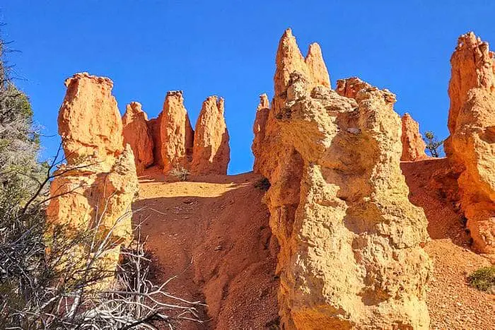
1. Navajo Loop Trail and Queen Garden Loop
The testimonials are accurate! Anywhere you choose to relax is a sight to behold. Stick to the counterclockwise advice if you’re a beginner or little out of shape. If you don’t start at Sunset and end at Sunrise, you’ll be in a world of hurt… This is a fantastic hike for stretching your calves! Overall, my hiking companion and I had a great day. Because this is a popular area, many people offered to take our photo. Good luck on your journey!
Length: 2.9 mi
Elevation gain: 646 ft
Route type: Loop
Kid friendly, Hiking, Views, Wildlife, Rocky, Fee, No dogs
2. Mossy Cave Turret Ark and Little Windows Trail
It was a pleasant hike. There is a restroom and parking near the trailhead. Otherwise, there is another parking lot 1000 feet ahead for overflow and RVs. If you want to see the waterfall, you’ll have to cross a little river. The mossy cave is tiny but adorable. Icicles are still present and may remain so until June. It’s packed, but that’s to be anticipated given that it’s only a mile long and you can still view several hoodoos along the way.
Length: 1.0 mi
Elevation gain: 118 ft
Route type: Out & back
Kid friendly, Hiking, Walking, Cave, River, Views, Waterfall, Wildlife, No shade, Fee, No dogs
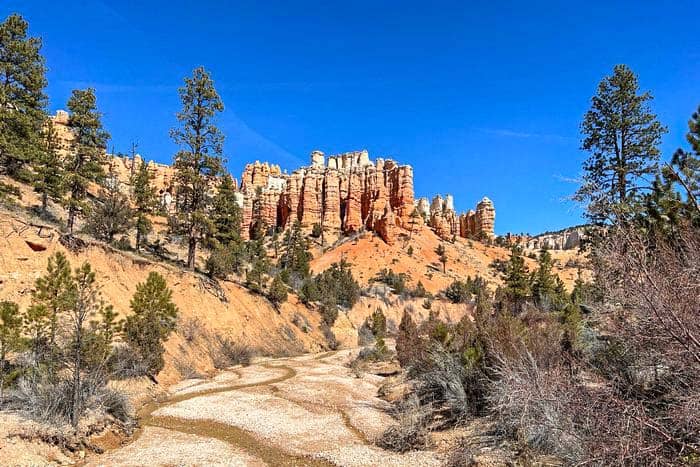
3. Real Fairyland Loop Trail
Fairyland Canyon is where I’m parked. It all started around 9 a.m. It was the finest idea to do this clockwise. Within 10 minutes, we spotted the hoodoos. There was no shade, and it was freezing and windy. The ascent was gradual; if we had gone ccw, the ascent would have been difficult. Download the National Parks app, which will highlight the hoodoos on the map. I had a great experience!
Length: 7.8 mi
Elevation gain: 1,545 ft
Route type: Loop
Hiking, Partially paved, Views, Wildflowers, Rocky, Fee, No dogs
4. Peekaboo Loop Trail
The loop is only 3 miles long, however the total journey from Sunrise Point to Peekaboo through the Navajo Loop route is 5.2 miles long. It was a little muddy, but the vista is breathtaking. This route will take you long to complete because there are photo opportunities around every curve. Beautiful. Early March, there was a little snow on the ground, as well as some slush and muck, but it was all easily handled.
Length: 5.2 mi
Elevation gain: 1,453 ft
Route type: Loop
Hiking, Horseback riding, River, Views, Wildlife, No shade, Fee, No dogs
5. Sunset Point to Sunrise Point
It was well worth the trip up here for sunrise. Watching the sun rise over the distant mountains and light up the canyon was breathtaking. It was, however, really cold!! Especially with the wind. Prepare yourself. After that, we walked to the lodge to warm up for breakfast and then resumed hiking.
Length: 1.1 mi
Elevation gain: 82 ft
Route type: Out & back
Dogs on leash, Kid friendly, Hiking, Walking, Paved, Views, Wildlife, Fee
6. Queen Victoria through Queen’s Garden Loop
Beautiful landscape and a great climb. It was about 10:45 a.m. when we went, and there was some ice and dirt. Going down from Sunset Point was not bad, but returning to Sunrise Point through the Navajo Loop was steeper, muddier, and had a lot more ice. It’s the season, yet it’s still lovely. We were glad we had yak trax traction devices on our boots.
Length: 2.1 mi
Elevation gain: 406 ft
Route type: Out & back
Kid friendly, Hiking, Walking, Views, Wildflowers, Rocky, Fee, No dogs
How to Get to Bryce Canyon National Park Free Camping Spots
Bryce Canyon national park is found in Southern Utah. It is approximately 4 hours from Las Vegas, NV, 2 hours from St George, UT, and 4 hours from Salt Lake City. There are three national parks nearest to Bryce Canyon: the North Rim of the Grand Canyon (3 hours), Capitol Reef National Park (2 hours), and Zion National Park (1.5 hours).
Cedar City Regional Airport, when flying, is closest to Bryce Canyon National Park. It is 19 miles away. However, if you prefer to fly to a large International Airport, you must book your tickets to Salt Lake City or Las Vegas.
If you will be driving, use highway 12 between Capitol Reef and Bryce Canyon National Park for the best scenery. There is also an alternative route along highway 89 from the North Rim of the Grand Canyon or Zion National Park.
Costs and Paid Camping for the Bryce Canyon National Park
All visitors require a pass to enter Bryce Canyon, National Park. The passes can be purchased online or at the entrance booths. Entrance fees include a private vehicle permit at $30, a motorcycle permit at $25, and an individual permit for those entering by foot or bicycle at $15. You should plan to spend around $180. It is the average daily price depending on your expenses.
Previous travelers at Bryce Canyon National Park have reportedly spent $45 on local transportation and $26 for one meal in a single day. The average hotel price for couples is $107. It means that if you plan to take a trip for two for one week, you will spend an average of $1,511. Camping fees for regular tent/RV site is $20 per tent site and $30 per RV site.
Places and Things to Do and See with Descriptions
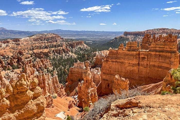
When you plan a short visit to Bryce Canyon National Park, you can drive to Inspiration, Sunset, Bryce, and Sunrise viewpoints. They are the main attractions. Inspiration Point has three viewpoints, with each point gaining elevation for more spectacular views. You can hike to the top. Go on a hike on the Queens Garden Trail, which begins at Sunrise Point, and descend among the rock formations.
The Bryce point, about 200 ft higher in elevation than Inspiration Point, provides a spectacular view of the hoodoos. Follow the Mossy Cave Trail along a sparkling river to get to the cave of dripping water. Go a little further to discover a beautiful desert oasis with a gorgeous waterfall.
Things to Do at the Bryce Canyon National Park
Make your first stop at the Visitor Centre to gather information about Bryce Canyon National Park. Next, check out the 20-minute film and the history museum. Then, go on an 18-mile scenic drive up to the end of the park to catch primary sites like Ponderosa Canyon, Yovimpa Point, and the National Bridge. The scenic drive is 1000+ feet high at the park’s highest elevation point of 9,115 feet at Rainbow Point.
Remember to carry a good camera and take photos early in the morning or later in the afternoon. In the early morning, capture Sunrise Point and Bryce Point. To capture some of the best sunset shots, go to Yovimpa Point, Inspiration Point, and Sunset Point. Early in the morning, you can also watch out for wildlife sightings of small mammals like jackrabbits, chipmunks, and squirrels scampering along the rim trail.
How Much Time Do You Need For Your Visit
Two days is enough to spend in Bryce Canyon National Park. The Park is small, and you can see most of the things in a single day. However, visiting for two days will give you a chance to check out the best viewpoints and hike the park’s longer trails.
Accommodations and Dining Near the Bryce National Park
There are many restaurants near Bryce Canyon National Park. They include Bryce Canyon Restaurant, Valhalla Pizza, Bryce Canyon Coffee Co, Stone Hearth Grille, IDK Barbecue, The Pizza Place, Ebenezer’s Barn and Grill, Bryce Canyon Pines, Cowboy Ranch House at Bryce Canyon Restaurant, Rustler’s Restaurant, and many others.
There are excellent accommodations in Bryce National Park for those who intend to stay for a few days. They include Best Western Plus Bryce Canyon Grand Hotel, Bryce Canyon Pines, Bryce View Lodge, Bryce Canyon Resort, Foster’s Bryce Canyon Motel, The Iron Gate Inn & Suites, and many others.
Best Time to Visit the Bryce Canyon National Park
May through September is when most people visit Bryce National Park. This period has the warmest weather, and there are a lot of ranger activities. October through April offers cooler temperatures, and fewer people visit to check out wildflowers and fall foliage. The Park is filled with snow during winter, and visitors can go cross-country skiing and snowshoeing. However, the weather during winter, spring, and fall at Bryce Canyon National Park can be variable due to high elevation.
You May Want to Join Our Boondocking Group on Facebook For More Information
You May Want to Join Our Campfire Recipes Group on Facebook For More Information