
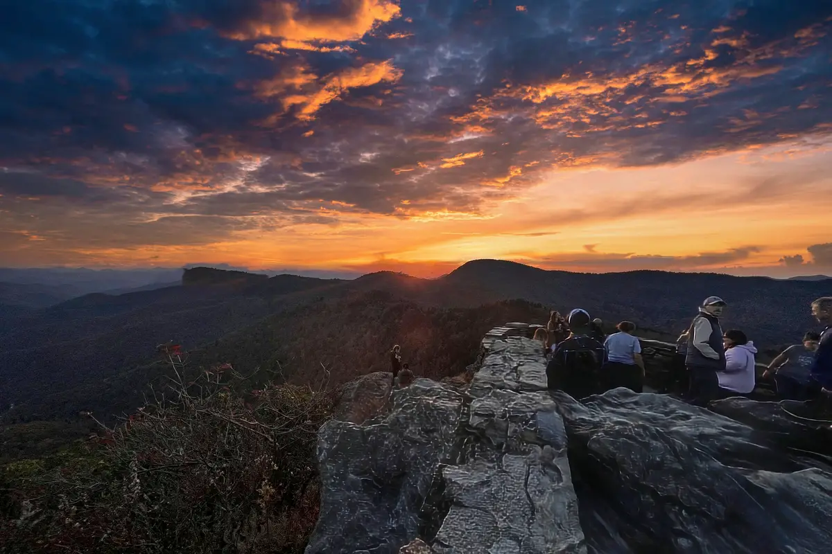
You will love your experience on the Flat Laurel Creek trail. It is a 7.4-mile out-and-back trail near Canton, North Carolina. Generally considered a moderately challenging route, it takes an average of 2 h 59 min to complete. This is a popular trail for hiking and mountain biking, but you can still enjoy some solitude during quieter times of day. Dogs are welcome, but must be on a leash.
Difficulty: Challenging
Length: 7.4 mi
Elevation gain: 823 ft
Route type: Out & back
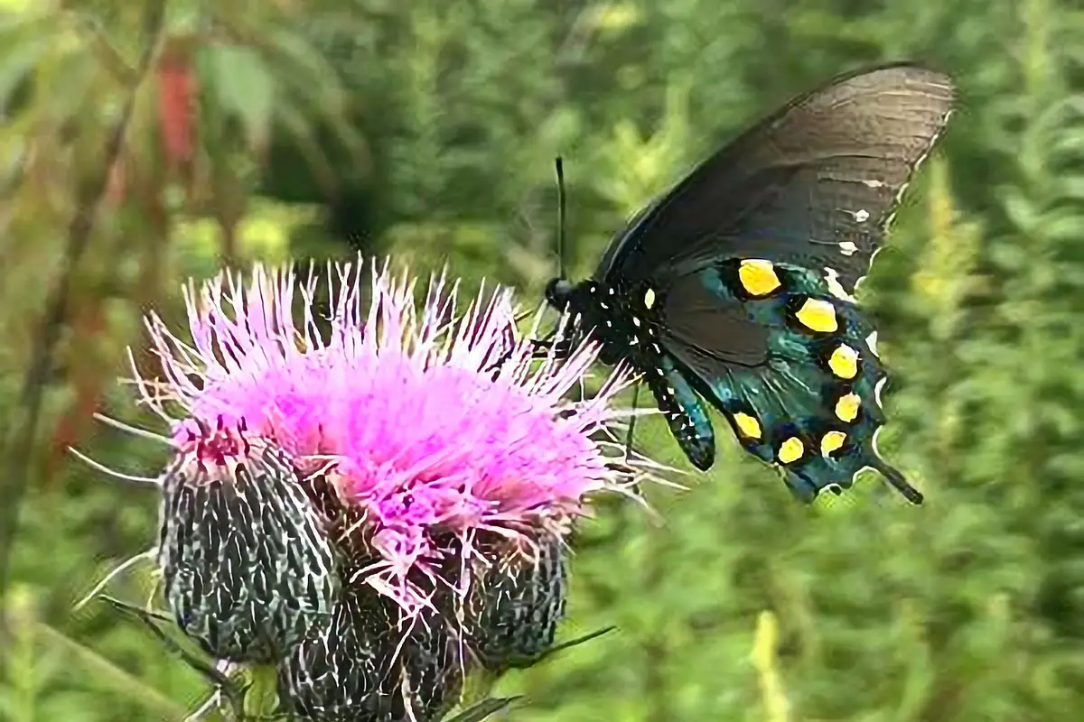
Dogs on leash, Hiking, Mountain biking, Forest, River, Waterfall, Wildflowers, Wildlife
Review
Great hike! We parked on the street for the Flat Laurel Creek trail. There are a few pull-off spots, but it’s mostly “take what you can find.” To get to the trail, we had to walk a bit on the road. We had fun in the snow, but we didn’t realize how much snow there was. Some parts are a little icy, though. We only saw two other groups on the trail we did about half of. There were some beautiful frozen waterfalls and some great camping spots that we will probably visit again.
Want more ideas to round-out your trip to the South-Eastern States?
► Alabama, Arkansas, Florida, Georgia, Louisiana, Mississippi, North Carolina, South Carolina, Tennessee ◄
- 94 Free Arkansas Boondocking Locations
- 29 Free Alabama Boondocking Locations
- 52 Best Louisiana Boondocking and Free RV Parking Spots
- 87 Best Mississippi Boondocking and Free RV Parking Spots
- 77 Great Georgia Boondocking – Free RV Parking & Camping Locations
- 90 Free Florida Boondocking – RV Parking and Camping Sites
- 61 Free North Carolina Boondocking – RV Parking & Camping Spots
- 26 Free South Carolina Boondocking Spots – RV Parking & Camping
- 34 Free Tennessee Boondocking – Camping Spots & RV Parking

The Best Flat Laurel Creek Trail Plus 2 Falls
check out our video
From the open top of Green Knob, across the gorge, you can see a lot of the falls from the Flat Laurel Creek trail. From the Mountains-to-Sea Trail on Mount Hardy, Green Mountain Trail follows Fork Ridge all the way down to NC 215, where Middle Prong and West Fork Pigeon River meet.
The first part of the Flat Laurel Creek trail between Mount Hardy and Green Knob has great views, including an open view of Wildcat Falls and the waterfalls of Flat Laurel Creek. The Forest Service made a map of Shining Rock and Middle Prong that shows the trails in detail. At N35.31815, W-82.92255, you can see Wildcat Falls.
At N35.33104, W-82.92145, you can see the falls on Flat Laurel Creek trail. I really think you should go on the hike to Green Knob. But if you want to keep going down the Green Mountain Trail to NC 215, I have some tips for you. In this part, there aren’t many good views, the trail is hard to follow, and it’s very steep. This part shows that there are people who build trails for the devil.
The Flat Laurel Creek trail starts near Sam Knob in Haywood County. This is close to the Blue Ridge Parkway areas of Graveyard Fields, Black Balsam Knob, and Tennent Mountain. Before it joins the upper end of the West Fork of the Pigeon River near the Three Arch Bridge on NC215 north of the Parkway, this beautiful stream flows for more than 1.5 miles and drops almost 100′ in elevation.
Along Flat Laurel Creek, there are a number of falls. A couple of them are pretty easy to get to by hopping from rock to rock. To see all of them, you need to be very good at climbing over rocks, and you should only do this if you are an experienced creek walker. This is a very popular place for hiking and primitive camping, and during the summer, the parking lots get very full.
If you come early, you should have no trouble finding a place to park. You’ll need a trail map of the Pisgah National Forest to see all of the hiking trails in this area. Several hikes in western North Carolina have some of the best views and high elevations. For more information about these hikes, go to this part of hikewnc.info.
This area also offers excellent early October fall color – usually between the first and second weeks. Flat Laurel Creek fishing is also a great passtime.
Flat Laurel Creek Description
From the upper Flat Laurel Creek trailhead, you can get to the upper creek access by following the old logging railroad grade down for less than 0.1 mile until you reach Bubbling Spring Branch. This stream is usually easy to cross by hopping over rocks. From the crossing, it is a little over 0.1 mile to another creek, which you can cross without getting wet unless the water is very high. From this crossing, you can see a pretty little waterfall upstream.
The railroad grade goes on for another 0.5 mile until it reaches an odd-looking concrete bridge at the bottom of Wildcat Falls.
From Wildcat Falls, stay on the easy grade for about 1.1 miles until the trail turns to the right and enters the Flat Laurel Creek drainage.
At N35.32520, W-82.89838, you’ll soon see a clear path on the left. Less than 100 yards further, at N35.32487, W-82.89767, you’ll see another side path (more like a gully) on the left. In 135 yards, you’ll come to a third path on the left at N35.32445, W-82.89658.
You can get to the creek by either of these Flat Laurel Creek trail routes. The third one is only a few yards long and leads to the creek at the top of all the falling water. If you start there, you won’t miss anything. The second one is also short, but it is very steep and leads to the creek at the base of the first waterfall. This is probably the best place to start because you can see the upper waterfall without having to walk down it.
The first path is steep and much longer. Years ago, it was also very confusing because it led to many different paths, making it easy to get lost and not know where to go. Someone told me that it went down to the creek near the lower trailhead, skipping all the waterfalls.
I put that information in the book. But when I hiked it recently, I didn’t see any clear ways down to the bottom Flat Laurel Creek trailhead. At the beginning of the main part of the waterfalls, the only clear path leads down to the creek. If you take this path, you’ll miss some of the smaller waterfalls upstream, but you’ll see all of the bigger ones downstream.
From the lower Flat Laurel Creek trailhead, follow the old logging grade straight to the creek to get to the lower creek access. You can start the creek walk here, but the waterfalls don’t start until a little further upstream. But before you get to the falls, there are some nice views of the creek with little waterfalls.
You can skip this part by taking a series of small paths on the river’s right side. To find them and stay on them, you’ll have to look around.
Once you’re in the creekbed, just take the path with the least amount of trouble. In the lower part, you’ll always be in or very close to the creek. You can’t stay in the creek in the upper part because the waterfalls are too big and dangerous to cross. I’ve always gone river right to avoid this section. Most of the woods are open and easy to walk through.
From where you can get to the upper part of the creek, the Flat Laurel Creek Trail keeps going along the railroad grade. It gets to the parking area at the end of FR 816 in about 1.5 miles. You can walk to the waterfalls from this trailhead or leave a shuttle car here, but be aware that the Blue Ridge Parkway, where FR 816 starts, is often closed in the winter.
Hiking Tips For Flat Laurel Creek Trail
Pack the 10 Essentials For Every Hike
1. Navigation + Communication Devices Fully Charged
2. Sun Protection
3. Proper Footwear + Extra Clothes
4. Water
5. Extra Food
6. Headlamp
7. First Aid + Repair Kit
8. Knife / Multi-tool
9. Fire Tools
10. Emergency Shelter
11. Trash Bag
Additional Tips
There was a sign in the parking lot that said bears were active in this area. When I came around a bend, there was a bear about 20 to 30 feet in front of me. It must have already eaten enough berries, though. This was a pretty cool thing to do, but I’m now carrying bear spray.
Directions To the Flat Laurel Creek Trailhead:
From Asheville, get on the Blue Ridge Parkway heading South. The quickest way to do this is to take I-240 West to I-26 East to Brevard Road (NC 191, exit 33). Turn left at the end of the ramp and follow Brevard Road about 2.4 miles. Turn right at the light at the entrance to the NC Arboretum/Blue Ridge Parkway ramp.
Turn to the left up the ramp and then turn right (South) on the Parkway. Go 26 1/2 miles (past Graveyard Fields) and turn right on Black Balsam Road. The parking area is at the end of the road after 1.2 miles, on the left at the Flat Laurel Creek trailhead.
Review
If I had to choose, the hike up Flat Laurel Creek trail to Sam Knob is my favorite short day hike .
Sam Knob is one of my favorite southern summits, and it is near the top of my short list. Add to that a nice 3-mile hike up a well-trodden trail through forests and fields at a high elevation, a few waterfalls, and long-distance views, and you have a hike that is a real gem that will never let you down. Sam Knob is a peak that stands alone at 6,050′. It is right next to the huge group of peaks that make up the Great Balsam Range.
Each of its two summits has a great view of the river gorges around it and about a dozen nearby 6000-foot mountains in the South.
I biked the whole Flat Laurel Creek trail about 5 years ago, from the 215 parking lot to the top, but I wouldn’t be able to do it now because the erosion has made it too hard for me. There are many 12″–18″ drops that would stop me from going up. Getting down on a bike would also be hard.
Flat Laurel Creek Nearby Trails to Hike
Graveyard Fields Trail
This 2.9-mile loop trail is close to Balsam Grove, North Carolina, and is a lot of fun. Most people think of it as a moderately hard route, and it takes an average of 1 hour and nine minutes to finish. This is a very popular place for fishing, hiking, and mountain biking, so you’ll probably run into other people as you explore.
From March to October is the best time to visit this trail. We allow dogs, but they have to be on a leash.
Difficulty: Moderate
Length: 2.9 mi
Elevation gain: 305 ft
Route type: Loop
Dogs on leash, Kid friendly, Fishing, Hiking, Mountain biking, Walking, Running, Forest, River, Views, Waterfall, Wildflowers, Wildlife, Rocky
Review
The best falls here are the Second Falls, which are not on this route. Make sure you go the extra short distance to see them. To see the best part of the Upper Falls, you have to go a little further up than it seems necessary on the map. On the out-and-back part to the Upper Falls, there are a lot of forks that aren’t marked.
Most, but not all, of the side trails are just ways to get around mud or other obstacles and get back to the main trail.
Shining Creek Path
Try this 17.1-mile trail near Pisgah Forest, North Carolina. It goes out and back. Most people think of it as a moderately hard route, and it takes an average of 10 hours and 44 minutes to finish. This is a popular trail for backpacking, birdwatching, and hiking, but you can still find some peace and quiet on it at less busy times.
The trail is beautiful and can be used at any time of year. Dogs are welcome, and in some places they can run free.
Difficulty: Moderate
Length: 17.1 mi
Elevation gain: 5,524 ft
Route type: Out & back
Backpacking, Hiking, Horseback riding, Bird watching, Dog friendly, Forest, River, Views, Wildflowers, Wildlife, Scramble, Washed out
Review
This is a great trail, but it gets a little more difficult in the winter. The rocks are slippery, and there aren’t many signs to show where to go. If you have a map with you, you’ll be fine. The trail is between easy and hard, with a lot of steep ups and downs. Overall, it was a lot of fun!
Along the river, this was a nice steady climb with some nice views of the water. With a full pack, this trail is a much better way to get to Shining Rock Ledge than the Art Loeb Trail from Daniel Boone Scout Camp. Bear Canisters are now needed to store food in this area if you want to camp. This is definitely true, as we had to chase a bear away from our campsite at Shining Rock Gap over and over again. But we didn’t have any problems as long as the food was put away properly at night.
Courthouse Falls Trail
This 0.6-mile trail near Balsam Grove, North Carolina, goes out and back. Most people think of it as an easy route, and it takes an average of 14 minutes to finish. This is a popular place to camp, hike, and run, so you’ll probably run into other people while you’re out exploring. The trail is beautiful and can be used at any time of year. We allow dogs, but they have to be on a leash.
Difficulty: Very Easy Even With the Add On Due to Road Closure
Length: 0.6 mi
Elevation gain: 49 ft
Route type: Out & back
Dogs on leash, Kid friendly, Camping, Hiking, Running, Forest, River, Views, Waterfall, Wildflowers, Wildlife
Review
As was already said, the road is closed, but the hike is still very nice. At least three-quarters of the time, along the river. Right now, the leaves are BEAUTIFUL. On a Sunday afternoon, when we went, there were only about five other people there. We got between 8 and 9 miles out of this hike because we did some extra scrambling in and out of the river.
Things to Do Near the Flat Laurel Creek Trail
Visit Sunburst Falls
Sunburst Falls is a beautiful waterfall that goes under an old stone bridge on Route 215 between Bethel, NC and the Blue Ridge Parkway. The Falls are on a creek called the West Fork of the Pigeon River, but locals usually call them Sunburst Falls because they are close to the town of Sunburst.
The upper part of the Falls is easy to see from the road and is a popular place for people to stop on their way up the beautiful and scenic Highway 215.
Sunburst Falls is right next to Highway 215, and it goes under a beautiful curved stone bridge from the 1930s. The water flows through an arch in the bridge and drops into smaller falls below the bridge. Here, you can see two sets of waterfalls: the upper falls, which are above the bridge, and the lower falls, which are below the bridge.
Visit Devils Courthouse
The Devil’s Courthouse is at milepost 422.4 on the Blue Ridge Parkway. It has a short but difficult trail that climbs a half-mile to the top, where there are great views of the mountains. The trail starts at the overlook parking area, which is next to the mountain. Most of the trail is paved.
The bare rock profile called Devil’s Courthouse looks and sounds scary, according to the sign at the overlook. Folk stories about this mountain have a lot to do with how “evil” it looks. A myth says that the devil holds court in a cave inside the mountain.
Cherokee legend says that Judaculla, a giant with crooked eyes, lived in this cave and used it as his dance room. Even though it is called Devil’s Courthouse and has a bad reputation, it is home to rare and fragile high-altitude plants.
Visit Courthouse Valley Overlook
From this lookout, it’s easy to see a wide range of beautiful sights. In the distance, the flatlands of the French Broad River join the Courthouse Valley down below.
At an impressive 5,720 feet tall, this dark mass of exposed rock seems to hang over the spruce forest that surrounds it. Cherokee legend says that a strong mountain giant named Judaculla danced and held court in a room under the rock.
On a clear day, visitors can see as far as North Carolina, South Carolina, Georgia, and Tennessee from the top of this legendary dance hall, which is reached by a tough half-mile trail.
Food and Diner Locations Near the Flat Laurel Creek Trail
Smoke on BBQ
585 S Caldwell St Brevard, NC 28712
Review
Absolutely incredible Q. I’m a tough reviewer of brisket, and I have to say that these burnt ends are some of the best I’ve ever had. I love that they come dry (with either sauce on the side), because I’d rather taste the BBQ than a sweet sauce. Even so, the sauces on the pulled pork sandwich were great. I liked the mustard sauce the most.
Corkys Dawg House
1910 Asheville Hwy Brevard, NC 28712
Review
Most delicious meal I’ve had in my week vacation here! The food had a strong flavor and was cooked just right. The atmosphere was fun and welcoming, and everyone who worked there was friendly and eager to help. As a treat, I also HIGHLY recommend the shakes.
Country Skillet
Old Rosman Hwy, Rosman, NC 28772
Review
Truly living up to it’s name, this gem serves 3 meals a day (most days – so check before going). Everything’s made to order, and typical down-home country fare. The kind of place where locals go, but tourists fit right in. People know each other, and the staff treats you like family.
You May Want to Join Our Boondocking Group on Facebook For More Information
You May Want to Join Our Campfire Recipes Group on Facebook For More Information