
The Middle Prong Trail is a 14.3-mile path near Townsend, Tennessee. Most people think of it as a moderately hard route, and it takes an average of 7 hours to finish. This trail is used by a lot of people to walk, run, and hike, but you can still get some alone time when it’s not busy. From March to October is the best time to visit this trail. Dogs can’t go on this trail, so you’ll have to leave them at home.
Difficulty: Leg Burner
Length: 14.3 mi
Elevation gain: 2,824 ft
Route type: Loop
Hiking, Walking, Running, Views, No dogs
Want more ideas to round-out your trip to Tennessee?
A lot of great ideas are in these posts!
- Our 9 Favorite Great Smoky Mountains National Park Cabin Rentals
- 17 Spots for Great Smoky Mountains National Park Photos
- 35 Best Smoky Mountain National Park Campgrounds & RV Parks
- 27 Best Great Smoky Mountains National Park Hotels By Entrance
- 12 Top Things To Do In Smoky Mountain National Park
- 19 Very Best Smoky Mountain National Park Waterfalls
- 5 Top Sugarlands Valley Nature Trail Hiking Things to Do
History of the Middle Prong Trail
You should already know that Middle Prong Trail is in the mountains near Tremont. When you put “tree” and “mountain” together, you get the word “Tremont.”
The Little River Railroad and Lumber Company, which was based in Townsend, cut down most of the trees in this area in the early 1900s. As a result, there aren’t many trees left in some areas. During the logging years, there were a lot of people living in the Tremont area. Even though not much is left, there are still some signs of the past.
Middle Prong Trail Highlights
Middle Prong Trail is a hike where the journey is more important than the destination, because there isn’t really a destination (unless you count the old Cadillac).
This is the real path to nowhere. On the Middle Prong Trail, there are often horses, so watch where you step. We didn’t see any horses or horse poop on our hike.
The beautiful water is the best thing about Middle Prong Trail. The trail runs along the river the whole way. From the beginning to the end, the rushing river, waterfalls, and cascades can be seen and heard.
Even though Abrams Falls Trail is much more popular, Middle Prong Trail has much better waterfalls and cascades. This is the trail to go on if you want to see and enjoy the best water in the Smokies.
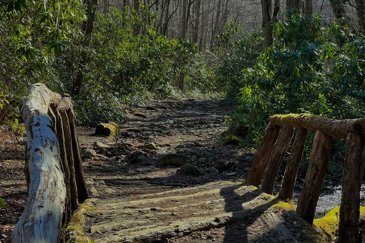
About 1.5 miles in, you will cross the small footbridge shown below. It goes over a small stream that flows into it. Even though the bridge looks a little worn, it is still safe to walk on. The area right before the bridge is very rocky.

The Great Middle Prong Trail and Waterfalls
check out our video
Description
One of the main reasons people go to the Smoky Mountains is to hike on the many trails. The Middle Prong Trail is good for both casual walkers and hard-core outdoor enthusiasts.
On some of these hiking trails in Great Smoky Mountains National Park, you can hear and feel the power of Smoky Mountain waterfalls. That’s exactly what you’ll get when you hike the Middle Prong Trail.
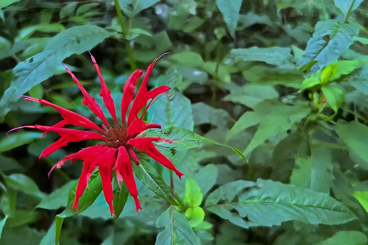
On this beautiful hike through the Smoky Mountains, you’ll see wildflowers, waterfalls, and even a bit of history, just for good measure.
The Middle Prong Trail is also nice because it is wide, at least in the beginning. The wide trail was once a railroad bed for the Little River Lumber Company when it was logging. It gives hikers plenty of room to come and go.
This hike along the Lynn Camp Prong part of the hike to the beautiful Indian Flats Falls is the perfect example of a stream hike in the Smoky Mountains. When you hike the Middle Prong Trail, don’t forget to bring your camera. From the spring flowers to the beautiful fall colors in October, you’ll want to take pictures of every step of this beautiful trail.
The hike is becoming more and more popular, so be prepared for crowds on busy fall weekends. The trail is moderately hard because it is long (14.3 miles round-trip) and has a lot of elevation gain.
Hiking Tips For the Middle Prong Trail
In the winter, cars aren’t allowed on the last three miles of Tremont Road, which lead to the Middle Prong Trail. If the weather is good, you can combine biking and hiking at Indian Flats Falls. Park at the place where the road is closed and ride your bike the last three miles to the trailhead. Note that you can’t ride bikes on the trail.
Along the Middle Prong Trail, bears are often seen, especially in the fall. While hiking, keep an eye out for them.
Even though spring and fall are the best times to hike Indian Flats Falls, the trail is fun and enjoyable any time of year. In April, the forest floor is covered with dwarf iris, trillium, jack-in-the-pulpit, violet, and other wildflowers. In October, the trail is lit up by the leaves.
The Great Smoky Mountains Institute at Tremont is the closest place to the Middle Prong Trail where you can use the bathroom. If the facility is closed, go back to the Cades Cove Picnic Area or stop in the town of Tremont.
Directions to Trailhead:
From the intersection of Little River Road and TN 73 at Townsend Y, go southwest toward Cades Cove. Turn left onto Tremont Road after going 0.2 miles. After two miles, the Great Smoky Mountains Institute at Tremont will be on your left, and then the road will turn into gravel.
Keep going three more miles down the gravel road until you reach the end of the road. Park here to get to the trail. If you want to park close to the trailhead on busy weekends, you should get there early.
The Middle Prong Trail starts by going over a high bridge over the Middle Prong River and into a flat area that used to be a lumber camp. The trail is wide, and the Lynn Camp Prong runs along the left side of it. The trail goes up higher over the river, and there are wildflowers all around.
As you walk up the trail, you’ll see chutes, falls, and pools in the river. The trail starts to even out, and at.7 miles, there is a bench where you can rest. In this area, there is a small waterfall that is all that is left of old splash dams that loggers used to help get logs down the mountain to the sawmill in Townsend.
Review
Because my wife and son wanted to see waterfalls and I wanted to see a different part of the Middle Prong Trail than I usually do, I chose this section. When I went to the visitor center to get a map, the veteran ranger at the desk told me that the Middle Prong Trail was his favorite hike in the whole park. Now I know why. The road is paved for the first part of the way to the Tremont Institute.
From the grounds, the Middle Prong Trail leads to Spruce Flat Falls. The West Prong trail, which goes up the side of the mountains, it starts at a parking lot on the south side of the road. Drive past both until you reach the end of the pavement. About four more miles of gravel lead up to the Middle Prong trail parking lot.
The road’s slope makes it easy for a family sedan to get there, Finding a place to park at the Middle Prong Trail trailhead without hitting a rock, a tree, or another car is the bigger problem.
The first part of the Middle Prong Trail has a gentle slope because it is another logging railbed. We got some great pictures of the lower and upper Lynn Camp falls, but we didn’t make it all the way to Indian Camp Falls, so that’s already on our list for our next trip.
Nearby Trails to Hike
Spruce Flats Falls
Enjoy the 1.8-mile Spruce Flats Falls Trail near Townsend, Tennessee. The trail goes out and back. Most people think of it as a moderately hard route, and it takes an average of 57 minutes to finish. This is a popular place to hike, so you’ll probably run into other people while you’re there. The trail is beautiful and can be used at any time of year. Dogs can’t go on this trail, so you’ll have to leave them at home.
Difficulty: Moderate Tough
Length: 1.8 mi
Elevation gain: 413 ft
Route type: Out & back
Hiking, Forest, River, Views, Waterfall, Wildflowers, Wildlife, Rocky, Scramble, Off trail, No dogs
Review
The trail is well marked. Everyone did well, from 5 to 65 years old. The path can get pretty steep, narrow, rocky, and wet. The falls are worth it in the end for sure. The trail was marked with yellow jacket nests, but they didn’t bother us at all. No bears were seen. Somewhat busy trail, which means we saw a lot of people, but not so many that they were in our way when we tried to move. Con: There’s only one bathroom stall. There are only about 10 places to park, and there is nowhere else to park if they are taken so go out early.
Little River Trail
Check out this out-and-back trail that is 12.3 miles long and is near Gatlinburg, Tennessee. Most people think of it as an easy route, and it takes an average of 4 hours and 45 minutes to finish. This is a popular place for hiking, camping, and fishing, so you’ll probably run into other people while you’re out exploring. The trail is beautiful and can be used at any time of year. Dogs can’t go on this trail, so you’ll have to leave them at home.
Difficulty: Long But Easy
Length: 12.3 mi
Elevation gain: 1,213 ft
Route type: Out & back
Kid friendly, Backpacking, Camping, Fishing, Hiking, Walking, Running, Forest, River, Views, Wildflowers, Wildlife, No dogs
Review
It was a beautiful steady uphill that was very easy to do for 3 miles. You can walk in a circle and come down on the other side, but we chose to go back the way we came along the river. With the leaves changing colors, it was so beautiful outside. Just the best. Dogs aren’t allowed, and most of the people we met on the trail were older.
A lot of people had walking poles, but you don’t need them for most of the first stretch. If you want a nice, safe hike in the Smokies that is also beautiful, this is a great choice. It’s easy to find because it’s right by the river. Oh, and after miles 1 and 2, there are a couple of clean benches where you can take a break. Bring water!
Sugarland Mountain Trail
This point-to-point trail is 11.7 miles long and is near Gatlinburg, Tennessee. Most people think of it as a difficult route, and it takes an average of 6 hours to finish. This is a popular trail for hiking, camping, and backpacking, but there are times of the day when you can still be alone. The trail is beautiful and can be used at any time of year. Dogs can’t go on this trail, so you’ll have to leave them at home.
Difficulty: Very Challenging
Length: 11.7 mi
Elevation gain: 4,422 ft
Route type: Point to point
Backpacking, Camping, Hiking, Running, Forest, River, Views, Wildflowers, Wildlife, No dogs
Review
On the Middle Prong Trail, I only went out and back 8 miles, but it was a beautiful hike. The parking lot was full, but I didn’t get there until 11 a.m. because I got off to a late start. Even though the parking lot was full, I was the only person on this trail, and it was raining, so I think everyone else was across the street. A few trees are down, but it’s easy to get around them. There are also two places that are sunk, so be careful after it rains a lot. I will be back for sure!
Things to Do Near the Middle Prong Trail
Visit the Sinks
The Sinks area is one of the most beautiful places along the Middle Prong Trail and the Little River Road scenic drive. Visitors can see Mother Nature at her best in this area, which is 12 miles west of the Sugarlands Visitor Center.
The Sinks are where a beautiful mountain river makes an S-turn, creating natural pools surrounded by huge river boulders on both sides. How did it come to be? Well, loggers used to be able to get to their jobs by going down the Little River. One day, the logs got stuck in the river. Uh-oh, right?
So, what could the woodcutters do? One solution, dynamite. With their explosion, the smart loggers blew up the bend and made a new way to get to the river. This is how “The Sinks” got its name. Now, it has water that is very clear, natural pools, and a waterfall. This is a great place to get out of the car and stretch your legs.
Even though this is a popular place to swim on hot summer days, please be aware that many people have drowned and been seriously hurt in this exact spot. We don’t think this is a good place to swim. Instead, you should go to the Greenbrier section of the National Park, which is calm and has shallow water.
Lynn Camp Prong Photo Spot
This hike to the cascades and waterfalls on Lynn Camp Prong is a good one if you want a short andeasy hike to a beautiful place. It’s good for families, and on the way up to the parking area, you might even find places to cool off in the Middle Prong of the Little River. This is also a good place to see beautiful fall colors if you go around the middle of October.
As it flows down the mountain next to the Middle Prong Trail, Lynn Camp Prong rushes and tumbles over many cascades. The trail follows the path of an old logging railroad, so it is wide and mostly flat, making it easy to walk. Along the trail, wildflowers bloom from spring to summer.
Drive the Cades Cove Scenic Loop
The Cades Cove Loop goes around the Great Smoky Mountains National Park for 11 miles. It is a beautiful drive with mountain peaks and lush, rolling green grasslands in the background.
Between 1818 and 1821, Europeans moved into the Cades Cove area.Today, Cades Cove in the Great Smoky Mountains National Park has the most historic buildings of any place in the park. Plan to get out of your car and look at the restored buildings along the scenic loop road. There are three churches, log homes, cantilevered barns, and a working mill.
The Cades Cove Loop is a beautiful drive that takes about two to four hours, depending on how busy it is. Since it’s a one-lane road, be ready to stop often. The slow pace lets you enjoy the beautiful mountain scenery, wildflower meadows, and different kinds of wildlife.
There are many places to stop, park, and stretch your legs while taking in the scenery along the road that gently curves. Make it a point to stop at the Visitors Center when you’re halfway around the Loop. Pick up some small items to take home with you. The store has souvenirs, maps, and other items made in the area.
There are lots of places to take pictures, and luckily there are also bathrooms. The John P. Cable Grist Mill, which is powered by water and is close to the visitor center, is a must-see for anyone interested in history.
Food and Diner Locations Near the Middle Prong Trail
The Riverstone Restaurant
8503 State Highway 73, Townsend, TN 37882-4310
Review
Two of us ate the trout that was grilled, and we both agree that it was AWESOME. The other two had different things. One of them had a baked potato, and the other had a BLT. They also liked what they ate. Also, someone got the peach cobbler and said it was “delicious.” I would only suggest that you don’t put so much salt in your gravy (luckily I asked for it on the side). The green beans tasted great. …. true southern style. I highly recommend stopping here to eat if you’re in Townsend, TN ….. Enjoy!
Black Bear Cafe
7621 E Lamar Alexander Pkwy, Townsend, TN 37882-3907
About
Review
On our way from Knoxville to Gatlinburg during the week, we stopped here for lunch. Even though it was busy, we were able to get a seat in about ten minutes. Small town life is fun. Some of the people eating there seemed to be regulars.
The service was quick and friendly. We ordered one of the daily specials, which was a huge chicken and a fish sandwich. All of the food was tasty. We were too full to try the homemade pies and other desserts, which was a shame. It was fun, and I’m glad we stopped. Closed Tuesday and Wednesday and in the winter
Hillbilly’s Restaurant
3275 Wears Valley Rd, Wears Valley, TN 37862-8313
About
Our restaurant is laid back and casual with a friendly staff. We do our best to provide you with a good meal and a feeling of family. We serve breakfast all day, lunch from 11-2,and have a breakfast buffet on Saturday and Sunday. We have also added dinner for October weekends. Please come check us out and sign our truck.
Review
We’ve driven by this restaurant a few times when we’ve been in the area. We stopped there on this trip after going to Cades Cove. It was very tasty! Only half of our group ate breakfast, while the other half ate lunch. No one had anything bad to say, and everyone was full. We’ll be back for sure! Our waitress was more than friendly and warm. There pancakes are AMAZING!
You May Want to Join Our Boondocking Group on Facebook For More Information
You May Want to Join Our Campfire Recipes Group on Facebook For More Information