
Check out the 3.6-mile Chimney Tops Trail near Gatlinburg, Tennessee. The Chimney Tops Trail goes out and back. It takes an average of 2 hours and 30 minutes to finish what most people think of as a difficult route. This is a popular place to hike, so you’ll probably run into other people while you’re there. From March to November is the best time to visit this trail. Dogs can’t go on this trail, so you’ll have to leave them at home.
Difficulty: Tough
Length: 3.6 mi
Elevation gain: 1,286 ft
Route type: Out & back
Hiking, Forest, River, Views, Wildflowers, Wildlife, Rocky, Scramble, No dogs
Want more ideas to round-out your trip to Tennessee?
A lot of great ideas are in these posts!
- Our 9 Favorite Great Smoky Mountains National Park Cabin Rentals
- 17 Spots for Great Smoky Mountains National Park Photos
- 35 Best Smoky Mountain National Park Campgrounds & RV Parks
- 27 Best Great Smoky Mountains National Park Hotels By Entrance
- 12 Top Things To Do In Smoky Mountain National Park
- 19 Very Best Smoky Mountain National Park Waterfalls
- 5 Top Sugarlands Valley Nature Trail Hiking Things to Do
5 Reasons You Must Visit Chimney Tops Trail
check out our video
Great Smoky Mountains National Park reopened the Chimney Tops Trail, which leads to a new lookout point, on October 6, 2017. Due to a wildfire in November 2016, the popular Chimney Tops Trail was closed for almost a whole year.
Because of that fire, the area around the pinnacles is now considered dangerous since it was completely destroyed. During the time that the Chimney Tops Trail was closed, park workers built a new observation deck about a quarter mile below the summit. From this deck, you can see Mount LeConte and the Chimney Tops pinnacles.
As was said above, the official end of this hike is about a quarter mile below the pinnacles. But from the new observation point, you can see Mount LeConte and the pinnacles in a great way. For everyone’s safety, the park has closed off all Chimney Tops Trails past this point.
It’s possible that this last part could open again in the future. In a press release from October 3, 2017, park officials said, “The park will consider Chimney Tops Trail rehabilitation in this area if it turns out that the ground is safe and stable enough for long-term trail construction.”
Hiking Chimney Tops
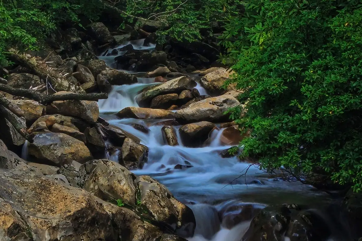
Begin your hike at the main parking lot and go down over the Walker Camp Prong Bridge. When you look downstream from the bridge, you can see where Walker Camp Prong and Road Prong meet to make the West Prong Little Pigeon River.
Follow the Chimney Tops Trail across the Road Prong, where it bends to the left and starts a steep climb, and then cross the Road Prong again. Keep going up, and for the third and last time, cross the Road Prong. After this third crossing, the trail opens up into an area called “Beech Flats.” When the Chimney Tops Trail splits, stay to the right to keep going to the Chimney Tops overview.
Start an easy climb that leads to a metal culvert in the middle of the Chimney Tops Trail. Take a quick break here to get some water and rest. You’ll need your strength for the next climb! For the next several hundred yards, the climb up the drainage is very steep and hard.
Until the very end of the elevation gain, there are no switchbacks on the Chimney Tops Trail. However, by this time, most of the elevation gain is already behind you. After the switchback, the trail gets easier and flattens out on a narrow ridge. Now comes the fun part!
At this point, there will be a sign telling you not to go any further. Take note of this and think about whether or not the view is worth the risk of falling into the ravine. If you’re ready to go on, put away any loose items and be ready to use both hands to climb the rocks.
Climb the rocky ridge that is right in front of you. Do not go to the right. Heavy erosion has broken up the Chimney Tops Trail here, making it very dangerous to scramble.
When you get to the top, you’ll see a view you’ll never forget. Mount LeConte is a big mountain to the northeast. The Boulevard is the name of the narrow ridge to the right of LeConte. In the southeast, you can see Mount Mingus. During the winter and early spring, you can see “the Loop” on Newfound Gap Road to the left of Mount Mingus. To the west is Sugarland Mountain, and to the northwest, far away, is Cove Mountain.
Go back the way you came to get back to the trailhead. At the intersection with the Beech Flats Trail, take the Road Prong Trail for a longer hike. Since you’ll be coming back to a different trailhead, plan ahead and leave a second car in the other parking area.
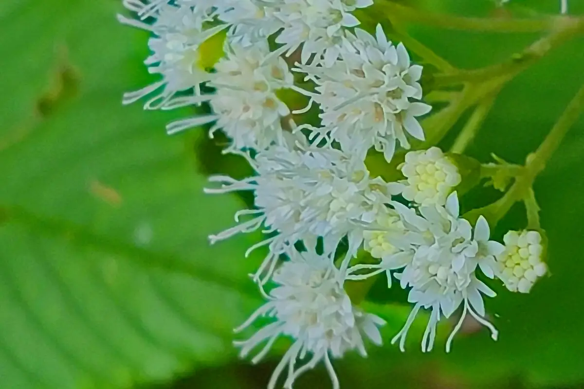
Along the Chimney Tops Trail, you’ll see lots of plants and animals, like squirrels who are eager for food (but don’t give them any, it’s against the rules). Due to how popular the Chimney Tops Trail is, you can also expect to see a lot of other people, which can slow you down on weekends. Along the trail, there are many places to take pictures, but the best views are at the top.
If you decide to hike the Chimney Tops Trail with young kids, make sure you always know where they are. It only takes one wrong step to fall from the top of the rock scramble.
Hiking Tips For the Chimney Tops Trail
One of the few mountains in the Smokies with a bare rock peak is Chimney Tops. Chimney Tops is called Duniskwalgunyi, which means “forked antler” in Cherokee. This is because it looks like the antlers of a young deer.
Even though it might be warmer and more crowded in the summer, I think you should wait until the afternoon to start your hike. If you wait until the afternoon, you can see the mountains across the valley without having to look through the haze caused by the morning sun.
The Chimney Tops Trail is also a very hard hike for people who have never been hiking before. Even though it’s rated as moderate because it’s not very long, it’s actually much harder because of how much elevation it gains.
Directions To the Chimney Tops Trail Trailhead
Drive 6.7 miles south on Newfound Gap Road to reach the Chimney Tops Trail trailhead from Sugarlands Visitor Center (or 22 miles north from Oconaluftee Visitor Center). Between “the loop” and the lower tunnel, look for a sizable parking lot on the west side of the street.
or
From Prineville, go about 16 miles south on Highway 27 toward Bowman Dam and Prineville Reservoir. Chimney Rock Campground is on one side of the road, and the trailhead is on the other.
Review
Great trail, and the view from the top is great too. “Hard” is too strong of a word. It’s a nice little climb that will make you sweat, but the trail isn’t too hard. From the trailhead to the lookout, it takes me 45 minutes, and it takes me 30 minutes to get back down.
This morning, there weren’t many people on the trail. We had no trouble finding a place to park. Until you reach the fourth bridge, the hike isn’t too hard. After that, it’s hard for sure. Get ready to climb a lot of stairs. Breaks were very important. The view from the top is nice, but it’s nothing special.
Please don’t be like the two idiot groups we saw this morning who ignored the sign at the top that said the peak was closed. Don’t put yourself or the people trying to help you in danger.
Definitely recommend if you want to squeeze in a quick hike, the views are quite rewarding.
Nearby Trails to Hike
Laurel Falls
Check out this 4.6-mile out-and-back trail near Hampton, Tennessee. Generally considered a moderately challenging route, it takes an average of 1 h 57 min to complete. This is a very popular area for birding, camping, and hiking, so you’ll likely encounter other people while exploring. The best times to visit this trail are March through October. Dogs are welcome and may be off-leash in some areas.
Difficulty: Moderately Challenging
Length: 4.6 mi
Elevation gain: 620 ft
Route type: Out & back
Camping, Hiking, Bird watching, Running, Dog friendly, Forest, River, Views, Waterfall, Wildflowers, Wildlife, Rocky
Alum Cave
Try this out-and-back trail that goes 11.0 miles near Gatlinburg, Tennessee. Most people think of it as a difficult route, and it takes an average of 6 hours and 23 minutes to finish. This is a popular place for hiking and backpacking, so you’ll probably run into other people while you’re out exploring.
From April to November is the best time to visit this trail. Dogs can’t go on this trail, so you’ll have to leave them at home.
Difficulty: Mildly Challenging
Length: 11.0 mi
Elevation gain: 3,061 ft
Route type: Out & back
Dogs on leash, Kid friendly, Camping, Hiking, Walking, Bird watching, Running, Cave, Forest, River, Views,
Rocky
Trillium Gap Trail
This out-and-back trail is 6.8 miles long and is close to Gatlinburg, Tennessee. Most people think of it as a moderately hard route, and it takes an average of 3 hours and 14 minutes to finish. This is a popular place to hike, so you’ll probably run into other people while you’re there. The trail is beautiful and can be used at any time of year. Dogs can’t go on this trail, so you’ll have to leave them at home.
Difficulty: Pretty Easy
Length: 6.8 mi
Elevation gain: 1,243 ft
Route type: Out & back
Kid friendly, Hiking, Forest, Views, Waterfall, Wildflowers, Wildlife, Rocky, No dogs
Things to Do Near the Chimney Tops Trail
Trickling Falls
One way, this trail is about 1.3 miles long. It is paved, and kids can go there as long as they are always watched. On this hike, there were wild blueberries, blackberries, and rhododendrons in bloom. No animals, though. Too noisy.
The waterfalls were fine. Not a lot of water moving. I guess it had been a while since it rained. When you get to falls, you must keep a close eye on children.
I suggest stopping anywhere in the park where there are signs saying “quiet walk” along the road. There aren’t many people on these hikes because there is only room for one or two cars to park.
Laurel Falls
Laurel Branch and the 80-foot high Laurel Falls are named for mountain laurel, an evergreen shrub which blooms along the trail and near the falls in May. The waterfall has an upper section and a lower section, which are separated by a bridge over the stream at the base of the upper falls.
Laurel Falls is one of the most popular places in the park, and there are only a few spots to park at the trailhead. The area is busiest on weekends and during the week
Arch Rock
In the Great Smoky Mountains, arches are rare, and you get to walk through this one! This gem is also on the way to Alum Cave Bluffs, so you can hit two gems at once. This arch is made of slate rock, which took many years to form. With the steps and cables built into it, this trail is easy to get through.
On your way to Alum Cave Bluffs, Arch Rock is about 1.4 miles from where the trail starts.
On its own, the trail to the bluffs is a moderate hike. On the way to Arch Rock, you’ll walk through a forest and along a stream.
A little further up the trail, you’ll reach Inspiration Point. From here, you’ll have a good view of the mountains and may even be able to see Eye of the Needle, a round hole on one of the mountain’s ridge lines. Don’t forget to get ready for the hike and bring a lot of water. Don’t forget to bring snacks, sunscreen, a first-aid kit, and a map.
Food and Diner Locations Near the Chimney Tops Trail
Smith and Son Corner Kitchen
812 Parkway Ste 105, Gatlinburg, TN 37738-3220
Review
We love eating at this restaurant so much! Service is always excellent. The food is good, and there are enough choices for everyone. The atmosphere is unbeatable! To get to the dining area, you have to go up some stairs, so be ready for that. When we’re in town, we’ll always stop here!
Cumberland Jacks
Review
I did an online order for delivery. It said it was going to be delivered by 9pm. 9pm rolled around and it wasn’t here so I called because the website said they closed at 9:30pm. The girl I spoke with was extremely nice and explained that orders for delivery were actually delivered by Doordash and they hadn’t been showing up. She then immediately asked if I’d like a refund.
I told her no I wanted the food and I’d just come get it (was really close to the hotel I was staying in). I got the food, got back to my room and ate and the food was extremely good! A
lso, as I was eating I got an email from them saying they adjusted my payment and refunded like half of it. I was shocked. I didn’t even think about the delivery fee and tip I’d paid until then but I’m pretty sure the refund was more than that. I highly recommend McAlister’s Deli in Pigeon Forge!
Log Cabin Pancake House
327 Historic Nature Trl, Gatlinburg, TN 37738-3346
Review
We ate here all three days of our vacation, and the service was always quick and had some of the nices people we met. The first day, there was a line out the door, but we were seated in less than 10 minutes. The food is cheap, and everything comes out fast and tastes great.
You May Want to Join Our Boondocking Group on Facebook For More Information
You May Want to Join Our Campfire Recipes Group on Facebook For More Information