

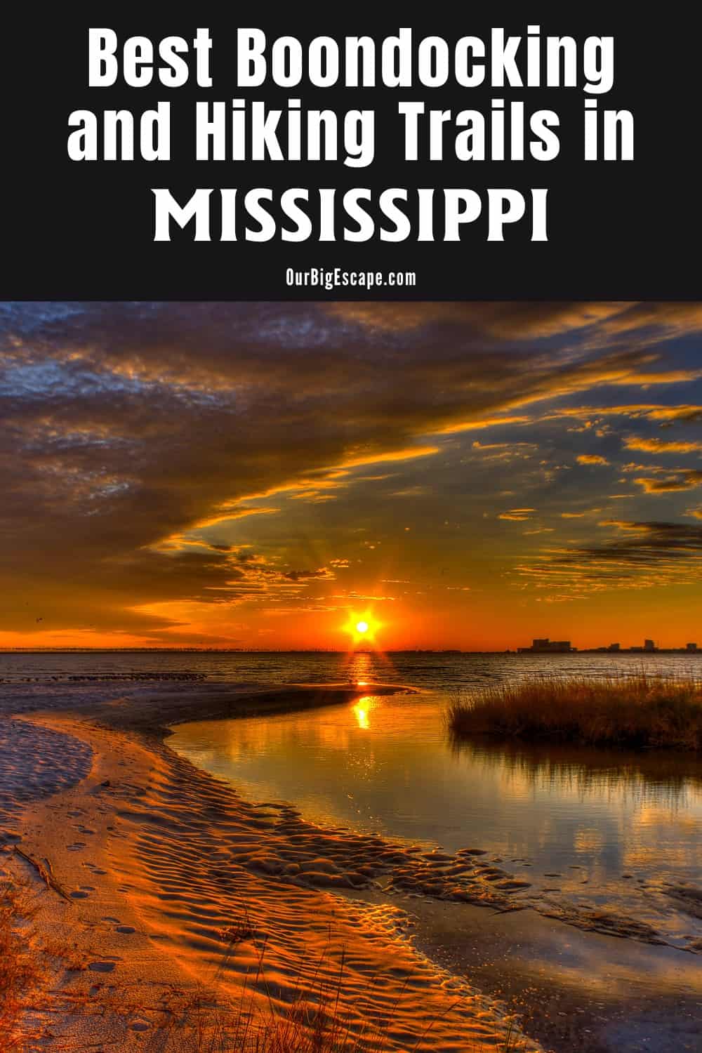
Mississippi is a wonderful destination to visit, and Mississippi boondocking lets you to do so on the cheap. Mississippi, dubbed “The Magnolia State,” is one of the most popular places for wildlife photographers and bird watchers. Free Mississippi Camping Spots and Free Mississippi Boondocking Spots are what we concentrated on when searching for the best Mississippi Boondocking Locations.
Jump directly to the 14 North Mississippi Boondocking Spots
Jump directly to the 24 Central Mississippi Boondocking Spots
Jump directly to the 43 Southeast Mississippi Boondocking Spots
Jump directly to the 6 Southwest Mississippi Boondocking Spots
Where to Boondock in Mississippi
While Mississippi has fewer free national forest campgrounds than many other states, it still has some excellent options. In Mississippi, there are conservation zones where you can camp for free. You should also check with local communities along your route to see if boondocking is permitted at their city parks. There is free camping Gulfport MS and boondocking East of the Mississippi.
Come experience the warmest welcome in the south and explore why camping in Mississippi feels like coming home.
Want more ideas to round-out your trip to the South-Eastern States?
► Alabama, Arkansas, Florida, Georgia, Louisiana, Mississippi, North Carolina, South Carolina, Tennessee ◄
- 29 Free Alabama Boondocking Locations
- 94 Free Arkansas Boondocking Locations
- 90 Free Florida Boondocking – RV Parking and Camping Sites
- 77 Great Georgia Boondocking – Free RV Parking & Camping Locations
- 52 Best Louisiana Boondocking and Free RV Parking Spots
- 61 Free North Carolina Boondocking – RV Parking & Camping Spots
- 26 Free South Carolina Boondocking Spots – RV Parking & Camping
- 34 Free Tennessee Boondocking – Camping Spots & RV Parking
check out our video
14 North Mississippi Boondocking Spots
Jump directly to the 24 Central Mississippi Boondocking Spots
Jump directly to the 43 Southeast Mississippi Boondocking Spots
Jump directly to the 6 Southwest Mississippi Boondocking Spots
1. Mississippi Boondocking – Hays Crossing
Address
265 Joes Road
Sardis, Mississippi
GPS: 34.450008, -89.759795
Elevation: 269′
Management Public – Corp of Engineers
Hays Crossing is open all year. Free Dispersed camping in the Corp of Engineers Mississippi Valley Division’s Vicksburg District. First come -> first camped. No reservations are accepted. The camping area is near Sardis Lake. This site is 5 1/2 miles from the main road. Walking distance approximately 1/8 mile to the lake that can be seen from the 5 available sites.
2. Free Mississippi Boondocking – Lake Sardis Clear Creek Primitive Campsite
Address
County Road 100
Lafayette Springs, Mississippi
GPS: 34.424371, -89.694754
Elevation: 367′
Management Public – Corp of Engineers (Official)
There are 6-15 campsites at this location. Campsite inside Army Corps land on the way to Clear Creek boat ramp. Vault toilet, half a dozen campsites. Just outside the fee area of the Clear Creek recreation area.
3. Mississippi Boondocking Spots – Piney Point
Address
County Road 506
Como, Mississippi
GPS: 34.51943, -89.617534
Elevation: 295′
Management Public – Corp of Engineers
Piney Point is open all year. Free Dispersed camping in the Corp of Engineers Mississippi Valley Division’s Vicksburg District. No reservations. First come, first served. The camping area is near Sardis Lake. Unique spot with a huge beach. Empty on a weekday in January. Would be difficult to get a rig back there bigger than ours. Roads very rough in the area. More suited for car camping or Class B RVs.
4. Mississippi Free Camping Spots – Graham Lake
Address
County Road 297
Abbeville, Mississippi
GPS: 34.533941, -89.457582
Elevation: 279′
Management Public – Corp of Engineers
Graham Lake is open all year. Free Dispersed camping in the Corp of Engineers Mississippi Valley Division’s Vicksburg District. This campsite does not use a reservation system. First come, first served. Out of the way, quiet, good for tent, truck, van, camper under 20′. Loaded with mosquitos as a very tiny creek runs by the sites.
5. Mississippi Free RV Parking – Point Pleasant
Address
Point Pleasant Road
Oakland, Mississippi
GPS: 34.137215, -89.838505
Elevation: 282′
Management Public – Corp of Engineers
Point Pleasant is open all year. The maximum RV length at Point Pleasant is 20 feet. This recreation area is part of Enid Lake.
6. Mississippi Free RV Boondocking – Bynum Creek
30 Jimmy Joyner Road
Water Valley, Mississippi
GPS: 34.17776, -89.735541
Elevation: 272′
Management Public – Corp of Engineers
Bynum Creek is open all year. The maximum RV length at Bynum Creek is 20 feet. This free campsite is located within the Corp of Engineers Mississippi Valley Division’s Vicksburg District. The camping area is near Enid Lake.
7. Free Mississippi Boondocking Locations – Prophet Bridge
Address
County Road 393
Oxford, Mississippi
GPS: 34.199798, -89.669715
Elevation: 279′
Management Public – Corp of Engineers
This free campsite is located within the Corp of Engineers Mississippi Valley Division’s Vicksburg District. First come -> first camped. No reservations are accepted.
8. Mississippi Free Dispersed Camping Locations – Paynatha Trail Head
Address
Okolona, Mississippi
GPS: 33.985504, -88.936485
Elevation: 378′
Management Public – Forest Service (USDA) (Unofficial)
The road in is Paved. There are 6-15 campsites at this location and the maximum RV length is Any. Ranger suggested this spot for an overnight stop as we were traveling down the Natchez Trace.
9. Mississippi Boondocking – Calhoun County WMA
Address
County Road 321
Calhoun City, Mississippi
GPS: 33.89627, -89.469967
Elevation: 463′
Management Public – Fish and Wildlife
The maximum RV length at Calhoun County WMA is 16 feet. This is a free dispersed campsite. First come -> First Camped. Reservations not accepted.
10. Free Mississippi Boondocking – Bryant
Address
County Road 75
Coffeeville, Mississippi
GPS: 33.921385, -89.69837
Elevation: 210′
Management Public – Corp of Engineers
Bryant is open all year. This free campsite is located within the Corp of Engineers Mississippi Valley Division’s Vicksburg District.
11. Mississippi Boondocking Spots – Skuna – Turkey Creek
Address
216 Rayford Horton Road
Coffeeville, Mississippi
GPS: 33.878112, -89.689183
Elevation: 240′
Management Public – Corp of Engineers
Skuna – Turkey Creek is open all year. The maximum RV length at Skuna – Turkey Creek is 20 feet. This free campsite is located within the Corp of Engineers Mississippi Valley Division’s Vicksburg District. The camping area is near Grenada Lake.
12. Mississippi Free Camping Spots – Choctaw
Address
Unnamed Road
Coffeeville, Mississippi
GPS: 33.828215, -89.642369
Elevation: 289′
Management Public – Corp of Engineers
Choctaw is open all year. This free campsite is located within the Corp of Engineers Mississippi Valley Division’s Vicksburg District. The camping area is near Grenada Lake.
13. Mississippi Free RV Parking – Malmaison WMA
Address
3006 Malmaison Road
Holcomb, Mississippi
GPS: 33.714553, -90.108512
Elevation: 200′
Management Public – Fish and Wildlife
This is a free dispersed campsite. First come -> first camped. No reservations are accepted.
14. Mississippi Free RV Boondocking – Jeff Busby
Address
Ackerman, Mississippi
GPS: 33.417076, -89.26902
Elevation: 473′
Management Public – National Park Service (Official)
The road in is Paved. Jeff Busby is open Year-round. There are 16-29 campsites at this location. You may stay 14 Nights at Jeff Busby.
24 Central Mississippi Boondocking Spots
Jump directly to the 14 North Mississippi Boondocking Spots
Jump directly to the 43 Southeast Mississippi Boondocking Spots
Jump directly to the 6 Southwest Mississippi Boondocking Spots
1. Mississippi Boondocking – FR 706
Address
Dawling Bayou Road
Yazoo City, Mississippi
GPS: 32.925705, -90.706437
Elevation: 171′
Management Public – Forest Service
Free Dispersed camping in the National Forests in Mississippi’s Delta Ranger District. This campsite does not use a reservation system. First come, first served. This location is at low elevation, beware of heavy rains.
2. Free Mississippi Boondocking – Tallahala WMA – CR – 2353
Address
45-152 County Road 2353
Louin, Mississippi
GPS: 32.150758, -89.270435
Elevation: 433′
Management Public – Fish and Wildlife
This is a free dispersed campsite. Reservations are not accepted at this campsite.
3. Mississippi Boondocking Spots – Green Ash WMA Rd
Address
Bowie Road
Yazoo City, Mississippi
GPS: 32.87261, -90.759885
Elevation: 108′
Management Public – Fish and Wildlife
Free Dispersed camping in the National Forests in Mississippi’s Delta Ranger District. First come -> First Camped. Reservations not accepted. This location is at low elevation.
4. Mississippi Free Camping Spots – Twin Oaks WMA – Fort Creek Rd #1
Address
Fork Creek Road
Rolling Fork, Mississippi
GPS: 32.852211, -90.835455
Elevation: 115′
Management
Public – Fish and Wildlife
The maximum RV length at Twin Oaks WMA – Fort Creek Rd #1 is 16 feet. This is a free dispersed campsite. First come -> first camped. No reservations are accepted. This location is at low elevation.
5. Mississippi Free RV Parking – Twin Oaks WMA – Fort Creek Rd #2
Address
Fork Creek Road
Rolling Fork, Mississippi
GPS: 32.842001, -90.83713
Elevation: 98′
Management Public – Fish and Wildlife
This is a free dispersed campsite. This campsite does not use a reservation system. First come, first served. This location is at low elevation, beware of heavy rains.
6. Mississippi Free RV Boondocking – Barge Lake
Address
Fire Tower Road
Rolling Fork, Mississippi
GPS: 32.816878, -90.809607
Elevation: 161′
Management Public – Forest Service
Free Dispersed camping in the National Forests in Mississippi’s Delta Ranger District. First come -> first served. No reservations accepted. This location is at low elevation, beware of heavy rains. All were closed with no notices posted when we tried to stay here April 2018. Tried contacting the ranger station with no answer. Seemed like a beautiful place wish they weren’t closed.
7. Free Mississippi Boondocking Locations – Camp 33 – A Pass or Permit is Required
Address
Oil Well Road
Rolling Fork, Mississippi
GPS: 32.79155, -90.843863
Elevation: 148′
Management Public – Forest Service
Free Dispersed camping in the National Forests in Mississippi’s Delta Ranger District. First come -> First Camped. Reservations not accepted. This location is at low elevation, beware of heavy rains.
8. Mississippi Free Dispersed Camping Locations – Sunflower WMA – Spanish Fork Rd
Address
Spanish Fort Road
Yazoo City, Mississippi
GPS: 32.734728, -90.761314
Elevation: 105′
Management Public – Fish and Wildlife
The maximum RV length at Sunflower WMA – Spanish Fork Rd is 16 feet. This is a free dispersed campsite. First come -> first served. No reservations accepted. This location is at low elevation, beware of heavy rains.
9. Mississippi Boondocking – FR 707
Address
County Road 703
Rolling Fork, Mississippi
GPS: 32.73414, -90.793702
Elevation: 89′
Management Public – Forest Service
Free Dispersed camping in the National Forests in Mississippi’s Delta Ranger District. First come -> first served. No reservations accepted. This location is at low elevation, beware of heavy rains.
10. Free Mississippi Boondocking – Shipland WMA
Address
Unnamed Road
Rolling Fork, Mississippi
GPS: 32.76617, -91.138595
Elevation: 115′
Management Public – Fish and Wildlife
This is a free dispersed campsite. First come -> first served. No reservations accepted. This location is at low elevation, beware of heavy rains.
11. Mississippi Boondocking Spots – Site 53A
Address
Unnamed Road
Yazoo City, Mississippi
GPS: 32.685166, -90.81462
Elevation: 89′
Management
Public – Forest Service
Free Dispersed camping in the National Forests in Mississippi’s Delta Ranger District. First come -> first camped. No reservations are accepted. This location is at low elevation, beware of heavy rains.
12. Mississippi Free Camping Spots – FR 721
Address
Unnamed Road
Yazoo City, Mississippi
GPS: 32.679216, -90.756283
Elevation: 92′
Management Public – Forest Service
Free Dispersed camping in the National Forests in Mississippi’s Delta Ranger District. First come -> first camped. No reservations are accepted. This location is at low elevation, beware of heavy rains.
13. Mississippi Free RV Parking – FR 720
Address
Unnamed Road
Yazoo City, Mississippi
GPS: 32.662697, -90.743136
Elevation: 98′
Management Public – Forest Service
Free Dispersed camping in the National Forests in Mississippi’s Delta Ranger District. Reservations are not accepted at this campsite. This location is at low elevation, beware of heavy rains.
14. Mississippi Free RV Boondocking – Mahannah WMA
Permit Required: The price is $30/year
Address
Anderson-Tully Road
Redwood, Mississippi
GPS: 32.54939, -90.869615
Elevation: 92′
Management Public – Fish and Wildlife Service (Official)
Mahannah WMA is open year round. You may stay 14 days at Mahannah WMA.
15. Free Mississippi Boondocking Locations – Bienville WMA – FR 508 – N
Address
Road 508-N
Morton, Mississippi
GPS: 32.459441, -89.63847
Elevation: 456′
Management Public – Fish and Wildlife
This is a free dispersed campsite. First come -> First Camped. Reservations not accepted. Nice primitive site. Only room for one RV. So you don’t know if its available until you get there. We had no problem because it was a Thursday in mid march.
16. Mississippi Free Dispersed Camping Locations – Bienville WMA – Clinton Rd
Address
8743-9533 Clifton Road
Forest, Mississippi
GPS: 32.432509, -89.557974
Elevation: 456′
Management Public – Fish and Wildlife
Free Dispersed camping in the National Forests in Mississippi’s Bienville Ranger District. First come -> first camped. No reservations are accepted.
17. Mississippi Boondocking – Caney Creek WMA – FR 538 – A
Address
Forest Road 538-A
Morton, Mississippi
GPS: 32.253323, -89.670937
Elevation: 551′
Management
Public – Fish and Wildlife
The maximum RV length at Caney Creek WMA – FR 538 – A is 16 feet. This is a free dispersed campsite. This campsite does not use a reservation system. First come, first served.
18. Free Mississippi Boondocking – Caney Creek WMA – Powell Road
Address
650-918 Powell Road
Pulaski, Mississippi
GPS: 32.225689, -89.615776
Elevation: 453′
Management Public – Fish and Wildlife
This is a free dispersed campsite. This campsite does not use a reservation system. First come, first served.
19. Mississippi Boondocking Spots – Caney Creek WMA – SCR – 538J
Address
SCR 538J
Morton, Mississippi
GPS: 32.205384, -89.632267
Elevation: 466′
Management Public – Fish and Wildlife
This is a free dispersed campsite. No reservations. First come, first served.
20. Mississippi Free Camping Spots – Caney Creek WMA – FR – 562
Address
Road No 562
Pulaski, Mississippi
GPS: 32.279737, -89.531633
Elevation: 515′
Management Public – Fish and Wildlife
The maximum RV length at Caney Creek WMA – FR – 562 is 16 feet.
21. Mississippi Free RV Parking – 533A
This is a FREE campsite.
Address
Pulaski, Mississippi
GPS: 32.128187, -89.500569
Elevation: 574′
Management Public – Forest Service (Unofficial)
22. Mississippi Free RV Boondocking – Tallahala WMA – Mudline Road
Address
Unnamed Road
Lake, Mississippi
GPS: 32.234893, -89.344752
Elevation: 463′
Management Public – Fish and Wildlife
This is a free dispersed campsite. First come -> First Camped. Reservations not accepted.
23. Free Mississippi Boondocking Locations – Tallahala WMA – Shopping Center Road
Address
Shopping Center Road 506 A
Lake, Mississippi
GPS: 32.231558, -89.32571
Elevation: 463′
Management Public – Fish and Wildlife
The maximum RV length at Tallahala WMA – Shopping Center Road is 16 feet. This is a free dispersed campsite. First come -> first camped. No reservations are accepted.
24. Mississippi Free Dispersed Camping Locations – Tallahala WMA – Cedar Creek
Address
Unnamed Road
Louin, Mississippi
GPS: 32.195259, -89.311305
Elevation: 400′
Management Public – Fish and Wildlife
The maximum RV length at Tallahala WMA – Cedar Creek is 16 feet. This is a free dispersed campsite. This campsite does not use a reservation system. First come, first served.
43 Southeast Mississippi Boondocking Spots
Jump directly to the 14 North Mississippi Boondocking Spots
Jump directly to the 24 Central Mississippi Boondocking Spots
Jump directly to the 6 Southwest Mississippi Boondocking Spots
1. Mississippi Free Dispersed Camping – Chickasawhay WMA – Road 201/SR 536
Address
Road 201
Ovett, Mississippi
GPS: 31.582017, -88.995751
Elevation: 289′
Management
Public – Fish and Wildlife
The maximum RV length at Chickasawhay WMA – Road 201/SR 536 is 16 feet. This is a free dispersed campsite. First come -> First Camped. Reservations not accepted.
2. Free Mississippi Boondocking – Long Leaf Horse Camp
Address
Road 218
Ovett, Mississippi
GPS: 31.570339, -88.987026
Elevation: 381′
Management Public – Forest Service
Long Leaf Horse Camp is open all year. This free campsite is located within the National Forests in Mississippi’s Chickasawhay Ranger District. First come -> first camped. No reservations are accepted. Very level large sites, as far as we could tell we were the only ones there. The road coming in was very smooth. No Internet.
3. Mississippi Boondocking Spots – Chickasawhay WMA – Old Culpepper Road #2
Address
Old Culpepper Road
Ovett, Mississippi
GPS: 31.542158, -88.955138
Elevation: 230′
Management Public – Fish and Wildlife
The maximum RV length at Chickasawhay WMA – Old Culpepper Road #2 is 18 feet. This is a free dispersed campsite. First come -> first camped. No reservations are accepted.
4. Mississippi Free Camping Spots – Chickasawhay WMA – FR 205
Address
Road 205 Forestry Service
Ovett, Mississippi
GPS: 31.476551, -88.950546
Elevation: 262′
Management Public – Fish and Wildlife
The maximum RV length at Chickasawhay WMA – FR 205 is 18 feet. This is a free dispersed campsite. Reservations are not accepted at this campsite.
5. Mississippi Free RV Parking – Mason Creek WMA – Fred Smith Road #2
Address
Fred Smith Road
Richton, Mississippi
GPS: 31.415929, -88.649721
Elevation: 285′
Management Public – Fish and Wildlife
This is a free dispersed campsite. Reservations are not accepted at this campsite.
6. Mississippi Free RV Boondocking – Mason Creek WMA – Will Smith Road
Address
Will Smith Road
Richton, Mississippi
GPS: 31.373652, -88.629858
Elevation: 305′
Management Public – Fish and Wildlife
This is a free dispersed campsite. First come -> first camped. No reservations are accepted.
7. Free Mississippi Boondocking Locations – Mason Creek WMA – Mary Road
Address
Mary Road
State Line, Mississippi
GPS: 31.343384, -88.626792
Elevation: 272′
Management Public – Fish and Wildlife
This is a free dispersed campsite. First come -> first served. No reservations accepted.
8. Mississippi Free Dispersed Camping Locations – De Soto National Forest Dispersed Campsite
Address
31.0793, -89.2687
Hattiesburg, Mississippi
GPS: 31.079739, -89.268743
Elevation: 167′
Management Public – Forest Service
The road in is Gravel. Free dispersed campsite at turnout / dead end of gravel road. Condition of road is suitable for a car.
9. Mississippi Boondocking – Big Creek Landing
Address
Unnamed Road
Hattiesburg, Mississippi
GPS: 31.070889, -89.254138
Elevation: 161′
Management Public – Forest Service
Big Creek Landing is open all year. This free campsite is located within the National Forests in Mississippi’s De Soto Ranger District. This location is at low elevation, beware of heavy rains. We stayed here 3 nights in mid November 2020. Nice quiet spot but loaded with garbage.
10. Free Mississippi Boondocking – Moody’s Landing
Address
26-46 Peret Tower Road
Brooklyn, Mississippi
GPS: 31.05435, -89.1177
Elevation: 131′
Management Public – Forest Service
Moody’s Landing is open all year. This free campsite is located within the National Forests in Mississippi’s De Soto Ranger District. First come -> first camped. No reservations are accepted. This location is at low elevation, beware of heavy rains.
11. Mississippi Boondocking Spots – Black Creek Float Trip Janice Landing
Address
1783-1807 Mississippi 29
Brooklyn, Mississippi
GPS: 30.994235, -89.050806
Elevation: 108′
Management
Public (Official)
The road in is Gravel and 0.1 miles from a paved road. Black Creek Float Trip Janice Landing is open year round. There are 6-15 campsites at this location. Canoe Landing with several tent sites, flush toilet, water, tables, fire/grill pits. Take Hwy 49 to Wiggins; take the North Wiggins exit off Hwy 49 for approximately 2 miles; take Hwy 29 north to County Rd 318 (Fairley Bridge Rd); go east 6 miles to Forest Service Rd 374; turn south and follow signs to the landing.
12. Mississippi Free Camping Spots – De Soto National Forest Dispersed Camping
Address
Forest Road 314
Beaumont, Mississippi
GPS: 31.121491, -88.926325
Elevation: 217′
Management Public – Forest Service
The road in is Dirt and 1 miles from a paved road. We got to the area later than expected. I couldn’t find any spots marked in the northern part of the forest on any of the apps we use. We drove around a bit aimlessly until I realized that if I zoomed in on the Terrain Google Map I could see the forest service roads.
13. Mississippi Free RV Parking – Leaf River WMA – FR – 354
Address
Fs 354
Wiggins, Mississippi
GPS: 31.054196, -88.86003
Elevation: 187′
Management Public – Fish and Wildlife
Activities: Wildlife Viewing
This is a free dispersed campsite. Reservations are not accepted at this campsite. This location is at low elevation, beware of heavy rains.
14. Mississippi Free RV Boondocking – Leaf River WMA – FR – 315 #4
Address
F S 353
Wiggins, Mississippi
GPS: 31.036484, -88.902386
Elevation: 276′
Management Public – Fish and Wildlife
This is a free dispersed campsite. First come -> First Camped. Reservations not accepted.
15. Free Mississippi Boondocking Locations – Desoto National Forest Dispersed Campsite
Address
Wiggins, Mississippi
GPS: 31.02995, -88.908655
Elevation: 249′
Management Public – Forest Service (Unofficial)
The road in is Gravel and 21 miles from a paved road. Desoto National Forest dispersed campsite is open year round. The maximum RV length at Desoto National Forest dispersed campsite is 35 feet. You may stay 14 days at Desoto National Forest dispersed campsite. While not very far form the Cypress Creek Campground, this was a good late-night rest stop. It is a wide level area off a well-maintained gravel road.
16. Mississippi Free Dispersed Camping Locations – Leaf River WMA – FR – 315 #3
Address
McLain Road
Wiggins, Mississippi
GPS: 31.017108, -88.919721
Elevation: 246′
Management Public – Fish and Wildlife
This is a free dispersed campsite. First come -> first camped. No reservations are accepted.
17. Mississippi Boondocking – Leaf River WMA – FR – 309 #1
Address
500-598 Jimmy Breland Road
Wiggins, Mississippi
GPS: 30.978587, -88.908455
Elevation: 282′
Management Public – Fish and Wildlife
The maximum RV length at Leaf River WMA – FR – 309 #1 is 18 feet. This is a free dispersed campsite. No reservations. First come, first served.
18. Free Mississippi Boondocking – Leaf River WMA – FR – 309A
Address
Forest Service 309-A
Wiggins, Mississippi
GPS: 30.969423, -88.889196
Elevation: 217′
Management Public – Fish and Wildlife
The maximum RV length at Leaf River WMA – FR – 309A is 25 feet. This is a free dispersed campsite. This campsite does not use a reservation system. First come, first served.
19. Mississippi Boondocking Spots – Leaf River WMA – Mars Hill Road #1
Address
Mars Hill Road
Wiggins, Mississippi
GPS: 30.950549, -88.902598
Elevation: 269′
Management Public – Fish and Wildlife
This is a free dispersed campsite. First come -> first camped. No reservations are accepted.
20. Mississippi Free Camping Spots – Leaf River WMA – Mars Hill Road #2
Address
Mars Hill Road
Wiggins, Mississippi
GPS: 30.943879, -88.900314
Elevation: 266′
Management Public – Fish and Wildlife
This is a free dispersed campsite. First come -> first camped. No reservations are accepted.
21. Mississippi Free RV Parking – Leaf River WMA – Mars Hill Road #3
Address
575-599 Mars Hill Road
Wiggins, Mississippi
GPS: 30.934439, -88.907039
Elevation: 253′
Management Public – Fish and Wildlife
This is a free dispersed campsite. First come -> First Camped. Reservations not accepted.
22. Mississippi Free RV Boondocking – Leaf River WMA – FR – 322
Address
Forest Service 322
Wiggins, Mississippi
GPS: 30.931762, -88.899185
Elevation: 262′
Management Public – Fish and Wildlife
The maximum RV length at Leaf River WMA – FR – 322 is 18 feet. This is a free dispersed campsite. First come -> first served. No reservations accepted.
23. Free Mississippi Boondocking Locations – Forest Service Road 435, DeSoto NF
Address
Perkinston, Mississippi
GPS: 30.691256, -89.072397
Elevation: 197′
Management Public – Forest Service (Official)
Very secluded. No amenities. Pack in, pack out. Approximately one mile of dirt road with small Creek to traverse, dead end road. A couple of pull-offs on road in. End has room for 2 or 3 rigs
24. Mississippi Free Dispersed Camping Locations – Airey Lake
The price is Free
Address
Saucier, Mississippi
GPS: 30.688574, -89.060417
Elevation: 177′
Management Public – Forest Service (USDA) (Official)
The road in is Gravel. There are 30 or more campsites at this location. A group campsite in the De Soto National Forest that can also be used by singles.
25. Mississippi Boondocking – Bigfoot Horse Camp & Trail
Address
Perkinston, Mississippi
GPS: 30.682759, -89.03947
Elevation: 154′
Management Public – Forest Service (Official)
Bigfoot Horse Camp & Trail is open year round. There are 6-15 campsites at this location. You may stay 14 days at Bigfoot Horse Camp & Trail. About 15 primitive camp sites with tables and fire pits. Used by horse riders to ride the trails. Water faucet but does not work. Verizon cell service 2 bars 3 g.
26. Free Mississippi Boondocking – POW Camp
Address
Forest Road No 420-E
Saucier, Mississippi
GPS: 30.637538, -89.004734
Elevation: 108′
Management Public – Forest Service
POW Camp is open all year. This free campsite is located within the National Forests in Mississippi’s De Soto Ranger District. This location is at low elevation. Large area with 5 acre lake, hiking trails, no amenities, very uneven terrain with mudpuddles in roads, no designated camping sites, trees abundant, historic remains of WWII prison camp, Verizon 3 bars.
27. Mississippi Boondocking Spots – Bethel Mountain Bike Trail (Trailhead)
Address
Saucier, Mississippi
GPS: 30.601645, -88.944798
Elevation: 112′
Management Public – State Forest (Unofficial)
You may stay 7 days at Bethel Mountain Bike Trail (Trailhead). This is the trailhead parking area for the mountain bike trails. It is a large area with plenty of room to overnight. There is a toilet there (just not well kept), no services and about a 1/2 mile walk down to the creek.
28. Mississippi Free Camping Spots – Red Creek WMA
Address
2589-2625 Wire Road East
Perkinston, Mississippi
GPS: 30.728907, -88.928758
Elevation: 187′
Management Public – Fish and Wildlife
The maximum RV length at Red Creek WMA is 25 feet. This is a free dispersed campsite. Reservations are not accepted at this campsite. This location is at low elevation, beware of heavy rains.
29. Mississippi Free RV Parking – Pascagoula River WMA – GMR Road
Address
Game Management River Road
Lucedale, Mississippi
GPS: 30.912688, -88.728431
Elevation: 43′
Management Public – Fish and Wildlife
The maximum RV length at Pascagoula River WMA – GMR Road is 16 feet. This is a free dispersed campsite. First come -> first camped. No reservations are accepted. This location is at low elevation, beware of heavy rains.
30. Mississippi Free RV Boondocking – Pascagoula River WMA – Davis Eddy
Address
199 John Smith Road
Lucedale, Mississippi
GPS: 30.903506, -88.747397
Elevation: 39′
Management Public – Fish and Wildlife
The maximum RV length at Pascagoula River WMA – Davis Eddy is 18 feet. This is a free dispersed campsite. Reservations are not accepted at this campsite. This location is at low elevation.
Address
Mississippi 26
Lucedale, Mississippi
GPS: 30.875354, -88.760893
Elevation: 36′
Management Public – Fish and Wildlife
The maximum RV length at Pascagoula River WMA – Hutson Lake is 18 feet. This is a free dispersed campsite. This campsite does not use a reservation system. First come, first served. This location is at low elevation, beware of heavy rains.
32. Mississippi Free Dispersed Camping Locations – Pascagoula River WMA – Pierce Lake
30.84387, -88.742006
Address
Unnamed Road
Lucedale, Mississippi
GPS: 30.84387, -88.742006
Elevation: 36′
Management Public – Fish and Wildlife
The maximum RV length at Pascagoula River WMA – Pierce Lake is 18 feet. This is a free dispersed campsite. First come -> first served. No reservations accepted. This location is at low elevation, beware of heavy rains.
33. Mississippi Boondocking – Pascagoula River WMA – Wilkerson Ferry #2
Address
East Wilkerson Ferry Road
Lucedale, Mississippi
GPS: 30.833843, -88.734959
Elevation: 36′
Management Public – Fish and Wildlife
The maximum RV length at Pascagoula River WMA – Wilkerson Ferry #2 is 25 feet. This is a free dispersed campsite. This campsite does not use a reservation system. First come, first served. This location is at low elevation.
34. Free Mississippi Boondocking – Pascagoula River WMA – Wilkerson Ferry #1
Address
Wilkerson Ferry Landing
Lucedale, Mississippi
GPS: 30.815421, -88.747291
Elevation: 36′
Management Public – Fish and Wildlife
The maximum RV length at Pascagoula River WMA – Wilkerson Ferry #1 is 18 feet. This is a free dispersed campsite. No reservations. First come, first served. This location is at low elevation.
35. Mississippi Boondocking Spots – Pascagoula River WMA – Lower Rice Lake
Address
1118-1198 Reg Green Road
Lucedale, Mississippi
GPS: 30.803608, -88.73287
Elevation: 33′
Management Public – Fish and Wildlife
The maximum RV length at Pascagoula River WMA – Lower Rice Lake is 18 feet. This is a free dispersed campsite. First come -> first camped. No reservations are accepted. This location is at low elevation.
36. Mississippi Free Camping Spots – Pascagoula River WMA – Plum Bluff
Address
298 Goff Basin Road
Lucedale, Mississippi
GPS: 30.799936, -88.700721
Elevation: 95′
Management Public – Fish and Wildlife
The maximum RV length at Pascagoula River WMA – Plum Bluff is 20 feet. This is a free dispersed campsite. Reservations are not accepted at this campsite. This location is at low elevation, beware of heavy rains.
37. Mississippi Free RV Parking – Pascagoula River WMA #1
Address
Berry Road
Perkinston, Mississippi
GPS: 30.750198, -88.704617
Elevation: 69′
Management Public – Fish and Wildlife
The maximum RV length at Pascagoula River WMA #1 is 16 feet. This is a free dispersed campsite. This campsite does not use a reservation system. First come, first served. This location is at low elevation, beware of heavy rains.
38. Mississippi Free RV Boondocking – Pascagoula River WMA – Cane/Fletcher
Address
20101-20199 Brewton Camp Road
Vancleave, Mississippi
GPS: 30.653895, -88.634244
Elevation: 46′
Management Public – Fish and Wildlife
The maximum RV length at Pascagoula River WMA – Cane/Fletcher is 18 feet. This is a free dispersed campsite. Reservations are not accepted at this campsite. This location is at low elevation.
39. Free Mississippi Boondocking Locations – Pascagoula River WMA – Graham Lake
Address
2010 Wade Vancleave Road
Vancleave, Mississippi
GPS: 30.617243, -88.63569
Elevation: 13′
Management Public – Fish and Wildlife Service (Official)
The road in is Gravel. The maximum RV length at Pascagoula River WMA – Graham Lake is 18 feet. Camping is allowed only in designated areas, or on sandbars and along rivers and creeks, provided such camp is visible from a boat. Camping is limited to 14 consecutive days. All campsites must be maintained in a neat and orderly manner.
40. Mississippi Free Dispersed Camping Locations – American Legion Post 33
Address
1126 Judge Sekul Ave Biloxi MS. 39530
Biloxi, Mississippi
GPS: 30.400925, -88.904369
Elevation: 23′
Management Private – American Legion Post (Official)
The road in is Paved. American Legion Post 33 is open June 3 on unless a weekend event is planned. There are 6-15 campsites at this location and the maximum RV length is unlimited. You may stay 30 days unless approved at American Legion Post 33. Location may be closed. Call before going.
We have room for approximately 15 campers or motor homes. They must be self contained. No electric, water, or sewer access. Strictly a Boondocking location.
41. Mississippi Boondocking – Breakwater Marina
Address
Biloxi, Mississippi
GPS: 30.39028, -88.96219
Management
Private – Officially as of 12/20, open to public (Official)
The road in is Paved. Breakwater Marina is open Year round. There are 30 or more campsites at this location and the maximum RV length is unlimited. Fishermen come and go at Breakwater Marina.
42. Free Mississippi Boondocking – Island View Casino Resort East Parking Lot
Address
Gulfport, Mississippi
GPS: 30.3674, -89.0928
Elevation: 20′
Management Private – Casino
43. Mississippi Boondocking Spots – Overnight Parking on Beach Blvd (US-90)
Address
Pass Christian, Mississippi
GPS: 30.324582, -89.215852
Elevation: 7′
There are multiple areas where the road widens into parking pull-outs for beach access along the beachfront all the way through Pass Christian and possibly into Gulfport.
6 Southwest Mississippi Boondocking Spots
Jump directly to the 14 North Mississippi Boondocking Spots
Jump directly to the 24 Central Mississippi Boondocking Spots
Jump directly to the 43 Southeast Mississippi Boondocking Spots
1. Mississippi Boondocking – Sandy Creek WMA
Address
347-351 Garden City Road
Roxie, Mississippi
GPS: 31.407323, -91.184958
Elevation: 256′
Management Public – Fish and Wildlife
This is a free dispersed campsite. This campsite does not use a reservation system. First come, first served. Just make sure to stay on the gravel part. I thought the mud looked dry and tried to turn around in the grass and got this RV stuck in the mud for the first time.
2. Free Mississippi Boondocking – Caston Creek WMA – Middleton Creek
Address
1623 Middleton Creek Road
Meadville, Mississippi
GPS: 31.384388, -90.848367
Elevation: 377′
Management Public – Fish and Wildlife
his is a free dispersed campsite. This campsite does not use a reservation system. First come, first served. Most of the forests I’ve been through this far in the South are quite congested, but the forest here is pretty open with lots of sunlight. Internet is excellent.
3. Mississippi Boondocking Spots – Caston Creek WMA – Kings Ferry Rd
Address
Kings Ferry Road
Meadville, Mississippi
GPS: 31.370587, -90.890522
Elevation: 338′
Management Public – Fish and Wildlife
This is a free dispersed campsite. First come -> first camped. No reservations are accepted. Settled on this site as the first one I went to had a lot of trash nearby. Great cell service here.
4. Mississippi Free Camping Spots – Caston Creek WMA – Rollinson Rd
Address
3724-3798 Rollinson Road
Liberty, Mississippi
GPS: 31.384388, -90.848367
Management Public – Fish and Wildlife Service
This is a free dispersed campsite. No reservations. First come, first served. The entire forest is a dead zone for cell service. The site is nice and quiet once you reach it. If using GPS you’d better get the data locked in before you enter the forest.
5. Mississippi Free RV Parking – Caston Creek WMA – Cobb Road
Address
6085-6175 Cobb Road
Gloster, Mississippi
GPS: 31.329551, -90.938088
Elevation: 338′
Management Public – Fish and Wildlife
This is a free dispersed campsite. This campsite does not use a reservation system. First come, first served.
6. Mississippi Free RV Boondocking – Caston Creek WMA – Cobb Road River Site
Address
Cobb Road
Gloster, Mississippi
GPS: 31.313004, -90.959265
Elevation: 344′
Management Public – Fish and Wildlife
This is a free dispersed campsite. Reservations are not accepted at this campsite.
About Mississippi
Mississippi is not only the home of the blues, but it is also a camper’s dream. Camping in Mississippi should be on every camping enthusiast’s bucket list, thanks to its abundance of streams, rivers — most notably the mighty Mississippi River — and miles of coastline along the Gulf of Mexico, as well as a seemingly endless array of national forests, parks, and wildlife refuges.
There are five main regions in Mississippi, and you’ll want to go boondocking in each of them. The red clay hills near Tupelo and Oxford in the northern section of the state are fantastic spots to go trekking. The Mississippi Delta region, located around Clarksdale in the state’s northeast corner, is an excellent site to go paddling on the Mississippi or Yahoo rivers. The Capital Region area, which is located below Jackson, is an excellent place to enjoy nature viewing while visiting the piney forests. West Central Mississippi, particularly the creeks and bayous surrounding Columbus and Meridian, is a terrific spot to go fishing. Finally, you should go to the Coastal Region in Hattiesburg to learn about the history of the area. With so many fantastic locations to visit, you’ll want to plan a Mississippi boondocking trip soon.
If you’re an avid camper in the southeast, you’ve most likely camped in the Cumberland Mountains, a popular destination for outdoor enthusiasts looking for a little elevation. Though Mississippi is a relatively flat state, it doesn’t mean there aren’t mountains. You just have to know where to look.
The town of Iuka, Mississippi has plenty of great camping areas and is located near historic Woodall Mountain. As the state’s highest point — a modest 806 feet — privately-owned Woodall Mountain may not compare to the Cumberland Mountains in size, but its Civil War history is legendary. And with activities such as rock climbing, hiking, canoeing and even disc golf close by, it’s a great way to get the best of all that camping in Mississippi has to offer.
One of the most popular areas for camping in Mississippi is along the forests of the Natchez Trace, as the southern part of this historic trail runs right through almost the entire state. The Natchez Trace, which is divided into nine parts named after local cities and villages, is an excellent spot to learn about Mississippi’s Native American heritage. The Pharr Mounds, which are located on the Natchez Trace’s Tishomingo-Belmont portion, are an ancient burial place utilized by nomadic tribes between 100 and 1200 A.D. Another portion, Donivan Slough, showcases the beauty of Mississippi’s tulip poplars, sycamores, and water oaks in the marshy bottomlands of the state.
Free Camping in Mississippi
Keeping many elements in mind when planning your boondocking journey might help you succeed. The weather is something you should think about. If you’re going camping during hurricane season, keep an eye on the weather forecast. These storms’ paths can shift rapidly. Know how to get out of the location where you’ll be camping. Bring a battery-operated weather radio with you so you can remain up to date on the latest news.
While there are some excellent sites to go boondocking in Mississippi with plenty of aid, many of the destinations are in remote areas. It may take some time for emergency services to arrive in those situations. Consider enrolling in a basic first-aid course and learning how to perform CPR. You should also have a good first-aid kit with you.
In Mississippi, there are a lot of great sites to go boondocking. There are several excellent choices near fishing spots, hunting grounds, and historic locations. When you go camping in Mississippi at a free location, you will be making stories that you will tell for a long time. Check out our blog for everything you need to know about boondocking in Mississippi before you leave.
Free Mississippi RV Camping And Boondocking
Unrestricted use Mississippi RV camping spots are well-documented, and boondocking (dispersed RV camping) is welcomed in the state’s national forests. RV camping is available for free or for a donation at a number of town and community parks. Don’t forget to look for free campsites in state wildlife areas.
FAQs on Mississippi Boondocking
Is Boondocking Legal in Mississippi?
US Forest Service – Information on National Forest recreation and Mississippi RV camping opportunities provided by the US Forest Service. Free boondocking (dispersed RV camping) is permitted.
Can You Boondock On The Natchez Trace Parkway?
Three campgrounds are managed by the Natchez Trace Parkway over its 444-mile length. Meriwether Lewis is located at Milepost 385.9, Jeff Busby is located at Milepost 193.1, and Rocky Springs is located at Milepost 54. The three Parkway campgrounds are free, primitive, and first come, first served.
Is Camping Free in Mississippi?
In Mississippi, there are conservation zones where you can camp for free. You should also check with local communities along your route to see if boondocking is permitted at their city parks. There is free tent camping in Mississippi.
Can You Camp Anywhere On The Mississippi River?
You may camp anywhere you choose, without having to worry about permits, bookings, or overcrowding. Any evidence of previously utilized campsites are washed away by annual flooding in April and May. Can you camp on the beach in Mississippi? Yes you can camp a sandbar for up to 14 days for free. You must proceed to the next sandbar, which is a specific distance away from the previous one (I believe it is a mile).
How Many National Parks Are There in Mississippi?
The nine National Parks in Mississippi include National Battlefields, National Heritage Areas, and more!
How Many State Parks Are There in Mississippi?
There are around 20 state parks in Mississippi that provide tent camping. Each park has its own set of amenities. Bathhouses, power, water, stores, activities centers, laundry facilities, and other amenities are available in some parks, such as Buccaneer State Park at Waveland on the southwest coast.
Is there BLM Land in Mississippi?
The Bureau of Land Management – Eastern States, Southeastern States District of the United States Department of the Interior is in charge of stewardship of public lands and resources in the 11 southeastern states bordering and east of the Mississippi River. The BLM manages over 1.5 million acres in Mississippi.
You May Want to Join Our Boondocking Group on Facebook For More Information
You May Want to Join Our Campfire Recipes Group on Facebook For More Information
Check Out Our Pictures On Instagram – Our Big Escape.