
Check out Hen Wallow Falls Via Hen Wallow Falls Trailhead. The Hen Wallow Falls hike a 4.5-mile trail that goes out and then back to Cosby, Tennessee. Most people think of it as a moderately hard route, and it takes an average of 2 hours and 18 minutes to finish. This is a popular place to hike, so you’ll probably run into other people while you’re there. The Hen Wallow Falls trail is beautiful and can be used at any time of year.
You’ll need to leave pups at home — dogs aren’t allowed on this trail.
Hen Wallow Falls is another waterfall in the Smokies that not many people go to. If the water flow on Lower Falling Branch is good, this moderate, Hen Wallow Falls hike is well worth the 4.5 miles round trip from the Hen Wallow Falls trailhead. When there isn’t much rain, the waterfall may just be a trickle.
Difficulty: A Bit Difficult
Length: 4.5 mi
Elevation gain: 964 ft
Route type: Out & back
Hiking, Forest, River, Views, Waterfall, Wildflowers, Wildlife, Rocky, No dogs
Hen Wallow Falls can be accessed through both the Hen Wallow Falls Trailhead and the Gabes Mountain Trail.
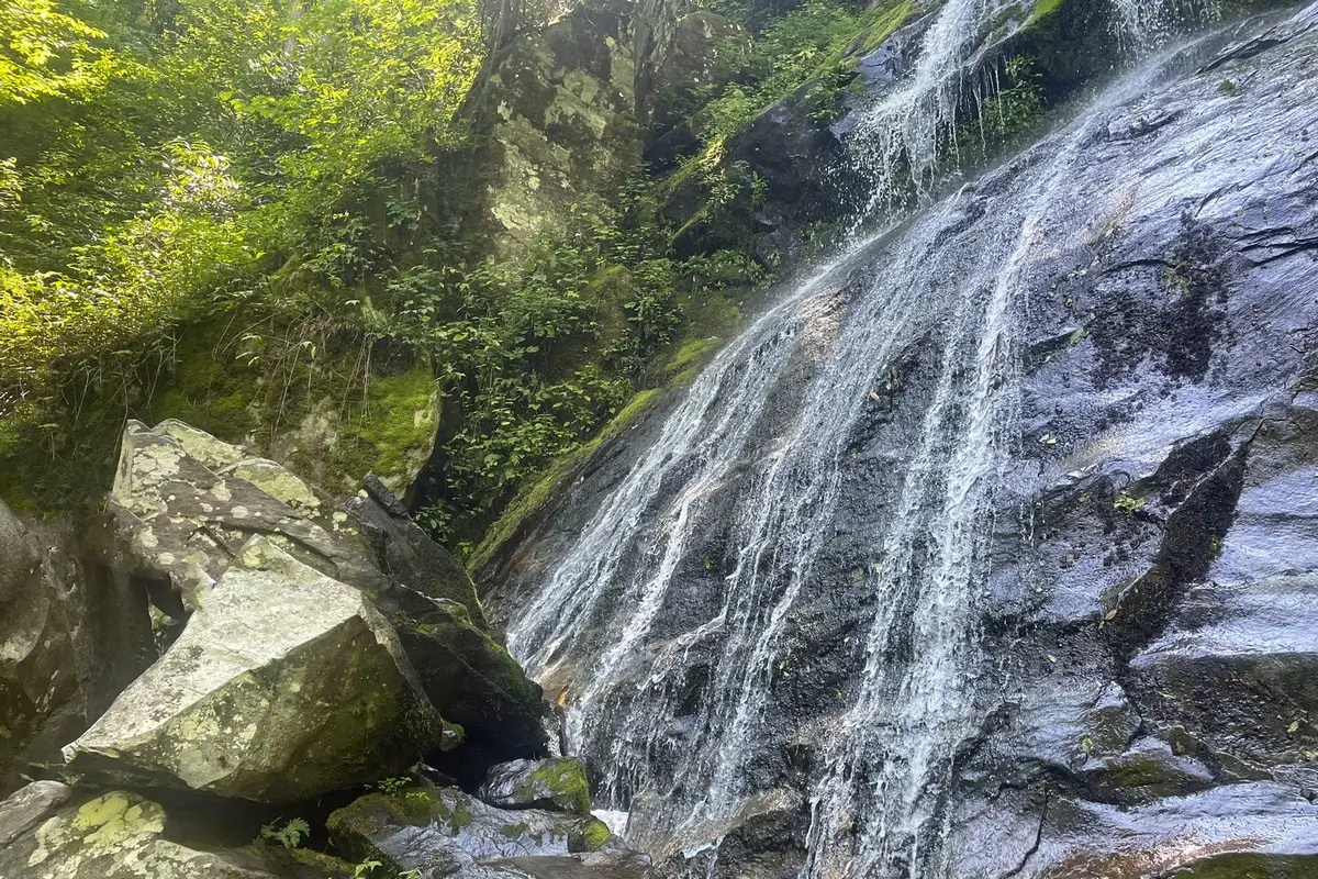
A nice walk through a hemlock and rhododendron forest gets you to Hen Wallow Falls. Steep switchbacks on a side trail with a sign lead to the bottom of the falls. At the top of the falls, Hen Wallow Creek is only two feet wide, but at the bottom, it spreads out to be twenty feet wide. The falls are 90 feet tall. If you look closely, you can often find salamanders in the water at the base of the falls.
In the winter, when it is very cold, the waterfall can freeze into a beautiful column of ice. After the falls, hikers on the Gabes Mountain Trail can enjoy a beautiful old-growth forest.
Want more ideas to round-out your hiking trip to Tennessee?
A lot of great trails are in these posts!
- 25 Best Hikes In Smoky Mountain National Park
- 5 Top Reasons To Visit Chimney Tops Trail
- The Great Middle Prong Trail Plus 2 Side Trails
- 5 Top Sugarlands Valley Nature Trail Hiking Things to Do

2 Easy Ways To Hen Wallow Falls Via Hen Wallow Falls Trailhead
check out our video
Hen Wallow Falls Description:
The start of the Hen Wallow Falls trail is at the entrance to the Cosby Campground, right across from the Cosby Picnic Area. Most of the Hen Wallow Falls trail seems like a moderate hike to me. On the 2 miles to the falls, the path goes up pretty steadily.
The Hen Wallow Falls trail is very rocky and has a lot of roots. When we hiked, wet leaves were all over it. The hardest part of the Hen Wallow Falls hike is the.2 miles to and from the falls. The trail down to the falls is very steep, which makes it hard to get back to the main trail.
The Hen Wallow Falls hike was great for both of us, and Laurel’s new knee didn’t have to work too hard. We liked how the scenery kept changing as we walked. There were three footbridges with different widths to cross, which was really cool, and the creek they crossed is gorgeous.
We loved seeing the different kinds of trees and bushes along the Hen Wallow Falls trail, as well as the big rocks right before the turnoff to the falls.
The waterfall flows over a very steep rock wall to the viewing area, then continues down the mountain through thick brush and steep rock. When it’s warmer and rainier, the mosses, ferns, and small plants that grow on the rock will look their best.
Hiking Tips For Hen Wallow Falls
Right next to the Cosby picnic area is the start of the trail to Hen Wallow Falls. Bring your own food, and after your waterfall hike, you can have a nice picnic!
Cosby is close to a lot of bears. At the Hen Wallow Falls trailhead parking lot and all over the national park, you will find heavy duty trash cans that are “bear-proof.” Be careful at all times, especially around children.
At the Hen Wallow Falls trailhead parking lot, there are toilets that flush that you can use (aka at the Cosby picnic area).
There is the Cosby Campground, which is the campground near Hen Wallow Falls. The start of the Gabes Mountain Trail is just a few minutes away by car from the campground.
Directions to Trailhead:
Directions: Take US 321 east out of Gatlinburg to get to I-40. Depending on where you are, drive 15 to 18 miles until you reach a stop sign where 321 meets TN 32. Turn right on TN 32 east and drive 1.2 miles to the entrance to the Cosby area and campground. From NC’s I-40, cross into Tennessee and drive 8 miles to the Foothills Parkway at exit 443.
If the Parkway is closed, you will have to keep going until US 321 Exit 440. Take the Foothills Parkway until it ends at 321 and 32. Turn left, and drive about 3 miles to the Cosby entrance, passing the right turn for US 321 to Gatlinburg on the way. Turn right into the Cosby entrance and drive just over 2 miles to the day hiker’s and picnic area parking lot on the left.
Look on the right side of the road right before you turn left into the parking lot. You’ll see the Gabes Mountain Trail. Follow this path to get to the waterfall.
Review
The Hen Wallow Falls trail starts its slow but steady climb up the mountain. A little more than a quarter of a mile in, a trail from the campground joins from the left. If you’re staying in the campground, this trail starts in a curve past site 64 in Section A.
After going a short distance farther, the trail crosses a stream on a log footbridge. After crossing a few more streams and going up a steeper hill, the trail goes down toward another creek and crosses it on a stone bridge after about a mile. Soon after this, the trail goes along an old road bed to an opening with a trail sign.
Follow the Gabes Mountain trail as it goes up more steeply. After about 1.5 miles, the trail will level out. This only lasts for a short time, though, because the trail goes up more before it meets the Hen Wallow Falls spur trail, which is more than 2 miles into the Hen Wallow Falls hike. Take this short side path down to the bottom of the 50-foot waterfall. The good news is that most of the way back is downhill.
The waterfall flows over a very steep rock wall to the viewing area, then continues down the mountain through thick brush and steep rock. When it’s warmer and rainier, the mosses, ferns, and small plants that grow on the rock will look their best.
Nearby Trails to Hike Near Hen Wallow Falls Trailhead
Chestnut Branch Trail
You can enjoy this 13.4-mile trail near Cosby, Tennessee. It goes out and back. It takes an average of 7 hours and 36 minutes to finish what most people think of as a difficult route. This trail is great for walking and running, and you probably won’t see many other people while you’re out exploring. The trail is beautiful and can be used at any time of year. Dogs can’t go on this trail, so you’ll have to leave them at home.
Difficulty: Difficult
Length: 13.4 mi
Elevation gain: 3,582 ft
Route type: Out & back
Hiking, Running, Forest, Views, Wildflowers, Wildlife, No dogs
Review
This is a great hike for every season because it has so much to offer. From the ranger’s station, the Hen Wallow Falls hike goes straight up the Chestnut Branch Trail. Follow this for two miles until it meets the AT. Take the AT south (to the left) for about 3.3 miles.
Along the way, there are some great places to stop and take in the view. You will reach the MT Cammerer Trail (not the Lower Mt. Cammerer Trail). Take this trail for 0.6 miles to get to the tower. There are a few rocky spots to get around. You can go inside this tower and take a look around. It was built in 1939 to keep an eye on the mountains.
There are many great views in the Smokies but this provides some of the best in the park.
Bluff Mountain Trauk
This 8.4-mile trail near Hays, North Carolina, goes out and back. Most people think of it as a moderately hard route, and it takes an average of 3 hours and 30 minutes to finish. This trail is used by a lot of people to watch birds, hike, and run, but you can still get some alone time during the day. The trail is beautiful and can be used at any time of year. We allow dogs, but they have to be on a leash.
Difficulty: Moderate
Length: 8.4 mi
Elevation gain: 1,131 ft
Route type: Out & back
Dogs on leash, Hiking, Walking, Bird watching, Running, Forest, Views, Wildflowers, Wildlife
Review
I liked this part of the trail because it had a lot of different sights and terrain. Wide open space. Zero trash. The trail is easy to follow even without signs. Ranger office and Bluffs are currently closed until May.
On the Blue Ridge Parkway, you are walking. It’s a more interesting hike if you take this trail and then the trail to the left (I don’t remember what it’s called). There are woods, open spaces, pastureland, and long views of mountains.
About 3 miles up, we stopped at a beautiful bald with big rocks and a wide view to eat some snacks before going back down. Keep an eye out for the white circles that mark the trail, as they can be hard to spot when the trail crosses a few streets or parking lots. Or, you can get a digital map before you go. Enjoy!
Max Patch Mountain Loop
This 1.5-mile loop trail is close to Hot Springs, North Carolina. Most people think of it as an easy route, and it takes an average of 45 minutes to finish. This is a popular place to walk, hike, and watch birds, so you’ll probably run into other people while you’re exploring. From April to October is the best time to visit this trail. We allow dogs, but they have to be on a leash.
Difficulty: Easy
Length: 1.5 mi
Elevation gain: 308 ft
Route type: Loop
Dogs on leash, Kid friendly, Hiking, Walking, Bird watching, Forest, Views, Wildflowers, Wildlife
Review
The Max Patch loop is a nice hike along a treeless summit of rolling hills. It’s a short hike to amazing views that go all the way around.
The trail heads north from the parking area at Max Patch. About 15 minutes into the hike, you’ll come to a sign that points to the Appalachian Trail to the left and the climb to the top of Max Patch Mountain to the right. From the top of this short 100-yard trail, you can see a great view of North Carolina, Tennessee, and Mount Mitchell to the northeast. Lovely in every way.
It’s an easy hike with beautiful views. Going counterclockwise is a little harder because of the stairs that go up, but you can avoid this by going clockwise. Even though it’s easy, it’s not for people who have trouble moving. High ratio of time spent driving to time spent hiking, but also a high ratio of views to time spent hiking. The hike/trip was good and busy, but it wasn’t my favorite.
Things to Do Near the Hen Wallow Falls Trailhead
Visit Ramsey Cascades and Waterfalls
Ramsey Cascades is the tallest and one of the most beautiful waterfalls in the park. Water falls 100 feet over some rocks and collects in a small pool where there are many salamanders that are good at hiding.
The trail to the waterfall is 4 miles long and goes up more than 2,000 feet in elevation. The 8-mile round-trip hike is considered to be very hard. Most of the way, it goes along fast-moving rivers and streams. The last 2 miles go through an old-growth cove hardwood forest with big tuliptrees, basswoods, silverbells, and yellow birches.
Mount Cammerer Lookout Tower
We finally get to the real Mount Cammerer Trail, which is a 0.6-mile walk through the woods that goes right to the fire tower. This is the best part of the whole hike, because the first half mile is just a wavy line on the elevation profile.
There is a place to tie up horses right before the end of the trail. I didn’t understand why until we kept going on the hike: the last part of this section is more about climbing up and around rocks than walking on a trail.
The end point is beautiful, which makes the hard hike so worth it. The lookout tower on Mount Cammerer is the first thing you’ll see as you walk up the trail. It is surrounded by big rocks. Hikers can go inside the fire tower and walk around the octagonal railing to see the Smoky Mountains from all sides.
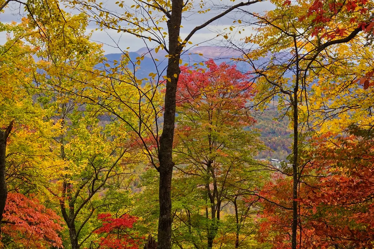
The Autumn colors we saw in October were completely breathtaking. If you’re brave enough, you can climb to the right and around the tower to the north facing rock outcropping for even more views.
Climb Works Mountain Ziplining
Come create the stories your family will always talk about
The top-rated and world-class Mountaintop Zipline tour is right across the street from the Great Smoky Mountains National Park. This is a fun and unique way to see one of the most beautiful places on earth.
If you want to get better at social media, this is the place to be! The Great Smoky Mountains National Park is right next to the Mountain Top Zipline, which is tucked away from the city. The views can’t be beat. Our guides will take pictures of you in groups, in action, and on our beautiful suspension bridges. T
These pictures would be great for a family Christmas card. You can also bring your own cell phone or action camera with you.
Food and Diner Locations Near the Hen Wallow Falls Trail
Chubs Kitchen
4925 Hooper Hwy, Cosby, TN 37722-3097
Review
Great place to grab a quick bite from a food truck. On the menu, there are many different kinds of melt sandwiches. Fresh food was made and served very hot. The food was ready in no time. All melts come with wedges. The owner also works as the cashier and is a really nice person. There are places to sit outside close by. The owners of Magnolia have started the Chub’s kitchen on a small scale due to labor shortage.
Docs 321 Cafe
4572 Hooper Hwy, Cosby, TN 37722-3097
Review
Great place to eat!! The food and service are both great, the lemonade is out of this world, and their smoked pies are out of this world. I really liked the food there and would recommend going there.
The Woodshed Restaurant
2593 Cosby Hwy, Newport, TN 37821-6536
Review
We’ve eaten here twice, and I’m sure I won’t get a ribeye steak anywhere else. I’m old and have eaten at a lot of steak houses, and this is the best beef I’ve ever had. Some of my family members have tried other things. My grandson loves their 8-inch-tall signature hamburger, and everything is great. The servers are very nice, and everyone gets great service. “The Woodshed” is a good name for the atmosphere.
You May Want to Join Our Boondocking Group on Facebook For More Information
You May Want to Join Our Campfire Recipes Group on Facebook For More Information