
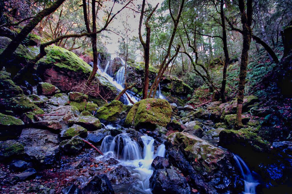
The main Smoky Mountain National Park waterfalls locations are known for their beauty and all of the incredible natural features you can see, from mountain views to wildlife. You will have to hit the trails to reach most of them, creating a fun thing to do with your family and friends.
You might be unsure of which waterfalls to go to, given the number you are able to see. The top 19 waterfalls of the Great Smoky Mountain National Park waterfalls are listed below.
19 Very Best Smoky Mountain National Park Waterfalls
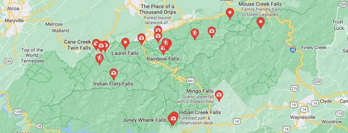
Great Smoky Mountain National Park Map Waterfalls Edition
There are only a few key components that account for the range’s abundance of stunning falls and plunges. One reason the Great Smoky Mountain National Park waterfalls are so harsh is that streams follow steep valley bottoms, giving the area’s water flow a generally tumbling, careening appearance.
Want more ideas to round-out your trip to Smoky Mountain National Park?
A lot of great ideas are in these posts!
- 13 Great Smoky Mountains Free Campsites (Updated 2022)
- 34 Free Tennessee Boondocking – Camping Spots & RV Parking
- OBE Great Smoky Mountains National Park Visitors Guide
- 4 Great Reasons to Visit the Smoky Mountain National Park Visitors Center
- 35 Best Smoky Mountain National Park Campgrounds & RV Parks
- 17 Spots for Great Smoky Mountains National Park Photos
- 25 Best Hikes In Smoky Mountain National Park
- 12 Top Things To Do In Smoky Mountain National Park
- Our 9 Favorite Smoky Mountains National Park Cabin Rentals
- 27 Best Great Smoky Mountains National Park Hotels By Entrance
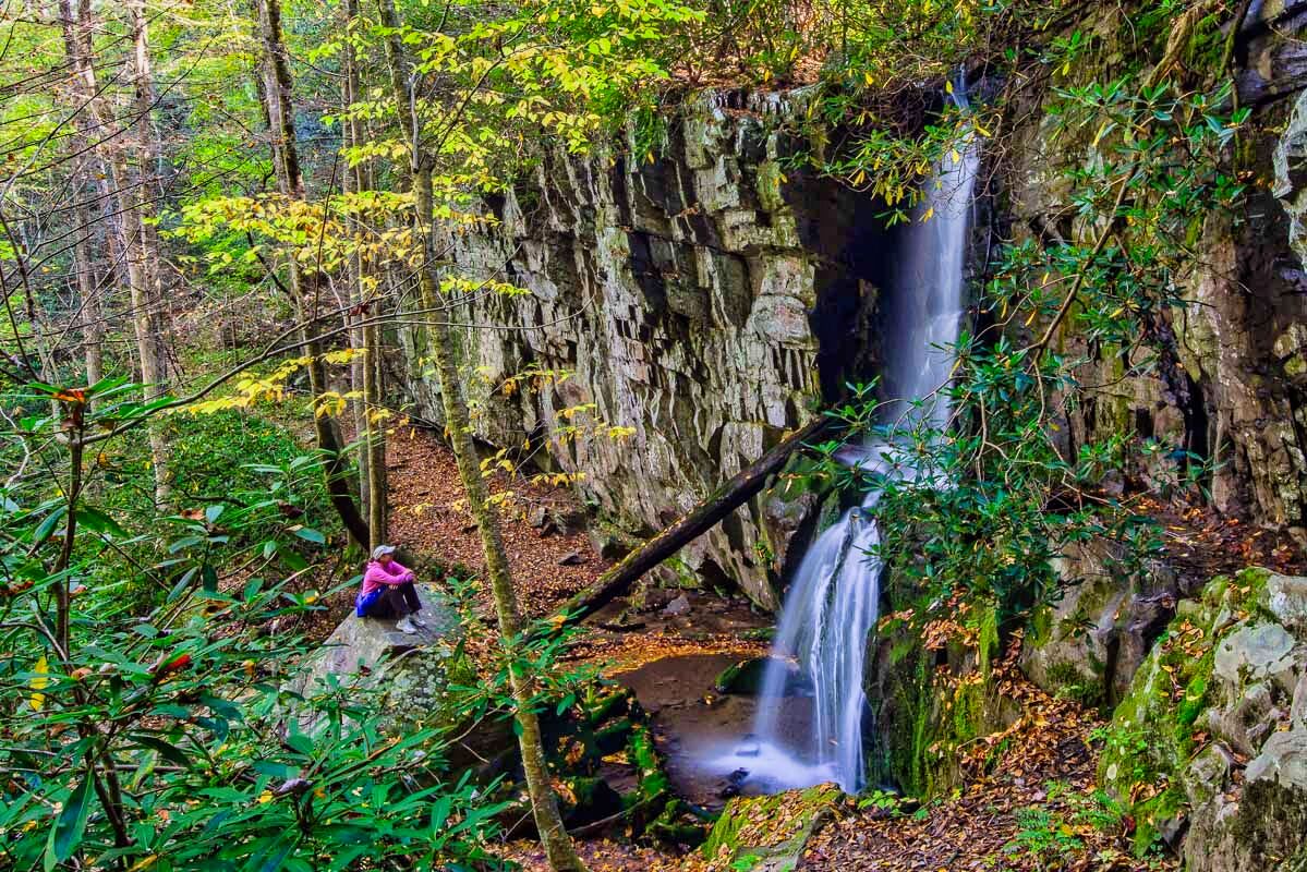
The Southern Appalachians’ largest block of high terrain is located in this range, which is not only steep but also high and rainy. In particular, the super-moist airmasses from the Gulf of Mexico that frequently slough across this region of the Southern Appalachians suck a lot of rainfall out of passing weather systems.
The upper Smokies may receive 90 inches or more of precipitation annually, which is a tremendous fountainhead that supplies a lot of water that gives in to gravity’s pull downward. Finally, the Great Smoky Mountains’ varied, primarily sedimentary geology layers rocks with varying resistance to erosion, most notably running water.
Ledges and cliffs of more durable formations, especially sandstones like the Thunderhead Sandstone, survive while less durable strata wear away, forcing down-cutting streams to spill or outright collapse over them.
19 Very Best Smoky Mountain National Park Waterfalls
check out our video
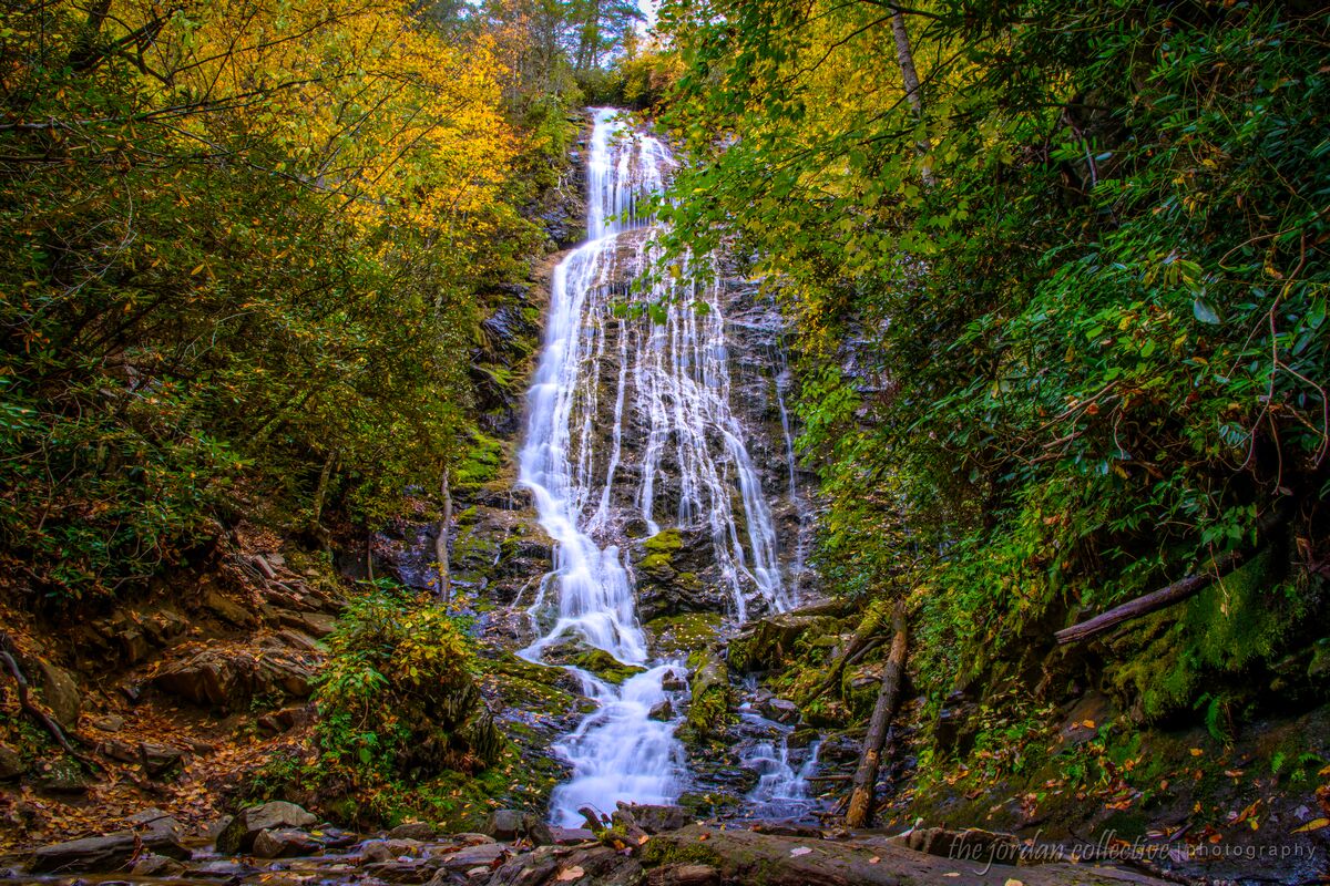
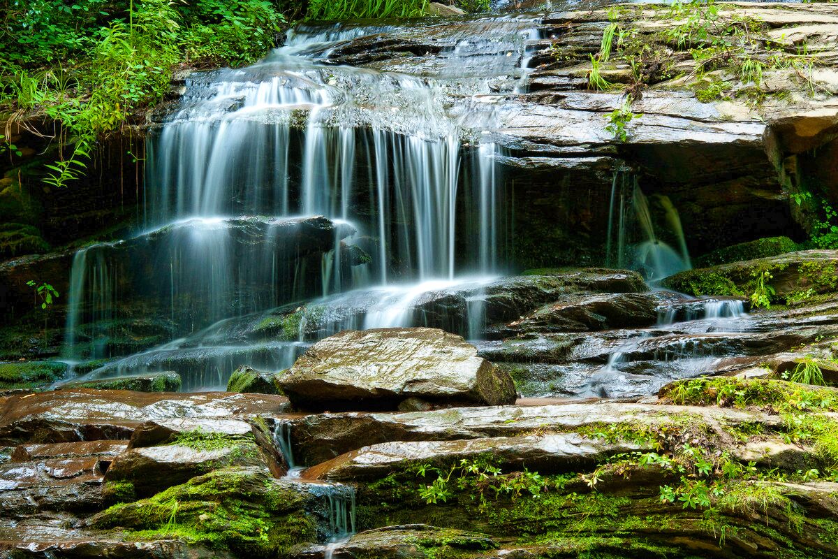
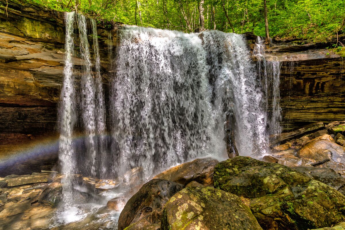
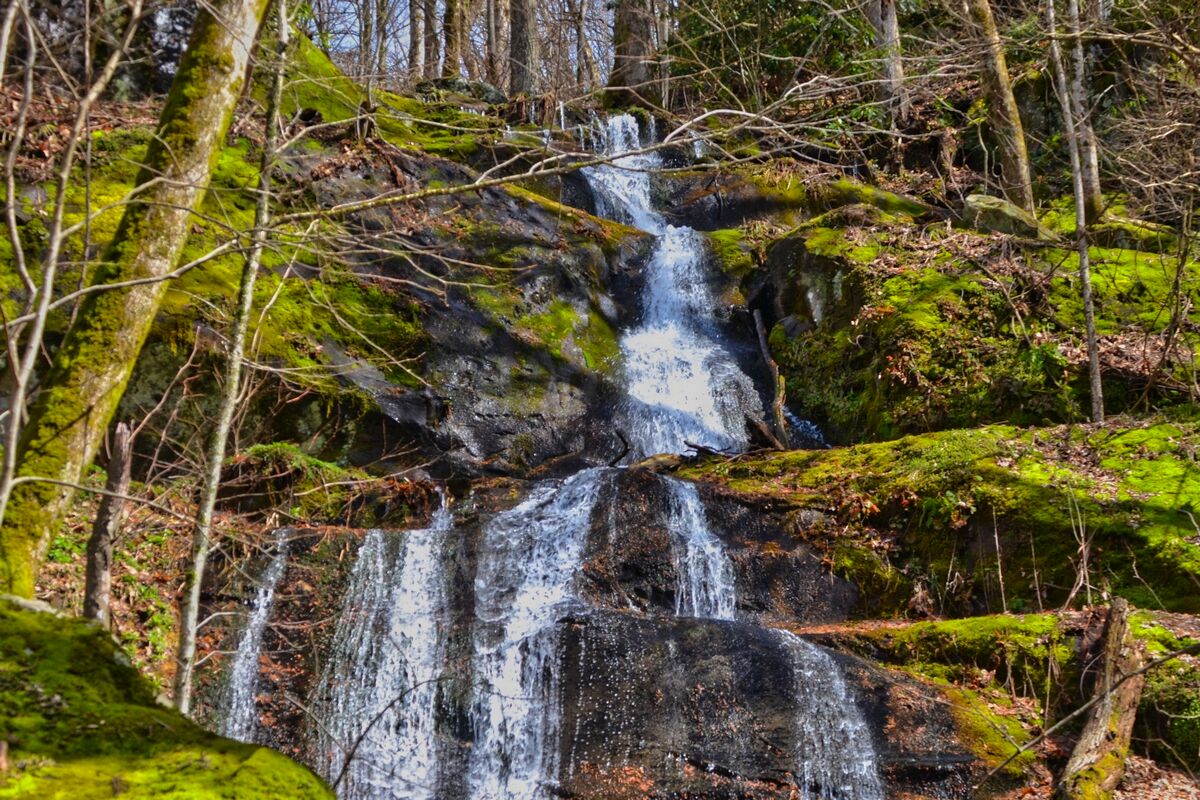
1. Place of a Thousand Drips
 Place of a Thousand Drips Great Smoky Mountain National Park Waterfalls (edited) from Mark Ordonez
Height of Falls: ~30′
Round-Trip Hike: 0.0 mi.
Difficulty: Drive-by
One of the beautiful Smoky Mountain National Park waterfalls, is located on a road with enough of pull-outs to allow those who try to go too quickly, get by. I stopped and allowed them to pass. Even though no wildlife was visible, it was still cool. Several locations with historic structures and river pathways was along this paved road.
Find out about this 6.7-mile roundtrip trail that runs close to Gatlinburg, Tennessee. It typically takes 3 hours and 31 minutes to do this trip, which is thought of as being simple. You’ll probably run into other people while exploring because this is a really popular location for birdwatching and picturesque driving.
The months of May through November are the optimum for hiking this trek. Dogs must stay at home because this trail is off-limits to them.
The Place of a Thousand Drips can be seen from your car, and a few quick treks in several locations offer fantastic photo opportunities. Its name, in my opinion, comes from the way it appears to divide into numerous drops, reunite, split once more, and so forth.
It’s a very interesting view. However, the unique channels and grooves the water has carved out through time make the falls a must-see.
Directions
• Head into Gatlinburg along US-441/TN-71. (You should notice signs for the Motor Trail, but if you don’t….)
• If headed North into Gatlinburg, you would turn right onto Historic Nature Trail/Cherokee Orchard Road, and essentially continue southeast along the road. The road turns into the Motor Trail inside of the park.
• Look for this falls on your left. It’s pretty clearly marked.
You can easily enter Great Smoky Mountain National Park and travel along the one-way Roaring Fork Motor Nature Trail just outside of Gatlinburg, Tennessee. It’s an interesting trip, and the motor path provides access to a variety of waterfalls.
I chose not to do some of the medium-length walks that some of them demand in order to observe the falls because there was relatively persistent thunder on the day I was there.
There are a few other waterfalls that can be easily viewed from the trail, though.
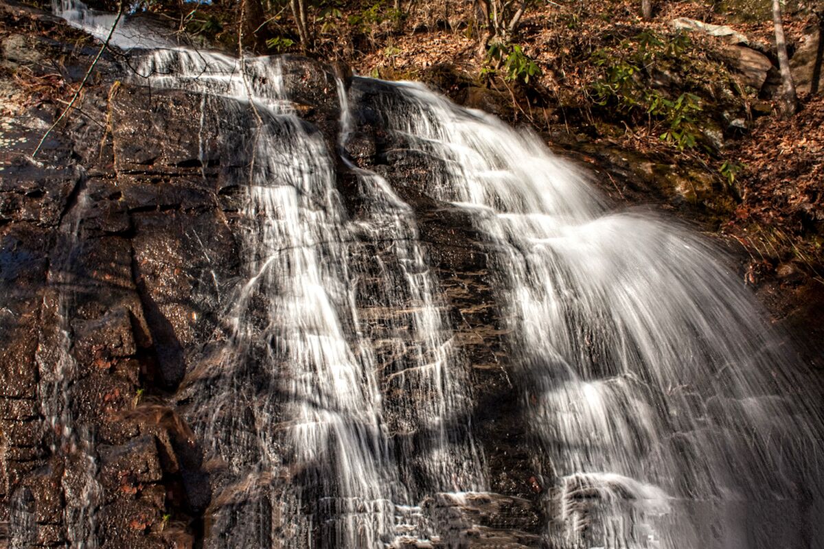
2. Grotto Falls Via the Trillium Gap Trail
 Grotto Falls Great Smoky Mountain National Park Waterfalls by (edited) by Frank Kehren
Height of Falls: 25′
Round-Trip Hike: 3.0 mi.
Difficulty: Moderate / Hourly
Super simple—even for small children. It is definitely worth it. There is a hard walk that leads up to the waterfall, but I’d say it’s only for adults. If you wish to avoid the crowds, it is also preferable to skip Saturday and Sunday.
Grotto Falls is one of the Great Smoky Mountain National Park waterfalls for summer hikers as well as salamanders because of the cool, wet environment that surrounds it. The Trillium Gap Trail leads directly to the 25-foot-tall waterfall in the Great Smoky Mountains National Park.
Grotto Falls caught me off guard a little bit because I wasn’t sure how many waterfalls I’d see. Even though this waterfall is small, it was nonetheless lovely to find it!
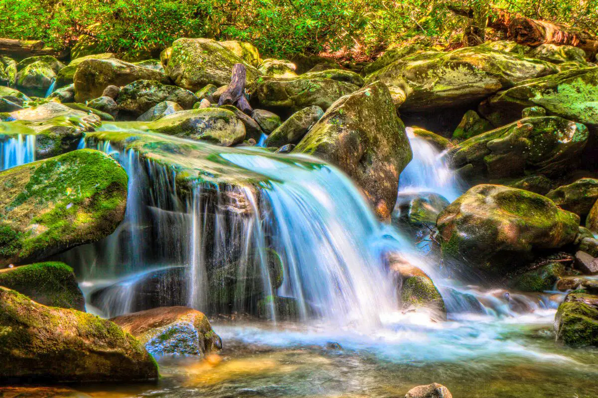
There are several Smoky Mountain National Park waterfalls in the vicinity of Dayton, and Yellow Springs has a few minor waterfalls as well. They are a part of the Glen Helen Nature Preserve, a small park that I thought was lovely and enjoyable. (Getting lost in the park is shockingly simple, but that’s not necessarily a bad thing.)
Directions:
• Head into Gatlinburg along US-441/TN-71. (You should notice signs for the Motor Trail, but if you don’t….)
• If headed north into Gatlinburg, you would turn right onto Historic Nature Trail/Cherokee Orchard Road, and essentially continue southeast along the road. The road turns into the Motor Trail inside of the park.
• Look for this falls on your left. If you reach the Place of a Thousand Drips, you’ve passed it, and you have to circle around again if you want to see it.
3. Mingo Falls
 Mingo Waterfalls in Smoky Mountain National Park (edited) by Kacey and Jordan
Height of Falls: 120′
Round-Trip Hike: 0.8 mi.
Difficulty: Average / Hourly
One of the tallest and most impressive Smoky Mountain National Park waterfalls is Mingo Falls, which is 120 feet tall. It is situated near the Great Smoky Mountains National Park, on the Cherokee Indian Reservation (Qualla Boundary).
There is no specific authorization needed to enter the reservation. Despite being only 0.4 miles long, the hike to the waterfall is nonetheless regarded as being moderately tough.
The steps were irregular in height and spacing, which made them worse than they needed to be. Going up actually made it impossible to establish a rhythm. It also has a sideways tilt. The trail is very easy once you pass the steps.
The falls are very breathtaking! The bridge provides an excellent vantage point! When traveling to the falls, be sure to keep an eye out for the signage. Your GPS will lead you astray. There is a sizable notice warning you to turn back since your GPS is inaccurate.
First things first: Mingo Falls is a great waterfall to explore. It lies just outside of Cherokee’s Great Smoky Mountains National Park and a short drive away (which is a town I could visit pretty frequently, especially in non-peak season).
I made sure to see Mingo Falls on my first trip. When I returned, I had some extra time before dusk and decided to explore Mingo Falls once more. I am happy I did.
As the trees’ leaves began to emerge in late April, they partially hid the falls. Early March didn’t have a problem with that! The volume of water rushing over the falls is equally remarkable.
Directions:
• You want to end up on Big Cove Road (Road 1410), and there are a few different ways to get there. If you’re on US-441 in Cherokee headed toward the Smoky Mountains Park entrance, you could turn right onto Acquoni Road, and then very soon after, turn left onto Big Cove. (If you miss that, there’s another road that leads to Big Cove right after that.)
• Drive for approximately 3.5 miles on Big Cove Road.
• There should be a sign for Mingo Falls, turn right onto Sherrill Cove Road. Literally a few hundred feet after this turn is the parking area for Mingo Falls. (Some GPS systems might direct you to turn onto Sherrill Cove Road much earlier, but ignore this. Sherrill Cove Road is a very narrow, winding dirt road, whereas Big Cove Falls is a paved road.)
• It’s an uphill hike from the parking area.
4. Spruce Flats Falls
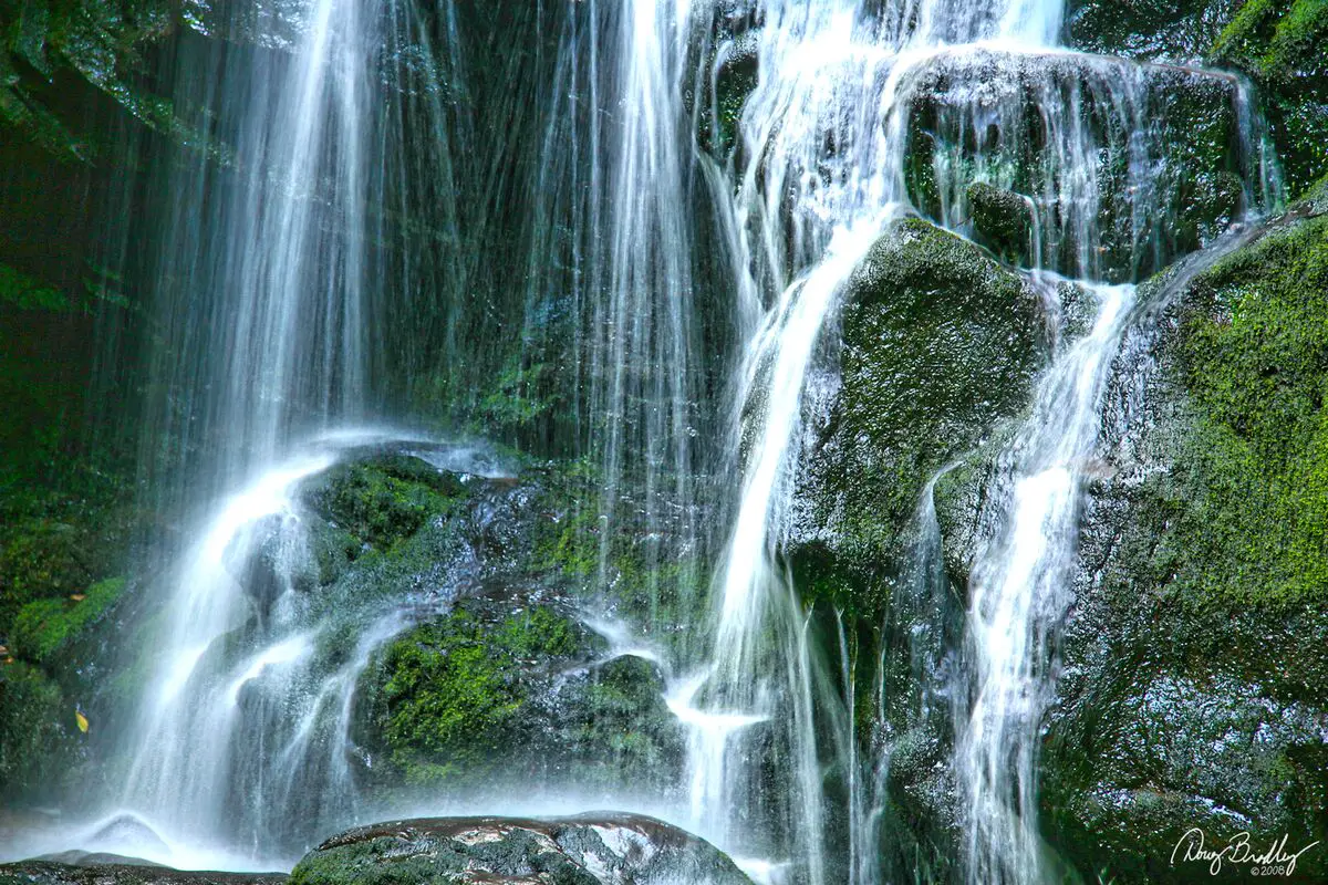 Spruce Flats Waterfalls in Great Smoky Mountain National Park (edited) by Doug Bradley
Height of Falls: 30′
Round-Trip Hike: 1.8 mi.
Difficulty: Moderate/ Hourly
Looking for a route that won’t be too challenging, but will nonetheless show you this Great Smoky Mountain National Park waterfalls stunning features? The Spruce Flats Falls Trail is a great trek! Along the way, you might even encounter some wildlife and a stunning waterfall.
Considering how little traffic this waterfalls at Great Smoky Mountain National Park receives, many people encounter wildlife there. Along the walk, you might encounter butterflies, birds, snakes, and even bears.
When you arrive at the falls, you’ll see salamanders and fish. Along with fauna, this trail also features old forest growth, which indicates that there are big trees in the region. Along the way, you’ll stroll next to the Little River, providing you with a beautiful vista to enjoy while hiking. Even a view of some of the mountains can be seen at a certain point on the trail.
Directions:
• From the parking area hikers should walk up the gravel road and turn left just before reaching the GSMIT dormitory building. The trailhead is located only a few yards from the building.
• Roughly 20 yards from the trailhead hikers will reach the Buckeye Trail junction. The Lumber Ridge Trail continues for another 4 miles to Buckhorn Gap and the intersection of the Meigs Creek and Meigs Mountain trails. To continue towards Spruce Flats Falls hikers should turn right onto the Buckeye Trail.
• From the junction the Buckeye Trail leads steeply uphill, and soon begins to travel above a series of tent cabins that are used by overnight guests of the institute. At just under two-tenths of a mile you’ll reach another split in the trail.
• At just under a half-mile the trail reaches its highest point, and soon begins descending towards the falls. As you descend the trail becomes progressively steeper and more rugged, especially as you get closer to the falls.
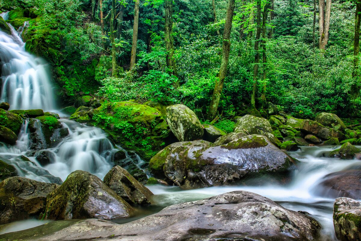
5. Deep Creek’s Three Waterfalls
 Great Smoky Mountain National Park Waterfalls Deep Creek (edited) by JR P
Height of Falls: 120′
Round-Trip Hike: 2.4 mi.
Difficulty: Average / Hourly
The throngs disperse for a much quieter journey along the whitewater rapids during the months other than summer. Given that it is at a lower level and gets less snow, this is one of our favorite places to hike in the winter. These pathways are off-limits to animals. Learn more about the vicinity of Deep Creek.
There are various hiking paths one can take in order to visit all three of these Smoky Mountain National Park waterfalls. The 2.4 mile option is the shortest. Five miles make up the Deep Creek-Indian Creek Loop.
Spend leisurely time at all three waterfalls in Great Smoky Mountain National Park at Deep Creek for about an hour and a half. Consider how life may have been for the families who called this lovely location home before the National Park was established. Any time of year, Deep Creek is lovely.
Indian Creek Falls
 Indian Creek Waterfalls in Great Smoky Mountain National Park (edited) by Timothy Wilden
After traveling the Deep Creek trail for about a mile, it ascends a slight incline to the point where Indian Creek merges with Deep Creek. Follow the Indian Creek Trail 200 feet upward to the right to reach the boisterous Indian Creek Falls, which thunders 25 feet to the pool below. The falls’ base can be reached by using a short side route.
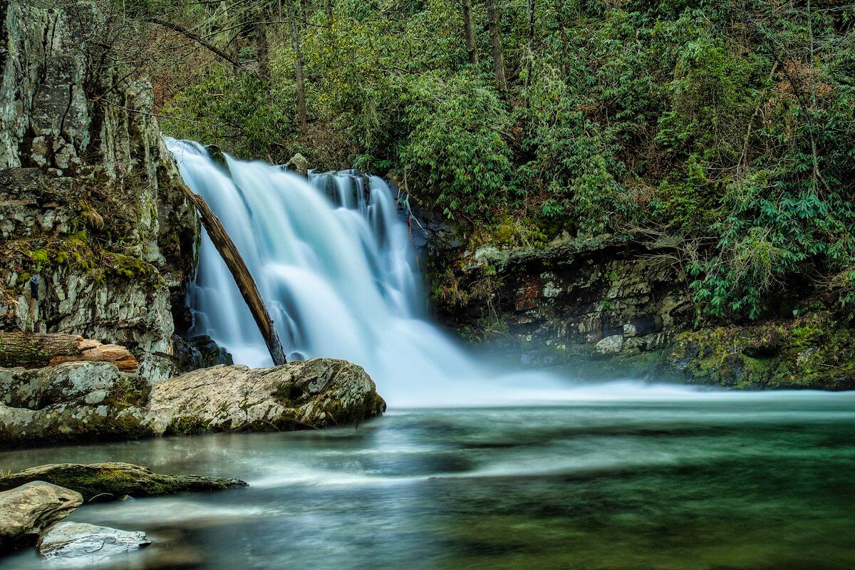
Tom Branch Falls
 Tom Branch Waterfalls in Smoky Mountain National Park (edited) by Timothy Wilden
Tom Branch waterfalls in Great Smoky Mountain National Park, a wispy cascade that gently splashes over 60 feet into Deep Creek, is reached after a short 1,000-foot hike from the main trailhead along the wide, level Deep Creek trail. You can sit on the bench next to the creek and enjoy the view of the inner-tubers floating by.
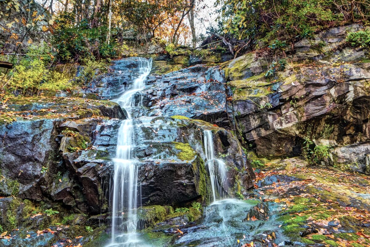
Juney Whank Falls
 Juney Whank Great Smoky Mountain National Park Waterfalls (edited) by Todd Barrow
Follow the well-marked trail 1/4 mile uphill from the Deep Creek trailhead parking area to Juney Whank Falls. Even before you get there, you can hear the roar of the falls. A handrail-equipped footbridge made of logs crosses a ninety-foot waterfall that begins above you before joining Deep Creek at the trail’s base.
Directions:
• Tom Branch Falls is an easy 1/4-mile walk from the parking area. There’s plenty of seating to watch the waterfalls and summer tubers drift by. These photos were taken after a rain, so water flow is often lower.
• Go another 1/3-mile to Indian Creek Falls, with a slight uphill walk by the rushing Deep Creek. Look for the Indian Creek Trail on the right, walk a short distance and turn left on a spur trail to the base of the 25-ft. waterfall in a cove.
• Return to Deep Creek Trail the way you came. Or, return to Deep Creek Trail and take a right to the Horse Trail that will take you to Juney Whank Falls (part of the 2.4-mile loop). See map below.
6. Hen Wallow Falls
 Hen Wallow Waterfalls in Great Smoky Mountain National Park (edited) by Michael Hicks
Height of Falls: 90′
Round-Trip Hike: 2.4 mi.
Difficulty: Moderate to Difficult / Hourly
Hemlock and rhododendron forests are traversed on the enjoyable journey to the waterfalls in Great Smoky Mountain National Park at Hen Wallow. This trail is 4.4 miles long and rated as having a moderate degree of difficulty. Hen Wallow Falls is 90 feet tall! The waterfall is barely 2 feet wide across at the top, yet 20 feet wide at the bottom.
Hen Wallow waterfalls in Great Smoky Mountain National Park are distinctive in that they are only 2 feet wide at the top but expand out to about 20 feet wide at the base as the water descends the 90-foot plunge.
The foot of the falls is packed with numerous rocks, some of which are quite jagged, making it difficult to view from above. Getting a nice distant shot of the falls is quite tough due to the relatively large drop that occurs further down from the base.
Many people have been hurt and died on the top rocks throughout the years because they are so slick. You may still touch and see the river by staying on the lower rocks, which are also quite safe.
Directions:
• Almost from the start the trail, it begins to make a steady climb up the northern flank of Snake Den Mountain. While ascending the Gabes Mountain Trail, which was once known as the Messer Trail, the roots and rocks will testify just how rough this route can be in some places.
• After walking a short distance Rock Creek will appear on your right. Soon after you’ll pass the side trail that leads to the Cosby Campground, almost four-tenths of a mile from the trailhead. Shortly thereafter the trail crosses over Rock Creek.
• At roughly seven-tenths of a mile you’ll pass a social trail that leads off to your right. Continue going straight here.
• Roughly 1 mile from the trailhead hikers will reach Messer Gap. There’s another faint side trail on your right here, that supposedly leads to an old grave site. To continue on towards the falls, hikers should proceed straight ahead.
7. Mouse Creek Falls
 Mouse Creek Waterfalls in Smoky Mountain National Park (edited) by Jim Liestman
Height of Falls: 45′
Round-Trip Hike: 4.0 mi.
Difficulty: Moderate / Half-Day
On the far side of Big Creek is where Mouse Creek waterfalls in Great Smoky Mountain National Park can be found. The falls have a height of 45 feet. To reach the falls and back, a four-mile round-trip hike that is moderate in effort is necessary. The hike to the waterfall and back usually takes two to three hours.
Big Bear Trail travels along a former railroad grade that was once used to transport lumber from the mountains during the early 20th century logging boom. The route to this waterfalls in Great Smoky Mountain National Park trail passes Midnight Hole, a large pool below a six-foot fall, at 1.4 kilometers.
A brief side route on the left at 2.1 miles brings hikers to a bench where they can relax and enjoy the view of Mouse Creek Falls.
Big Creek Trail follows an old railroad line that was employed in the 20th century to transport lumber out of the mountains. The distance is 4 miles roundtrip. The climb has a very slight elevation and is comparatively level.
You will pass the Midnight Hole, a stunning pool beneath a 6-foot-tall waterfall, as you travel the trail. Mouse Creek Falls are located a little higher up and to the right. There is a seat where you may sit and take in the 45-foot waterfall.
Directions:
• Exit I-40 at Waterville Road (#451).
• Turn left after crossing the Pigeon River and proceed 2.3 miles to an intersection.
• Continue straight, past the ranger station, to a large parking area at road’s end to reach the trailhead.
8. Cataract Falls
 Great Smoky Mountain National Park Waterfalls Cataract Falls (edited) by Missy S
Height of Falls: 45′
Round-Trip Hike: 4.0 mi.
Difficulty: Moderate / Half-Day
It really is all stairs. Small and regular at first, the stairs gradually increase in size and difficulty as you ascend. There isn’t much actual scrambling, but a few places are close. Though you will perspire, it is worthwhile to travel all the way to the picnic place.
The descent to this waterfalls in Great Smoky Mountain National Park is not perilous, but the ascent is a heart-pounder and there are a few spots where you may need to shuffle through some loose mud or leap a little.
The walk to this Smoky Mountain National Park waterfalls is a bit tough on the knees at times. Always use appropriate footwear. You underestimate how lengthy it is.
Bring water and a snack at the top so you may stop and catch your breath. Swimming is prohibited, although the shade of the trees keeps things cool. It’s definitely longer than what’s described here, and moderate is probably more appropriate than strenuous.
Directions:
• Take the main Parkway (Highway 441) out of Gatlinburg into the Great Smoky Mountains National Park. When you reach Sugarlands Visitor Center (on your right), turn Right on Little River Road and park at the Sugarlands Visitor Center.
• To find the trail, begin walking down the concrete path to the left of the Sugarlands Visitor Center (near the outdoor restrooms and vending area). This will quickly turn into the Fighting Creek Nature Trail to Cataract Falls.
9. Baskins Creek Falls
 Baskins Creek Waterfalls in Great Smoky Mountain National Park (edited) by Sradke
Height of Falls: 40′
Round-Trip Hike: 4.0 mi.
Difficulty: Moderate / Half-Day
For those who enjoy the outdoors, Baskins Creek waterfalls in Great Smoky Mountain National Park is one of the most well-liked Pigeon Forge attractions. It is renowned for providing some of the Smoky Mountains’ most picturesque views that are convenient for families and hikers of all ages.
One of the eight picturesque locations for Smoky Mountain National Park waterfalls is just off the Roaring Fork Motor Nature Trail. It is Baskins Creek Falls.
Along the Roaring Fork Motor Nature Trail, you can get to the Baskins Creek Trail’s trailhead. There is a brief, simple ascent to the waterfall along the 3-mile roundtrip walk. Along the journey, you may observe some local wildlife and catch glimpses of the mountains. The waterfall is 40 feet tall and has two levels. Once you get to the waterfall, you can have a picnic, unwind, and enjoy the view.
A brief, simple ascent leads into the hike to the waterfalls in Great Smoky Mountain National Park at Baskins Creek, commonly known as Baskins Falls.
If you’re hiking in the Winter or the early Spring, you’ll have some good views of the mountains to the west at about a quarter of a mile along with a few glimpses of Gatlinburg. However, the Summertime foliage will probably block these sights.
Directions:
• Take US 441 south to Gatlinburg.
• Turn right on East Parkway.
• Turn left on Cherokee Orchard Road.
• Continue to the left when the road ends and meets with Historic Nature Trail.
• Hang to the right at the fork in the road, which begins a one-way loop.
• Roaring Fork Motor Nature Trail will be 0.9 miles down the loop on the right.
• Go another 0.2 miles and you’ll be at the trailhead for the Baskins Creek Trail.
10. The Sinks
 The Sinks Waterfalls in Smoky Mountain National Park (edited) by Frank Kehren
Height of Falls: 15′
Round-Trip Hike: .5 mi.
Difficulty: Easy / Half-Day
One of the most stunning locations along the Little River Road scenic drive is the Sinks region to the waterfalls in Great Smoky Mountain National Park. The Sugarlands Visitor Center is 12 miles to the west of this location, where visitors can see Mother Nature at her best!
The Sinks are a set of naturally occurring pools bordered on both sides by enormous river rocks that were created when a lovely mountain river carved out an S-curve. In fact, loggers used to have access to the Little River back then.
The enormous whirlpool at the base of this Smoky Mountain National Park waterfalls, which swirls like water emptying in a sink, gave it its name. The Sinks, like any waterfall in the Smokies, is most beautiful after a heavy downpour in the mountains.
The Little River’s whole volume is channeled by this magnificent cascade, which also generates powerful currents. A deep swimming hole that is wonderful to enjoy in the summer has been developed through time by the river’s force.
Please be warned that while being a well-liked swimming hole and jumping area on hot summer days, this particular location has seen numerous drownings and numerous catastrophic injuries. Here, swimming is strongly discouraged; instead, head to the National Park’s tranquil and shallow Greenbrier portion.
Directions:
• From downtown Gatlinburg, drive into the National Park.
• Immediately after passing the Sugarlands Visitor Center, turn right on Little River Road.
• The parking area for The Sinks is approximately 12 miles west of the visitor center on the left side of Little River Road.
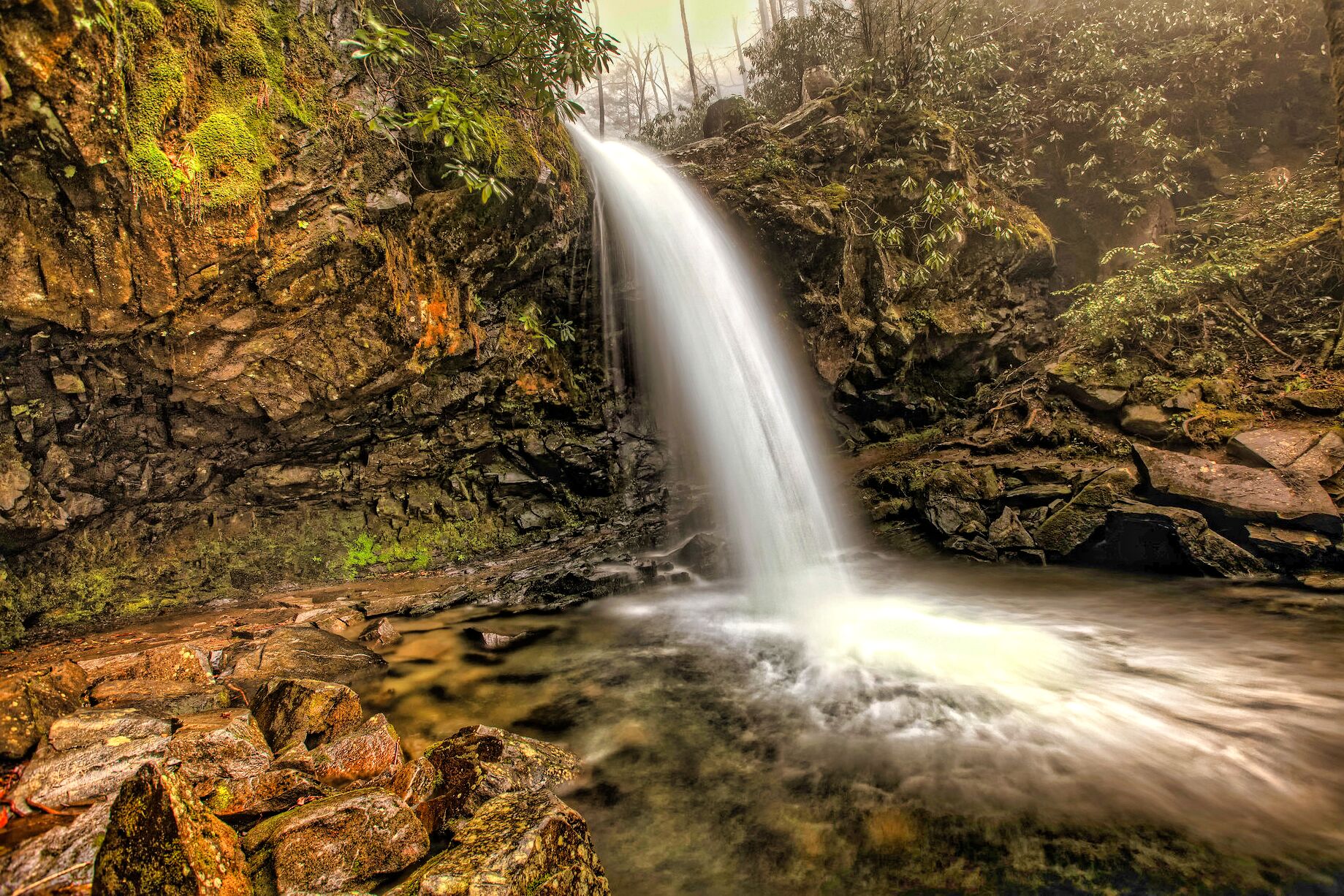
11. Laurel Falls
 Great Smoky Mountain National Park Waterfalls Laurel Falls (edited) by Thomas
Height of Falls: 80′
Round-Trip Hike: 2.6 mi.
Difficulty: Easy / Hourly
The mountain laurel, an evergreen shrub that blossoms along the trail and close to the waterfalls in Great Smoky Mountain National Park in May, is the inspiration for the names of Laurel Branch and the 80-foot-tall Laurel Falls. A boardwalk that spans the stream at the base of the higher falls separates the upper and lower sections of Laurel Falls.
There is a limited amount of parking at the trailhead for the falls because it is well-liked by park visitors. Both on weekdays throughout the summer and on weekends throughout the year, the area is quite crowded.
Laurel Falls is 2.6 miles away, and the hike there is rated as being of moderate difficulty. On average, the climb to the Smoky Mountain National Park waterfalls and back takes two hours.
Although the trail is paved, it is rocky and uneven with a few brief, steep sections that can be hazardous in wet weather. In addition, some of the trail has severe drop-offs, making it unsuitable for wheelchairs or strollers. At all times, children must be closely watched.
Directions:
• To access the trailhead of Laurel Falls Trail from the Sugarlands Visitor Center. t
• Turn toward Cades Cove on Little River Road and drive 3.5 miles to the trailhead.
• Parking areas are available on both sides of the road.
12. Rainbow Falls
 Rainbow Waterfalls in Great Smoky Mountain National Park (edited) by Tim Lumley
Height of Falls: 80′
Round-Trip Hike: 5.4 mi.
Difficulty: Average / Half-Day
The Rainbow Falls Great Smoky Mountains National Park trail begins with a tough ascent through a sizable boulder field that lasts for the first two-thirds of a mile. Le Conte Creek will fall down the mountain to your right as you pass through this location. Along this section of the path, hikers will come across a number of fantastic picnic spots.
Due to the terrain it travels over, the Smoky Mountain National Park waterfalls here has developed a reputation as being a difficult walk over the years. The park took action in 2017 by starting a significant, two-year initiative to repair the trail and increase hiker safety.
The project’s primary goals were to strengthen trail segments that were eroding and restore trail tread that had been harmed by strong winds and fire during the Chimney Tops 2 wildfire in November 2016.
In order to build a strong and long-lasting trail corridor, workers erected over 350 stairs through tight, steep corridors, almost 600 feet of elevated trail surfaces, nearly 400 drainage components, and over 1000 native stones throughout the route.
The rehabilitation project also removed numerous, side pathways built by visitors that caused erosion and hiker confusion.
Directions:
• Take Historic Nature Trail Drive (traffic light #8 in Gatlinburg) into the park.
• At mile 3.4, just after the road becomes one-way, turn right into the Rainbow Falls Parking Area.
13. Ramsey Cascades
 Ramsey Cascades Waterfalls in Smoky Mountain National Park (edited) by Michael Hicks
Height of Falls: 1o0′
Round-Trip Hike: 8.1 mi.
Difficulty: Average / Full Day
Ramsey Cascades is the tallest waterfalls in Great Smoky Mountain National Park and one of the most spectacular. Water drops 100 feet over rock outcroppings and collects in a small pool where numerous well-camouflaged salamanders can be found.
One of the best hikes in the Great Smoky Mountains National Park is the Ramsey Cascades Trail, which offers access to an old-growth forest and the park’s biggest waterfall. Ramsey Cascades, which are situated on the park’s northeastern side, are remote and provide a welcome break from the throng that may be found in many other areas of the park.
But getting to this magnificent falls won’t be simple. It demands a strenuous 8-mile roundtrip hike with an elevation rise of more than 2,000 feet, but the journey is worthwhile!
The 8-mile roundtrip climb is rated as tough due to the trail’s elevation increase of almost 2,000′ over its 4-mile length. For a large portion of its length, it follows rapid rivers and streams. Large tulip trees, basswoods, silver bells, and yellow birches can be seen among the old-growth cove hardwood trees that line the final two miles of the trail.
Directions:
• Trailhead: Drive six miles east of Gatlinburg on Highway 321. and
• Turn at the Greenbrier entrance to the park.
• Follow the signs 4.7 miles to the trailhead.
14. Abrams Falls
 Great Smoky Mountain National Park Waterfalls Abrams Falls (edited) by Frank Kehren
Height of Falls: 20′
Round-Trip Hike: 5.0 mi.
Difficulty: Average / Half-Day
At first glance, Abrams Falls in the Great Smoky Mountains National Park seems like a peaceful place to visit. The waterfall itself is about 20 feet high, and the journey to get there is only around five kilometers round trip. However, a closer inspection of the water shows a beautiful and distinctive Smoky Mountain waterfall attraction.
Abrams Waterfalls in Great Smoky Mountain National Park’ is one of the Smoky Mountain National Park waterfalls with a low height but, is somewhat compensated for by the volume of water that rushes over it.
A long, deep pool at its foot makes for a lovely backdrop, but hikers should be warned: Swimming in the pool at the base of the falls is exceedingly dangerous and has even in the past resulted in swimmer deaths due to powerful currents and undertow.
On the Cades Cove Loop Road, past stop #10, there is a signposted turnoff that leads to the Abrams Falls trailhead. The trail travels through hemlock and rhododendron forest along the brook and pine-oak forest on the ridges.
Although some people may regard the hike as challenging due to its duration and topography, it is generally thought of as moderately difficult to get to the falls. It typically takes three to four hours to climb to and from the falls.
The Cherokee chief, Abrams, whose village formerly stood several miles downstream is honored with the name of this waterfalls in Great Smoky Mountain National Park. Its remarkable look serves as a lovely reminder of the Great Smoky Mountains National Park’s unsurpassed magnificence.
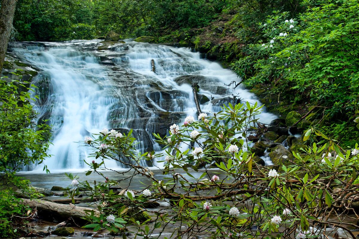
15. Lynn Camp Prong Cascades
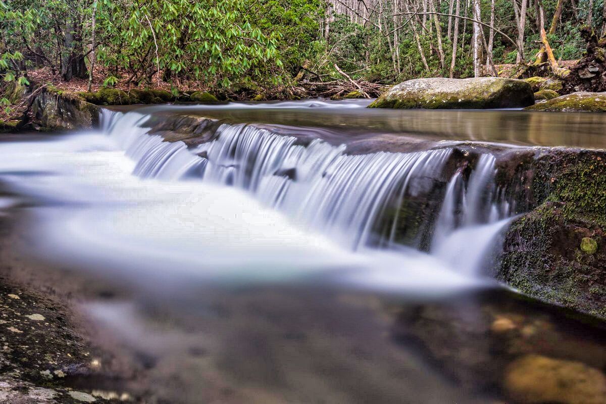 Lynn Camp Prong Cascades Waterfalls in Great Smoky Mountain National Park (edited) by Kaustubhyn
Height of Falls: 65′
Round-Trip Hike: 5.0 mi.
Difficulty: Average / Full-Day
There are multiple falls and cascades in the Lynn Camp Prong waterfalls in Great Smoky Mountain National Park. The lengths of the upper, middle, and lower cascades are 35 feet, 85 feet, and 55 feet respectively.
The lower cascade’s final plummet into the plunge pool is ten feet. The distance from the upper cascade to the plunge pool is a total of 65 feet. Along the cascade, there are a few log seats where you may relax and take in the view.
This trip to the cascades and to the Smoky Mountain National Park waterfalls on Lynn Camp Prong is a wonderful choice if you’re searching for a shorter, reasonably simple hike to a gorgeous place.
On your way up to the parking area, you might even find places to cool off on the Middle Prong of the Little River because it is family-friendly. If you visit in mid-October, which is the ideal time, this region is also fantastic for gorgeous autumnal color.
Directions:
• From the Sugarlands Visitor Center, drive west on Little River Rd for 17.6 miles to the intersection of Laurel Creek Rd and TN 73, also known as the Townsend Wye. Bear left on Laurel Creek Road towards Tremont and Cades Cove.
• In .2 miles, turn left on the Tremont Rd towards the Great Smoky Mountain Institute. Two miles up Tremont Rd, the institute and parking for Spruce Flats Falls will be on the left. Keep going straight.
• The road turns to gravel here and you’ll continue another 3 miles to where the road ends at the parking area for the Middle Prong Trail and the waterfalls.
• Look along the drive to the trail head for places to pull off and enjoy the sights and sounds of Middle Prong Waterfalls in Great Smoky Mountain National Park.
16. Fern Branch Falls
 Fern Branch Waterfalls in Smoky Mountain National Park (edited) by JJJJ56CP
Height of Falls: 50′
Round-Trip Hike: 4.0 mi.
Difficulty: Average / Half-Day
In the eastern region of the Great Smoky Mountains National Park, on the Porters Creek Trail, a moderately challenging 4-mile roundtrip climb (2 miles each way), is a stunning 50-foot cascade called Fern Branch Falls.
If you’re in the mood for a walk in the woods, this route, which has some beautiful natural scenery and is one of the less trafficked ones that you can drive to, is well worth a visit.
The Great Smoky Mountains typically evoke visions of grand vistas, refreshing running streams, and lush forest in the minds of its visitors. Well, there are plenty of these kinds of sights along the Porters Creek Trail that leads to Fern Branch Falls. The moss-covered stones and trees that are typical of this ecosystem can be seen as you go along Porters Creek early in the tour.
You’ll pass a cemetery and some of the remains of the Greenbrier Cove village as you cross a log bridge that will lead you deeper into the forest and closer to this Smoky Mountain National Park waterfalls site. These historic buildings are widespread in the region and provide a wealth of information about the past of the region prior to the creation of the national park.
Finally, you’ll reach Fern Branch Falls, a 50-foot-tall cascade that’s the ideal spot to pause for a meal, some rest, and some priceless pictures. The remaining 1.7 miles bring hikers to Campground 31, a backcountry camping location.
Directions:
• From I-40 in NC, cross into Tennessee and drive 8 miles to exit 443 – the Foothills Parkway. If the Parkway is closed, you will have to continue to exit 440 at US 321. Take the Foothills Parkway until it ends at 321/32.
• Turn left, drive just under 2 miles and turn right on 321. Drive 11.9 miles, cross the bridge over the Little Pigeon River, and immediately turn left on Greenbriar Rd. Coming from Gatlinburg, drive 5-6 miles from town and turn right on Greenbriar Rd.
• The parking area for the Porters Creek Trail is 4.1 miles down this gravel road. Drive slowly as the road narrows to 1 lane in places. At 3.2 miles you will pass the left turn for the Ramsay Cascades parking.
• The hike begins at the gated road.
You May Want to Join Our Boondocking Group on Facebook For More Information
You May Want to Join Our Campfire Recipes Group on Facebook For More Information