Texas boondocking areas have plenty of unique campsites to explore. With just a little planning and preparation, you can have awesome adventures boondocking in Texas!
Jump directly to the 17 Texas Boondocking Areas In The Panhandle
Jump directly to the 21 NE Texas Campsites
Jump directly to the 26 NW Texas Camping Locations
Jump directly to the 18 West Texas Boondocking Campsites
Jump directly to the 60 SE Texas Free Camping Spots
Jump directly to the 23 Deep-South Boondocking Sites
Texas Boondocking Areas In The Panhandle Section
Texas is a state of contrasts, with big metropolis like Dallas and Houston juxtaposed beside some of the country’s least populous counties in the west. While most people identify Texas with cacti, sagebrush, and hot afternoons on the Gulf Coast, the state contains a number of high elevation places that can be fairly frigid. When boondocking in Texas, always be prepared.
Federal land, like as national parks and recreation sites, will continue to be your best bets for boondocking. State parks, natural regions, and even some city parks in the state give excellent boondocking opportunities. Dry camping is often permitted at private parking lots such as truck stops and Walmarts, despite the fact that it is frequently forbidden in other states and localities.
While Texas may lack the large swaths of BLM and Forest Service land seen west of the Rockies, it still has plenty of boondocking opportunities.
Want more ideas to round-out your trip to the South-Central States?
► Kansas, Oklahoma, Texas ◄
- 12 Free NE Kansas Boondocking – Camping Spots & RV Parking
- 22 Free NW Kansas Boondocking – RV Parking & Camping Spots
- 33 Free SE Kansas Boondocking – Camping Spots & RV Parking
- 5 Free SW Kansas Boondocking – Camping Sites & RV Parking
- 72 Free Kansas Boondocking – Camping Spots & RV Parking
- 45 Amazing Oklahoma Boondocking Locations Including Maps
- 165 Awesome Texas Boondocking Areas Along With Maps
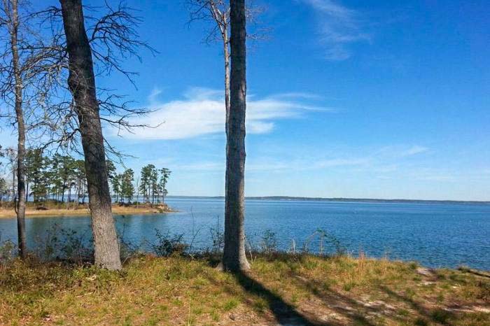
17 Texas Boondocking Areas In The Panhandle
Jump directly to the 21 NE Texas Campsites
Jump directly to the 26 NW Texas Camping Locations
Jump directly to the 18 West Texas Boondocking Campsites
Jump directly to the 60 SE Texas Free Camping Spots
Jump directly to the 23 Deep-South Boondocking Sites
check out our video
1. Picnic Area/Rest Stop
Address
VALLE DE ORO, Texas
GPS: 35.524409, -102.261227
Elevation: 3173′
Management: Public – Rest Area (Official)
The road in is Paved. Picnic area/rest stop is open Unknown. There are 1-5 Texas boondocking areas at this location and the maximum RV length is unlimited. You may stay 24 hours free then need permit at Picnic area/rest stop. On 385 small rest area. Really can fit any size rig. Plenty of dumpsters, which the locals like to come to every 30 minutes to illegally dump their household and personal construction trash. Surrounded by horse pasture. Some highway noise. Free for 24 hours then need permit.
2. Texhoma Park aka Dumas City Park
Address
Dumas, Texas
GPS: 35.866676, -101.979454
Elevation: 3669′
Management: Public – City Park (Official)
The road in is Paved. There are 6-15 Free Texas campsites at this location. Electric hook ups. Water and dump station availble. Hard surface and level. nice park with playground for the kids. Drawbacks would be the train which is just across the street.
3. Picnic Area Masterson
Address
Masterson, Texas
GPS: 35.672706, -101.964816
Elevation: 3691′
Management: Public – Rest Area (Official)
The road in is Paved. The maximum RV length at Picnic area is unlimited. You may stay 24 hours at Picnic area. 24 hour picnic/camping area on SB hwy 87. Texas camping locations.
4. Rosita Flats OHV
Address
Canadian River Road
Amarillo, Texas
GPS: 35.468678, -101.876325
Elevation: 2995′
Management: Public – National Park Service (Official)
The road in is Dirt. Rosita Flats OHV is open year round. There are 30 or more Texas boondocking areas at this location. You may stay 14 days at Rosita Flats OHV. The south river shore is part of the Sanford National Recreation Area, most recently known as Lake Meredith National Recreation Area. They’ve designated this as an ATV area, and lots of informal trails crisscross the sand dunes. When I camped here last year, it was pretty quiet at night. It’s easy access off the highway.
5. Mullinaw Creek
Address
McBride Canyon Road
Texas
GPS: 35.530169, -101.758669
Elevation: 2943′
Management: Public – National Park Service (Official)
The road in is Gravel and 3-5 miles from a paved road. Mullinaw Creek is open year round. There are 6-15 Free Texas campsites at this location and the maximum RV length is 25 feet. You may stay 14 per 30 day period at Mullinaw Creek. This campground is located down a paved road, but the camping area is on a gravel/dirt road 3-5 miles from the pavement. There 3 shade shelters with picnic tables, grills, and fire rings. There are about 3 picnic tables scattered about. There are 2 pit toilets and trash cans. There are many tent sites here and you will find some pull offs as you travel down the dirt road.
6. McBride Canyon
Address
McBride Canyon Road
Texas
GPS: 35.543684, -101.733585
Elevation: 2992′
Management: Public – National Park Service (Official)
The road in is Paved. McBride Canyon is open year round. There are 1-5 Texas camping locations at this site and the maximum RV length is 15 feet. You may stay 14 per 30 day period at McBride Canyon. This campground is located down a paved road, but the camping area is on a gravel/dirt road a couple of hundred feet off the pavement. There 2 shade shelters with picnic tables, grills, and fire rings. there are about 5 picnic tables scattered about. There are 2 pit toilets and trash cans.
7. Lower Plum Creek
Address
Plum Creek Road
Fritch, Texas
GPS: 35.592267, -101.726126
Elevation: 2927′
Management: Public – National Park Service (Official)
The road in is Gravel and 1 miles from a paved road. Lower Plum Creek is open year round. There are 6-15 Texas boondocking areas at this location and the maximum RV length is 25 feet. You may stay 14 per 30 day period at Lower Plum Creek. This is a popular area for horseback riding, hiking, and bicycling. Devil’s Canyon Trail is for beginner to experienced horseback riders, as well as hikers and mountain bikers. This campground is located down a steep grade but paved road until you get to the crossroads where it all turns to gravel. Then it is 1 mile on the gravel road to the campsite.
8. Lake Meredith
Address
Amarillo, Texas
GPS: 35.63866, -101.658447
Elevation: 2936′
Management: Public – National Park Service (Official)
The road in is Gravel. Lake Meredith is open Year Round. There are 30 or more Free Texas campsites at this location. You may stay 14 days at Lake Meredith. Lake Meredith offers a variety of camping opportunities, including scenic overlooks, shoreline camping, and wooded campgrounds. All campgrounds are free. No reservations are needed; sites are on a first-come first-serve basis. Trailer/RV hookups and showers are not available. Dump stations with potable water are located near Fritch Fortress and Sanford-Yake.
9. Harbor Bay
Address
Lakeview Drive
Fritch, Texas
GPS: 35.64749, -101.629236
Elevation: 2936′
Management: Public – National Park Service (Official)
The road in is Paved. Harbor Bay is open year round. There are 30 or more Texas camping locations at this site and the maximum RV length is 25 feet. You may stay 14 per 30 day period at Harbor Bay. Located just outside Fritch (turn west onto Lakeview Drive from Highway 136/Broadway), this large, open camping area has developed sites. There are 6 shade shelters with grills, pinic tables and fire rings. There are 3 pit toilets.
10. Blue Creek Bridge
Address
Hwy 1913
Fritch, Texas
GPS: 35.722618, -101.663863
Elevation: 2959′
Management: Public – National Park Service (Official)
The road in is Paved. Blue Creek Bridge is open year round. There are 6-15 Texas boondocking areas at this location and the maximum RV length is 15 feet. You may stay 14 per 30 day period at Blue Creek Bridge. This campground is located on paved road hwy 1913 but the camping are is on dirt roads as soon as you turn off the hwy. There are about 3 picnic tables scattered about. There are 2 pit toilets and trash cans.
11. Chimney Hollow
Address
Off Blue West Road
Fritch, Texas
GPS: 35.693451, -101.640485
Elevation: 2936′
Management: Public – National Park Service (Official)
The road in is Dirt and 1 miles from a paved road. Chimney Hollow is open year round. There are 6-15 Free Texas campsites at this location and the maximum RV length is 15 feet. You may stay 14 per 30 day period at Chimney Hollow. Located near Blue West, this remote and semi-developed campground is tucked in the Blue Creek embankment, which affords the area protection from prevailing winds. This campground is located down a paved road, but the camping area is on a dirt road 1 mile from the pavement. There are about 3 picnic tables scattered about.
12. Blue West Campground
Address
Blue West Road
Fritch, Texas
GPS: 35.684658, -101.628107
Elevation: 3058′
Management: Public – National Park Service (Official)
The road in is Paved. Blue West Campground is open year round. There are 6-15 Texas camping locations at this site and the maximum RV length is 25 feet. You may stay 14 per 30 day period at Blue West Campground. This campsite is located on a spectacular bluff overlooking Lake Meredith near the marina, on Blue West Rd. There are 6 shade shelters with picnic tables, but still lots of room for more rigs and tents. The road in is paved. There is 1 pit toilet which is serviced weekly. There are trash cans. There is a sewer dump at this location, but no water.
13. Fritch Fortress Campground
Address
Fritch Fortress Hwy.
Fritch, Texas
GPS: 35.6824, -101.5978
Elevation: 3094′
Management: Public (Official)
The road in is Paved. There are 6-15 Texas boondocking areas at this location. Lake Meredith National Recreation Area offers a variety of campgrounds where you can enjoy the lake or get a bit off the beaten path. free. – water view – trash service – dump and fresh water – clean modern bathrooms with free showers – over the air tv – good Verizon and ATT service – 20 minutes to a National Monument.
14. Cedar Canyon
Address
Off Sanford-Yake Road
Fritch, Texas
GPS: 35.693902, -101.573033
Elevation: 2936′
Management: Public – National Park Service (Official)
The road in is Paved. Cedar Canyon is open year round. There are 6-15 Free Texas campsites at this location and the maximum RV length is unlimited. You may stay 14 per 30 day period at Cedar Canyon. This small cove lies between Fritch Fortress and Sanford-Yake campgrounds. The area features beach camping with no individual campsites. Camping area is soft during rainy conditions. Drive with caution when leaving paved roads. Bathroom with potable water and flush toilets near parking lot.
15. Huber City Park
Address
Borger, Texas
GPS: 35.65411, -101.397469
Elevation: 3115′
Management: Public – City Park (Unofficial)
There are 6-15 campsites at this location. South edge of town, East side of SH-207. Huber City Park has 10 Texas camping locations with 30-amp electric & water, chemical toilets, dump. Free. 3 day limit. Exercise track, playground, picnic areas. Supermarket, restaurants, and fuel nearby.
16. Stinnett Park
Address
Stinnett, Texas
GPS: 35.825573, -101.444214
Elevation: 3178′
Management: Public – City Park (Official)
The road in is Paved. Free RV campsites with electric and water. Swimming pool with showers. Texas boondocking areas.
17. Thompson Grove Picnic Area
Address
Dalhart, Texas
GPS: 36.415017, -102.806053
Elevation: 4353′
Management: Public – Forest Service (Official)
Thompson Grove Picnic Area is open Year Round. There are 6-15 Free Texas campsites at this location. You may stay 14 Days at Thompson Grove Picnic Area. Thompson Grove is a picnic area in Rita Blanca National Grassland. There is plenty of shade from cottonwood trees in the picnic area. It is surrounded by nothing but prairie and sky otherwise.
Boondocking in Texas In The North East Section
Many beautiful sites to go boondocking in Texas may be found deep in the middle of the state, where the skies are usually clear. Free camping is available in Texas from the Piney Woods of East Texas to the Panhandle, and from the Gulf of Mexico to the Red River.
In Texas, boondocking is rather simple. After all, this massive state spans more than 268,000 square miles. And, because Texas is so expansive, you’ll want to take advantage of the various boondocking opportunities throughout the state. Consider visiting great destinations, which include two national parks, over 250 state parks, and a plethora of additional attractions.
Consider your destination when planning your boondocking vacation to Texas. The weather in Texas may be fickle, so check the forecast before heading out. It’s often useful to have a weather radio or app that can notify you to sudden changes in the weather.
21 NE Texas Campsites
Jump directly to the 17 Texas Boondocking Areas In The Panhandle
Jump directly to the 26 NW Texas Camping Locations
Jump directly to the 18 West Texas Boondocking Campsites
Jump directly to the 60 SE Texas Free Camping Spots
Jump directly to the 23 Deep-South Boondocking Sites
1. Caddo NG WMA – FM 3910
Address
1643-1665 Calmac
Wolfe City, Texas
GPS: 33.407071, -96.001394
Elevation: 692′
Management: Public – Fish and Wildlife
Free Texas boondocking areas in the National Forests in Texas’s Caddo – Lyndon B. Johnson National Grasslands. Reservations are not accepted at this campsite.
2. Tawakoni WMA
Address
A Mud Trail
Lone Oak, Texas
GPS: 32.990212, -95.989433
Elevation: 513′
Management: Public – Fish and Wildlife Service (Official)
Texas campsites in Tawakoni WMA is open closed during hunts. primitive camping area is located on the Pawnee Inlet Unit. It is in native condition most of the year. Before hunting begins in the Fall, the campground area is cleared, otherwise, be prepared to clear the area before setting up camp. The road may also be rough. A PASS or PERMIT is required at this campsite
3. Old Sabine Bottom WMA – Sabine River Camping Area
Address
County Road 3390
Lindale, Texas
GPS: 32.600988, -95.329113
Elevation: 341′
Management: Public – Fish and Wildlife Service (Official)
Old Sabine Bottom WMA – Sabine River Camping Area is open Year round – limited to hunters during hunting season. You may stay 14 days in Texas camping locations at Old Sabine Bottom WMA – Sabine River Camping Area. Texas WMAs require a permit to enter. The $12 Limited Public Use (LPU) Permit is good for camping in addition to admission. A PASS or PERMIT is required at this campsite
4. Old Sabine Bottom WMA – Oak Tree Camping Area
Address
21187 County Road 4106
Lindale, Texas
GPS: 32.588302, -95.346859
Elevation: 344′
Management: Public – Fish and Wildlife (Official)
Old Sabine Bottom WMA – Oak Tree Camping Area is open Year round – limited to hunters during hunting season. You may stay 14 days in Texas boondocking areas at Old Sabine Bottom WMA – Oak Tree Camping Area. A PASS or PERMIT is required at this campsite
5. Old Sabine Bottom WMA – Camp 1
Address
21187 County Road 4106
Lindale, Texas
GPS: 32.584774, -95.351166
Elevation: 354′
Management
Public – Fish and Wildlife Service (Official)
Old Sabine Bottom WMA – Camp 1 is open Year round – limited to hunters during hunting season. You may stay 14 days in Texas campsites at Old Sabine Bottom WMA – Camp 1. The Old Sabine Bottom WMA has 5,158 acres located north of Tyler in Smith County. The area is five miles northeast of Lindale. The WMA is bounded on the west by FM 1804 and meanders between the Old Sabine River Channel and the Sabine River. A PASS or PERMIT is required at this campsite
6. Fish Hawke Point @ Hawkins Lake
Address
Hawkins, Texas
GPS: 32.620198, -95.252551
Elevation: 361′
Management: Public – County Park (Official)
Public Lake surrounded by residential areas. Hawkins, Texas. Trash bins and a portable toilet cleaned regularly. Texas camping locations. You can see where previous people parked or had fires. Very peaceful.
7. Lake Hawkins
Address
White Oak, Texas
GPS: 32.5207, -94.8417
Elevation: 295′
Management: Public – Fish and Wildlife Service (Unofficial)
Public Lake surrounded by residential areas. Hawkins, Texas. Trash bins and a portable toilet cleaned regularly. Texas boondocking areas Not designated spots. You can see where previous people parked or had fires. Very peaceful.
8. West Dam @ Lake Quitman
Address
Quitman, Texas
GPS: 32.860874, -95.460388
Elevation: 412′
Management: Public – County Park (Official)
West Dam @ Lake Quitman is open Year-round. There are 1-5 Texas campsites at this location. No fees required. One-lane concrete ramp, parking capacity 5.
9. Lake Winnsboro North Park
Address
Winnsboro, Texas
GPS: 32.891785, -95.354607
Elevation: 439′
Management: Public – County Park (Official)
The road in is Paved. Lake Winnsboro North Park is open Year-round. There are 6-15 Texas camping locations at this location and the maximum RV length is 35′. A county park on a jetty. We had it all to ourselves in January. All sites are on the water, have picnic tables and trash cans. They are not level, dirt, and most are difficult to maneuver to. I wouldn’t suggest anything longer than 35′, but I guess a determined person could find a spot for a much larger rig. Low hanging trees.
10. Titus County Freshwater Supply District
Address
352 Fort Sherman Dam Road
Mount Pleasant, Texas
GPS: 33.09201, -95.01334
Elevation: 348′
Management: Public – County Park (Official)
The road in is Paved. There are 30 or more Texas boondocking areas at this location. You may stay 10 Days at Titus County Freshwater Supply District. Free campsite on Lake Bob Sandlin in Texas.
11. Cedar Springs
Address
Upshur County Landing Road
Ore City, Texas
GPS: 32.840822, -94.696681
Elevation: 269′
Management: Public – Corp of Engineers
Cedar Springs is open all year. This free campsite is located within the Corp of Engineers Southwestern Division’s Fort Worth District. The Texas campsites near Lake O’ The Pines.
12. Caddo Lake WMA
Address
State Highway 43
Caddo Lake, Texas
GPS: 32.739967, -94.167259
Elevation: 183′
Management: Public – Fish and Wildlife Service (Official)
Texas camping locations in Caddo Lake WMA is open closed during hunts. Camping is free of charge but all campers must check in and out and possess a permit to recreate on Texas WMAs. The permit is $12 or $48 is required to recreate on all Texas WMAs. A PASS or PERMIT is required at this campsite.
13. Municipal Lot
Address
Jefferson, Texas
GPS: 32.755776, -94.344034
Elevation: 194′
Management: Public (Official)
The road in is Paved. Municipal Lot is open All year. There are 6-15 Texas boondocking areas at this location and the maximum RV length is unlimited. You may stay Unlimited at Municipal Lot. Free to park, $12 per day to use the 30/50 hookups and water. Jefferson is a very hospitable, walkble town north of Marshall. Stayed a week visiting an old buddy, the lot is across the street from the sheriff’s Dept and as safe as it gets.
14. Jackson Creek – Wright Patman Lake
Address
Atlanta, Texas
GPS: 33.221031, -94.30014
Elevation: 281′
Management: Public – Corps of Engineers (Official)
The road in is Paved. Jackson Creek – Wright Patman Lake is open Year-round. There are 16-29 Texas campsites at this location and the maximum RV length is 25′. You may stay 14 Nights at Jackson Creek – Wright Patman Lake. Jackson Creek is a free camping park with a boat ramp. Camping is allowed for no more than 14 days. Facilities include picnic tables, ground fire rings and lantern holders at each campsite and a central vault toilet. No water or electricity is available.
15. Thomas Lake Co
Address
Unnamed Road
Naples, Texas
GPS: 33.266856, -94.470848
Elevation: 246′
Management: Public – County Park
Texas camping locations. First come -> first camped. No reservations are accepted. I have been camping here several days its is open and basically a disperse campground now free and has a nice Lake with a boat ramp. There are no fire rings a few picnic tables metal scattered throuh park and no sites laid out so you basically pull in wherever you can get on first come
16. Eiffel Tower, Paris, TX
Address
Paris, Texas
GPS: 33.6618, -95.5555
Elevation: 607′
Management: Public – City community center (Official)
12 Texas boondocking areas in back of the community center, next to a quaint miniature Eiffel Tower and a very moving veterans memorial. Sites are set up for back in, but we parked across 4 of them (being the only ones here) and didn’t have to unhook our 30′ TT from our TV. Too short to back in and not disconnect.
17. Caddo NG WMA – FM 2415
Address
2059 County Road 2415
Sumner, Texas
GPS: 33.761647, -95.870003
Elevation: 568′
Management: Public – Fish and Wildlife
Caddo NG WMA – FM 2415 is open all year. Free Texas campsites in the National Forests in Texas’s Caddo – Lyndon B. Johnson National Grasslands. Reservations are not accepted at this campsite.
18. Caddo NG WMA – FS 2325
Address
Unnamed Road
Telephone, Texas
GPS: 33.774818, -95.942573
Management: Public – Fish and Wildlife
The road in is Gravel. Caddo NG WMA – FS 2325 is open all year. The maximum RV length at Caddo NG WMA – FS 2325 is unlimited. You may stay 14 days in Texas camping locations at Caddo NG WMA – FS 2325. Free Dispersed camping in the National Forests in Texas’s Caddo – Lyndon B. Johnson National Grasslands. This campsite does not use a reservation system. First come, first served. A PASS or PERMIT is required at this campsite
19. Caddo NG WMA – FS 2285
Address
1603 County Road 2285
Ivanhoe, Texas
GPS: 33.711226, -96.045576
Elevation: 587′
Management: Public – Fish and Wildlife
Free Texas boondocking areas in the National Forests in Texas’s Caddo – Lyndon B. Johnson National Grasslands. This campsite does not use a reservation system. First come, first served. A PASS or PERMIT is required at this campsite
20. Caddo NG WMA – FS 2700
Address
County Road 2300
Telephone, Texas
GPS: 33.725942, -95.987262
Elevation: 531′
Management: Public – Fish and Wildlife
Caddo NG WMA – Road 2700 is open all year. Free Texas campsites in the National Forests in Texas’s Caddo – Lyndon B. Johnson National Grasslands. First come -> first served. No reservations accepted. A PASS or PERMIT is required at this campsite
21. Caddo NG WMA – FM 409
Address
Farm to Market Road 409
Honey Grove, Texas
GPS: 33.744885, -95.95296
Elevation: 541′
Management: Public – Fish and Wildlife
Caddo NG WMA – FM 409 is open all year. Free Dispersed camping in the National Forests in Texas’s Caddo – Lyndon B. Johnson National Grasslands. First come -> first camped. No reservations are accepted at Texas camping locations. A PASS or PERMIT is required at this campsite.
Free Texas Camping In The North West Section
Many localities and chambers of commerce in Texas promote boondocking sites to entice you to visit their place. Many can be found in East Texas under large shade trees near swampland.
Free camping is available in Texas, either immediately on the beach or within walking distance along the coast. There are prospects near Big Bend National Park and the Guadalupe Mountains National Park as you travel west.
When planning your boondocking journey, there are a number of considerations to keep in mind. Maintaining a positive outlook permits you to come up with a solution. Texas is a large state with many interesting spots to visit.
26 NW Texas Camping Locations
Jump directly to the 17 Texas Boondocking Areas In The Panhandle
Jump directly to the 21 NE Texas Campsites
Jump directly to the 18 West Texas Boondocking Campsites
Jump directly to the 60 SE Texas Free Camping Spots
Jump directly to the 23 Deep-South Boondocking Sites
1. Soldier Bluff – Lake Whitney
Address
Hwy 22
Whitney, Texas
GPS: 31.863211, -97.374916
Elevation: 544′
Management: Public – Corps of Engineers (Official)
The road in is Gravel and 0 miles from a paved road. Soldier Bluff – Lake Whitney is open Year-round. There are 6-15 Texas boondocking areas at this location and the maximum RV length is 35′. You may stay 14 Nights at Soldier Bluff – Lake Whitney. COE park, no entrance fee. All sites are free. Listed as having 14 primitive sites, but only about 8 are RV (35′ max) friendly. There is longer parking at the boat ramp, but the sign at the entrance to the park says “camp in designated areas only”.
2. Seabee Park
Address
Abilene, Texas
GPS: 32.53733, -99.71466
Elevation: 1637′
Management: Public – City Park (Official)
City owned park, on or very near Brazos River just outside of Abilene, TX. City phone number 325-676-6217, address 6525 West Lake Rd, long road back to campground area, one area with pot holes due to construction, 4-6 Texas campsites, any size, there are flush toilets and dumpsters, saw some tent campers with fires, pavilion/roof area over picnic table, there is some kind of trail, due to weather was not able to explore.
3. Seabee Park @ Ft. Phantom Hill Lake
Address
Seabee Park Rd.
Abilene, Texas
GPS: 32.542728, -99.70855
Elevation: 1643′
Management: Public – City Park (Official)
Seabee Park @ Ft. Phantom Hill Lake is open Year-round. There are 1-5 Texas camping locations at this site. You may stay 48hrs at Seabee Park @ Ft. Phantom Hill Lake. Four campsites. Grills, covered picnic tables, and restrooms. Located at the very southwest end of the lake, offers a model airplane field with a concrete runway, restrooms and a small boat ramp. Birding.
4. De Cordova Bend Park
Address
de Cordova Bend Park Road
Granbury, Texas
GPS: 32.377085, -97.689584
Elevation: 696′
Management: Public – Brazos River Athority (Official)
The road in is Paved. De Cordova Bend Park is open Year round. There are 30 or more Texas boondocking areas at this location and the maximum RV length is unlimited. You may stay 14 without long stay permit at De Cordova Bend Park. First come first served very nice park on Lake Granbury with shopping near by.
5. Rough Creek Park
Address
2209 S. Morgan Granbury, TX
Granbury, Texas
GPS: 32.418446, -97.786685
Elevation: 699′
Management: Public – State Park (Official)
The road in is Paved. Rough Creek Park is open year round. There are 16-29 Texas campsites at this location and the maximum RV length is 35 feet. You may stay 10 days at Rough Creek Park. Nice camp sites in a small park. Bathrooms, boat ramp, fishing piers, grills, picnin tables and trash barrels. There are spots for about 20 tents that have a fence around them. There are spots for about 10 rvs. 2 back in, and the rest are pull thru. Everything you need is about 5 minutes away. There is some road noise.
6. Hunter Park
Address
2800 Weatherford Hwy, Cleburne, TX
Granbury, Texas
GPS: 32.479331, -97.794003
Elevation: 712′
Management: Public – State Park (Official)
The road in is Paved. There are 1-5 Texas camping locations at this site. On Lake Granbury, 2800 Weatherford Hwy, Cleburne, TX. There are a handful of first come first served campsites. Follow the sign for boat access. Camping is free and park admission is free. There are flush toilets available (although no TP when we were there).
7. Thorp Spring Park
Address
2300 Lipan Highway
Granbury, Texas
GPS: 32.473465, -97.815487
Elevation: 696′
Management: Public – State Park (Official)
The road in is Paved. Thorp Spring Park is open Year round. There are 1-5 Texas boondocking areas at this location and the maximum RV length is 25 feet. You may stay 10 days at Thorp Spring Park. Nice quite park with 2 tent sites and enough room for about 3-5 rvs. Bathrooms, boat ramp, grills, picnic tables, and trash barrels. Dollar general within walking distance. No designated parking spots just a large paved parking area.
8. Daniel Lake
Address
Breckenridge, Texas
GPS: 32.645592, -98.87249
Elevation: 1278′
Management: Public – City Park (Unofficial)
Texas campsites at Daniel Lake is open Year-round. No facilities except 3 boat ramps, garbage cans, and a couple of scattered picnic tables. It would appear that this park used to have more facilities by the looks of the old foundations. The wind was very strong. There were lots of ducks in the lake. This place is a local secret.
9. Hubbard Creek Reservoir
Address
County Road 278
Breckenridge, Texas
GPS: 32.834971, -98.974961
Elevation: 1201′
Management: Public – City Park
The town of Breckenridge maintains the Texas camping locations at this site.
10. River Park – Brazos River Public Use Area #7
Address
200 Red Bluff Road
Graford, Texas
GPS: 32.87014, -98.4214
Elevation: 909′
Management: Public – State Park (Official)
River Park – Brazos River Public Use Area #7 is open year round. There are 6-15 Texas boondocking areas at this location. You may stay 7 days at River Park – Camping includes 10 tent sites, tables, grills, fire pits. River access, trail head, restroom, parking. Free and open year round.
11. Scenic Cove Campground – Brazos River Area #1
Address
3401 Scenic Point Road
Graford, Texas
GPS: 32.882553, -98.447577
Elevation: 1004′
Management: Public – State Park (Official)
Scenic Cove Campground – Brazos River Area #1 is open year round. There are 16-29 Texas campsites at this location. You may stay 7 days at Scenic Cove Campground – Brazos River Area #1. Camping includes 22 campsites all covered, with tables, fire pits Free and open year round Boat ramp, Courtesy dock, parking, protected swim area, hiking trail, restrooms with handicap accessibility, picnic areas
12. Downtown PK – Brazos River Public Use Area #2
Address
1718 Park Road 36
Graford, Texas
GPS: 32.891242, -98.452156
Elevation: 1040′
Management: Public – State Park (Official)
Downtown PK – Brazos River Public Use Area #2 is open year round. You may stay 7 days in Texas camping locations at Downtown PK – Brazos River Public Use Area #2. Restroom, Parking and picnic areas. Lake access limited, deep water with no designated swim area. Fishing.
13. BRA #4 South, South D&D
Address
2969 FM 2951
Graford, Texas
GPS: 32.88487, -98.486296
Elevation: 1017′
Management: Public – State Park (Official)
The road in is Gravel and 1 miles from a paved road. BRA #4 South, South D&D is open All Year Round. There are 30 or more Texas boondocking areas at this location and the maximum RV length is 25 feet. You may stay 7 Days at BRA #4 South, South D&D. The Brazos River Authority has 8 Public Use Areas that allow free camping. 7 on the peninsula on the East side of the lake and one on the West side of the lake North of Possum Kingdom State Park. All 8 Public Use Areas are open year round and are free except for two Areas, D&D North and Sandy Beach which have showers and playgrounds but only charge on weekends in the Summer.
14. Bug Beach – Brazos River Public Use Area #5
Address
2760 Frontier Unit Road
Graford, Texas
GPS: 32.875385, -98.505661
Elevation: 1004′
Management: Public – State Park (Official)
Bug Beach – Brazos River Public Use Area #5 is open year round. There are 6-15 Texas campsites at this location. You may stay 7 days at Bug Beach – Camping includes 10 tent sites with tables and fire pits. Free and open year round. Boat ramp available. Restroom, picnic tables, protected swimming area, parking, trail heads.
15. Dead Pump Jack
Address
Decatur, Texas
GPS: 33.330367, -97.615667
Elevation: 1010′
Management: Public
Near LBJ Grasslands. Texas camping locations.
16. Stonewall Jackson Camp
Address
Stonewall Road
Holliday, Texas
GPS: 33.786254, -98.678998
Elevation: 1017′
Management: Public – City Park
This park is managed by the city of Holliday. This is a free dispersed campsite. First come -> first served. No reservations accepted. Texas boondocking areas.
17. Miller Creek
Address
munday, Texas
GPS: 33.415775, -99.389847
Elevation: 1357′
Management: Public – County Park (Official)
Miller Creek is open all year. There are 6-15 Texas campsites at this location and the maximum RV length is any. You may stay 14 at Miller Creek. nice sites on miller creek reseviour….14-21 days max….no water or toilets. trash and launch ramp….trees for some shade…water and air at water station very close….gravel road from by Seymour.
18. Haskell City Park
The price is 16
Address
Haskell, Texas
GPS: 33.156261, -99.731799
Elevation: 1581′
Management: Public – town park (Official)
There are 30 or more Texas camping locations at this site. First night free. After the first night, it is $16/night. Good little city park next to an expo center/rodeo arena. Sites are gravel, easy to level pull thrus. We were welcome by the Director of Public Works who lives on site. Full hookups, good Verizon signal, over the air TV channels, what else could you ask for and it’s free. Better than Walmart.
19. City Park
Address
Knox City, Texas
GPS: 33.41644, -99.81804
Elevation: 1532′
Management: Public – City Park (Official)
FHU 30/50 amp 2 nights free then $10 per night, 14 day max. Well kept City pool and park across street. Small farm town. Texas boondocking areas.
20. Andrews Church of Christ
Address
700 W Broadway St
Andrews, Texas
GPS: 32.317162, -102.553734
Elevation: 3176′
Management: Public – County Park (Official)
Andrews CoC is open Year-round. There are 6-15 Texas campsites at this location. They have six sites with 30 amp electricity, water and sewer. You’ll be parking on a large asphalt lot behind the Chamber of Commerce building. The normal stay is three days, but this can be extended by checking with the office staff. There are also two covered picnic tables. The chamber campsite is located just one block from the Andrews City Lake Park. You can also enjoy Andrews’ Prairie Dog Town.
21. Seminole City Park
Address
Seminole, Texas
GPS: 32.722611, -102.649452
Elevation: 3309′
Management: Public – City Park (Official)
The road in is Paved. Seminole City Park is open Year-round. There are 6-15 Texas camping locations at this site and the maximum RV length is 32′. You may stay 4 nights at Seminole City Park. 6 back-in spots on the north side of the city park. Side street to the west is on the “drag,” but park closes at 10 pm and area is patrolled well by PD. Call police when you arrive and they will unlock the electrical and sewer for you.
22. Lamesa RV Parking Area
Address
Lamesa, Texas
GPS: 32.722473, -101.957771
Elevation: 2947′
Management: Public – City Park (Official)
The road in is Paved. There are 6-15 Texas boondocking areas at this location. You may stay 4 nights then fee at Lamesa RV Parking Area. Free campground use is limited to 4 days. $20/day fee after 4 days.
· 30 amp outlets – water & sewer dump station – · 2 pull through sites – · 8 back into sites
23. South Park
Address
Hamlin, Texas
GPS: 32.819035, -100.098457
Elevation: 1772′
Management: Public – City Park (Official)
The road in is Gravel and <1mi miles from a paved road. Texas campsites on South Lake. Camping area 50 acres. Grills, fishing, boat ramp, scenic views, no toilets or showers.
24. Hamlin City Park
Address
808 sw E st
Hamlin, Texas
GPS: 32.87537, -100.13093
Elevation: 1716′
Management: Public – city park (Official)
The road in is Gravel and .1 miles from a paved road. There are 6-15 Texas camping locations at this site and the maximum RV length is 45 feet. You may stay 1 night free; $15/night thereafter at Hamlin City Park. 8 picnic shelters, each with 3-30 Amp outlets and dual water faucets. Parking is on a large grassy field. Flush bathrooms on site. No dump station but the city RV park had that. Food, fuel, and laundry close by.
25. Coleman Park
The price is Free
Address
Brownfield, Texas
GPS: 33.172825, -102.275803
Elevation: 3278′
Management: Public – City Park (Official)
The road in is Paved. There are 6-15 Texas boondocking areas at this location. You may stay 5 Days at Coleman Park. We have overnighted at Coleman Park several times in the past few of years. The designated rv sites all have electric and water hookuos, with a dump station nearby. It’s a park in a small west Texas town. And for west Texas, It’s a great place to overnight for FREE! If someone parked at a spot with no utility hookups, they were not parked in the RV area of the park.
26. Waylon Jennings RV Park
Address
Highway 395
Littlefield, Texas
GPS: 33.912407, -102.326553
Elevation: 3560′
Management: Public – City Park (Official)
The road in is Paved. There are 6-15 Texas campsites at this location and the maximum RV length is no limit. You may stay 4 days for free, then $20 night at Waylon Jennings RV Park. Free city park camping in the town where Waylon Jennings grew up. Donation boxes in park but no fee is charged for the first four nights. $20 per night after that. Easy access off Highway 385 right in town. Hardware store on one side and the Lamb County Agriculture Community Center and Veterans Memorial on the other. Fannie Mae Memorial Horseshoe courts adjacent. Very interesting stop with hookups for free!
Free Campsites in Texas In The West Section
Try the Lone Star State if you’re seeking for an outdoor adventure in a state where you can see multiple eco-regions. Camping in Texas can be a genuinely unique experience, with landscapes ranging from plains to deserts, mountains to marshes, and everything in between. If you know where to look, you can find plenty of free camping in Texas.
Boondocking in this state is ideal for a trip to the Gulf Coast’s beaches, the Texas Hill Country’s piney woodlands, or the wide grasslands. It’s always a good idea to double-check if you’re at a location where you can legally use dispersed camping in Texas.
18 West Texas Boondocking Campsites
Jump directly to the 17 Texas Boondocking Areas In The Panhandle
Jump directly to the 21 NE Texas Campsites
Jump directly to the 26 NW Texas Camping Locations
Jump directly to the 60 SE Texas Free Camping Spots
Jump directly to the 23 Deep-South Boondocking Sites
1. Sycamore Creek Access
Address
Brackettville, Texas
GPS: 29.255554, -100.752343
Elevation: 883′
Management: Public – Rest Area
This little pulloff for fishermen looks like a good spot for one night. It’s protected from the highway by a slope and trees. Probably some decent fishing if you’re up to it. Texas boondocking areas.
2. Schreiner City Park
Address
N 1th St
Junction, Texas
GPS: 30.491325, -99.759613
Elevation: 1685′
Management: Public – City Park (Official)
Schreiner City Park is open Year-round. You may stay 2-3 Nights at Schreiner City Park. This spot is known by many different names (Junction City Park, “Schrier” City Park, and Fairgrounds ). Texas campsites in Camping area of 15 acres. Along the northwest bank of the South Llano River. Swimming-lake & pool, fishing, ball field, restrooms, bbq grills, scenic views.
3. Rough Creek Park
Address
Exxon Road
Robert Lee, Texas
GPS: 31.978738, -100.587257
Elevation: 1926′
Management: Private – Utility Company
Texas camping locations. No reservations. First come, first served. It’s a beautiful place in a post industrial, post apocalyptic kind of way.
4. Lake Trammell Park
Address
100-198 County Road 296
Sweetwater, Texas
GPS: 32.366454, -100.431939
Elevation: 2293′
Management: Public – County Park
Lake Trammell Park is open all year. Texas boondocking areas. First come -> First Camped. Reservations not accepted. This is a nice fishing and camping spot. The coordinates will get you to the fork at the lake. There is a site there with picnic tables but it is a bit trashy and uneven, possibly good for an RV. There are other sites on either end of the fork.
5. Marfa Mystery Lights Viewing Center
Address
Marfa, Texas
GPS: 30.2753, -103.882
Elevation: 4764′
Management: Public – State Park (Unofficial)
The road in is Paved. Located about eight miles east of Marfa on U.S. 67/90. Texas campsites in the viewing center for the Marfa lights. There were lots of people at the outdoor viewing area in the evening, but it was relatively quiet at night.
6. Point of Rocks Picnic Area
Address
Fort Davis, Texas
GPS: 30.534289, -104.065245
Elevation: 5466′
Management: Public – Rest Area (Official)
The road in is Paved. There are 1-5 Texas camping locations at this site and the maximum RV length is 45 feet. You may stay 24 hours at Point of Rocks Picnic Area. Fantastic site for overnight stay. NOT A CAMPGROUND, but in Texas you can stay at any roadside park overnight, just no tents. Quiet, great views and unbelievable stars at night.
7. Madera Canyon Loop Roadside Park
Address
Fort Davis, Texas
GPS: 30.706381, -104.105743
Elevation: 5836′
Management: Public – State Park (Unofficial)
The road in is Paved. There are 6-15 Texas boondocking areas at this location. Nice roadside loop with several good spots.
8. Truscott Brine Lake
Address
13173, CR2631 Crowell, TX 79227-9400
Crowell, Texas
GPS: 33.787042, -99.823837
Elevation: 1470′
Management: Public – Corps of Engineers (Official)
The road in is Gravel and 2 miles from a paved road. Truscott Brine Lake is open Year Round. There are 1-5 Texas campsites at this location. Nice quite place. Great for star gazing. Dove and duck hunting. Also hogs. Lots of whitetail but you can not hunt them.
9. Raspberry Park, West of Crowell, TX
Address
Truscott, Texas
GPS: 34.013225, -99.897041
Elevation: 1677′
Management: Public – Rest Area (Official)
You may stay overnight at Raspberry park, west of Crowell Tx. Picnic area. Large parking area for Texas camping locations with 2 picnic shelters with tables. 24 hour stay allowed in Texas rest areas.
10. Hardeman County Safety Rest Area
Address
Quanah, Texas
GPS: 34.26929, -99.63485
Management: Public – Rest Area (Unofficial)
Parking and overnight rv sleeping area in large rest area. Very well lit. Relatively new and nicely maintained. Restrooms and vending. Public information and displays. Picnic tables but no campsites or hookups. Separate areas for north and south bound traffic. Texas boondocking areas.
11. Memphis City
Address
Broome Road
Memphis, Texas
GPS: 34.711578, -100.535564
Elevation: 1995′
Management: Public – City Park
We were able to call ahead and setup the free permit to be here as we were not coming in until after the city hall closed. Make sure you call if you will arrive after 5 PM weekdays. You must have the free permit on file at city hall to stay here. There are 8 Texas campsites with water, 20, 30, and 50 amp. I do not see a dump station anywhere in the park.
12. Donley County Safety Rest Area
Address
U.S. 287
Hedley, Texas
GPS: 34.830247, -100.615731
Elevation: 2526′
Management: Public – County Park
Donley County Safety Rest Area is open all year. Parking and overnight rv sleeping area in large rest area. Very well lit. Relatively new and nicely maintained. Restrooms and vending. Public information and displays. Texas camping locations with picnic tables but no campsites or hookups. Separate areas for north and south bound traffic.
13. SH 207 Palo Duro Canyon Overlook
Address
Claude, Texas
GPS: 34.797817, -101.43932
Elevation: 3127′
Management: Public – Rest Area (Official)
The road in is Paved. Rest area with good parking and a beautiful overlook showcasing the lower reaches of Palo Duro Canyon. Large, flat grassy area where we pitched a tent with no trouble a few years back (2010-ish). Texas boondocking areas with No facilities except picnic tables, but it’s well above the road so it’s quiet and dark.
14. Silverton Municipal City Park
Address
Silverton, Texas
GPS: 34.473827, -101.307309
Elevation: 3281′
Management: Public – City Park (Official)
3 Free 50 Amp and water hookups at small City Park. Texas campsites are level gravel and grass. Can accommodate large rig. Nice playground area. Restaurant within walking distance.
15. Wayne Russell Municipal RV Park
Address
US 70
Floydada, Texas
GPS: 33.993321, -101.341774
Elevation: 3190′
Management: Public – City Park (Official)
The road in is Paved. There are 6-15 Texas camping locations at this site and the maximum RV length is 40+. You may stay 5 days at Wayne Russell Municipal RV Park. Small city park with electric, water, and a dump station. Free for two days-$10.00 after that. 5 day limit-more with permission.
Gravel lot with small trees. Picnic tables in grassy area. Showers and restrooms when pool is opened. Good Wifi signal.
16. Lions Park
Address
24 Texas 207
Ralls, Texas
GPS: 33.669966, -101.387241
Elevation: 3107′
Management: Public – City Park (Official)
The road in is Gravel and .25 miles from a paved road. There are 1-5 Texas boondocking areas at this location and the maximum RV length is 25 feet. You may stay 3 nights at Lions Park. The town of Ralls maintains this camping area. 4 back in campsites with 30 amp electrical and water. Located on the South side of the pool building. Dump station on North side of pool building by the road. City worker says the place is free for 3 nights. Not recommended for RVs over 24 foot long.
17. Crosbyton City Park
Address
US 82 and Aspen Street intersection
Crosbyton, Texas
GPS: 33.658775, -101.232216
Elevation: 3011′
Management: Public – City Park (Official)
The road in is Paved. There are 1-5 Texas campsites at this location and the maximum RV length is 40+. Small city park on the east end of town. Full hookup-free for 2 days-$10.00 after that.
Just a gravel lot without trees. Not very scenic. Pool,playground and picnic shelters at park area.
18. Silver Falls Rest Area
Address
Crosbyton, Texas
GPS: 33.665995, -101.158621
Elevation: 2671′
Management: Public – Rest Area (Official)
Texas does not have many rest areas, but this one is spectacular. Texas camping locations about 45 miles east of Lubbock eastbound on Highway 82. It is nestled and a small Valley very well maintained and very nice restrooms.
Texas Free Camping In The South East Section
Texas is home to some of the country’s most underappreciated state and national parks. Texas has something for everyone, from Big Bend National Park to Lockhart State Park. Whether you’re on a budget or want to make the most of your camping trip, Texas is a great spot to visit.
Most people think of boondocking as free camping, but it isn’t always the case. Some locations charge a fee for camping, while others are located within a national park and require a pass. While some areas charge a fee, the majority of Texas boondocking is free.
60 SE Texas Free Camping Spots
Jump directly to the 17 Texas Boondocking Areas In The Panhandle
Jump directly to the 21 NE Texas Campsites
Jump directly to the 26 NW Texas Camping Locations
Jump directly to the 18 West Texas Boondocking Campsites
Jump directly to the 23 Deep-South Boondocking Sites
1. Old Omen West Park
Address
Old Omen Road
Tyler, Texas
GPS: 32.240475, -95.136749
Elevation: 381′
Management: Public – City Park
Old Omen West Park is open all year. This is basically a medium sized asphalt parking lot for a day use area that allows camping. Texas boondocking areas with some picnic tables here and trash cans. This lot is very level. It is at the dead-end of the road and somewhat quite. There is room for 5-6 rigs any size. Verizon service here.
2. Lake Tyler Concession Area
Address
Whitehouse, Texas
GPS: 32.212147, -95.18087
Elevation: 381′
Management: Public – City Park (Unofficial)
The road in is Paved. Texas campsites in Lake Tyler Concession Area is open year round. The maximum RV length at Lake Tyler Concession Area is any. FREE camping on Lake Tyler. There is a pay campground very close by as well if you need amenities. 1. You won’t be disappointed.
3. Tinkle Park
Address
CR 176/Tinkle Park Road
Gary City, Texas
GPS: 32.0199, -94.4367
Elevation: 282′
Management
Public – Panola County Fresh Water District (Official)
The road in is Gravel and 1/4 mile miles from a paved road. Tinkle Park is open All year. There are 1-5 Texas camping locations at this site and the maximum RV length is 15 feet. Boat ramp and small dock on Lake Murvaul, with dirt loop for camping. Can be deep mud if raining. Picnic tables & trash containers.
4. Yellow Dog County Park
Address
Joaquin, Texas
GPS: 32.004616, -94.091961
Elevation: 166′
Management: Public – County Park (Official)
The road in is Gravel and 1 mile miles from a paved road. There are 6-15 Texas boondocking areas at this location. County park with boat ramp on the Sabine River just upstream from Toledo Bend Lake. Has picnic tables and a drop toilet. It’s within a Texas WMA, but does not require the usual WMA fee. Several oil drilling sites in the area, so gravel roads are more improved than might be expected.
5. Haley’s Ferry
Address
F S 100
Shelbyville, Texas
GPS: 31.73338, -93.827568
Elevation: 184′
Management: Public – Forest Service
Free Texas campsites in the National Forests in Texas’s Sabine Ranger District. This campsite does not use a reservation system. First come, first served. This location is at low elevation.
6. Sandy Creek
Address
County Road 1211
Center, Texas
GPS: 31.704931, -94.336892
Elevation: 308′
Management: Public – City Park
Texas camping locations at Sandy Creek is open all year. We drove there expecting a place to park. The location is gorgeous, right by the lake , nice put in for boats. However, there isn’t a flat spot anywhere and there were big trenches in the sand.. Might be OK for 4 wheel drive truck camper but that’t it. The town is obviously not maintaining this road. Road is now upgraded 2021.
7. Pinkston Dam
Address
County Road 1510
Center, Texas
GPS: 31.710224, -94.363006
Elevation: 305′
Management: Public – City Park
Pinkston Dam is open all year. Texas boondocking areas.
8. Neches Bluff Overlook
Address
Forest Service Road 511-A
Grapeland, Texas
GPS: 31.567391, -95.163462
Elevation: 364′
Management: Public – Forest Service
Free Texas campsites in the National Forests in Texas’s Davy Crockett Ranger District. First come -> First Camped. Reservations not accepted. This is a really nice dispersed camping area. There are about four good spots that are level, large and clear of underbrush. The forest of mixed hardwood and conifer provides plenty of shade. No amenities other than a vault toilet. Very quiet.
9. Raines Morgan Hunting Camp
Address
Crockett, Texas
GPS: 31.34547, -95.25828
Elevation: 440′
Management: Public – Forest Service (Official)
The road in is Dirt. There are 6-15 Texas camping locations at this site and the maximum RV length is 45 feet. Dispersed camping in Davy Crockett National Forest. This area is an official hunting camp during hunting season but in the off season it’s mostly empty. There are camping spots all along the road. Some require high clearance and some can be muddy.
10. Bushy Camp
Address
Kennard, Texas
GPS: 31.380696, -95.092646
Elevation: 374′
Management: Public – Forest Service (Official)
The road in is Gravel. The maximum RV length at Bushy Camp is unlimited. Hunting camp Houston County it’s a gravel road with Texas boondocking areas on both sides.
11. Fayetteville Town Square
Address
Town Square
Fayetteville, Texas
GPS: 29.904879, -96.674751
Elevation: 409′
Management: Public – City Park (Unofficial)
The road in is Paved. Texas campsites for a night or two on the town square in Fayetteville, TX. Must call and get permission from the man who rents out the lodge. 979- 966 3795, or the mayor at 979 249 6702. Usually people use the side that borders FM Road 159 so that you are not blocking any stores or premium parking.
12. Alabama Creek WMA – FR 509C
Address
Forrest Road 509
Apple Springs, Texas
GPS: 31.183769, -94.939755
Elevation: 279′
Management: Public – Fish and Wildlife
Free Texas camping locations. No reservations. First come, first served.This is a great place to camp. It has a few small ponds to go swimming and fishing, although the fish aren’t anything to write home about. There was some local traffic every now and then but nobody camped overnight, except me. I highly recommend 4×4 to get here, the road has many sections that are extremely rutted.
13. Alabama Creek WMA – FR 509
Address
Forrest Road 509
Apple Springs, Texas
GPS: 31.176293, -94.912751
Elevation: 269′
Management: Public – Fish and Wildlife
Texas boondocking areas. Reservations are not accepted at this campsite.
14. Alabama Creek WMA
Address
Farm to Market Road 2262
Apple Springs, Texas
GPS: 31.189083, -94.887808
Elevation: 240′
Management: Public – Fish and Wildlife
Free Texas campsites. No reservations. First come, first served.
15. Alabama Creek WMA – Holly Bluff 2
Address
Holly Bluff Road
Apple Springs, Texas
GPS: 31.197579, -94.875418
Elevation: 213′
Management: Public – Fish and Wildlife
This is a free Texas camping locations. This campsite does not use a reservation system. First come, first served. The road in is dirt and passable by most vehicles. A bit rutted and muddy after a rain. High use by hunters. At the end of the road are some turn arounds and decent camping by the river. A few fire rings can be found.
16. Alabama Creek WMA – Holly Bluff 3
Address
Holly Bluff Road
Apple Springs, Texas
GPS: 31.201264, -94.864422
Elevation: 272′
Management: Public – Fish and Wildlife
Texas boondocking areas. First come -> First Camped. Reservations not accepted. Road wasn’t bad coming in except for right at entrance of where you park at. I am posting a picture as you have to go around a large hole in the road. I am in a minivan and I made it and it’s a dirt/large gravel road go below 10 mph.
17. Campbell Timberland Mgmt Unit 106
Address
Farm to Market Road 3316
San Augustine, Texas
GPS: 31.451401, -94.280999
Elevation: 328′
Management: Public – State Park
Free Texas campsites. First come -> First Camped. Reservations not accepted.
18. Bannister WMA – Road 374
Address
Farm to Market Road 1277
Broaddus, Texas
GPS: 31.335736, -94.252312
Elevation: 308′
Management: Public – Fish and Wildlife
This is a free Texas camping locations. First come -> first served. No reservations accepted.
19. Bannister WMA – Road 307A
Address
FS Road 307A
Broaddus, Texas
GPS: 31.340524, -94.205844
Elevation: 325′
Management: Public – Fish and Wildlife
Texas boondocking areas. First come -> first served. No reservations accepted.
20. Bannister WMA – Road 300
Address
Forest Road
Broaddus, Texas
GPS: 31.300417, -94.201474
Elevation: 312′
Management: Public – Fish and Wildlife
Free Texas campsites. No reservations. First come, first served.
21. Bouton Lake Recreation Area
Address
County Road 16
Zavalla, Texas
GPS: 31.027351, -94.316912
Elevation: 108′
Management: Public – Forest Service
This free Texas camping locations within the National Forests in Texas’s Angelina Ranger District. This campsite does not use a reservation system. First come, first served.This location is at low elevation.
22. Sandy Creek
Address
Zavalla, Texas
GPS: 31.099358, -94.201973
Elevation: 187′
Management: Public – Forest Service (Official)
Sandy Creek is open outside of hunting season. There are 6-15 Texas boondocking areas at this location and the maximum RV length is 35 feet. You may stay 14 days at Sandy Creek. A decommissioned campground in the Angelina National Forest. It is now a dispersed camping area.
10 sites to choose from, and each site has a level tent pad.
23. Five Fingers Cemetery
Address
Broaddus, Texas
GPS: 31.12313, -94.12643
Elevation: 207′
Management: Public – Forest Service (Unofficial)
The road in is 4×4 and 2 miles from a paved road. There are 1-5 Free Texas campsites at this location. Off-road trail to primitive camp sites
24. Moore Plantation WMA – Road 152
Address
Trail Between the Lakes
Hemphill, Texas
GPS: 31.265732, -93.882698
Elevation: 351′
Management: Public – Fish and Wildlife
Moore Plantation WMA – Road 152 is open all year. This is a free Texas camping locations. No reservations. First come, first served.
25. Moore Plantation WMA – Road 114B
Address
F R 114B
Pineland, Texas
GPS: 31.206639, -93.917598
Elevation: 243′
Management: Public – Fish and Wildlife
Moore Plantation WMA – Road 114B is open all year. Texas boondocking areas. First come -> first camped. No reservations are accepted. Great place to boondock. One spot was big enough the fit our 35ft rv (no pull through). Great for AT&T service, no Verizon service.
26. Sam Forse Collins Recreational Park
Address
Burkeville, Texas
GPS: 31.16560 -93.57901
Elevation: 194′
Management: Public – Sabine River Authority of TX (Official)
Free public park with Free Texas campsites, picnic areas, rest rooms, showers. Did not check water – may be off in winter. Nice grassy park w/ mature pines overlooking Toledo Bend Reservoir. Four day camping limit, no camping under pavilions. Very quiet in December – I suspect it is a different situation in the summer.
27. Campbell Timberland Mgmt Unit 122 – East Site
Address
Private 6025
Newton, Texas
GPS: 30.913771, -93.642938
Elevation: 295′
Management: Public – State Park
Campbell Timberland Mgmt Unit 122 – East Site is open all year. This is a free Texas camping locations. No reservations. First come, first served.
28. Campbell Timberland Mgmt Unit 122 – West Site
Address
Prv Road 5004
Newton, Texas
GPS: 30.899421, -93.749631
Elevation: 325′
Management: Public – State Park
Campbell Timberland Mgmt Unit 122 – West Site is open all year. Texas boondocking areas. First come -> first served. No reservations accepted.
29. Neblett Creek Hunt Camp
Address
Forest Service Road 229
Cleveland, Texas
GPS: 30.468956, -95.263227
Elevation: 305′
Management: Public – Forest Service
Free Texas campsites located within the National Forests in Texas’s Sam Houston Ranger District.
30. Clear Creek Hunters Camp
Address
Coldspring, Texas
GPS: 30.541676, -95.159015
Elevation: 285′
Management: Public – Forest Service (Unofficial)
Meadow site at legal road deadended; 4×4 high clearance off road vehicles required beyond camp; very quiet spot. Texas camping locations but no facilities, creek nearby only for filtering water; mowed occasionally, great berries after cut; can be muddy after heavy rains; great wildlife observation area off hunting season.
31. FR 220 Hunt Camp
Address
Forest Service Road 220
Coldspring, Texas
GPS: 30.533035, -95.134408
Elevation: 305′
Management: Public – Forest Service
Free camping in the Houston National Forest. This is one of many Texas boondocking areas.
32. NFSR-217A Hunter Camp
Address
NFSR-217A S Houston National Forest.
Coldspring, Texas
GPS: 30.487658, -95.124736
Elevation: 267′
Management: Public – Forest Service (Official)
The road in is Gravel and 1 mile miles from a paved road. NFSR-217A Hunter camp is open Year round. There are 6-15 free Texas campsites at this location and the maximum RV length is 35 feet. You may stay 14 Days at NFSR-217A Hunter camp.
33. Four Notch Hunter Camp
Address
Forest Service Road 213
Huntsville, Texas
GPS: 30.64597, -95.423009
Elevation: 443′
Management: Public – Forest Service
This free Texas camping locations within the National Forests in Texas’s Sam Houston Ranger District.
34. Kelly’s Pond Campground
Address
Forest Service Road 271
Montgomery, Texas
GPS: 30.51055, -95.662125
Elevation: 246′
Management: Public – Forest Service (USDA) (Official)
The road in is Dirt. There are 6-15 Texas boondocking areas at this location. This campground area located at the end of Forest Service Road 271. It has eight campsites with picnic tables, fire rings and lantern posts. Tent camping is available here. Individuals must utilize the adjacent parking area and walk into the camping units. Kelly’s Pond is a trailhead for the Sam Houston Multi-Use motorized trail.
35. Road 204A
Address
Montgomery, Texas
GPS: 30.515836, -95.611404
Management: Public – Forest Service (Official)
The road in is Dirt and 2.2 miles from a paved road. There are 1-5 free Texas campsites at this location. The gravel forest road dead ends at the waters edge. One nice campsite is tucked down a tight side road about 20 yards from the roads end. There are several more pull out spots along 204A for those that want seclusion but don’t need to be near the water.
36. Sand Branch
Address
Montgomery, Texas
GPS: 30.493485, -95.600576
Management: Public – Forest Service
The road in is Dirt and 2.5 miles from a paved road. There are 6-15 Texas camping locations at this site. Several nice camp sites on the water varying in size from one tent to several. Some are a bit rough, others have good RV access and parking. The ones near the end of the road appear to be flatter and have better water access.
37. Sam Houston National Forest – Equestrian Parking
Address
New Waverly, Texas
GPS: 30.528091, -95.563751
Elevation: 320′
Management: Public – Forest Service (USDA) (Official)
The road in is Gravel and .2 miles from a paved road. The maximum RV length at Sam Houston National Forest – Equestrian Parking is 45. You may stay 14 days in Texas boondocking areas at Sam Houston National Forest – Equestrian Parking. The signs for this area identify it as Equestrian Parking. There is a grassy area that makes a nice spot for a larger rig as well as several tent / small trailer areas up underneath the pines.
38. Big Woods Hunters Camp
Address
Forest Service Road 202
Coldspring, Texas
GPS: 30.626139, -95.310337
Elevation: 436′
Management: Public – Forest Service
Free Texas campsites located within the National Forests in Texas’s Sam Houston Ranger District.
39. Neblett Creek Hunt Camp
Address
Forest Service Road 229
Cleveland, Texas
GPS: 30.468956, -95.263227
Elevation: 305′
Management: Public – Forest Service
This free Texas camping locations within the National Forests in Texas’s Sam Houston Ranger District.
40. LSHT TH#15
Address
Cleveland, Texas
GPS: 30.392954, -95.158313
Elevation: 187′
Management: Public – Forest Service (Unofficial)
The road in is Paved. There are 1-5 Texas boondocking areas at this location. This is the Eastern Terminus for the Lone Star Hiking Trail. There is a dirt parking lot and a small information kiosk. You’d have no problem tent camping about 50 feet from the parking lot in a stand of pines. No services of any kind.
41. Shell Oil Road Hunter Camp
Address
Cleveland, Texas
GPS: 30.420432, -95.151064
Elevation: 193′
Management: Public – Forest Service (Official)
The road in is Gravel and 1 mile miles from a paved road. shell oil road hunter camp is open Year round. There are 1-5 free Texas campsites at this location and the maximum RV length is unlimited. You may stay Not posted at shell oil road hunter camp. Baseball field size patch of grass in tall pine tree forest surround with tangled underbrush. 3 concrete slabs on grade suitable for RV parking.
42. NFSR-217A Hunter Camp
Address
NFSR-217A S Houston National Forest.
Coldspring, Texas
GPS: 30.487658, -95.124736
Elevation: 267′
Management: Public – Forest Service (Official)
The road in is Gravel and 1 mile miles from a paved road. NFSR-217A Hunter camp is open Year round. There are 6-15 Texas camping locations at this site and the maximum RV length is 35 feet. You may stay 14 Days at NFSR-217A Hunter camp. Horse camp. GPS 30.487658, -95.125289. Gravel road is wide and well maintained, no holes. Nfsr-217 connects to paved road 2666.
43. FR 220 Hunt Camp
Address
Forest Service Road 220
Coldspring, Texas
GPS: 30.533035, -95.134408
Elevation: 305′
Management: Public – Forest Service
Free camping in the Houston National Forest. This is one of many Texas boondocking areas.
44. Clear Creek Hunters Camp
Address
Coldspring, Texas
GPS: 30.541676, -95.159015
Elevation: 285′
Management: Public – Forest Service (Unofficial)
Meadow site at legal road deadended; 4×4/ high clearance off road vehicles required beyond camp; very quiet spot. Free Texas campsites but no facilities, creek nearby only for filtering water; mowed occasionally, great berries after cut; can be muddy after heavy rains; great wildlife observation area off hunting season.
45. Hwy 87 West Neches River Bridge
Address
Hwy
Bridge City, Texas
GPS: 29.999469, -93.867458
Elevation: 7′
Management: Public – Fishing area with allowable camping
The road in is Gravel and .1 miles from a paved road. Hwy 87 West just before Neches River Bridge is open year round. There are 1-5 Texas camping locations at this site. You may stay n/a at Hwy 87 West just before Neches River Bridge. Primitive camping, great fishing and crabbing, turn in right after low bridge approaching Neches river Bridge coming from Bridge City Texas. These “camping areas” are just pull offs along the water.
46. McFaddin Beach
Address
Unnamed Road
Stowell, Texas
GPS: 29.659565, -94.099466
Elevation: 52′
Management: Public – Fish and Wildlife
Texas boondocking areas. First come -> first camped. No reservations are accepted. This location is at low elevation.
47. Winnie-Stowell Park
Address
335 Park St.
Winnie, Texas
GPS: 29.812117, -94.380234
Elevation: 22′
Management: Public – County Park (Official)
Winnie-Stowell Park is open Year Round. You may stay 3 days in free Texas campsites at Winnie-Stowell Park. Sweet little Texas town with all the services that you need. No designated campsites, just don’t block any roads or park in the middle of the soccer field. There’s a large, asphalt parking area. We camped under the oaks in the grass. It was a bit warm in the sun, but under the trees, it was about perfect.
48. McFaddin Beach, the ‘Unofficial’ Nude Beach of Texas
Address
High Island, Texas
GPS: 29.572224, -94.327164
Elevation: 6′
Management: Public – Fish and Wildlife Service (Unofficial)
The road in is 4×4. Free Texas camping locations in McFaddin Beach, the ‘Unofficial’ Nude Beach of Texas is open year-round. The maximum RV length at McFaddin Beach, the ‘Unofficial’ Nude Beach of Texas is 15ft. While it is not offically allowed, many come here to sun bathe in the buff. A 4×4 may be required.
49. High Island Beach
Address
HWY 87
High Island, Texas
GPS: 29.549679, -94.387321
Elevation: 5′
Management: Public – County Park (Official)
The road in is Gravel. High Island Beach is open year-round. There are 30 or more Texas boondocking areas at this location and the maximum RV length is unlimited. Free beach camping on the edge of defunct Texas Highway 87 on the Bolivar Peninsula near High Island, TX Where the road ends. Free, beach camping. From here to Sea Rim State Park, storm surge from Hurricane Jerry destroyed Texas Highway 87 in 1990.
50. Gilchrist Free Beach
Address
Highway 124
High Island, Texas
GPS: 29.535549, -94.425407
Elevation: 6′
Management: Public – County Park (Official)
Gilchrist Free Beach is open year round. There are 30 or more free Texas campsites at this location and the maximum RV length is unlimited. You may stay 3 days at Gilchrist Free Beach. Camping and parking are free for about 3-4 miles on each side of this marker, from 4th street east to the county line. Some places are better than others.
51. Bolivar Flats Free Beach
Address
Port Bolivar, Texas
GPS: 29.377028, -94.729769
Elevation: 2′
Management: Public – County Park (Official)
Bolivar Flats Free Beach is open year round. There are 6-15 Texas camping locations at this site and the maximum RV length is unlimited. You may stay 3 days at Bolivar Flats Free Beach. This is one of two free beaches in this Galveston County. This is the free beach on the west side of the Bolivar Peninsula.
52. Texas City Dike
Address
Texas City, Texas
GPS: 29.3898, -94.88611
Elevation: 3′
Management -Public
Texas boondocking areas with best giant Redfish bank fishing in Texas. Quiet location with fishermen coming and going, long dike into the ocean to rest by the water and plenty of space to find your own space.
53. Bryan Beach
Address
End of FM Road 1495
Freeport, Texas
GPS: 28.912136, -95.335365
Elevation: 4′
Management: Public – City Park (Unofficial)
The road in is Dirt and 0.1 miles from a paved road. Bryan Beach is open year-round. There are 30 or more free Texas campsites at this location and the maximum RV length is Any. Free beach camping on a barrier island near Freeport, TX. Tents and RVs welcome. The first mile has trash cans and a couple of portable potties. Unlike any other beach that I have been on in Texas, this one had OHVers on the weekend.
54. Brazoria County Free Beach
Address
Bluewater Highway
Surfside Beach, Texas
GPS: 28.977917, -95.252724
Elevation: 4′
Management: Public – County Park (Unofficial)
The road in is Dirt. Brazoria County Free Beach is open year-round. There are 30 or more Texas camping locations at this site and the maximum RV length is any. Free camping on the shore of the Gulf of Mexico. Located just down the road from Surfside Village. From Surfside Beach, head Northeast on Bluewater Highway towards Galveston.
55. Surfside Beach
Address
Nacal Drive
Freeport, Texas
GPS: 29.00393, -95.221435
Elevation: 7′
Management: Public – State Park
Texas boondocking areas in Surfside Beach is open all year. The maximum RV length at Surfside Beach is unlimited. Beachfront camping on the Gulf of Mexico. Whats not to love?
56. Brushie Prairie
Address
Dawson, Texas
GPS: 31.968987, -96.732285
Elevation: 434′
Management: Public – Corps of Engineers (Official)
Listed in COE book as free Texas campsites. While I cannot find any mention of camping here online, I have stayed overnight in many COE areas that are described like this one. As with all locations on this website, you might want to do additional research if this is out of the way.
57. Public Use Area #3
Address
Farm to Market 3371
Groesbeck, Texas
GPS: 31.448137, -96.377473
Elevation: 374′
Management: Public – County Park
Public Use Area #3 is open all year. This is a free Texas camping locations. This campsite does not use a reservation system. First come, first served. Arrived at night and was very pleased with the lakeside view, quietness, and covered picnic tables. A great place to overnight for sure!
58. Lake Limestone County Public Use Area #2
Address
County Road 775
Groesbeck, Texas
GPS: 31.431393, -96.375085
Elevation: 367′
Management: Public – County Park
Texas boondocking areas in Lake Limestone County Public Use Area #2 is open all year.
59. Limestone Lake Park
Address
County Road 366 Marquez, TX 77865
Marquez, Texas
GPS: 31.338976, -96.307354
Elevation: 391′
Management: Public – Corps of Engineers (Official)
The road in is Paved. There are 16-29 free Texas campsites at this location. Well maintained park on Lake Limestone near Marquez,Texas. Toilet but no showers or RV hookups. Lots of campsites but was deserted when we arrived. Next morning fishermen began to show up. Fishing pier and boat ramp.
60. Cow Rest Picnic Area
Address
Marlin, Texas
GPS: 31.25043889691113, -96.84782852795398
Elevation: 351′
Management: Public – TX Picnic Area (Official)
The road in is Paved. Cow Rest Picnic Area is open year round. You may stay overnight at Cow Rest Picnic Area. Free Texas camping locations with small pull-off with covered picnic tables and trash. Not sure if you can overnight. 31.25043889691113, -96.84782852795398
Boondocking The Great State of Texas
Depending on where you go for free camping in Texas, you might have a variety of experiences. Fortunately, the state’s alternatives appear to be limitless.
The Texas Parks and Wildlife Department oversees these rural regions around the state. There are 47 wildlife areas in the state, with many of them offering free camping. Check with each venue to learn about the rules about when and where camping is permitted.
Picnic tables, fire rings, and other customary campsite facilities are not available in National Forests. In most cases, a 14-day stay limit is imposed. Leave No Trace standards must also be followed by campers.
23 Deep-South Boondocking Sites
Jump directly to the 17 Texas Boondocking Areas In The Panhandle
Jump directly to the 21 NE Texas Campsites
Jump directly to the 26 NW Texas Camping Locations
Jump directly to the 18 West Texas Boondocking Campsites
Jump directly to the 60 SE Texas Free Camping Spots
1. Mustang Wilderness
Address
Will Smith Road
Ganado, Texas
GPS: 29.000241, -96.52954
Elevation: 56′
Management: Private – Utility Company
Texas boondocking areas in Mustang Wilderness is open all year. Located seven miles east of Edna. From US 59, go two miles south on FM 2982. Two-lane improved boat ramp.
2. Hollywood Bottom Park
Address
County Road 444
Wharton, Texas
GPS: 29.161757, -96.044556
Elevation: 76′
Management: Public – County Park (Official)
You may stay 5 days in a row and 10 in 30 in Free Texas campsites at Hollywood Bottom Park. Looks like a very small park with a toilet and limited parking. This free camping is geared towards rafters using tents. Picnic tables and grills are available at walk-in sites. Hollywood Bottom Park is along the Colorado River south of Wharton. Its sandy beach is good for launching canoes and kayaks.
3. Chamber Park
Address
Canal Drive / FM 457
Sargent, Texas
GPS: 28.770845, -95.614845
Elevation: 7′
Management: Public – County Park (Official)
Free Texas camping locations in Chamber Park is open Year Round. Free overnight camping. Covered Picnic Tables, Potable Water, Handicapped Parking – Wheelchair Accessibility, County Law Patroled. Located at the end of Farm Road 457 on the Gulf of Mexico.In addition to the parks, Matagorda County Beaches are available for camping.
4. West Mooring Dock Park
Address
Canal Drive
Sargent, Texas
GPS: 28.763615, -95.630043
Elevation: 5′
Management: Public – County Park (Official)
The road in is Paved. Texas boondocking areas in West Mooring Dock Park is open Year Round. Overnight Camping for free on a barrier island at a Texas Matagorda County park. The main feature here is a the boat ramp. Restroom, Covered Picnic Tables, Handicapped Parking – Wheelchair Accessibility, County Law Patrolled.
5. Carl Park
Address
Farm Road 521
Palacios, Texas
GPS: 28.786306, -96.151299
Elevation: 4′
Management: Public – County Park (Official)
Carl Park is open Year Round. Free Texas campsites located on Farm Road 521 and The Tres Palacios River, this free Matagorda County park allows overnight camping. Carl Park has a boat ramp, fishing dock, trash containers, covered picnic tables, and BBQ grills. It does not have any RV amenities, drinking water, nor restrooms.
6. FM 521 River Park
Address
Farm to Market 521
Wadsworth, Texas
GPS: 28.78767, -95.996704
Elevation: 20′
Management: Public – County Park (Official)
The road in is Paved. On the Colorado River. Operated by Matagorda County. Tents welcome. The 13-acre park was developed by the LCRA and is operated by Matagorda County. It is four miles west of Wadsworth on FM 521. The facilities include free Texas camping locations, picnic sites, chemical toilet, playground, fishing piers and group pavilion. A boat ramp allows for launching of canoes, kayaks and light watercraft.
7. River Bend Boat Ramp
Farm Road 2031
Matagorda, Texas
GPS: 28.670017, -95.964401
Elevation: 6′
Management: Public – County Park (Official)
The road in is Paved. Texas boondocking areas at River Bend Boat Ramp is open Year Round. A county run park for a boat ramp on the Colorado River. Free overnight camping is permitted. No amenities – no drinking water, restrooms, or seating. Located on Farm Road 2031 1 mile South of Matagorda, Tx.
8. Jetty Park
Address
FM 2031/Beach Road
Matagorda, Texas
GPS: 28.597786, -95.977936
Elevation: 9′
Management: Public – County Park (Official)
The road in is Paved. Jetty Park is open Year Round. There are 30 or more Free Texas campsites at this location and the maximum RV length is any. You may stay 24hrs at Jetty Park. Free overnight camping in a Matagorda County beach park. Covered picnic tables with BBQ grill that you can drive up to. Large parking lot. The beach is vehicle accessible so and you can camp directly on it. There’s a restroom and trash cans are provided.
9. Oyster Lake Park
Address
Oyster Lake Road
Collegeport, Texas
GPS: 28.612429, -96.212746
Elevation: 2′
Management: Public – County Park (Official)
The road in is Paved. Oyster Lake Park is open Year Round. No fees. Overnight camping in a Matagorda County Park. Free Texas camping locations but No amenities at all! Oyster Lake Park is on Matagorda Bay at the end of Oyster Lake Road. In addition to the Parks, Matagorda County Beaches are available for camping. Beaches in Texas are considered roads and all normal traffic rules apply.
10. Olivia Haterius Park
Address
SH 172, Olivia, TX
Port Lavaca, Texas
GPS: 28.636431, -96.456266
Elevation: 8′
Management: Public – City Park (Official)
The road in is Paved. You may stay 5 days in Texas boondocking areas at Olivia Haterius Park. Treeless field on a back bay, with a couple of picnic shelters, a playground, and a boat ramp. No parking on grass, so I’m unsure where your RV would go. Oldest Swedish colony in Texas .
11. Lighthouse Beach
Address
Port Lavaca, Texas
GPS: 28.640075, -96.613917
Elevation: 10′
Management: Public County Park (Unofficial)
Nice place to bring the family and relax. Very shallow water where small kids can play without too much worry. Bathrooms and showers on site. Free Texas campsites available to stay.
12. Magnolia Beach
Address
415 Ocean Drive
Port Lavaca, Texas
GPS: 28.558502, -96.53347
Elevation: 3′
Management: Public – County Park (Unofficial)
The road in is Dirt and 0.1 miles from a paved road. Magnolia Beach is open Year Round. There are 30 or more free Texas camping locations at this site and the maximum RV length is any. Miles of free beach boondocking on hard, flat sand/dirt up away from the water. There’s a variety of spots along this bayside beach. Some are right on the water, some are across the highway from the ocean, some have sun shelters, tables, trash cans, and bbqs. Plenty of room for any sized rig.
13. Indianola Beach
Address
Magnolia Beach, Texas
GPS: 28.545303, -96.519806
Elevation: 7′
Management: Public – County Park (Official)
The road in is Dirt and .1 miles from a paved road. Indianola Beach is open Year-round. There are 30 or more Texas boondocking areas at this location and the maximum RV length is unlimited. You may stay 14 days at Indianola Beach. Beachfront with approximately a half a mile. Plenty of room for big rigs tent camping and Van camping would be discouraged in this area because there are no bath houses to use.
14. Indianola Park
Address
South Ocean Drive
Indianola, Texas
GPS: 28.527257, -96.508281
Elevation: 6′
Management: Public – County Park (Unofficial)
Boondocking in a dirt parking lot at a park overlooking the ocean. Free Texas campsites in Indianola, a “ghost town” with a lot of history.
15. Cuero City Park
Address
Ray Harmon Drive
Cuero, Texas
GPS: 29.085394, -97.273201
Elevation: 210′
Management: Public – City Park (Unofficial)
The road in is Paved. The maximum RV length in Texas camping locations at Cuero City Park is any. Free camping for tents only. RVs must pay $40/night and park in the provided RV parking spaces (no size limit) with hookups and covered tables near the lake. All campers must preregister with the city, during business hours, before setting up. Restrooms. Trash cans. Nice walking path around the lake. Beautiful. Quiet. Fishermen and geese frequent the area.
16. Port Aransas Free Beach Parking North
Address
Port Aransas Beach Road
Port Aransas, Texas
GPS: 27.83479, -97.04581
Elevation: 3′
Management: Public – County Park (Official)
The road in is Dirt. There are 6-15 Texas boondocking areas at this location and the maximum RV length is unlimited.
17. Mustang Island
Address
Port Aransas, Texas
GPS: 27.7039, -97.15324
Elevation: 3′
Management: Public – State Park (Official)
The road in is Dirt. There are 30 or more Free Texas campsites at this location and the maximum RV length is unlimited. No permit is required to park from Access Road 2 (Marker 99) south 2mi to Mustang Island jetty. Toilets and trash receptacles are available near the access roads.
18. Mustang Beach
Address
Corpus Christi, Texas
GPS: 27.638474, -97.18979
Elevation: 3′
Management: Public – State Park (Official)
The road in is 4×4. Mustang Beach is open year round. There are 30 or more free Texas camping locations at this site and the maximum RV length is unlimited. From Access Road 3 to Newport Access Road (Marker 196), a permit is not required to park. This is a narrow beach and caution is advised. 4×4 is recommended. Keep an eye on the weather. An extremely high tide or storm could cover this beach in water.
19. North Beach PINS
A Pass or Permit is Required
Address
Corpus Christi, Texas
GPS: 27.477709, -97.273679
Elevation: 2′
Management: Public – National Park Service
The road in is Dirt and 0.1 miles from a paved road. North Beach PINS is open year round. There are 6-15 Texas boondocking areas at this location and the maximum RV length is 35 feet. You may stay 14 days at North Beach PINS. Free camping within the Padre Island National Seashore. Located on the left right before the park entrance. You must fill out a free permit at a self check station.
20. Fred Stone County Park & Pier
Address
Port Mansfield, Texas
GPS: 26.568879, -97.428983
Elevation: 3′
Management: Public – County Park (Official)
The road in is Paved. Fred Stone County Park & Pier is open All year. There are 6-15 Free Texas campsites at this location. You may stay 72 hrs at Fred Stone County Park & Pier. You can stay 2 nights (72 hrs) here. It’s at the end of town by the Laguna Madre bay. There’s a fishing pier, a dozen awnings with fire pits, trash cans, a bathroom, water spigot.
21. 186 Creek Crossing
Address
Port Mansfield, Texas
GPS: 26.503692, -97.489186
Elevation: 7′
Management: Public – Parking lot (Unofficial)
The road in is Paved. There are 1-5 free Texas camping locations at this site. There’s paved public parking on both sides of the bridge over this creek. It’s mostly for fishermen, I think. No signs say you can’t park overnight, though. The road is busy. Not the nicest spot, but seems okay to catch a few winks. Great Verizon 4G.
22. Duval County Park
Address
Benavides, Texas
GPS: 27.555885, -98.480131
Elevation: 443′
Management: Public – County Park (Official)
The road in is Dirt and 1 miles from a paved road. Duval County Park is open Year round. There are 1-5 Texas boondocking areas at this location and the maximum RV length is unlimited. You may stay Unknown at Duval County Park. Huge place. Great Verizon. Even has a shooting range! Has electric outlets on pavilion to charge up or run items, but not hookups, per se.
23. Falcon Heights, Tx
Address
Falcon Heights, Texas
GPS: 26.565191, -99.127838
Elevation: 354′
Management: Public – City Park (Unofficial)
The road in is Gravel and 1/4 mile miles from a paved road. There are 30 or more Free Texas campsites at this location. Nice spot next to Falcon Dam State Park. Free first nite and $1.50/ day for longer stay. Has water hookups and free hot showers. Wonderful birding and near by lake is great for all water activity. It is community owned
You May Want to Join Our Boondocking Group on Facebook For More Information
You May Want to Join Our Campfire Recipes Group on Facebook For More Information
Check Out Our Pictures On Instagram – Our Big Escape.