

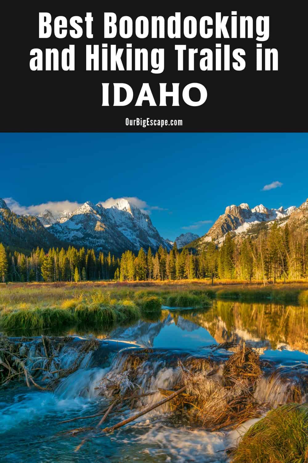
Idaho Boondocking areas are well known for their unspoiled, rugged landscapes. Idaho has 3,100 miles of rivers – more than any other state. Hells Canyon is deeper than the Grand Canyon. Shoshone Falls (212 feet), near Twin Falls, drops 52 feet further than Niagara Falls. Idaho produces 72 types of precious and semi-precious stones. Some found nowhere else in the world.
| These Boondocking & Camping Areas are concentrated in the Northern part of IDAHO |
Free Idaho Boondocking Areas
Priest Lake, Lake Pend Oreille, and Lake Coeur d’Alene are just a few of the spectacular lakes found in northern Idaho. Ski resorts, theme and amusement parks, and hundreds of miles of bicycle trails are among the exciting activities available. Idaho boondocking areas in the panhandle offers adventure with a number of state parks and gorgeous byways.
Let’s begin with water. Mountain lakes with craggy crests and historic Western villages, large, meandering rivers teeming with trout, and sluggish streams where moose graze on mossy grasslands. Visit Coeur d’Alene for swimming, boating, shopping, and golfing; Sandpoint for a lake cruise, Idaho hiking, and exquisite dining; or Priest Lake for undisturbed wilderness exploration.
Want more ideas to round-out your trip to the North-Western States?
► Idaho, Montana, Oregon, Washington, Wyoming ◄
- 66 Free Central Idaho Boondocking – RV Parking & Camping Spots
- 78 Free Northern Idaho Boondocking – Camping & RV Parking
- 60 Free SE Idaho Boondocking – RV Parking & Camping Sites
- 40 Free SW Idaho Boondocking – RV Parking & Camping
- 198 Amazing Montana Boondocking Sites Including Maps
- 54 Free NE Oregon Boondocking Locations With Maps – North East Section
- 104 Free Boondocking Spots in NW Oregon With Maps – North West Section
- 308 Awesome Washington Boondocking Spaces With Maps
- 38 Free Boondocking Locations in Wyoming With Maps – North East Section
- 49 Free Wyoming Boondocking Campsites With Maps – North West Section
- 44 Free Boondocking Campsites In Wyoming With Maps – South East Section
- 66 Free Boondocking Spots in Wyoming With Maps – South West Section
78 Amazing Northern Idaho Boondocking Areas Along With Maps
check out our video
1. Squaw Creek Road
Address
Kooskia, Idaho
GPS: 46.506427, -114.865939
Elevation: 3346′
Management: Public – Forest Service (Unofficial)
There are 1-5 Idaho boondocking areas at this location. This campsite is quiet, on a creek, and close to the Jerry Johnson hot springs trailhead. It is not much more than a pull out on the side of the road, but there is a lot of space, and the two times we’ve stayed here, not a single car drove past us.
2. Elk Summit
Address
Elm Summit Creek
Kooskia, Idaho
GPS: 46.327996, -114.647334
Elevation: 5764′
Management: Public – Forest Service
Elk Summit is open Jun-Oct. This sweet destination of a campground rests a short distance from the 1.34 million acre Selway-Bitterroot Wilderness. Located just 24 miles south of Highway 12, you’ll have available to you 15 Idaho dispersed campgrounds, stock facilities, stunning scenery, and access to some of the nation’s wildest country including many remote alpine lakes and mountain peaks. Hoodoo Lake is just a short stroll from the campground.
3. Musselshell Meadows
Address
County Road 535
Weippe, Idaho
GPS: 46.356918, -115.743556
Elevation: 3199′
Management: Public – Forest Service
Free Idaho dispersed campgrounds in the Nez Perce-Clearwater National Forest’s Lochsa/Powell Ranger District. No reservations. First come, first served.
4. Knife Edge Campground
Address
Kooskia, Idaho
GPS: 46.22677, -115.47453
Elevation: 1660′
Management: Public – Forest Service (Official)
The road in is Paved. Knife Edge Campground is open year round but may not be accessible in the winter. There are 1-5 Idaho dispersed campgrounds at this location and the maximum RV length is 35 feet. You may stay 14 days at Knife Edge Campground. One of the many small, national forest campgrounds that are located along US 12. Most have a fee but Knife Edge is free.
5. Fog Mountain TH
Address
National Forest Development Road 319
Kooskia, Idaho
GPS: 46.114405, -115.204475
Elevation: 5925′
Management: Public – Forest Service
The road in is 4×4. Fog Mountain TH is open May-Sep. Free Idaho Boondocking Areas in the Nez Perce-Clearwater National Forest’s Moose Creek Ranger District. First come -> First Camped. Reservations not accepted. 4-wheel drive and high clearance recommended.
6. Twentyfive Mile Bar
Address
Selway Road
Kooskia, Idaho
GPS: 46.07614, -115.412152
Elevation: 1631′
Management: Public – Forest Service
Idaho Boondocking Areas located within the Nez Perce-Clearwater National Forest’s Moose Creek Ranger District.
7. O’Hara Saddle
Address
National Forest Development Road 464
Kooskia, Idaho
GPS: 45.952313, -115.517181
Elevation: 5233′
Management: Public – Forest Service
Idaho Boondocking Areas at the edge of a meadow on an open ridge top. The campground is a nice location to park your OHV and camp for the night It provides fire rings and two camp pads. There is no toilet currently available. Heaviest use is by hunters during big game season.
8. Elk Summit
Address
Road 471
Elk City, Idaho
GPS: 45.880027, -115.540035
Elevation: 6398′
Management: Public – Forest Service
Free Idaho Boondocking Areas in the Nez Perce-Clearwater National Forest’s Red River Ranger District. First come -> first camped. No reservations are accepted.
9. Dam View
Address
Unnamed Road
Orofino, Idaho
GPS: 46.507273, -116.288952
Elevation: 2011′
Management: Public – Corp of Engineers
Dam View is open May-Sep. Idaho Boondocking Areas are part of Dworshak Reservoir.
10. Canyon Creek
Address
4118 Canyon Creek Road
Orofino, Idaho
GPS: 46.555359, -116.23378
Elevation: 1637′
Management: Public – Corp of Engineers
Idaho Boondocking Areas in Canyon Creek is open May-Sep. The maximum RV length at Canyon Creek is 10 feet. This free campsite is located within the Corp of Engineers Northwestern Division’s Walla Walla District. The camping area is near Dworshak Reservoir.
11. Ahsahka
Address
Orofino, Idaho
GPS: 46.500451, -116.316324
Elevation: 991′
Management: Public – Fish and Wildlife Service (Official)
About 10 sites for Idaho Boondocking Areas on the Clearwater river, 2 boat ramps. Suitable for large RV’s if parked parallel to drive.
12. Cherry Lane Access Area
Address
31219 U.S. 12
Lenore, Idaho
GPS: 46.512223, -116.683608
Elevation: 840′
Management: Public – State Park
Free Idaho dispersed campgrounds. This campsite does nuse a reservation systerm. First come, first served.
13. Gibbs Eddy Access
Address
1 mi. E of Arrow Br. (US 12)(MP 16) – Clearwater River-S bank
Lapwai, Idaho
GPS: 46.481362, -116.753388
Elevation: 817′
Management: Public – Fish and Wildlife Service (Official)
The road in is Paved. There are 1-5 Idaho boondocking areas at this location and the maximum RV length is 35 feet. You may stay 10 days at Gibbs Eddy Access. Rest area, boat launch and fishing access along highway 12 that permits camping.
14. McCroskey State Park
Address
Plummer, Idaho
GPS: 47.082516, -116.915817
Elevation: 3506′
Management: Public – State Park (Unofficial)
The road in is Gravel. Primitive and standard camping opportunities only. Idaho boondocking areas have Vault toilets are available for use and potable water is now available within the park and located at approximately mile 8.25 on Skyline Drive.
15. Horse Camp TH
Address
National Forest Development Road 1427
Harvard, Idaho
GPS: 46.98856, -116.60277
Elevation: 3136′
Management: Public – Forest Service
Free Idaho boondocking areas in the Nez Perce-Clearwater National Forest’s Palouse Ranger District. First come -> First Camped. Reservations not accepted.
16. Latah County Fairgrounds
Address
1021 Harold
Moscow, Idaho
GPS: 46.723555, -116.984191
Elevation: 2586′
Management: Public – County Park (Official)
The road in is Paved. There are 6-15 Idaho dispersed campgrounds at this location and the maximum RV length is 45 feet. Latah County fairgrounds. Very clean in town (Moscow, Idaho) walking distance to downtown. Right across street from Safeway and shopping.
17. Canyon Creek
Address
4118 Canyon Creek Road
Orofino, Idaho
GPS: 46.555359, -116.23378
Elevation: 1637′
Management: Public – Corp of Engineers
Canyon Creek is open May-Sep. The maximum RV length at Canyon Creek is 10 feet. Idaho boondocking areas located within the Corp of Engineers Northwestern Division’s Walla Walla District. The camping area is near Dworshak Reservoir.
18. Bailey’s Bar
Address
104 Main St
Bovill, Idaho
GPS: 46.86063, -116.397957
Elevation: 2855′
Management: Public – City Park (Official)
Idaho boondocking areas Next to Bailey’s Bar, there is a flat grassy campground. No showers but does have running water and fire pit.
19. Forest Service Campsites
Address
Highway 382
Elk River, Idaho
GPS: 46.803684, -116.17279
Elevation: 2841′
Management: Public – Forest Service (Official)
There are 12+ Idaho boondocking areas in North of Elk River on 382. Many of these sites are open areas and have access for large RV.
20. Porcupine Lake
Address
Idaho Centennial Trail
Hope, Idaho
GPS: 48.244032, -116.184943
Elevation: 4803′
Management: Public – Forest Service
Porcupine Lake is open May-Sep. Idaho boondocking areas located within the Idaho Panhandle National Forests’s Sandpoint Ranger District. This campsite does nuse a reservation systerm. First come, first served.
21. Little Meadow Creek
Address
Grandad Road
Orofino, Idaho
GPS: 46.791309, -115.953772
Elevation: 1624′
Management: Public – Corp of Engineers
Idaho boondocking areas in Little Meadow Creek is open May-Sep. This free campsite is located within the Corp of Engineers Northwestern Division’s Walla Walla District. First come -> first served. No reservations accepted.The camping area is near Dworshak Reservoir.
22. Smith Ridge TH
Address
Unnamed Road
Idaho
GPS: 46.906797, -115.680069
Elevation: 4895′
Management: Public – Forest Service
Free Idaho dispersed campgrounds in the Nez Perce-Clearwater National Forest’s North Fork Ranger District. First come -> first served. No reservations accepted.
23. EC Rettig
Address
Idaho 11
Pierce, Idaho
GPS: 46.615424, -115.805345
Elevation: 3281′
Management: Public – Forest Service
Free Idaho Boondocking Areas. First come -> first camped. No reservations are accepted.
24. Riviera
Address
County Road 247
Idaho
GPS: 46.779137, -115.480495
Elevation: 1932′
Management: Public – Forest Service
Idaho dispersed campgrounds in the Nez Perce-Clearwater National Forest’s North Fork Ranger District. No reservations. First come, first served.
25. Jazz Creek
Address
County Road 250
Idaho
GPS: 46.601758, -115.53044
Elevation: 2733′
Management: Public – Forest Service
Idaho dispersed campgrounds in the Nez Perce-Clearwater National Forest’s North Fork Ranger District. First come -> First Camped. Reservations not accepted.
26. Fourth of July TH
Address
County Road 250
Idaho
GPS: 46.663964, -115.379181
Elevation: 2454′
Management: Public – Forest Service
Free Idaho dispersed campgrounds in the Nez Perce-Clearwater National Forest’s North Fork Ranger District. Reservations are not accepted at this campsite.
27. Mush Saddle
Address
County Road 711
Headquarters, Idaho
GPS: 46.75336, -115.367523
Elevation: 5364′
Management: Public – Forest Service
Idaho boondocking areas in the Nez Perce-Clearwater National Forest’s North Fork Ranger District. This campsite does not use a reservation system. First come, first served.
28. Flat Creek
Address
County Road 250
Idaho
GPS: 46.721054, -115.292395
Elevation: 2707′
Management: Public – Forest Service
Idaho boondocking areas in the Nez Perce-Clearwater National Forest’s North Fork Ranger District. First come -> first camped. No reservations are accepted.
29. Junction Creek
Address
Moose Creek Road
Idaho
GPS: 46.719403, -115.233221
Elevation: 2785′
Management: Public – Forest Service
Idaho boondocking areas in the Nez Perce-Clearwater National Forest’s North Fork Ranger District. First come -> first camped. No reservations are accepted.
30. Cayuse Landing Camp
Address
Forest Road 581A
Idaho
GPS: 46.665224, -115.077962
Elevation: 3530′
Management: Public – Forest Service
The maximum RV length at Cayuse Landing Camp is 6 feet. Idaho dispersed campgrounds in the Nez Perce-Clearwater National Forest’s North Fork Ranger District. First come -> first camped. No reservations are accepted.
31. Goose Creek/Lake Creek
Address
Unnamed Road
Idaho
GPS: 46.863492, -115.003698
Elevation: 4354′
Management: Public – Forest Service
Idaho boondocking areas in the Nez Perce-Clearwater National Forest’s North Fork Ranger District. First come -> first camped. No reservations are accepted.
32. Crater Lake
Address
Saint Joe Nf Road 301
Clarkia, Idaho
GPS: 47.034533, -115.97722
Elevation: 6250′
Management: Public – Bureau of Land Management
Crater Lake is open Jul-Sep. Idaho boondocking areas in the Bureau of Land Management Coeur d’Alene District. First come -> first camped. No reservations are accepted.
33. Smith Ridge TH
Address
Unnamed Road
Idaho
GPS: 46.906797, -115.680069
Elevation: 4895′
Management: Public – Forest Service
Idaho boondocking areas in the Nez Perce-Clearwater National Forest’s North Fork Ranger District. First come -> first served. No reservations accepted.
34. Heller Creek
Address
National Forest Development Road 320
Avery, Idaho
GPS: 47.064922, -115.218723
Elevation: 4744′
Management: Public – Forest Service
Idaho boondocking areas in Heller Creek is open Jul-Oct. This free campsite is located within the Idaho Panhandle National Forests’s St. Joe Ranger District.
35. Fly Flat
Address
Saint Joe River Road
Avery, Idaho
GPS: 47.112833, -115.390829
Elevation: 3458′
Management: Public – Forest Service
Idaho boondocking areas in Fly Flat is open May-Oct. This free campsite is located within the Idaho Panhandle National Forests’s St. Joe Ranger District. WOW!!! I thought Montana was beautiful. I got lost and found this place and thought I had died and gone to Heaven.
36. Beaver Creek Campground
Address
St. Joe River Rd. (FR 218)
Avery, Idaho
GPS: 47.081699, -115.354897
Elevation: 3652′
Management: Public – Forest Service (USDA) (Official)
Beaver Creek Campground is open June – Oct. There are 1-5 Idaho dispersed campgrounds at this location. Free camping in the Idaho Panhandle National Forest. 3 campsites on the St. Joe Wild and Scenic River. Excellent fishing for cutthroat trout. Trail from campground goes to Fly Peak.
37. Line Creek Stock Camp
Address
National Forest Development Road 218
Avery, Idaho
GPS: 47.043958, -115.349748
Elevation: 3740′
Management: Public – Forest Service
Idaho boondocking areas in Line Creek Stock Camp is open May-Sep. This free campsite is located within the Idaho Panhandle National Forests’s St. Joe Ranger District.
38. Spruce Tree
Address
National Forest Development Road 218
Avery, Idaho
GPS: 47.038021, -115.347894
Elevation: 3760′
Management: Public – Forest Service
Idaho boondocking areas in Spruce Tree is open May-Oct. This free campsite is located within the Idaho Panhandle National Forests’s St. Joe Ranger District.
39. Snow Peak WMA – Twin Lakes
Address
National Forest Development Road 631
Avery, Idaho
GPS: 47.079998, -115.489444
Elevation: 5863′
Management: Public – Fish and Wildlife
Free Idaho Boondocking Areas. First come -> first served. No reservations accepted.
40. Mammoth Springs
Address
201
Avery, Idaho
GPS: 47.10394, -115.629597
Elevation: 5620′
Management: Public – Forest Service
Idaho boondocking areas in Mammoth Springs is open Jun-Oct. This free campsite is located within the Idaho Panhandle National Forests’s St. Joe Ranger District.
41. Snow Peak WMA – Bathtub Mt
Address
Saint Joe Nf Road 201
Avery, Idaho
GPS: 47.07867, -115.579022
Elevation: 5896′
Management: Public – Fish and Wildlife
Free Idaho Boondocking Areas. First come -> first served. No reservations accepted.
42. Surveyors Lookout
Address
Saint Joe Nf Road 395
Avery, Idaho
GPS: 46.99619, -115.530891
Elevation: 5935′
Management: Public – Forest Service
Idaho dispersed campgrounds in the Idaho Panhandle National Forests’s St. Joe Ranger District. No reservations. First come, first served.
43. Orphan Point
Address
Saint Joe Nf Road 301
Clarkia, Idaho
GPS: 47.044858, -115.944875
Elevation: 5945′
Management: Public – Bureau of Land Management
Idaho boondocking areas in Orphan Point is open Jul-Sep. This free campsite is located within the Bureau of Land Management Coeur d’Alene District.
44. Crater Lake
Address
Saint Joe Nf Road 301
Clarkia, Idaho
GPS: 47.034533, -115.97722
Elevation: 6250′
Management: Public – Bureau of Land Management
Idaho boondocking areas in Crater Lake is open Jul-Sep. Idaho boondocking areas in the Bureau of Land Management Coeur d’Alene District. First come -> first camped. No reservations are accepted.
45. Marble Creek
Address
Saint Joe Nf Road 321
Calder, Idaho
GPS: 47.197908, -116.067878
Elevation: 2782′
Management: Public – Forest Service
Idaho boondocking areas located within the Idaho Panhandle National Forests’s St. Joe Ranger District.
46. Donkey Creek
Address
Saint Joe Nf Road 321
Calder, Idaho
GPS: 47.185128, -116.080694
Elevation: 2851′
Management: Public – Forest Service (Official)
Idaho dispersed campgrounds located within the Idaho Panhandle National Forests’s St. Joe Ranger District. I stopped here while exploring the area 9/17/18. There appears to be 3 sites here and maybe a 4th one. There is a pit toilet that had toilet paper stocked when I looked.
47. Camp 3
Address
Saint Joe Nf Road 321
St. Maries, Idaho
GPS: 47.130012, -116.103048
Elevation: 3215′
Management: Public – Forest Service
Camp 3 is open May-Sep. Idaho dispersed campgrounds located within the Idaho Panhandle National Forests’s St. Joe Ranger District.
48. FS-391 / FS-388
Address
Saint Regis, Idaho
GPS: 47.227555, -115.304722
Elevation: 5764′
Management: Public – Forest Service
I found this beautiful spot high in the mountains and about 20 degrees cooler (July) after I got lost south of St Regis Montana Idaho dispersed campgrounds are about a 35 minute drive from St Regis and an hour and 15 from Avery Idaho Well maintained gravel road on the Montana side. Paved on the Idaho side Big open spaces On the Montana / Idaho Panhandle border 47.227555, -115.304722.
49. Lookout Pass
Address
Mullan, Idaho
Mullan, Idaho
GPS: 47.456038, -115.696764
Elevation: 4746′
Management: Public – Forest Service (Official)
The road in is Gravel and 5 miles from a paved road. There are 6-15 Idaho boondocking areas at this location and the maximum RV length is unlimited. Lookout Pass is located on Interstate 90, on the border of Idaho and Montana, 5 miles east of Mullan, Idaho. Pass the ski area parking lot and continue on the gravel road that winds around the mountain.
50. St. Joe’s Dispersed Camping
Address
Avery, Idaho
GPS: 47.294552, -115.775918
Elevation: 2786′
Management: Public – Forest Service (Official)
The road in is Gravel. You may stay 14 days in Idaho dispersed campgrounds at St. Joe’s Dispersed Camping. It is only 4 miles up Forest Road 456 after you turn left onto it from Avery. Shady and large spot with a trickling creek in background. Firepit.
51. Big Creek (Marble Creek)
Address
Big Creek Road
Calder, Idaho
GPS: 47.303505, -116.120144
Elevation: 2379′
Management: Public – Forest Service
Idaho dispersed campgrounds in Big Creek (Marble Creek) is open May-Sep. This free campsite is located within the Idaho Panhandle National Forests’s St. Joe Ranger District.
52. Big Creek – Panhandle NF
Address
St. Marie, Idaho
GPS: 47.34811, -116.123497
Elevation: 2840′
Management: Public – Forest Service (USDA) (Official)
Big Creek – Panhandle NF is open May (open year round, but services shut down in winter). There are 6-15 Idaho dispersed campgrounds at this location. You may stay 14 Days at Big Creek – Panhandle NF. 9 campsites and a day use area. Fishing in Big Creek. CCC trailhead to the south accesses Big Creek/East Fork National Recreation Trail, and offers a stock loading ramp and corral.
53. Elsie Lake (dupe)
Address
Wardner, Idaho
GPS: 47.426562, -116.023713
Elevation: 5072′
Management: Public – Forest Service (Official)
Do not attempt this drive in a 30′ ft or larger 5th wheel or motorhome or Class C. Idaho dispersed campgrounds near the lake located 12 miles off I-90. The first two miles are paved and the final 10 miles are on a single lane dirt national forest service road. There are very few places to pull over if you encounter another vehicle coming in the opposite direction and one of you will have to back up to allow the other to pass.
54. East Fork Lost Creek TH
Address
National Forest Development Road 442
Wallace, Idaho
GPS: 47.713686, -115.933182
Elevation: 2598′
Management: Public – Forest Service
Idaho dispersed campgrounds in the Idaho Panhandle National Forests’s Coeur d’Alene River Ranger District. First come -> first served. No reservations accepted.
55. Couer d’laine River
Address
Prichard, Idaho
GPS: 47.651869, -116.095602
Elevation: 2285′
Management: Public – National Park Service (Unofficial)
The road in is Dirt and 2 miles from a paved road. There are 30 or more Idaho boondocking areas at this location and the maximum RV length is unlimited. You may stay 14days at Idaho dispersed campgrounds in Couer d’laine River. Great spot with one potty and river access. Somewhat popular. Firepits established.
56. Couer d’laine River Boondocking
Address
Old River Road
Linfor, Idaho
GPS: 47.5956, -116.24434
Elevation: 2195′
Management: Public – Forest Service
The road in is Dirt. The maximum RV length at Couer d’laine River Boondocking is 25 feet. Free Idaho dispersed campgrounds nestled in the trees and along the edge of Couer d’laine River. The campsites are a little tight so large rigs are not recommended. Two bars of verizon and ATT but neither work very well.
57. Breakwater
Address
National Forest Development Road 413
Cataldo, Idaho
GPS: 47.65672, -116.362981
Elevation: 2372′
Management: Public – Forest Service
Idaho boondocking areas in the Idaho Panhandle National Forests’s Coeur d’Alene River Ranger District. Reservations are not accepted at this campsite. Free Idaho Boondocking Areas. First come -> first served. No reservations accepted.
Very beautiful area! There are a lot of free campsites in this area. No bathrooms no water besides the creek. All are first come first serve. We go camping here a lot. lots of Wildlife
58. Tingley Springs
Address
Baldy Road
Saint Maries, Idaho
GPS: 47.357897, -116.413003
Elevation: 5049′
Management: Public – Bureau of Land Management
Idaho dispersed campgrounds in Tingley Springs is open Jun-Sep. This free campsite is located within the Bureau of Land Management Coeur d’Alene District.
59. Coeur d’Alene River WMA – Bull Run Lake
Address
15801-15899 West Bull Run Road
Cataldo, Idaho
GPS: 47.531194, -116.481047
Elevation: 2136′
Management: Public – Fish and Wildlife
Free Idaho Boondocking Areas. First come -> first camped. No reservations are accepted.
60. Coeur d’Alene River WMA – Rose Lake
Address
23982 South Watson Road
Cataldo, Idaho
GPS: 47.553351, -116.45734
Elevation: 2175′
Management: Public – State Forest (Official)
Free Idaho dispersed campgrounds. First come -> first served. No reservations accepted.
61. Lakes Divide Road
Address
Coeur d’Alene, Idaho
GPS: 47.61908, -116.5344
Elevation: 3428′
Management: Public – Forest Service (Unofficial)
Quick stop off of I90 east of Coeur d’Alene. Free Idaho Boondocking Areas.
62. Medicine Lake
Address
East Rainy Hill Road
Cataldo, Idaho
GPS: 47.473887, -116.588081
Elevation: 2136′
Management: Public – State Park
Free Idaho dispersed campgrounds. First come -> first served. No reservations accepted. Drove up the hill across from the boat ramp. There’s a small turn around and a bit of a pull out for a <30ft rig. Wouldn’t bring a large trailer up there. Several tent areas with fire rings and beautiful views of the lakes. There are a few spots down by the road heavily rutted. An abandoned rv sat there when I visited.
63. Wolf Lodge Bay I-97 Turnout
Address
Coeur d’Alene, Idaho
GPS: 47.61727, -116.65053
Elevation: 2382′
Management: Public (Official)
Large turnout gravel area off I-97. Free Idaho Boondocking Areas for tents to set up for a night or two. If you’re desperate for one night it’s perfect! View of the lake and not many bugs. Highly recommend if you need a place to camp by Coeur d’Alene.
64. Beauty Bay – Turnout
Address
Harrison, Idaho
GPS: 47.61145, -116.67802
Elevation: 2142′
Management: Public – Forest Service (Official)
Idaho boondocking areas in Gravel turn-out off I-97, right outside of Coeur d’Alene. It’s a lot bigger than the other turn-outs off the road and it showed signs of being used by dispersal campers before us! It’s across the road from the lake, and we fell asleep to crickets chirping!
65. Whiskey Rock Bay
Address
National Forest Development Road 278
Bayview, Idaho
GPS: 48.050722, -116.45539
Elevation: 2077′
Management: Public – Forest Service
Idaho boondocking areas in Whiskey Rock Bay is open May-Sep. This free campsite is located within the Idaho Panhandle National Forests’s Sandpoint Ranger District. Do NOT come here unless you have a 4×4 with high clearance. Impossible to pass with an RV. I went down Lakeview Cutoff Rd and almost got stuck a few times before managing to go up a connecting road that was also in bad shape. Do not underestimate this warning. This campsite is best accessed by boat. An OHV would make it down easily.
66. Granite Lake Dispersed Camping
Address
3 miles from Athol
Athol, Idaho
GPS: 48.006509, -116.68919
Elevation: 2160′
Management: Public – Forest Service (Official)
The road in is Dirt and 1 mile miles from a paved road. There are 1-5 Idaho dispersed campgrounds at this location and the maximum RV length is 15 feet. You may stay 3 days at Granite Lake Dispersed Camping. Small camping area with outhouse, boat ramp, and a fishing dock. You can stay 3 days. If you do geocaching, there is a hidden one. There an 3 in the area!!
67. Pend Oreille WMA – Clark Fork Drift Yard
Address
Driftwood Yard Road
Hope, Idaho
GPS: 48.173677, -116.231985
Elevation: 2070′
Management: Public – Fish and Wildlife
Idaho boondocking areas in Pend Oreille WMA – Clark Fork Drift Yard is open all year. Pend Oreille WMA – Clark Fork Drift Yard is open all year.
68. Green Bay
Address
Green Bay Road
Sagle, Idaho
GPS: 48.178114, -116.407962
Elevation: 2106′
Management: Public – Forest Service
Idaho boondocking areas in Green Bay is open May-Sep. This free campsite is located within the Idaho Panhandle National Forests’s Sandpoint Ranger District. This campsite does nuse a reservation systerm. First come, first served.
69. Pend Oreille WMA – Morton Slough
Address
10014-10094 Lakeshore Drive
Sagle, Idaho
GPS: 48.207003, -116.680235
Elevation: 2142′
Management: Public – Fish and Wildlife
Pend Oreille WMA – Morton Slough is open all year. Free Idaho Boondocking Areas. First come -> First Camped. Reservations not accepted.
70. Schweitzer Mountain Fire Station
Address
Ponderay, Idaho
GPS: 48.347663, -116.599693
Elevation: 4219′
Management: Private – Resort (Official)
The road in is Gravel. There are 16-29 Idaho dispersed campgrounds at this location and the maximum RV length is unlimited. You may stay 3 days at Schweitzer Mountain Fire Station. According to their website, self-contained RVs can park up to 3 nights near the fire station for free. Additional permission needed from parking attendants in the village area needed if more nights are desired. There is 1 port-a-potty and trash recepticles. This place is a mountain biker and skiing paradise right above a gorgeous lake and city.
71. Navigation
Address
Idaho Centennial Trail
Coolin, Idaho
GPS: 48.794377, -116.910504
Elevation: 2477′
Management: Public – Forest Service
Idaho boondocking areas located within the Idaho Panhandle National Forests’s Priest Lake Ranger District. First come -> first served. No reservations accepted.
72. Plowboy
Address
Idaho Centennial Trail
Coolin, Idaho
GPS: 48.769379, -116.880945
Elevation: 2480′
Management: Public – Forest Service
Idaho boondocking areas located within the Idaho Panhandle National Forests’s Priest Lake Ranger District. No reservations. First come, first served.What directions did you use to get to this spot? Also how long was the hike in? Are there trail signs to follow?
73. Copper Ridge
Address
Bonners Ferry, Idaho
GPS: 48.955241, -116.108017
Elevation: 5833′
Management: Public – Forest Service (Official)
The road in is Gravel and 10 miles from a paved road. Copper Ridge is open Snow?. There are 1-5 Idaho boondocking areas at this location and the maximum RV length is 25 feet. You may stay 14 days at Copper Ridge. We never did reach Copper Lake! We drove 10 miles up the gravel road (great shape!)and didn’t get to the lake. Fantastic views! Can fill with water at Copper Falls Campground. Continue 2 miles and there is walk to falls. Overlook Trail and a loop at the bottom of fall.
74. Solomon Lake
Address
Solomon Lake Road
Moyie Springs, Idaho
GPS: 48.796428, -116.101992
Elevation: 3343′
Management: Public – Forest Service
Idaho dispersed campgrounds in the Idaho Panhandle National Forests’s Bonners Ferry Ranger District. No reservations. First come, first served.
75. Dawson Lake Access Area
Address
Meadow Creek Road
Bonners Ferry, Idaho
GPS: 48.781169, -116.237776
Elevation: 2959′
Management: Public – State Park
Free Idaho Boondocking Areas. First come -> first camped. No reservations are accepted. Found this site using a variety of boondocking skills. Google Earth being one of them. Thought it would be isolated. Well, it is, sort of, but lots of folks come every day to fish. No motors allowed on the lake so it’s kayaking and electric motor driven boats. It rained on us every day, but not a lot. Got down into the 40’s every night.
76. Smith Lake
Address
Smith Lake Road
Bonners Ferry, Idaho
GPS: 48.778836, -116.263793
Elevation: 3018′
Management: Public – Forest Service
Idaho boondocking areas in Smith Lake is open May-Sep. The maximum RV length at Smith Lake is 16 feet. This free campsite is located within the Idaho Panhandle National Forests’s Bonners Ferry Ranger District. This is a great site! It is bear and coyote country, so be prepared for the wildlife. Pit toilets are well-maintained and stocked. The entire area was clean and well-used. And the stars… amazing.
77. Boundary County Deep Creek Boat Ramp
Address
Bonners Ferry, Idaho
GPS: 48.70666, -116.38383
Elevation: 1772′
Management: Public – County Park (Official)
Great spot, right on river. Idaho boondocking areas in Boundary County.
78. Boundary County Fairgrounds
Address
Bonners Ferry, Idaho
GPS: 48.694728, -116.318607
Elevation: 1768′
Management: Public – County Fair Grounds
72 hour parking in Idaho boondocking areas at Bonners Ferry. We put up our tent trailer there for a night. Got the info from the visitor center. There was a bit of train noise but doable.
Idaho Camping in the National Forests
Idaho RV parking areas has vast lakes and miles of rivers. The forest is abundant with animals, including huge game such as elk and deer, as well as grizzly bears, wolves, and caribou. Idaho has a rich history that continues to connect families and forests, from lush evergreen mountains to the coastlines of large bodies of water.
Lower Kootenai River Dispersed Camping Areas
The Purcell and Cabinet Ranges, as well as the Montana Line, border the Lower Kootenai River Area (Bonners Ferry District) on the east, the rocky Selkirk Range on the west, and the Canadian border on the north. The Kootenai River runs through the district, meandering north and west, and the Moyie River joins it from the north. All these areas have free Idaho boondocking areas for you to enjoy.
Peaks range in elevation from 6000 to 7000 feet, but due to extensive glaciers, they are rough. They are well-known for their mountaineering difficulty.
There are numerous beautiful lakes, both low-elevation lakes with simple access and high-elevation subalpine lakes that can only be reached by path or bushwhacking. Great places to visit for Idaho Camping.
Year-round recreational activities abound on National Forest properties. Backcountry, undeveloped, semi-primitive recreation is popular, along with Idaho Hiking. Urban activities like auto touring, white water rafting, and car camping are also popular
On the District, more than 360 miles of trails are open and accessible for campers who are also looking for Idaho hiking areas. Only about 60 miles of it is allowed to motorized traffic; the rest is good for stock, hiking, and camping. Mountain bikers, berry pickers, and hunters can also take advantage of miles of gated road.
Throughout the District, Idaho RV Parking an dispersed automobile camping is common. In addition to various picnic and camping places and interpretive sites, four campgrounds offer planned recreation alternatives.
The District rents out two lookouts and one cabin to the general public. Cold water and ice fishing, as well as white water rafting, canoeing, and swimming, are popular activities. Berry and mushroom harvesting, as well as Christmas tree cutting, are popular activities throughout the holiday season.
Thousands of acres are available for cross-country skiing and snowmobiling in the winter. Year to year, the groomed pathways change.
Idaho Camping Areas
Copper Creek Campground
Meadow Creek Campground
Robinson Lake Campground
Smith Lake Campground
Snyder Guard Station
Idaho RV Parking and Camping
Copper Creek Campground
Meadow Creek Campground
Robinson Lake Campground
Snyder Guard Station
Dispersed Camping
Snyder Guard Station
Solomon Lake Fishing
Free Idaho Boondocking Areas in the Pend Oreille Lake Area
The Kalispel, Kutenai, and other indigenous peoples were among the first to settle in this region. They lived along the canals and survived by relying on the area’s bountiful natural resources.
The Pend Oreille Lake area is known for its year-round leisure opportunities. Idaho camping, fishing, hunting, berry picking, trail hikes, nature walks, horseback riding, bike riding, ATV/OHV routes, and skiing are just a few of the activities available in the forest.
Idaho Camping Sites
Green Bay Campground
Sam Owen Campground
Whiskey Rock Bay Campground
Idaho RV Parking and Camping
Sam Owen Campground
Dispersed Camping
Beetop-Roundtop Trail #120
Harrison Lake Trailhead #217
Lake Darling Trail #52
Maiden Rock Campground
Priest Lake Area
In 1846, Father Desmet renamed Priest Lake Roothaan Lake in honor of his Jesuit Superior in Rome. Roothaan is still the name of a high peak in the Selkirk Range. Captain John Mullan labeled this lake as Kaniksu Lake on one of his charts in 1865. Although this has never been confirmed, it is thought that “Kaniksu” was Black Robe’s Indian name.
In the early 1900s, the name of the lake was gradually changed from Kaniksu Lake to Priest Lake, which relates to the early-day Jesuit missionary priests who built a base camp near Kalispell Bay in the 1840s. The lake is one of Idaho’s three largest and most picturesque lakes, as well as a popular recreation destination. In 1963, the world’s biggest Makinaw trout was taken here. The lake is also home to Dolly Varden, Cutthroat, and Kokanee. Fishing for Dolly Varden is now prohibited, and any caught must be returned to the lake.
The Upper Priest Lake Scenic Area includes Upper Priest Lake. On Upper Priest Lake, there were five small parcels of private land totaling around 420 acres. These lands were purchased by the Forest Service in 1967 with the help of the Nature Conservancy. Upper Priest Lake’s whole shoreline is now owned by the state of Idaho or the federal government, and it is managed as a scenic area.
Along with the lower Priest River, which was once known as a log-drive stream, the Upper Priest River, which flows into Upper Priest Lake, is being evaluated for inclusion in the Wild and Scenic Rivers system. The first known drive took place in 1901, and the last one took place in 1949. The largest drive occurred in 1931, when the “river pigs” herded 50,000 cedar poles and 125,000,000 board feet or logs down the river.
Idaho Camping Spots
Bartoo Island Group Site/Campgrounds
Beaver Creek Campground
Geisinger Campground
Kalispell Island Group Site and other Campgrounds
Luby Bay Campground
Navigation Campground
Osprey Campground
Outlet at Priest Lake Campground
Plowboy Campground
Reeder Bay Campground
Trapper Creek Campground
Idaho RV Parking and Camping
Luby Bay Campground
Dispersed Camping
Lakeshore Trail #294
Navigation Trailhead #291
Plowboy Mountain Trail #295
Upper Priest Lake Trail #302
Upper Priest River Trail #308
Free Idaho Camping Sites
Smith Lake – Bonner’s Ferry, ID – This campsite is open from May until September. You may camp here in a tent or an RV with a maximum length of 16 feet. There is access to drinking water and vault restrooms on-site. Tons of wildlife in this area too!
Whiskey Rock Bay – Bayview, ID – This campsite is open from May to September. There are 10 campsites available, 3 of which are next to the water. Vault restrooms are on site but no water is available.
Granite Lake – McCall, ID – There are 7 sites available here with trails leading to and from the campsites. The road into the campsite is not appropriate for RV type trailers. This spot if great for tent camping. Each site does have a picnic table and a fire ring with vault toilets available for use.
Solomon Lake – Moyie Springs, ID – This is a dispersed camping area with no water access for drinking. You must bring your own water when you stay. There are vault restrooms on-site for campers and the site is accessible fairly easily by anyone.
Kamiah City Park – Kamiah, ID – The road into this campsite is a gravel road. There are 6 to 15 campsites but there is some RV access with the exception of no RV’s over 40 feet in length. They only allow day use now.
Sublett Reservoir – Malta, ID – The road into the campsite is gravel. The campsite is opened from summer to fall with up to 5 campsites with a maximum stay of up to 14 days. The campsites have fire rings and picnic tables and there are restrooms for public use.
McCroskey State Park – Plummer, ID – Primitive and standard camping sites are available here. There are vault toilets and potable water on site. Each campsite has a fire ring and picnic table at each of the 9 campsites.
Breakwater– Cataldo, ID – This campsite is completely primitive camping only. There are several options to choose from. There are no bathrooms or water to use on site other than the creek. Camping here means you need to take out any trash you have as well.
Canyon Creek – Orofino, ID – This campground is developed with a boat ramp, dock, outhouse, and camping sites with a picnic table and fire pits. It feels rustic due to the unfinished condition of the roadways and camping sites. The area is heavily forested and is situated right on the water. Canyon Creek has two vault style outhouses, both in good condition and well-stocked. There are 17 camping sites, each with a picnic table & fire pit with grill.
You May Want to Join Our Boondocking Group on Facebook For More Information
You May Want to Join Our Campfire Recipes Group on Facebook For More Information
Check Out Our Pictures On Instagram – Our Big Escape.