

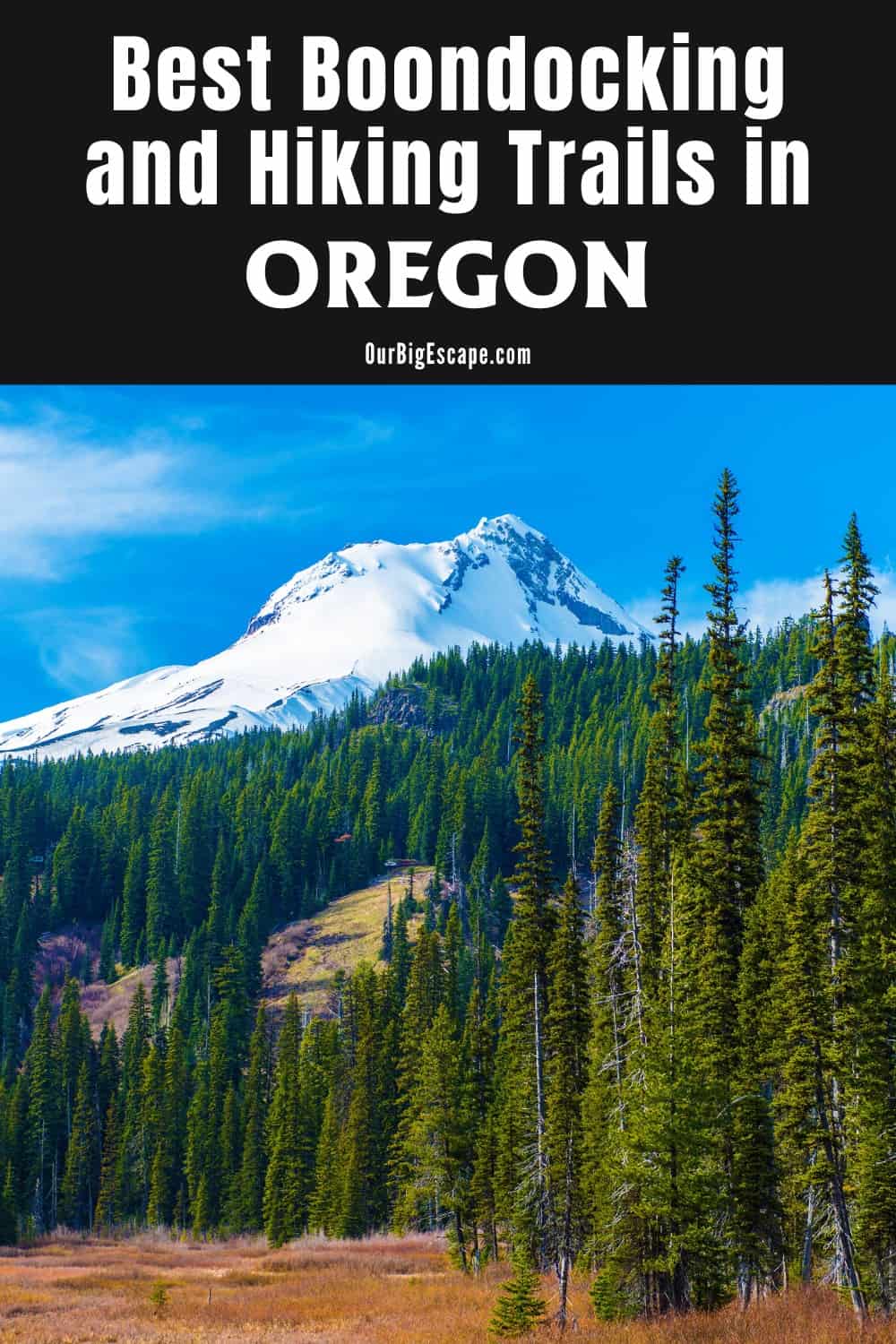
It’s difficult to beat staying in free Oregon boondocking locations when it comes to sleeping amid breathtaking scenery and moderate conditions. Mountains, greenery, and plenty of places to pitch a tent abound in this lovely state. This can often be done for very little money, if not for nothing at all. However, there are only a few locations in Oregon where you can get free camping.
| These Boondocking Locations are concentrated in the North East part of Oregon |
Dispersed Camping Spots In Oregon
Oregon allows dispersed camping, which can be a great way to see the state. Year-round dispersed camping is permitted in state and national forests, and the state does not require a permit or previous approval.
While most Forest Service campgrounds in Oregon have facilities such as fire rings, picnic tables, and, in some circumstances, plumbing, dispersed camping does not. Dispersed camping spots in Oregon is a true adventure. While this form of camping may necessitate a little more expertise and experience, it can be a fantastic way to enjoy free camping spots in Oregon.
Leave No Trace principles must be followed by all campers. These requirements include things like camping on bare earth rather than foliage, keeping your campground at least 200 feet away from any water source, and removing any garbage and debris when you depart.
Want more ideas to round-out your trip to the North-Western States?
► Idaho, Montana, Oregon, Washington, Wyoming ◄
- 66 Free Central Idaho Boondocking – RV Parking & Camping Spots
- 78 Free Northern Idaho Boondocking – Camping & RV Parking
- 60 Free SE Idaho Boondocking – RV Parking & Camping Sites
- 40 Free SW Idaho Boondocking – RV Parking & Camping
- 198 Amazing Montana Boondocking Sites Including Maps
- 54 Free NE Oregon Boondocking Locations With Maps – North East Section
- 104 Free Boondocking Spots in NW Oregon With Maps – North West Section
- 308 Awesome Washington Boondocking Spaces With Maps
- 38 Free Boondocking Locations in Wyoming With Maps – North East Section
- 49 Free Wyoming Boondocking Campsites With Maps – North West Section
- 44 Free Boondocking Campsites In Wyoming With Maps – South East Section
- 66 Free Boondocking Spots in Wyoming With Maps – South West Section
54 Free NE Oregon Boondocking Locations With Maps
check out our video
1. Beaulah Reservoir
Address
3182 Beulah Road
Juntura, Oregon
GPS: 43.923222, -118.142641
Elevation: 3369′
Management: Public – Bureau of Land Management
Free Oregon boondocking locations in the Bureau of Land Management: Malheur District. This campsite does not use a reservation system. First come, first served.
2. Idlewild Sno-Park
Address
Burns, Oregon
GPS: 43.80516, -118.98553
Elevation: 5367′
Management: Public – Forest Service (Official)
Free during the summer. A large, level parking lot with a vault toilet. Camping spots in Oregon and Permits are required Nov-April. They cost $4/day, $9/3-day, $25/year.
3. Donnelly Camp
Address
National Forest Development Road 41
Burns, Oregon
GPS: 43.854651, -119.534337
Elevation: 5512′
Management: Public – Forest Service
Free Oregon boondocking locations in the Malheur National Forest’s Emigrant Creek Ranger District. First come -> First Camped. Reservations not accepted.
4. Pendleton Springs Camp
Address
National Forest Development Road 400
Oregon
GPS: 43.933457, -119.509232
Elevation: 5942′
Management: Public – Forest Service
Camping spots in Oregon in the Malheur National Forest’s Emigrant Creek Ranger District. First come -> first served. No reservations accepted.
5. Tamarack Forest Camp
Address
National Forest Development Road 56
Seneca, Oregon
GPS: 44.031559, -118.83624
Elevation: 5420′
Management: Public – Forest Service
Free Oregon boondocking locations in the Malheur National Forest’s Emigrant Creek Ranger District. No reservations. First come, first served. About 6.5 miles (2 miles unpaved) off 395. A loop off the forest road with multiple areas to set up camp. The spring runs water from a pipe continuously into a tub and can be used to fill buckets to douse your fire. Stone fire pits and lots of big wood to burn. Dispersed forest camping, so if it were occupied we could have looked for another spot down the road.
6. Crane Crossing
Address
National Forest Develop Road 774 Trail
Prairie City, Oregon
GPS: 44.158758, -118.366734
Elevation: 4498′
Management: Public – Forest Service
Crane Crossing is open May-Sep. Camping spots in Oregon in the Malheur National Forest’s Prairie City Ranger District. Reservations are not accepted at this campsite. We were traveling through the forest from the west side and the gps sent our Prius off the beaten path. If you don’t have 4wd we don’t recommend this option. We ended up turning around.
7. Little Crane
Address
National Forest Development Road 16
Prairie City, Oregon
GPS: 44.194885, -118.410683
Elevation: 5561′
Management: Public – Forest Service
Free Oregon boondocking locations are located within the Malheur National Forest’s Prairie City Ranger District.
8. Huddleston Sno-Park
Address
Summit Prairie Road
Prairie City, Oregon
GPS: 44.238988, -118.515401
Elevation: 5702′
Management: Public – Forest Service
Huddleston Sno-Park is open all year. Camping spots in Oregon in the Malheur National Forest’s Prairie City Ranger District. First come -> first camped. No reservations are accepted.
9. Starr Sno-Park
Address
Highway 395
Canyon City, Oregon
GPS: 44.24891, -119.02803
Elevation: 4980′
Management: Public – Forest Service (Official)
The road in is Paved. Starr Sno-Park is open year round. There are 1-5 free Oregon boondocking locations at this location and the maximum RV length is unlimited. You may stay 14 days at Starr Sno-Park. A large gravel lot with vault toilet. No cellular service. A permit is required between Nov 1 and April 30. It costs $4/day $9/3days 25/year. This state sponsored Sno-Park provides parking near the west end of the Forest’s snowmobile trail system. Located on the south side of beautiful Canyon Mountain visitors will find miles of groomed snowmobile trails to enjoy.
10. Billy Fields Forest Camp
Address
National Forest Development Road 21
Dayville, Oregon
GPS: 44.346624, -119.299503
Elevation: 4147′
Management: Public – Forest Service
Billy Fields Forest Camp is open Jun-Oct. Camping spots in Oregon Billy Fields Forest Camp is a great starting point for those wanting to hunt, fish, or look for wild horses. For those wishing to hike and explore Fields Peak Trail is within 3 miles of the campground. This camping area offers a 6 horse tie-stall with manger. Water for horses is available in adjacent Billy Fields Creek. This rustic campground features wooden picnic tables and metal fire rings.
11. Oregon Mine
Address
Forest Service Road 2170
Dayville, Oregon
GPS: 44.276956, -119.296947
Elevation: 4360′
Management: Public – Forest Service
Oregon Mine is open all year. Free Oregon boondocking locations are adjacent to Murderer’s Creek, this little campground is a great base camp for hunters. The campground is a nice area for those wishing to horse camp, a buck and pole corral is located adjacent to the campground. Visitors to the campground can enjoy bird watching, hunting and fishing in near by creeks.
12. Schneider Wilderness Area
Address
National Forest Development Road 47
Dayville, Oregon
GPS: 44.411121, -119.541752
Elevation: 2562′
Management: Public – Bureau of Land Management
Camping spots in Oregon in the Bureau of Land Management: Central Oregon District. First come -> first served. No reservations accepted. Beautiful area, well worth the trip. Free camping, however you need a parking permit if you plan on taking a vehicle. Permit can be bought online, or anywhere fishing licenses are sold
13. Bully Creek Reservoir
Address
Vale, Oregon
GPS: 44.032342, -117.413195
Elevation: 2549′
Management: Public – Bureau of Land Management: (Official)
If you drive about a mile or two up the road from the paid Bully Creek Park Campground, you will drive over 2 cattlegaurds and then you are on BLM land. There are plenty of roads you can drive along with Free Oregon boondocking locations to set up camp!
14. Snake River
Address
Along highway 201
Huntington, Oregon
GPS: 44.257409, -117.166818
Elevation: 2093′
Management: Public – Forest Service (USDA) (Unofficial)
The road in is Paved. The maximum RV length at Snake River is any. Camping spots in Oregon available just off I-84 on highway 201 right along the snake River. One of these in particular is right beside 2 Passport Americia campgrounds. They are first come first served but you can stay for 14 days
15. Spring RA Dispersed Camping
Address
28403 Snake River Rd
Huntington, Oregon
GPS: 44.407152, -117.229394
Elevation: 2136′
Management: Public – Bureau of Land Management: (Official)
The road in is Dirt. The maximum RV length at Spring RA Dispersed Camping is unlimited. Free Oregon boondocking locations with nominal fee camping nearby
16. Frog Heaven Forest Camp
Address
National Forest Development Road 2110
La Grande, Oregon
GPS: 45.212667, -118.601878
Elevation: 4774′
Management: Public – Forest Service
Frog Heaven Forest Camp is open May-Sep. Camping spots in Oregon – No facilities are provided nor is this area maintained. It is truly for the camper wanting to rough it. Check with La Grande Ranger District office for more ponds to fish in the Blue Mountains.
17. Four Corners Sno-Park
Address
Nfsr 210
Ukiah, Oregon
GPS: 45.178545, -118.606864
Elevation: 4390′
Management: Public – Forest Service
This site features a large paved parking lot for the convenience of snowmobile users and cross country skiers. Free Oregon boondocking locations are in this open area but has no marked or groomed trails.
18. Umapine OHV Campground
Address
Forest Road 5160
La Grande, Oregon
GPS: 45.114322, -118.562681
Elevation: 5089′
Management: Public – Forest Service
The road in is Gravel. There are 6-15 camping spots in Oregon at this location and the maximum RV length is 45 feet. You may stay 14 days at Umapine ohv campground. After an eight mile ride up a single lane gravel road, you’ll come upon a well taken care of campground with 8 single sites. about 1/2 of the sites will only accommodate small vehicles. The other will handle larger rigs, some up to 40′. There are vault toilets and metal fire rings with grates. None of the campsites are full sun.
19. Forest Road 010
Address
Oregon
GPS: 45.091324, -118.709602
Elevation: 4777′
Management: Public – Forest Service
The road in is Gravel. There are 1-5 Free Oregon boondocking locations at this location and the maximum RV length is unlimited. You may stay 14 days at Forest Road 010. Dispersed camping. Usable Verizon 3g with booster. Open field with a small pond. Room for any sizes rv.
20. Twin Ponds Dispersed Camping
Address
NFR-052
Ukiah, Oregon
GPS: 45.077904, -118.893845
Elevation: 4449′
Management: Public – Forest Service
The road in is Gravel. There are 1-5 camping spots in Oregon at this location and the maximum RV length is unlimited. You may stay 14 days at Twin Ponds Dispersed Camping. 4 to 5 designated sites. Gravel and dirt. Some with rock fire rings. Two stocked trout ponds. Gravel road. No size limit.
21. Drift Fence Campground
Address
Forest Road 52
Ukiah, Oregon
GPS: 45.071766, -118.875836
Elevation: 4619′
Management: Public – USDA Forest Service
Drift Fence Campground is open unless snow blocks the route. It is maintained seasonally from Memorial Day until mid-November. There are 6-15 Free Oregon boondocking locations at this location. You may stay 14 days at Drift Fence Campground. Drift Fence Campground is situated along the paved Blue Mountain Scenic Byway and is traditionally a hunting camp. This is a small, rustic site and the short access road is in poor condition. It features 6 campsites and 2 vault toilets.
22. Mushroom Camp
Address
Dale, Oregon
GPS: 45.06566, -118.85517
Elevation: 4738′
Management: Public – Forest Service (Official)
The road in is Dirt and 1/2 miles from a paved road. There are 16-29 camping spots in Oregon at this location and the maximum RV length is 25 feet. Very primitive site. As the name suggests, I assume this is a favorite spot for mushroom hunters. There is a sign on NFD Rd. 52 about 1/4 mile from the access road. The ONLY amenities are numbered campsites, sometimes a fire ring, and it seems plenty of firewood to gather.
23. Gold Dredge
Address
National Forest Development Road 5506
Ukiah, Oregon
GPS: 45.001844, -118.819107
Elevation: 3048′
Management: Public – Forest Service
Gold Dredge is open May-Nov. The maximum RV length at Gold Dredge is 40 feet. Free Oregon boondocking locations in a peaceful campground set in an open Ponderosa pine stand along the Wild and Scenic North Fork John Day River. Gold Dredge features 7 campsties and 1 accessible vault toilet. There is no potable water or garbage service, so please pack your garbage home.
24. Misery Spring
Address
National Forest Development Road 5225
Pomeroy, Oregon
GPS: 44.935032, -118.546968
Elevation: 5866′
Management: Public – Forest Service
Camping spots in Oregon Moon Meadows is very large, and the trailhead features themselves (corrals, toilet, message board, dispersed camps) are spread out in the general area. However, all trails connect with Road 5225, so the message board relates to them all.
25. Blue Springs Summit Sno-Park
Address
Bull Run to Baker Road 24
Sumpter, Oregon
GPS: 44.753894, -118.287003
Elevation: 5702′
Management: Public – Forest Service
Blue Springs Summit Sno-Park is open all year. Free Oregon boondocking locations in the Wallowa-Whitman National Forest’s Whitman Ranger District. No reservations. First come, first served.
26. Head O’ Boulder Forest Camp
Address
Forest Service Road 4500-537
Susanville, Oregon
GPS: 44.75513, -118.692
Elevation: 7178′
Management: Public – USDA Forest Service (Official)
This rustic camp offers a few sites and is also a trailhead which accesses the Vinegar Hill Scenic Area. It is only maintained during hunting season. There are 1-5 camping spots in Oregon at this location and the maximum RV length is 45 feet.
27. South of Head of Boulder on FR 4500-537
Address
Oregon
GPS: 44.74548, -118.70507
Elevation: 6611′
Management: Public – Forest Service
The road in is Gravel and 8 miles from a paved road. There are 1-5 Free Oregon boondocking locations at this location and the maximum RV length is 25 feet. This dispersed campsite is hidden behind a treeline off the road to the nearby Head o’ Boulder site. There are two campsites, each with large rock fire rings (about 5′ interior diameter).
28. Forest Road 048
Address
Long Creek, Oregon
GPS: 44.682906, -119.140586
Elevation: 5194′
Management: Public – Forest Service
Camping spots in Oregon on Forest Road 48. Open area will handle any sized rig. Take the second entrance. The first one is steep.
29. Long Creek Summit
Address
Long Creek, Oregon
GPS: 44.679651, -119.132099
Elevation: 5098′
Management: There are 1-5 Free Oregon boondocking locations at this location and the maximum RV length is unlimited. Large graveled area good for an overnight. Easy off and on to highway 395. Great Verizon LTE signal.
30. Carter Rest Area (Highway 395)
Address
Highway 395
Long Creek, Oregon
GPS: 44.684015, -119.098876
Elevation: 4570′
Management: Public – Rest Area (Official)
You may stay overnight at camping spots in Oregon Carter Rest Area (Highway 395). A small rest area with a picnic table and toilets. There is only enough room for 2-3 cars on the main parking area. If you take the loop, there is room for about 2-3 rigs to pull off to the shoulder. Great Verizon LTE signal.
31. Raddue Forest Camp
Address
National Forest Development Road 131
Mount Vernon, Oregon
GPS: 44.560133, -119.084769
Elevation: 4196′
Management: Public – Forest Service (Official)
The road in is Dirt. There are 1-5 Free Oregon boondocking locations at this location and the maximum RV length is 25 feet. This campsite is located within the Malheur National Forest’s Blue Mountain Ranger District.
32. Malheur NF301 Gate
Address
Prairie City, Oregon
GPS: 44.5338, -118.6127
Elevation: 5036′
Management: Public – Forest Service (Unofficial)
The camping sites were closed and most of the forest roads were horribly muddy or were still covered in snow. Found these Camping spots in Oregon just inside the Malheur Natoinal Forest boundary. The sign indicates that the gate is locked year-round, but access is permissible, except to motor vehicles.
33. Dry Fork of Clear Creek, Malheur National Forest
Address
Oregon
GPS: 44.530702, -118.444277
Elevation: 4672′
Management: Public – Forest Service (Unofficial)
The road in is Gravel and 3.8 miles from a paved road. There are 1-5 Free Oregon boondocking locations at this location and the maximum RV length is 35 feet. You may stay 14 days at Dry Fork of Clear Creek, Malheur National Forest. Several campsites around a meadow along the Dry Fork of Clear Creek at the entrance to an area called Frosty Gulch on USFS maps. It is less than 4 miles off of OR State Hwy 26 on Road #2640 (AKA: Dry Fork Road) a well-maintained gravel road.
34. Blue Springs Summit Sno-Park
Address
Bull Run to Baker Road 24
Sumpter, Oregon
GPS: 44.753894, -118.287003
Elevation: 5702′
Management: Public – Forest Service
Blue Springs Summit Sno-Park is open all year. Camping spots in Oregon in the Wallowa-Whitman National Forest’s Whitman Ranger District. No reservations. First come, first served.
35. Morgan Lake
Address
Morgan Lake Drive
La Grande, Oregon
GPS: 45.30043, -118.135208
Elevation: 4157′
Management: Public – City Park (Official)
The road in is Gravel. There are 6-15 Free Oregon boondocking locations at this location. You may stay 3 days at Morgan Lake. Owned and maintained by the City of La Grande, 7 day limit From their website: “Atop a mountain just a few minutes’ driving time from the heart of the city, Morgan Lake offers a quiet, motor-free respite from daily cares, with camping, fishing and hiking opportunities.
36. National Forest Road 605
Address
La Grande, Oregon
GPS: 45.324793, -118.337791
Elevation: 3750′
Management: Public – Forest Service (Unofficial)
The road in is Gravel. There are 1-5 Camping spots in Oregon at this location and the maximum RV length is 35 feet. You may stay 14 days at National Forest Road 605. Dispersed camping. Room for most rvs but the road is a bit tight in some places. Nice campsites in tue shade and in the sun. Usable 1 bar of unboosted 4g att. 3 bars 4g great verizon unboosted
37. Indian Lake
Address
Pilot Rock, Oregon
GPS: 45.37092, -118.55737
Elevation: 4180′
Management: Private – Indian (Official)
Free Oregon boondocking locations South East of Pilot Rock.
38. Mount Emily Recreation Area (MERA)
Address
62747 Fox Hill Road
La Grande, Oregon
GPS: 45.36219, -118.1212
Management: Public – County Park (Official)
There are 6-15 Camping spots in Oregon at this location. This is an OHV camp ground about 3 miles off the 84. DO NOT drive your motorhome as the road is 17% incline up to the campground. It’s free, nice bathroom and relatively quite with an amazing view of la grande. There’s about 8 sites with a large parking area and fire pits.
39. Spring Creek
Address
National Forest Development Road 21
La Grande, Oregon
GPS: 45.357388, -118.312265
Elevation: 3356′
Management: Public – Forest Service
Spring Creek is open May-Sep. Spring Creek Campground is located in an open pine forest near a small meadow. Just a short drive from Interstate 84, this small campground offers 4 Free Oregon boondocking locations which are occassionally used for family reunions or group camping.
40. National Forest Road 024
Address
Forest Road 024
La Grande, Oregon
GPS: 45.426657, -118.302341
Elevation: 4016′
Management: Public – Forest Service
The road in is Gravel. There are 1-5 Camping spots in Oregon at this location and the maximum RV length is unlimited. You may stay 14 days at National Forest Road 024. Free, dispersed camping near a pond. There is a large open area and a couple of smaller treed campsites. The road from the interstate is a well maintained gravel road that any vehicle can traverse. Dusty. FR024 is dirt. Great Verizon and ATT cellular.
41. National Forest Road 031
Address
Forest Road 031
La Grande, Oregon
GPS: 45.4411, -118.33838
Elevation: 4190′
Management: Public – Forest Service (Unofficial)
The road in is Gravel. There are 6-15 Free Oregon boondocking locations at this location and the maximum RV length is unlimited. You may stay 14 days at National Forest Road 031. Dispersed camping. Large sites on both sides of Forest Road 031. Some have lots of sun. Easy access from the interstate. Good cellular signals. The soil in the area is a fine clay dust which the wind blows everywhere. It makes you feel pretty dirty.
42. NF3740
Address
Summerville, Oregon
GPS: 45.611773, -118.062938
Elevation: 3373′
Management: Public – Forest Service (Official)
The road in is Gravel and 5 miles from a paved road. There are 1-5 Camping spots in Oregon at this location and the maximum RV length is 35 feet. You may stay 14 at NF3740. Flat open campsite next to a creek. Sheltered with a rock campfire pit. Plenty of room for a couple of larger TT or 5W rigs. Wouldn’t recommend for Class As. Decent gravel road but narrow and needs grading with several pot holes. Could make it in a car if careful.
43. Deadman’s Pass WB Rest Area
Address
Pendleton, Oregon
GPS: 45.599757, -118.506888
Elevation: 3593′
Management: Public – Rest Area
The road in is Paved. Deadman’s Pass WB Rest Area is open year round. There are 1-5 Free Oregon boondocking locations at this location. You may stay 12hrs at Deadman’s Pass WB Rest Area. Overnight RV Parking. No camping – No tents. There is an RV dump station at the west bound location.
44. Deadman Pass Lookout Area
Address
Pendleton, Oregon
GPS: 45.584921, -118.620774
Elevation: 3048′
Management: Public – Rest Area
The road in is Paved. Camping spots in Oregon Deadman Pass Lookout Area is open year round. The maximum RV length at Deadman Pass Lookout Area is unlimited. You may stay overnight at Deadman Pass Lookout Area. Vast vistas looking west, just missed a cool sunset. Big covered table area.
45. Burnt River Canyon #1 Dispersed
Address
31413 Burnt River Canyon Lane
Baker City, Oregon
GPS: 44.575722, -117.53927
Elevation: 2802′
Management: Public – Bureau of Land Management
Free Oregon boondocking locations in the Bureau of Land Management: Baker District. First come -> first served. No reservations accepted. It gets very, very hot in the Burnt River Canyon. This camping spot is also WHERE THE RATTLESNAKES GO to COOL OFF. Be VERY AWARE OF EVERY STEP YOU TAKE.
46. Basser Diggins
Address
Lookout Mountain Road
Durkee, Oregon
GPS: 44.597469, -117.259967
Elevation: 5925′
Management: Public – Bureau of Land Management
Basser Diggins is open Jun-Sep. Camping spots in Oregon are located within the Bureau of Land Management: Baker District.
47. Swedes Landing
Address
Snake River Road
Richland, Oregon
GPS: 44.640769, -117.106554
Elevation: 2090′
Management: Public – Bureau of Land Management
Free Oregon boondocking locations in the Bureau of Land Management: Baker District. No reservations. First come, first served.
48. Catherine Summit Sno Park
Address
53032 Medical Springs Highway
Union, Oregon
GPS: 45.097435, -117.670613
Elevation: 4157′
Management: Public – Forest Service
Catherine Summit Sno is open all year. Camping spots in Oregon in the Wallowa-Whitman National Forest’s La Grande Ranger District. First come -> first served. No reservations accepted.
49. North Fork Catherine Creek
Address
National Forest Development Road 7785
Union, Oregon
GPS: 45.131915, -117.629538
Elevation: 3852′
Management: Public – Forest Service
North Fork Catherine Creek is open Jun-Sep. The maximum RV length at North Fork Catherine Creek is 18 feet. The North Fork Catherine Creek Campground is a unique facility since the campsites are spread out for over 1 mile beginning at the Buck Creek road up to the North Fork Catherine Creek Trailhead. Free Oregon boondocking locations are set back in the cool evergreen forest and is a popular area in the summer months for those wanting to escape the heat, enjoy the sounds of the stream, view wildlife, or take a short hike along the creek.
50. Balm Creek Reservoir
Address
National Forest Development 7040
Oregon
GPS: 44.973787, -117.493369
Elevation: 4564′
Management: Public – Forest Service
This is a free dispersed campsite. First come -> first camped. Camping spots in Oregon and No reservations are accepted. Buggy pond with no ATT, Verizon, or TMO service. 5th wheel camped right in the middle of the path blocking ingress so I did not camp there.
51. Two Color
Address
National Forest Development Road 7755
Halfway, Oregon
GPS: 45.037362, -117.445549
Elevation: 4770′
Management: Public – Forest Service
Free Oregon boondocking locations along Wild and Scenic Eagle Creek, Two Color Campground is set amongst towering pine and spruce trees which offer cool shade in the summer months. Popular activites include; fishing for stocked rainbow trout, and day hikes into the Eagle Cap Wilderness located 3 miles up Forest Road 7755 road. Also located nearby is Two Color Guard Station.
52. Copper Creek
Address
Ballard Creek Road
Imnaha, Oregon
GPS: 45.079347, -116.785966
Elevation: 1716′
Management: Public – Bureau of Land Management
Camping spots in Oregon are located within the Bureau of Land Management: Baker District.
53. Westfall
Address
49922 Homestead Road
Halfway, Oregon
GPS: 44.990599, -116.854574
Elevation: 1716′
Management: Public – Bureau of Land Management
Free Oregon boondocking locations in the Bureau of Land Management: Baker District. First come -> first served. No reservations accepted.
54. McBride
Address
National Forest Development Road 77
Halfway, Oregon
GPS: 44.934692, -117.222502
Elevation: 4705′
Management: Public – Forest Service
McBride is open May-Sep. The maximum RV length at McBride is 18 feet. Camping spots in Oregon on a small campground located along Brooks Ditch with lots of shade provided by a mixed pine-fir forest. The campground is popular in the Summer with local campers and berry pickers, and in the Fall for hunters.
Free Camping Spots in Oregon on Public Lands
Over 16 million acres of public property are managed by the Bureau of Land Management (BLM) in Oregon and Washington. While some of these campsites provide developed campgrounds for a fee, free Oregon boondocking locations on public lands are also available.
Campers are not allowed to stay for more than 14 days in a row within a 28-day period. When the 14-day limit is reached, campers must relocate at least 25 miles away to find a new campsite.
Free State Park Camping Spots In Oregon
While most State Parks charge a fee to stay on their grounds and use their camping facilities, a few groups of campers are exempt. U.S. veterans with a service-related disability and active military on official leave are eligible for special camping passes from the State. Free parking and camping in Oregon State Parks, including RV sites, campsites, and horse campsites, are available with this pass.
Free Oregon Boondocking Locations
If you prefer to camp in your van or trailer, Oregon RV boondocking is a simple and enjoyable way to save money. Boondocking is usually done outside of developed campsites, which means there is no water or electricity. Campers may easily take advantage of free camping in Oregon and experience all of the state’s picturesque beauties with a little extra effort.
Overnight RV boondocking in Oregon in a parking lot, like a Walmart, is sometimes possible, but campers should first obtain permission from the business management.
Eastern Oregon: Welcome to the Wild West in Oregon’s NE corner. The landscape here is dominated by wide-open skies, sagebrush plains, and jagged mountain ranges. Perfect for Oregon dispersed campsites. It’s totally up to you how you use this large outdoor playground. Ski down isolated slopes, fish for ravenous steelhead, or simply observe wildlife as it passes by.
Wagon ruts from the Oregon Trail, colorful prehistoric fossil beds, and creepy ghost towns are all available at dispersed campsites in Oregon. That’s only the beginning. Eastern Oregon is where your next great story will be discovered.
Boondocking Areas in Oregon Painted Hills This is one of the three units that make up the John Day Fossil Beds National Monument, the Painted Hills is named for the delicate layers of reds, yellows, golds, and blacks in its soil. The hills make you feel as if you’ve stepped into another world, but you’re actually seeing into the past of our own planet. The colors of the hills’ sunsets change with the amount of moisture in the air and the amount of light available, making each visit unique.
When you visit the Painted Hills, from your Oregon boondocking campsites, you may see millions of years of history exposed one color at a time in the strata of earth’s mountains. The hills’ name comes from the beautifully colored stratifications in the soil, and the Painted Hills’ yellows, golds, blacks, and reds are best viewed late in the afternoon.
The claystones differ with ever-changing light and moisture levels, so tones and hues may appear to change from one visit to the next. It’s simple to see why the Painted Hills are considered one of Oregon’s seven wonders after you’ve seen them for yourself.
You May Want to Join Our Boondocking Group on Facebook For More Information
You May Want to Join Our Campfire Recipes Group on Facebook For More Information
Check Out Our Pictures On Instagram – Our Big Escape.