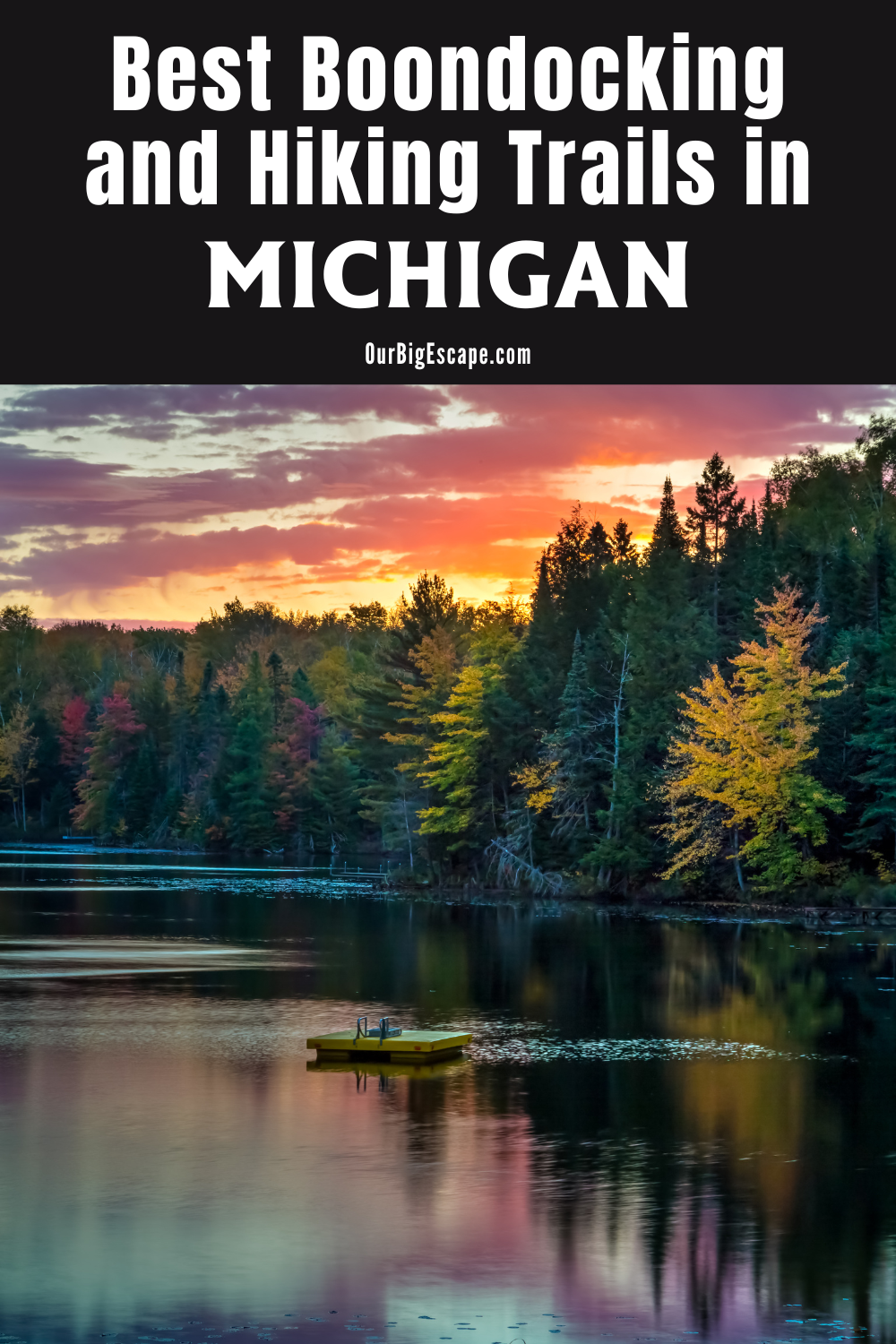
Although it isn’t well known for Michigan boondocking locations, the Great Lakes State does have several lovely spots for free camping and boondocking. While dispersed camping in Michigan is still difficult for many, we’ve compiled a list of 64 boondocking locations from all around the state that you might find interesting.
Jump directly to the 32 Free Upper Peninsula Michigan Boondocking Locations
Jump directly to the 31 Michigan Boondocking Locations In the Lower Peninsula
Michigan Boondocking Locations
You’ve come to the correct place if you’re looking for some terrific free camping in Upper Peninsula Michigan Boondocking Locations for an upcoming U.P. road trip or camping excursion! We’ve got 32 free Michigan camping spots in the Upper Peninsula for you to check out.
There are 32 free Michigan camping spots. That means you’ll need to be prepared to boondock or wild camp without running water, electricity, garbage service, or shower facilities. Before going boondocking, familiarize yourself with the 7 Leave No Trace Principles.
The Department of Natural Resources (DNR) maintains many of these locations on Michigan State Forest land. This site’s ‘Rules For Dispersed Camping’ category has information on how to use this land for free.
Always leave sites in better condition than when you arrived, which may include cleaning up other people’s trash. Michigan boondocking locations are frequently closed because they are too expensive to maintain when a large number of people leave trash all over them. We recommend bringing a few garbage bags and disposable gloves with you.
These campgrounds are not open during the winter because they are located in the chilly and sometimes severe Upper Peninsula. The majority of them are open between Memorial Day and Labor Day.
Bugs! Rather than making a mental note of every single bug swarm – from biting flies to mosquitoes – we’re only saying it once! If you’re visiting Upper Peninsula Michigan boondocking locations, make sure you have various bug-repellent alternatives.
Want more ideas to round-out your trip to the North-Eastern States?
► Illinois, Indiana, Kentucky, Michigan, New York, Ohio, Pennsylvania, Virginia, West Virginia, Wisconsin ◄
- 16 Free Illinois Boondocking Spots With Maps
- 18 Free Indiana Boondocking Camp Sites Along With Maps
- 32 Free Kentucky Boondocking Camping Grounds Plus Maps
- 64 Free Michigan Boondocking Locations Including Maps
- 77 Amazing New York Boondocking Campsites And Maps
- 24 Free Ohio Boondocking Camping Areas Including Maps
- 47 Top Pennsylvania Boondocking Areas With Maps
- 47 Best Virginia Boondocking Sites Also Maps
- 19 Top West Virginia Boondocking Camp Sites And Maps
- 31 Favorite Wisconsin Boondocking Spots Plus Maps
32 Free Upper Peninsula Michigan Boondocking Locations
Jump directly to the 31 Michigan Boondocking Locations In the Lower Peninsula
check out our video
1. Cedarville, MI
Address
Highway M-134 between Cedarville and DeTour Village
De Tour Village, Michigan
GPS: 45.96968, -84.07427
Management: Public – State land (Official)
The road in is Paved. Cedarville, MI is open All year. There are 1-5 Michigan boondocking locations at this area and the maximum RV length is unlimited. You may stay 14 Days at Cedarville, MI. Several pullouts on the South side of M-134 between Cedarville and DeTour Village.
2. Thayer’s Lake
Address
Lake Linden, Michigan
GPS: 47.28839, -88.253632
Elevation: 774′
Management: Public – State Forest (Official)
The road in is Dirt and 1.5 miles from a paved road. Thayer’s Lake is open year round. There are 1-5 Free Michigan camping spots at this location. You may stay 15 nights at Thayer’s Lake. Shallow lake with fishing on Michigan State Forest Land. The Trout River runs from the lake. Dispersed camping, no facilities.
3. Hiawatha National Forest Site
Address
Saint Ignace, Michigan
GPS: 46.018146, -84.719897
Management: Public – Forest Service
We found this little site while driving around the forest for Free Michigan boondocking locations.. Seems to have been used many times before, accessible to any vehicle. Close to a highway to it gets noisy and the mosquitoes are really bad in the summer. But it is a good site for a night.
4. Castle Rock Road – St. Ignace, MI
Address
St. Ignace, Michigan
GPS: 45.922312, -84.797911
Elevation: 636′
Management: Public – National Park Service (Unofficial)
From Castle Rock Road, continue past the North Country Trail Trailhead. Look for the next road on the left. There is a small lake with Michigan camping spots.
5. North Shore of Lake Superior from Wild Cat Rd.
Address
Paradise, Michigan
GPS: 46.763213, -85.021967
Elevation: 610′
Management: Public – State Forest
The road in is Dirt. A permit is required to stay on state forest land. Free Michigan boondocking locations. This is a spot you can camp in the Paradise area. It is good for tent/car camping. I would think a trailer could make it down the dirt road, but turning it around would be a problem.
6. The Widewaters
Address
Paradise, Michigan
GPS: 46.746331, -85.1194
Elevation: 669′
Management: Public – State Forest (Official)
The road in is Dirt. Free Michigan camping spots.
7. Shelldrake Lake Dam
Address
Paradise, Michigan
GPS: 46.71258, -85.06436
Elevation: 650′
Management: Public – State Forest
The road in is Dirt and 3 miles from a paved road. There are 1-5 Michigan boondocking locations at this area and the maximum RV length is unlimited. A PASS or PERMIT is required at this campsite.
8. CCC Camp “prison camp” near Tahquamenon Falls
Address
Paradise, Michigan
GPS: 46.641113, -85.126612
Elevation: 696′
Management: Public – State Forest (Official)
The road in is Gravel and <1 miles from a paved road. Free Michigan camping spots. The maximum RV length at CCC Camp “prison camp” near Tahquamenon Falls is unlimited.
9. Lake Perrault
Address
Toivola, Michigan
GPS: 47.029353, -88.731405
Elevation: 1257′
Management: Public – DNR Managed Area (Unofficial)
The road in is Gravel and 0,25 miles from a paved road. There are 1-5 Michigan boondocking locations at this area and the maximum RV length is 45 feet
10. Lake Michigan Scenic Pull-Off
Address
Naubinway, Michigan
GPS: 46.09735, -85.397656
Elevation: 587′
Management: Public – pulloff (Unofficial)
Pull-off on the side of rte 2. Very pretty, right on the beach (also right on rte 2) No one bothered us and there were 2 other campers parked through the night. Free Michigan camping spots.
11. Hanson Creek Campsite
Address
Rock River, Michigan
GPS: 46.43079, -86.93956
Elevation: 751′
Management: Public – Forest Service (Unofficial)
The road in is Dirt and 4 miles from a paved road. Hanson Creek Campsite is open year round. There are 1-5 Michigan boondocking locations at this area and the maximum RV length is 25 feet. You may stay 16 nights at Hanson Creek Campsite.
12. Hovey Lake Dispersed Camping Area
Address
CR 519
Wetmore, Michigan
GPS: 46.291, -86.700996
Elevation: 852′
Management: Public – Forest Service (USDA)
There are 1-5 Free Michigan camping spots at this location. This isolated, quiet, family type camping area is located on the east side of Hovey Lake. It is a good place for canoeing, bird watching, or just enjoying nature’s surroundings. North Country National Scenic Trail is nearby. There are 4 campsites, each with a table and fire ring
13. Oakwood Trails Trailhead
Address
Forest Road 2473C
Munising, Michigan
GPS: 46.28718, -86.7031
Elevation: 879′
Management: Public – Forest Service (Official)
The road in is Dirt and 2 miles from a paved road. There are 6-15 Michigan boondocking locations at this area and the maximum RV length is unlimited. While walking around on a trail I found this site and looked it up on the Hiawatha National Forest website to make sure it was authorized for camping. The area itself is a large field with some places that you can back into or park in the central area along the edge.
14. Pull out off of M28
Address
Shingleton, Michigan
GPS: 46.365838, -86.531822
Elevation: 883′
Management: Public – National Park Service (Unofficial)
Westbound on 28, Free Michigan camping spots in Hiawatha National Forest land, a few miles past Shingleton, MI
15. Hiking – Ottawa NF near the Porcupine Mountains
Address
White Pine, Michigan
GPS: 46.70982, -89.76244
Elevation: 1194′
Management: Public – Forest Service (Official)
The road in is Dirt. There are 30 or more Michigan boondocking locations at this area and the maximum RV length is unlimited. You may stay 16 days at Ottawa NF near the Porcupine Mountains.
16. Visit Pictured Rocks Nat. Lakeshore
Address
Grand Marais, Michigan
GPS: 46.6279, -86.09573
Elevation: 891′
Management: Public – The Inland Buffer Zone is a mixture of fed, state, & private ownership (Unofficial)
The road in is Dirt and 3/4 mile miles from a paved road. Visit Pictured Rocks Nat. Lakeshore is open any. There are 1-5 Free Michigan camping spots at this location and the maximum RV length is unlimited. You may stay up to 14 days? at Visit Pictured Rocks Nat. Lakeshore.
17. Snow Mobile Parking
Address
Shingleton, Michigan
GPS: 46.52724, -86.22137
Elevation: 925′
Management: Public – Forest Service (Unofficial)
The road in is Paved. There are 30 or more Michigan boondocking locations at this area and the maximum RV length is unlimited. You may stay unknown at Snow Mobile Parking.
18. Haymeadow Creek Campsite
Address
Rapid River, Michigan
GPS: 46.022655, -86.859605
Elevation: 705′
Management: Public – Forest Service (Official)
The road in is Paved. There are 6-15 Free Michigan camping spots at this location. You may stay 14 days at Haymeadow Creek Campsite. Haymeadow Creek Campground is located approximately 11 miles from Rapid River. Dispersed Camping There are 15 large campsites, all with tables and fire rings. Drinking water is available at a hand pump and there are toilet facilities.
19. Peninsula Point Lighthouse
Address
Rapid River, Michigan
GPS: 45.667839, -86.967269
Elevation: 584′
Management: Public – Forest Service
The road in is Gravel and 1/2 miles from a paved road. There are 1-5 Michigan boondocking locations at this area and the maximum RV length is 25 feet. You may stay 14 days at Peninsula point lighthouse. About a quarter mile before the lighthouse. There are 2-3 pull out on fed land. Saw class B. Not much bigger then class c can fit on the road.
20. Moose Rapids Township CG
Address
River Road
Champion, Michigan
GPS: 46.457504, -88.073439
Elevation: 1529′
Management: Public – City Park
The town of Champion maintains this camping area. Free Michigan camping spots. First come -> First Camped. Reservations not accepted.
21. Blockhouse Campground
Address
End of forest road 2180
Iron River, Michigan
GPS: 46.267239, -88.651428
Elevation: 1467′
Management: Public – Forest Service (USDA) (Unofficial)
The road in is Gravel and 8 miles miles from a paved road. Blockhouse Campground is open may 1 to nov 30. There are 1-5 Michigan boondocking locations at this area and the maximum RV length is 45 foot or more.
22. Paint Forks Campground
Address
990 Lalley Road
Iron River, Michigan
GPS: 46.232197, -88.717903
Elevation: 1468′
Management: Public – Forest Service (USDA) (Unofficial)
The road in is Gravel and 5 miles miles from a paved road. Paint Forks campground is open may 1 to nov 30. There are 1-5 Free Michigan camping spots at this location and the maximum RV length is 45 foot or more. This is a free national forest campground in the Ottawa National Forest. There are 4 lovely wooded sites, a pitcher pump, and an outhouse. Not overly maintained, so expect high weeds or picking up some fallen branches as a form of payment for staying there!
23. Sturgeon River Campground
Address
Covington, Michigan
GPS: 46.570036, -88.656507
Elevation: 1035′
Management: Public – Forest Service (Official)
The road in is Gravel and Six miles from a paved road. There are 6-15 Michigan boondocking locations at this area and the maximum RV length is unlimited. You may stay 14 Days at Sturgeon River Campground.
24. Burned Dam Campground
Address
FR 4500
Watersmeet, Michigan
GPS: 46.313999, -89.053001
Elevation: 1603′
Management: Public – Forest Service (USDA)
Burned Dam Campground is open Year-round. This rustic campground provides visitors with access to deep woods with fishing and canoeing opportunities on the Middle Branch of the Ontonagon River. Free Michigan camping spots just a short walk from the Mex-I-Min-E Falls.
25. Robbins Pond
Address
Forest Highway 6964
Bruce Crossing, Michigan
GPS: 46.381097, -89.228297
Elevation: 1309′
Management: Public – Forest Service
This deep woods dispersed campground is located on Robbins Pond, a well known trout pond. It features three campsites and is located in the northeast corner of the Watersmeet Ranger District. Free Michigan boondocking locations. Currently there are limited services provided at this campground.
26. Bond Falls Flowage
Address
Bond Falls Road
Bruce Crossing, Michigan
GPS: 46.408591, -89.129778
Elevation: 1439′
Management Private – Utility Company (Official)
The road in is Gravel and 6 miles from a paved road. Bond Falls Flowage is open June 1 through September 15. There are 16-29 Free Michigan camping spots at this location and the maximum RV length is 35 feet. You may stay 14 nights at Bond Falls Flowage.
27. Trout Creek Township Park
Address
Trout Creek, Michigan
GPS: 46.4766, -89.013771
Management: Public – County Park (Unofficial)
You may stay overnight in Free Michigan boondocking locations at Trout Creek Township Park. A nice place to stay for a night, We stayed here in October 2016. It is a paved parking lot area off Highway 28. It was a nice quiet spot.
28. Sparrow Rapids Campground
Address
FR 1100
Trout Creek, Michigan
GPS: 46.504776, -88.94735
Elevation: 1158′
Management: Public – Forest Service (USDA)
There are 6-15 Free Michigan camping spots at this location. Sparrow Rapids Campground provides visitors with an opportunity to be near wilderness and a Wild River/Recreation River at the same time. This campground has 6 campsites that can accomodate tents, trailers, and motorhomes. It a limited service campground.
29. Sturgeon River Campground
Address
Covington, Michigan
GPS: 46.570036, -88.656507
Elevation: 1035′
Management: Public – Forest Service (Official)
The road in is Gravel and Six miles from a paved road. There are 6-15 Michigan boondocking locations at this area and the maximum RV length is unlimited. You may stay 14 Days at Sturgeon River Campground.
30. Matchwood
Address
Matchwood Tower Road
Ewen, Michigan
GPS: 46.496899, -89.427439
Elevation: 1299′
Management: Public – Forest Service
Free Michigan camping spots located within the Ottawa National Forest’s Bergland Ranger District.
31. Hiking – Mandan Road
Address
Copper Harbor, Michigan
GPS: 47.463096, -87.824826
Elevation: 725′
Management Private – Nature Conservancy (Unofficial)
The road in is Dirt and 1 miles from a paved road. Mandan Road is open year round. There are 1-5 Michigan boondocking locations at this area. Unofficial campsites are found along Mandan Road, up the hill from Mud Lake and in the Mary Macdonald Preserve, east of Copper Harbor. These are small pulloffs with old campfires.
32. No Name Lake
Address
Copper Harbor, Michigan
GPS: 47.403264, -87.805754
Elevation: 666′
Management: Public – Forest Service (Official)
The road in is 4×4. Hoar Lake is open year round. There are 1-5 Free Michigan camping spots at this location. You may stay 14 days at Hoar Lake. Nice little hiding spot if you can find. Camping here will give you this lake all to yourself. You will need a Jeep or truck to get here.
Lower Peninsula Boondocking Locations
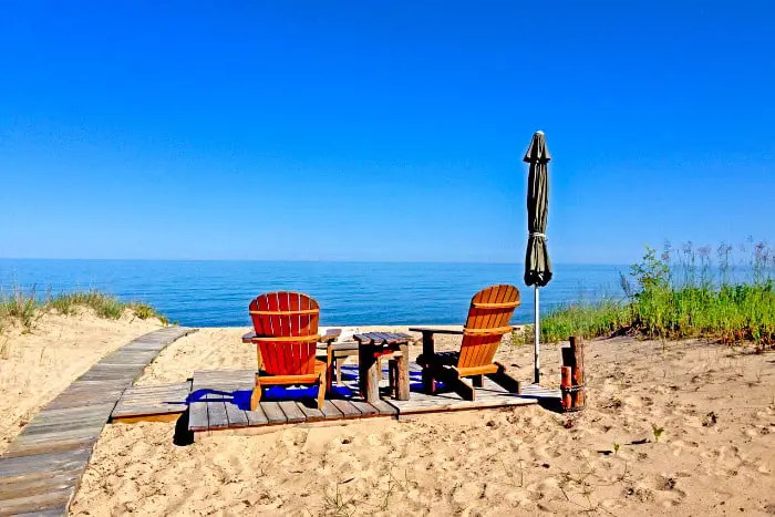
Michigan is a fantastic place to go camping. You’re likely to find a location among the millions of acres of national and state forests, 11,000 lakes, over 3000 miles of Great Lakes shoreline, and 100 state parks. Finding Michigan boondocking locations may take a little more effort, but if you are resourceful and ready to travel, you will almost certainly be able to find something suitable.
The Huron-Manistee National Forest (the Huron on the east side of the state and the Manistee on the west) is a fantastic spot to start in the lower peninsula. There are numerous Free Michigan camping spots to be discovered in addition to the countless dispersed campsites throughout the forests, with nearly 1 million acres and hundreds of kilometers of rivers and streams.
Look for Cooper Creek Road and Green Road near the Nordhouse Dunes Wilderness Area, which are both free on the Manistee side closest to Lake Michigan. The Nordhouse Dunes are a lovely spot to camp and explore. A useful map and booklet from the National Forest Service explains everything in detail. Several approaches to the Big Sable Point Light House provide excellent Michigan hiking opportunities.
Despite its isolated location, the Upper Hamlin Grocery Store on Nurnberg Road is a convenient stop for fresh water, a disposal station, and supplies. To the north is the Lake Michigan National Recreation Area, while to the south is Ludington State Park.
31 Michigan Boondocking Locations In the Lower Peninsula
Jump directly to the 32 Free Upper Peninsula Michigan Boondocking Locations
1. Ferry Parking
Address
115 W Central Ave, Mackinaw City, MI
Mackinaw City, Michigan
GPS: 45.78113, -84.73409
Elevation: 604′
Management Private – Parking Lot (Official)
The road in is Paved. Ferry parking is open year round. There are 30 or more Michigan boondocking locations at this area and the maximum RV length is unlimited. You may stay overnight at Ferry parking. Permit required.
2. French Farm Lake
Address
Mackinaw City, Michigan
GPS: 45.763809, -84.768967
Elevation: 627′
Management: Public – Fish and Wildlife Service (Official)
There are 6-15 Free Michigan camping spots at this location. You may stay 14 days at French Farm Lake. Take Trails End Road 1.75 miles west out of Mackinaw City. Turn left on an unnamed dirt/gravel road 50 feet before the stop sign at Wilderness Park Drive. Follow the road to six numbered sites.
3. Topinabee Rest Area
Address
Cheboygan, Michigan
GPS: 45.50268, -84.61388
Elevation: 735′
Management: Public – Rest Area (Official)
Michigan boondocking locations at MDOT Rest Area, very quite during the night, stayed there for one night passing through to the UP. Also great overlook.
4. Outdoor Trial – Pigeon River Country SF
Address
Wolverine, Michigan
GPS: 45.27122, -84.45713
Elevation: 856′
Management
Public – State Forest (Official)
The road in is Dirt and just over 500 feet. miles from a paved road. Outdoor Trial – Pigeon River Country SF is open First come first serve. There are 1-5 Free Michigan camping spots at this location. You may stay 14 Days at Outdoor Trial – Pigeon River Country SF. Free Pass or Permit needed.
5. McKinley Horse Camp
Address
US Highway Govt 4428
Mio, Michigan
GPS: 44.639199, -83.971291
Elevation: 958′
Management: Public – Forest Service
Michigan boondocking locations at McKinley Horse Camp is open all year. Nice quiet place, easy access for larger vehicles. Basically a horse camping trailhead, so respect those users. Vault toilets are clean and non smelly (late June). Saw one other truck drive thru mid week when I stayed overnight. Water was not available, and the spigot was labeled “non-potable” anyway.
6. Union Corners at Huron NF
Address
1755 S. Mitchell St. Cadillac, MI 49601
Rose City, Michigan
GPS: 44.54685, -84.19053
Elevation: 1168′
Management: Public – Forest Service
The road in is Dirt. Union Corners at Huron NF is open Year Round. There are 1-5 Free Michigan camping spots at this location and the maximum RV length is 15 feet. You may stay 14 days at Union Corners at Huron NF. You might fit a small camper in there assuming you can get down the road which is passable by most passenger cars.
7. Dushaue
Address
Atlanta, Michigan
GPS: 45.031876, -84.182899
Elevation: 909′
Management: Public – State Forest (Official)
The road in is Gravel and 1/4 miles from a paved road. Dushaue is open All year. There are 30 or more Michigan boondocking locations at this area and the maximum RV length is unlimited. You may stay 13 days at Dushaue.
8. Lime Lake (Pearl Lake Natural Area)
Address
Lake Ann, Michigan
GPS: 44.75512, -85.93082
Elevation: 820′
Management: Public – State Forest (Unofficial)
Free Michigan camping spots easy to get to. The road ends at the lake and I’ve camped all along the shore past it. Fairly quiet, only have ran into a handful of other campers and fisherman.
9. Cut River
Address
Roscommon, Michigan
GPS: 44.42917, -84.65404
Elevation: 1165′
Management: Public – State Forest (Official)
The road in is Dirt and 3.2 miles miles from a paved road. Cut River is open year round but seasonal road/not plowed. There are 6-15 Michigan boondocking locations at this area and the maximum RV length is 15 feet. You may stay 14 days at Cut River.
10. Condon Lakes West
Address
Bitely, Michigan
GPS: 43.75801, -85.89986
Elevation: 922′
Management: Public – USDA Forest Service
The road in is Dirt. There are 1-5 Free Michigan camping spots at this location and the maximum RV length is unlimited. This area is very popular for mushroom and berry picking, as well as hunting, fishing and camping.
11. Sulak Campground
Address
Township of Branch, Michigan
GPS: 43.924428, -86.012759
Elevation: 791′
Management: Public – USDA Forest Service
This site is primarily used by anglers, hunters and families for camping. There is a short, .25 mile walk from Michigan boondocking locations to the river, through federal and state land. The river access is operated by the MI-DNRE. To download the Pere Marquette River, National Scenic River
12. Whelan Lake Area
Address
FR 6661
Custer, Michigan
GPS: 43.910482, -86.157488
Elevation: 748′
Management: Public – USDA Forest Service
The road in is Gravel. Whelan Lake Area is open year round. There are 16-29 Free Michigan camping spots at this location and the maximum RV length is unlimited. You may stay 14 days at Whelan Lake Area.
13. Nordhouse Dunes Wilderness Area (hike-in)
Address
Free Soil, Michigan
GPS: 44.08724, -86.44505
Elevation: 617′
Management: Public – Forest Service (Official)
The road in is Dirt and 5 miles from a paved road. Nordhouse Dunes Wilderness Area (hike-in) is open 24/7/365. There are 30 or more Michigan boondocking locations at this area. You may stay 14 Days at Nordhouse Dunes Wilderness Area (hike-in).
14. Lake Michigan Recreation Area
Address
W. Forest Trail Road/Green Rd
Manistee, Michigan
GPS: 44.1054, -86.400948
Elevation: 658′
Management: Public – Forest Service (USDA) (Unofficial)
The road in is Dirt and 1 miles from a paved road. Lake Michigan Recreation Area is open All year, weather permitting.. There are 30 or more Free Michigan camping spots at this location and the maximum RV length is 30′. You may stay 14 Days per site at Lake Michigan Recreation Area.Lake Michigan Recreation Area
15. Hiking – Manistee NF Dispersed Camping
Address
Stronach, Michigan
GPS: 44.12692, -86.38411
Elevation: 659′
Management: Public – Forest Service (Official)
The road in is 4×4 and 1 miles from a paved road. Manistee NF Dispersed Camping is open Year Round. There are 1-5 Michigan boondocking locations at this area. You may stay 14 days at Manistee NF Dispersed Camping.
16. Marzinski Horse CG
Address
1001-1999 Marzinski Road
Manistee, Michigan
GPS: 44.225747, -86.161859
Elevation: 732′
Management: Public – Forest Service
Marzinski Horse CG is open May-Sep. Free Michigan camping spots located within the Huron-Manistee National Forest’s Manistee Ranger District. About three tenths mile south of 55. Twenty-one cleared, spacious, wooded sites. Very Nice.
17. Upper River Road Sites
Address
Brethren, Michigan
GPS: 44.27497, -85.94392
Elevation: 778′
Management: Public – Forest Service (Official)
The road in is 4×4 and 2-3 miles from a paved road. There are 6-15 Michigan boondocking locations at this area. Multiple large sites down a bumpy, muddy road. 4×4 recommended. Was here Memorial Weekend and only one other site was occupied. Flat ground with makeshift camp rings.
18. Upper Manistee River Sites
Address
Brethren, Michigan
GPS: 44.2657, -85.92418
Elevation: 735′
Management: Public – Forest Service (Official)
There are several great Free Michigan camping spots along the upper Manistee river road. Numbered signs are located beside the road pointing the way. Most sites have a direct view of the river and are true hidden gems!
19. Government Landing
Address
Dickson, Michigan
GPS: 44.263275, -85.888673
Elevation: 793′
Management: Public – USDA Forest Service
This camping area is named for Government Island. The 3 Michigan boondocking locations are part of the Forest Services’ 41 designated dispersed sites along the Upper Manistee River. The main access road along the powerline is a snowmobile trail in the winter.
20. Michigan State Forest
Address
Sanford, Michigan
GPS: 43.726762, -84.407809
Elevation: 659′
Management: Public – State Forest (Official)
Free Michigan camping spots on state land all that is required is the state pass and a dispersed camping permit which is also free. You can stay for 14 days and then have to move on. Bring the bug spray for sure and it also has its days and night were its a little busy.
21. Michigan State Forest – Gladwin
Address
Bentley, Michigan
GPS: 43.97906, -84.20991
Elevation: 758′
Management: Public – State Forest (Official)
Free 14 day camping permit you can get from the DNR. Thousands of acres of State land, ORV, truck, Michigan hiking trails galore. Michigan boondocking locations have No hookups, you’re out in the sticks for sure. Weekends can be a bit crowded but during the week is pretty quiet.
22. Canoe Camp
Address
Roscommon Township, Michigan
GPS: 44.211, -84.82487
Elevation: 1112′
Management: Public – State Forest
Free Michigan camping spots at Canoe Camp is open year round. You may stay 14 days at Canoe Camp.
23. West Branch Rest Area 433
Address
West Branch, Michigan
GPS: 44.2311, -84.21036
Elevation: 925′
Management: Public – Rest Area (Unofficial)
The road in is Paved. The maximum RV length at West Branch Rest Area 433 is unlimited. Michigan boondocking locations at Rest Area on I-75 North just before the West Branch exit. The truck parking is in the back. Has long spaces for tractor trailer trucks as well as RV’s.
24. Withey Lake Camp Ground
Address
Prescott, Michigan
GPS: 44.291992, -84.003718
Elevation: 876′
Management: Public – Township owned (Official)
Free Michigan camping spots but no services. There are multiple campsites look for fire rings. There are no amenities of any kind.
25. Sand Road
Address
Sand Road
Rothbury, Michigan
GPS: 43.476573, -86.231537
Elevation: 623′
Management: Public – Forest Service (Unofficial)
The road in is Dirt and Zero miles from a paved road. There are 6-15 Michigan boondocking locations at this area. Along Sand Road there are multiple campsites look for fire rings. There are no amenities of any kind.
26. I-69 Lapeer Rest Area
Address
Attica, Michigan
GPS: 43.005338, -83.219719
Elevation: 965′
Management: Public – Rest Area (Official)
The road in is Paved. The eastbound I-69 rest area 8 miles east of Lapeer MI is great. It is above the highway, and surrounded by forest so I-69 noise is minimal. We spent one night on the car side with a 22 ft RV and it was very restful. Free Michigan camping spots.
27. Northfield Township Rest Area
Address
Ann Arbor, Michigan
GPS: 42.35497, -83.74902
Elevation: 942′
Management: Public – Rest Area (Unofficial)
A MDOT (Michigan Department of Transportation) rest area on southbound US-23 just north of Ann Arbor, MI. There are plenty of parking spaces for cars and longer vehicles like motorhomes with trailers at Michigan boondocking locations.
28. Webberville Rest Area
Address
hwy 96 and Stockbridge Rd.
Webberville, Michigan
GPS: 42.660632, -84.199004
Elevation: 892′
Management State
The road in is Paved. There are 6-15 Free Michigan camping spots at this location.
29. Battle Creek Rest Area
Address
Battle Creek, Michigan
GPS: 42.263463, -85.218423
Elevation: 974′
Management: Public – Rest Area (Official)
The road in is Paved. Michigan boondocking locations at Battle creek rest area is open year round. The maximum RV length at Battle creek rest area is unlimited. You may stay overnight at Battle creek rest area.
30. Shady Brook Park
Address
200-500 South Van Buren Street
Bloomingdale, Michigan
GPS: 42.378037, -85.957841
Elevation: 712′
Management: Public – Village Campground (Official)
The road in is Paved. Shady Brook Park is open April-Oct. There are 1-5 Free Michigan camping spots at this location and the maximum RV length is 15 feet. You may stay Unknown at Shady Brook Park.
31. New Buffalo Welcome Center
Address
New Buffalo, Michigan 49117
New Buffalo, Michigan
GPS: 41.765209, -86.740562
Elevation: 696′
Management: Public – Rest Area (Official)
The road in is Paved. New Buffalo Welcome Center is open All. There are 30 or more Michigan boondocking locations at this area and the maximum RV length is unlimited. You may stay 1 at New Buffalo Welcome Center.
You May Want to Join Our Boondocking Group on Facebook For More Information
You May Want to Join Our Campfire Recipes Group on Facebook For More Information
Check Out Our Pictures On Instagram – Our Big Escape.