There are numerous excellent answers to the question of where to find Wisconsin boondocking spots. In Wisconsin, you may discover excellent free camping no matter where you go.
Jump directly to the 25 Northern Wisconsin Boondocking
Jump directly to the 6 Southern Wisconsin Boondocking
Wisconsin Boondocking Spots
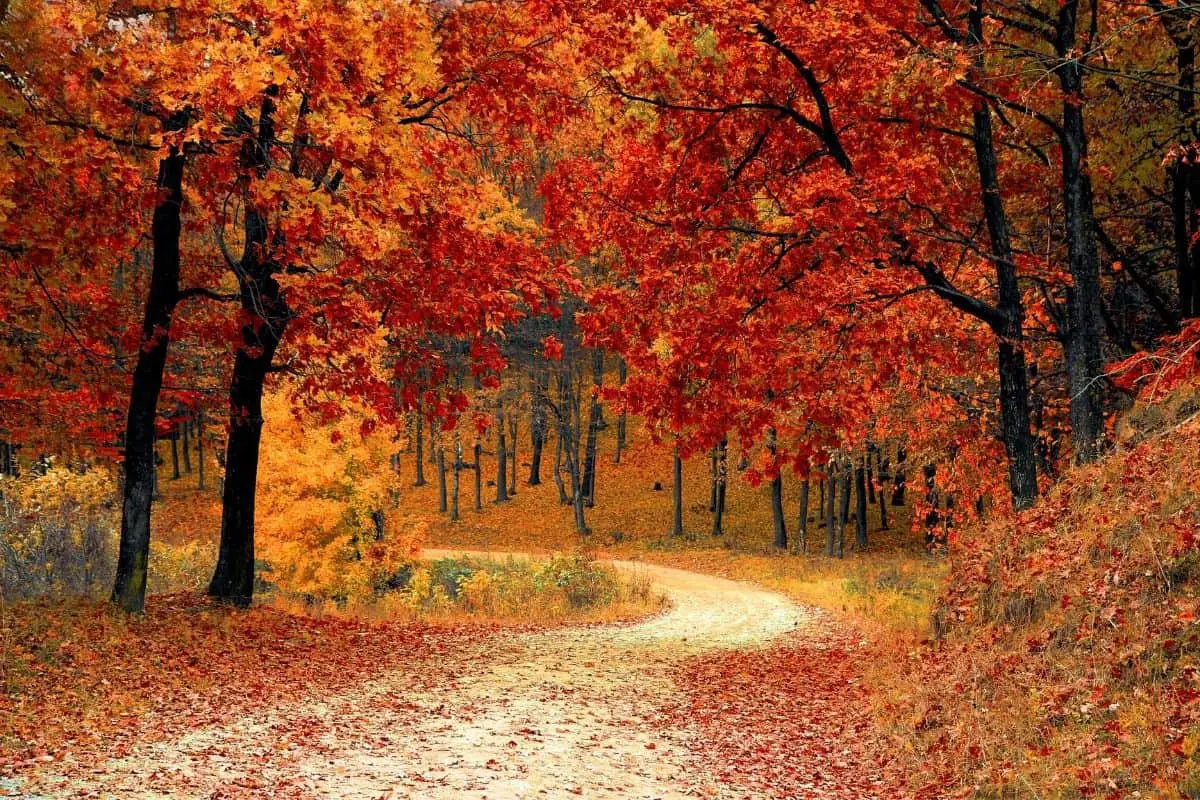
You’re dreaming of ‘boondocking’ when the image that comes to mind is a secluded site deep in the bush. Walking off the grid and constructing your own campground is what boondocking is. Other names that are synonymous can be dispersed camping, remote camping, backpack camping, wilderness camping, and non-designated camping.
While free camping and boondocking opportunities are not as plentiful in America’s Dairyland as they are in adjacent northern states, they do exist.
Wisconsin boondocking places at County Road O Landing, located on the state’s western border along the Saint Croix National Scenic Riverway, offer rustic camping with easy access to put in a canoe or kayak right from the campsite.
Aside from that, these are basic, free Wisconsin dispersed campsites with a vault toilet. Although it is a national park, the National Scenic Riverway is smaller and has fewer amenities than most.
Despite the abundance of national and state forest properties in Wisconsin, free camping appropriate for RVs is nearly impossible to come by in those situations.
Want more ideas to round-out your trip to the North-Eastern States?
► Illinois, Indiana, Kentucky, Michigan, New York, Ohio, Pennsylvania, Virginia, West Virginia, Wisconsin ◄
- 16 Free Illinois Boondocking Spots With Maps
- 18 Free Indiana Boondocking Camp Sites Along With Maps
- 32 Free Kentucky Boondocking Camping Grounds Plus Maps
- 64 Free Michigan Boondocking Locations Including Maps
- 77 Amazing New York Boondocking Campsites And Maps
- 24 Free Ohio Boondocking Camping Areas Including Maps
- 47 Top Pennsylvania Boondocking Areas With Maps
- 47 Best Virginia Boondocking Sites Also Maps
- 19 Top West Virginia Boondocking Camp Sites And Maps
- 31 Favorite Wisconsin Boondocking Spots Plus Maps
25 Northern Wisconsin Boondocking
Jump directly to the 6 Southern Wisconsin Boondocking
check out our video
1. County O Landing
Address
county o landing grantsburg wi
Grantsburg, Wisconsin
GPS: 45.688599, -92.868805
Elevation: 886′
Management: Public – State Natural Area (Official)
There are 1-5 Wisconsin boondocking spots at this location. You may stay 3 days at County O Landing. Nice spot on the river.
2. Madge Roadside Rest Stop
Address
Sarona, Wisconsin
GPS: 45.746219, -91.741413
Elevation: 1250′
Management: Public – Rest Area (Unofficial)
This is a small roadside rest stop with a long abandoned pitt toilet only. Wisconsin dispersed campsites about 5 miles East of Hwy 53 on City Rd. B. It is well hidden just on the south side of county road B about a half mile west of Rolling Thunder RV Park. If you pass the park you’ve gone too far. There is room for one RV under 40′, no hookups, small trail down to waters edge for some fishing or swimming on a small pond.
3. Swan Creek Park
Address
Schwartz Rd
Exeland, Wisconsin
GPS: 45.666906, -91.23627
Elevation: 1171′
Management: Public – County Park (Official)
The road in is Paved. Swan Creek Park is open Summer only. There are 1-5 Wisconsin boondocking spots at this location and the maximum RV length is unlimited. You may stay 3 at Swan Creek Park. This small town park has a loop with 5 electric hookups in the center. Call Sue for availability and access.
4. Free Wisconsin RV Parking – Cooper Dam
Address
W9104 County Line Rd
Ogema, Wisconsin
GPS: 45.3782, -90.5344
Elevation: 1391′
Management: Public – Forest Service
The road in is Gravel and 3 miles from a paved road. Cooper Dam is open Unknown. There are 6-15 Wisconsin dispersed campsites at this location and the maximum RV length is 15 feet. You may stay 14 at Cooper Dam.
5. Pioneer Park
Address
W4905 Holmes Street
Ogema, Wisconsin
GPS: 45.443634, -90.289726
Elevation: 1555′
Management: Public – City Park (Official)
Pioneer Park is open Year round. There are 1-5 Wisconsin boondocking spots at this location. Campsites, picnic tables, boat landing and fishing on Ogema Millpond, playground, ball field, horseshoe pits & ATV/horse pull track.
6. Chelsea Lake County Park
Address
Chelsea, Wisconsin
GPS: 45.301176, -90.311287
Elevation: 1552′
Management: Public – County Park (Unofficial)
Wisconsin dispersed campsites in large parking lot next to a lake with a boat ramp, picnic tables, grills, well pump, vaulted toilets, and a shelter. Clear lake w 2 docks. Unsupervised swimming. Perfect kayaking spot. We stealth-camped in our van, Monday-Wednesday. Busy during the day with locals, quiet at night.
7. Horn Lake and Lincoln County Forest
Address
Irma, Wisconsin
GPS: 45.30234, -89.63485
Elevation: 1529′
Management: Public – Forest Service (Official)
The road in is Dirt. There are 30 or more Wisconsin boondocking spots at this location. You may stay 14 days at Horn Lake and Lincoln County Forest. The Horn Lake campsite and the entire Lincoln county forest is free to camp for 14 days with no
8. Farr Lake, Nicolet Forest
Address
Logan, Wisconsin
GPS: 45.15656, -88.36237
Elevation: 915′
Management: Public – Forest Service (Official)
The road in is Dirt and 5 miles from a paved road. Farr Lake, Nicolet Forest is open All year. There are 1-5 Wisconsin dispersed campsites at this location and the maximum RV length is 35 feet. You may stay 14 days at Farr Lake, Nicolet Forest. National forest primitive site. 2 campsites. Large flat area. Box toilet with fence. No tables. Lots of down firewood. Lake very silty near edge. Road minivan OK. Very pretty location.
9. Free Wisconsin RV Parking – Mountain Lake Road #1, Oconto County
Address
Mountain Lake Road
Markton, Wisconsin
GPS: 45.14818, -88.59719
Elevation: 1047′
Management: Public – Forest Service (Official)
The road in is Gravel and 1 miles from a paved road. Mountain Lake Road #1, Oconto County is open All year. There are 1-5 Wisconsin boondocking spots at this location and the maximum RV length is 25 feet. You may stay 14 days at Mountain Lake Road #1, Oconto County. Nice primitive (dispersed) campsite by a small river on National forest land. Minivan OK. Picnic table. Box toilet-no fence. Fire ring. Clean flowing water for bathing or washing dishes.
10. Mountain Lake Road #2, Oconto County
Address
Mountain Lake Road
Mountain, Wisconsin
GPS: 45.17769, -88.56876
Elevation: 1053′
Management: Public – Forest Service (Official)
The road in is Gravel and 3 miles from a paved road. Mountain Lake Road #2, Oconto County is open All year. There are 1-5 Wisconsin dispersed campsites at this location and the maximum RV length is 15 feet. You may stay 14 days at Mountain Lake Road #2, Oconto County.
11. Mountain Lake Road #3, Oconto County
Address
Mountain Lake Road
Mountain, Wisconsin
GPS: 45.18769, -88.56313
Elevation: 1093′
Management: Public – Forest Service (Official)
The road in is Gravel and 3 miles from a paved road. Mountain Lake Road #3, Oconto County is open All year. There are 1-5 Wisconsin boondocking spots at this location and the maximum RV length is unlimited. You may stay 14 days at Mountain Lake Road #3, Oconto County.
12. Mountain Lake Road #4, Oconto County
Address
Mountain lake Road
Mountain, Wisconsin
GPS: 45.19799, -88.55556
Elevation: 1122′
Management: Public – Forest Service (Official)
The road in is Gravel and 1 miles from a paved road. Mountain Lake Road #4, Oconto County is open All year. There are 1-5 Wisconsin dispersed campsites at this location and the maximum RV length is unlimited. You may stay 14 days at Mountain Lake Road #4, Oconto County.
13. North End Waubee Lake
Address
Lakewood, Wisconsin
GPS: 45.34873, -88.44805
Elevation: 1214′
Management: Public – Forest Service (Official)
The road in is Paved. North End Waubee Lake is open All year. There are 1-5 Wisconsin boondocking spots at this location. You may stay 14 at North End Waubee Lake.
14. Free Wisconsin RV Parking – Knowles Creek Road
Address
Lakewood, Wisconsin
GPS: 45.36705, -88.48781
Elevation: 1220′
Management: Public – Forest Service (Official)
The road in is Gravel and 3 miles miles from a paved road. Knowles Creek Road is open all year. There are 1-5 Wisconsin dispersed campsites at this location and the maximum RV length is unlimited. You may stay 14 days at Knowles Creek Road. Just east of Knowles creek on the south side of the road. There is NO road sign for the campsite. Close to the road. No picnic table. No fire ring. There is a box toilet.
15. South End Long Lake
Address
Townsend, Wisconsin
GPS: 45.36717, -88.52025
Elevation: 1289′
Management: Public – Forest Service (Official)
The road in is Gravel and 4 miles miles from a paved road. South End Long Lake is open All year. There are 1-5 Wisconsin boondocking spots at this location and the maximum RV length is 35 feet. You may stay 14 days at South End Long Lake.
16. Old Knowles Creek Road Dam
Address
Townsend, Wisconsin
GPS: 45.36663, -88.52317
Elevation: 1257′
Management: Public – Forest Service (Official)
The road in is Gravel and 4 miles miles from a paved road. Old Knowles Creek Road Dam is open all year. There are 1-5 Wisconsin dispersed campsites at this location and the maximum RV length is 35 feet. This might be a popular place during the summer. Good luck figuring out what the turtle electric fence is for. Protect the turtles? Keep out the turtles?
17. Rat River
Address
Athelstane, Wisconsin
GPS: 45.48046, -88.44547
Elevation: 1309′
Management: Public – Forest Service (Official)
Wisconsin Boondocking spots on the Rat River. Has port-o-let and fire ring.
18. Peshtigo River #1
Address
Goodman, Wisconsin
GPS: 45.51106, -88.43664
Elevation: 1270′
Management: Public – Forest Service (Official)
The road in is Gravel and 5 miles miles from a paved road. Peshtigo River #1 is open All year. There are 1-5 Wisconsin dispersed campsites at this location and the maximum RV length is unlimited. You may stay 14 days at Peshtigo River #1. There are 4 dispersed campsites along this river. I think they are mostly used by people canoeing down the river. Picnic table. Real outhouse with concrete vault and stainless steel pedestal.
19. Peshtigo River #2
Address
Goodman, Wisconsin
GPS: 45.56185, -88.49485
Elevation: 1381′
Management: Public – Forest Service (Official)
The road in is Gravel and 5 miles miles from a paved road. Peshtigo River #2 is open All year. There are 1-5 Wisconsin boondocking spots at this location and the maximum RV length is unlimited. You may stay 14 days at Peshtigo River #2. Another dispersed site along the river. Nice outhouse with concrete vault and stainless steel pedestal. No tables. Has fire ring. Close to the road, might be dusty during the summer. Lots of big rocks to sit on.
20. Free Wisconsin RV Parking – Peeksville
Address
Glidden, Wisconsin
GPS: 46.14147, -90.45519
Elevation: 1558′
Management: Public – County P ark (Official)
Wisconsin dispersed campsites located by a creek. Only has two fire pits but can fit 2-3 RVs or several tent campers. To get there from Glidden, WI, take Lincoln St for about 2.5 miles then turn right onto East Side Fire Lane. Keep going. Once you pass Masterson Fire Lane, the campsite is on the right.
21. Marion Park
Address
Park Street
Glidden, Wisconsin
GPS: 46.13403, -90.589892
Elevation: 1608′
Management: Public – City Park
Nice city park for a day or two. Wisconsin boondocking spots.
22. Foster Falls
Address
end of Sullivan Fire Lane
Saxon, Wisconsin
GPS: 46.421083, -90.458332
Elevation: 1319′
Management: Public – County Park (Official)
The road in is Gravel and maybe 3 miles? miles from a paved road. There are 1-5 Wisconsin dispersed campsites at this location and the maximum RV length is 15 feet. You may stay 14 days at Foster Falls. Small rustic campsite at the end of a gravel road. Nice hiking to waterfall. Very remote, visited by locals and guys in pickups out drinking beer.
23. Potato River Falls
Address
Falls Road
Saxon, Wisconsin
GPS: 46.463467, -90.529003
Elevation: 1063′
Management: Public – County Park
The road in is Gravel and maybe 2 miles, gravel road is in good condition, easy access miles from a paved road. There are 1-5 Wisconsin boondocking spots at this location and the maximum RV length is 15. You may stay 14 days at Potato River Falls.
24. Chequamegon
Address
Mason, Wisconsin
GPS: 46.554359, -91.233789
Elevation: 1161′
Management: Public – Forest Service (Unofficial)
The coordinates will bring you to the road where we camped. There is no official site in the area that we could find, but we pulled in on the left side of the road into an ATV trail and it was very quiet. Wisconsin dispersed campsites.
25. Free Wisconsin RV Parking – Brule River State Forest (hike-in)
Address
Maple, Wisconsin
GPS: 46.675576, -91.593653
Elevation: 722′
Management: Public – State Forest (Official)
The road in is Gravel and .5 miles from a paved road. There are 1-5 Wisconsin boondocking spots at this location and the maximum RV length is 25 feet.
6 Southern Wisconsin Boondocking
Jump directly to the 25 Northern Wisconsin Boondocking
1. Bakers Field – Town
Address
The “400” State Trail
Wonewoc, Wisconsin
GPS: 43.652369, -90.223884
Elevation: 922′
Management:
Wisconsin boondocking spots are on the bike trail. Sounds like no access via car. Bike in only.
2. WisDOT Rest Area 10
Address
Lyndon Station, Wisconsin
GPS: 43.75125, -89.9486
Management: Public – Rest Area
Wisconsin dispersed campsites at one of the nice rest areas along 90/94. Pull through parking in the car area good for my B class. One small sign “No overnight camping” so keep it on the down low and no tents.
3. Jamieson Park
Address
Poynette, Wisconsin
GPS: 43.384924, -89.42954
Elevation: 820′
Management: Public – County Park (Unofficial)
Free Wisconsin boondocking spots with hiking trails surrounding the area. Very great place to get off of the interstate and relax for a weekend. Port-a-john facilities, one shelter, and water pump is on-site.
4. Free Wisconsin RV Parking – Wilmot Raceway Kenosha County Fairgrounds (weekends)
Address
Twin Lakes, Wisconsin
GPS: 42.518841, -88.183656
Elevation: 751′
Management: Public – County Fair Ground (Official)
Wilmot Raceway Kenosha County Fairgrounds (weekends) is open weekends and for special events. Basically a grassy area that they allow you to park overnight after events. No tent camping. Self-contained Wisconsin dispersed campsites only. There is a posted camping sign, so semi official. Stayed here twice after events. Anywhere from two to thirty campers.
5. Rest Stop 22
Address
Beloit, Wisconsin
GPS: 42.505841, -88.983456
Elevation: 817′
Management: Public – Rest Area (Official)
The road in is Paved. Rest stop 22 is open year round. The maximum RV length at Rest stop 22 is unlimited. You may stay overnight at Rest stop 22. Wisconsin boondocking spots with Clean safe rest area for overnight parking, lots of space to park but no tent camping. It’s a little loud but I parked my small trailer on the auto side and the trucks didn’t bother me.
6. Grand View Acres
Address
15000 State Line Rd Durand Il
Brodhead, Wisconsin
GPS: 42.49936, -89.31823
Elevation: 758′
Management: Private – Farm driveway/ field (Official)
The road in is Paved. Grand View Acres is open year round. There are 1-5 Wisconsin dispersed campsites at this location and the maximum RV length is unlimited. You may stay 4 days at Grand View Acres. We allow RVs to camp along our lane for a night or two free. We have no facilities, water showers or bathrooms so you must be FULLY self contained. NO TENTs.
Wisconsin Dispersed Campsites
Connecting with Wisconsin dispersed campsites is the ultimate freedom in outdoors recreation. Wisconsin has millions of acres where you can set up your own camp. The vast extent of the locations where you can camp, as well as the differences in restrictions between them, create a number of difficulties for individuals looking to primitive camp.
Wisconsin offers a lot of public land where you can go camping in the woods. State forests encompass 500,000 acres, county forests two million acres, national forests 1.5 million acres, and five federal wilderness areas 1.5 million acres. When everything is said and done, Wisconsin has approximately 4 million acres of rustic camping.
You must practice by doing in order to become ultimately adept in these wonderful outdoor arts. If you’re new to primitive camping, start by selecting locations that are visible from a road, forest road, or significant trail. You can start venturing deeper into the woods once you’ve mastered using a paper map and compass and have gathered the necessary survival supplies for spending time in the wilderness.
This is when things become really exciting, and you’ll locate the greatest places to camp away from trails and roads so you can fully immerse yourself in nature.
You May Want to Join Our Boondocking Group on Facebook For More Information
You May Want to Join Our Campfire Recipes Group on Facebook For More Information
Check Out Our Pictures On Instagram – Our Big Escape.