| As of Jan 1, 2012, all Virginia Department of Game and Inland Fisheries areas — pretty much any state WMA area — now requires either a valid VA (or non-resident VA) hunting license, fishing license, VA boat registration, or a paid Access Permit (daily, yearly, or group) to set foot on DGIF WMA lands. Basically, all campsites in Virginia under the Fish and Wildlife category now cost a minimum of $4 per day for a day pass, $23 for a yearly pass, or one of the above licenses/waivers. Saltwater fishing licenses aren’t valid. (EDIT: freshwater licenses are $23/yr for residents). Learn more about the Access Permit » |
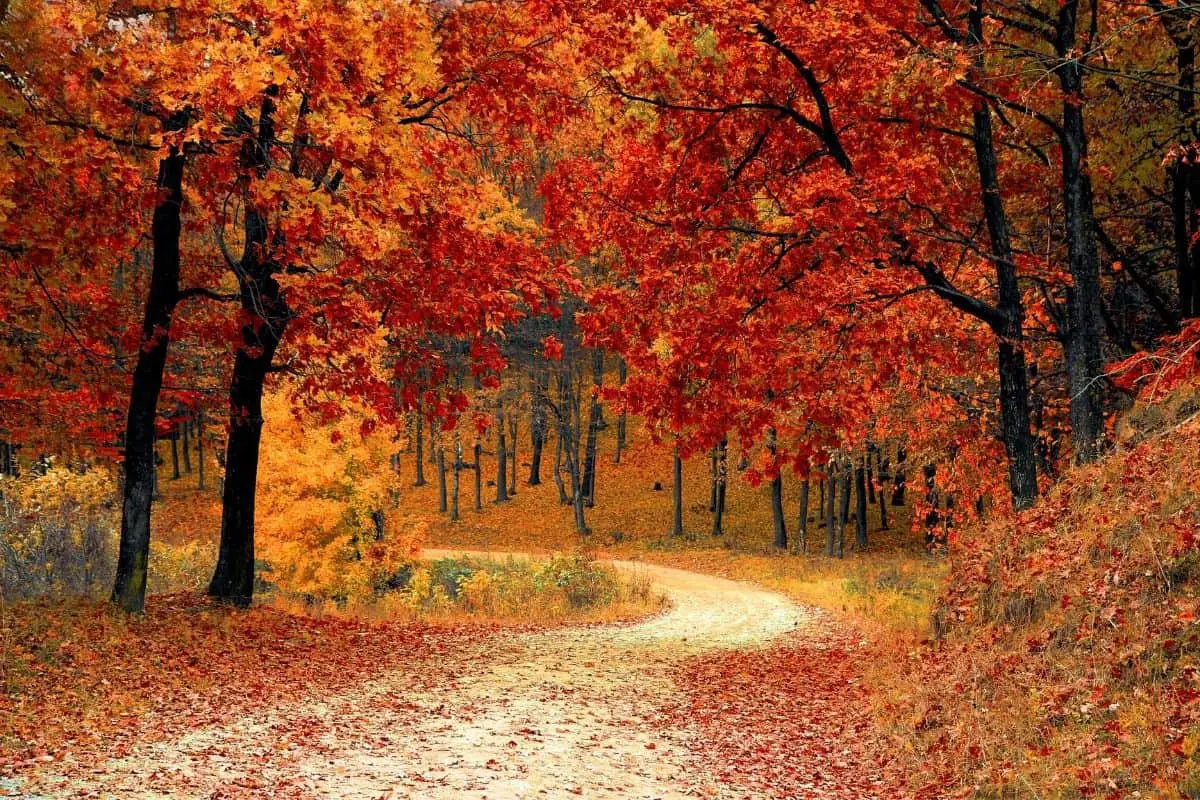
There are miles of public parks, national forests, and Virginia boondocking sites to choose from, if you want to spend some time outside. Virginia is one of the best places to visit if you want to be out in nature. The Blue Ridge Parkway was one of the top ten most visited National Parks in the United States last year.
Jump directly to the 14 Northern Virginia Boondocking Sites
Jump directly to the 12 South East Virginia Camping Areas
Jump directly to the 21 South West Virginia Boondocking Sites
Northern Virginia Boondocking Sites
They say Virginia is for lovers, and that surely applies to boondocking enthusiasts. While the state is recognized for densely populated urban centers such as Washington, D.C., and Richmond, the great majority of its land is undeveloped. Shenandoah National Park, one of the most popular in the national park system, is made for Virginia camping areas.
Few people realize, however, how many free, off-the-grid camping options exist in the Old Dominion State. Get off the beaten route, prepare for self-sufficiency, and save up some cash to camp in this stunning state.
While Virginia lacks the size of national forests or the number of national parks found in some western states, there is plenty of public land for boondockers to enjoy. In Virginia, there are numerous wildlife management areas, recreation areas, and wilderness areas where you can easily get a free camping site.
However, “free” does not imply “no paperwork.” Most of these places will ask you to fill out a permit application, but it will be free. As a safety measure, parks simply want to know how many groups are camping in the area each night. There’s also the question of how long you can stay; most of these regions only allow seven nights in a thirty-night period.
Want more ideas to round-out your trip to the North-Eastern States?
► Illinois, Indiana, Kentucky, Michigan, New York, Ohio, Pennsylvania, Virginia, West Virginia, Wisconsin ◄
- 16 Free Illinois Boondocking Spots With Maps
- 18 Free Indiana Boondocking Camp Sites Along With Maps
- 32 Free Kentucky Boondocking Camping Grounds Plus Maps
- 64 Free Michigan Boondocking Locations Including Maps
- 77 Amazing New York Boondocking Campsites And Maps
- 24 Free Ohio Boondocking Camping Areas Including Maps
- 47 Top Pennsylvania Boondocking Areas With Maps
- 47 Best Virginia Boondocking Sites Also Maps
- 19 Top West Virginia Boondocking Camp Sites And Maps
- 31 Favorite Wisconsin Boondocking Spots Plus Maps
14 Northern Virginia Boondocking Sites
Jump directly to the 12 South East Virginia Camping Areas
Jump directly to the 21 South West Virginia Boondocking Sites
check out our video
1. Pettigrew WMA
Address
Port Royal, Virginia
GPS: 38.210606, -77.275581
Elevation: 180′
Management
Public – Fish and Wildlife Service (Official)
Free Virginia boondocking sites in Pettigrew WMA is open Year Round. You may stay 14 Days at Pettigrew WMA. Nearly level, the 934-acre Pettigew Wildlife Management Area’s modest elevations range from 50 to 200 feet. Most of the area is forested. Oaks and beech dominate hardwood stands, and pine stands consist of both Virginia and Loblolly. Formerly part of Fort A.P. Hill, areas that were once open, when used by the military for training, have reverted to Virginia pine and lower growing vegetation.
2. Rapidan WMA
Address
Culpeper, Virginia
GPS: 38.42173, -78.406632
Elevation: 1562′
Management
Public – Fish and Wildlife Service (Official)
Virginia camping areas in Rapidan WMA is open Year Round. You may stay 14 Days at Rapidan WMA. The area consists of 10,326 acres broken into eight separate tracts distributed along the east slope of the Blue Ridge Mountains in Madison and Greene Counties. Four of these tracts adjoin Shenandoah National Park and share nearly 25 miles of boundary. Elevation ranges from 1,400 to 3,840 feet.
3. C.F. Phelps WMA
Address
Sumerduck, Virginia
GPS: 38.465637, -77.750008
Elevation: 347′
Management Public – Fish and Wildlife Service (Official)
C.F. Phelps WMA is open Year Round. There are 16-29 Virginia boondocking sites at this location. You may stay 14 Days at C.F. Phelps WMA. Most of the management area’s 4,539 acres are in southern Fauquier County with the balance being in Culpeper County. Over 1,000 of these acres are open.
4. Weston WMA
Address
Casanova, Virginia
GPS: 38.664269, -77.698135
Elevation: 356′
Management Public – Fish and Wildlife Service (Official)
Weston WMA is open Year Round. You may stay 14 Days in Virginia boondocking sites at Weston WMA. Located near Casanova, close to the heart of Fauquier County’s horse country, the 271 acre Weston has a variety of habitat features. Mature hardwood forests predominate and are found on upland terraces and along the meandering Turkey Run.
5. Narrow Gate Farm
Address
Amissville, Virginia
GPS: 38.6715, -77.9956
Elevation: 512′
Management Private – Privately Owned Farm (Official)
Virginia boondocking sites on Our working farm is located in the middle of many local wineries, Washington D.C. is 60 miles east of us, there are many Caverns within 40 miles of us and Skyline Drive is about 30 miles away. Many Civil War battlefield attractions are nearby. Monticello and Montpelier are both within an hours drive.
6. Dispersed on Crisman Hollow
Address
Luray, Virginia
GPS: 38.69034, -78.58193
Elevation: 2005′
Management Public – Forest Service (Official)
The road in is Gravel. There are 6-15 Virginia camping areas at this location. Multiple primitive sites along a nice creek. most are walk ups with large boulders and signs blocking drive up but have fire rings and plenty of tent space. Spread out with lots of privacy. We didn’t stay here but passed by while exploring the Forest.
7. Flagpole Knob
Address
Forest Road 85A
Dayton, Virginia
GPS: 38.510211, -79.183711
Elevation: 4377′
Management Public – Forest Service
Free Virginia boondocking sites in the George Washington and Jefferson National Forest’s North River Ranger District. First come -> First Camped. Reservations not accepted. Access is via a 4×4 recommended road. Just got back from Flag Pole Knob. The road is very narrow. only one car wide, and if meeting others it can be challenging, 4 Wheel is useful ( a must in wet weather) and high ground clearance is a must. I have a good size popup camper (box is 11 feet), was tight in a couple places.
8. Dry Run
Address
Hinton, Virginia
GPS: 38.564991, -79.08806
Elevation: 1978′
Management Public – Forest Service (Official)
The road in is Paved. There are 1-5 Virginia camping areas at this location. You may stay 14 days at Dry Run. good campsite along teh dry river, about a 5 minute walk from the side of route 33 in George Washington national forest. perfect for large groups or by yourself. parking along road.
9. Slate Lick Fields
Address
Fulks Run, Virginia
GPS: 38.605652, -78.957977
Elevation: 1445′
Management Public – Forest Service (USDA) (Unofficial)
Virginia boondocking sites located within the North River Ranger District of Virginia’s George Washington National Forest. GPS and map location are approximate.This is a popular area for horse campers.
10. South Fork Shenandoah River
Address
Luray, Virginia
GPS: 38.770537, -78.391351
Elevation: 705′
Management Public – Forest Service (Official)
The road in is Gravel and 7 miles from a paved road. South Fork Shenandoah River is open Year Round. There are 1-5 Virginia camping areas at this location. You may stay 14 at South Fork Shenandoah River. This location is in Luray, Virginia. There is 5-6 campsites with a bathroom (2 non-flush toilets). These campsites are located at mile marker number 13 on the river.
11. Wolf Gap
Address
Columbia Furnace, Virginia
GPS: 38.924095, -78.68866
Elevation: 2236′
Management Public – Forest Service (USDA) (Official)
Wolf Gap is open Year Round. There are 6-15 Virginia boondocking sites at this location. You may stay 14 Days at Wolf Gap. Enjoy a wooded retreat on the Virginia and West Virginia state lines. Once the site of Civilian Conservation Corps Camp, Wolf Gap F-3, this campground provides 9 Virginia boondocking sites complete with tent pad, picnic table and fire ring.
12. Columbia Furnace Boondock
Address
Woodstock, Virginia
GPS: 38.91471, -78.62722
Elevation: 1552′
Management Public – Forest Service (Unofficial)
Virginia camping areas in a large gravel lot owned by the state forest service as part of George Washington National Forest. Likely fits 5+ large RVs. Plenty of space and less than 5 miles to town. Very friendly forest rangers and completely legal. Lots of smaller campsites along the main forest road. Plenty of space for everone.
13. Little Fort
Address
Woodstock, Virginia
GPS: 38.867289, -78.444355
Elevation: 1375′
Management Public – Forest Service (USDA) (Official)
Little Fort is open Year Round. There are 6-15 Virginia boondocking sites at this location. You may stay 14 Days at Little Fort. Little Fort is a minimally developed recreation area near the meadow that was once a rest stop for a stagecoach line. There are 9 campsites and vault toilets. No water is available, please bring your own.
14. Thompson WMA
Address
Linden, Virginia
GPS: 38.980198, -78.004852
Elevation: 1900′
Management Public – Fish and Wildlife Service (Official)
Thompson WMA is open Year Round. You may stay 14 Days in Virginia camping areas at Thompson WMA. The lower portion of the area is accessible from I-66 at Markham by taking 688 north, or from U. S. Route 17, near Paris, on 688 south. The upper portion is reached from state route 55 at Linden, north on Route 638 and a fire trail to the Davenport Tract. A PASS or PERMIT is required at this campsite.
12 South East Virginia Camping Areas
Jump directly to the 14 Northern Virginia Boondocking Sites
Jump directly to the 21 South West Virginia Boondocking Sites
1. James River WMA
Address
Wingina, Virginia
GPS: 37.668743, -78.723198
Elevation: 400′
Management Public – Fish and Wildlife Service (Official)
The road in is Dirt and 1 miles from a paved road. James River WMA is open Year Round. There are 1-5 Virginia boondocking sites at this location. You may stay 14 Days at James River WMA. The area’s 1,213 acres vary from hilly in the upper woodland to level bottomland along the James River. Elevation ranges from 350 to 500 feet. The area fronts on the James River for a length of slightly over one mile. Approximately 200 acres of the area are open, a lingering result of past use for pasture and cropland. A PASS or PERMIT is required at this campsite.
2. Hardware River WMA
Address
Scottsville, Virginia
GPS: 37.76746, -78.432747
Elevation: 416′
Management Public – Fish and Wildlife Service (Official)
Hardware River WMA is open Year Round. You may stay 14 Days in Virginia camping areas at Hardware River WMA. The Hardware Wildlife Management Area is located south of State Route 6, east of Scottsville. From Scottsville turn right onto 611 to access the western portion of the area. From 611, one parking area is to the left on Kidds Mill Road; another is at the end of route 611.
3. Horsepen Lake WMA
Address
Buckingham, Virginia
GPS: 37.499039, -78.575279
Elevation: 628′
Management Public – Fish and Wildlife Service (Official)
Horsepen Lake WMA is open Year Round. You may stay 14 Days in Virginia boondocking sites at Horsepen Lake WMA. The area consists of 2,910 acres of rolling hills with numerous small streams and beaver ponds. It is situated on the southeastern part of the Slate River drainage at an elevation of about 500 feet. A PASS or PERMIT is required at this campsite.
4. Featherfin WMA
Address
Farmville, Virginia
GPS: 37.358631, -78.561493
Elevation: 504′
Management Public – Fish and Wildlife Service (Unofficial)
Featherfin WMA is open Year Round. There are 6-15 Virginia camping areas at this location. You may stay 14 Days at Featherfin WMA. Many hardwoods stands were selectively harvested over the past 30 or 40 years, but mature hardwoods exist throughout much of the area. Most of the pine forests are composed of various aged loblolly pine stands planted on old farm fields as they were taken out of agricultural production. Diverse wetland habitats border the Appomattox River, including approximately 125 acres of low ground fields in the central part of the area. A PASS or PERMIT is required at this campsite.
5. Powhaten WMA
Address
Richmond, Virginia
GPS: 37.566353, -77.986252
Elevation: 306′
Management Public – Fish and Wildlife Service (Official)
Powhaten WMA is open Year Round. You may stay 14 Days in Virginia boondocking sites at Powhaten WMA. The area’s acreage is contiguous although divided by Route 60 and has one privately owned interior property. Water on the area includes, four “farm” ponds and the twin Powhatan Lakes along with numerous beaver ponds and marshes along Sallee Creek. A small waterfowl impoundment exists just east of the crossing of Salmon Creek and the CCC trail. Elevations on the area range from 200 to 350 feet.A PASS or PERMIT is required at this campsite.
6. Amelia WMA
Address
Genito, Virginia
GPS: 37.457043, -77.916039
Elevation: 321′
Management Public – Fish and Wildlife Service (Unofficial)
Amelia WMA is open Year Round. You may stay 14 Days in Virginia camping areas at Amelia WMA. Amelia Wildlife Management Area is primarily upland habitat with approximately 175 acres of bottomland hardwoods and beaver swamps along the Appomattox River. A PASS or PERMIT is required at this campsite.
7. Chickahominy WMA
Address
Unnamed Road
Charles City, Virginia
GPS: 37.300923, -76.899026
Elevation: 23′
Management Public – Fish and Wildlife Service
You may stay 14 Days in Virginia boondocking sites at Chickahominy WMA. A PASS or PERMIT is required at this campsite.
8. Hog Island WMA
The price is $4/day or $23/year
Address
1017-1367 Landing Drive
Surry, Virginia
GPS: 37.139717, -76.676469
Elevation: 16′
Management Public – Fish and Wildlife Service
Virginia camping areas on the Carlisle Tract ONLY. Horseback riding is also allowed. A PASS or PERMIT is required at this campsite.
9. Dismal Swamp Tract of Cavalier WMA
Address
Deep Creek, Virginia
GPS: 36.661743, -76.353966
Elevation: 68′
Management Public – Fish and Wildlife Service (Official)
Dismal Swamp Tract of Cavalier WMA is open Year Round. There are 1-5 Virginia boondocking sites at this location. You may stay 14 Days at Dismal Swamp Tract of Cavalier WMA. A PASS or PERMIT is required at this campsite.
10. Cavalier WMA
Address
Deep Creek, Virginia
GPS: 36.581402, -76.339287
Elevation: 13′
Management Public – Fish and Wildlife Service (Official)
Cavalier WMA is open Nov 30 – Sep 30. There are 1-5 Virginia camping areas at this location. You may stay 14 Days at Cavalier WMA. A PASS or PERMIT is required at this campsite.
11. Big Woods WMA
Address
Unnamed Road
Wakefield, Virginia
GPS: 36.941935, -77.057322
Elevation: 95′
Management Public – Fish and Wildlife
Virginia boondocking sites location is at low elevation. A PASS or PERMIT is required at this campsite.
12. Dick Cross WMA
Address
Boydton, Virginia
GPS: 36.612534, -78.294441
Elevation: 302′
Management
Public – Fish and Wildlife Service (Official)
Dick Cross WMA is open Year Round. You may stay 14 Days in Virginia camping areas at Dick Cross WMA. A PASS or PERMIT is required at this campsite.
Southwest Virginia Boondocking Sites
In Virginia, there are many great sites to go boondocking. If you drive from the west to the east coast of Virginia, you will pass through many beautiful regions to discover.
You’ll start in the valley before heading into the stunning Blue Ridge Mountains, where you’ll want to visit Roanoke and Salem. After that, you’ll return to Piedmont, where you can see historic towns like Culpepper.
The tidewater coastal plains with historic communities like Jamestown and Williamsburg, as well as excellent beach towns like Cape Charles and Chincoteague, run along the coast. In Virginia, there are wonderful locations to camp for free in each region.
The Rapidan Wildlife Management Area in Madison and Greene Counties has a lot to offer. This region borders Shenandoah National Park in four separate places, so you can easily enjoy Virginia boondocking while touring both. It’s an excellent place to go deer, gray squirrel, and ruffed grouse shooting during the season. The Rapidan and Conway Rivers are great spots for trout fishing. There are many kilometers of hiking routes to explore, particularly near the rivers.
Lambert’s Meadow in Daleville is an excellent boondocking spot in Virginia. A six-person shelter is available. This Appalachian Trail station provides good hiking options. Sit on the flat-top rocks beside the creek and have a picnic. Lambert’s Meadow is an excellent spot for wildlife viewing, with the possibility of seeing bear and deer.
21 South-West Virginia Boondocking Sites
Jump directly to the 14 Northern Virginia Boondocking Sites
Jump directly to the 12 South East Virginia Camping Areas
1. Hidden Valley WMA
Address
Lebanon, Virginia
GPS: 36.850441, -82.078835
Elevation: 3683′
Management Public – Fish and Wildlife Service (Official)
Hidden Valley WMA is open Year Round. You may stay 14 Days in Virginia boondocking sites at Hidden Valley WMA. Access to the area is from U.S. Route 19, between Abingdon and Lebanon, on State Route 690. Consult map for greater detail. A PASS or PERMIT is required at this campsite.
2. Crabtree Falls VA
Address
Roseland, Virginia
GPS: 37.84758, -79.12203
Elevation: 2589′
Management Public – Forest Service (Official)Crabtree Falls VA
Virginia camping areas on Route 826 also known as meadows lane, right off route 56 near Montebello VA ( fire road to upper falls parking lot ) Large sign says 4 wheel drive / high ground clearance vehicles recommended beyond this point. Fire road is not too bad and I drove a Ford Taurus station wagon to the upper parking lot and saw plenty of sedans.
3. George Washington State Park
Address
Amherst, Virginia
GPS: 37.74615, -79.13641
Elevation: 1860′
Management Public – Forest Service (Official)
The road in is 4×4 and 1.5 miles from a paved road. George Washington State Park is open Year round. There are 1-5 Virginia boondocking sites at this location. Campsite just outside the George Washington state forest. Off road capable vehicle recomended.
4. Hog Camp Gap
Address
Vesuvius, Virginia
GPS: 37.760449, -79.195725
Elevation: 3504′
Management Public – Forest Service (Unofficial)
Virginia camping areas Right off the AT, a large clearing where many people camp in the National Forest. Used by a lot of thru-hikers, but it’s accessible by car via a bumpy dirt road. I’ve driven there many times in passenger vehicles (i.e. Prius) and it’s fine, but take it slow.
5. Oronoco Campground
Address
Near the corner of 605, and Jordan Road
Vesuvius, Virginia
GPS: 37.746931, -79.263976
Elevation: 1699′
Management Public – Forest Service (Official)
The road in is Paved. There are 6-15 Virginia boondocking sites at this location. Just off of the Blue Ridge Parkway off of Route 60. There are two pit toilets in the campground but no other facilities. National Forest Campground.
6. Steel Bridge Campground
Address
Paint Bank, Virginia
GPS: 37.598677, -80.229336
Elevation: 1939′
Management Public – Forest Service (Official)
Free, fishing stream, must reserve ahead online with forest service or call. Deserted. no services. Virginia camping areas with Outhouse, picnic tables, pole for hanging food.
7. The Pines
Address
New Castle, Virginia
GPS: 37.605, -80.075829
Elevation: 1909′
Management Public – Forest Service (USDA) (Official)
The Pines is open 5/1 – 12/7. There are 16-29 Virginia boondocking sites at this location. You may stay 14 Days at The Pines. Located in the Barbours Creek Wilderness Area at the base of Potts Mountain, the Pines is a campsite with 17 family camping sites and 4 camping units with space for horse trailers to pull in. Horse corral and unloading ramps. Water available.
8. Andy Layne / Tinker’s Cliffs Trailhead Parking Lot
Address
Troutville, Virginia
GPS: 37.457492, -80.017327
Elevation: 1490′
Management Public – Forest Service (Unofficial)
The road in is Gravel. There are 6-15 Virginia camping areas at this location and the maximum RV length is 25 feet. You may stay 2-3 nights at Andy Layne / Tinker’s Cliffs Trailhead Parking Lot.
9. Havens WMA
Address
Roanoke, Virginia
GPS: 37.353905, -80.120003
Elevation: 1481′
Management Public – Fish and Wildlife Service (Official)
Havens WMA is open Year Round. You may stay 14 Days in Virginia boondocking sites at Havens WMA. Located in the Appalachian Highlands, this area has grown to 7,190 acres. Havens occupies a part of Fort Lewis Mountain, about five miles west of the Roanoke-Salem area. A PASS or PERMIT is required at this campsite.
10. Smith Mt Cooperative WMA
Address
Silver Dollar Lane
Huddleston, Virginia
GPS: 37.059704, -79.516459
Elevation: 1289′
Management Public – Fish and Wildlife Service
Virginia camping areas at Smith Mountain Lake area is approximately 5,000 acre public hunting and fishing area located on one of the region’s most beautiful and most prominent geologic features at the southeast end of AEP Smith Mountain Lake in Bedford and Pittsylvania counties near Roanoke, Virginia. The mountain area is covered with trees with lake access for fishing. A PASS or PERMIT is required at this campsite.
11. Turkeycock WMA
Address
Snow Creek, Virginia
GPS: 36.809357, -79.74305
Elevation: 1146′
Management Public – Fish and Wildlife Service (Official)
Turkeycock WMA is open Year Round. You may stay 14 Days in Virginia boondocking sites at Turkeycock WMA. Elongated Turkeycock Mountain Wildlife Management Area lies along the ridge of Turkeycock Mountain northwest of Martinsville. Here, the mountain’s ridge also forms the boundary between Franklin and Henry Counties, and the management area’s 2,679 acres extend into both counties. A PASS or PERMIT is required at this campsite.
12. White Oak Mountain WMA
Address
Chatham, Virginia
GPS: 36.781899, -79.326088
Elevation: 727′
Management Public – Fish and Wildlife Service (Official)
White Oak Mountain WMA is open Year Round. You may stay 14 Days in Virginia camping areas at White Oak Mountain WMA. The area’s 2,748 acres are about two-thirds forested. Timber types are mixed hardwoods and pines including lob-lolly, and Virginia pine. A PASS or PERMIT is required at this campsite.
13. Fairystone Farms WMA
Address
Bassett, Virginia
GPS: 36.763165, -80.110306
Elevation: 1369′
Management Public – Fish and Wildlife Service (Official)
Fairystone Farms WMA is open Year Round. There are 6-15 Virginia boondocking sites at this location. You may stay 14 Days at Fairystone Farms WMA. A PASS or PERMIT is required at this campsite.
14. Walnut Flats
Address
Holly Brook, Virginia
GPS: 37.199093, -80.886757
Elevation: 2504′
Management Public – Forest Service (USDA) (Official)
Walnut Flats is open 5/1 – 12/7. There are 1-5 Virginia camping areas at this location. You may stay 14 Days at Walnut Flats. Camping area features six units with grills and lantern posts, well water and toilets. Numerous hiking trails, including the Appalachian Trail are easily accessible. A large expanse of the Jefferson National Forest for hunting, fishing and hiking.
15. Appalachian Trail Parking
Address
State Route 606 Bland, VA
Bland, Virginia
GPS: 37.170151, -80.901867
Elevation: 2057′
Management Public – Forest Service
The road in is Gravel. Appalachian Trail Parking is open Year Round. There are 1-5 Virginia boondocking sites at this location and the maximum RV length is 15 feet. Small Lot off 606 within a mile north of 42. Room for 3 or 4 cars. Free tent campsites on on either side of the bridge. This was an awesome site. I stayed here for 3 days while exploring the Appalachian trail. Parked here with no problems. 40 ft from the river and the trail.
16. Stewarts Creek WMA
Address
Lambsburg, Virginia
GPS: 36.59927, -80.78331
Elevation: 1827′
Management Public – Fish and Wildlife Service (Official)
Stewarts Creek WMA is open Year Round. You may stay 14 Days in Virginia camping areas at Stewarts Creek WMA. A PASS or PERMIT is required at this campsite.
17. Crooked Creek WMA
Address
Woodlawn, Virginia
GPS: 36.67572, -80.813866
Elevation: 2410′
Management
Public – Fish and Wildlife Service (Official)
Crooked Creek WMA is open Year Round. There are 1-5 Virginia boondocking sites at this location. You may stay 14 Days at Crooked Creek WMA. The area is located four miles east of Galax and four miles south of U.S. 58 from the village of Woodlawn. Access Route 620 south from Route 58 at Woodlawn. Distant travelers coming from the north or south can conveniently use Interstate Route 77 and exit at Hillsville onto Route 58 west. Consult the map for detail. A PASS or PERMIT is required at this campsite.
18. Big Survey WMA
Address
Wytheville, Virginia
GPS: 36.900631, -81.037193
Elevation: 2915′
Management Public – Fish and Wildlife Service (Official)
Big Survey WMA is open Year Round. There are 1-5 Virginia camping areas at this location. You may stay 14 Days at Big Survey WMA. The area lies immediately south of Wytheville. State Route 640 bisects the property. A PASS or PERMIT is required at this campsite.
19. Big Bend
Address
Bland, Virginia
GPS: 37.02454, -81.176098
Elevation: 3935′
Management Public – Forest Service (Unofficial)
The road in is Dirt and 0 miles from a paved road. There are 1-5 Virginia boondocking sites at this location. You may stay 3 days? at Big Bend. An old run down picnic area with great views. The road on Walker Mountain is rough, rocky, and seems to maintained only for the cell phone towers that are just down the road from the campsite.
20. Scales Trailhead
Address
Appalachian Trail
Mouth of Wilson, Virginia
GPS: 36.670356, -81.486889
Elevation: 4633′
Management Public – Forest Service
Virginia camping areas at Scales Trailhead is open Apr-Dec. Amazing but not easy!! You need some clearance on your car (we were definitely worried about popping a tire on our Forester, but we made it). Not sure I’d recommend taking a larger van or trailer up here. A PASS or PERMIT is required at this campsite.
21. Clinch Mountain WMA
Address
Saltville, Virginia
GPS: 36.904839, -81.773171
Elevation: 2073′
Management – Public – Fish and Wildlife Service (Official)
Clinch Mountain WMA is open Year Round. You may stay 14 Days in Virginia boondocking sites at Clinch Mountain WMA. The closest town is Saltville, reached from I-81 and Chilhowie via state route 107. In Saltville, turn left onto route 91 (1/4 mile); then right onto route 634; bear left onto 613 and proceed 3 1/2 miles; then right onto route 747 to the area. Consult map for greater detail.
Virginia Camping Areas
Virginia is a popular destination for outdoor enthusiasts, thanks to the Appalachian Trail and the Blue Ridge Mountains. There are both public and private campgrounds, several of which are RV accessible (state parks, national forests, national parks).
Picnic tables, fire rings, and neighboring bathhouses are frequently included in the fee charged by developed campgrounds. Water, power, and sewer hookups may be available at these established campgrounds.
The majority of undeveloped camping areas lack amenities. They make up for what they lack in amenities with discounts. Consider dispersed camping a means to improve your survival skills while also reconnecting with nature.
On certain public lands, primitive walk-in tent camping is an option. Dispersed camping, on the other hand, must be done away from any developed recreational areas or campgrounds.
When dispersed camping, remember to select a level or worn place that appears to have been camped on before to be a good steward of the land. Camping in a designated area will help to maintain the landscape and ecosystem. Camping is limited to a maximum of 14 days in every 28-day period to help safeguard the natural regions.
You May Want to Join Our Boondocking Group on Facebook For More Information
You May Want to Join Our Campfire Recipes Group on Facebook For More Information
Check Out Our Pictures On Instagram – Our Big Escape.