

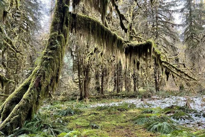
If you’re looking for great Washington boondocking spaces, there are plenty of options in the Olympic National Forest, around Olympic National Park.
Jump directly to the 83 Free NE Washington Boondocking Spots
Jump directly to the 78 Amazing NW Washington Boondocking Campsites
Jump directly to the 24 Favorite Washington Boondocking ONP Campgrounds
Jump directly to the 63 Best SE Washington Boondocking Sites
Jump directly to the 60 Top SW Washington Boondocking Spaces
NE Washington Boondocking Spots Including Maps
Along Puget Sound’s convoluted canals, which extend from north of Seattle to Olympia, you can find unique sites to camp. The San Juan Islands in Washington offer excellent boondocking opportunities. There are some fantastic free camping spots in Washington, particularly in the Olympic National Forest and around Olympic National Park.
Southwest Washington, near Vancouver and the Columbia River Gorge National Scenic Area, has several hidden beauties for boondocking. Snowy places near Mount Rainier National Park are frequently available for free camping into the early summer. With so many fantastic options for boondocking in Washington, picking a favorite might be difficult, so you’ll want to go often.
Want more ideas to round-out your trip to the North-Western States?
► Idaho, Montana, Oregon, Washington, Wyoming ◄
- 66 Free Central Idaho Boondocking – RV Parking & Camping Spots
- 78 Free Northern Idaho Boondocking – Camping & RV Parking
- 60 Free SE Idaho Boondocking – RV Parking & Camping Sites
- 40 Free SW Idaho Boondocking – RV Parking & Camping
- 198 Amazing Montana Boondocking Sites Including Maps
- 54 Free NE Oregon Boondocking Locations With Maps – North East Section
- 104 Free Boondocking Spots in NW Oregon With Maps – North West Section
- 308 Awesome Washington Boondocking Spaces With Maps
- 38 Free Boondocking Locations in Wyoming With Maps – North East Section
- 49 Free Wyoming Boondocking Campsites With Maps – North West Section
- 44 Free Boondocking Campsites In Wyoming With Maps – South East Section
- 66 Free Boondocking Spots in Wyoming With Maps – South West Section

83 Free NE Washington Boondocking Spots
Jump directly to the 78 Amazing NW Washington Boondocking Campsites
Jump directly to the 24 Favorite Washington Boondocking ONP Campgrounds
Jump directly to the 63 Best SE Washington Boondocking Sites
Jump directly to the 60 Top SW Washington Boondocking Spaces
check out our video
1. Populars
Address
Steamboat Rock Park Entrance Road
Electric City, Washington
GPS: 47.82949, -119.133995
Elevation: 1585′
Management Public – State Park
Populars is open all year. Washington boondocking spaces. First come -> first served. No reservations accepted. Not a campsite. Day use and boat launch only. However Steamboat State Park is just down the road.
2. Colockum Road
Address
Colockum Road
Ellensburg, Washington
GPS: 47.199172, -120.277638
Elevation: 5384′
Management Public – State Park
Washington boondocking locations. This campsite does not use a reservation system. First come, first served.
3. Mad River Sno-Park
Address
North F S 5700
Entiat, Washington
GPS: 47.748768, -120.393536
Elevation: 1437′
Management Public – State Park
Free Washington campsites. This campsite does not use a reservation system. First come, first served.
4. Douglas Creek
Address
Palisades, Washington
GPS: 47.509525, -119.949487
Elevation: 1755′
Management Public – Bureau of Land Management (Official)
The road in is Gravel and 8 miles from a paved road. Douglas Creek is open 03/01 – 11/30. There are 30 or more Washington boondocking spaces at this location and the maximum RV length is unlimited. You may stay 14 days at Douglas Creek. BLM Douglas Creek canyon for its hunting, fishing, hiking, and dispersed camping experiences, as well as swimming in the deep pools and waterfalls at its south end.
5. Douglas Creek
Address
Slack Canyon Road Southwest
Palisades, Washington
GPS: 47.484563, -119.898207
Elevation: 1486′
Management Public – Bureau of Land Management
Douglas Creek is open Mar-Nov. Washington boondocking locations located within the Bureau of Land Management Wenatchee District.
6. Foal Ct Rimrock Meadows Lot 21 Blk 20 #2
Address
Palisades, Washington
GPS: 47.458798, -119.739325
Elevation: 1581′
Management Private – Privately Owned Campground (Official)
The road in is Dirt and 2.1 miles from a paved road. Foal Ct Rimrock Meadows Lot 21 Blk 20 #2 is open year-round. There are 1-5 Free Washington campsites at this location and the maximum RV length is 45 feet. You may stay 2 nights at Foal Ct Rimrock
7. Jameson Lake
Address
441-651 South Jameson Lake Road
Waterville, Washington
GPS: 47.674766, -119.62802
Elevation: 1814′
Management Public – State Park
Free Washington campsites. First come -> First Camped. Reservations not accepted. There are several Washington boondocking spaces in this area. It is located in the heart of Moses Coulee. This is range land. Cattle are all around. I’m the evening you’ll hear coyotes and possibly see mule deer.
8. Million Dollar
Address
Coulee City, Washington
GPS: 47.75557, -119.224434
Elevation: 1576′
Management
Public – Fish and Wildlife Service (Official)
You may stay 21 nights in 30 in Washington boondocking locations at Million Dollar. Banks Lake is a man-made impoundment in a 27 mile portion of a natural coulee. Most of the 91 miles of shoreline are ringed with basalt clifs and talus slopes. There are about 23 islands in the reservoir.
9. Banks Lake, WA Dry Camping
Address
Coulee City, Washington
GPS: 47.723694, -119.25475
Elevation: 1585′
Management Public – Banks Lake Wildlife Recreation Area (Official)
The road in is Gravel and .5 miles from a paved road. Banks Lake, WA Dry Camping is open All. There are 1-5 Free Washington campsites at this location and the maximum RV length is 15 feet. You may stay Unlimited at Banks Lake, WA Dry Camping.
10. Million Dollar South
Address
Coulee Boulevard
Coulee City, Washington
GPS: 47.719427, -119.257919
Elevation: 1598′
Management Public – State Park
Washington boondocking spaces. First come -> first served. No reservations accepted.
11. Ankeny #1
Address
Coulee City, Washington
GPS: 47.628555, -119.328575
Elevation: 1581′
Management Public – Fish and Wildlife Service (Official)
The road in is Gravel and 0.25 miles from a paved road. The maximum RV length at Ankeny #1 is Any. You may stay 21 in 30 nights in Washington boondocking locations at Ankeny #1. Banks Lake is a man-made impoundment in a 27 mile portion of a natural coulee. Most of the 91 miles of shoreline are ringed with basalt clifs and talus slopes. There are about 23 islands in the reservoir.
12. Lena Lake
Address
Coulee City, Washington
GPS: 47.618668, -119.32193
Elevation: 1539′
Management Public – Fish and Wildlife Service (Official)
The road in is Dirt and 0.75 miles from a paved road. You may stay 21 in 30 nights in Free Washington campsites at Lena Lake. Banks Lake is a man-made impoundment in a 27 mile portion of a natural coulee. Most of the 91 miles of shoreline are ringed with basalt clifs and talus slopes. There are about 23 islands in the reservoir.
13. Blue Lake
Address
Hwy 17
Coulee City, Washington
GPS: 47.580231, -119.448853
Elevation: 2431′
Management Public – State Forest (Unofficial)
The road in is Paved. There are 1-5 Washington boondocking spaces at this location. Take Hwy. 17 out of Soap Lake, WA about six miles to Blue Lake. Just past the first resort are 3 or 4 turnouts right on the lake. No power, or facilities, but a great place to spend a night or two. The hwy. is a little noisy, but not enough to keep me away.
It’s just a short drive to Grand Coulee Dam, and If you fish, Blue Lake has great trout.
14. Blue Lake
Address
31970 Moore Road Northeast
Coulee City, Washington
GPS: 47.552543, -119.455457
Elevation: 1102′
Management Public – State Park
Blue Lake is open May-Sep. Washington boondocking locations. First come -> First Camped. Reservations not accepted.
15. Gloyd – Rd 7
Address
10467-10999 Road 7 Northeast
Moses Lake, Washington
GPS: 47.189453, -119.265661
Elevation: 1083′
Management Public – State Park
Free Washington campsites. First come -> First Camped. Reservations not accepted. Gravel parking area 1/2 mile from highway but still on moderately busy road. Good cell service.
16. Gloyd – Rd 10
Address
9370-9998 Road 10 Northeast
Moses Lake, Washington
GPS: 47.231238, -119.286407
Elevation: 1109′
Management Public – State Park
Gloyd – Rd 10 is open all year. Washington boondocking spaces. First come -> first served. No reservations accepted. Gravel parking area right on fairly busy highway. Good cell service. Not free, permit required.
17. Gloyd – Rd 12
Address
9001-9799 Road 12 Northeast
Moses Lake, Washington
GPS: 47.265085, -119.306879
Elevation: 1148′
Management Public – State Park
Gloyd – Rd 12 is open all year. Washington boondocking locations. Reservations are not accepted at this campsite. Private but dusty, nice place to overnight
18. Gloyd – Rd 14
Address
3131 West Wapato Drive
Moses Lake, Washington
GPS: 47.295666, -119.315774
Elevation: 1214′
Management Public – State Park
Gloyd – Rd 14 is open all year. Free Washington campsites. First come -> first camped. No reservations are accepted. Gravel parking area 1 mile from highway on gravel road. Parking area is right opposite someone’s house. Good cell service. Not free, permit required
19. Fish Trap RA – Cow Canyon
Address
Unnamed Road
Sprague, Washington
GPS: 47.375863, -117.812603
Elevation: 2165′
Management Public – Bureau of Land Management
The road in is Gravel. Fish Trap RA – Cow Canyon is open all year. There are 1-5 Washington boondocking spaces at this location and the maximum RV length is 20 feet. You may stay 14 days at Fish Trap RA – Cow Canyon.
20. Folsom Farm Site
Address
Sprague, Washington
GPS: 47.367937, -117.830412
Elevation: 2195′
Management Public (Unofficial)
Down a 0.5 mile side road, near a large barn with a bit of history. Washington boondocking locations has a picnic table, toilet and a few trees. Can be a bit windswept but you can retreat to the relative shelter of the nearby Fishlake Resort if it gets too bad.
21. Fishtrap Recreation Area
Address
Sprague, Washington
GPS: 47.333889, -117.863271
Elevation: 2103′
Management Public – Bureau of Land Management (Official)
There are 1-5 Free Washington campsites at this location. You may stay 14 days at Fishtrap Recreation Area. The Fishtrap Recreation Area covers over 7,000 acres of public land which is managed by the Bureau of Land Management. There are various habitat types from forest, shrub, grassland, wetlands and lakes. These areas are home to a wide variety of wildlife along with beautiful landscapes and even an old farmstead.
22. Sprague Rest Area
Address
Sprague, Washington
GPS: 47.293023, -118.033081
Elevation: 2034′
Management Public – Rest Area (Official)
The road in is Paved. Sprague Rest Area is open year round. There are 1-5 Washington boondocking spaces at this location and the maximum RV length is unlimited. You may stay one night at Sprague Rest Area. A safety rest area off of Interstate 90 (highway 395). Both east and west bound have rest areas. East bound has a free RV dump station
23. Odessa Tourist Park
Address
Odessa, Washington
GPS: 47.334229, -118.686897
Elevation: 1547′
Management Public – City Park (Official)
You may stay 3 nights free in Washington boondocking locations at Odessa Tourist Park. Whether you enjoy a nine-hole round of golf with your RV parked at the RV hookup site, swimming at the aquatic recreation center, resting under the shade trees at our beautiful Reiman Park while the barbeque is warming, camping at the Tourist Park, hiking or horseback riding on the local BLM Pacific Lake Trail, Odessa is the place to be.
24. Pacific Lake
Address
10498 Lakeview Ranch Loop North
Odessa, Washington
GPS: 47.415118, -118.732877
Elevation: 1608′
Management Public – Bureau of Land Management
You’ll find quiet picnic and Free Washington campsites a short distance east of the Lakeview Ranch buildings and within view of the now dry Pacific and Walter Lakes. Corrals at the ranch, used sometimes to hold wild horse adoptions, are usually available for trail horses overnight.
25. Coffeepot Lake
Address
Harrington, Washington
GPS: 47.499567, -118.557197
Elevation: 1831′
Management Public – Bureau of Land Management (Official)
The road in is Paved. There are 6-15 Washington boondocking spaces at this location and the maximum RV length is 35 feet. BLM 6 camp sites good fishing
26. Twin Lakes
Address
Unnamed Road
Davenport, Washington
GPS: 47.530364, -118.505796
Elevation: 1883′
Management Public – Bureau of Land Management
Twin Lakes is open all year. Washington boondocking locations located within the Bureau of Land Management Border District.
27. Davenport Lions Club Park
Address
Davenport, Washington
GPS: 47.653232, -118.149117
Elevation: 2372′
Management Public – City of Davenport and Lions Club sponsored park (Unofficial)
Free Washington campsites at nice city park with trees and on-street parking along curb on Park St, between Harker (5th) and 6th. Come in off 6th to park at curb. One block from main street businesses and restaurants.
28. Davenport Sports Complex
Address
Davenport, Washington
GPS: 47.662016, -118.145898
Elevation: 2425′
Management Public – city park (Official)
Washington boondocking spaces in parking lot for baseball complex. Large paved and unpaved parking area. There are bathrooms that may or may not be open 24hrs. On the edge of town, a little close to the highway but gets very quiet at night. City website notes this to be ok as a rv parking area. Alternative is at the fairgrounds on other side of town.
29. Echo Valley Sno-Park
Address
National Forest Development Road 8010
Chelan, Washington
GPS: 47.934049, -120.035557
Elevation: 3409′
Management Public – Forest Service
Echo Valley Sno-Park is open all year. Washington boondocking locations in the Okanogan-Wenatchee National Forest’s Chelan Ranger District during the summer. A permit is required during the winter. First come -> first camped. No reservations are accepted.
30. Antilon Lake Sno-Park
Address
1510-1798 Grade Creek Road
Manson, Washington
GPS: 47.957902, -120.148952
Elevation: 2251′
Management Public – State Park
Free Washington campsites. First come -> First Camped. Reservations not accepted.
31. Antilon Lake
Address
Manson, Washington
GPS: 47.978403, -120.163608
Elevation: 2393′
Management Public – Forest Service (Official)
The road in is Dirt and 2 miles from a paved road. There are 6-15 Washington boondocking spaces at this location. Forest service campground. Primitive camps with outhouses (no water)
32. Black Canyon Sno-Park
Address
50-56 Black Canyon Road
Pateros, Washington
GPS: 48.067184, -120.021554
Elevation: 1329′
Management Public – State Park
Washington boondocking locations. First come -> First Camped. Reservations not accepted. Quiet except for sounds of the stream. No shade. Toilet. Slightly sloped. Weak cell signal for texting or voice. It’s ok. Plenty of space for parking and turning.
33. South Fork Gold Creek Sno-Park
Address
215C South Fork Gold Creek Road
Pateros, Washington
GPS: 48.156586, -120.150084
Elevation: 2123′
Management Public – State Park
Free Washington campsites. First come -> First Camped. Reservations not accepted.
34. Andrews Creek TH
Address
National Forest Development Road 5160
Winthrop, Washington
GPS: 48.756312, -120.138843
Elevation: 2700′
Management Public – Forest Service
Washington boondocking spaces in the Okanogan-Wenatchee National Forest’s Methow Valley Ranger District. This campsite does not use a reservation system. First come, first served.
35. Bobcat
Address
National Forest Development Road 51
Winthrop, Washington
GPS: 48.61139, -120.166427
Elevation: 2146′
Management Public – State Park
Washington boondocking locations. First come -> first served. No reservations accepted.
36. Eightmile Sno-Park
Address
National Forest Development Road 51
Winthrop, Washington
GPS: 48.599844, -120.167121
Elevation: 2119′
Management Public – State Park
Free Washington campsites. First come -> first camped. No reservations are accepted.
37. Boulder Creek
Address
National Forest Development Road 51
Winthrop, Washington
GPS: 48.579004, -120.174484
Elevation: 2080′
Management Public – State Park
Washington boondocking spaces. First come -> first camped. No reservations are accepted.
38. Ramsey Creek
Address
National Forest Development Road 200
Winthrop, Washington
GPS: 48.542294, -120.145215
Elevation: 2959′
Management Public – State Park
Washington boondocking locations. First come -> first served. No reservations accepted.
39. O’Sullivan Pond
Address
National Forest Development Road 100
Winthrop, Washington
GPS: 48.518855, -120.146451
Elevation: 2828′
Management Public – State Park
Free Washington campsites. First come -> first served. No reservations accepted.
40. Couger Lake
Address
Unnamed Road
Winthrop, Washington
GPS: 48.476547, -120.095992
Elevation: 3232′
Management Public – State Park
Washington boondocking spaces. First come -> first served. No reservations accepted.
41. Campbell Lake
Address
Campbell Lake Road
Winthrop, Washington
GPS: 48.44036, -120.066485
Elevation: 2818′
Management Public – State Park
Washington boondocking locations. First come -> first served. No reservations accepted.
42. Upper Cold Springs TH
Address
Unnamed Road
Loomis, Washington
GPS: 48.936115, -119.796902
Elevation: 6335′
Management Public – State Park
Free Washington campsites. First come -> first served. No reservations accepted.
43. Cutchie #2
Address
320 Chopaka Road
Loomis, Washington
GPS: 48.957145, -119.714821
Elevation: 1201′
Management Public – State Park
Washington boondocking spaces. This campsite does not use a reservation system. First come, first served.
44. Chopaka Lake
Address
Unnamed Road
Loomis, Washington
GPS: 48.916966, -119.702024
Elevation: 2930′
Management Public – Bureau of Land Management
Chopaka Lake is open all year. Washington boondocking locations located within the Bureau of Land Management Wenatchee District.
45. Cutchie #3
Address
2281 Loomis-Oroville Road
Loomis, Washington
GPS: 48.947438, -119.652252
Elevation: 1165′
Management Public – State Park
Free Washington campsites. First come -> First Camped. Reservations not accepted.
46. Sidley Lake
Address
800-940 County Highway 4777
Oroville, Washington
GPS: 48.991898, -119.221874
Elevation: 3694′
Management Public – State Park
Sidley Lake is open all year. Washington boondocking spaces. Reservations are not accepted at this campsite.
47. Oroville
Address
200 Blue Lake Road
Oroville, Washington
GPS: 48.901313, -119.498528
Elevation: 1834′
Management Public – State Park
Oroville is open May-Oct. Washington boondocking locations. No reservations. First come, first served.
48. Conners Lake
Address
Conners Lake Access Road
Loomis, Washington
GPS: 48.750816, -119.662317
Elevation: 1512′
Management Public – State Park
Conners Lake is open May-Oct. Free Washington campsites. Reservations are not accepted at this campsite.
49. Forde Lake
Address
Sinlahekin Road
Tonasket, Washington
GPS: 48.736962, -119.670011
Elevation: 1568′
Management Public – State Park
Forde Lake is open May-Oct. Washington boondocking spaces. First come -> First Camped. Reservations not accepted.
50. Salmon Meadows
Address
Conconully, Washington
GPS: 48.657351, -119.839331
Elevation: 4469′
Management Public – Forest Service (Official)
The road in is Gravel and .5 miles from a paved road. Salmon Meadows is open May through October. There are 30 or more Washington boondocking spaces at this location and the maximum RV length is unlimited. Large grassy area with some trees at the end of the paved road NF 38. 10 miles north of Conconully. The area is free now but the USFS is doing some development so that may change. 2 pit toilets
51. Blue Lake North
Address
Sinlahekin Road
Tonasket, Washington
GPS: 48.682928, -119.688036
Elevation: 1696′
Management Public – State Park
Blue Lake North is open May-Sep. Free Washington campsites. First come -> First Camped. Reservations not accepted.
52. Blue Lake South
Address
Sinlahekin Road
Tonasket, Washington
GPS: 48.671366, -119.689286
Elevation: 1736′
Management Public – State Park
Blue Lake South is open May-Sep. Washington boondocking spaces. First come -> first camped. No reservations are accepted.
53. Peacock Meadows Sno-Park
Address
297 West Fork Road
Okanogan, Washington
GPS: 48.52932, -119.788912
Elevation: 2592′
Management Public – State Park
Peacock Meadows Sno-Park is open all year. Washington boondocking locations. No reservations. First come, first served.
54. Fish Lake #6
Address
Sinlahekin Road
Okanogan, Washington
GPS: 48.612587, -119.705954
Elevation: 1831′
Management Public – State Park
Fish Lake #6 is open May-Oct. Free Washington campsites. First come -> First Camped. Reservations not accepted.
55. Limebelt
Address
627 Limebelt Road
Tonasket, Washington
GPS: 48.568394, -119.612047
Elevation: 2592′
Management Public – State Park
Limebelt is open all year. Washington boondocking spaces. Reservations are not accepted at this campsite.
56. Green Lake
Address
410G Green Lake Road
Okanogan, Washington
GPS: 48.451259, -119.6271
Elevation: 1568′
Management Public – State Park
Washington boondocking locations. First come -> first camped. No reservations are accepted.
57. Crawfish Lake Campground
Address
NF 30-100 Tonasket, WA 98855
Riverside, Washington
GPS: 48.4838, -119.2146
Elevation: 4505′
Management Public – Forest Service (Official)
The road in is Gravel and 5 miles from a paved road. There are 16-29 Free Washington campsites at this location. You may stay 14 days at Crawfish Lake Campground.
58. Round Lake
Address
528-530 Aeneas Valley Road
Tonasket, Washington
GPS: 48.607761, -119.127998
Elevation: 2625′
Management Public – State Park
Round Lake is open May-Oct. Washington boondocking spaces. No reservations. First come, first served.
59. Ell Lake
Address
3 Ell Lake Road
Tonasket, Washington
GPS: 48.601682, -119.117919
Elevation: 2618′
Management Public – State Park
Ell Lake is open May-Oct. Washington boondocking locations. First come -> First Camped. Reservations not accepted. Empty in early September. Parked by the boat launch since I had the whole place to myself. Vault toilets. Very peaceful, no bugs. Fish appeared to be active in the evening.
60. Bonaparte TH
Address
Unnamed Road
Tonasket, Washington
GPS: 48.826273, -119.123638
Elevation: 4482′
Management Public – Forest Service
Free Washington campsites in the Okanogan-Wenatchee National Forest’s Tonasket Ranger District. Reservations are not accepted at this campsite.
61. Lyman Lake
Address
Tonasket, Washington
GPS: 48.523102, -119.019997
Elevation: 2911′
Management Public – Forest Service (USDA) (Official)
There are 1-5 Washington boondocking spaces at this location. You may stay 14 days at Lyman Lake. This campground is located next to Lyman Lake, and has 4 single camps.
62. Empire Lake Sno-Park
Address
North Fork Trout Creek Road
Republic, Washington
GPS: 48.770328, -118.74108
Elevation: 3100′
Management Public – State Park
Empire Lake Sno-Park is open all year. Washington boondocking locations. First come -> first camped. No reservations are accepted. Could not get to the site because the road got too narrow for our 18 foot trailer.
63. Scatter Creek Sno-Park
Address
National Forest Development Road 53
Republic, Washington
GPS: 48.54926, -118.749175
Elevation: 2224′
Management Public – Forest Service
Scatter Creek Sno-Park is open all year. Free Washington campsites. First come -> first served. No reservations accepted.
64. Hall Creek Sno-Park
Address
National Forest Development Road 2050
Republic, Washington
GPS: 48.575198, -118.586574
Elevation: 3622′
Management Public – State Park
Hall Creek Sno-Park is open all year. Washington boondocking spaces. First come -> First Camped. Reservations not accepted.
65. Jungle Hill Horse Camp
Address
National Forest Development Road 2040
Republic, Washington
GPS: 48.633279, -118.545319
Elevation: 4177′
Management Public – Forest Service
Washington boondocking spaces located within the Colville National Forest’s Republic Ranger District. Spacious, wooded campsites. Two trailheads within half a mile that connect to over 20 miles of trails. Quiet. Easy half mile of graded dirt road to access. Near the Cascades National Park. Shaded and cool with a creek running by close enough to hear. Moss on the trees and dense growth near the creek.
66. Jungle Hill Camp, Colville NF
Address
Kettle Falls, Washington
GPS: 48.63484, -118.45181
Elevation: 4419′
Management Public – Forest Service (Official)
This is a NF site close to Sherman Pass, just a mile or so off the pavement. It it primarily used by hunter in the fall so watch out for horse poop. There is no potable water, but Free Washington campsites have fire pits and tables, with a vault toilet. As far as I know there is no self-pay. It is very convenient for all the trails up on the Kettle Crest.
67. Albian Hill Sno-Park
Address
National Forest Development Road 2030
Kettle Falls, Washington
GPS: 48.632772, -118.445087
Elevation: 4295′
Management Public – State Park
Washington boondocking spaces. First come -> First Camped. Reservations not accepted. 1.5 km gravel road good for any unit. No problem turning any unit around. Camp in sun, open areas or in shaded forest sites, 3 great hikes just up hwy.
68. Davis Lake Campground
Address
County Road 2695
Colville, Washington
GPS: 48.739166, -118.227776
Elevation: 4531′
Management Public – Forest Service (USDA) (Official)
Davis Lake Campground is open Spring – Fall. Free Campground with four Washington boondocking locations suitable for car camping, very small RVs and tent camping. Operated by Colville National Forest of Washington State. Nice, secluded campsites. No reservations. No drinking water or garbage services. Pack it in, pack it out! Shore or non-motorized boat fishing. There is a one mile trail around lake.
69. Trout Lake Campground
Address
FS Road 020
Colville, Washington
GPS: 48.62389, -118.239845
Elevation: 3087′
Management Public – Forest Service (USDA) (Official)
The maximum RV length at Trout Lake Campground is very small. Free camping in the Colville National Forest of Washington State. Four small Free Washington campsites. First come first serve. No amenities. Pack it in pack it out. Bring all of the water that you will need with you.
70. Kettle Falls Rotary Park
Address
Kettle Falls, Washington
GPS: 48.609896, -118.062293
Elevation: 1631′
Management Public – City Park (Unofficial)
The road in is Paved. There are 1-5 Washington boondocking spaces at this location and the maximum RV length is 40′. You may stay 1 night at Kettle Falls Rotary Park. This is a lovely late evening pull-in for an RV (not tent) and park right by the park behind the Info centre. Wi-fi available at info centre if open.
71. Kings Lake Sno-Park
Address
4384 Kl Road
Usk, Washington
GPS: 48.386595, -117.206016
Elevation: 3120′
Management Public – Forest Service
Washington boondocking locations located within the Colville National Forest’s Newport Ranger District.
72. Little Twin Lakes Campground
Address
Hwy 20 East
Colville, Washington
GPS: 48.574505, -117.645561
Elevation: 3731′
Management Public – Forest Service (USDA) (Official)
There are 16-29 Free Washington campsites at this location. Free camping in the Colville National Forest. Little Twin Lakes Campground is located in district 1. This campground is equipped with tent/trailer sites, fishing dock and boat launch.
73. Mill Creek Sno-Park
Address
Radar Dome Drive Trail
Colville, Washington
GPS: 48.611217, -117.551707
Elevation: 3189′
Management Public – State Park
Washington boondocking spaces. First come -> First Camped. Reservations not accepted.
74. Big Meadow Lake Campground
Address
Ione, Washington
GPS: 48.729, -117.561997
Elevation: 3423′
Management Public – Forest Service (USDA) (Official)
There are 16-29 Washington boondocking locations at this location. Located in district 1 and can be accessed by County road 2695. This campground is equipped with tent/trailer sites, interpretive trails, boat launch, and a nice fishing dock.
75. Box Canyon Dam Campground
Address
Washinton SR 31
Ione, Washington
GPS: 48.781448, -117.418839
Elevation: 2012′
Management Public – County Park (Official)
Washington boondocking spaces located at the Box Canyon Dam. AKA Campbell Park? The campground is owned by the people of Pend Oreille County and operated by Pend Oreille Public Utility District.
76. Paupac Sno-Park
Address
National Forest Development Road 1935
Cusick, Washington
GPS: 48.76536, -117.296467
Elevation: 2769′
Management Public – State Park
Washington boondocking spaces. No reservations. First come, first served.
77. Tillicum Creek Dispersed camping
Address
Metaline Falls, Washington
GPS: 48.72735, -117.073347
Management Public – Forest Service (Official)
Dispersed camping site, room for about 5 Washington boondocking locations on the south side of a USFS road just off of NF-302, more sites potentially further down the road. No facilities. Quiet. Currently fire restrictions, no fires.
78. Stagger Inn
Address
National Forest Development Road 302
Metaline Falls, Washington
GPS: 48.766644, -117.060793
Elevation: 3304′
Management Public – Forest Service
Free Washington campsites located within the Idaho Panhandle National Forests’s Priest Lake Ranger District. 8/15/2017: This site is currently closed to camping, it may be used for day use only per the USFS.
79. Sullivan Creek #3
Address
National Forest Development Road 22
Metaline Falls, Washington
GPS: 48.83601, -117.221601
Elevation: 2854′
Management Public – Forest Service
Washington boondocking spaces in the Colville National Forest’s Sullivan Lake Ranger District. Reservations are not accepted at this campsite.
80. Sullivan Creek #2
Address
National Forest Development Road 22
Metaline Falls, Washington
GPS: 48.832623, -117.248531
Elevation: 2746′
Management Public – Forest Service
Washington boondocking locations in the Colville National Forest’s Sullivan Lake Ranger District. First come -> first camped. No reservations are accepted.
81. Silver Creek Campground
Address
Forest Road 075
Colville, Washington
GPS: 48.930071, -117.484798
Elevation: 4955′
Management Public – Forest Service (USDA) (Unofficial)
Free Washington campsites operated by Colville National Forest. Trailhead for Abercrombie Mountain Trail. This campground is very much unconfirmed. Proceed with caution. Please report on your findings.
82. Boundary Dam
Address
Pend Oreille, Washington
GPS: 48.987045, -117.349434
Elevation: 1995′
Management Public – City Park (Official)
There are 6-15 Washington boondocking spaces at this location.
83. Salmo Basin
Address
Unnamed Road
Metaline Falls, Washington
GPS: 48.9555, -117.080815
Elevation: 5935′
Management Public – Forest Service
Washington boondocking locations in the Colville National Forest’s Sullivan Lake Ranger District. No reservations. First come, first served.
NW Washington Boondocking Campsites
The Pacific Northwest, in particular Washington State, is known around the world for its natural beauty and quantity of outdoor leisure possibilities. People can be found hiking, canoeing, fishing, climbing, and camping throughout the state all year. With so much to see and do, it’s no surprise that boondocking, also known as dispersed camping, is a popular method to travel around Washington.
Boondocking in Washington is a fantastic way to explore the area, with over 22 million acres of forest land (more than half the state!) and over 8,000 lakes. It allows you to go wherever you can drive your car and saves the worry, not to mention the cost, of looking for campsites on developed grounds. Many campers like this choice since it saves them money on campsite fees. A free camping vacation in Washington state is a great opportunity to get to know the area.
78 Amazing NW Washington Boondocking Campsites
Jump directly to the 83 Free NE Washington Boondocking Spots
Jump directly to the 24 Favorite Washington Boondocking ONP Campgrounds
Jump directly to the 63 Best SE Washington Boondocking Sites
Jump directly to the 60 Top SW Washington Boondocking Spaces
1. Forest Route 73
Address
Enumclaw, Washington
GPS: 47.008844, -121.617311
Elevation: 2905′
Management: Public- Forest Service
Mt. Baker-Snoqualmie National Forest. There are plenty of Washington boondocking spaces all along route 73. We took a spot right by a nice creek. The biggest issue with the area was the trash. It was probably one of the most disgusting forests we’ve seen in terms of trash.
2. Pyramid Creek Sno-Park
Address
National Forest Development Road 110
Enumclaw, Washington
GPS: 47.113467, -121.457646
Elevation: 2700′
Management: Public- State Park
Washington boondocking locations. No reservations. First come, first served.
3. Lost Meadow
Address
National Forest Development Road 19
Naches, Washington
GPS: 47.063022, -121.218978
Elevation: 3064′
Management: Public- Forest Service
Free Dispersed camping in the Okanogan-Wenatchee National Forest’s Naches Ranger District. Free Washington campsites do not use a reservation system. First come, first served.
4. Quartz Mt
Address
National Forest Development Road 3100
Cle Elum, Washington
GPS: 47.076652, -121.079621
Elevation: 6099′
Management: Public- Forest Service
The maximum RV length at Quartz Mt is 22 feet. Washington boondocking spaces located within the Okanogan-Wenatchee National Forest’s Cle Elum Ranger District.
5. Little Naches
Address
FS19 (Little Naches Rd.)
Naches, Washington
GPS: 46.996178, -121.109421
Elevation: 2628′
Management: Public- Forest Service (USDA) (Official)
The road in is Paved. Little Naches is open Year round depending on snow. The maximum RV length at Little Naches is None. Located along FS19 (Little Naches Rd.) west of Naches. This area has two FS campgrounds for fee parking however, Washington boondocking locations abound all along FS19 and up the side roads in the area. During summer this is a favorite area for Jeeps, ATVs and motorcycels however usually during mid week there is very little traffic and the area is quite peacefull.
6. Boulder Cave Sno-Park
Address
3208-3302 National Forest Development Road 1704
Naches, Washington
GPS: 46.951965, -121.079766
Elevation: 2457′
Management: Public- State Park
Free Washington campsites. This campsite does not use a reservation system. First come, first served.
7. Milk Pond Campground
Address
Naches, Washington
GPS: 46.9872, -121.063
Elevation: 2979′
Management: Public- Forest Service (Official)
There are 1-5 Washington boondocking spaces at this location. Open, can’t park right next to campground but right close…
8. Manastash Sno-Park
Address
20432 Manastash Road
Ellensburg, Washington
GPS: 46.978526, -120.81994
Elevation: 2959′
Management: Public- State Park
Washington boondocking locations. First come -> first camped. No reservations are accepted. We’ve stayed many times in the area there is free dispersed camping throughout there is also depending on how far up you go a couple pay spots that have a minute he’s we always camp near the river with no amenities and have Camp there in RVs trailers and Tents and loved it every time it is a bit far out of town and we lose cell phone signal but it’s well worth it
9. Riders Camp
Address
Okanogan-Wenatchee National Forest, Washington
GPS: 47.0291, -120.936
Elevation: 4179′
Management: Public- USDA Forest Service
Free Washington campsites has an improved dispersed camp area for groups. Seasonal stock water available at the creek. Directions:25 miles west of Ellensburg on Forest Service Road 3100.
10. Tamarack Spring
Address
Quartz Mountain Road
Thorp, Washington
GPS: 47.063643, -120.897845
Elevation: 4656′
Management: Public- State Park
Tamarack Spring is open Apr-Oct. Washington boondocking spaces. Reservations are not accepted at this campsite.
11. Homestead Valley Road Pulloff
Address
North Bend, Washington
GPS: 47.43813, -121.66117
Elevation: 1214′
Management: Public- Forest Service (Unofficial)
The road in is Paved. There are 16-29 Washington boondocking locations at this location and the maximum RV length is unlimited. You may stay overnight at Homestead Valley Road Pulloff. Very large (size of two lanes) paved shoulder of Homestead Valley Rd. This is the first van parking I could find inside Mt. Baker Snoqualmie National Forest after driving east from Seattle. There were many vans and trucks parked here before me, there is a no tent and no fire sign but there is nothing to dissuade parking or overnight parking.
12. Tinkham Road NF-55
Address
North Bend, Washington
GPS: 47.39363, -121.543567
Elevation: 1621′
Management
The road in is Gravel. There are 30 or more Free Washington campsites at this location. Wooded campsites all along Tinkham road aka NF-55 between exits 42-47. There’s an actual campground closer to exit 42 then further up, but it’s not free. Nearby hiking, picnic area, crystal hunting, rock climbing. Popular on weekends.
13. Keechelus Boat Launch
Address
Snoqualmie Pass, Washington
GPS: 47.376818, -121.389496
Elevation: 2500′
Management Public
Keechelus Boat Launch is open year round. Next to the boat launch. Very nice, free Washington boondocking spaces.
14. Price Creek Westbound Sno-Park
Address
1650 Stampede Pass Road
Easton, Washington
GPS: 47.304937, -121.318767
Elevation: 2431′
Management: Public- State Park
Washington boondocking locations. Reservations are not accepted at this campsite. This was closed due to the wildlife crossing that is under construction. Call First.
15. Martin
Address
Easton, Washington
GPS: 47.2802, -121.31538
Elevation: 2671′
Management: Public- Forest Service (Official)
The road in is Gravel and 1.5 – 2.0 miles from a paved road. Martin is open All year round. There are 1-5 Free Washington campsites at this location and the maximum RV length is 25 feet. You may stay 7 days at Martin. Free camping to anyone, first come first serve, multiple camping spots beneath some well shaded tree canopy, 5-10 min off of I-90 via Stampede Pass road and along NF-420 road just below Martin which is about 10 miles west of Easton.
16. Evergreen Sno-Park
Address
All Seasons Drive
Cle Elum, Washington
GPS: 47.153205, -121.025774
Elevation: 2480′
Management: Public- State Park
Washington boondocking spaces in the Evergreen Sno-Park is approximately six miles southwest of Cle Elum. It is at a 2,200 foot elevation and gives snowmobilers access to more than 100 miles of groomed trails on the Taneum-Manastash trail system. The park replaces the old Woods and Steele staging area and can accommodate up to 25 vehicles with trailers.
17. Paved Clearing inside the National Forest
Address
Deming, Washington
GPS: 48.90429, -121.86181
Elevation: 1293′
Management: Public- National Park Service (Official)
Washington boondocking locations right next to the river and there is a tent site on the river in the same location. It is not a level pad so you would need to park closer toward the road to level out. The marked location is approximate; It is about 100 feet on the right past Mile Marker 38. All that said, this has got to be the most mouse infested area I have ever stayed. I imagine it is partially due to it being so close to a water source.
18. Rest stop and Dump Station free
Address
Cle Elum, Washington
GPS: 47.161362, -120.845046
Elevation: 2129′
Management: Public- Freeway rest stop (Official)
The road in is Paved. The maximum RV length at Free Washington campsites is unlimited. Rest stop and dump station free.
19. Colockum Road
Address
Colockum Road
Ellensburg, Washington
GPS: 47.199172, -120.277638
Elevation: 5384′
Management: Public- State Park
This is a free dispersed campsite. Washington boondocking spaces do not use a reservation system. First come, first served.
20. Coleman Canyon
Address
Coleman Creek Road
Ellensburg, Washington
GPS: 47.104569, -120.398814
Elevation: 2654′
Management: Public- State Park
Washington boondocking locations. First come -> first camped. No reservations are accepted. This is a very nice primitive site. People come by with 4 wheelers or pick up trucks on the higher road, but nobody was camping here but me. It’s slow going on the gravel road to get here, but worth it. There was a sign you’re supposed to have a county or state pass, but no one bothered me. The only sounds are the birds and the creek.
21. Schnebly Canyon
Address
Schnebly Road
Ellensburg, Washington
GPS: 47.093833, -120.4352
Elevation: 2297′
Management: Public- State Park
Free Washington campsites. First come -> first served. No reservations accepted. Large dispersed camping area, on a hill with a sweeping view of Ellensburg. I spent a quiet night here in winter, but based on the number of targets, and the numerous piles of dead elk carcasses and skeletons littering the land, it might be uncomfortable place to be at times. Large power lines run through the camping area.
22. Blewett Pass
Address
Cle Elum, Washington
GPS: 47.33648, -120.57875
Elevation: 4147′
Management: Public- Bureau of Land Management (Unofficial)
Washington boondocking spaces with easy access about 400 ft off hwy, good for a night. RV’s and trailers are good here and easy turn around.
23. Lion Rock Spring
Address
Unnamed Road
Cle Elum, Washington
GPS: 47.251418, -120.58166
Elevation: 6207′
Management: Public- Forest Service
Lion Rock Spring is open May-Sep. The maximum RV length at Lion Rock Spring is 22 feet. Washington boondocking locations within the Okanogan-Wenatchee National Forest’s Cle Elum Ranger District.
24. Liberty
Address
Liberty, Washington
GPS: 47.246506, -120.683441
Elevation: 2532′
Management: Public- County Park (Unofficial)
The road in is Gravel. Free Washington campsites at Liberty is open Year Round. The maximum RV length at Liberty is None. Located just ouside the old mining town of Liberty this is a small turnout good for a short term stay and is a popular camping spot.
25. Reecer Creek Road FS 3500
Address
Ellensburg, Washington
GPS: 47.191264, -120.585517
Management
Beautiful spot overlooking Reecer Creek gorge and central Washington farmland. Washington boondocking spaces throughout further up the road. Good road condition but not a lot of turnarounds.
26. Reecer Creek Sno-Park
Address
18683-19199 Reecer Creek Road
Ellensburg, Washington
GPS: 47.15874, -120.61334
Elevation: 2762′
Management: Public- State Park
Washington boondocking locations. This campsite does not use a reservation system. First come, first served. Main camp on bald located up a one lane paved rd. Dirt trail to the right takes you up to a nice clearing with amazing views of the valley bellow and windmills. Really a great spot!
27. Twentynine Pines
Address
Teanaway Road, Cle Elum, WA 98922
Wenatchee, Washington
GPS: 47.328811, -120.854172
Elevation: 2600′
Management: Public- DNR (Official)
The road in is Paved. There are 30 or more Free Washington campsites at this location and the maximum RV length is unlimited. You may stay 7 days at Twentynine Pines. A minimally-managed campground in the Teanaway Community Forest, which is now owned by the WA Department of Natural Resources.
28.Indian Camp – Teanaway
Address
National Forest Development Road 113
Cle Elum, Washington
GPS: 47.290372, -120.955179
Elevation: 2592′
Management: Public- State Park
Washington boondocking spaces. This campsite does not use a reservation system. First come, first served.
29. Salmon la sac
Address
Ronald, Washington
GPS: 47.41159, -121.09283
Elevation: 2497′
Management: Public- Forest Service (Unofficial)
Washington boondocking locations at Salmon la sac.
30. Box Canyon Creek Site
Address
Snoqualmie Pass, Washington
GPS: 47.38972, -121.26682
Elevation: 2618′
Management: Public- Forest Service (Official)
The road in is Gravel. Great site for car camping very secluded with no other campsites nearby. Free Washington campsites along the Forest Road that lead to this specific site but most of them were already taken when we arrived around 3pm on a Saturday. I’m glad they were taken because it forced us to drive deeper into the woods and find this gem. large fire ring and room for multiple cars and tents. Absolutely no cell service. Small creek nearby that you can hear rushing as you fall asleep at night.
31. Joel’s Kachess Lake Logging Road Campsite
Address
Snoqualmie Pass, Washington
GPS: 47.359405, -121.252006
Elevation: 2477′
Management: Public- Forest Service
The road in is Gravel and .25 miles from a paved road. Joel’s Kachess Lake Logging road campsite is open I believe year round. There are 1-5 Washington boondocking spaces at this location. You may stay Not Sure (I’v stayed 3 nights) at Joel’s Kachess Lake Logging road, it is a large flat site with a fire pit. I’ve camped here many times to avoid the $20+ fee 1/4 mile away. Then just pay $4/day if you have a boat for the launch. Never been bothered here.
32. Leavenworth Lot P6
Address
Leavenworth, Washington
GPS: 47.591248, -120.670959
Elevation: 1184′
Management: Public(Unofficial)
The road in is Gravel. The maximum RV length at Leavenworth Lot P6 is unlimited. This is a gravel parking lot in the town of Leavenworth. The new signage prohibits overnight RV parking. I noticed several others parked here. Noisy with Highway 2 so have ear plugs. Washington boondocking locations with a porta potty.
33. North Snoqualmie Fork
Address
47.661734, -121.584074 – Mt Baker/Snoqualmie National Forest
North Bend, Washington
GPS: 47.661485, -121.587002
Elevation: 1557′
Management: Public- Forest Service (Official)
The road in is Gravel and 18 miles from a paved road. North Snoqualmie Fork is open Year round. There are 1-5 Free Washington campsites at this location and the maximum RV length is unlimited. Taking North Fork Road SE up from North Bend/Snoqualmie quickly becomes a long gravel road traveling through private forest land. The area is busy on summer weekends and the spaces fill up fast, so aim for arriving before 1pm.
34. South Fork Gold Creek Sno-Park
Address
215C South Fork Gold Creek Road
Pateros, Washington
GPS: 48.156586, -120.150084
Elevation: 2123′
Management: Public- State Park
Washington boondocking spaces. First come -> First Camped. Reservations not accepted.
35. Antilon Lake
Address
Manson, Washington
GPS: 47.978403, -120.163608
Elevation: 2393′
Management: Public- Forest Service (Official)
The road in is Dirt and 2 miles from a paved road. There are 6-15 Washington boondocking locations at this location. Forest service campground. Primitive camps with outhouses (no water)
36. Antilon Lake Sno-Park
Address
1510-1798 Grade Creek Road
Manson, Washington
GPS: 47.957902, -120.148952
Elevation: 2251′
Management: Public- State Park
Free Washington campsites. First come -> First Camped. Reservations not accepted. Gate locked on our last visit here.
37. Mad River Sno-Park
Address
North F S 5700
Entiat, Washington
GPS: 47.748768, -120.393536
Elevation: 1437′
Management: Public- State Park
Washington boondocking spaces. First come -> First Camped. Reservations not accepted.
38. Entiat River Sno-Park
Address
18140-18196 National Forest Development Road 51
Entiat, Washington
GPS: 47.909806, -120.485603
Elevation: 1795′
Management: Public- State Park
Washington boondocking locations. No reservations. First come, first served.
39. Deer Camp
Address
Leavenworth, Washington
GPS: 47.807813, -120.594066
Elevation: 3064′
Management: Public- Forest Service
Free Washington campsites nestled in the woods. Outhouse, 2 sites with fire rings and 7.5km of dirt Road to reach here.
40. Lake Wenatchee Airstrip Sno-Park
Address
County Highway 22
Leavenworth, Washington
GPS: 47.817793, -120.725366
Elevation: 1946′
Management: Public- State Park
Lake Wenatchee Airstrip Sno-Park is open all year. Washington boondocking spaces. Reservations are not accepted at this campsite. Enjoyed this place, careful of fires, there is a state park right up the road, there is access to trails good solar and you can get satellite easy in and out good verizon
41. Okanogan Wenatchee NF 6306
Address
Leavenworth, Washington
GPS: 47.87058, -120.697417
Management: Public- Forest Service (Unofficial)
The road in is Gravel and 1 miles from a paved road. There are 1-5 Washington boondocking locations at this location. Quiet dry camping spot in the Okanogan-Wenatchee National Forest. Very secluded and flat. Site is about 1/4 mile up NF 6306 on the left hand sided. We were able to fit our 27ft Airstream without problem. Great gravel riding if you dig that sort of thing.
42. Nason Creek
Address
Whitepine Creek Road
Leavenworth, Washington
GPS: 47.77506, -120.915346
Elevation: 2333′
Management: Public- Forest Service
Free Washington campsites in the Okanogan-Wenatchee National Forest’s Wenatchee River Ranger District. First come -> First Camped. Reservations not accepted. The road in is narrow, rutted and pot holed dirt about 3.5 miles. With very little gravel it can be slick when wet and you’ll want to avoid.
43. Napeequa Crossing Campground
Address
24907 County Highway 167 Leavenworth, WA 98826
Leavenworth, Washington
GPS: 47.919872, -120.894603
Elevation: 1952′
Management: Public- Forest Service (Official)
The road in is Paved. There are 1-5 Washington boondocking spaces at this location and the maximum RV length is 25 feet. Located right on the White River, 7 miles from Lake Wenatchee. There’s three or four decent RV sites, and room for more tent camping if you can park somewhere. 2 vault toilets, picnic tables, and fire rings. About half of the area is shaded by large douglas firs. The road in is paved, but the sites are either gravel or packed dirt.
44. Grasshopper Meadows Campground
Address
Leavenworth, Washington
GPS: 47.9405, -120.926
Elevation: 2022′
Management: Public- USDA Forest Service (Official)
The road in is Gravel and 1-2 miles from a paved road. There are 1-5 Washington boondocking locations at this location. Located along the White River, 10 miles from Lake Wenatchee, this campground offers river access.
45. Old Cascades Highway
Address
Skykomish, Washington
GPS: 47.718439, -121.208906
Elevation: 1709′
Management: Public- Forest Service (Unofficial)
There are 1-5 Free Washington campsites at this location. Nice spot by a creek with fire ring. About a mile west of Iron Goat trail. Parking for 1-2 cars.
46. North Snoqualmie Fork
Address
47.661734, -121.584074 – Mt Baker/Snoqualmie National Forest
North Bend, Washington
GPS: 47.661485, -121.587002
Elevation: 1557′
Management: Public- Forest Service (Official)
The road in is Gravel and 18 miles from a paved road. North Snoqualmie Fork is open Year round. There are 1-5 Washington boondocking spaces at this location and the maximum RV length is unlimited. After 18 miles and crossing three bridges (the last is bright red) you reach the upper parts of the North Fork and public land. There are two excellent sites on Lennox creek (a tributary of the North Fork) just before the fourth bridge. There are also areas along the road, but not as nice and often used for target shooting in the direction of the cliff east of the road.
47. Climbers
Address
Gold Bar, Washington
GPS: 47.816238, -121.565875
Elevation: 518′
Management: Public- Forest Service (Official)
Washington boondocking locations in State park area 14 day limit rock climbers normally stay here. Best are for free camping in this area for sure! Right off the river. Tent camping plenty of room for RVs and or trailers. Signal is good enough for texting but streaming movies/shows is not that great. My husband and I have stayed here several nights different time for rock climbing.
48. Hidden Campsites (Outskirts of Index)
Address
Index Galena Rd.
Gold Bar, Washington
GPS: 47.87019, -121.47979
Elevation: 1096′
Management: Public- Forest Service (Unofficial)
The road in is Paved. Hidden Campsites (Outskirts of Index) is open All year. There are 1-5 Free Washington campsites at this location. Couple campsites hidden along a back country road. About two and a half miles up this road on the left hand side is an almost hidden set of barrier cement blocks. Enough room for a truck or car to fit in front of blocks. Down the hill from that are a couple more campsites.
49. Virgin Lake Camp Area
Address
Blanca Lake trail 1052
Gold Bar, Washington
GPS: 47.928287, -121.338465
Elevation: 4573′
Management: Public- State Park
Virgin Lake Camp Area is open all year. Washington boondocking spaces. First come -> First Camped. Reservations not accepted. This is a Tent site. The trail is 3+ miles uphill with lots of switchbacks. Be in shape to climb, or start early and give yourself plenty of time to rest on the way up. Grass field to camp on, and a primitive vault toilet. Virgin lake is a pond, but follow the trail down to Blanca Lake, and you find a Gem of a lake. Glacial fed lake with a stunning green color. Stayed there overnight 9 years ago
50. Mt. Loop Hwy
Address
mt. loop hwy granite falls, wa 98253
Granite Falls, Washington
GPS: 48.069132, -121.643182
Elevation: 1319′
Management: Public- National Park Service (Official)
The road in is Paved. There are 6-15 Washington boondocking locations at this location and the maximum RV length is 25 feet. You may stay 14 days at Mt. Loop Hwy. Free camping all along the side of the mt loop hwy. Also pay camps available but no electricity hookups on the pay sites. All the sites are along the river.
51. Mountain Loop Highway, Near Verlot
Address
48.073105 -121.694183
Granite Falls, Washington
GPS: 48.073105, -121.694183
Elevation: 1230′
Management: Public- Forest Service (Official)
The road in is Paved. Mountain Loop Highway, near Verlot is open Year Round. There are 1-5 Free Washington campsites at this location. Located 4.9 miles (7.9kms) from Verlot, WA – the campsite is just past Bridge 576 over Schweitzer Creek. The campsite is on the left side of the road as you head east, in a narrow section between the road and the river – there is a small pull out with rocks between the road and the campsite.
52. Andrews Creek TH
Address
National Forest Development Road 5160
Winthrop, Washington
GPS: 48.756312, -120.138843
Elevation: 2700′
Management: Public- Forest Service
Washington boondocking spaces in the Okanogan-Wenatchee National Forest’s Methow Valley Ranger District. This campsite does not use a reservation system. First come, first served.
53. Goat Creek Sno-Park
Address
376 Goat Creek Road
Winthrop, Washington
GPS: 48.581914, -120.373816
Elevation: 2215′
Management: Public- State Park
Goat Creek Sno-Park is open all year. Washington boondocking locations. First come -> First Camped. Reservations not accepted. Large camping area during the summer – tons of space for everything from tents to large rigs! There is a main parking lot, but also some more “private” sites among the trees. Fires were prohibited when we were there (marked by a red “No Burning” flag in the unofficial fire rings left by previous campers), there are a few fire rings around for when campfires are OK.
54. Bobcat
Address
National Forest Development Road 51
Winthrop, Washington
GPS: 48.61139, -120.166427
Elevation: 2146′
Management: Public- State Park
Free Washington campsites. First come -> first served. No reservations accepted.
55. Eightmile Sno-Park
Address
National Forest Development Road 51
Winthrop, Washington
GPS: 48.599844, -120.167121
Elevation: 2119′
Management: Public- State Park
Washington boondocking spaces. First come -> first camped. No reservations are accepted.
56. Boulder Creek
Address
National Forest Development Road 51
Winthrop, Washington
GPS: 48.579004, -120.174484
Elevation: 2080′
Management: Public- State Park
Washington boondocking locations. First come -> first camped. No reservations are accepted.
57. Ramsey Creek
Address
National Forest Development Road 200
Winthrop, Washington
GPS: 48.533989, -120.136669
Elevation: 2959′
Management: Public- State Park
Free Washington campsites. First come -> first served. No reservations accepted. Also, there are no restroom facilities at this site. If you look on Google Maps using the satellite view, you can see this is a big open area next to the creek. It’s mostly level and has many rock campfire rings around the edges. It is obviously used as a hunting camp in the fall as there are carcass hanging beams and lots of deer bones littered about.
58. O’Sullivan Pond
Address
National Forest Development Road 100
Winthrop, Washington
GPS: 48.518855, -120.146451
Elevation: 2828′
Management: Public- State Park
Washington boondocking spaces. First come -> first served. No reservations accepted.
59. Upper Lake Pearrygin
Address
Winthrop, Washington
GPS: 48.493402, -120.12125
Elevation: 2654′
Management: Public- State (Unofficial)
The road in is Dirt and about 15 miles from a paved road. Upper Lake Pearrygin is open unknown. There are 16-29 Washington boondocking locations at this location. You may stay unknown at Upper Lake Pearrygin. We went looking for this camping area that we had previously heard about from friends. Take the dirt road past the signs for Lake Pearrygin camping. Once you get to the very top of the hill and see a house/building, go right, towards all of the trees and wooded area. You will go over a metal grate,
60. Couger Lake
Address
Unnamed Road
Winthrop, Washington
GPS: 48.476547, -120.095992
Elevation: 3232′
Management: Public- State Park
Free Washington campsites. First come -> first served. No reservations accepted. I don’t even know where to start, it’s kind of surreal and might be all in our head. First if all, my partner and I use this site constantly, so we’re used to the occasional odd and sketchy spot… But this spot was maybe the most foreboding. One technical thing about this site is that you need to buy a recreational pass, which to can purchase online.
61. Campbell Lake
Address
Campbell Lake Road
Winthrop, Washington
GPS: 48.44036, -120.066485
Elevation: 2818′
Management: Public- State Park
Washington boondocking spaces. First come -> first served. No reservations accepted. After driving 2.5 miles on rough dirt roads, the area with best pull out is posted as no overnight camping. There were no easy, obvious places to disperse camp off the road – just lots of brush and tall grass.
62. Casecade River Rd Hidden Large Site
Address
Marblemount, Washington
GPS: 48.46935, -121.20742
Elevation: 1545′
Management: Public- Forest Service
The road in is Dirt and 4 miles from a paved road. There are 1-5 Washington boondocking locations at this location and the maximum RV length is 35 feet. You may stay 14 days at Casecade River Rd hidden large site. My family went up Cascade River Rd looking for a campsite during 4th of July weekend. Couldn’t find anything that would accommodate all of us plus my travel trailer. Found a paid site in the Mount Baker Snoqualmie National Forest (Marble Creek campground I believe) and the host said the last site just got taken and I asked her if she knew of any large spots that we could disperse camp at. She saved the day. Follow Cascade River Rd to Mile Marker 14, then take the next right. Then you will take the next right again (about .2 miles down the trail). It is a large spot that I think will accommodate any size rig.
63. Hard Creek Bridge
Address
Marblemount, Washington
GPS: 48.480533, -121.224890
Elevation: 1827′
Management: Public- Forest Service (Unofficial)
Free Washington campsites (pullout) at the Hard Creek bridge on Cascade River Road. Right off the road, 1 Fire ring, water fall near by and an open view.
64. Forest Route 1550
Address
Marblemount, Washington
GPS: 48.50088, -121.251087
Elevation: 1072′
Management: Public- Forest Service
Mt. Baker-Snoqualmie National Forest Washington boondocking spaces. It’s in a lush forest by the Cascade River. Short distance from the Cascade Pass trailhead and Hidden Lake trailhead. Great spot.
65. Finney Creek Sno-Park
Address
Finney Creek Road
Concrete, Washington
GPS: 48.45989, -121.701548
Elevation: 935′
Management: Public- State Park
Washington boondocking locations. First come -> first camped. No reservations are accepted. There are no campsites along this road. It is a logging road and while it does have pullouts, they are meant for passing vehicles, not camping.
66. Hwy 20 pullout
Address
Rockport, Washington
GPS: 48.490705, -121.564748
Elevation: 240′
Management Public
Free Washington campsites (pullout) on the side of the road. Has a small pond and Beaver dam. Very beautiful site. The only disturbance was the heavy (at times) traffic. Lots of motorcycles headed over the pass. We pulled our 25 foot rv along side of the road. You could another rv with some manuevering. Great free spot. Would stay here again.
67. Sutter Creek Rest Area
Address
State Route 20
Concrete, Washington
GPS: 48.494541, -121.541748
Elevation: 253′
Management: Public- Rest Area (Unofficial)
The road in is Paved. There are 1-5 Washington boondocking spaces at this location. This is a large paved pull through pullout that can accomidate any size trailer. Located between the river and the road.
68. Mt Baker NRA Sno-Park
Address
National Forest Development Road 12
Concrete, Washington
GPS: 48.675068, -121.740808
Elevation: 1663′
Management: Public- State Park
Washington boondocking locations. First come -> first camped. No reservations are accepted. Large fire pit, not official. This is off the side of the gravel parkinglot used for the snow park. Enough room for 4 tents, and could make more room under the trees. Lots of gunfire around and there are as many shells as pieces of gravel in the lot. Bugs aren’t too bad, but would bring bugspray. Couldn’t find a way to the river near by. Many salmon berries and soon to be ripe thimble berries.
69. Lower Sandy
Address
Concrete, Washington
GPS: 48.691991, -121.681192
Elevation: 732′
Management: Public- Forest Service (Official)
The road in is Gravel and 2 miles from a paved road. There are 6-15 Free Washington campsites at this location and the maximum RV length is 25 feet. Multiple dispersed campsites at the end of a gravel road along Baker Lake. There is along small dock. Some sites have fire rings and picnic tables. There is one pit toilet.
70. Anderson and Watson Lakes Road
Address
Concrete, Washington
GPS: 48.66812, -121.61458
Elevation: 4183′
Management: Public(Unofficial)
The road in is Dirt. There are 1-5 Washington boondocking spaces at this location. Along the 10 mile dirt road to the Anderson and Watson Lakes trail are 5 camp sites, most with phenomenal views, the first site 4 miles in and the last site just before the trail head at 4600ft. Most sites have views of Baker Lake and the dam below. Sites have stone fire rings and gravel parking. Nearest toilet is a vault toilet at the trailhead parkinglot
71. Baker Lake Horse Camp
Address
Baker River Trail
Concrete, Washington
GPS: 48.750486, -121.555574
Elevation: 774′
Management: Public- Forest Service
Washington boondocking locations in the Mt. Baker-Snoqualmie National Forest’s Mt. Baker Ranger District. No reservations. First come, first served. We were here today. Location was great, plenty of parking. Predominantly users were tent campers, camping in the sandy creek bed. The parking lot is the trailhead for Baker Lake Trail.. A pit toilet , was clean but door did not lock. Cell service nonexistent.
72. Salmon Creek
Address
Deming, Washington
GPS: 48.885715, -121.656418
Elevation: 2212′
Management: Public- Forest Service (Unofficial)
The road in is Dirt and 2 .5 miles from a paved road. There are 1-5 Free Washington campsites at this location. Off wa. 542 up forest service road 3070. Primitive. Bring in BRING OUT!!! Outstanding view. There is a little place to park a van, suv, or car on the left about two miles in. Keep going another 300 feet and there is a turn around with good camping spots around.
73. Salmon Ridge Sno-Park
Address
Deming, Washington
GPS: 48.90363, -121.69466
Elevation: 2014′
Management: Public- National Park Service (Official)
Located in the Mt. Baker-Snoqualmie National Forest approximately 13 miles east of Glacier, Washington on the Mt. Baker Highway, State Route 542 The park is a large open area directly across the road from the Silver Firs campground. It is approximately 48 miles from Bellingham. There are Washington boondocking spaces down a road inside the park but they can be difficult to maneuver in and out of (except for one spot) if your rig is too big ( I have a 30ft TT).
74. Ross Lake Recreation Area
Address
Unknown
Rockport, Washington
GPS: 48.998188, -121.067101
Elevation: 1604′
Management: Public- National Park Service
The road in is Gravel. There are 16-29 Washington boondocking locations at this location. All Ross Lake campsites are equipped with fire-rings, picnic tables, and vault toilets. While there are 19 campsites on the lake, only the Hozomeen campground is accessible by car (from Hope, British Columbia). Permits are not required for day use or for camping in car-accessed campgrounds along State Route 20 or at the drive-in campground at Hozomeen.
75. Little Gee Lake
Address
Unnamed Road
Concrete, Washington
GPS: 48.418583, -121.812638
Elevation: 4209′
Management: Public- Forest Service
Free Washington campsites in the Mt. Baker-Snoqualmie National Forest’s Mt. Baker Ranger District. First come -> first camped. No reservations are accepted. What an incredible spot! If you drive about 150 yards up past Little Gee Lake, you will find a clearing that has the most breathtaking views! My wife and I set up a little fire-pit there using the rocks nearby. So be sure to burn responsibly, and enjoy this amazing camp-spot!
76. Pioneer Horse Camp
Address
Pacific Northwest Trail
Concrete, Washington
GPS: 48.679871, -121.897119
Elevation: 2172′
Management: Public- Forest Service
Washington boondocking spaces in the Mt. Baker-Snoqualmie National Forest’s Mt. Baker Ranger District. This campsite does not use a reservation system. First come, first served.
77. Canyon Creek Sno-Park
Address
National Forest Development Road 31
Deming, Washington
GPS: 48.904735, -121.911067
Elevation: 1060′
Management: Public- State Park
Canyon Creek Sno-Park is open all year. This is a free dispersed campsite. First come -> First Camped. Reservations not accepted. Beautiful places to camp on the edge of the Nooksack River. The directions have the way point just at the turnoff from the Mt Baker Road turn-off. In actual fact, continue to drive about 6 miles up the road and you will come to some dispersed sites just as the road crosses the river. The road is mostly paved except for 1 rough patch. Several Washington boondocking locations to camp in.
78. Clearing Inside the National Forest
Address
Deming, Washington
GPS: 48.90661, -121.89644
Elevation: 1260′
Management: Public- National Park Service (Official)
Free Washington campsites rarely used by anyone. It is just an open area about two miles past Glacier on the (first) Left past mile marker 36. There is a road inside the area that leads to a tent site about 50 yards up the hill. This site is a place where the forestry service piles fill dirt and at times will come and grab some.
Washington Boondocking Olympic National Park Campgrounds
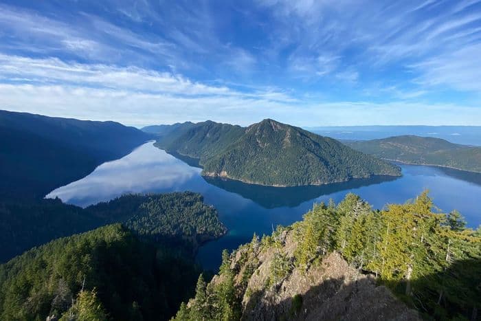
Regardless of where you are in the country, finding a free camping spot might be difficult. From the misty coastline to the moss-draped rainforests and jagged peaks, there are plenty of free camping opportunities in Washington state for Pacific Northwesterners and tourists visiting America’s upper left.
Washington is one of the country’s top outdoor recreation locations, with over 19 million acres of public land. Among those millions of acres are popular national parks like Olympic and the North Cascades, where camping is normally charged and reservations are required. However, unless otherwise specified, they also include national forests and BLM land, where camping is free.
24 Favorite Washington Boondocking ONP Campgrounds
Jump directly to the 83 Free NE Washington Boondocking Spots
Jump directly to the 78 Amazing NW Washington Boondocking Campsites
Jump directly to the 63 Best SE Washington Boondocking Sites
Jump directly to the 60 Top SW Washington Boondocking Spaces
1. NF-011 Road Near Blyn, WA
Address
Sequim, Washington
GPS: 47.997641, -123.014152
Elevation: 732′
Management Public – Forest Service (Official)
The road in is Dirt and less than 10 miles from a paved road. NF-011 road near blyn, WA is open all year. There are 1-5 Washington boondocking spaces at this location and the maximum RV length is 15 feet. You may stay 14 days at NF-011 road near blyn, WA. Just a national forest road that ends at two gravel clearings where there is evidence of campfires and a diy shooting range. There are also spots to pull off along the road before the clearings. Beautiful forest, can hear the river below.
2. Big Sandy Shore
Address
Chimacum, Washington
GPS: 47.913638, -122.786625
Elevation: 509′
8.9 miles up 104 from Hood Canal Bridge, Half-Way Mark. Right onto Sandy Shore Rd, ( not Lake Rd ). Washington boondocking locations about 1/2 mile or so on left Side of gravel rd. PICK UP YOUR TRASH PLEASE. put a lot of work into cleaning this place up. Watch out for tall dead alder tree 1/2 way rotten or woodpeckers through & will fall soon. We are getting out of here till then, but nice quiet spot, not much road traffic, Highway is loud though.
3. Sandy Shore Road Campsite
Address
Quilcene, Washington
GPS: 47.90524, -122.77813
Elevation: 577′
Management Public – Forest Service (Unofficial)
The road in is Dirt and 1 miles from a paved road. Sandy Shore Road Campsite is open 365. There are 1-5 Free Washington campsites at this location and the maximum RV length is 15 feet. You may stay 21 at Sandy Shore Road Campsite. This is a great open site for astrophotography. The road is gravel from the highway, and there are several pullouts along the road to park your camper van or car.
4. Unnamed Turnout MP309/310
Address
Unknown
Brinnon, Washington
GPS: 47.657902, -122.924759
Elevation: 150′
Management Parking Lot – Truck Stop
The maximum RV length at Washington boondocking spaces at Unnamed Turnout MP309/310 is unlimited. Just a gravel field that’s suitable for overnight RV parking
5. NF-012 road
Address
Brinnon, Washington
GPS: 47.639687, -122.975298
Management Public – Forest Service (Unofficial)
The road in is Gravel and 2 miles from a paved road. You may stay 14 days in Washington boondocking locations at NF-012 road. Dead end spot at the end of a road in the national forest. Big enough to turn around and to fit a small RV. Perfectly good spot to camp for a night, woods everywhere, clean site. Didn’t explore much beyond but here were various dirt roads and other pulloffs to check out.
6. FS2480 clear cut
Address
Hoodsport, Washington
GPS: 47.539687, -123.093244
Elevation: 869′
Management Public – State Forest
The road in is Gravel and 3.3 miles from a paved road. There are 1-5 Free Washington campsites at this location and the maximum RV length is 45 feet. Short spur road dead ending in a couple of year old clear cut. Firm gravel road. View to Hood Canal to the east. Little shade, but lots of room. Plenty of firewood. Sun and moon rises are beautiful. Take Jorsted Creek Rd/FS24 off of US101, bearing right at FS2480, around 3.3 miles. The logged area has been replanted, but the saplings are mostly a foot or less in height.
7. NF-2419 Dispersed Overlook
Address
Hoodsport, Washington
GPS: 47.50797, -123.21966
Elevation: 1985′
ManagementPublic – Forest Service (Unofficial)
NF-2419 has nice Washington boondocking spaces – it’s a bit up from the road and doesn’t get much road dust (at least during the 3 days I was there). The trees provide a good mix of shade and sun throughout the day. It’s about 2500 feet up, so not too cold at night. 😉 The view is quite nice as well. The only downside is that there’s no signal, and this road is quite popular with hikers, so there’s a car every 15-20 mins or so. NF-2464, facing the camp site, might be worth exploring. -)
8. Mount Rose Trailhead
Address
Hoodsport, Washington
GPS: 47.495487, -123.267632
Elevation: 784′
Management Public – Forest Service (Unofficial)
Headed to the Staircase area of Olympic via N Lake Cushman Rd, you will come across a sign for the Mount Rose Trailhead. The road to the trailhead does have a bit of a pothole issue (i.e. there are about a million potholes!). Washington boondocking locations.
9. Wynoochee River – Spot
Address
Montesano, Washington
GPS: 47.445034, -123.552992
Elevation: 860′
Management Public – Forest Service (Official)
You may stay 14 days in Free Washington campsites at Wynoochee River – Spot. Nice spot right by the river. No power or hookups. Great for boondocking. Large rigs are fine. Class C for sure!
10. Campbell Tree Grove Campground
Address
Forest Service Road 2204
Montesano, Washington
GPS: 47.4822, -123.68589
Elevation: 1109′
Management Public – Forest Service (Official)
Campbell Tree Grove Campground is open May to September. There are 16-29 Washington boondocking spaces at this location and the maximum RV length is 15 feet. You may stay 14 days at Campbell Tree Grove Campground. Campbell Tree Grove Campground is located adjacent to the West Fork Hump Tulips River in the beautiful temperate rain forest. The Campbell Tree Grove encompasses an impressive stand of old growth which illuminate this distinctive and vital wild area.Access to the West Fork Humptulips Trail #806 along the river adjacent to the campground.
11. NF3117
Address
Port Angeles, Washington
GPS: 48.115399, -124.254332
Elevation: 781′
Management Public – Forest Service (Unofficial)
The road in is 4×4 and All dirt no rv miles from a paved road. NF3117 is open Always. There are 6-15 Washington boondocking locations at this location. You may stay 14 days at NF3117. Nf3117 is a road off of 113 for tent camping narrow road from down trees no rv no campers 4×4 when wet difficult to turn around small 4×4 great spot away from road small brook hear the water flow bountiful firewood pack in and out please keep clean free camping
12. Beaver Lake
Address
Port Angeles, Washington
GPS: 48.11375, -124.2458
Elevation: 561′
Management Public – Forest Service (Official)
The road in is Paved. Beaver Lake is open year round. There are 1-5 Free Washington campsites at this location and the maximum RV length is unlimited. You may stay 14 days at Beaver Lake. Roadside diversion with two picnic tables one at either end of potholed dirt road. Centered between road 113 and lake expect road noise even through the night. Lake is lined with birch trees and cattail marsh and is a beautiful view. Pine tree mountain on opposite side.
13. Bear Creek Rec Site MM206
Address
maxium length 30 feet
Port Angeles, Washington
GPS: 48.094414, -124.267128
Elevation: 515′
Management Public – Forest Service (USDA)
There are 16-29 Washington boondocking spaces at this location. Located on Burnt Mountain Road in the Olympic National Forest.
14. Road A
Address
Beaver, Washington
GPS: 47.97279, -124.31943
Elevation: 531′
Management Public – Service (Official)
Washington boondocking locations off the road with rustic fire rings. No potable water and pack out trash. Right off beautiful creek with great swimming holes. Inside Olympic national forest. Drive north of Forks Wa. On 101 north about one mile and make a right on Road A. Drive 8 miles and you will start seeing the sites on the right.
15. NF-2932 across the Bridge, Calawah River
Address
Forks, Washington
GPS: 47.962574, -124.293331
Elevation: 509′
Management Public – Forest Service (Official)
The road in is Gravel and Can’t remember 100%, but it was not more than a mile or two on unpaved miles from a paved road. There are 1-5 Free Washington campsites at this location and the maximum RV length is 15 feet. Stayed at this free site in August 2016. From Forks, drive a couple minutes north until you see the turnoff for NF-29 on your right (near some industrial warehouses). Continue on this road for about 6 miles until you see a large bridge on your right where a spur road (NF-2932) turns off. It’s just a half mile or so past the Klahanie Campground (paid, official NFS site).
16. Elk Ridge
Address
Forks, Washington
GPS: 47.94435, -124.27474
Management Public – Forest Service (Unofficial)
The road in is Gravel. The maximum RV length at Elk Ridge is 15 feet. Washington boondocking spaces 1 mile North of Forks turn right on Sitkum-Solduc Rd; right at the fork to continue on NF-29; Turn right onto NF2932; gravel road continues up hillside for roughly 6 miles. Plenty of nice spaces to park; quite a few people using the road in late September for motocross, mudding, and shooting.
17. Upper Hoh Road Spots
Address
Forks, Washington
GPS: 47.81644, -124.050245
Elevation: 489′
Management Public – Service (Unofficial)
Washington boondocking locations along this road I saw about 6 different cars parked doing dispersed car/tent camping in different areas accessible not far off the road. This is a long road so there are quite a few, but limited spots. I’m not sure if you can do so after the pay to enter station for Olympic (I would ask to make sure if all the other spots are taken), but I did see them before it. There is one pit toilet before that pay station in a brown hut with a small parking lot which is where I slept in my vehicle.
18. Morgan’s Crossing
Address
Forks, Washington
GPS: 47.812626, -124.12213
Elevation: 318′
Management Public – Forest Service
The road in is Dirt and 1000ft miles from a paved road. There are 1-5 Free Washington campsites at this location and the maximum RV length is 15 feet. Very close to Olympic ‘s Hoh river rainforest entrance. Located in Olympic National forest. Ideal if you want to visit this area early in the morning or late in the afternoon. Enter from Upper Hoh road, site is at 1000 ft from it, almost on the river bank. Site is a half-circle about 75ft diameter, so campers can make a u-turn. There is even a vault toilet a little bit back, to my surprise, very clean.
19. Hoh River Trust
Address
Forks, Washington
GPS: 47.803744, -124.096882
Elevation: 399′
Management Public – Hoh River Trust (Official)
The road in is Dirt and 2 miles from a paved road. There are 1-5 Washington boondocking spaces at this location. You may stay 7 days at Hoh River Trust. This area is at the end of a gravel track, known locally as Water Mark Road or Owl Creek Road. Follow Upper Hoh Road east from Hwy 101, around 8 miles, and the road will split at a Y. Take the gravel road to the right, drive to the end, and you’ll find a sign posted on a tree saying that camping is allowed in designated areas.
20. Southern Olympic Peninsula, NF-21 (aka Boundary Road), Matheny Creek
Address
Amanda Park, Washington
GPS: 47.571087, -124.037842
Elevation: 581′
Management Public – Forest Service (Official)
The road in is Paved. There are 1-5 Washington boondocking locations at this location and the maximum RV length is 35 feet. Drive approximately 10.5 miles west of Amanda Park, WA on US-101. You’ll see signs for NF-21. Turn right and continue down the road for 8.0 miles, all paved. You’ll pass a bridge near the 8 mile mark, and the campsite is just past the bridge on the right. It’s a pretty large spot, and larger RVs shouldn’t have a problem maneuvering (we have a 19′ travel trailer and it was super easy).
21. Satsop Lake
Address
NFD Road 2222
Montesano, Washington
GPS: 47.413205, -123.530915
Elevation: 1575′
Management Public – Forest Service (Official)
The road in is 4×4 and 5 miles from a paved road. Satsop Lake is open Year round. There are 1-5 Free Washington campsites at this location. You may stay 21 days at Satsop Lake. This campsite is located within the Olympic National Forest’s Hood Canal Ranger District/Hoodsport.
22. Quinault Ridge Road (FS RD 2258)
Address
National Forest Development Road 2258
Quinault, Washington
GPS: 47.3476451, -123.9056875
Elevation: 551′
Management Public – Forest Service
The road in is Gravel and .2 miles from a paved road. Quinault Ridge Road (FS RD 2258) is open year round. There are 1-5 Washington boondocking spaces at this location and the maximum RV length is 25 feet. I had technical issues using the location feature, so here are the coordinates if it didn’t take: 47.3476451, -123.9056875.2 miles from highway, but couldn’t hear any traffic. 3G on Verizon. Primative. No facilities. Pack in, pack out. Gravel. Three fire rings. Two on initial small loop and one in back. The coordinates are for the back site where I camped in my minivan. I believe an RV can manage the back site, but you might walk in first to be sure.
23. 38th Pl. (Beach access road)
Address
Seaview, Washington
GPS: 46.33028, -124.06483
Elevation: 23′
Management Public – State Park (Unofficial)
Washington boondocking locations toward the end of 38th Place beach access road, either in the small parking area or on the side of the road on the stretch approaching the beach. There is a sign saying no camping on the beach. I would not park beyond that sign. I stayed here many times, sometimes multiple nights in a row with no issue whatsoever. People frequently drive their 4x4s down to the beach (often well into the night and early morning), but other than that it’s fairly quiet and felt safe.
24. Gravel Turnout
Address
Naselle, Washington
GPS: 46.429233, -123.856374
Elevation: 7′
Management Public (Unofficial)
The road in is Paved. There are 1-5 Free Washington campsites at this location and the maximum RV length is unlimited. Flat gravel turnout on the East side of highway 4 just 100 yards to the south of it’s intersection with highway 101. Small stream on one side and an ocean bay on the other. Not much traffic and very beautiful.
SE Washington Boondocking Sites
The Washington State Department of Natural Resources (DNR) oversees 5.6 million acres of forest, rangeland, agricultural, aquatic, and commercial areas. The DNR strives to give public access to outdoor recreation activities throughout Washington State.
Hiking, hunting, fishing, horseback riding, camping, off-road vehicle (ORV) riding, mountain biking, and boating are all popular activities on DNR-managed areas. Over 1,100 miles of trails, 143 recreation locations, and a diverse range of landscapes are managed by the DNR across the state.
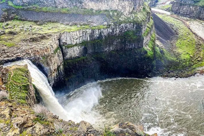
63 Best SE Washington Boondocking Sites
Jump directly to the 83 Free NE Washington Boondocking Spots
Jump directly to the 78 Amazing NW Washington Boondocking Campsites
Jump directly to the 24 Favorite Washington Boondocking ONP Campgrounds
Jump directly to the 60 Top SW Washington Boondocking Spaces
1. 9 miles South Kennewick Wa I-82
Address
Kennewick, Washington
GPS: 46.00578, -119.238078
Elevation: 830′
Management – Public – Off a dead end road (Unofficial)
Washington boondocking spaces take exit 122 off Interstate 82, go east on Coffin Rd, turn North on Bofer Canyon Rd. The next street that is a dead end go south there’s a pull off on the road big enough for two campers there is a little noise from the interstate were hidden halfway behind the Hill
2. Coffin Road
Address
Kennewick, Washington
GPS: 46.025292, -119.227281
Elevation: 989′
Management – Public – Bureau of Land Management (Unofficial)
The road in is Dirt. Coffin Road is open all year. There are 16-29 Washington boondocking sites at this location and the maximum RV length is 35 feet. You may stay 24 hours at Coffin Road.
3. The Manhattan Project – Hanford, WA
Address
2000 Logston Blvd, Richland WA
Richland, Washington
GPS: 46.31851, -119.299655
Elevation: 364′
Management Private – Parking lot of visitor center (Unofficial)
The road in is Paved. There are 6-15 Free Washington campsites at this location and the maximum RV length is unlimited. You may stay 1 night at The Manhattan Project – Hanford, WA.
4. Horse Heaven Hills
Address
N McBee Road
Prosser, Washington
GPS: 46.245328, -119.520915
Elevation: 1640′
Management – Public – Bureau of Land Management (Official)
Website
The road in is Dirt. You may stay 14 days in Washington boondocking spaces at Horse Heaven Hills. Free dispersed camping on BLM land not too far from Kennewick, WA. No amenities. It’s just you and nature.
5. Buckshot
Address
Unnamed Road
Mattawa, Washington
GPS: 46.710877, -119.952321
Elevation: 495′
Management – Public – State Park
Washington boondocking locations. No reservations. First come, first served. Talked to a fellow who had been there a few days. He said the locals come down every evening and raise hell. Spinning Brodie’s in the gravel, etc. The area is a boat launch not a camping area really.
6. Nunnally Lake
Address
19988 Road 17 Southwest
Royal City, Washington
GPS: 46.839015, -119.906198
Elevation: 535′
Management – Public – State Park
Free Washington campsites. First come -> First Camped. Reservations not accepted. GPS location co-ordinates inaccurate. The turn off is about 1/2 further on with a sign saying Public Fishing, opposite the ORV site. Nice walk to the lake and views are pretty. A little road noise but parking area is set back from the road more than the other areas along the road.
7. Mouth of Grande Ronde
Address
35947-40687 Snake River Road
Asotin, Washington
GPS: 46.080374, -116.981756
Elevation: 853′
Management – Public – State Park
Washington boondocking spaces.First come -> First Camped. Reservations not accepted.
8. Lenice Lake
Address
Milwaukee Road (railroad grade)
Royal City, Washington
GPS: 46.838037, -119.832068
Elevation: 554′
Management – Public – State Park
Lenice Lake is open Mar-Nov. Washington boondocking locations. First come -> first camped. No reservations are accepted. Note: You actually cannot legally get to the lake by vehicle. The previous review was helpful, but it is clearly posted that unauthorized vehicles are not permitted down by the lake.
9. Crab Creek Launch
Address
Road 17 Southwest
Royal City, Washington
GPS: 46.832568, -119.776462
Elevation: 515′
Management – Public – State Park
Crab Creek Launch is open all year. Free Washington campsites. First come -> First Camped. Reservations not accepted.
10. Clementine Lake
Address
8496 Road 14 Southwest
Royal City, Washington
GPS: 46.872187, -119.6549
Elevation: 984′
Management – Public – State Park
Clementine Lake is open all year. Washington boondocking spaces. This campsite does not use a reservation system. First come, first served.
11. Red Rock Lake
Address
5727 Road West 2 Northeast
Royal City, Washington
GPS: 46.875682, -119.585011
Elevation: 712′
Management – Public – State Park
Red Rock Lake is open all year. Washington boondocking locations. First come -> first served. No reservations accepted. Beautiful spot. Fairly easy to find by looking at Google satellite map and following dirt roads. Sign posted that Washington Discovery Pass required.
12. Adams Rd 239 Drain
Address
George, Washington
GPS: 47.015816, -119.770203
Elevation: 1152′
Management – Public – Fish and Wildlife Service (Official)
You may stay 21 in 30 nights in Free Washington campsites at Adams Rd 239 Drain.
13. Beda Lake
Address
Moses Lake, Washington
GPS: 47.049183, -119.547195
Elevation: 1134′
Management – Public – Fish and Wildlife Service (Official)
The road in is Dirt and 0.5 miles from a paved road. Washington boondocking spaces.
14. Dodson Frenchman
Address
George, Washington
GPS: 46.991699, -119.557556
Elevation: 1124′
Management – Public – Fish and Wildlife Service (Official)
You may stay 21 nights in 30 nights in Washington boondocking locations at Dodson Frenchman. Camping is free, but a permit is required to be on all Washington FWS land. Once purchased, it is good at all Washington WMAs. Buy a Washington FWS vehicle use permit ($10.95). Unmarked campsites in designated area.
15. Frenchmen Hills #3
Address
115 Oak Street North
Royal City, Washington
GPS: 46.978168, -119.585611
Elevation: 1122′
Management – Public – State Park
Frenchmen Hills #3 is open all year. Free Washington campsites. Reservations are not accepted at this campsite.
16. Frenchmen Hills #2
Address
904 Frenchman Hills Road West
Royal City, Washington
GPS: 46.96168, -119.516733
Elevation: 1122′
Management – Public – State Park
Frenchmen Hills #2 is open all year. Washington boondocking spaces. Reservations are not accepted at this campsite.
17. Frenchmen Hills #1
Address
2-826 Frenchman Hills Road West
Royal City, Washington
GPS: 46.962657, -119.496897
Elevation: 1122′
Management – Public – State Park
Frenchmen Hills #1 is open all year. Washington boondocking locations. Reservations are not accepted at this campsite.
18. Sand Dunes
Address
Potato hill rd
moses lake, Washington
GPS: 47.062637, -119.326027
Elevation: 1064′
Management – Public – State Park (Unofficial)
The road in is Dirt and 0-3 miles from a paved road. Sand Dunes is open all year. There are 30 or more Free Washington campsites at this location and the maximum RV length is unlimited. Free camping on sand dunes and in potholes. ONLY out houses. NO showers, water spigots, fire pits, or established camp sites.
19. Medicare East
Address
10387 Road 6 Southeast
Moses Lake, Washington
GPS: 46.99566, -119.275951
Elevation: 1056′
Management – Public – State Park
Medicare East is open all year. Washington boondocking spaces. Reservations are not accepted at this campsite. You need one of those passes to stay here, although this spot looked like heaven I stayed at a spot down the road.
20. Lower Goose
Address
8999 Kulm Road Southeast
Othello, Washington
GPS: 46.924018, -119.295104
Elevation: 869′
Management – Public – State Park
Lower Goose is open all year. Washington boondocking locations, each very dispersed. We took the one on the south end of the lake. Quiet – especially for Memorial Day weekend. There was only one other tent along the entire lake. Coyotes through most of the night, and a few huge owls at dawn. It really is a beautiful spot.
21. Sampson’s Pit
Address
2111 West Basin Street
Moses Lake, Washington
GPS: 46.987713, -119.252799
Elevation: 1047′
Management – Public – State Park
Sampson’s Pit is open all year. Free Washington campsites. First come -> first served. No reservations accepted.
22. Glen Williams
Address
O’Sullivan Dam Road
Moses Lake, Washington
GPS: 46.982928, -119.255712
Elevation: 1056′
Management – Public – State Park
Glen Williams is open all year. Washington boondocking spaces.No reservations. First come, first served. It is ok in a pinch…. This is a paved parking lot with a boat ramp. Lots of cars coming and going. Camping here is legal with a discovery pass. There were three Class A’s with us.
23. Heller Bar
Address
35947-40687 Snake River Road
Asotin, Washington
GPS: 46.086032, -116.983415
Elevation: 833′
Management – Public – State Park
Washington boondocking locations. Reservations are not accepted at this campsite.
24. Lind Coulee – Island Site
Address
416 11th Street Northwest
Warden, Washington
GPS: 46.986336, -119.223055
Elevation: 1050′
Management – Public – State Park
Lind Coulee – Island Site is open all year. Free Washington campsites. Reservations are not accepted at this campsite.
25. Lind Coulee – East Bridge Site
Address
6501-6599 Road M Southeast
Moses Lake, Washington
GPS: 46.993844, -119.208212
Elevation: 1050′
Management – Public – State Park
Lind Coulee – East Bridge Site is open all year. Washington boondocking spaces. Reservations are not accepted at this campsite.
26. Warden Lake Outfall
Address
Unnamed Road
Warden, Washington
GPS: 46.992091, -119.170653
Elevation: 1043′
Management – Public – State Park
Warden Lake Outfall is open all year. Washington boondocking locations. Reservations are not accepted at this campsite. Gate cloaed Oct 1 , contra internet description. Open gravel area still quiet with room for 2 RVs. Don’t bother!
27. Warden Lake North
Address
Warden Lake Access Road
Warden, Washington
GPS: 46.980989, -119.159082
Elevation: 1083′
Management – Public – State Park
Warden Lake North is open May-Sep. Free Washington campsites. First come -> first served. No reservations accepted.
28. Susan Lake
Address
Unnamed Road
Warden, Washington
GPS: 46.957828, -119.200478
Elevation: 1060′
Management – Public – State Park
Susan Lake is open all year. Washington boondocking spaces. First come -> first served. No reservations accepted.
29. Katy Lake
Address
322 11th Street Northwest
Warden, Washington
GPS: 46.949725, -119.20349
Elevation: 1060′
Management – Public – State Park
Katy Lake is open all year. Washington boondocking locations. First come -> first camped. No reservations are accepted. Easy access, pretty nice view to the west, fire pit, solitude, verizon cell reception. Lots of mosquitos in late June. Would stay here again
30. Northend/Canal Lake North
Address
Unnamed Road
Warden, Washington
GPS: 46.930085, -119.18088
Elevation: 1004′
Management – Public – State Park
Northend/Canal Lake North is open all year. Free Washington campsites. Reservations are not accepted at this campsite.
31. Windmill Lake
Address
Unnamed Road
Warden, Washington
GPS: 46.931887, -119.17699
Elevation: 1001′
Management – Public – State Park
Washington boondocking spaces. No reservations. First come, first served.
32. Herman Lake South
Address
Unnamed Road
Othello, Washington
GPS: 46.897334, -119.20006
Elevation: 945′
Management – Public – State Park
Washington boondocking locations. First come -> first served. No reservations accepted. Nice quiet spot overlooking Herman Lake.
There is a vault toilet over by Lyle Lake – Discover Pass needed there. Not sue of land ownership at this spot, but it is obviously used as a campsite.
33. Juniper Dunes OHV
Address
Peterson Road
Pasco, Washington
GPS: 46.437857, -118.828125
Elevation: 997′
Management – Public – Bureau of Land Management (Official)
The road in is Dirt and 4-6 (depending on site choice) miles from a paved road. Juniper Dunes OHV is open Year around. There are 16-29 Free Washington campsites at this location and the maximum RV length is unlimited. You may stay 14 days at Juniper Dunes OHV.
34. Walker Park
Address
Walker Pit Road
Prescott, Washington
GPS: 46.428728, -118.633004
Elevation: 459′
Management – Public – Corp of Engineers
Walker Park is open all year. Washington boondocking spaces in the Corp of Engineers Northwestern Division’s Walla Walla District. This campsite does not use a reservation system. First come, first served. The camping area is near Lake Sacajawea.
35. Windust Park
Address
Windust, Washington
GPS: 46.53466, -118.578339
Elevation: 483′
Management – Public – Corps of Engineers (Official)
Windust Park is open Year-round. Despite the sign, Washington boondocking locations are free.
36. Mathews
Address
Matthew Road
Pasco, Washington
GPS: 46.543299, -118.552938
Elevation: 472′
Management – Public – Corp of Engineers
Mathews is open all year. Free Washington campsites in the Corp of Engineers Northwestern Division’s Walla Walla District. This campsite does not use a reservation system. First come, first served. The camping area is near Lake Sacajawea. There is really only one flat spot, right next to the outhouse! The outhouse was very clean. The trains passed about every 3-4 hours but they did not honk so you kind of slept through after the first couple of times.
37. Devil’s Bench
Address
Devils Canyon Road
Prescott, Washington
GPS: 46.56748, -118.537398
Elevation: 561′
Management – Public – Corp of Engineers
Devil’s Bench is open all year. Washington boondocking spaces in the Corp of Engineers Northwestern Division’s Walla Walla District. Reservations are not accepted at this campsite. The camping area is near Lake Herbert G West.
38. Ayer Boat Basin
Address
Casey Road
Prescott, Washington
GPS: 46.58602, -118.367921
Elevation: 548′
Management – Public – Corp of Engineers
Ayer Boat Basin is open all year. The maximum RV length at Ayer Boat Basin is 40 feet. Washington boondocking locations in the Corp of Engineers Northwestern Division’s Walla Walla District. First come -> first camped. No reservations are accepted. The camping area is near Lake Herbert G West.
39. Rock Creek/Escure Ranch
Address
Endicott, Washington
GPS: 47.014299, -117.943748
Elevation: 1457′
Management – Public – Bureau of Land Management (Official)
The road in is Gravel and 10 miles from a paved road. Rock Creek/Escure Ranch is open all year. There are 6-15 Free Washington campsites at this location and the maximum RV length is unlimited. You may stay 14 at Rock Creek/Escure Ranch.
40. Texas Rapids Army Corps Of Engineers
Address
Little Goose Dam Rd.
Dayton, Washington
GPS: 46.56295, -118.09972
Elevation: 548′
Management – Public – Corp of Engineers (Official)
The road in is Gravel and 100 ft. miles from a paved road. Texas Rapids Army Corps Of Engineers is open year round. There are 1-5 Washington boondocking spaces at this location and the maximum RV length is 45 feet. You may stay 14 at Texas Rapids Army Corps Of Engineers.
41. Riparia Park
Address
Little Goose Dam Road
LaCrosse, Washington
GPS: 46.577225, -118.09051
Elevation: 551′
Management – Public – Corp of Engineers
Riparia Park is open all year. The maximum RV length at Riparia Park is 40 feet. Washington boondocking locations in the Corp of Engineers Northwestern Division’s Walla Walla District. First come -> first camped. No reservations are accepted. The camping area is near Lake Herbert G West.
42. Little Goose Landing
Address
LaCrosse, Washington
GPS: 46.585185, -118.00392
Elevation: 650′
Management Website
The road in is Paved. Little Goose Landing is open All year. There are 6-15 Free Washington campsites at this location and the maximum RV length is 35 feet. You may stay 14 days in any 30 day period at Little Goose Landing.
43. Willows Landing
Address
633-757 Hastings Hill Road
Pomeroy, Washington
GPS: 46.681893, -117.749482
Elevation: 646′
Management – Public – Corp of Engineers
Willows Landing is open all year. Washington boondocking spaces.
44. Caboose Park / Public RV Parking
Address
Dayton, Washington
GPS: 46.320129, -117.981812
Elevation: 1604′
Management – Public – City park (Official)
The road in is Paved. There are 16-29 Washington boondocking locations at this location and the maximum RV length is unlimited. Free public overnight RV Parking. No tents. Dry camping only in a gravel lot. Signs clearly marked location from main road.
45. Pioneer Park
Address
Dayton, Washington
GPS: 46.287924, -117.80733
Elevation: 3547′
Management Private – Landowner allow camping as long as people don’t leave a mess. (Unofficial)
The road in is Gravel. There are 1-5 Free Washington campsites at this location. Free campsite on private land. First come first serve.
46. Pataha Campground
Address
Pomeroy, Washington
GPS: 46.291798, -117.515424
Elevation: 3789′
Management – Public – Forest Service (Official)
The road in is Gravel and 7 miles miles from a paved road. There are 1-5 Washington boondocking spaces at this location. Lovely small campground, no fee, one pit toilet, there are designated fire pits, and picnic tables at all the sites, no potable water, but there is a stream and a small pond if you have a filter.
47. Rose Springs Sno-Park
Address
National Forest Development Road 911
Pomeroy, Washington
GPS: 46.275892, -117.557009
Elevation: 4783′
Management – Public – State Park
Washington boondocking locations. First come -> first served. No reservations accepted.
48. Teal Spring Campground
Address
Forest Service Road 4000020
Pomeroy, Washington
GPS: 46.18859, -117.57196
Elevation: 5670′
Management – Public – USDA Forest Service (Official)
Teal Spring Campground is open summer. Offering a spectacular view of the Tucannon drainage and the Wenaha-Tucannon Wilderness, Free Washington campsites offers OHV and day hiking opportunities. 7 tent/trailer campsites.
49. Grouse Flats
Address
Anatone, Washington
GPS: 46.012371, -117.495453
Elevation: 3693′
Management – Public – Fish and Wildlife Service (Unofficial)
The road in is Dirt. The 640-acre Grouse Flats unit Washington boondocking spaces located in Garfield County about 65 miles southwest of the town of Asotin. Elevations range from 3,600 to 4,160 feet. It includes some ponds, but no year-round creeks or significant drainages.
50. Illia Landing
Address
Ilia Landing
Pomeroy, Washington
GPS: 46.696498, -117.471467
Elevation: 650′
Management – Public – Corp of Engineers
Illia Landing is open all year. Washington boondocking sites located within the Corp of Engineers Northwestern Division’s Walla Walla District. The camping area is near Lake Bryan.
51. Offield Landing
Address
618-628 Wawawai Grade Road
Pomeroy, Washington
GPS: 46.652663, -117.418228
Elevation: 748′
Management – Public – Corp of Engineers
Offield Landing is open all year. Free Washington campsites in the Corp of Engineers Northwestern Division’s Walla Walla District. First come -> first camped. No reservations are accepted. The camping area is near Lower Granite Lake.
52. Wawawai Landing
Address
Wawawai Road
Colton, Washington
GPS: 46.614535, -117.376628
Elevation: 748′
Management – Public – Corp of Engineers
Wawawai Landing is open all year. Washington boondocking spaces in the Corp of Engineers Northwestern Division’s Walla Walla District. Reservations are not accepted at this campsite. The camping area is near Lower Granite Lake.
53. Lower Granite Lake
Address
Colton, Washington
GPS: 46.595012, -117.345486
Elevation: 923′
Management – Public – Corps of Engineers (Official)
The road in is Paved. There are 6-15 Washington boondocking locations at this location and the maximum RV length is unlimited. You may stay 14 days at Lower Granite Lake. A number of free camping spots along the river between Wawawai and Clarkston. Most have cover and all have fire pits and attached grill. Many with beach access for swimming or fishing. Boat ramp nearby at Wawawai landing.
54. Blyton Landing
Address
Wawawai Road
Colton, Washington
GPS: 46.559292, -117.270758
Elevation: 745′
Management – Public – Corp of Engineers
Blyton Landing is open all year. All Along Wawawai Rd between Wawawai county park and Nisqually John Landing is Free Washington campsites anywhere you can pull over. Most sites look like day-use picnic areas or boat launches, but they’re officially sanctioned camping areas.
55. Nisqually John Landing
Address
Wawawai Road
Clarkston, Washington
GPS: 46.476878, -117.235039
Elevation: 748′
Management – Public – Corp of Engineers
Washington boondocking spaces in the Corp of Engineers Northwestern Division’s Walla Walla District. First come -> first camped. No reservations are accepted. The camping area is near Lower Granite Lake.
56. Rose Springs Sno-Park
Address
National Forest Development Road 911
Pomeroy, Washington
GPS: 46.275892, -117.557009
Elevation: 4783′
Management – Public – State Park
Washington boondocking locations. First come -> first served. No reservations accepted.
57. Teal Spring Campground
Address
Forest Service Road 4000020
Pomeroy, Washington
GPS: 46.18859, -117.57196
Elevation: 5670′
Management – Public – USDA Forest Service (Official)
Teal Spring Campground is open summer. Offering a spectacular view of the Tucannon drainage and the Wenaha-Tucannon Wilderness, Free Washington campsites offers OHV and day hiking opportunities. 7 tent/trailer campsites.
58. Cloverland Sno-Park
Address
National Forest Development Road 43
Asotin, Washington
GPS: 46.14825, -117.335174
Elevation: 4738′
Management
Public – State Park
Washington boondocking spaces. First come -> first served. No reservations accepted.
59. Botts
Address
61376 Washington 129
Anatone, Washington
GPS: 46.037094, -117.252684
Elevation: 1250′
Management – Public – State Park
Washington boondocking locations. This campsite does not use a reservation system. First come, first served.
60. R. Boggan
Address
44897 Washington 129
Anatone, Washington
GPS: 46.041742, -117.253003
Elevation: 1250′
Management – Public – State Park
Free Washington campsites. First come -> First Camped. Reservations not accepted. Take a right just after bridge, before Boggan’s Oasis and head down toward river. Spacious enough for RVs, saw a tent but the space isnt super private. Best for a quick stay for campers.
61. Schumaker Grade
Address
Shumaker Road
Anatone, Washington
GPS: 46.047135, -117.08331
Elevation: 1043′
Management – Public – State Park
Washington boondocking spaces.No reservations. First come, first served. The spot marked is on state land and is only accessible on foot or boat. State land starts 1/4 mile east of Shumaker Grade Rd, there are a few spots to camp between there and the day use parking area at the end of vehicle travel. There is another spot to camp about 1-3/4 miles west along Shumaker Grade Rd.
62. Ebson #3
Leave a ReviewThis is a FREE campsite.
Address
40770-40798 Snake River Road
Anatone, Washington
GPS: 46.070472, -117.004795
Elevation: 873′
Management – Public – State Park
Washington boondocking locations. First come -> first served. No reservations accepted.
63. Ebson #1
Address
35947-40687 Snake River Road
Asotin, Washington
GPS: 46.062733, -116.994609
Elevation: 863′
Management – Public – State Park
Washington boondocking spaces. First come -> first camped. No reservations are accepted. Not a bad area, quite a few campsites,lots of fishing, not but a few feet from the river, good restrooms. Very nice breezes.
SW Washington Boondocking Spaces
Washington DFW Lands: Since 1939, the state has been acquiring crucial properties for public ownership in order to maintain fish and wildlife habitat. The Washington Department of Fish and Wildlife (WDFW) now owns or maintains roughly a million acres of land across the state, organized into 32 wildlife areas. WDFW owns or operates over 700 water access facilities in addition to wildlife areas.
Wildlife viewing, shooting, fishing, hiking, and camping are all available in Washington’s wildlife areas, which are diverse in habitat and species. The activities are plenty with over 150 distinct regions to select from. While not all wildlife areas, particularly in Eastern Washington, allow scattered camping, many do.
60 Top SW Washington Boondocking Spaces
Jump directly to the 83 Free NE Washington Boondocking Spots
Jump directly to the 78 Amazing NW Washington Boondocking Campsites
Jump directly to the 24 Favorite Washington Boondocking ONP Campgrounds
Jump directly to the 63 Best SE Washington Boondocking Sites
1. Red Rock Lake
Address
5727 Road West 2 Northeast
Royal City, Washington
GPS: 46.875682, -119.585011
Elevation: 712′
Management: Public- State Park
Red Rock Lake is open all year. Washington boondocking spaces. First come -> first served. No reservations accepted. Beautiful spot. Fairly easy to find by looking at Google satellite map and following dirt roads. Sign posted that Washington Discovery Pass required.
2. Clementine Lake
Address
8496 Road 14 Southwest
Royal City, Washington
GPS: 46.872187, -119.6549
Elevation: 984′
Management: Public- State Park
Clementine Lake is open all year. Washington boondocking locations. This campsite does not use a reservation system. First come, first served.
3. Crab Creek Launch
Address
Road 17 Southwest
Royal City, Washington
GPS: 46.832568, -119.776462
Elevation: 515′
Management: Public- State Park
Crab Creek Launch is open all year. Free Washington campsites. First come -> First Camped. Reservations not accepted.
4. Lenice Lake
Address
Milwaukee Road (railroad grade)
Royal City, Washington
GPS: 46.838037, -119.832068
Elevation: 554′
Management: Public- State Park
Washington boondocking spaces near Lenice Lake is open Mar-Nov. You actually cannot legally get to the lake by vehicle. The previous review was helpful, but it is clearly posted that unauthorized vehicles are not permitted down by the lake
5. Nunnally Lake
Address
19988 Road 17 Southwest
Royal City, Washington
GPS: 46.839015, -119.906198
Elevation: 535′
Management: Public- State Park
Washington boondocking locations. First come -> First Camped. Reservations not accepted. GPS location co-ordinates inaccurate. The turn off is about 1/2 further on with a sign saying Public Fishing, opposite the ORV site.
6. Horse Heaven Hills
Address
N McBee Road
Prosser, Washington
GPS: 46.245328, -119.520915
Elevation: 1640′
Management: Public- Bureau of Land Management (Official)
The road in is Dirt. You may stay 14 days at Horse Heaven Hills. Free Washington campsites on BLM land not too far from Kennewick, WA. No amenities. It’s just you and nature.
7. Nile Sno-Park
Address
National Forest Development Road 1611
Naches, Washington
GPS: 46.851389, -121.00991
Elevation: 2398′
Management: Public- State Park
Washington boondocking spaces. This campsite does not use a reservation system. First come, first served. Nice place to stay for a day or 2. many spots throughout 410 north into the forest. Close but not too close to a gas station and food joint. Was perfect for my trip from Boise to Seattle. I took 410 North through the forest to Seattle and this is a beautiful drive!
8. Rattlesnake Sno-Park
Address
National Forest Development Road 1500
Naches, Washington
GPS: 46.811365, -120.947782
Elevation: 2113′
Management: Public- State Park
Washington boondocking locations. First come -> first camped. No reservations are accepted.
9. Rimrock Pullout Hwy 12
Address
Goose Prairie, Washington
GPS: 46.67593, -121.06462
Elevation: 2500′
Management: Public(Unofficial)
The road in is Dirt. The maximum RV length in Free Washington campsites at Rimrock pullout Hwy 12 is 25 feet. Not official campsite, more of a pullout right off Hwy 12. Intermittent road noise, but it mostly dies off after dark. Not sure about legal status, but partially concealed from road. No “NO OVERNIGHT” signs.
10. South Fork Tieton Dispersed Camping
Address
US 12
Naches, Washington
GPS: 46.666047, -121.102512
Elevation: 2613′
Management: Public- Forest Service
The road in is Dirt and 1-2 miles miles from a paved road. There are 6-15 Washington boondocking spaces at this location and the maximum RV length is 45 feet. You may stay 14 days at South Fork Tieton Dispersed Camping. Beautiful boondocking spots are located for about five miles along the Tieton River going east from Rimrock Lake. The one pictured above is about 1/2 mile in on FR 580.
11. Ahtanum Sno-Park
Address
Unnamed Road
Yakima, Washington
GPS: 46.510693, -121.02033
Elevation: 3248′
Management: Public- State Park
Washington boondocking locations. First come -> first served. No reservations accepted.
12. Avery Park
Address
Wishram, Washington
GPS: 45.662182, -121.036408
Elevation: 161′
Management: Public- Corps of Engineers (Official)
There are 1-5 Free Washington campsites at this location. You may stay 14 Nights at Avery Park. Avery Park is a Treaty Fishing Access Site. As such it is shared by Native American Tribes and the general public. During the Salmon harvest season, the park is reserved for the exclusive use of the Native American Tribes.
13. Rock Creek Park
Address
Unnamed Road
Roosevelt, Washington
GPS: 45.719424, -120.46081
Elevation: 272′
Management: Public- Corp of Engineers
Rock Creek Park is open all year. Washington boondocking spaces in the Corp of Engineers Northwestern Division’s Portland District. This campsite does not use a reservation system. First come, first served.
14. Sundale Park
Address
Sundale, Washington
GPS: 45.7183, -120.318359
Elevation: 329′
Management: Public- Corps of Engineers (Official)
There are 1-5 Washington boondocking sites at this location. You may stay 14 Nights at Sundale Park. Sundale Park is a Treaty Fishing Access Site. As such it is shared by Native American Tribes and the general public. During the Salmon harvest season, Sundale Park is reserved for the exclusive use of the Native American Tribes. Other than those times, the park is open year round. Sundale Park is a small park but big on fishing opportunities.
15. Roosevelt Park
Address
Roosevelt, Washington
GPS: 45.732449, -120.22049
Elevation: 276′
Management: Public- Corps of Engineers (Official)
The road in is Paved. There are 6-15 Free Washington campsites at this location. You may stay 14 Nights at Roosevelt Park. Corp of engineers campground on the Columbia River. Roosevelt Park also provides visitors with flush restrooms, a lawn area, picnic tables, a covered picnic area, play equipment, swim beach, barbecue grills, and showers.
16. Alderdale
Address
mm 149
Alderdale, Washington
GPS: 45.834873, -119.934731
Elevation: 279′
Management: Public- State Forest (Official)
Alderdale is open During salmon season only. There are 6-15 Washington boondocking spaces at this location. If you have a large RV, you should walk into it to make sure it’s open. When the gates are locked, the turnaround areas in front of the gates are only sized for cars to turn around in.
17. Paterson WA
Address
Prosser, Washington
GPS: 45.933612, -119.596632
Management: Private – Railroad land as described by a local (Unofficial)
The road in is Gravel and . 5 miles from a paved road. There are 1-5 Washington boondocking locations at this location and the maximum RV length is 15 feet. The local store described it as a railroad Road. Looks to me like an abandoned County or state camping area. Very overgrown but serviceable gravel roads, privacy, quiet. Except for the railroad.
18. Mt Rainier national Forest Road
Address
Ashford, Washington
GPS: 46.734734, -121.906716
Elevation: 2064′
Management: Public- Forest Service (Official)
Mt Rainier national forest road is open spring-fall. You may stay 14 days at Mt Rainier national forest road. Free Washington campsites along the north side of the road. Some have improvised fire rings. We were directed to this place by a ranger in the Mt Rainier National Park.
19. Summit Creek (Hike-In)
Address
National Forest Development Road 4510
Randle, Washington
GPS: 46.710398, -121.536702
Elevation: 2352′
Management: Public- Forest Service
Summit Creek (Hike-In) is open year round. There are 1-5 Washington boondocking spaces at this location. You may stay 14 days at Summit Creek (Hike-In). The forest service has removed all facilities and closed the road. Enjoy what they’ve left behind! Summit Creek Campground is a small, rustic site located on a small flat between Summit Creek and Forest Road 4510 in a mid-elevation stand of Douglas fir, western hemlock, and western red cedar.
20. Soda Spring
Address
Randle, Washington
GPS: 46.703476, -121.481272
Elevation: 3182′
Management: Public- State Park
Soda Spring Campground is a small, rustic site located at the end of Forest Road 4510.052 in a stand of Douglas fir, western hemlock, and silver fir. The Campground has 6 Washington boondocking locations suitable for tent camping, pickup campers, or smaller trailers.
21. Skate Creek Sno-Park
Address
National Forest Development Road 52
Packwood, Washington
GPS: 46.63837, -121.71165
Elevation: 1568′
Management: Public- State Park
Free Washington campsites. This campsite does not use a reservation system. First come, first served. Have been to skate creek twice now. The most recent in 2016. Loved it. Perfect place for all recreational fun. Plan on going again this summer
22. Packwood WA NF
Address
Packwood, Washington
GPS: 46.63448, -121.679917
Elevation: 1430′
Management: Public- Forest Service (Unofficial)
The road in is Gravel. Washington boondocking spaces in National forest. This spot is at the end of a road that that appears to have been a rock quarry at one time and is still used as a shotgun range at times. Large flat areas for tent camping and RVs. Sadly, locals leave a bit if trash around, mostly spent shotgun shells and aluminum cans.
23. Bevin Lake Rest Area
Address
Randle, Washington
GPS: 46.55278, -121.73637
Elevation: 988′
Management: Public- Rest Area (Official)
The road in is Paved. Washington boondocking locations at Bevin Lake Rest Area is open year round. The maximum RV length at Bevin Lake Rest Area is unlimited. You may stay 8 hours at Bevin Lake Rest Area. Off Rt. 12, about 15 miles outside of Randle. Not much in the area. Signs say, “please limit your stay to 8 hours” and there is plenty of RV parking for any size rig.
24. Cash Prairie TH
Address
National Forest Development Road 199
Naches, Washington
GPS: 46.715459, -121.165477
Elevation: 6319′
Management: Public- Forest Service
From Naches, WA follow Highway 12 W for 21.6 miles. Turn right on Forest Road 1500. Continue on Road 1500 for about 9 miles. Turn left onto spur Road 199 and go 2.1 miles to end of road to Cash Prairie Trailhead and Free Washington campsites.
25. Iron Creek Dispersed Campsite
Address
Randle, Washington
GPS: 46.427984, -121.98043
Elevation: 1189′
Management: Public- Forest Service (Unofficial)
The road in is Dirt. Iron Creek Dispersed Campsite is open Year Round. There are 1-5 Washington boondocking spaces at this location and the maximum RV length is 15 feet. You may stay 7 at Iron Creek Dispersed Campsite. This is just beyond the pay-for Iron Creek campsite. Go down past the official campsite on US Forest Service road towards Mt. St. Helens.
26. Willow Tree TH
Address
National Forest Development Road 1362
Naches, Washington
GPS: 46.673119, -121.167519
Elevation: 3829′
Management: Unknown
Washington boondocking locations in the Okanogan-Wenatchee National Forest’s Naches Ranger District. No reservations. First come, first served.
27. Russell Ridge TH
Address
National Forest Development Road 1382
Naches, Washington
GPS: 46.664751, -121.205161
Elevation: 4997′
Management: Public- Forest Service
Free Washington campsites in the Okanogan-Wenatchee National Forest’s Naches Ranger District. First come -> first served. No reservations accepted.
28. Cowlitz Trout Hatchery Blue Creek
Address
Toledo, Washington
GPS: 46.483826, -122.730632
Elevation: 164′
Management: Private – Tacoma power boat launch (Official)
Boat launch with Washington boondocking spaces, no fires but bbq is ok. Lots of space to pull huge RVs into.
29. Iron Creek Dispersed Campsite
Address
Randle, Washington
GPS: 46.427984, -121.98043
Elevation: 1189′
ManagementPublic – Forest Service (Unofficial)
The road in is Dirt. Iron Creek Dispersed Campsite is open Year Round. There are 1-5 Washington boondocking locations at this location and the maximum RV length is 15 feet. You may stay 7 at Iron Creek Dispersed Campsite. This is just beyond the pay-for Iron Creek campsite. Go down past the official campsite on US Forest Service road towards Mt. St. Helens.
30. Bear Meadows Logging Road
Address
Cougar, Washington
GPS: 46.31623, -122.0347
Elevation: 3986′
Management: Public- Forest Service (Unofficial)
Free Washington campsites at scenic overlook on logging road just off of fs99. The turnoff is unmarked in the right just before reaching the Bear Meadows viewpoint-if you see Bear Meadows you have gone too far. Take the logging road on the right and head downhill for several hundred meters.
31. FR-7708
Address
Gifford-Pinchot, Washington
GPS: 46.336418, -121.967987
Elevation: 2652′
Management: Public- Forest Service
Beautiful Washington boondocking spaces near a pool on a creek. The water is really cold. Lots of berries to pick. Unfortunately, the commercial berry pickers come here as well and they use the pool for water.
32. Chambers Lake
Address
Randle, Washington
GPS: 46.465948, -121.531648
Elevation: 4522′
Management: Public- Forest Service (Official)
The road in is Gravel and 17 miles from a paved road. There are 6-15 Washington boondocking locations at this location and the maximum RV length is 35 feet. Decommissioned national forest campground on Chambers Lake. Located near Snowgrass and Berry Patch trailheads, 17 miles from hwy 12 just east of Randle, WA.
33. Orr Creek Sno-Park
Address
National Forest Development Road 5603
Randle, Washington
GPS: 46.350466, -121.597704
Elevation: 2913′
Management: Public- State Park
Free Washington campsites. This campsite does not use a reservation system. First come, first served. Good spot,Great sun vault toilet. Elk pass through from time to time, have even seen them under my awning!
34. Council Lake
Address
council lake, Washington
GPS: 46.266884, -121.629982
Elevation: 4265′
Management: Public- Forest Service (USDA) (Official)
The road in is Gravel and 3 miles from a paved road. There are 6-15 Washington boondocking spaces at this location. It has 1 outhouse, great fishing, very quiet, very enjoyable campground. all for free
35. Forest Road 9705
Address
Cougar, Washington
GPS: 46.18798, -121.82302
Elevation: 2211′
Management: Public- Forest Service
The road in is Paved. Several pullouts on the road past the Lewis River Horse Camp. Washington boondocking locations have rock fire pits and lots of room for cars. The road is fairly quiet.
36. NF-83 Dispersed Camping – Gifford Pinchot National Forest
Address
1501 E. Evergreen Blvd. Vancouver, WA 98661
Cougar, Washington
GPS: 46.118704, -122.195365
Elevation: 2228′
Management: Public- Forest Service (Unofficial)
The road in is Dirt and .1 miles from a paved road. There are 1-5 Free Washington campsites at this location. You may stay 14 days at NF-83 Dispersed Camping – Gifford Pinchot National Forest. There were many sites along this road, each with a fire ring. The site we stayed at was 2.2 miles North of NF-8303 on the right. This was a dirt drive that pulled into a large grass clearing just off the road.
37. Forest Route 9039
Address
Gifford-Pinchot, Washington
GPS: 46.110056, -121.99432
Elevation: 1688′
Management: Public- Forest Service
Mostly hunting in this area. There was a deer hanging station at our camp. Also firewood signs everywhere. There are several Washington boondocking spaces tucked away.
38. FR9039 Boondocking
Address
Cougar, Washington
GPS: 46.086716, -121.997529
Elevation: 1546′
ManagementPublic – Forest Service (Unofficial)
The road in is Gravel and 2 miles from a paved road. FR9039 Boondocking is open yearly. There are 1-5 Washington boondocking sites at this location and the maximum RV length is 25 feet. You may stay 14 days on Forest Land at FR9039 Boondocking. a few good spots right off forest road 9039. could fit a 25′ trailer and truck. we had a 19′ and truck, plenty of room. V
39. Curley Creek Sno-Park
Address
Meadow Creek Road
Carson, Washington
GPS: 46.026705, -121.891036
Elevation: 2900′
Management: Public- State Park
Free Washington campsites. First come -> First Camped. Reservations not accepted.
40. Rush Creek Sno-Park
Address
Meadow Creek Road
Carson, Washington
GPS: 46.035354, -121.880896
Elevation: 3031′
Management: Public- State Park
Washington boondocking spaces. First come -> first camped. No reservations are accepted.
41. Lone Butte Sno-Park
Address
National Forest Development Road 30
Carson, Washington
GPS: 46.044029, -121.859371
Elevation: 3166′
Management: Public- State Park
Washington boondocking locations. No reservations. First come, first served.
42. Campground: Morrison Creek
Address
National Forest Road 8040
Washington
GPS: 46.12921, -121.517
Elevation: 4639′
Management: Public- USDA Forest Service
The road in is Gravel and 5.4 miles from a paved road. There are 6-15 Free Washington campsites at this location. This site was burned over in the Cascade Creek Fire of 2012. Several primitive camp sites are available, some along Morrison Creek.
43. Smith Butte Sno-Park
Address
National Forest Development Road 82
Trout Lake, Washington
GPS: 46.078994, -121.453606
Elevation: 3845′
Management
Public – State Park
Washington boondocking spaces . First come -> first camped. No reservations are accepted.
44. Flattop Sno-Park
Address
National Forest Development Road 88
Trout Lake, Washington
GPS: 46.056878, -121.628389
Elevation: 2621′
Management: Public- State Park
Washington boondocking locations. No reservations. First come, first served.
45. Snow King Sno-Park
Address
National Forest Development Road 101
Trout Lake, Washington
GPS: 46.054571, -121.471947
Elevation: 3235′
Management: Public- State Park
Free Washington campsites. First come -> First Camped. Reservations not accepted.
46. Outlet Creek
Address
Glenwood, Washington
GPS: 46.015816, -121.219841
Elevation: 1822′
Management: Public- State Forest (Unofficial)
Washington boondocking spaces along mill ponds and Outlet Creek, three to four miles east of Glenwood. It’s un-crowded; trees provide plenty of shade. The main campground, just east of the bridge over Outlet Creek, has outhouses
47. Upper Panther Creek Dispersed
Address
Carson, Washington
GPS: 45.84941, -121.85544
Elevation: 1467′
Management: Public- Forest Service (Unofficial)
Nice, large, fairly flat, grassy, Washington boondocking locations with fire-ring by the side of the road. Note that this site is along NF-6513 and does not appear to be maintained except by the locals.
48. Near Lava Beds
Address
Cook, Washington
GPS: 45.91383, -121.695408
Elevation: 2995′
Management: Public- Forest Service (Unofficial)
You may stay 14 days at Near Lava Beds. About 45 minutes from the Columbia River, near Cook, WA Follow google directions to Free Washington campsites near this pond. Its on the way to Big Lava Beds. The paved road ends. then its another couple of miles.
49. Forest Route 60
Address
Carson, Washington
GPS: 45.924556, -121.774469
Elevation: 3553′
Management: Public- Forest Service
Washington boondocking spaces in Gifford Pinchot National Forest. Several spots along Forest Route 60. Some of the sites are a bit difficult to get into with an RV. We were close to the ice cave and the natural bridge.
50. Panther Creek Dispersed #2
Address
Carson, Washington
GPS: 45.834828, -121.870893
Elevation: 978′
Management: Public- Forest Service (Official)
Washington boondocking locations along Panther Creek with a fire pit. Most accessible with a small rv/camper.
51. Bridge of the Gods Boulders Camp
Address
blue lake road
cascade locks, Washington
GPS: 45.677521, -121.933304
Elevation: 487′
Management: Public- Bureau of Land Managment (Unofficial)
The road in is Paved. There are 1-5 Free Washington campsites at this location and the maximum RV length is 20. Good if you like bouldering I guess, also just a really great, free, out of the way place. There is not a whole lot of room, enough for probably 5-6 campsites; it’s just kind of a road through the woods with some room on either side of the road.
52. Dog Creek Falls
Address
Cook, Washington
GPS: 45.710525, -121.675296
Elevation: 112′
Management: Public- Forest Service (Unofficial)
Washington boondocking spaces in area next to highway.
53. Greenhorn Creek
Address
Randle, Washington
GPS: 46.433576, -121.940737
Management: Public- Forest Service (Unofficial)
The road in is Paved. Greenhorn creek is open Year round if you can get up there in winter. There are 1-5 Washington boondocking locations at this location and the maximum RV length is 25 feet. You may stay 2 weeks at Greenhorn creek. 3 spots along the greenhorn creek that are shaded and hearing the creek 24/7 is a bonus. All the spots could fit a 24 foot RV but tents pop up trailers
54. Huckleberry Access
Address
National Forest Development Road 580
Washington
GPS: 46.091105, -121.79985
Elevation: 4203′
Management: Public- Forest Service
Free Washington campsites in Huckleberry Access is open May-Oct. The maximum RV length at Huckleberry Access is 32 feet. This viewpoint area offers a view of Mount St Helens. In season it is an ideal spot to find huckleberries. It is paved with plenty of room for RV’s.
55. Lone Butte Sno-Park
Address
National Forest Development Road 30
Carson, Washington
GPS: 46.044029, -121.859371
Elevation: 3166′
Management: Public- State Park
Washington boondocking spaces. No reservations. First come, first served.
56. Rush Creek Sno-Park
Address
Meadow Creek Road
Carson, Washington
GPS: 46.035354, -121.880896
Elevation: 3031′
Management: Public- State Park
Washington boondocking locations. First come -> first camped. No reservations are accepted.
57. Curley Creek Sno-Park
Address
Meadow Creek Road
Carson, Washington
GPS: 46.026705, -121.891036
Elevation: 2900′
Management: Public- State Park
Free Washington campsites. First come -> First Camped. Reservations not accepted.
58. Free Southwest Washington Camping Spots -NF-83 Dispersed Camping – Gifford Pinchot National Forest
Address
1501 E. Evergreen Blvd. Vancouver, WA 98661
Cougar, Washington
GPS: 46.118704, -122.195365
Elevation: 2228′
Management: Public- Forest Service (Unofficial)
The road in is Dirt and .1 miles from a paved road. There are 1-5 Washington boondocking spaces at this location. You may stay 14 days at NF-83 Dispersed Camping – Gifford Pinchot National Forest.
59. Bear Meadows Logging Road
Address
Cougar, Washington
GPS: 46.31623, -122.0347
Elevation: 3986′
Management: Public- Forest Service (Unofficial)
Washington boondocking locations on scenic overlook on logging road just off of fs99. The turnoff is unmarked in the right just before reaching the Bear Meadows viewpoint-if you see Bear Meadows you have gone too far.
60. FR-7708
Address
Gifford-Pinchot, Washington
GPS: 46.336418, -121.967987
Elevation: 2652′
Management: Public- Forest Service
Free Washington campsites. First come -> First Camped. Reservations not accepted.
You May Want to Join Our Boondocking Group on Facebook For More Information
You May Want to Join Our Campfire Recipes Group on Facebook For More Information
Check Out Our Pictures On Instagram – Our Big Escape.