

Free Canyonland National Park Campsites and Free RV parking spots can be difficult to find near the park. We have chosen our favorite 25 all near the park for you today.
Want more ideas to round-out your trip to Utah?
A lot of great ideas are in these posts!
- 24 Amazing Arches National Park Hiking Trails – Easy, Moderate, Hard
- 19 Great NE Utah Boondocking Spots With Maps
- 32 Free North-Central Utah Boondocking Areas Along With Maps
- 24 Top NW Utah Boondocking Locations Including Maps
- 51 Amazing East-Central Utah Boondocking Campsites And Maps
- 33 Best Central Utah Boondocking Sites Also Maps
- 21 Favorite West-Central Utah Boondocking Camp Sites Plus Maps
- 36 Free SE Utah Boondocking Camping Sites And Maps
- 43 Amazing South-Central Utah Boondocking Campgrounds With Maps
- 54 Top SW Utah Boondocking Camping Areas Including Maps
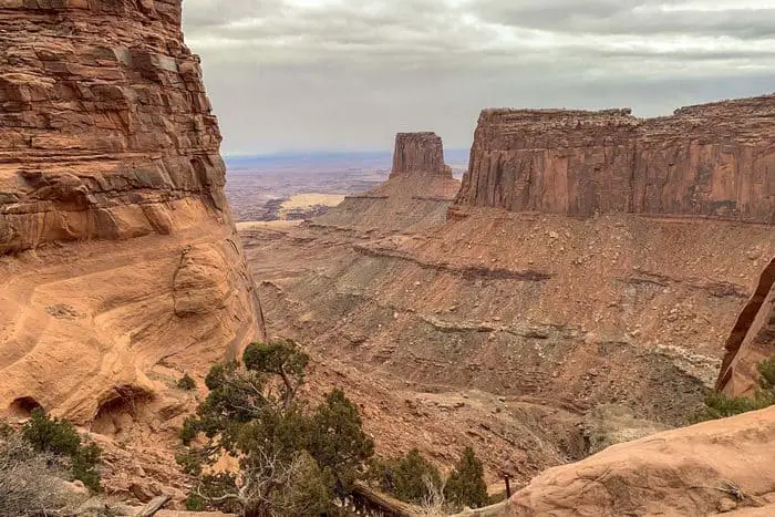
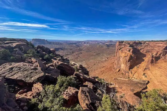
Canyonlands National Park is one of the Utah National Parks and it is around 337,598 acres. The park has many fascinating features including canyons, buttes, mesas, arches, fins, spires, and rivers. Canyonlands National Park is adjacent to the Arches National Park but the two have utterly different sceneries. The park consists of four districts and Horseshoe Canyon. The four districts include The Island in the Sky, The Rivers, The Needles, and The Maze.
Why Visit the Canyonlands National Park
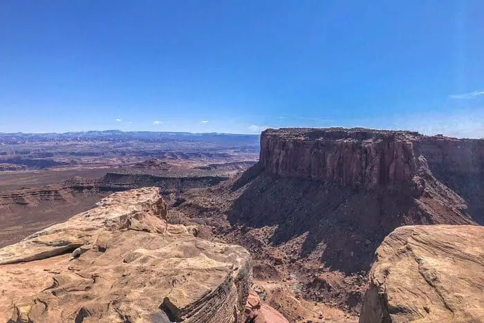
A visit to the Canyonlands National Park is worth it because of the numerous spectacular views. The park is full of stunning features that catch the eye including the mesas, buttes, canyons, arches, and rivers. There are many beautiful views along the paved scenic drive and in the Island in the Sky which sits on a mesa with a height of 1500 feet. Canyonlands National Park is therefore a great destination for your vacation and it is a place where you can obtain a wonderful experience with your entire family.
check out our video
History of the Canyonlands National Park
Many groups of people have moved in and out of the Canyonlands National Park in the last 10,000 years. The creation of the Canyonlands National park was advocated by Bates Wilson who was also the Arches National Monument Superintendent. That call was supported from 1961 by Stewart Udall the Interior Secretary then after he visited the land that is today, the Canyonlands. Canyonlands National Park was then established in September 1964 by President Lyndon B. Johnson and expanded in 1971 to its current size after the Horseshoe Canyon Annex was added.
How to Get To the Canyonlands National Park
If coming from far, you can fly to Walker Field Airport in Grand Junction Colorado. Then from the airport, you can drive for about 1 hour and 45 minutes to Moab town. Once in Moab town, drive towards North for 10 miles along Highway 191. Then from there, drive towards Southwest along Highway 313 for a distance of 22 miles to reach the Canyonlands National Park. It will take you around 40 minutes from Moab town to the visitor center in the park.
Costs and Camping For the Canyonlands National Park
You are required to pay an entry fee to access the Canyonlands National Park. The weekly pass into the park is $30 for a private vehicle with not more than 15 occupants and $25 for a motorcycle. Pedestrians, hikers, and bicyclists are charged $15 per person while children under the age of 15 enter for free. Island in the Sky campers usually pay $15 per night while The Needles campers pay $20 per night.
23 Free Canyonlands National Park Boondocking Locations
1. Canyonlands National Park – Canyonlands NP – Potato Bottom
Address
Potato Bottom Campground B
Moab, Utah
GPS: 38.431606, -110.010694
Elevation: 3967′
Management Public – National Park Service
The road in is 4×4. The permit costs $30 and is good for 14 days and up to 5 Backpackers or 9 people and three vehicles. One motorcycle is considered one vehicle. Backpackers may stay up to seven consecutive nights in any one site or zone.
Best Review:
None

2. Free Canyonlands National Park Boondocking Locations – Horseshoe Canyon
Address
Unnamed Road
Utah
GPS: 38.474081, -110.200243
Elevation: 5341′
Management – Public – Bureau of Land Management
The road in is 4×4. Free Dispersed camping in the Bureau of Land Management Richfield District. No reservations. First come, first served. Vehicles with high clearance and 4WD are suggested.
Best Review:
Nice campground mostly due to its location and views. Exists to provide camping and parking at the head of the trail into Horseshoe Canyon and its rock art. The 31 miles of dirt road in from Highway 24 aren’t bad but sometimes there are long sections of drifted sand to be crossed. In April 2018 they were working on one 100 yard section of sand with a grader and bulldozers. Has a pit latrine with nice painted reproductions of some of the rock art. During the season there is a volunteer ranger who lives in a sheepherder’s trailer above and out of sight from the campground. He primarily acts as a docent and guardian for the rock art.
Amenities:
Restrooms
3. Free Canyonlands National Park Camping Spots – Mineral Bottom
Address
BLM 129
Moab, Utah
GPS: 38.524748, -109.992977
Elevation: 3950′
Management – Public – Bureau of Land Management
Free Dispersed camping in the Bureau of Land Management Moab District. Reservations are not accepted at this campsite.
Amenities:
Restrooms
Best Review:
None
4. Free Canyonlands National Park RV Parking – Bridger Jack Mesa
Address
Beef Basin Road
Moab, Utah
GPS: 38.086149, -109.594346
Elevation: 5282′
Management – Public – Bureau of Land Management
Free Dispersed camping in the Bureau of Land Management Monticello District. First come -> first camped. No reservations are accepted.
Best Review:
Bridger Jack Mesa is open all year. I really liked this place and am glad to have a place near Canyonlands where I can just show up and be able to camp legally. It’s so much nicer than having to make reservations with the law enforcement folks and be on a schedule. The other campers are climbers and there is a friendly scene. The road up to the campground is pretty rough and probably keeps a lot of people out. If you are not familiar with Utah be aware that dirt roads can turn to quicksand after it rains or snows. I drive a Blazer that has 4×4 and good clearance, and had not problem at all.
5. Canyonlands National Park – Horsethief Trail (Mineral Rd) Canyonlands, UT
Address
Moab, Utah
GPS: 38.590363, -109.840694
Elevation: 5741′
Management – Public – Bureau of Land Management
The road in is Dirt and 2 miles from a paved road. Horsethief Trail (Mineral Rd) Canyonlands, UT is open year round I believe. There are 16-29 campsites at this location and the maximum RV length is 45 feet. You may stay 14 days at Horsethief Trail (Mineral Rd) Canyonlands, UT.
Best Review:
This BLM site was quiet and level, we slept great. Although there was another rig within sight, we still felt like the only ones out there. There was also a fire ring. No wildlife sightings, but footprints and other evidence all around. Many of the sites were already taken by 5pm when we rolled in. But we eventually found a very nice spot.
6. Free Canyonlands National Park Boondocking Locations – Small pullout off of BLM Rd 137
Address
Moab, Utah
GPS: 38.641008, -109.814553
Elevation: 5344′
Management – Public – Bureau of Land Management
Small Pullout on left side of road if traveling North West down road in between both Lone Mesa campgrounds from highway 313. This is a small area with room for 3 or 4 sites. There is an unmarked trail that leads up the hill perpendicular to the road way. A small walk leads to the top to reveal 360 degree views of the area, privacy, large space and small fire pit.
Best Review:
Free camping 13 miles from the entrance to Islands in the sky. Plenty of room for multiple RVs. The road in is bumpy gravel, but we did just fine. Take the road to lone Mesa group campsite. Travel about a mile past the turn off .
7. Free Canyonlands National Park Camping Spots – BLM 137
Address
BLM 137,
Moab, Utah
GPS: 38.644005, -109.819677
Elevation: 5290′
Management – Public – Bureau of Land Management
The road in is Gravel. You may stay 14 days at BLM 137. Turn off 313 near milepost 14, onto BLM 137. There is a sign for Lone Mesa Group Campground. Turn onto gravel road. Instead of turning right to Lone Mesa Campground continue down gravel road about a mile. You will see campsite on your left.
Best Review:
Stayed here in May 2021. I stayed in the loop area with all the RVs. Good service! No facilities. It is in a desert environment, so a portable toilet system is needed. Quite crowded. Hed people park very close to me two nights in a row. Not the best place for privacy. The road was rough. I had to drive fairly slow in my prius, but made it without much issue. (Side note: other cars were booking it down the gravel road and rocks would fly everywhere, so keep a good distance from other cars). Good location between Arches and Canyonlands.
8. Free Canyonlands National Park RV Parking – Hammond Canyon Overlook
Address
Utah
GPS: 37.681236, -109.767778
Elevation: 8058′
Management – Public – Forest Service
The road in is Dirt and 15 miles from a paved road. Hammond Canyon Overlook is open April to early Decemberi. There are 6-15 campsites at this location and the maximum RV length is 15 feet. You may stay 14 Days at Hammond Canyon Overlook.
Best Review:
One of the highest elevation camps in the area at 8000 feet with ok+ plus views of Hammond Canyon. One large site with easy access near corrals, several along Canyon rim with high clearance access. As I recall this was at the limit of 3g smartphone access. You can see the worst of the road from the corrals and there are plenty of alternatives in the area. Elk Ridge Road itself is a good quality gravel road.
9. Canyonlands National Park – Human Painted Rocks in Burch Canyon
Address
Lake Powell, Utah
GPS: 37.610409, -109.929119
Elevation: 6811′
Management – Public – Bureau of Land Management
The road in is Dirt and 6 miles from a paved road. There are 1-5 campsites at this location. Cool little prepared spot on public lands great for tent camping (and you can pull your RV in.
Best Review:
My friend and I car camped here for just one night on our way in to Natural Bridges National Monument. It was a great spot! The road in was just over a mile and we had no problems in our minivan. Found a nice flat spot to park and sleep. Noticed a few fire pits around the location but didn’t use them. It’s nice and quiet and away from the road but I imagine in the summer it might get more crowded.
10. Canyonlands National Park Free Campsites – Burch Canyon Road
Address
Road 254
San Juan County, Utah
GPS: 37.601438, -109.923472
Elevation: 6998′
Management – Public – Forest Service
You may stay 14 days at Burch Canyon Road. About 3 miles outside of Natural Bridges National Monument UT, look for a sign for Deer Flat Rd. Turn onto that road. Smaller sites on the left in the trees just as you turn into the road (Burch Canyon) and a larger site (large turnaround area) about a half mile up the road. Several more sites further back the road. But road can be rutty especially if wet. The road is ok first half mile. The park ranger suggested the area to us.
Best Review:
There are two roads close to each other that both have plenty of places to camp. I found a nice back-in site for my 19′ trailer down the eastern road. Anything longer than that may prove difficult to turn around so scope things out first.
11. Free Canyonlands National Park Camping Spots – Fry Mesa
Address
Lake Powell, Utah
GPS: 37.622705, -110.083528
Elevation: 5843′
Management – Public – Bureau of Land Management
The road in is Dirt and .2 miles from a paved road. There are 1-5 campsites at this location. Just off the 95 down a short dirt road, there were a few fire rings set up when we stayed there.
Best Review:
None
12. Free Canyonlands National Park RV Parking – Grand Gulch
Address
Utah 95
Blanding, Utah
GPS: 37.582931, -109.893541
Elevation: 6772′
Management – Public – Bureau of Land Management
The road in is 4×4. Free Dispersed camping in the Bureau of Land Management Monticello District. No reservations. First come, first served. It is recommended that you have 4×4 and high clearance to reach this free camping area.
Best Review:
None
13. Canyonlands National Park – Jct 95 – 261
Address
Unnamed Road
Blanding, Utah
GPS: 37.570671, -109.882549
Elevation: 6801′
Management – Public – Bureau of Land Management
Free Dispersed camping in the Bureau of Land Management Monticello District. No reservations. First come, first served.
Best Review:
About a half mile of the paved road. Downhill going in, not bad. About halfway for 1/16 mile gets washed out, just got to pick your route. I made it fine with my jeep liberty and homemade utility trailer camper. comes out a a large flat area covered in pea gravel. Plenty of room. I would stay here again but due to the bad spot in the road would look got a better spot. No cell signal for att.
14. Free Canyonlands National Park Boondocking Locations – Jacob’s Chair
Address
Utah 95
Lake Powell, Utah
GPS: 37.706954, -110.23939
Elevation: 4849′
Management – Public – Bureau of Land Management
Free Dispersed camping in the Bureau of Land Management Monticello District. First come -> First Camped. Reservations not accepted.
Best Review:
I spent a little over a week there. I was in a 29’class c pulling a motorcycle trailer, and had no trouble getting in and out. The site is close to the highway, but there is not much traffic. I had no cell service, and the nearest pit toilet is about 10 miles away. I was parked on the rim of the canyon with great views in all directions! I had the site to myself most of the time with the occasional motorcycle or jeep going up the trail to Jacobs Chair.
15. Free Canyonlands National Park Camping Spots – Salvation Knoll
Address
Blanding, Utah
GPS: 37.561635, -109.813721
Elevation: 7021′
Management – Public – Bureau of Land Management
The road in is Dirt and 1 miles from a paved road. There are 6-15 campsites at this location and the maximum RV length is 35 feet.
Best Review:
We stayed in this area for 3 nights in April/2021. Found a great site 1.7 miles in from the highway, noticed no traffic at all for the entire time we were there. Lots of room and a beautiful spot down in a little canyon area. We were tent camping, but this large site can likely accommodate all but the biggest rigs.
16. Free Canyonlands National Park RV Parking – Blue Notch Road BLM Boondock
Address
Hanksville, Utah
GPS: 37.763397, -110.293869
Elevation: 4823′
Management – Public – Bureau of Land Management
The road in is Dirt and .5 miles from a paved road. There are 1-5 campsites at this location and the maximum RV length is 40+. You may stay 14 days at Blue Notch Road BLM Boondock.
Best Review:
Blue Notch Road is about five miles south of the boundary of Glen Canyon NRA, directly off of route 95. It’s a 4 wheel drive road that leads to the lake but the first half mile is in good condition and can be driven by any vehicle. The camping spot is 1/2 mile in on the left hand side in a cleared area with a stone fire ring. It’s slightly sloped. The views are beautiful – red bluffs in all directions.
17. Canyonlands National Park – White Canyon Overlook
Address
Lake Powell, Utah
GPS: 37.798324, -110.304595
Elevation: 4610′
Management – Public
West of Natural Bridges National Monument on Hwy 95, just a large pullover site at MP 62.5, but beautiful views of the canyon and not much traffic on Hwy 95 so pretty quiet. There is another larger area about 5 miles east of here as well – both on the canyon side of the road.
Best Review:
None
18. Free Canyonlands National Park Boondocking Locations – BLM dispersed camping
Address
Monticello, Utah
GPS: 38.090756, -109.566584
Elevation: 5348′
Management – Public – Bureau of Land Management
The road in is Dirt. After newspaper rock, but before reaching canyonlands park, either side of the highway for a small section is BLM land open to dispersed camping. There is a great map of the area at newspaper rock showing where you can go, and what areas are free. You can go through the fences with a BLM sign, just be sure to close behind you.
Best Review:
This is a gorgeous place to camp just outside of Needles. Yes it is BLM land and yes they currently let you camp on it, but they close it for camping and any other recreation from about early spring until the fall. This is for the sake of the habitat for the raptor population, and so they can study them. I stayed here in late June, 2022 and was woken up in the morning by a guy from the forest service who had come out to study the birds. There are a few different gates you can go through, the others had a big “NO CAMPING” sign on them and I guess it applied to the one I went through as well.
19. Free Canyonlands National Park Camping Spots – Lockhart Rd Needles Dist Canyonlands NP
Address
Lockhart Rd
Moab, Utah
GPS: 38.1795, -109.66695
Elevation: 4917′
Management – Public – Bureau of Land Management
The road in is Gravel. There are 30 or more campsites at this location. CAMP ONLY IN DESIGNATED PLACES when near Bridger Jack Mesa, Creek Pasture, and Hamburger Rock Campground!!!
Best Review:
A popular boondocking area near the Needles District of Canyonlands Natl Park. Get there early if you can, especially on weekends and holidays. From the highway to the stream crossing you’ll find dozens of user made boondock sites. Don’t go any further than the steam crossing, unless you check it out first. Past the stream may be ok for your pickup camper, but it gets “tight”! There is a wonderful waterfall to the west of the crossing. Some sites have spectacular views; some are sheltered below rock rims.
20. Free Canyonlands National Park RV Parking – Newspaper Rock
Address
Utah 211 Scenic
Monticello, Utah
GPS: 37.988538, -109.519169
Elevation: 6129′
Management – Public – Bureau of Land Management
The maximum RV length at Newspaper Rock is 25 feet. Free Dispersed camping in the Bureau of Land Management Monticello District. This campsite does not use a reservation system. First come, first served.
Best Review:
This is not a campground. You cannot stay here. There is a map here of campgrounds further down the road that you can stay at, one or two of which are free.
21. Canyonlands National Park – Dispersed Camping near Hamburger Rock Campground
Address
GPS: 38.203849, -109.671794
Elevation: 4744′
Management – Public – Bureau of Land Management
The road in is Gravel and 1+ miles from a paved road. There are 6-15 campsites at this location.
Amenities:
Fire Ring
Restrooms
Best Review:
Several camping spots on the road to and past Hamburger Rock Campground, just outside of the Needles District of Canyonlands NP. Really beautiful area and there are some open, higher spots with great 360 views of the valley but there are also ones closer to the river in a valley area that are surrounded by cliffs. Several have walking access to pit toilets. I was in a SUV, but I saw many trailers and longer motor homes.
22. Free Canyonlands National Park Camping Spots – Lockhart Basin Dispersed Camping
Address
Monticello, Utah
GPS: 38.21329, -109.678366
Elevation: 4662′
Management – Public – Bureau of Land Management
About 5 miles from Canyonlands National Park, Needles district, turn off the 211 onto Lockhart Rd (unsigned, but there’s an info display), after a mile or so there starts to be a lot of distributed camping. Road is unpaved but passable by 2WD all the way to the creek. After the creek, the land becomes Utah State Trust Land where you can also camp for free. Restrooms are available at the (paid) BLM camping area right in the middle of the (free) distributed camping.
Best Review:
Beautiful area, near enough to Needles, but there’s tons of traffic here in the summer and fall, and it’s hard to find a camping spot. Also, for 2WD, watch where you pull off of the gravel road to park. Easy to get stuck in deep sand, and towing will cost you TONS out there. No cell service.
23.Canyonlands National Park – Turner Water Canyon
Address
Monticello, Utah
GPS: 38.008240, -109.473491
Elevation: 6542′
Management – Public – Bureau of Land Management
The road in is Dirt and 1 miles from a paved road. There are 1-5 campsites at this location and the maximum RV length is 25 feet. You may stay 14 at Turner Water Canyon. This dirt road leads to a spectacular panoramic view of the area. It’s about 2 mile or so from the more traveled dirt road which leads to county road 211.
Best Review:
**(Corrected GPS 7/2022) Reviewed: 9/2020 – Great website, but not at the coordinates listed. It’s actually here: 38°00’27.3″N 109°28’26.5″W After you turn north on Jackson Spring Road you’ll need to take a right turn on a track that goes up a ridge parallel to the paved road. There are 2 turns to choose from. I took the second one so can’t comment on the quality of the first. Very quiet, and beautiful spot.
Top 10 Trails to Hike at the Canyonlands National Park
Canyonlands National Park has a variety of hiking trails where some can take you just a few minutes and others can even take overnight to cover. The trails have signs to direct you on what to do. However, since there is no water along the hiking trails, you must carry a gallon of water when you start the hike.
Canyonlands National Park Hiking #1. Grand View Point Trail
For this trail, you will need to hike for about 1 hour and 30 minutes to cover a distance of 2 miles with an elevation gain of 10 feet. It is therefore rated as easy. On this trail, you will have a panoramic view of the Canyonlands
Length: 1.8 mi
Elevation gain: 160 ft
Route type: Out & back
Kid friendly, Hiking, Nature trips, Walking, Views, Wildlife, Rocky
Canyonlands National Park Hiking #2. Lathrop Trail
This trail gives you spectacular views of the La Sal Mountains and the Colorado River. It is 12 miles long with an elevation gain of 500 feet hence rated as difficult.
Length: 10.6 mi
Elevation gain: 2,582 ft
Route type: Out & back
Camping, Hiking, Nature trips, Views
Canyonlands National Park Hiking #3. Mesa Arch Trail
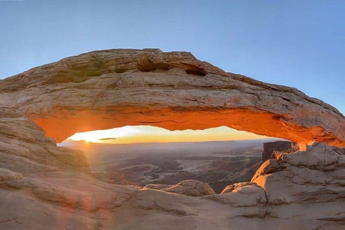
It is 1/2 miles long with an elevation of 25 feet hence rated as easy. It features a beautiful Arch on the edge of a cliff and it takes only 30 minutes.
Length: 0.7 mi
Elevation gain: 88 ft
Route type: Loop
Kid friendly, Hiking, Nature trips, OHV/Off-road driving, Running, Views, Wildflowers, Wildlife, Rocky, No shade
Canyonlands National Park Hiking #4. Murphy Loop Trail
It has a length of 8 miles with an elevation gain of 427 meters and it takes 5-7 hours. Since it is steep and strenuous, it is rated as difficult
Length: 10.1 mi
Elevation gain: 1,614 ft
Route type: Loop
Backpacking, Camping, Hiking, Nature trips, Views, Wildlife, Scramble, No shade
Canyonlands National Park Hiking #5. Neck Spring Trail
It is 6 miles long with an elevation gain of 91 meters. It features springs and it will take you 3-4 hours.
Length: 5.3 mi
Elevation gain: 666 ft
Route type: Loop
Kid friendly, Hiking, Nature trips, Walking, Running, Forest, Views, Wildflowers, Wildlife
Canyonlands National Park Hiking #6. Whale Rock Trail
It has a length of 1 mile with an elevation gain of 25 feet meters and it will take you just one hour. It is moderate and it gives you stunning views of the park.
Length: 0.8 mi
Elevation gain: 131 ft
Route type: Out & back
Kid friendly, Hiking, Walking, Running, Views, Wildlife, Rocky, Scramble, No shade
Canyonlands National Park Hiking #7. White Rim Overlook Trail
If you’re in the area, you must go on this hike. The route had very few people on it, and the views at the finish are breathtaking. Because there is limited parking, plan beforehand. The hike is relatively easy; on the way out, you are gradually descending without realizing it. The incline is noticeable on the way back up, but it isn’t too difficult.
Length: 1.8 mi
Elevation gain: 160 ft
Route type: Out & back
Kid friendly, Hiking, Walking, Views
Canyonlands National Park Hiking #8. Upheaval Dome Trail
This is a fantastic feature! I definitely recommend walking to the second overlook; just keep an eye out for the cairns; my group got turned around a few of times since they weren’t paying attention!
Length: 1.3 mi
Elevation gain: 226 ft
Route type: Out & back
Kid friendly, Hiking, Nature trips, Running, Forest, Views, Wildflowers, Wildlife, Rocky, No shade
Canyonlands National Park Hiking #9. Aztec Butte Trail
The ascent up the Aztec Butte was difficult due to the lack of a route, sand on the slippery rock, and steep grades. The top of the butte wasn’t particularly impressive.
Length: 1.7 mi
Elevation gain: 259 ft
Route type: Out & back
Kid friendly, Hiking, OHV/Off-road driving, Walking, Running, Views, Wildlife, No shade
Canyonlands National Park Hiking #10. Chesler Park Viewpoint
This hike is popular, so get there early if you can. The climb up to the Chesler Park Saddle was fantastic. Look to your left for a little “viewpoint” sign and walk up onto the rocks for a spectacular view. Just a little further down the trail, you’ll come across an Arch in the cliff face to your left. This is the point at which we decided to turn around. Total distance: 5.9 miles, elevation gain: 1217 feet, time: 3 hours 40 minutes, including a lunch time stop.
Length: 5.4 mi
Elevation gain: 1,151 ft
Route type: Out & back
Hiking, Walking, River, Views, Wildflowers, Rocky, No shade
Places and Things to Do and See with Descriptions
Since there are many things to do and see in the Canyonlands National Park, staying there for a considerable duration is essential. That helps you to make many visits to different spots inside the park. For that reason, therefore, deciding where you camp during your trip is critical. The boondocking spots in Canyonlands consist of two front-country campgrounds (Island in the Sky and The Needles) and many other backcountry camping spots and below are the ten great of them:
1. Island in the Sky Campground
This campground is also known as the Willow Flat. The campground has 12 campsites that are given on a first-come-first-served basis. That means that for you to get a campsite from this campground, you have to do proper planning and arrive early enough. Arriving early is essential especially during the peak season since it protects you from the frustration of missing a campsite. The proximity of this campground to the Mesa Arch makes many campers prefer it to any other in or around the Canyonlands National Park. However, it is good to note that the campground has no clean water and that means that you have to carry your water from the Visitor’s Center. You will therefore need a good-size container for carrying the water.
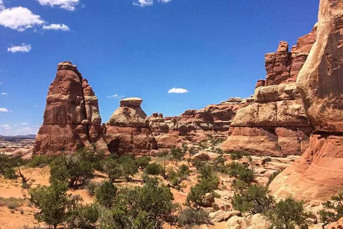
2. The Needles Campground
The Needles is the largest campground in Canyonlands National Park. It consists of 26 individual campsites and three group sites located in different spots in the Needles District. The campground has fire rings, picnic tables, and toilet facilities. If you want to camp for one night as an individual, you will be charged $20. During spring and fall, you can make reservations for individual sites while during the other times of the year, the sites are given on a first-come-first-served basis. Reservations are important since the campsites fill very quickly during spring and fall. Reservations for group sites can be done from Mid-March to Mid-November.
3. Airport Campground
This campground derives its name from a formation within that area that resembles an airport tower. The campground is also flat and open space hence looking like a landing strip. For you to access the four campsites in the area, permits are required.
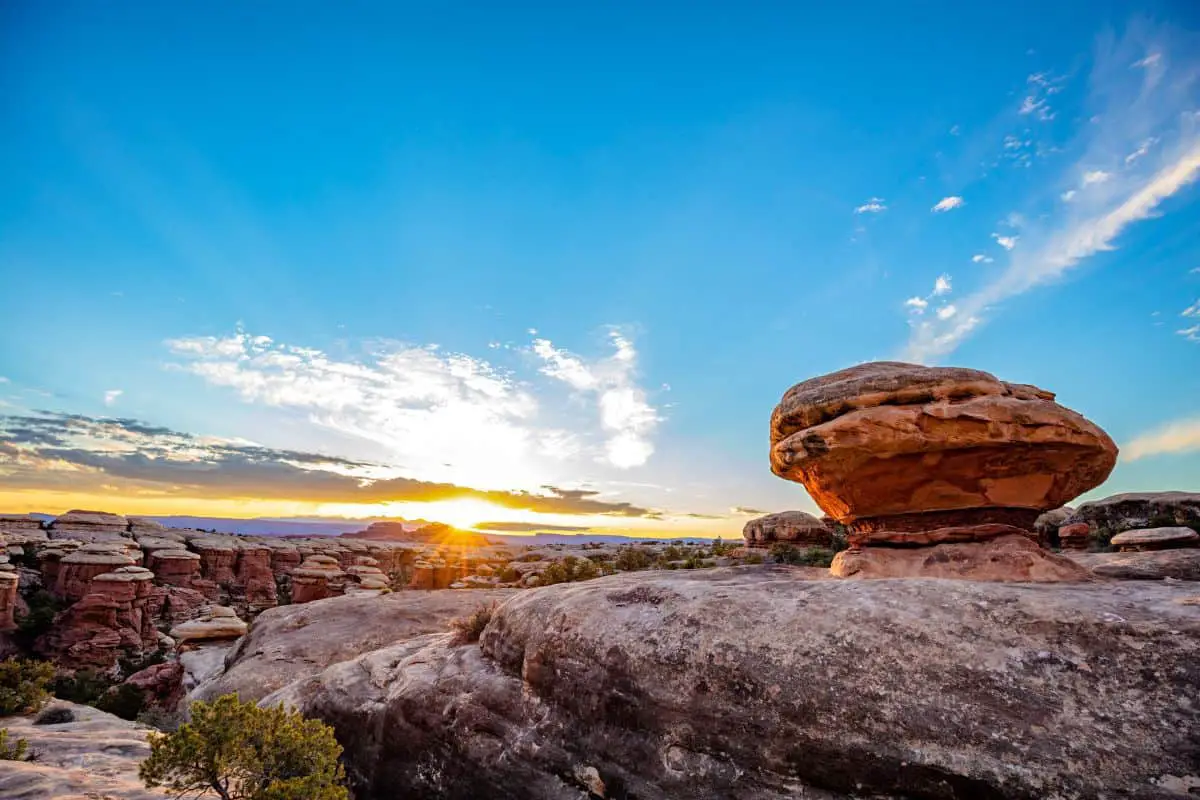
4. Chesler Park
Boondocking at Chesler Park is just fascinating. However, to access the site, you will have to hike a distance of around 11.6 miles but the hike is worth it. As you take the hike, there are colorful sceneries such as the red sandstone and high prairie formations. Furthermore, the campsite usually has fewer people hence no crowding.
5. Devil’s Kitchen Campsites
Devil’s Kitchen Campsite is just a stunning destination, but you will require to drive for about 4-5 hours along the difficult Elephant Hill Road. A four-wheel drive with a length of not more than 21 feet is required to get through the difficult drive. The campground has 4 campsites and a toilet.
6. Gooseberry Campground
This campground is located along the White Rim Trail and lies on a Mesa. That allows you to have stunning views of most parts of the Canyonlands National Park. If you have your own car the better since accessing it on foot will require much time as the hike is long.
7. Labyrinth
Labyrinth Campsites are located on the Island in the Sky District adjacent to White Rim Road. The Green River is also just a few meters away from these campsites. Labyrinth campsites have a very beautiful view of the sky. The wonderful view and the Green River make these campsites unique.
8. Maze Overlook Campground
Once you get yourself a permit, you can access this campground by foot or through either a mountain bike or overland vehicle. The campground has great solitude but has only two sites with no amenities. That requires you to bring your own facilities including a toilet system.
9. Murphy Point Overlook
You will need to plan ahead for you to find yourself in Murphy Point Overlook Campsites because it is only one permit that is given per night. Within these campsites, you will have a great experience of the sunset and sunrise just from the comfort of your tent window.
10. White Crack
To access White Crack Campground, you will require a high-clearance vehicle and carry sunscreen and enough water. The campground has only one site.
Things to Do at the Canyonlands National Park
A visit to the Canyonlands National Park would not be complete if you don’t stop over at the following areas and enjoy different views of the park:
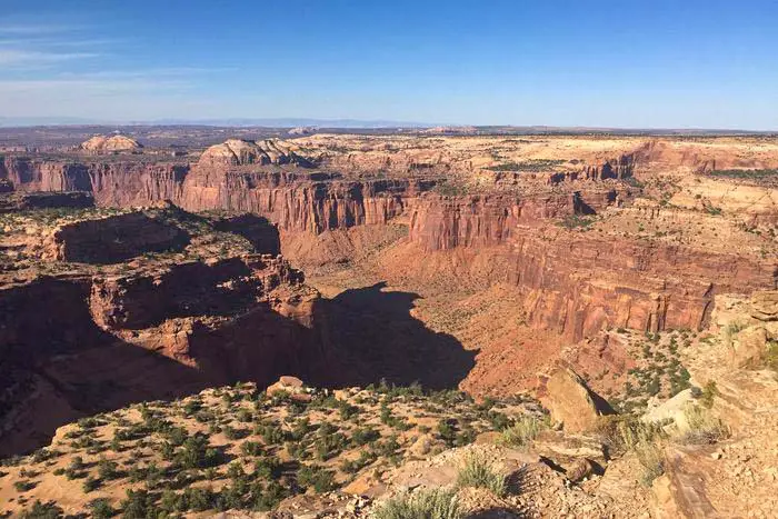
1. Grand View Point
This is an impressive viewpoint in the Canyonlands National Park. From this point, you can have a stunning view of numerous canyons shaped by the Colorado River and Green River.
2. Aztec Butte
Aztec Butte Trail gives you an open view of the Island in the Sky Mesa and the Trail Canyon while it only takes you 1.5 hours.
3. Green River Overlook
Enjoying a view from the Green River Overlook is another top thing to do at the Canyonlands National Park. Apart from the Green River, you can also see Ekker Butte, White Rim Road, and Orange Cliffs from this wonderful viewpoint.
4. Mesa Arch
This is one of the famous formations in Canyonlands National Park and while standing on its top, you will have a spectacular view of the La Sal Mountains and the White Rim. To get iconic pictures of this wonderful formation, taking them at sunrise would be the best time.
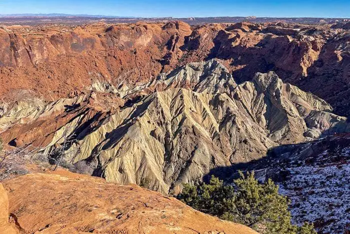
5. Upheaval Dome
This is another beautiful scenery at the Canyonlands National Park that you don’t want to miss anytime you visit the park. It is a huge crater that was probably formed by a meteorite.
6. White Rim Road
White Rim Road loops around the Island in the Sky mesa and it takes around 2 days with a four-wheel drive. This scenic dirty drive will lead you to sceneries that are not easily accessible by hiking.
How Much Time Do You Need For Your Visit
You will require a couple of hours to 2 days for your visit to the Canyonlands National Park. If you are just interested in a few hikes and just a little experience, then a couple of hours are enough. However, if you are an enthusiastic adventurer, 2 days and 2 nights are perfect for you to have a breathtaking experience. On day one, you can visit the Mesa Arch, Upheaval Dome, Green River Overlook, and Grandview Point. On day two you can enjoy jet boat riding along the Colorado River and ride up the Shafer Trail.
Accommodations and Dining Near the Canyonlands National Park
Canyonlands National Park has no dining and lodging facilities but you can get them from the nearby communities such as Moab town which is closer to the Island in the sky, Monticello which is closer to The Needles, and Green River which is closer to The Maze. Some of the restaurants in Moab include Moab Gateway Inn, River Canyon Lodge, Gonzo Inn, Archway Inn, and many more. You can choose any restaurant around Canyonlands National Park depending on your preferences. For instance, there are restaurants best for romantic atmosphere, for families and others are good for their affordability.
Best Time to Visit the Canyonlands National Park
The best time to visit Canyons National Park is during spring or fall when temperatures are neither too high nor too low. Summers are usually hot with temperatures as high as 380 and hence not good for hikers while temperatures can go even below freezing point during winter. If you want some solitude by avoiding crowds, November to February is the best time though you can not access some trails during these months.
What to Pack For Your Visit To the Canyonlands National Park
For you to have a wonderful experience at the Canyonlands National Park, you will need to carry all the essential things required during such a trip. Some of the things that you need to pack include:
• Sunglasses, sun cream, and a hat to protect yourself from sunburn.
• Camera
• First-aid Kit in case of injuries
• Food and snacks
• Water bottles for hydration due to the high desert temperatures in the park
• Clothing and footwear: You will need light clothes and enough layers in case temperatures get too cold. You will also require sturdy hiking shoes.
You might also like some of the articles from our website about boondocking and travel.
For complete photos and videos of our trip visit our photos on our page Facebook Page