

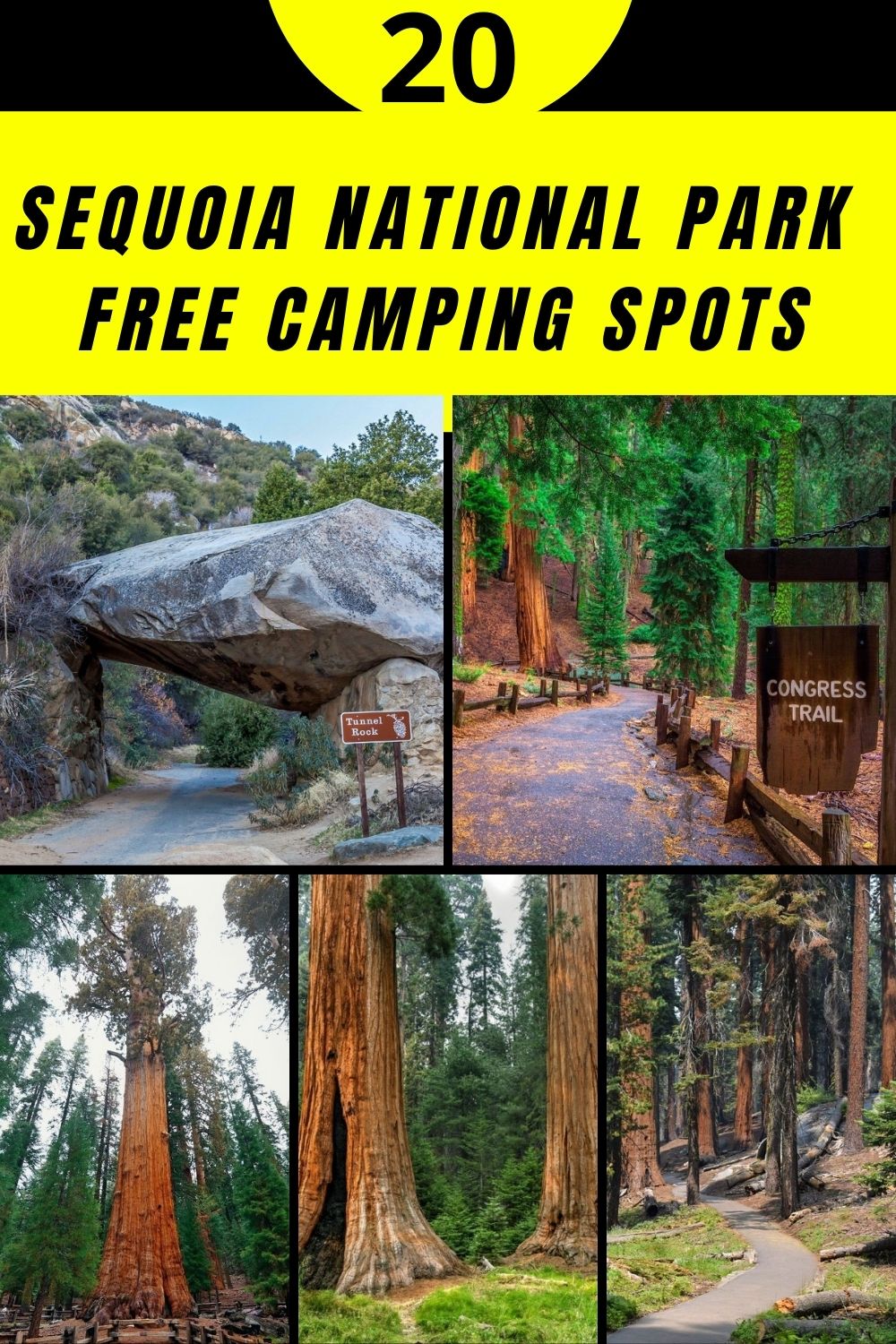
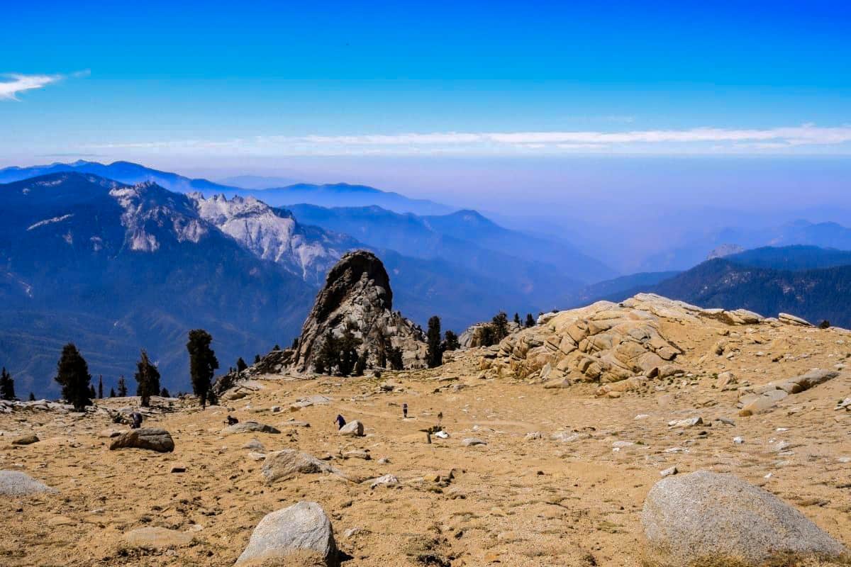
Sequoia National Park in central California is around a 3.5-hour drive from Los Angeles. The park comprises over 631 square miles, and it is home to the largest trees worldwide, mountain peaks, and peaceful canyons. Sequoia National Park is famous for its forest of giant sequoia trees.
On the western section of the Sierra Nevada Mountains, you will come across the last remaining sequoia trees. They can grow between 5000 and 8000 feet high and are among the longest-living trees in the world. A team of researchers recorded the oldest sequoia tree ever, which was around 3,200 years old.
President Benjamin Harrison established Sequoia National Park on 1890 September 25 as the second national park. The President had an aim to protect the forested mountainous terrain. It was the first national park formed to protect living organisms. The area was first home to Western Mono or “Monachee,” who settled in the Kaweah River drainage.
Want more ideas to round-out your trip to California?
A lot of great ideas are in these posts!
- 6 Top Pinnacles National Park Boondocking Locations
- 14 Redwood National Park Boondocking (Updated 2022)
- 18 Kings Canyon National Park Boondocking (Updated 2022)
- 15 Yosemite National Park Camping Spots (Updated 2022)
- 5 Death Valley Salt Flats Boondocking (Updated 2022)
- 419 Awesome California Boondocking Campsites And Maps
- Our Top 25 Yosemite Hikes For All Ages
- 5 Best Hiking Trail Bonita Falls Photos Hot Spots
- 8 Places to Visit in Sequoia National Park
The United States Army Cavalry troops were tasked to safeguard Sequoia National Park. From 1891 through 1913, Army Cavalrymen were sent to the Presidio of San Francisco, including Colonel Charles Young, the first African American military superintendent (1903). Walter Fry, the park’s first civilian superintendent, was hired in 1914. Three years later, in 1916, Sequoia national park Service was founded.
Free Camping and Boondocking Locations Near Sequoia National Park National Park
check out our video
1. Sequoia National Park National Park Free Campgrounds and Boondocking – Kern Plateau – Bonita Meadow
Address
Forest Route 22S41
California
GPS: c
Elevation: 8425′
Management: Forest Service
Free Dispersed camping in the Sequoia National Forest’s Kern River Ranger District. First come -> first camped. No reservations are accepted. This is a high elevation location.
Best Review:
None

2. Sequoia National Forest Free Campgrounds and Boondocking – Kern Plateau – Paloma Meadows
Address
Forest Route 22S20
California
GPS: 36.017353, -118.32719
Elevation: 8468′
Management: Forest Service
Free Dispersed camping in the Sequoia National Forest’s Kern River Ranger District. Reservations are not accepted at this campsite. This is a high elevation location.
Best Review:
None
3. Sequoia National Park National Park Free Campgrounds and Boondocking – Brush Creek Dispersed – Sequoia National Forest
Address
Kernville, California
GPS: 35.97142, -118.479027
Elevation: 4446′
Management: Forest Service
The road in is Dirt. You may stay 14 Nights at Brush Creek Dispersed – Sequoia National Forest.
Best Review:
I positively love Brush Creek. When my grandkids were little, we went there 2 or 3 times per year. Alas, the kids all grew up and spread out, and started families of their own. Last Thanksgiving, my oldest grandson, Skip, and myself and others decided to have a small family reunion at Brush Creek this coming June. It certainly is roughing it a bit, as ther are no “facilities”, if you get my drift, so come prepared, porta potty, etc. Bring your own water, or a filtering device.
Best Review:
4. Sequoia National Park National Forest Free Campgrounds and Boondocking – Calkins Flat
Address
1941 Kern River Highway
Kernville, California
GPS: 35.918243, -118.490873
Elevation: 3504′
Management: Forest Service
Free Dispersed camping in the Sequoia National Forest’s Kern River Ranger District. First come -> first camped. No reservations are accepted.
Best Review:
None
5. Sequoia National Park National Park Free Campgrounds and Boondocking – Upper Peppermint Creek
Address
2750 W. Yowlumne Ave
Springville, California
GPS: 36.08152, -118.527134
Elevation: 7013′
Management: Forest Service
The road in is Paved. There are 30 or more campsites at this location and the maximum RV length is 25 feet. Very beautiful, but it is peppermint and roads are dirt. However it has a n umber of trees and with permit a campfire. A small creek runs thru middle and if you do not act badly(shooting while drinking) you will have a great time.
Best Review:
None
6. Sequoia National Park National Forest Free Campgrounds and Boondocking – Big Rock
Address
Camp Nelson, California
GPS: 36.02468, -118.561294
Elevation: 6381′
Management: Forest Service
The road in is Dirt and .1 miles from a paved road. There are 1-5 campsites at this location. Large sandy area near The Trail of 100 Giants in Sequoia National Forest.
Best Review:
Fantastic campsite. Big enough for 4-5 tents (with a comfortable amount of space). Roughly 3-4 passenger cars. Could fit maybe 2 larger rigs, but the road down is a bit tricky. We had no issue in a passenger car, but there are some larger ruts, and sharp turns (that being said, it is a very short road down to the camping area).
Make sure you have your (free) permit if you are making a fire, or using a camping stove.
Lovely area, nice flat sandy/gravel area for camping, surrounded by a small hill on all sides, and pine trees. Very quiet despite its proximity to the road.
7. Sequoia National Park National Park Free Campgrounds and Boondocking – Ant Canyon Dispersed Camping – Upper Kern River – Sequoia National Forest
Address
Kern River Rd / Mountain Hwy 99
Kernville, California
GPS: 35.88595, -118.45757
Elevation: 3274′
Management: Forest Service
The road in is Paved. You may stay 14 Nights at Ant Canyon Dispersed Camping – Upper Kern River – Sequoia National Forest.
Best Review:
The best spot is just north on Old Mountain Highway 99 of j3061’s coordinates – just south of Salmon Creek on the river side. Don’t blink or you will miss it. Once you pull off the road and down into the little lot, there is a ‘Day Use Only’ skinny sign, but if you make a sharp 180 degree left turn – you will pull into a sweet little incognito camping spot with a fire ring (but don’t use it…no fires) and flat tent spot in front of you with great shade trees. We did not tent camp, but this is great for hidden car camping as you are not visible from the main road.
8. Sequoia National Park National Forest Free Campgrounds and Boondocking – Blackrock Trailhead Golden Trout
Address
Kennedy Meadows, California
GPS: 36.117333, -118.267305
Elevation: 8504′
Management: Forest Service
There are 30 or more campsites at this location. You may stay 1 night at Blackrock Trailhead Golden Trout. Sequoia National Forest.
Amenities:
Horse Corral
Best Review:
The Blackrock Trailhead is a beautiful and easily accessible gateway into the Golden Trout Wilderness. This trailhead is used for camping, hiking, and staging for backpacking trips in the wilderness. Camping is limited to one night and intended as a staging area for those who are going to hike Golden Trout Wilderness. the Horse corrals are available for any stock being utilized in the area. No water provided.
9. Sequoia National Park National Park Free Campgrounds and Boondocking – Kern Plateau – Osa Meadows
Address
Forest Route 20S25
Inyokern, California
GPS: 36.180981, -118.301175
Elevation: 8560′
Management: Forest Service
Free Dispersed camping in the Sequoia National Forest’s Kern River Ranger District. Reservations are not accepted at this campsite. This is a high elevation location.
Best Review:
None
10. Sequoia National Park National Forest Free Campgrounds and Boondocking – Chico Flat Campground
Address
Mountain Road 99
Kernville, California
GPS: 35.8235, -118.462
Elevation: 2935′
Management: Forest Service
Chico Flat Campground is open year round. Free dispersed camping on Upper Kern River in the Sequoia National Forest. Camping and campfires (fire permit required) within 25 feet of the water’s edge is prohibited due to the Wild and Scenic Designation.
Best Review:
It is a wonderful little spot by the river. Pull in sites and regular parking sites. BRING SHADE! We stayed here this weekend and it was hot! Lots of trees and limited “tent camp areas” on the far side of the parking lot but due to this fact we were pretty secluded away from the crowd. Tie yourself off to one of the trees or a rock in the river and float the day away. Wonderful place, minus the lack of shade available at the pull in sites.
11. Sequoia National Park National Park Free Campgrounds and Boondocking – Frog Meadow
Address
Forest Route 24S50
California Hot Springs, California
GPS: 35.874131, -118.575252
Elevation: 7582′
Management: Forest Service
Frog Meadow is open Jun-Oct. The maximum RV length at Frog Meadow is 16 feet. Frog Meadow Guard Station sits at a meadows edge at an elevation of 7,760 feet in the heart of the the Sequoia National Forest and Sequoia National Monument.
Best Review:
The cabin is two hours northeast of Bakersfield, California. It was constructed in the mid-1930s by the Civilian Conservation Corps as a residence for Forest Service fire patrolmen stationed in the area.
The cabin sleeps ten. For larger groups, Frog Meadow Campground is a quarter-mile away and has ten sites that are available on a first-come, first-served basis. Natural Features: The cabin is situated among firs and pines overlooking the meadow. Cattle or deer can often be seen grazing in the field in the early morning and evening hours.
12. Sequoia National Park National Forest Free Campgrounds and Boondocking – Kennedy Meadows Campground
Address
Inyokern, California
GPS: 36.053439, -118.129385
Elevation: 6168′
Management: Forest Service
Free Dispersed camping at Kennedy Meadows. Reservations are not accepted at this campsite. This is a high elevation location.
Best Review:
This is a Sequoia National Forest campground with plenty of space recreation opportunities. The forest service wanted to shut down the site but has kept it available due to a deal with the nearby Kennedy Meadows general store. It appears that the general store owners manage the campground now and allow it to remain a trash free and operable site. No payment or reservation is required but do stop in the general store and buy what you need from the guys who help keep it running.
13. Sequoia National Park National Park Free Campgrounds and Boondocking – Panorama
Address
Forest Route 23S16
Posey, California
GPS: 35.808549, -118.571461
Elevation: 7349′
Management: Forest Service
This free campsite is located within the Sequoia National Forest’s Western Divide Ranger District. This is a high elevation location.
Best Review:
None
14. Sequoia National Park National Forest Free Campgrounds and Boondocking – 18 Miles: – Long Valley Campground
Address
Long Valley Rd.
Inyokern, California
GPS: 35.844894, -118.15152
Elevation: 5363′
Management: Forest Service
The road in is Dirt. You may stay 14 Nights at Long Valley Campground. Free camping in California. Long Valley Campground is located in a semi -wooded setting at 5,200 feet in elevation. Containing 13 sites, this area is the trailhead for a 3-mile trail down to the South Fork of the Kern River within the Dome Land Wilderness.
Best Review:
None
15. Sequoia National Park National Park Free Campgrounds and Boondocking – Multiple Dispersed Sites
Address
Wofford Heights, California
GPS: 35.747751, -118.560942
Elevation: 5577′
Management: Forest Service
Multiple Dispersed sites on forest service land. The road in is Dirt. You may stay 14 Nights at Long Valley Campground.
Amenities:
Fire Ring
Picnic Tables
Restrooms
Best Review:
None
16. Sequoia National Park National Forest Free Campgrounds and Boondocking – Cedar Creek
Address
Evans Road
Wofford Heights, California
GPS: 35.74902, -118.582742
Elevation: 4892′
Management: Forest Service
Free Dispersed camping – > No Reservations Cedar Creek is open all year.
Amenities:
Restrooms
Best Review:
Cedar Creek is open all year. 4800-foot elevation. 11 campsites, with fishing on Cedar Creek. This high elevation campground is a more rustic and mountainous area. The campground offers picnic tables and restrooms. Unsuitable for trailers. Cedar Creek runs the entire length of the campground on both the north and south sides of Hwy 155.
From Glennville, go 10 miles east on CA 155, the campground will be on both the north and south sides of the highway. From Lake Isabella head north on Hwy 155 6 miles where the highway then years to the west. Take Hwy 155 west for 14 miles, and the campground is accessible from the highway. Chains required in the winter.
17. Sequoia National Park National Park Free Campgrounds and Boondocking – Dispersed Campsite – Evans Road – Sequoia National Forest
Address
Glennville, California
GPS: 35.744483, -118.596544
Elevation: 4872′
Management: Forest Service
The road in is Dirt and .1 miles from a paved road. Dispersed Campsite – Evans Road – Sequoia National Forest is open weather permitted. There are 1-5 campsites at this location. You may stay 14 days at Dispersed Campsite – Evans Road – Sequoia National Forest.
Best Review:
Pull off the road, slightly uphill, pull around the circle. A bit sketchy, but I made it in a front wheel drive hatchback. Nice flat area to put up a tent or two, car is parked behind a rock/mound and hidden from the road. Found by chance after finding cedar creek closed to all people, not sure it it’s legit, but we weren’t the first to have camped there. Great views, sounds of bugs and a rocky creek to help you sleep.
18. Sequoia National Park National Forest Free Campgrounds and Boondocking – Stine Cove
Address
6651 Sierra Way
Kernville, California
GPS: 35.679037, -118.409049
Elevation: 2602′
Management: Forest Service
Stine Cove is open all year. This is a free dispersed campsite. No reservations. First come, first served.
Best Review:
Nice area right on Lake Isabella. No shade and a little road noise. Vault toilet. We were the only ones camping. A few people came to fish and walk the beach. You will need a fire permit for cooking on charcoal, gas and for fire pit.
19. Sequoia National Park National Park Free Campgrounds and Boondocking – Haiwee Canyon Road
Address
Olancha, California
GPS: 36.138515, -118.019756
Elevation: 4948′
Management: Unknown
Haiwee Canyon Rd. is open all year. This is a free dispersed campsite. No reservations. First come, first served.
Best Review:
Fantastic quiet spot. The road is not the worst I have been on but great car must be taken. Several spots of rocks to get over and around. I made it in a 24′ class C towing a small car. I did drive very slow. I did not go as far as the creek. There are 2 nice spots after the power lines and before the curve. Nice fire pits to mark the spots. Perfect setting at the foot of the mountains with the reservoir in front. Lots of hiking and biking. I would definitely come again. Good 4G/LTE signal. Would be 5 stars but for the road.
20. Sequoia National Park National Forest Free Campgrounds and Boondocking – Hanning Flat
Address
Patterson Lane
Weldon, California
GPS: 35.67798, -118.371065
Elevation: 2612′
Management: Forest Service
Free Dispersed camping in the Sequoia National Forest’s Kern River Ranger District. This campsite does not use a reservation system. First come, first served.
Best Review:
The Hanning flat was amazing! So many beautiful areas to hike too. Lots of areas for rock climbing. It was peaceful and Serene. Light usage (not a lot of people ) campfires are allowed(with permit.) I love that place and I will come back!!!
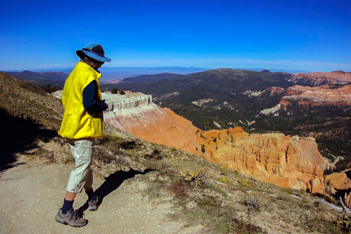
Top 15 Trails to Hike at the Sequoia National Park
Lace up your hiking boots, or slip on your sneakers – there are more than 1,000 miles of Sequoia & Kings Canyon hiking trails for visitors of every ability and inclination. From gentle ambles among giant sequoias to moderate day hikes and full-throttle ascents (including the highest point in the lower 48 states!),
1. General Sherman Tree Trail
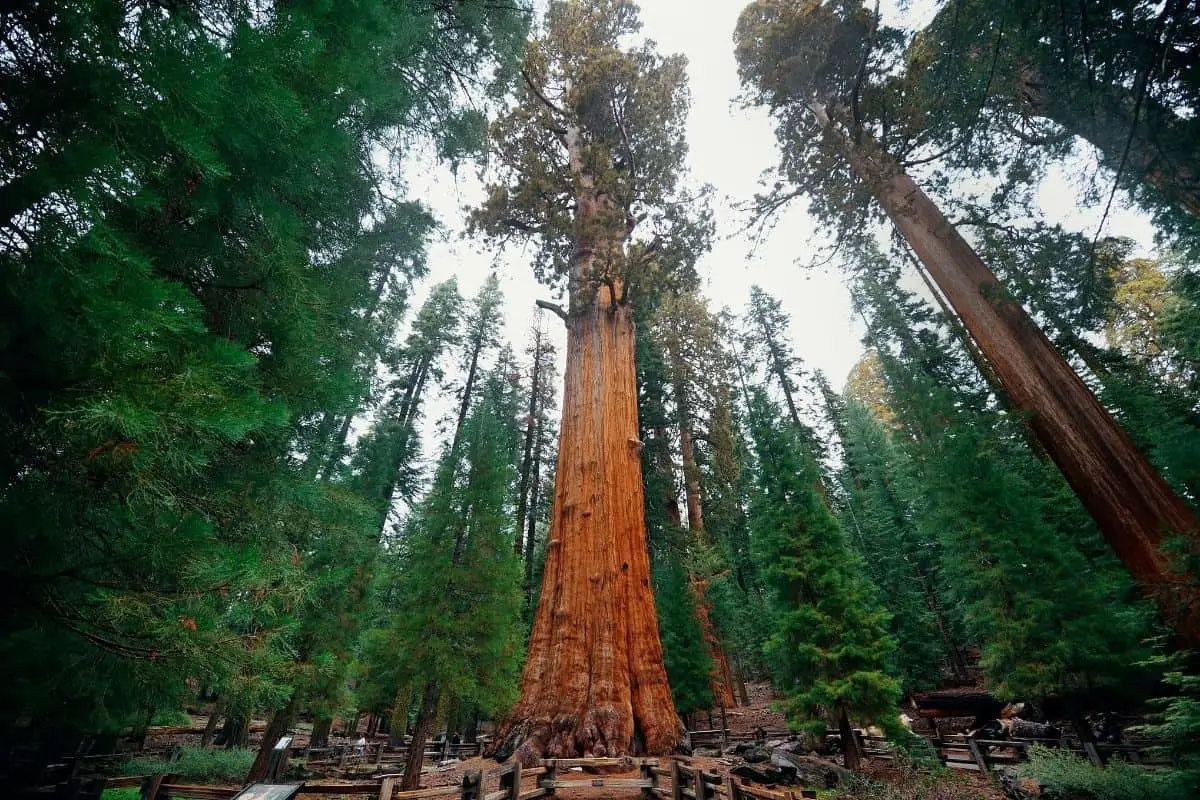
This paved trail will lead you to see the largest tree in the world, General Sherman. You’ll walk down a hill from the parking lot and return by walking back up. Read about the second-largest Sequoia, General Grant in Kings Canyon National Park, in my post about the 16 best trails in the national park system.
Note: This trail is located around 7,000 feet in elevation and can be steep. Allow yourself time to acclimate and rest while you hike this trail. For those with physical disabilities, there is an accessible parking area with a shorter, accessible trail leading to the General Sherman Tree.
Difficulty: Moderate
Distance: 0.8 mi / 1.3 km one-way
Elevation Gain: 154 ft / 47 m
Families, wheelchairs, strollers
2. Big Trees Trail
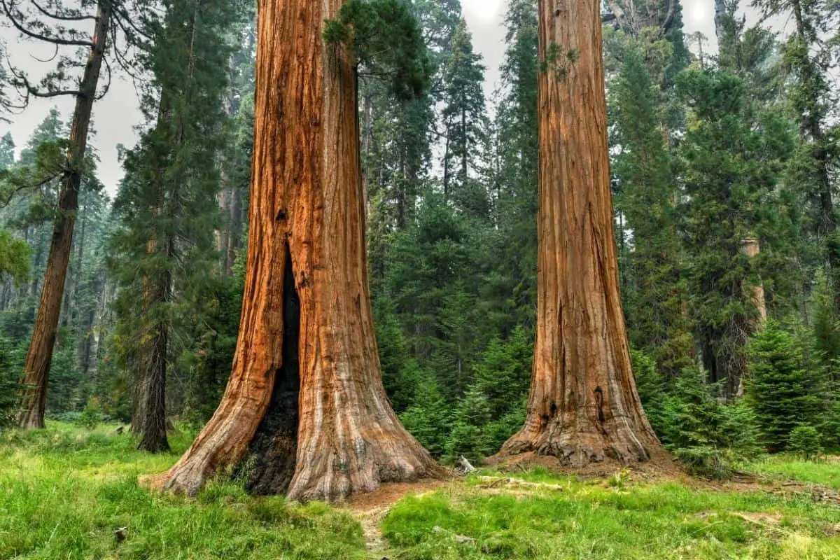
Beginning at the Giant Forest Museum, this trail takes you through one of the park’s Sequoia groves. Along this accessible path, you’ll find hundreds of Sequoia trees. Waysides along the way will also answer commonly asked questions, such as why do Sequoias thrive in the High Sierra?
Difficulty: Easy
Distance: 1.4 mi / 2.3 km one-way
Elevation Gain: 50 ft / 15 m
Families, wheelchairs, strollers
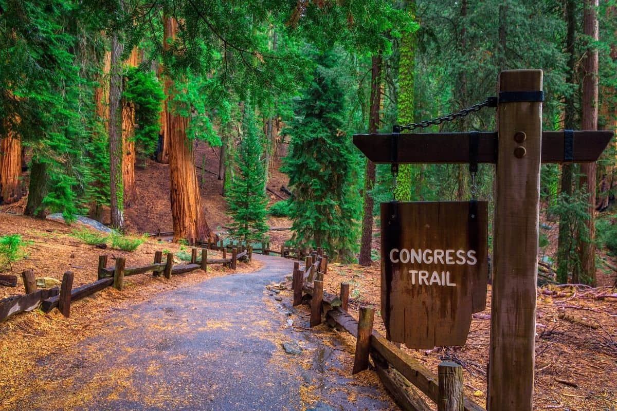
3. Congress Trail
The Congress Trail is an extension of the trail to the General Sherman Tree. Along the trail, you’ll see more of the world’s largest trees and interpretive displays so you can learn more about the Sequoias. The trail includes the Senate and Congress groups along with the President Tree and the McKinley Tree. Are you noticing a theme?
Difficulty: Easy
Distance: 2 mi / 3.2 km loop
Elevation Gain: 230 ft / 70 m
Families, wheelchairs, strollers
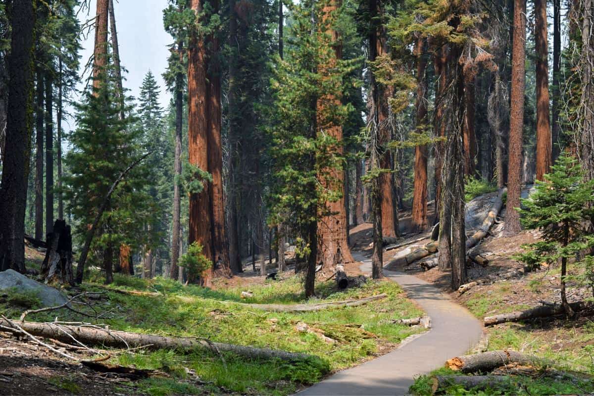
4. Congress-Trail of the Sequoias-Tharp’s Log-Congress Loop
To expand even further, you can take the Sherman Tree Trail to the Congress Trail to the Trail of the Sequoias to form a long loop. No matter which loop you choose, prepare to be in awe of these massive wonders. The trail is partially paved (near the General Sherman Tree).
Note: AllTrails refers to this as the Giant Forest Loop, but this is NOT an official trail name. Make sure to note the true trail names to avoid getting lost while exploring the best hikes in Sequoia National Park.
Difficulty: Easy
Distance: 7 mi / 11.3 km one-way
Elevation Gain: 1,282 ft / 391 m
Families, seeing the big trees without the crowds, trail runners
5. Moro Rock Trail
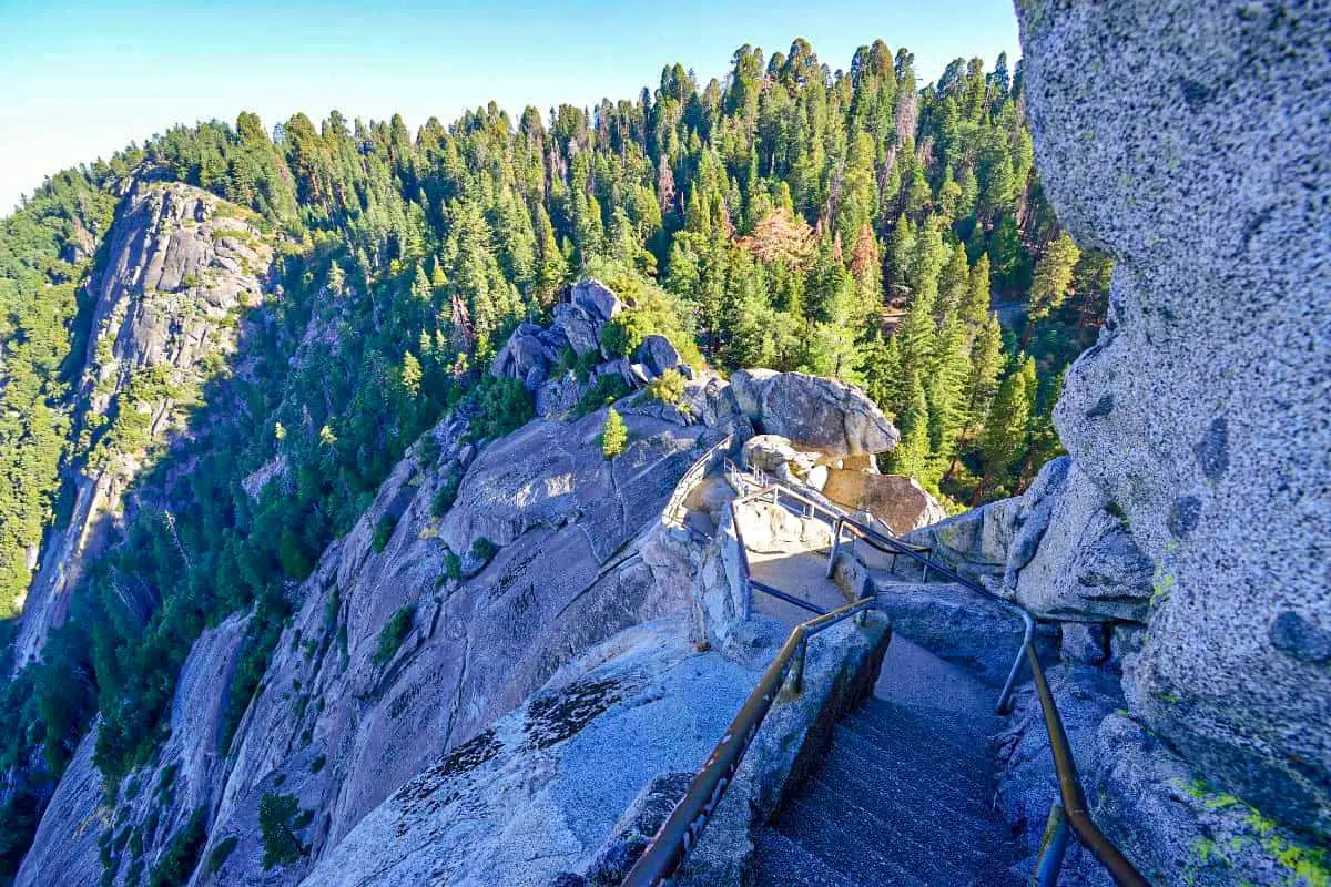
One of the most popular hikes in Sequoia National Park tasks you with climbing over 400 stairs to reach the top of Moro Rock for a spectacular view. The full panorama is truly breathtaking, both in beauty and necessity. The 400-stair climb is especially challenging at elevation for those who aren’t used to it, so take your time.
Note: Social distancing is not possible on the staircase. Please wear your mask on Moro Rock!
A paved staircase leads to the top of a granite rock
Difficulty: Moderate
Distance: 0.6 mi / 1 km one-way
Elevation Gain: 300 ft / 91 m
Rock climbing, views
6. Crystal Cave Trail
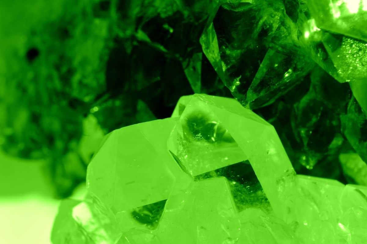
This trail is partially paved. There’s a waterfall on your way to the cave entrance. You must purchase tickets for the cave before your hike ($18 per person). You cannot hike the trail without a cave ticket. Tickets can be purchased online.
Flowstone and stalactites in a cave
Difficulty: Moderate
Distance: 0.8 mi / 1.3 km one-way
Elevation Gain: 291 ft / 87 m
Families, walking
Cost: $18
7. Tokopah Falls (Tokopah Valley Trail)
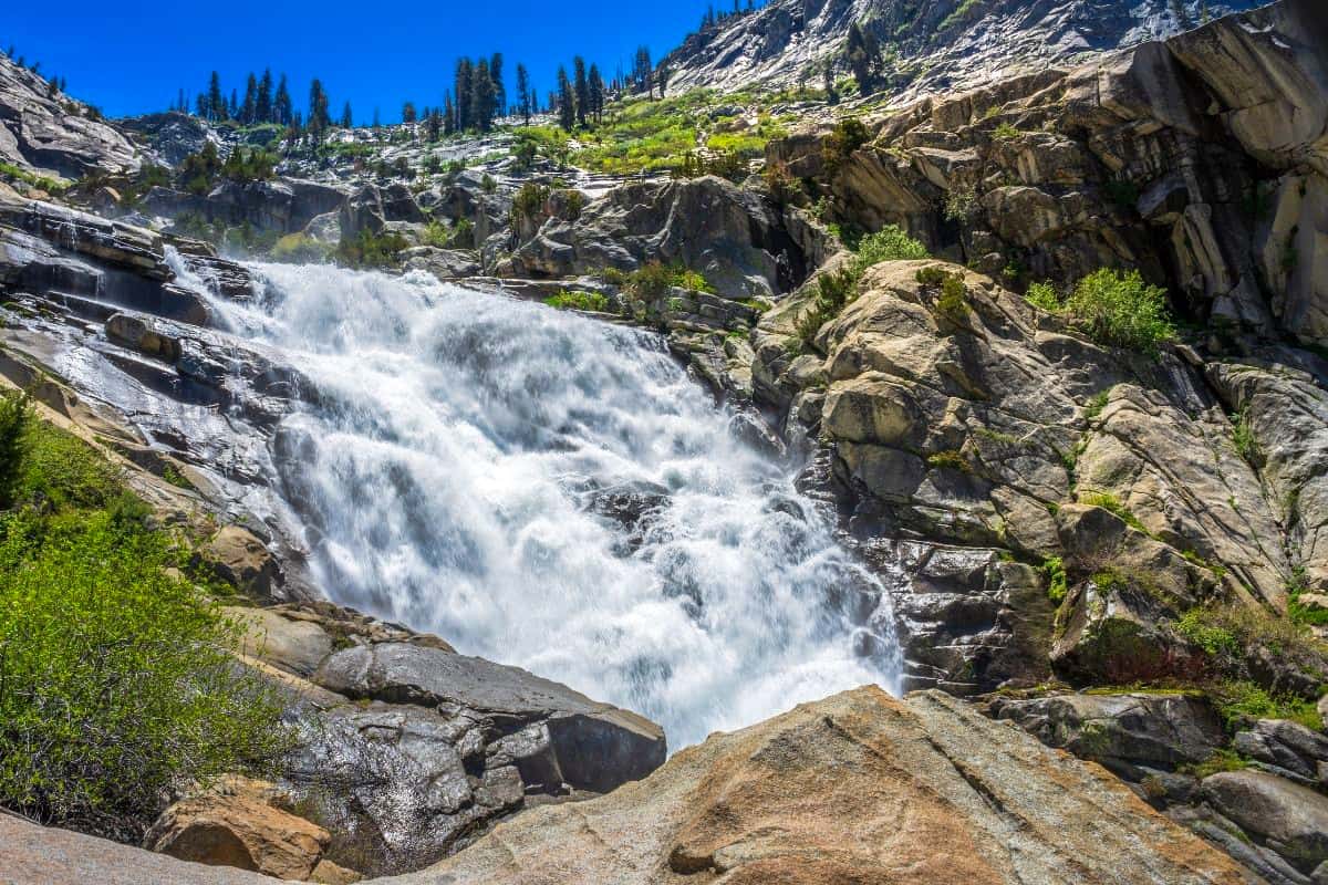
This rocky trail leads you two miles through the forest to a waterfall. You’ll walk through a valley along the Middle Fork of the Kaweah River, passing occasional meadows. The falls are best in spring as the snow melts from the higher peaks. In late summer, you may only see a trickle.
Difficulty: Moderate
Distance: 2 mi / 3.8 km one-way
Elevation Gain: 630 ft / 192 m
Families, walking, trail runners
8. Big Baldy Ridge Trail
This lovely trail takes you up to a ridge for fantastic views. Along the way, you’ll walk through fields of wildflowers (if the season is right).
Difficulty: Moderate
Distance: 5.5 mi / 8.9 km loop
Elevation Gain: 1,391 ft / 424 m
Wildflowers, walking, trail running, views
9. Ladybug Camp Trail
Another trail with marvelous diversity is the Ladybug Camp Trail. You’ll pass through Sequoia trees on your way to outstanding views.
Note: Due to the 2020 wildfires, use caution as you hike in this area.
Difficulty: Moderate
Distance: 7.2 mi / 11.6 km one-way
Elevation Gain: 1,952 ft / 595 m
Families, backpacking, camping, mountain biking, trail running
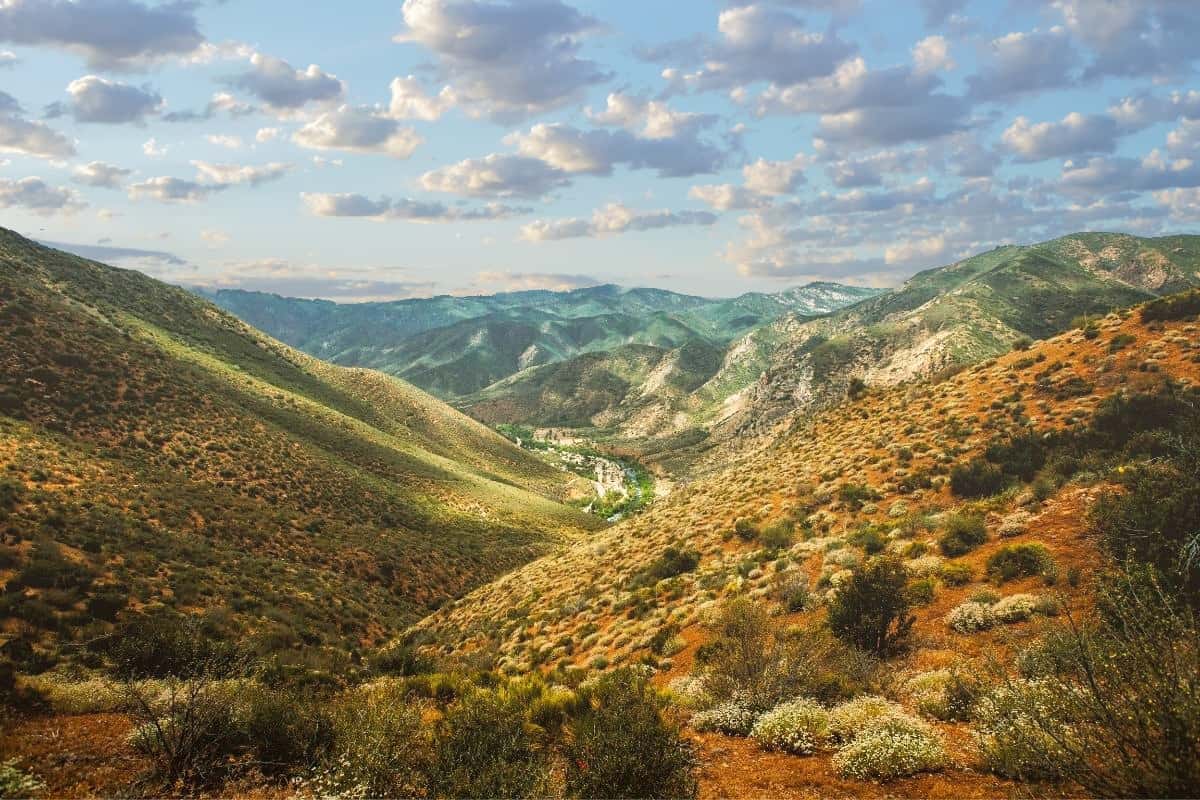
10. Marble Falls Trail

One of the park’s longer moderate trails is Marble Falls. You’ll walk through a deep canyon in the Foothills District of the park toward a waterfall. Look out for poison oak along the trail (remember, leaves of three!) and prepare for a strenuous climb. I would not recommend this trail in the summer – it is challenging to find shade, and temperatures exceed 100 degrees all too often. If you insist on hiking to Marble Falls, go as early as you can.
Difficulty: Moderate
Distance: 7.4 mi / 12 km one-way
Elevation Gain: 2,150 ft / 655 m
Walking, trail running, wildflowers
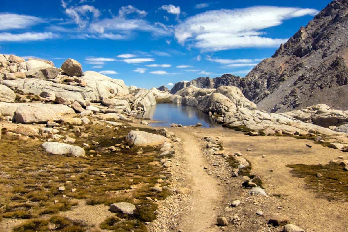
11. Watchtower Trail to Heather Lake Trail
In the Lodgepole area of the park, you’ll find a variety of trails to Sequoia groves, alpine lakes, and mountain vistas. The Watchtower Trail will lead to all of these, and you can continue beyond Heather Lake if you wish to see more. This trail is best in the summer; as soon as ice is present, the trail is closed for the winter season.
Difficulty: Moderate
Distance: 8.1 mi / 13 km one-way
Elevation Gain: 2,112 ft / 647 m
Backpacking, horseback riding, snowshoeing, trail running, views
12. Mineral King Trail to Eagle Lake Trail
You’ll be gaining elevation on this hike, rounding out at about 10,000 feet at Eagle Lake. Make sure you know you are prepared for the altitude. To make this a longer trip, you can connect with the Mosquito Lakes Trail.
Difficulty: Strenuous
Distance: 7.2 mi / 11.6 km one-way
Elevation Gain: 2,200 ft / 671 m
Hiking, trail running
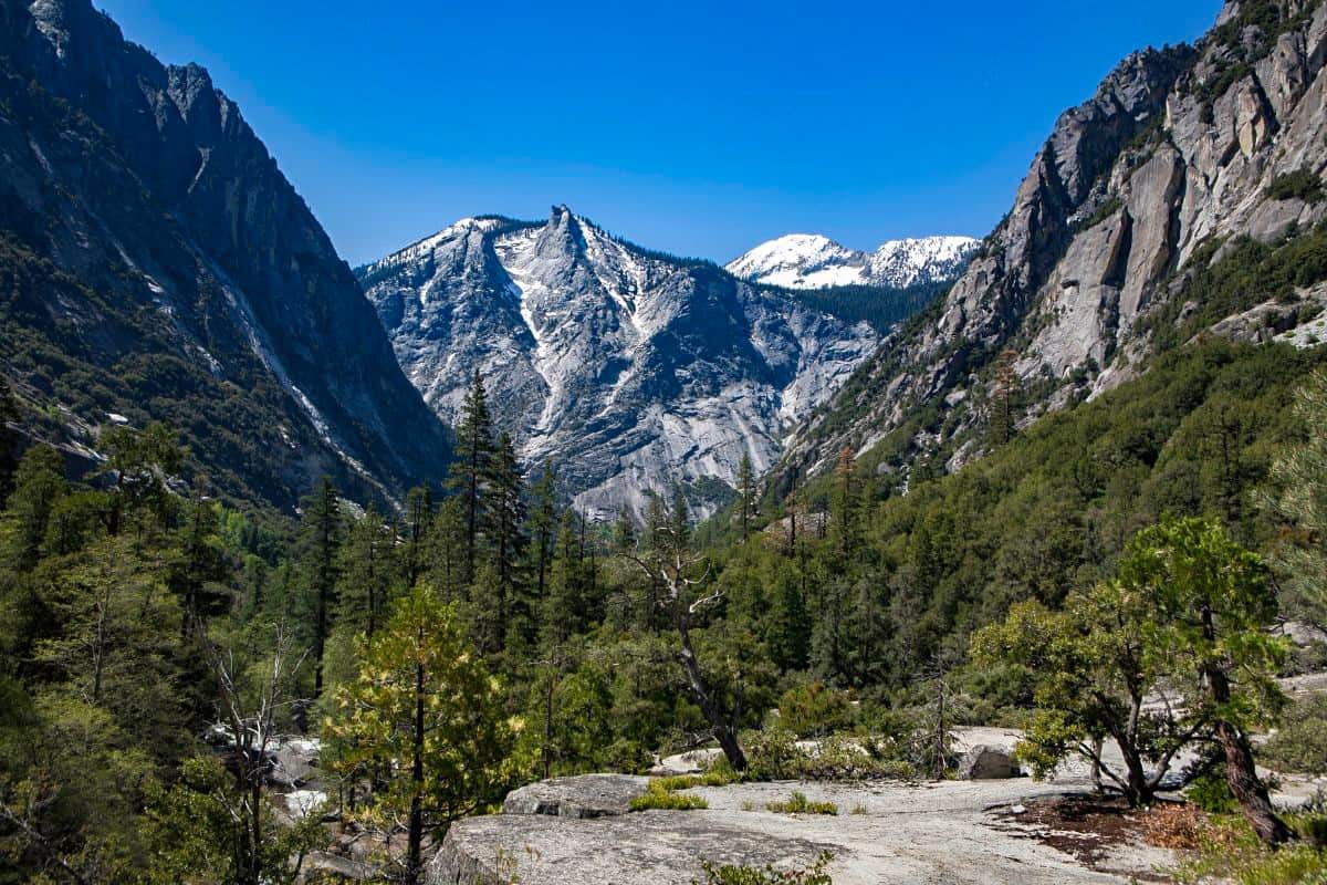
13. Alta Peak Trail
If you’re looking for a tough hike with grand rewards, go for Alta Peak. It’s challenging, so make sure you are up for an adventure. Enjoy the views from over 11,000 feet!
Difficulty: Strenuous
Distance: 7.5 mi / 12 km one-way
Elevation Gain: 4,500 ft / 1,372 m
Experienced hikers, cross-country skiing, snowshoeing, trail running
14. Monarch Lakes via Sawtooth Pass Trail Trail
This is a great day hike with wonderful views. If you’re interested in backpacking, you can continue on by connecting with the Sawtooth Pass Trail (next on the list), which leads to more beautiful lakes.
Difficulty: Strenuous
Distance: 8.4 mi / 13.5 km round-trip
Elevation Gain: 2,500 ft / 762 m
Backpacking, camping, hiking
15. Sawtooth Pass Trail
This strenuous trail leads to beautiful views of the Sawtooth Valley. You can also continue on to see the stunning Columbine Lakes.
Difficulty: Strenuous
Distance: 12.7 mi / 20.4 km round-trip
Elevation Gain: 4,313 ft / 1,314 m
Hiking, rock climbing, backpacking

Costs and Paid Camping For the Sequoia National Park
Sequoia National Park has seven campgrounds, each giving a unique experience amidst the world’s largest trees. These campgrounds, which are divided into three areas, provide something for every type of traveler. The cost of camping in one of these campgrounds is affordable and ranges between 12 and 22 dollars per night.
6 Places and Things to Do and See with Descriptions
1. General Sherman Tree
With a height of 275 feet, this tree is the largest in the United States and the entire world. The tree was incredible, and several other Sequoias in the Sequoia National Park area, as well as a fallen tree that an adult can walk under.
2. Buck Rock Lookout
Judging from the relatively small number of reviews, the Buck Rock Fire Lookout seems to be not well-known, but it rivals more famous Moro Rock as an essential viewpoint to visit in the Kings Canyon / Sequoia National Park area. While Buck Rock is only a few miles off the main Generals Highway route through the national parks, it does require a short (a little over 2 mile) approach along a dirt road. It’s not a difficult road at all, but it will be helpful to drive it in an SUV or other higher-clearance vehicle
3. Giant Forest Museum
It provides an overview of the region’s gigantic sequoias, meadows, and human history. The museum is housed in the National Register of Old Places-listed historic Giant Forest market structure. The Giant Forest offers various walks, ranging from small one-hour excursions to daylong excursions in Sequoia National Park.
4. Mount Whitney
This is the tallest peak in the contiguous United States, standing at 14,494 feet above sea level. Join the tens of thousands of people who climb this mountain every year on a long one-day or two-day journey. It is only a 22-mile round-trip hike, after all!
5. Tunnel Log
Visitors to Sequoia and Kings Canyon can drive through Sequoia Park’s fallen “Tunnel Log” located along the Crescent Meadow Road in Giant Forest.
The fallen Tunnel Log of Sequoia National Park came into being after an unnamed giant sequoia fell across the Crescent Meadow Road in late 1937 as a result of “natural causes.” The following summer, a tunnel was cut through the fallen log as a visitor attraction.
6. Tunnel Rock
This granite boulder created a tunnel over the Generals Highway until the road was rerouted. If you want to take a closer look, accessible parking and a paved path provide easy access to the old roadway beneath Tunnel Rock.
How to Get To the Sequoia National Park
Getting to Sequoia National Park is easy with the availability of several entry points. Fresno Yosemite International Airport is 53 miles from Sequoia National Park and Visalia Municipality Airport if you prefer flying into the nearest airport. International airports are a few hours’ drive from the park.
If you plan on driving to the park, be aware that mountain roads are narrow and curvy. RVs, trailers, and other vehicles longer than 22 feet (6.8 meters) are subject to length restrictions and recommendations.
Hanford and Fresno are the closest Amtrak stations to the Sequoia National Park. Amtrak operates bus connections from Hanford to Visalia Transit Center, connecting with the Sequoia Shuttle (summer only). Hanford is roughly 20 miles west of Visalia and one hour and 45 minutes from Highway 198’s Sequoia National Park Entrance.
Things to Do at the Sequoia National Park
1. Walk through Chimney Tree
Even though fire murdered this tree tragically, it transformed it into Chimney Tree, and it is still a fun destination to visit because it is still standing, and you can walk inside! This is the location to go if you want to experience what it is like to be inside a Sequoia tree. Because it is so unique, it is quickly becoming most tourists’ favorite Sequoia National Park attractions.
2. Enjoy the seedlings at the Giant Forest Museum.
This is a fun place to visit in Sequoia National Park if you want to learn more about Sequoia’s various forest parts and observe the baby Sequoia seedlings growing near the windows. If you are curious about how Sequoias grow into the giants we know and love, here is a fascinating and fast stop to witness them in their infancy!
3. Hume lake
This lovely lake, located between Grant Grove and Kings Canyon, was designed to give water to a flume. It is now a swimming and paddle-boating place.
How Much Time Do You Need For Your Visit
Depending on how much trekking you choose to do, you may spend anywhere from two days to two weeks in Sequoia National Park trails. It is primarily a hiking area. Walking Congress Trail and seeing the General Sherman tree is a must. This may take a few hours.
Accommodations and Dining Near the Sequoia National Park
1. Wuksachi Lodge
It is located in Sequoia National Park’s Giant Forest section, the facility has 102 guest rooms, a cocktail lounge, a full-service restaurant, and a gift store.
2. John Muir Lodge
Grant Grove Village has 36 motel rooms and a restaurant in the Grant Grove region. A sequoia grove, market, post office, restaurant, tourist center, and a gift store are within a half-mile of the lodge.
3. Three rivers
The small town itself is not particularly remarkable, but it does have the advantage of being the gateway to Sequoia National Park, which explains why there are various inexpensive lodging options here. You can find other hotels along Generals Highway as you approach the park’s entrance.
9. Best Time to Visit the Sequoia National Park
The months of June to August are the greatest for visiting Sequoia national park because the weather is the most consistent. The park is open all year, but certain seasons present unique problems, such as during the winter season in December, and snow chains or tires are required to navigate park roads safely.
What to Pack For Your Visit To the Sequoia National Park
This list will guarantee that you have everything you need to enjoy a day in Sequoia National Park, whether you are a first-time visitor or a seasoned park expert. Please keep in mind that you will not leave anything on the Shuttle during your journey, so make sure you have everything you need with you.
A backpack to put your supplies
Water to keep you hydrated
Snacks to maintain your energy levels
Camera to capture the best memories
Binoculars to help you see the glory of the environment
You May Want to Join Our Boondocking Group on Facebook For More Information
You May Want to Join Our Campfire Recipes Group on Facebook For More Information