Boondocking Bandelier National Monument is a great activity near Los Alamos in Sandoval and Los Alamos counties, New Mexico. We loved our trip there and to the other 3 stops nearby we had to share this with you.
Why Visit the Bandelier National Monument
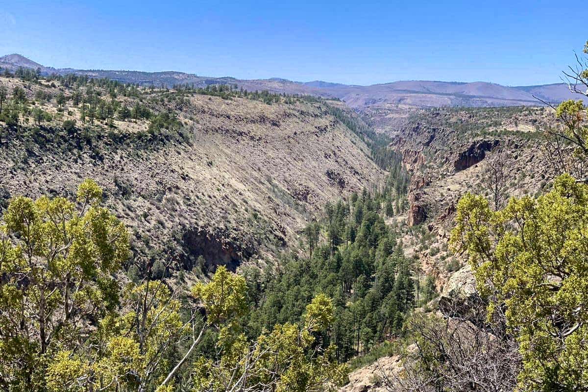
This beautiful destination covers an estimated area of 120 square kilometers, and it is under the management of the National Park Service. Additionally, Bandelier National Monument is home to some of the more unique attractions in New Mexico and the United States. It is a never to miss location to visit during your trip to New Mexico. It will be a memory you will always remember.
Here Are the Reasons We Loved Exploring Bandelier
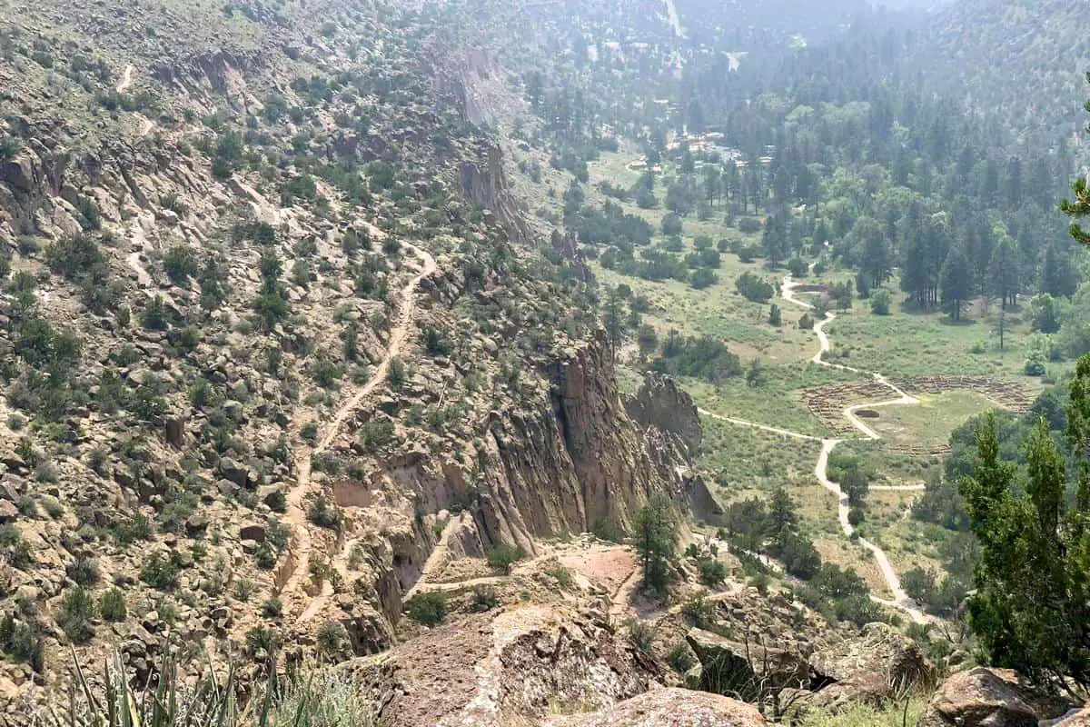
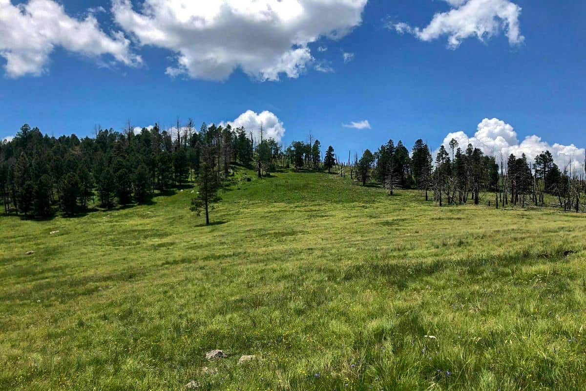
There are more than 70 miles of trails in Bandelier National Monument. This national monument features over 70 miles trails are suitable for hiking, cross country skiing, and snowshoeing. During the summer you can go hiking on the trails there. While during the winter (between Mid-November to Mid-March), you can cross country skiing and snowshoe is some trails such as the trails in the Upper Frijoles Area off of Highway 4, i.e., The Cerro Grande Trail, The Alamo Boundary Trail, two Upper Frijoles trail 2.4 miles round-trip and Upper Frijoles Loop trail 5 miles round trip. Other trails include Pueblo Loop Trail, Falls Trail, Alcove House Trail, Frey Trail, and many more.
Want more ideas to round-out your trip to New Mexico?
A lot of great ideas are in these posts!
- 14 Free Rio Grande del Norte Boondocking (Updated 2022)
- 141 Best New Mexico Boondocking Spots Plus Maps
- 17 White Sands National Park Boondocking & Free Camping Sites
- 12 Top Las Cruces Free Camping and El Paso Boondocking Stops
- 9 Best El Morro National Monument Boondocking Spots
- 16 Gila Cliff Dwellings Monument Boondocking (Updated 2022)
Bandelier National Monument is home to over 100 flower species that grow and bloom. The variety of flower species in this national monument provides it with beautiful and unique scenery when they bloom. Some of the flower species in this national monument include Musk thistle, Whole leaf Indian paintbrush, Wyoming Indian paintbrush, Missouri milkvetch, common yarrow, and many more.
There is incredible wildlife that calls Bandelier National Monument home that you may get a chance to see during your visit. During your visit, you will find a variety of snakes, butterflies, birds, and other wildlife. More than 55 species of mammals, including more than ten species of bats, mule deer, Abert’s squirrels, mountain lions, and many more, call this national monument home.
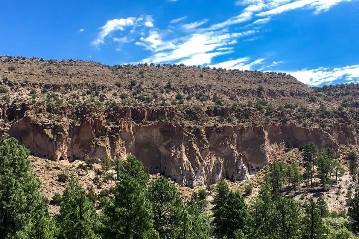
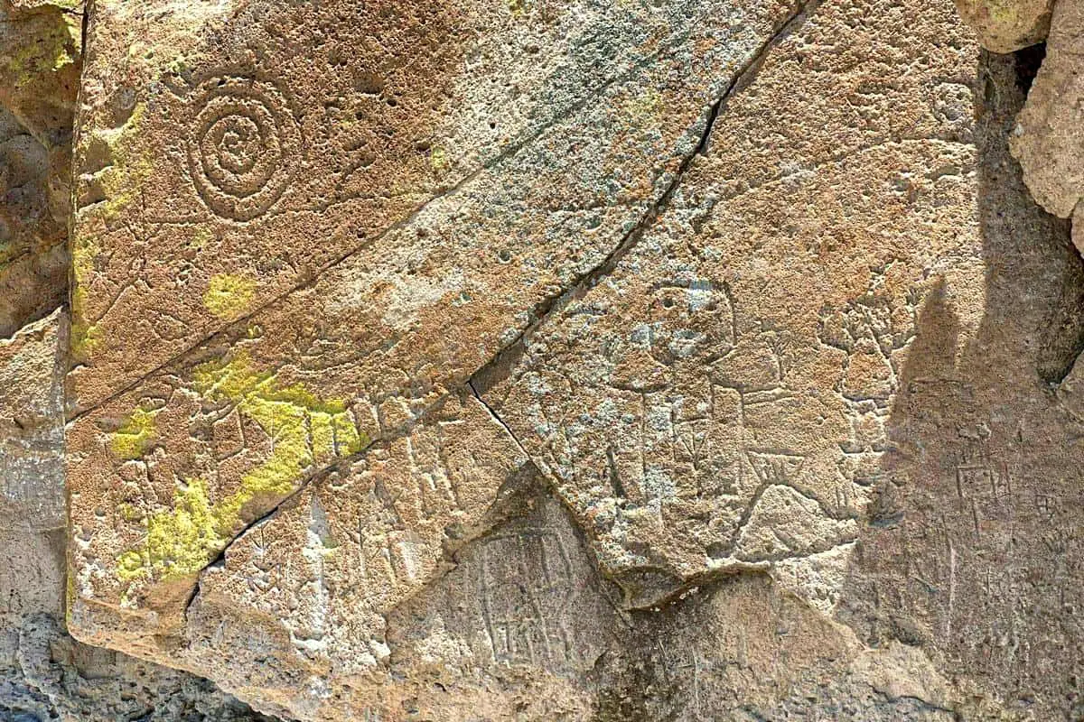
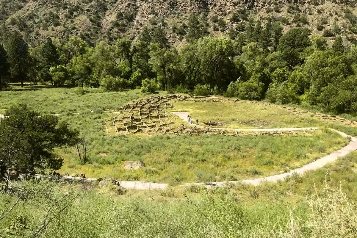
Bandelier National Monument is home to some fascinating and captivating historical artifacts. This is one of the unique ancestral settlements found in the Bandelier National Monument that you can visit during your trip there. You will get to visit and see caves, petroglyphs, and the Ancestral Pueblo village of Tsankawi while in Bandelier National Monument.
Bandelier National Monument features some of the best places you can use for outdoor expeditions either with friends or as a family. There are some great spots in this national monument that you can pitch your tents and enjoy viewing the sky beauty at night during your outdoor expedition. There are great places for backpacking in Bandelier National Monument.
check out our video
History of Bandelier National Monument
The history of this national monument extends to more than 10,000 years back. Around 10,000 years back, before 1150 CE, nomadic hunter and gatherers followed migrating wildlife across the mesas and canyons to this region. After 1150 CE, the Ancestral Pueblo people started settling around this region and building permanent settlements where they stayed. The permanent settlement can be witnessed in the Tsankawi section.
By around 1550, the Ancestral Pueblo people started to move from their homes to settle along Rio Grande (Cochiti, San Felipe, San Ildefonso, Santa Clara, Santo Domingo). The Spanish settlers made Frijoles Canyon their home in the mid-1700s. Further, in the late 1800s, Jose Montoya of Cochiti Pueblo decided to bring and show a Swiss-American anthropologist, Adolph Bandelier, his people’s ancestral homelands. Adolph F. A. Bandelier described the settlements he saw during his visit as the grandest thing he had ever seen.
In 1916 a legislation to create a national monument was created. President Woodrow Wilson then signed the created legislation, and Bandelier National Monument was formed and named after the Swiss-American Adolph F. A. Bandelier. This national monument was created to preserve the Ancestral homes of the Pueblo people. During World War II, this national monument was closed for public use since it was being used to house the Manhattan Project and military personnel. 3. Places and Things to Do and See with Descriptions in Bandelier National Monument
Bandelier National Monument is a vast destination that covers around 33,677 acres in the United States. There are great destinations, attractions, and various sightseeing within this natural monument that will make your trip memorable by visiting and seeing. Here are the best places and things to do and see during your visit to Bandelier National Monument.
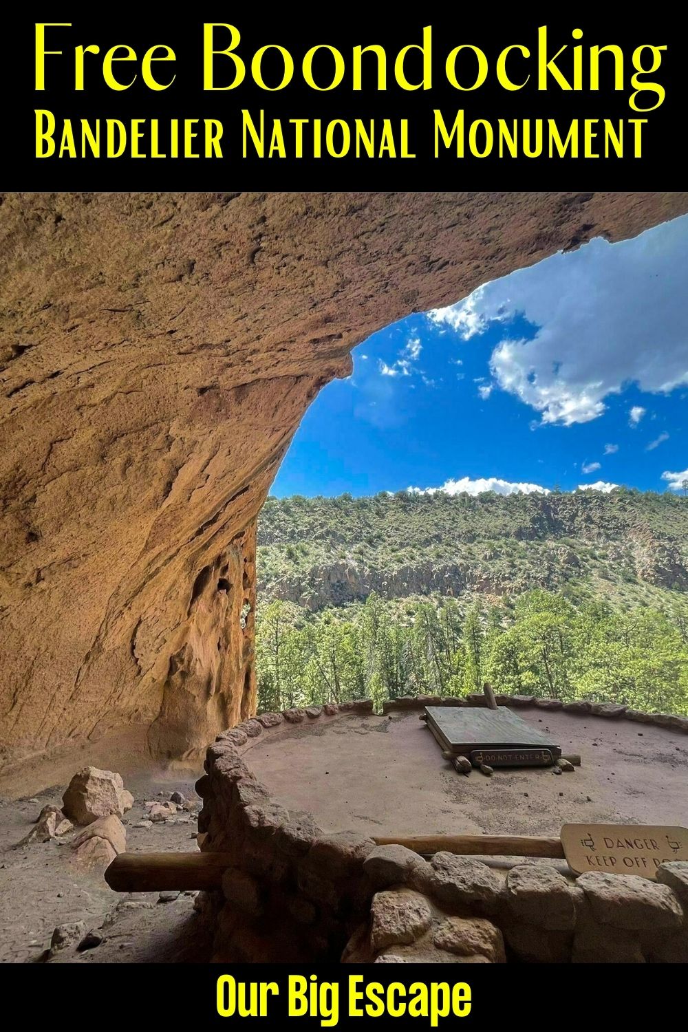
9 Boondocking Bandelier National Monument Boondocking Locations
1. Boondocking Bandelier National Monument Free Locations – American Spring
Address
Los Alamos, New Mexico
GPS: 35.837497, -106.381919
Elevation: 8258′
Management: Forest Service
The road in is Dirt and 0.5 miles from a paved road. Not recommended for RVs. Cleared area with rocks forming fire ring.
Best Review:
Go west on NM 4 for 1.4 miles after the intersection with W Jemez Rd/501. Turn right (north) onto an unpaved road and go about 1/2 mile and turn left. The spot is on the right.
There are also several places you can find fire rings made from rocks if you turn down any of the dirt roads. In particular, if you hang an immediate right after getting onto the dirt road off NM 4. This is within the national forest.

2. Boondocking Bandelier National Monument Boondockers Friendly Locations – Pajarito Spring
Address
Los Alamos, New Mexico
GPS: 35.845222, -106.381406
Elevation: 8249′
Management: Forest Service
The road in is Dirt and 1.4 miles from a paved road. There are 6-15 campsites at this location.
Best Review:
Not to be confused with Pajarito Springs farther southeast in White Rock, Pajarito Spring is a series of free, open campgrounds 3 miles east on Highway 4 from the southwestern-most corner of Los Alamos National Laboratory. The road is not fit for large RV\’s.
3. Bandelier National Monument Free Locations – Caja del Rio Plateau
Address
Santa Fe, New Mexico
GPS: 35.691879, -106.21582
Elevation: 6692′
Management: Forest Service
The road in is 4×4 and 10Miles miles from a paved road. Caja del Rio Plateau is open Year Round. There are 30 or more campsites at this location and the maximum RV length is N/A. You may stay 14 Days at Caja del Rio Plateau.
Best Review:
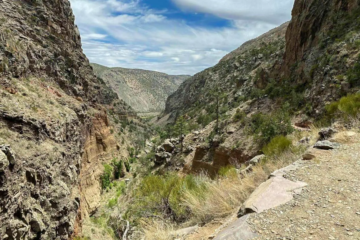
The Caja del Rio Plateau is a huge and desolate collection of old volcanos, wells, horse traps and other remnants of the wild west, and dirt roads & trails. It sits at the eastern edge of the Rio Grande, the life blood of central NM, between the river and Santa Fe. The views from the Caja are incredible, sometimes to the west overlooking Los Alamos / White Rock, sometimes to the south towards Albuquerque. Typical western big sky.
4. Boondocking Bandelier National Monument Boondockers Friendly Locations – Diablo Canyon
Address
Santa Fe, New Mexico
GPS: 35.804642, -106.136192
Elevation: 5845′
Management: Bureau of Land Management
The road in is Dirt and 10 miles from a paved road. Diablo Canyon is open Year Round. You may stay 14 day standard BLM at Diablo Canyon.
Best Review:
A rock climbing, hiking, and ATV destination on BLM land. All open primitive camping near the road. There are probably other places to overnight along the 10 or so miles of dirt road, but the canyon is worth seeing and wandering around. In another couple of miles the road hits the Rio Grande.
5. Bandelier National Monument Free Locations – – Santa Fe National Forest
Address
Santa Fe, New Mexico
GPS: 35.68954, -106.09418
Elevation: 6440′
Management: Forest Service
Caja Del Rio – Santa Fe National Forest is open year round. The maximum RV length at Caja Del Rio – Santa Fe National Forest is unlimited. You may stay 14 days at Caja Del Rio – Santa Fe National Forest.
Best Review:
Large semi arid plateau, primarily piñon and juniper. Is great place to camp if you are visiting Santa Fe. Picnic , camp area has gravel roads, shelter, and vault toilets. No electricity, water, or dump stations. Great place to stargaze. Popular cattle grazing and equestrian area. 10 minutes from Santa Fe Walmart.
6. Boondocking Bandelier National Monument Boondockers Friendly Locations – San Diego Canyon Overlook
Address
Jemez Springs, New Mexico
GPS: 35.8547, -106.6249
Elevation: 8166′
Management: Forest Service
The road in is Dirt. San Diego Canyon Overlook is open year round. There are 6-15 campsites at this location and the maximum RV length is 25 feet. You may stay 14 days at San Diego Canyon Overlook.
Amenities:
Pets Welcome
Restrooms
Best Review:
There’s a bunch of nice, dispersed campsites off NM 4, along an unmarked forest road. This is in Santa Fe National Forest land, near the Valle Caldera National Preserve. Most vehicles should be able to handle the road in dry weather (except really big rigs). What makes this area stand out are two features: 1. It’s less than 1/2 mile to the vault toilets at the San Diego Canyon Overlook (which sure beats a cathole. There’s decent Verizon 3G internet and voice signal.
7. Bandelier National Monument Free Locations – La Bajada Rest Area
Address
Santa Fe, New Mexico
GPS: 35.527471, -106.156485
Elevation: 6132′
Management: Rest Area
The road in is Paved. La Bajada Rest Area is open Year round. There are 16-29 campsites at this location. Small rest area on the north bound before arriving to Santa Fe.
Amenities:
Drinking Water
Picnic Tables
Restrooms
Best Review:
The campsite I planned to stay was closed for maintenance so I chose here to spend my night. I was kind of worried because I was afraid the noise of the highway and creepy people at night. I was wrong. It is a rest area with very clean bathroom and vending machine.
8. Boondocking Bandelier National Monument Boondockers Friendly Locations – Hot Rock Road
Address
Jemez Springs, New Mexico
GPS: 35.87619, -106.69321
Elevation: 8537′
Management: Forest Service
The road in is Dirt and 0.3 miles from a paved road. There are 1-5 campsites at this location. Near Fenton Hill Observatory. A couple of good RV spots about a 5min drive from Antonio Creek rec areas (with fishing, swimming, picnic shelters, etc.) There are better sites nearby but those are more popular and fill up fast.
Best Review:
Head West onto Hot Rock Rd from NM-126 and turn right. There are a couple spots on the right side on the way in, but a large spot (could probably fit 2 RVs) is at ~0.3mi and up to this point the road is dirt but in very good shape. Past this spot and beyond the fork are a few more sites, but the road is deeply rutted and requires high clearance. There are also lots of cows in the area.
9. Bandelier National Monument Free Locations – Gilman Tunnels Dispersed Camping
Address
Jemez Pueblo, New Mexico
GPS: 35.72994, -106.75855
Elevation: 6056′
Management: Forest Service
A few dispersed camping sites in the Santa Fe National Forest next to the Rio Guadalupe and the Jemez and Gilman Tunnels.
Best Review:
There are several tent spots and fire rings in the half mile south of the tunnels just off the road on both sides. There are one or two spaces I think an RV could get into and several pull-offs if you don’t mind camping by the road.
Paid Camping Options
Bandelier National Monument has one of the best-designated campgrounds that you can use to pitch your tents if you are staying overnight for an enjoyable trip and visit. There are two main designated campgrounds in Bandelier National Monument, i.e., Juniper and Ponderosa. Juniper Campground is for smaller groups of less than ten people. This campground has restrooms, running water, picnic tables, grills, firewood, and a dumping station. It operates on a first-come, first-serve basis.
The second campground is the Ponderosa which is suitable for more than ten people, and it requires a reservation. There are campers pit toilets, tent sites, picnic tables, and small cooking shelters at this campground. You can camp on these campgrounds if you want to start hiking very early in the morning or if you want to join the rangers for astronomy nights and learn about the celestial wonders of the world, plus taking bat strolls.
Top 9 Trails to Hike at Bandelier National Monument
Bandelier National Monument has over 70 miles of trails that you can use to hike on during your visit. The best trails in Bandelier National Monument that you can go hiking on include:
1. Burro Trail
Burro Trail is a 8.6 mile lightly trafficked out and back trail located near Pena Blanca, New Mexico that features a river and is rated as moderate. The trail is primarily used for hiking and is best used from April until October. There is an 856 elevation gain on the trail.
I listed the trail first not because it was my favorite but because so many people miss it and you need to do to enjoy the views it offers. No secret finish just and easy hike with nature to enjoy along the way.
Length: 8.6 mi
Elevation gain: 856 ft
Route type: Out & back
Hiking, River, Views, Wildflowers, Wildlife, No shade, Fee, No dogs
2. Frey Trail
This is one of the best moderate-rated trails in the Bandelier National Monument. This trail is moderately trafficked, and it spans 3.1 miles with an elevation gain of 603 feet. You will be using an out and back route type while hiking on this trail. Additionally, you will have spectacular bird’s eye views of Tyuonyi while hiking on this trail. The best time for hiking on this trail is between April and October, and you should bring along plenty of water.
This is one of my favorite trails at Bandelier National Monument. It is located to the right just after you pass the toll station and you park on the left. It was kind of okay until I hit the top of the mesa then the views of the ruins and the canyon opened up and I was thrilled. From there it kept getting better and better until I reached the ruins. Not a lot of shade so bring adequate water and sunscreen even in winter. Trail can be closed at times in the winter and the mud is probably something you don’t want to hike through. Try early Spring or late Fall.
Length: 3.1 mi
Elevation gain: 603 ft
Route type: Out & back
Kid friendly, Hiking, Running, Forest, Views, Rocky, Snow, Fee, No dogs
3. Upper Falls Trail
This is another trail that is suitable for all skill levels to hike on in Bandelier National Monument. This trail spans 2.9 miles, and you will be using an out and back route type with an elevation gain of 495 feet. Additionally, this trail is moderately trafficked, and you may come across a variety of wildlife while hiking along this trail.
Just one of my number one paths that I’ve done at Bandelier! Obviously you need to experience all of the different paths that incorporate bluff abodes, however this one is an incredible expansion to those. Not very long, genuinely simple, and the falls are wonderful. I’ve done this one twice. The first run through the falls had evaporated, however on the second time they were available and flawless. There is both a covered, woodland segment just as an uncovered/radiant more rough part. You will love it.
Length: 2.9 mi
Elevation gain: 495 ft
Route type: Out & back
Kid friendly, Hiking, River, Views, Waterfall, Wildflowers, Wildlife, Fee, No dogs
4. Tsankawi Ruins Trail
This is another heavily trafficked trail suitable for all skill levels for hiking in Bandelier National Monument. Additionally, while hiking here, you will cover a distance of 1.6 miles using a loop trail with an elevation gain of 236 feet. This trail is accessible all year round, and there are beautiful wildflowers and a variety of bird species that you will spot while hiking on this trail.
I am from the SE so these type of ancient ruins are not something I ever had access to and I dearly love them. The views were outstanding, the stairways and trails created into the ground and canyon walls cannot be described only to be visited and enjoyed.
Length: 1.6 mi
Elevation gain: 236 ft
Route type: Loop
Kid friendly, Hiking, Bird watching, Cave, Views, Wildflowers, Wildlife, Rocky, Scramble, Fee, No dogs
5. Cerro Grande Trail
Cerro Grande Trail is a moderate-rated hiking trail, and it is lightly trafficked. This trail spans 4.2 miles, and while hiking there, you will be using an out and back route type with an elevation gain of 1223 feet. Additionally, you will have excellent views of Valles Caldera and lower Bandelier while hiking on this trail. There are beautiful flowers and a variety of bird species around this trail. The best time to hike on this trail is between April and October.
This is truly a great hike. I had planned on hiking another trail, but changed my mind at the last minute. The views of Valles Caldera and the surrounding area were magnificent. The hike is a bit steeper than I visualized and very hot near the top with no shade. The path was a combination of dirt and gravel and is plainly marked. I started around 8:00 AM and will go out as early as sunrise if I ever do the trail again.
Length: 4.2 mi
Elevation gain: 1,223 ft
Route type: Out & back
Hiking, Walking, Bird watching, Running, Forest, Views, Wildflowers, Wildlife, Snow, Fee, No dogs
6. Frijolito Trail

This trail spans around 2.6 miles. It is a loop-type trail with an elevation gain of 528 feet. Additionally, this trail is moderate-rated, and therefore you are likely to find it lightly trafficked. While hiking on this trail, especially between April and October, you will spot beautiful wildflowers and bird species along and near this trail.
This is a good hike but not my absolute favorite at the ruins. It is very steep in places and constant switchbacks to reach the top. No shade so cloudy days are best even in winter because of the higher than normal altitude. There was a $25 fee per vehicle and no cash was accepted. We have a senior park pass so we were in for free.
Length: 2.6 mi
Elevation gain: 528 ft
Route type: Loop
Kid friendly, Hiking, Walking, Bird watching, Running, Forest, Views, Wildflowers, Wildlife, Snow, Fee, No dogs
7. Burnt Mesa Trail
This is one of the great trails in this national monument that you can visit with kids since it is suitable for all skill levels. This trail spans 5.3 miles, and while hiking, you will be using an out and back route type with an elevation gain of 456 feet. There are beautiful flowers and a variety of birds that you will spot while hiking on this trail. During the winter season, you can use this trail for cross-country skiing.
This out and back trail has over 15 toppled ruins you can enjoy. You will also have a chance to watch the elk herds in Winter and has great wildflowers in the Spring. Great hike that is a must add on to your Bandelier National Park trails to visit list.
Length: 5.3 mi
Elevation gain: 456 ft
Route type: Out & back
Kid friendly, Cross-country skiing, Hiking, Bird watching, Forest, Wildflowers, Wildlife, Fee, No dogs
8. Tyuonyi Overlook Trail
This trail is moderately trafficked, and it is suitable for all skill levels. The trail spans 2.1 miles, and it is an out and back trail with an elevation gain of 196 feet. Additionally, this trail is accessible all year round, and it offers one of the best scenic views.
Flat easy trail for my wife who had hip surgery 10 months ago. Even though I did the hike early the sun was already hot so regardless of the time take plenty of water and stay hydrated. I will be adding other trails and will return again for sure.
Length: 2.1 mi
Elevation gain: 196 ft
Route type: Out & back
Kid friendly, Hiking, Views, Snow, No shade, Fee
9. Yapashi Pueblo and Stone Lions
This is one of the best trails in Bandelier National Monument that you can visit and hike on during your trip there. The trail spans 11.9 miles, and while hiking on it, you will be using an out and back route type with an elevation gain of 1228 feet. This trail is moderate-rated, and while hiking there, you will get a chance to see wildlife.
One of the most memorable hikes I have ever made but difficult.
The first petroglyphs will be when you arrive at the Alamo, take a right and go down into the canyon. When you do get to the Yapashi Riuns you may say was it worth this but there are more surprises to come. The ground is littered with shads of pottery with designs. Like finding seashells on the beach to examine. These were made over 1000 years ago and you are holding history in your hands. Needless to say examine them carefully and return them to their original places if possible. The only reason you get this experience is because those who visited there before you left them for your enjoyment.
I hope you enjoy Bandelier as much as we did.
Length: 11.9 mi
Elevation gain: 2,578 ft
Route type: Out & back
Hiking, Views, Wildlife, Snow, No shade, Historic site, Fee
A Bit Of A Different Thing To Do While Visiting Bandelier National Monument
1. Hiking, cross-country skiing, and snowshoeing
Bandelier National Monument features more than 70 miles of trails that you can use to stretch your muscles on during your visit. During your visit in the summer, spring, or autumn, you can go hiking on the multiple trails in this national monument while having fabulous views of surrounding areas. Additionally, while hiking along the trails in this national monument, there are a variety of bird species, plant life, and animals that you may come across or spot from a distance.
Visit Bandelier National Monument during the winter seasons. You can go cross-country skiing and snowshoe in some of the trails, especially in the Upper Frijoles Area off of Highway 4, i.e., The Cerro Grande Trail, The Alamo Boundary Trail, two Upper Frijoles trail 2.4 miles round-trip, and Upper Frijoles Loop trail 5 miles round trip. Other trails include Pueblo Loop Trail, Falls Trail, Alcove House Trail, Frey Trail, and many more.
You May Want to Join Our Boondocking Group on Facebook For More Information
You May Want to Join Our Campfire Recipes Group on Facebook For More Information