
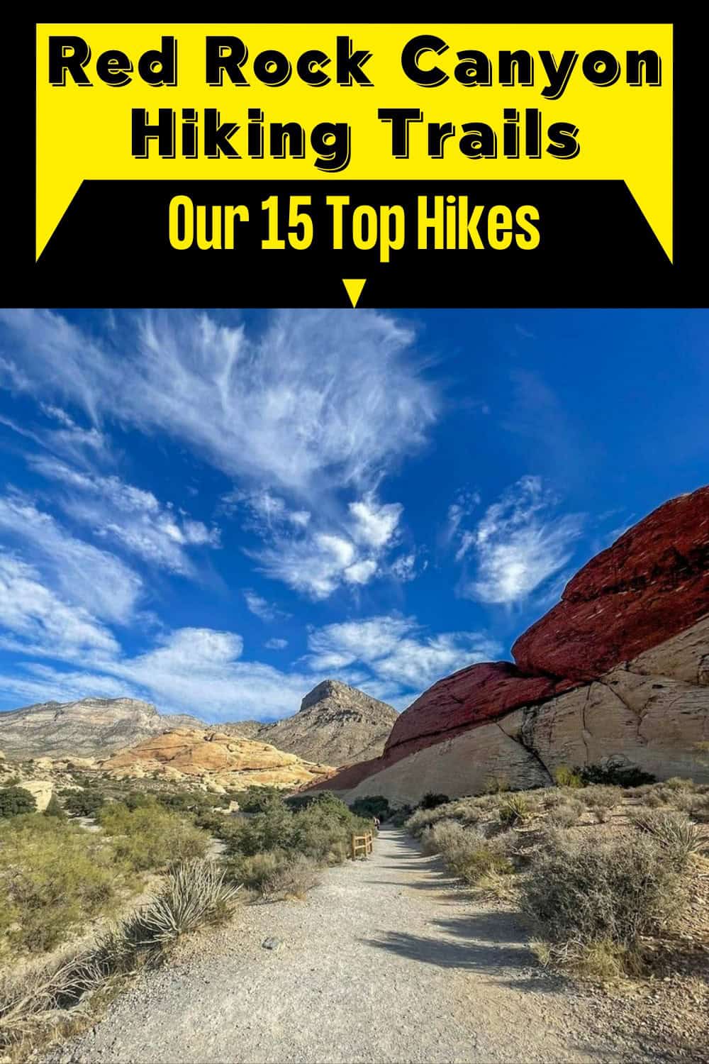
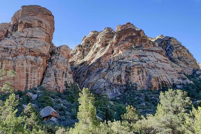
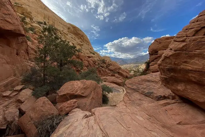
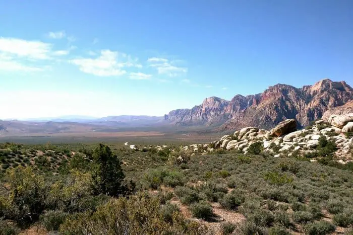
There’s no shortage of truly great Red Rock Canyon Hiking Trails for intrepid explorers who wish to escape the noise of the city. And you don’t need to travel far to find them. Red Rock Canyon National Conservation Area is a thirty-minute drive west of downtown Las Vegas and offers visitors their choice of dozens of spectacular hiking routes.
Red Rock is 13-miles long with a scenic through road that hikers can use to drive right up to their chosen trail. Not only is the route itself a beautiful drive, but visitors can easily loop back to start another trail when they’re done with their first adventure.
Want more ideas to round-out your trip to Nevada?
A lot of great ideas are in these posts!
- 12 Great Basin National Park Boondocking Spots (Updated 2022)
- 18 Mt Charleston Free Camping Spots (Updated 2022)
- 18 Red Rock Canyon Boondocking (Updated 2022)
- 19 Nelson Nevada Ghost Town Boondocking (Updated 2022)
- 9 Gold Butte Monument Boondocking Spots (Updated 2022)
- 15 Mount Charleston Hiking Trails: Our Favorites
Please note this road is a one-way system. If you’re pressed for time but want to hike more than one trail, we recommend marking your routes on a map so you don’t drive out to the farthest trail first and then have to loop back.
If you’ve got a National Parks Pass, entry to Red Rock is free of charge. For everybody else, there’s a charge of $15 per car. In the summer, there’s a peak season charge ($2) for visitors who arrive after 8am and you’ll need to enter at the time stated on your ticket. If you don’t want to pay this fee, be on your trail bright and early!
Our 15 Best Red Rock Hiking Trails
check out our video
1. Red Rock Canyon Hiking at Kraft Boulders and Kraft Mountain Loop
Kraft Boulders and Kraft Mountain Loop is a 3.1 mile moderately trafficked loop trail located near Blue Diamond, Nevada that features beautiful wild flowers and is rated as moderate. The trail offers a number of activity options and is accessible year-round. Dogs and horses are also able to use this trail. Kraft Mountain Loop is a relatively gentle hike through rugged terrain. There aren’t any overly challenging sections but there’s a lack of shade along the route.
It’s wise to start early and finish when temperatures are still below 90 if you can. The counterclockwise loop can be completed in well under ninety minutes. It’s mostly straightforward but be extra careful when approaching the sharp turn about halfway along the loop. The turnoff isn’t as clear as it could be and we had to retrace some of our steps after missing the sign.
Even so, we got such a kick out of the Kraft Mountain Loop we went back and did it again several weeks later. Scrambling across the Canyon creek bed was a memorable highlight we couldn’t do just once.
Length: 3.1 mi
Elevation gain: 593 ft
Route type: Loop
Hiking, Horseback riding, Nature trips, Bird watching, Running, Dog friendly, Views, Wildflowers, Wildlife, Rocky, Scramble, No shade

2. Red Rock Canyon Trails Pine Creek Canyon Trail
Pine Creek Canyon Trail is a 3.4 mile heavily trafficked out and back trail located near Las Vegas, Nevada that features a waterfall and is good for all skill levels. The trail offers a number of activity options and is accessible year-round. Dogs are also able to use this trail but must be kept on leash. This is a trail we’ve hiked several times before and continue to be drawn back to. It’s the waterfalls, of course it is. While it’s not the only place you’ll find them in Red Rock, other locations are a bit less stable and prone to flash floods.
Pine Creek Canyon is a safe spot to check out tadpoles, frogs, lizards and other critters that hang around the water. The Pine Creek Canyon Trail is an easy walk as it’s under four miles long without any steep sections. Though a lot of the trail is unshaded so come prepared. The heat can make it feel more difficult than it is. Bring plenty of water, don’t forget your snacks and try to start early if you’re worried about sun exposure.
Length: 3.4 mi
Elevation gain: 515 ft
Route type: Out & back
Dogs on leash, Hiking, Nature trips, Walking, Bird watching, Running, Views, Waterfall, Wildlife
3. Red Rock Canyon Hiking at Wilson’s Pimple Loop
Wilson’s Pimple Loop is a 4.7 mile heavily trafficked loop trail located near Las Vegas, Nevada that offers scenic views and is rated as moderate. The trail is primarily used for hiking and running and is best used from September until June. Dogs are also able to use this trail.
The charmingly named Wilson’s Pimple is one of the easiest routes in Red Rock. There’s a bit of gentle climbing to do as you approach the loop’s peak but it’s nothing to fear. Plenty of children hike this trail with their parents because it’s quick, straightforward and takes you past some cool wildlife on a lucky day.
The last time we hiked it we spotted some wild deer. The only thing to be aware of is how many other trails cross over Wilson’s Pimple Loop. The route itself is simple but it’s easy to get confused and turn when you don’t need to because there are so many intersecting trails. Keep a close eye on the map once you’ve hiked around the pimple to make sure you stay on track.
Length: 4.7 mi
Elevation gain: 652 ft
Route type: Loop
Hiking, Running, Dog friendly, Views, Rocky, Scramble
4. Red Rock Canyon Trails at White Rock and La Madre Springs Loop
White Rock and La Madre Springs Loop Trail is a 7.5 mile heavily trafficked loop trail located near Las Vegas, Nevada that features beautiful wild flowers and is rated as moderate. The trail is primarily used for hiking, running, camping, and bird watching and is best used from September until March. Dogs are also able to use this trail but must be kept on leash.
We took a counterclockwise route along La Madre Springs Loop but we intend to return someday and try the clockwise route. This is a superb trail for spotting large animals like donkeys and deer. We got a very close look at some wild deer toward the east end of the excursion and there’s no shortage of lizards and snakes.
La Madre Springs Loop is a variable trail and whether you find it difficult will depend on your stamina. It’s one of the longer routes but there are no steep slopes or scrambles and plenty of places to stop and rest. You could even take older children with you if they’ve got a bit of experience hiking in the heat. If you’re up for it, hiking just beyond the red line on the map will take you to a stream. And another half mile beyond that there’s an abandoned cabin.
Length: 7.5 mi
Elevation gain: 1,479 f t
Route type: Loop
Dogs on leash, Camping, Hiking, Bird watching, Running, Views, Wildflowers, Wildlife, Rocky, Scramble
5. Red Rock Canyon Hiking at Guardian Angel Pass
Guardian Angel Pass is a 3.2 mile heavily trafficked loop trail located near Las Vegas, Nevada that features beautiful wild flowers and is rated as difficult. The trail is primarily used for hiking, nature trips, and bird watching and is best used from April until September.
You can hike Guardian Angel Pass clockwise and counterclockwise, like most of Red Rock’s trails, but we strongly recommend you attempt it counterclockwise first if you’re not familiar. There’s a serious scramble at one end and you can either do it at the start or the finish when you’re already a bit gassed.
Certainly, if you’re walking in the evening, head counterclockwise so you’re not climbing in dim light. The wash on Guardian Angel Pass is one of the best routes to hike on an early summer morning. The view at the top is magnificent and the landscape is breathtakingly still and calm before 9am.
Later in the day, it gets fairly breezy so you might want to carry a light jacket. The westerly trail is a nice adventure but it can be tricky to navigate at times. Pay attention to your map; there’s a lot of break-off paths in this area.
Length: 3.2 mi
Elevation gain: 679 ft
Route type: Loop
Hiking, Nature trips, Bird watching, Views, Wildflowers, Wildlife, Rocky, Scramble, No shade
6. Red Rock Canyon Trails Ice Box Canyon Trail
Ice Box Canyon Trail is a 2.3 mile heavily trafficked out and back trail located near Las Vegas, Nevada that features a waterfall and is rated as moderate. The trail is primarily used for hiking, nature trips, and bird watching and is best used from September until May. Dogs are also able to use this trail but must be kept on leash.
Ice Box Canyon is a more ambitious trail but it shouldn’t trouble anybody with moderate experience. It’s not the best route for children and pets though. There are several scramble sections where hikers need to climb up and over some pretty big boulders. If your party isn’t used to scrambling, it’ll just turn into you hoisting a 50-lb dog or squirming toddler over every rock and it will get tiring.
The final stretch of the Ice Box Canyon route isn’t clearly signposted. There aren’t many markers so you need to use your map to stay on track. If you’re not careful, you’ll find yourself off-trail and having to retrace your steps. It happened on our Red Rock hike and one of us ended up with a sprained ankle and a broken phone after slipping on some wet boulders.
It could have easily turned into an emergency if we were less experienced hikers. The Ice Box Canyon Trail is a great way to spend an afternoon. But don’t forget, when you’re out in nature, you’ve got to keep your wits about you.
Length: 2.3 mi
Elevation gain: 577 ft
Route type: Out & back
Dogs on leash, Hiking, Nature trips, Bird watching, Views, Waterfall, Wildflowers, Wildlife, Bugs, Rocky, Scramble, No shade
7. Red Rock Canyon Hiking Trails at Fossil Ridge Loop
Fossil Ridge Loop is a 4.3 mile heavily trafficked loop trail located near Blue Diamond, Nevada that offers the chance to see wildlife and is rated as moderate. The trail is primarily used for hiking, walking, running, and mountain biking and is accessible year-round. Dogs are also able to use this trail but must be kept on leash.
Fossil Ridge Loop is probably one of the busiest trails in Red Rock Canyon National Conservation Area. Expect to see lots of hikers, rock climbers and even a few horse riding parties along the way. They’re drawn here by the incredible views of the park at the highest point on the trail.
If you’ve never hiked Fossil Ridge before, it’s worth doing at least once but experienced hikers might want to give the crowds a miss. The views from the top are special but we prefer quieter trails so Fossil Ridge Loop isn’t somewhere we revisit often. If you do walk it, keep your map open while ascending and descending the peak. It’s easy to wander off-trail and, in this area, easier than you think to scramble 500ft off route and get stuck.
Length: 4.3 mi
Elevation gain: 784 ft
Route type: Loop
Dogs on leash, Kid friendly, Hiking, Mountain biking, Walking, Running, Views, Wildlife, Rocky
8. Red Rock Canyon Trails at Calico Tanks Trail
Calico Tanks Trail is a 2.2 mile heavily trafficked out and back trail located near Las Vegas, Nevada that features beautiful wild flowers and is rated as moderate. The trail is primarily used for hiking and running and is best used from October until April. Dogs are also able to use this trail but must be kept on leash.
Calico Tanks Trail is one of the great Red Rock Nevada hikes. It’s a magnificent route with several jaw-dropping overlooks, a few rock pools and some short but steep climbing sections. There’s little here to challenge an experienced hiker but it’s also not a trail to stroll through. The ascents can quickly become an obstacle for those who don’t plan correctly, drink plenty of water or take rests in the shade.
The last time we hiked Calico Tanks we saw a lady with heat exhaustion being emergency evacuated. Stay safe out there. It’s a good rule of thumb to bring more water than you think you need. And if you can start your trail hike early in the morning so you can finish before temperatures rise in the afternoon.
Length: 2.2 mi
Elevation gain: 406 ft
Route type: Out & back
Dogs on leash, Kid friendly, Hiking, Running, Cave, Views, Wildflowers, Wildlife, Rocky, Scramble
9. Red Rock Canyon Hiking at North Oak Creek Trail
North Oak Creek Trail is a 4.7 mile heavily trafficked loop trail located near Las Vegas, Nevada that features beautiful wild flowers and is rated as moderate. The trail is primarily used for hiking, walking, running, and horses and is best used from October until May. Dogs and horses are also able to use this trail.
This trail starts off really gentle but takes some surprising turns about halfway through and becomes a much more rugged route. North Oak Creek is far from the most challenging trail we’ve hiked but do be aware of these variable sections. We recommend walking the route counterclockwise from the south exit as it bypasses some of the more crowded stretches.
North Oak Creek Trail is deceptively flat until its midway point when the terrain gets much rockier. There are no dicey scrambles and you shouldn’t feel overexerted at any point but do pay attention to the map or you’ll end up climbing boulders you don’t need to.
We love this route because it delivers a little bit of everything. You get the majestic red rock vistas, of course, but there’s also a gorgeous little creek and even some pine trees on the journey. When you’ve got a bunch of hiking notches on your belt, you appreciate the rarer landmarks and, at Red Rock, that means green trees.
Length: 4.7 mi
Elevation gain: 518 ft
Route type: Loop
Kid friendly, Hiking, Horseback riding, Walking, Running, Dog friendly, Views, Wildflowers, Rocky, No shade
10. Turtlehead Peak Trail
Turtlehead Peak Trail is a 4.6 mile heavily trafficked out and back trail located near Blue Diamond, Nevada that features beautiful wild flowers and is rated as difficult. The trail is primarily used for hiking, nature trips, and bird watching and is accessible year-round. Dogs are also able to use this trail but must be kept on leash.
This is definitely one of the tougher trails we’ve walked in Red Rock. Turtlehead Peak Trail is rough, rocky and largely unshaded. You can get heatstroke out here very quickly so you need lots of water and a good degree of fitness to tackle it. It’s not suitable for children and a lot of dogs struggle on the scrambles.
The first time we attempted it we took our dog along with us and had to turn off the trail early because the heat became too much for her. Though we completed the Turtlehead Peak Trail easily enough a few weeks later, we learned an important lesson and wouldn’t bring a dog on this hike again. Turtlehead Peak Trail is clearly signposted. You shouldn’t have any difficulties staying on the trail if you follow the yellow markers.
Length: 4.6 mi
Elevation gain: 1,988 ft
Route type: Out & back
Hiking, Nature trips, Bird watching, Views, Wildflowers, Wildlife, Rocky, No shade
11. Lost Creek Trail
Lost Creek Trail is a 0.6 mile heavily trafficked out and back trail located near Las Vegas, Nevada that features a waterfall and is good for all skill levels. The trail is primarily used for hiking, walking, nature trips, and bird watching and is accessible year-round. Dogs are also able to use this trail.
Here’s a Red Rock trail we’d happily recommend to children, dogs, older individuals and anybody with a lower level of fitness who wants to try hiking for the first time. The Lost Creek Trail is pretty short with just one gentle ascent that takes hikers along a rickety’ wooden walkway.
Spoiler alert, it’s all very safe and unchallenging. This route isn’t going to satisfy experienced hikers but children love it. It gets busy in the summer with kids and dogs dashing excitedly about the boulders. There’s a hint of a waterfall along the way but it’s dry throughout much of the year so it may go unnoticed.
Length: 0.6 mi
Elevation gain: 91 ft
Route type: Out & back
Kid friendly, Hiking, Nature trips, Walking, Bird watching, Dog friendly, Forest, River, Views, Waterfall, Wildflowers,
12. White Rock Hills Loop Trail
White Rock Hills Loop Trail is a 6.1 mile heavily trafficked loop trail located near Las Vegas, Nevada that features beautiful wild flowers and is rated as moderate. The trail offers a number of activity options and is best used from March until October. Dogs are also able to use this trail.
White Rock Hills is a popular Red Rock trail because its terrain is gentle enough for the endurance runners who like to train out here in the desert. It’s quite far into the conservation area – and the drive to the trailhead can be confusing – so it’s popular but rarely crowded with tourists.
This one is for the explorers who don’t mind going a little further to escape the Tik Tokers and selfie sticks. The White Rock Hills Loop starts out as two different trails combined. They follow one another for a short time and then separate. You need to stick to the left-hand trail when this happens.
The only area which caused us some confusion was around the Willow Springs car park. We lost the trail until we noticed a VERY small marker off to the left of the entrance. It’s just beyond the last section of the different side trails/exhibit areas for the final section. Follow this to loop back to the start of the trail and the spot where you parked your car.
Again, this hiking trail is popular with runners and endurance athletes because it’s lengthy and mostly flat. You can comfortably run about 70% of it. The rest you need to slow down to pick your way around boulders. There isn’t much scrambling to do here, just a few awkward rocks that are too big to run over.
Length: 6.1 mi
Elevation gain: 1,135 ft
Route type: Loop
Hiking, Nature trips, Walking, Bird watching, Running, Dog friendly, Views, Wildflowers, Wildlife, Rocky
13. Red Rock Canyon Hiking Trails at Calico Hills Trail
Calico Hills Trail is a 6.4 mile heavily trafficked out and back trail located near Las Vegas, Nevada that offers scenic views and is rated as difficult. The trail is primarily used for hiking and is accessible year-round. The only challenging section of the Calico Hills Trail is at the beginning so you should have plenty of energy to get it done. It’s a very long ascent – not overly steep but definitely long enough to feel like a serious workout – so you’ll need lots of water.
We tackled the climb in mid-August and it was hot, humid and harsh on the legs and feet. Once you’re over the initial climb, the trail evens out and becomes a mild, gentle route with some easy scrambles and fantastic views of Vegas. It’s one of our all-time favorite places to visit in the Calico basin and there’s a lot of great Red Rock Nevada hikes up there.
Length: 6.4 mi
Elevation gain: 1,108 ft
Route type: Out & back
Hiking, Views, Rocky, Scramble, No dogs
14. Red Rock Canyon Hiking Trails First Creek Canyon Trail
First Creek Canyon Trail is a 3.4 mile heavily trafficked out and back trail located near Las Vegas, Nevada that features a waterfall and is rated as moderate. The trail offers a number of activity options and is accessible year-round. Dogs are also able to use this trail.
The First Creek Canyon Trail is another option for first-time hikers and those with children and pets. It’s a pleasant, satisfying walk although the views here aren’t as spectacular as they are on some other routes. For the first mile, you get to walk on sand which is a novelty if you’re used to hard, red rock.
It’s not a Red Rock trail we’d hike again because it doesn’t offer much for people with experience. Although it’s worth noting there’s an interesting Canyon and a smallish peak about two miles off the rail. We haven’t explored these areas yet but they’re clearly marked on the map. You could, if you wanted to make First Creek Canyon more exciting, take a detour and check them out.
Length: 3.4 mi
Elevation gain: 377 ft
Route type: Out & back
Hiking, Nature trips, Bird watching, Running, Dog friendly, Views, Waterfall, Wildflowers, Wildlife, Rocky, Scramble, No shade
15. Red Rock Canyon Hiking Trails at La Madre Springs Trail
La Madre Springs Trail is a 3.5 mile heavily trafficked out and back trail located near Las Vegas, Nevada that features a waterfall and is rated as moderate. The trail is primarily used for hiking and is accessible year-round. Dogs are also able to use this trail but must be kept on leash.
We had a wonderful time hiking La Madre Springs because the terrain is variable and there’s a great deal to discover if your eyes and ears are open.
Length: 3.5 mi
Elevation gain: 698 ft
Route type: Out & back
Dogs on leash, Hiking, Views, Waterfall, Wildflowers, Wildlife, Bugs, Over grown, Rocky, Scramble, Snow
You May Want to Join Our Boondocking Group on Facebook For More Information
You May Want to Join Our Campfire Recipes Group on Facebook For More Information