

Gold Butte Monument Boondocking locations are not found within the actual Monument Area. But, there are many nearby Free Gold Butte Monument Boondocking Spots.
Gold Butte Monument is located in the Mojave Desert in Southern Nevada and it is an short trip from Las Vegas to Gold Butte National Monument. From Las Vegas to Gold Butte Monument will take you approximately two and a half to three hours.
Want more ideas to round-out your trip to Nevada?
A lot of great ideas are in these posts!
- 12 Great Basin National Park Boondocking Spots (Updated 2022)
- 18 Mt Charleston Free Camping Spots (Updated 2022)
- 18 Red Rock Canyon Boondocking (Updated 2022)
- 19 Nelson Nevada Ghost Town Boondocking (Updated 2022)
- 9 Gold Butte Monument Boondocking Spots (Updated 2022)
- 15 Mount Charleston Hiking Trails: Our Favorites
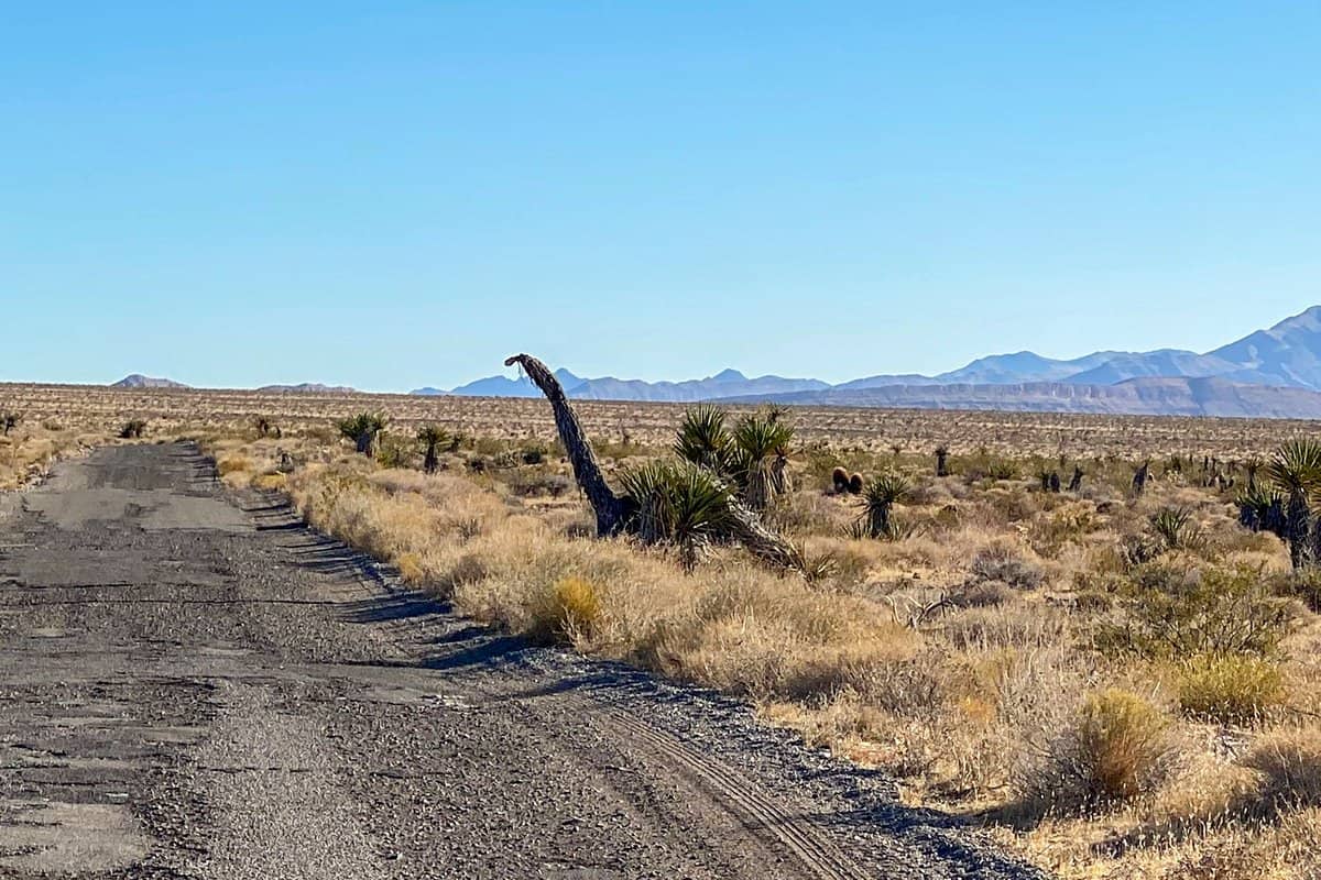
Because of being a little hard to get to, it has very few tourists. This national monument is worth visiting. There are plenty of great Gold Butte Monument Boondocking Locations just outside the area.
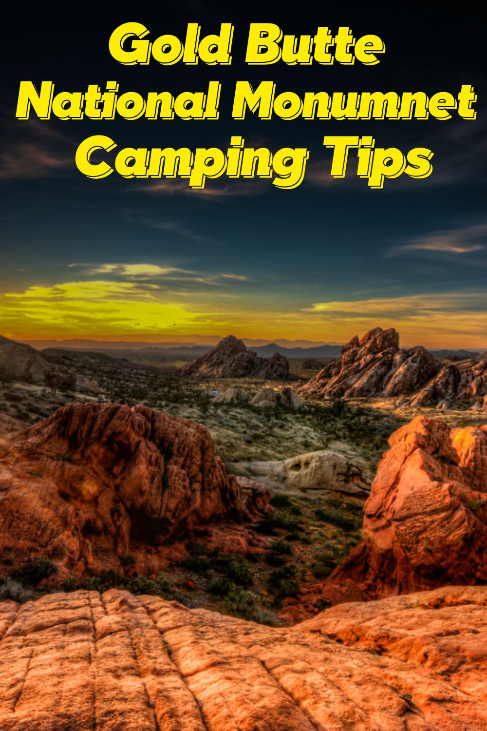
Covering approximately 300,000 acres of land, this national monument features various natural as well as cultural resources including sandstone towers, rock arts and wildlife habitat.
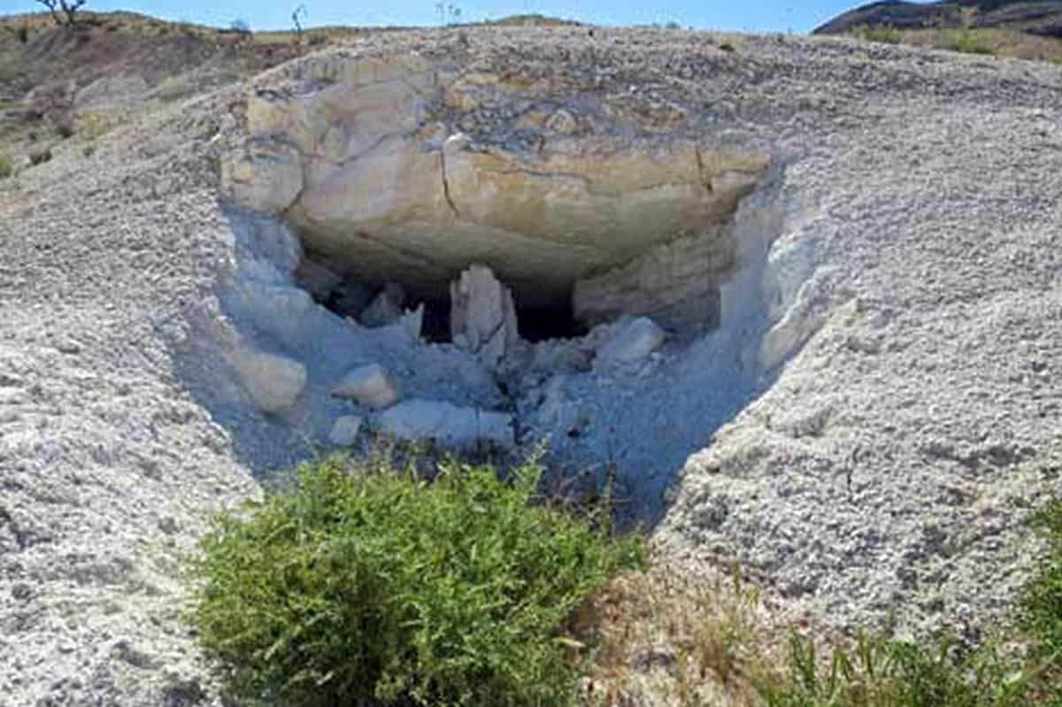
In addition to that, this area protects historical mining sites and ranches like the ghost town Gold Butte Monument. In this ghost town, there are few mine openings, cement foundation along with relatively small pieces of rusting equipment.
How to Get to Gold Butte Monument
The first thing you need to be aware of is that most roads into Gold Butte Monument will require a 4-wheel drive vehicle equipped with high clearance. It would be best if you also considered coming with spare tires, a well-detailed map, extra gas as well as food and water in case of any emergency.
To get there, you should take the Interstate 15 which is north of Las Vegas and then take the Exit 112 towards Bunkerville/Riverside and keep heading south. You will then cross a bridge over Virgin River and then turn west on the first road after the bridge. When you are visiting the area, don’t forget to check out the numerous Gold Butte Monument boondocking sites and locations.
Free Gold Butte Monument Boondocking Locations
Gold Butte Monument is located on a very difficult unattended road and free boondocking is all 10 to as much as 25 miles from the entrance. The best way to visit is to camp inside the monument.
You can take a trailer or RV into the monument but it will just have to be a slow crawl along parts of the road. On the brighter side once in the monument the road is good and passable for any vehicle.
The best part of visiting Gold Butte Monument is that there is no entrance fee. In addition, camping in this monument is unregulated. However, you should consider choosing a low-impact or an existing site and try to practice Leave-No-Trace skills.
Some of the common camping sites in the national monument include Whitney Pocket and the Gold Butte Townsite. And there are other various camping spots you might consider choosing.
Top Gold Butte Monument Boondocking – Nearby
check out our video
1. Nearby Gold Butte Monument Boondocking Locations – South Cove
Address
GPS: 36.088919, -114.105943
Management: Bureau of Land Management
Free boondocking locations->No Reservations.
Best Review:
Beautiful place to stay – lake and mountain views, rock formations overlooking the lake shore, gorgeous sunsets and sunrises. Not really very level but manageable. Stayed here in a 26′ class A and a tent, January 2nd and 3rd 2020. Close enough to Grand Canyon West for a daytrip. Gold Butte Monument Boondocking Spots are convenient to other sources.

2. Nearby Gold Butte Monument Boondocking Spots – Grand Canyon-Parashant National Monument Pakoon Springs
Address
Pakoon Springs Road
Littlefield, Arizona
GPS: 36.418255, -113.960678
Elevation: 2288′
Management: Bureau of Land Management
The road in is Dirt. You may stay two weeks (14 days) at Grand Canyon-Parashant National Monument Pakoon Springs. There are no developed campsites with facilities within the national monument.
Best Review:
Visitors can pick their own campsite, but please camp at least 200 feet from water sources and use biodegradable soap. Camping is permitted for up to 14 days. Gold Butte Monument Camping Spots.
3. Nearby Gold Butte Monument Camping Spots – Whitney Pockets
Address
Arizona Road
Bunkerville, Nevada
GPS: 36.524198, -114.133117
Elevation: 3144′
Management: Bureau of Land Management
The road in is Gravel. There are 6-15 campsites at this location and the maximum RV length is unlimited. Free boondocking on BLM owned desert land. Flat and open at the base of beautiful red rock. Dry camping in the middle of the desert. No facilities or utilities. No reservations taken.
Best Review:
Nestled in a cluster of sandstone outcrops with cultural resource sites including prehistoric habitation. Lots of rock formations. It’s a great place for photography and exploring on foot, by bike, on horseback, or ATV. and history in the area. Petroglyphs near by. It can be very busy on the weekends.
4. Nearby Gold Butte Monument RV Parking – Sand Mine Road
Address
Sand Mine Road
Overton, Nevada
GPS: 36.471602, -114.440813
Elevation: 1604′
Management: Bureau of Land Management
The road in is Dirt. The maximum RV length at Sand Mine Road is unlimited. You may stay 14 days at Sand Mine Road. Dispersed camping on BLM land near Valley of Fire State Park and Lake
Best Review:
Mead. Level, quiet, and wide open. Full sun. Services and a dump station are 7 miles away in Overton. The road in is in great shape for the first few miles.
5. Nearby Gold Butte Monument RV Boondocking – Snowbird Mesa aka Poverty Flats
Address
Snowbird Mesa aka Poverty Flats
Overton, Nevada
GPS: 36.48497, -114.444626
Elevation: 1592′
Management: Bureau of Reclamation
Free boondocking lcoations -> No reservations.
Best Review:
I travelled here with a 35’ 5th wheel, long bed pickup and parked on the west side of the road along the rim of the gulch. The area was very flat and could easily accommodate large rigs. It is close to the road so expect some road noise but it wasn’t heavy. The east side of the road has more area to park and allows you to get further away from the highway. The higher level was a little rough at the pull off point and had a somewhat steep uphill grade to get to the flat area. There were sites along the edge of the mesa giving a view over the basin.
6. Nearby Gold Butte Monument Dispersed Camping – Bonelli Landing
Address
Bonelli Landing Road
Temple Bar Marina, Arizona
GPS: 36.083545, -114.485137
Elevation: 1234′
Management: National Park Service
Free boondocking locations -> No reservations.
Best Review:
This is one of our favorite spots even after almost a year of boondock camping full time. We stayed here mid April 2018 for about 5 days and had the entire place to ourselves as far as the eye could see! Only a handful of day users came through, and most kept their distance (not all were as courteous).
The weekend however, brought droves of campers. If you prefer total privacy, then maybe avoid weekends. There are wild donkeys, wild horses, and a stray bull. The animals kept their distance as well. The water was warm and pretty clean. The road to the site is a 6 mile dirt road with some soft sand spots. I was able to navigate it easily in a 2WD heavy van, and even saw someone show up in a 2WD sport car.
7. Nearby Gold Butte Monument Boondocking – Overton Wildlife Management Area
Address
Nevada
GPS: 36.5165, -114.4241
Elevation: 1243′
Management: State Park
Overton Wildlife Management Area is open year round. There are 6-15 campsites at this location. You may stay 8 days at Overton Wildlife Management Area.
Best Review:
None
8. Nearby Gold Butte Monument Boondocking Locations – Bonelli Bay
Address
Temple Bar Marina, Arizona
GPS: 36.043981, -114.461896
Elevation: 1201′
Management: National Park Service
The road in is Dirt and 8 miles from a paved road. Bonelli Bay is open year round. The maximum RV length at Bonelli Bay is unlimited. You may stay 14 days at Bonelli Bay. From hwy 93 take the road to Temple Bar.
Best Review:
The toll station for collecting the NP fee doesn’t seem to be active in winter. After 16 miles, at a sharp curve to the right, turn left into the dust road. The road has deep cross grooves that may not be passible by 2WD vehicles.
After 8 miles you get to sandy shores at the lake, either having gone straight to Bonelli Ramp, or having turned right to Bonelli Bay. The shore is swampy and the lake cannot be accessed walking.
Waste management at the turn-off from the paved road. Gas at Temple Bar daily from 8 to 5, Regular only. Next gas 50 miles at Boulder.
9. Nearby Gold Butte Monument Boondocking Spots – Meadview Overlook
Address
Meadview, Arizona
GPS: 35.939639, -113.976044
Elevation: 5528′
Management: Bureau of Land Management
The road in is Dirt. You may stay 14 days at Meadview Overlook. amp near the edge of the mesa and overlook Meadview and Lake Mead. At night you’ll see the glow of Vegas to the west.
Best Review:
Take the road toward the Grand Canyon Skywalk then turn left(north) when you’re near the top. There’s a big gravel pile and a sign for the Skywalk and you’ll go over a cattle guard. It’s a slow 7.5 miles over a dirt road that I would not recommend for a regular car.
However there are a ton of spots within a mile of the highway that wouldn’t be a challenge. Just no view. Junipers and Josh us trees dominate this landscape. Heard coyotes howling and chased off a dozen wild boars. Very secluded, private.
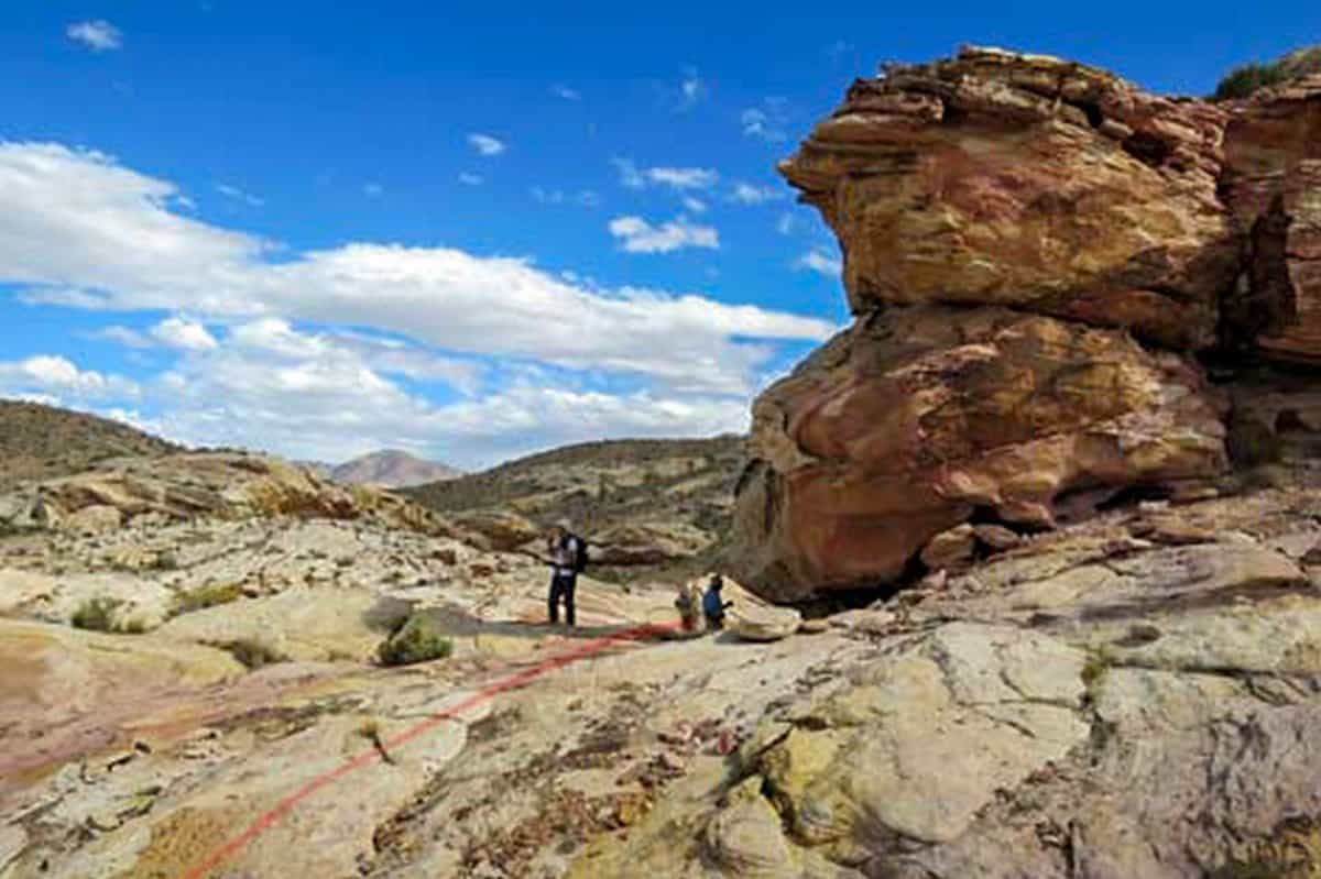
Top 10 Trails to Hike at the Gold Butte Monument
Driving through Gold Butte, we came across a small pullout and a sign saying simple TRAIL. Well, you cannot overlook that! Armed with no information, we wandered along the old road that was now relegated to being a trail. The Grotto ended up being a short hike, but a more fun than I would have expected. Somewhat like Seven Keyholes, the path visits a couple of small side canyons. These canyons are short, but unique and beautiful.
Gold Butte Monument Trail #1 – Gold Butte OHV
Very first 21 miles of the highway are just kind of paved, but it’s not completely smooth. Pit holes and patches are visible in the pavement, which is deteriorating. Whitney Pocket is the end of the pavement. The next 20 miles to the Gold Butte townsite are on a rough, wide, and rocky road that has received little maintenance. Any vehicle with good tires and adequate ground clearance will be able to make it all the way here. The western loop, which runs from the town site to Devil’s Throat, is narrow and difficult to navigate. Although 4 wheel drive is not required, a high ground clearance is required.
Length: 89.3 mi
Elevation gain: 6,958 ft
Route type: Loop
Dogs on leash, OHV/Off-road driving, Views, Wildflowers, Wildlife, Rocky
Gold Butte Monument Trail #2 – Gold Butte Fire Lookout
For the final couple of miles of road, you’ll need to have plenty of clearance. There are some sections that look more like a stream bed, and there are snow drifts in other areas as well. When I was about a half mile from the trailhead, I was stopped by a large snowdrift. I traveled the entire distance on snowshoes. The trail was in good condition, with the exception of the final third of a mile. Insufficient safety was provided by the tree wells, incline, and show conditions. Hopefully, the drifts will have receded enough to make this possible in a couple of weeks.
Length: 2.5 mi
Elevation gain: 734 ft
Route type: Out & back
Dogs on leash, Hiking, Snowshoeing, Walking, Forest, Views, Wildlife, Rocky, Historic site
Gold Butte Monument Trail #3 – Little Finland Loop
We hiked around the loop in the clockwise direction, which was about a 4 mile walk, and then we arrived at Little Finland (you could just do the little loop on the SE side for a shorter hike). Once we arrived at Little Finland, it was a case of picking your own adventure route because we were only interested in exploring the rock formations.
Length: 6.6 mi
Elevation gain: 298 ft
Route type: Loop
Hiking, Nature trips, Rocky
Gold Butte Monument Trail #4 – Whitney Pocket
To get there, you have to travel 20 miles on a dirt road. I understand why vehicles with high ground clearance are recommended. Our car was parked where the app said it should be, and we then wandered around looking for the trailhead. Nothing was marked, but we were able to locate it with the assistance of the app. However, it was a disappointment. Before returning to the starting point, you must walk around two rock formations. We took a detour off the trail to explore the red rocks near the parking lot, which turned out to be more enjoyable than the trail itself.
Length: 1.6 mi
Elevation gain: 160 ft
Route type: Loop
Hiking, Nature trips, Walking, Rocky
Gold Butte Monument Trail #5 – Finland Grotto Road
Although this is rated as an easy hike, we went 8.6 miles and completed the entire popsicle loop. To see the truly impressive wall of petroglyphs, you must hike all the way to the end of the out and back portion of the trail. Go to your left and up a small rise at the end of the trail and you will come across the best petroglyphs, which are located in a small slot area. Best of luck and enjoy yourself. And this isn’t just a leisurely stroll through the woods. Simply because of its length, I believe it to be moderate in difficulty. Make sure to use your GPS because if you are not familiar with a compass and a map, you will become disoriented.
Length: 7.6 mi
Elevation gain: 583 ft
Route type: Loop
Hiking, Nature trips, Views, No shade
Gold Butte Monument Trail #6 – Gold Butte Peak
Despite the short distance, the hike is strenuous due to the steepness of the old mining road; hiking poles are highly recommended for this hike. The final 0.1 miles are a steep climb through a boulder field that is liberally peppered with soft gravel, and shrubbery.
Length: 3.6 Miles
Elevation gain: 500 ft
Route type: Out and Back
Hiking, Nature trips, Views, No shade
Gold Butte Monument Trail #7 – Falling Man Petroglyph Site
The Falling Man Rock Art Site is an intriguing area where people once inhabited and wrote Rock Stories (petroglyphs and pictographs) on the cliffs and walls of the surrounding cliffs and mountains. While hiking to and from the Falling Man panel, hikers may notice habitation sites and petroglyphs on crags and boulders along the trail, which serve as evidence of the lives that these people led before they were killed.
Length: 6 Miles
Elevation gain: 500 ft
Route type: Out and Back
Hiking, Nature trips, Views, No shade
Gold Butte Monument Trail #8 – Bauer Mine
It is not especially fascinating in and of itself, but it is a wonderful 6- to 11-mile round-trip hike over easy landscapes into a rarely visited area of Gold Butte that contains curious geology, breathtaking views of the surrounding mountains, and a little bit of mining history. In general, the mine area is at the bottom of a valley, and hikers have a number of options from there, including climbing up one or both of the surrounding higher ridges.
Length: 11 Miles
Elevation gain: 500 ft
Route type: Out and Back
Hiking, Nature trips, Views, No shade
Gold Butte Monument Trail #9 – Uranium Mine Route
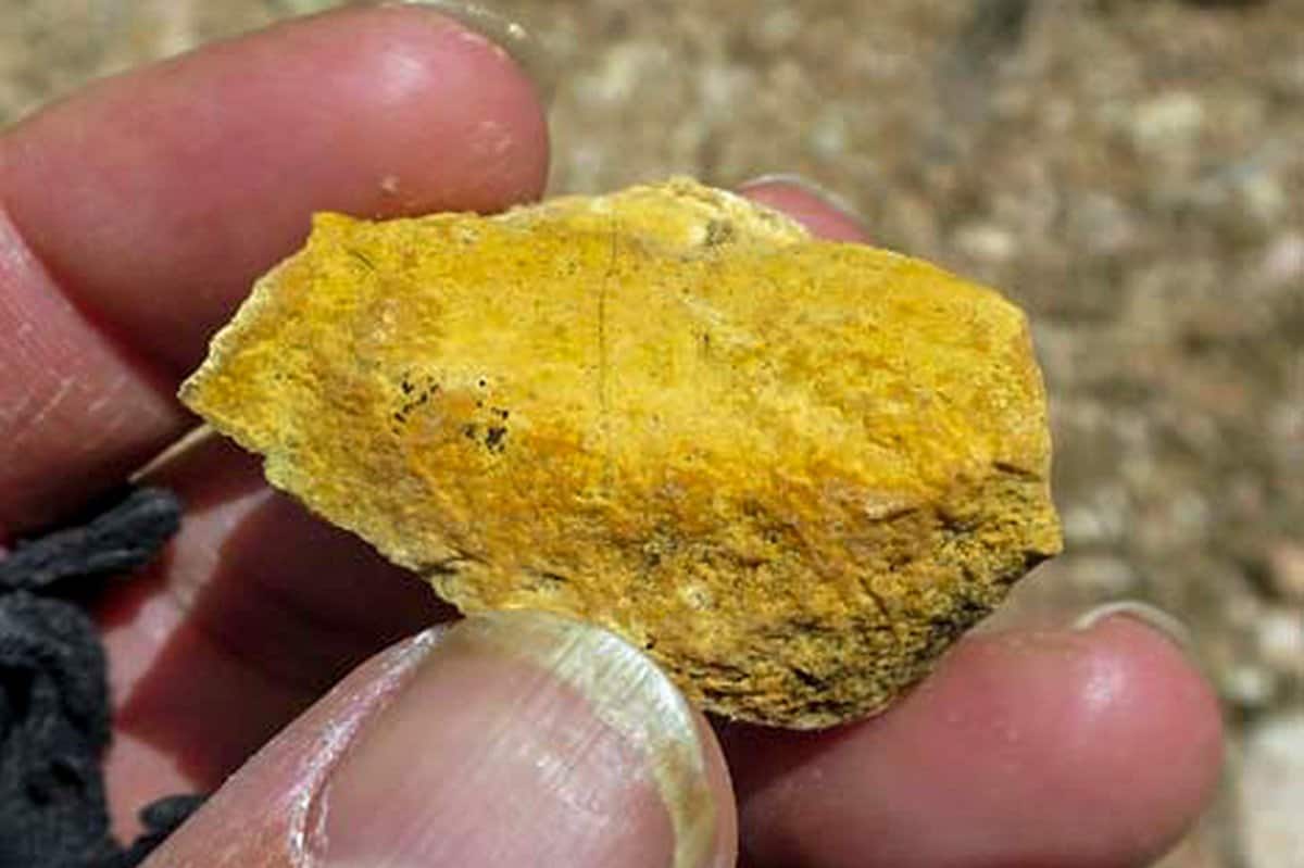
Long Shot Prospect, Blue Chip Prospect, and Uranium Mine are all names given to prospecting sites in the 1950s and 1960s where prospectors came in, discovered some uranium ore, spent time and money building roads and digging a tunnel before abandoning the area and leaving a damaged and polluted landscape in their wake.
To reach the mine, this 1.8-mile round-trip route follows an old prospecting road that climbs steeply up the hillside before traversing across the side of a ridge on the other side. As you can see, this is an in-and-out hike in this steep and rocky terrain.
Length: 1.8 mi
Elevation gain: 500 ft
Route type: Out and Back
Hiking, Nature trips, Views, No shade
Gold Butte Monument Trail #10 – Gold Butte
The petrographs are located on the out and back portion of the trail to the northwest. According to the all trails map, the hike is scenic, but it is not marked. It’s essentially a game of “choose your own adventure.” I would strongly advise you to take the road that runs to the east of the all trails map and follow it. It would be approximately 8 miles round trip if we went this route. After you turn off of the paved road, the last 3 miles or so are extremely difficult to navigate. We were traveling at a speed of 5-10 miles per hour.
Length: 7.6 mi
Elevation gain: 583 ft
Route type: Loop
Hiking, Nature trips, Views, No shade
Gold Butte Monument Places and Things to See
Gold Butte Monument is a safe place. It features some incredible sites that are worth visiting and varied wildlife for you to see. Some of the must-visit places in this monument include:
1. Whitney Pocket
It is by far the first point of interest once you get to Gold Butte Monument. Here, you will find a dam and storage cave that was constructed by the Civilian Conservation Corps at the beginning of 1930s.
2. Little Finland
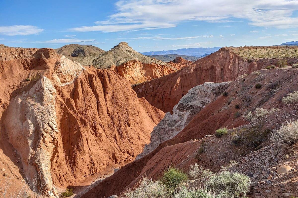
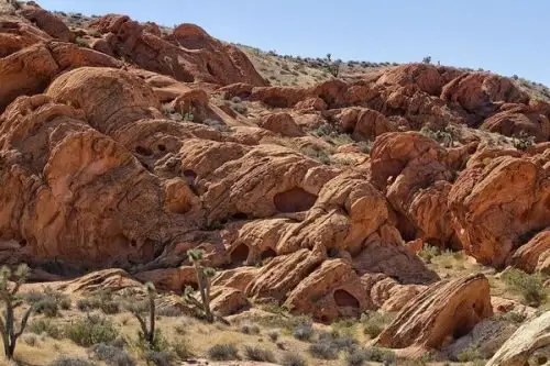
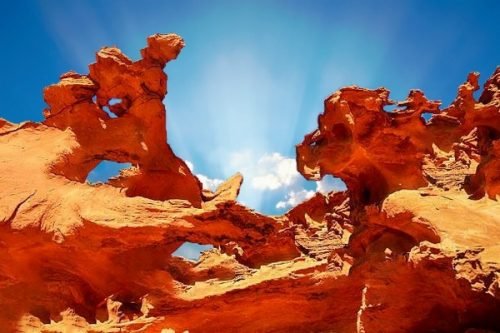
This is the most photographed area in the Gold Butte Monument. It is famous for its incredible rock formation that is bright orange in color; strong winds created the rock formation. These rocks are adorned by beautiful palm trees which makes it more picturesque.
3. Devils throat.
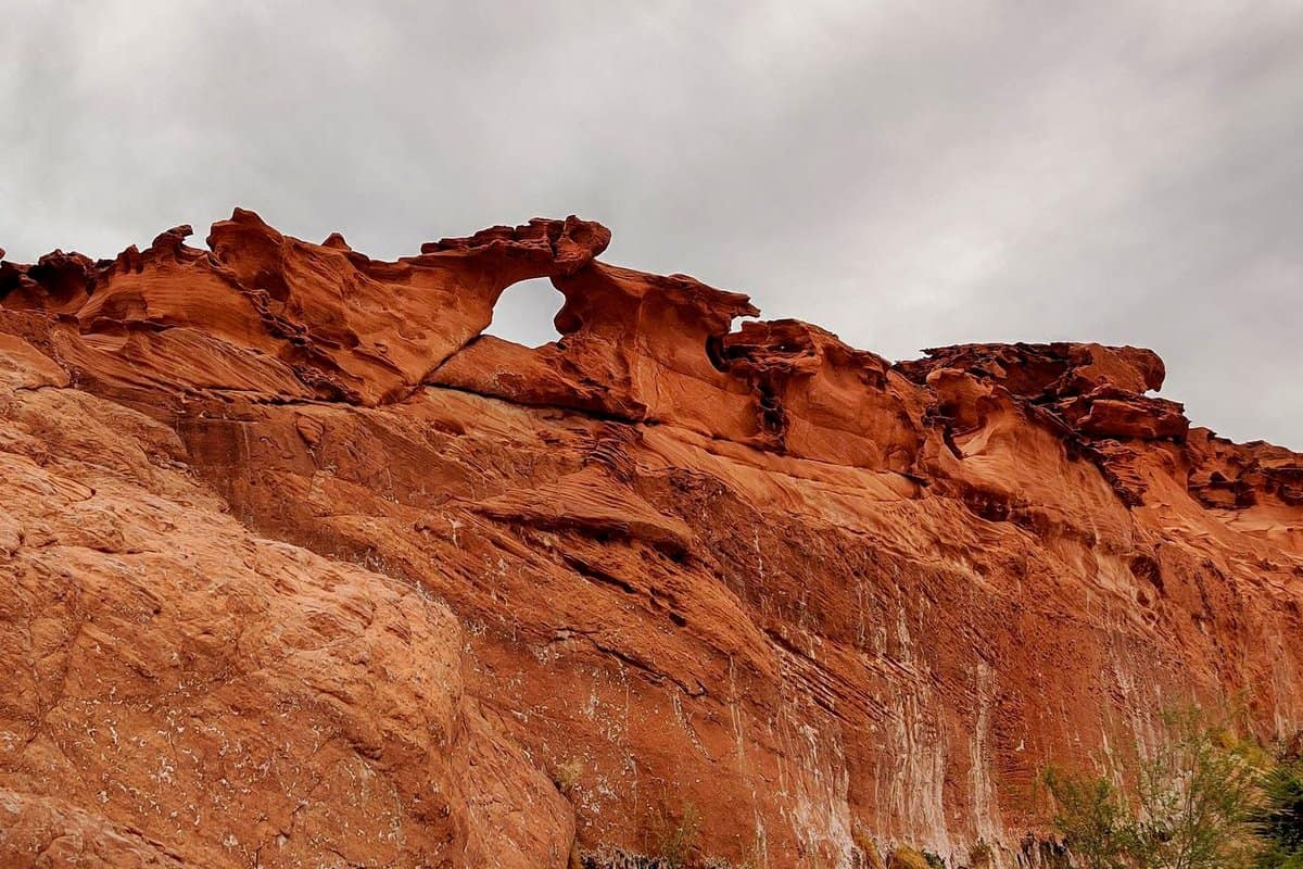
This is a 110-foot deep sinkhole at the edge of Gold Butte Monument, and it is among one of the most unusual features in this area.
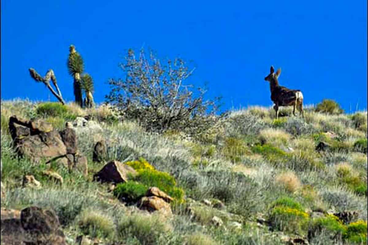
When it comes to wildlife, some of the animals you will see while in this national monument include;
☛ Mojave Desert Tortoise
☛ Desert Bighorn Sheep
☛ Cooper’s Hawk
☛ Mountain Lions
☛ Desert Kangaroo Rats
☛ Sidewinders
☛ Golden Eagles
☛ Bald Eagles
☛ Banded Gila Monster
☛ Allen’s Big-eared Bats
Five Best Things To Do at Gold Butte Monument
The top five best activities to do while in the Gold Butte Monument include:
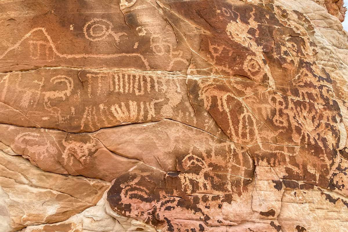
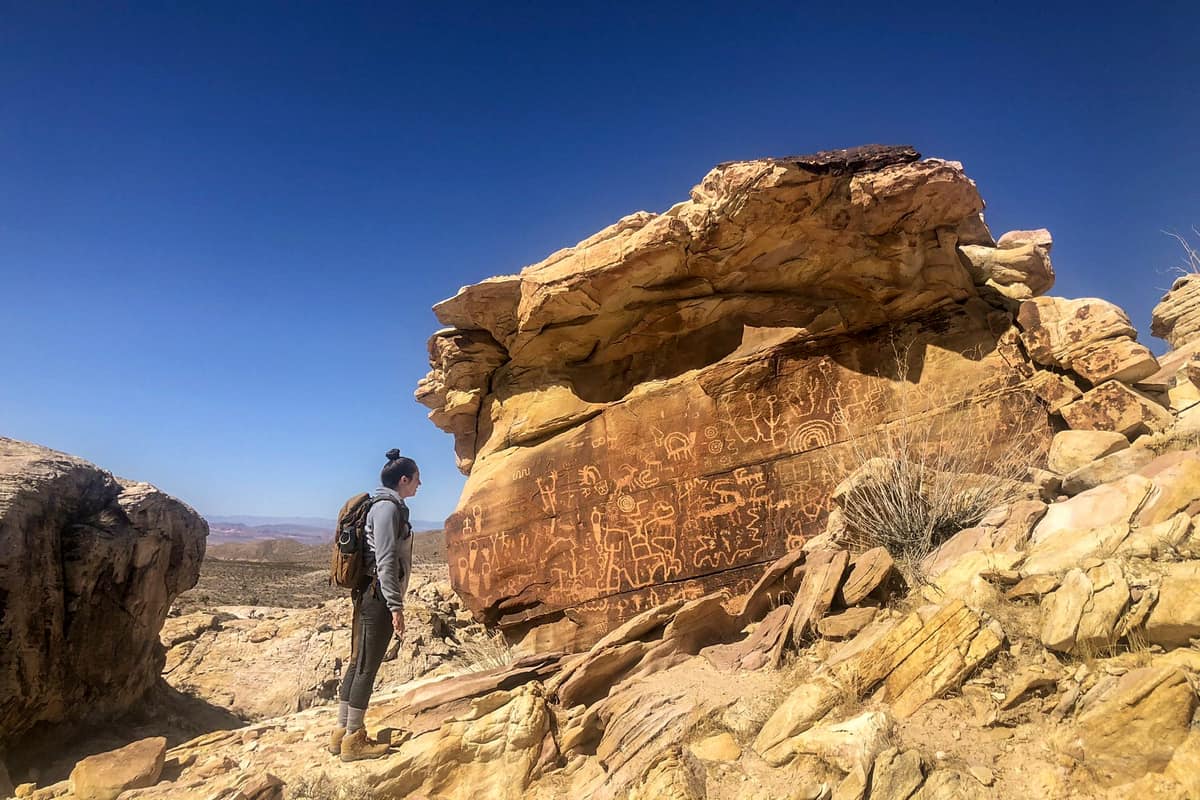
1. Visit the Petroglyph Panels at Newspaper Rock
In Gold Butte, you will be able to see petroglyphs. It is considered as one of the best places to visit. You will be able to see how the Nuwuvi used the landscape of the Mojave Desert. It is beyond description. There are up to 400 rocks of art panels that are covered with approximately 3,500 petroglyphs.
2. Hiking, Backpacking, Biking and Camping
These are some of the best outdoor activities you might consider doing in Gold Butte Monument. This national monument has some of the best hiking and biking trails.
Since the national monument is vast, there are several camping spots you might consider choosing including Whitney Pocket, which is said to be the most famous camping spot. When you spend a night here, you will be able to enjoy some of the best views of the Milky Way.
3. Check Out The Ghost Town
While visiting, you should not leave before visiting the Gold Butte Ghost Town. This is a remnant of gold mining times. This ghost town used to be for Gold Butte Mining District, and this is where the monument got its name.
The ghost town was established in the early 1900s and had approximately 2000 residents in peak days. Nevertheless, the town became deserted after ten years. There are some structures present in the town, and it is worth checking out.
4. Hunting (Permit Required)
If you are into hunting, then you will enjoy your visit to the Gold Butte Monument. While in this monument, you will be able to hunt some of its wildlife such as the desert bighorn sheep.
5. Horseback Riding
You will be able to enjoy horseback riding through canyons and peaks. This is one of the best ways of touring the canyons and peaks in this particular monument.
The Gold Butte Monument is an incredible place that is certainly worth visiting. It is a fantastic place for outdoor recreation activities. As we conclude, we hope that you find this article helpful as you plan your visit to the Gold Butte Monument.
You May Want to Join Our Boondocking Group on Facebook For More Information
You May Want to Join Our Campfire Recipes Group on Facebook For More Information