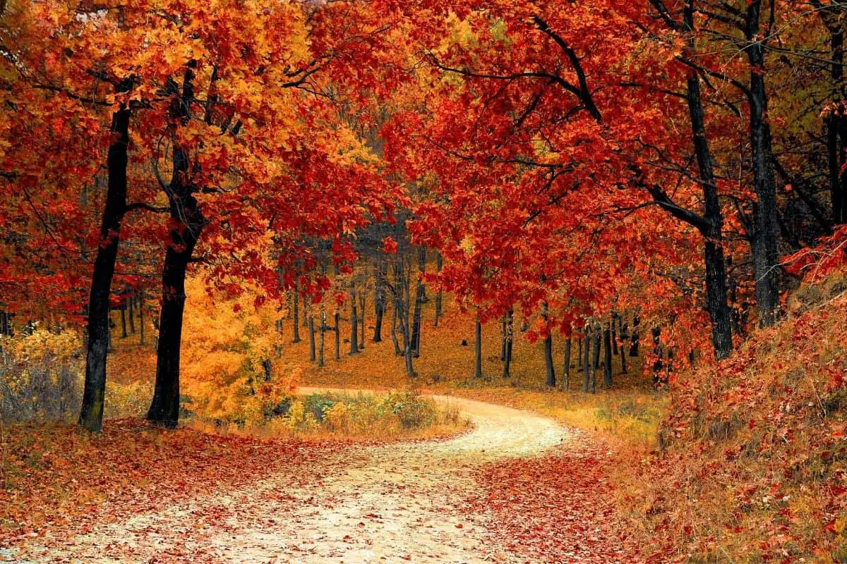
If you’re willing to venture onto the road less traveled, North Dakota boondocking spots offer a number of choices. This enormous, sparsely inhabited state has it everything, whether you wish to wake up to views of the badlands or the limitless plains.
Jump directly to the 42 North East Section of North Dakota Boondocking Spots
Jump directly to the 22 North West Section of Free North Dakota Camping Areas
Jump directly to the 27 South East Section of North Dakota Dispersed Campsites
Jump directly to the 15 South West Section of North Dakota Boondocking Sites
North Dakota Boondocking Spots
North Dakota is one of the country’s best-kept secrets when it comes to adventure camping. Many people simply pass through on their route to Montana and Wyoming’s majestic Rockies.
Despite the abundance of open land in the state, finding a place to boondock in North Dakota takes some effort. The state’s grasslands are the most accessible; the Forest Service manages them, and many of them are available to free North Dakota camping areas.
It’s helpful to know what to expect when boondocking in North Dakota when you’re planning your trip. Locals who come to hunt, fish, and enjoy the state’s vast wilderness use many of the state’s free campgrounds.
On weekdays, you’ll have the most tranquil experience. On weekends, arrive early and bring earplugs, especially if you’re going to a popular spot like Sweet Briar Lake or Scoria Pit.
check out our video
Want more ideas to round-out your trip to the North-Central States?
► Iowa, Minnesota, Nebraska, North Dakota, South Dakota ◄
- 38 Top Iowa Boondocking Campsites With Maps
- 85 Awesome Minnesota Boondocking Areas Plus Maps
- 153 Free Nebraska Boondocking Sites Including Maps
- 106 Best North Dakota Boondocking Spots Along With Maps
- 67 Amazing South Dakota Boondocking Spaces And Maps

42 North East Section of North Dakota Boondocking Spots
1. Steckel Landing
Address
292nd Avenue Northwest
Wilton, North Dakota
GPS: 47.12935, -100.937888
Elevation: 1686′
Management: Public – County Park
Beautiful North Dakota boondocking spots right on the river. Pretty rural spot with a lovely drive up along the river. Backed into a pull in right next to the second dock after passing a couple sites holding unattended pop-ups. After sitting on the dock, I had a lot of tiny annoying metal splinters, so watch out for that.
2. Harmony Lake
Address
501-599 3rd Street Southwest
McClusky, North Dakota
GPS: 47.381611, -100.653904
Elevation: 1936′
Management: Public – State Park
Free North Dakota camping areas. First come -> first served. No reservations accepted.
3. West Park Lake
Address
901-983 4th Street Southwest
Mercer, North Dakota
GPS: 47.36071, -100.792068
Elevation: 1844′
Management: Public – State Park
West Park Lake is open all year. Absolutely beautiful sites and huge! North Dakota dispersed campsites with fire rings and picnic tables. We gad a boat ramp on our private peninsula at site 15. Just a couple of other campers on other sites, but felt alone, couldn’t even see them once parked. Too breezy to use our fire pit. BUT if it rains, get out. Whatever kind of sand is there, gets very slippery when wet!
4. Heckers Lake
Address
Unnamed Road
McClusky, North Dakota
GPS: 47.34039, -100.676536
Elevation: 1870′
Management: Public – State Park
Heckers Lake is open all year. Free North Dakota boondocking spots. Reservations are not accepted at this campsite.
5. Audubon WMA
Address
Unnamed Road
Coleharbor, North Dakota
GPS: 47.62574, -101.186278
Elevation: 1854′
Management: Public – Fish and Wildlife
Free North Dakota camping areas. First come -> first camped. No reservations are accepted. It is quiet and secluded no bathrooms no real shade to speak of. Still a good little spot.
6. Brekken Holmes Recreation Area
Address
Turtle Lake, North Dakota
GPS: 47.544209, -100.903442
Elevation: 1827′
Management: Public – Bureau of Reclamation (Official)
There are 16-29 North Dakota dispersed campsites at this location. One and one-half miles north of Turtle Lake. GPS approximate.
7. Lake Holmes
Address
1352-1376 9th Street Northwest
Turtle Lake, North Dakota
GPS: 47.538854, -100.878041
Elevation: 1814′
Management: Public – State Park
Lake Holmes is open all year. Free North Dakota boondocking spots. This campsite does not use a reservation system. First come, first served.
8. Lightning Lake
Address
Unnamed Road
Turtle Lake, North Dakota
GPS: 47.527607, -100.867816
Elevation: 1837′
Management: Public – State Park
Free North Dakota camping areas. No reservations. First come, first served.
9. West Park Lake
Address
901-983 4th Street Southwest
Mercer, North Dakota
GPS: 47.36071, -100.792068
Elevation: 1844′
Management: Public – State Park
West Park Lake is open all year. Free North Dakota dispersed campsites. First come -> First Camped. Reservations not accepted. Absolutely beautiful sites and huge! Some with fire rings and picnic tables. We gad a boat ramp on our private peninsula at site 15. Just a couple of other campers on other sites, but felt alone, couldn’t even see them once parked. Too breezy to use our fire pit. BUT if it rains, get out. Whatever kind of sand is there, gets very slippery when wet!
10. Harmony Lake
Address
501-599 3rd Street Southwest
McClusky, North Dakota
GPS: 47.381611, -100.653904
Elevation: 1936′
Management: Public – State Park
Free North Dakota boondocking spots. First come -> first served. No reservations accepted.
11. Heckers Lake
Address
Unnamed Road
McClusky, North Dakota
GPS: 47.34039, -100.676536
Elevation: 1870′
Management: Public – State Park
Heckers Lake is open all year. Free North Dakota camping areas. Reservations are not accepted at this campsite.
12. Mitchell Lake
Address
33031-33099 301st Street Northeast
Wing, North Dakota
GPS: 47.170591, -100.304503
Elevation: 1929′
Management: Public – State Park
Free North Dakota dispersed campsites. First come -> First Camped. Reservations not accepted. GPS and directions are off—this is not on the SE side but the SW side of the lake. Continue on Rt. 36W for about 1/8 to 1/4 mile past Wing to the Lake Mitchell boat launch turn. Take dirt road back about 2 miles. Decent road. Great site. There is a gravel pull off and a section that is grass edging the lake on the SW side of the lake. No cell service at site but good as you got closer to Rt. 36. Bring bug juice–you will need it.
13. Wing City Park Campground
Address
200-246 2nd Avenue West
Wing, North Dakota
GPS: 47.141515, -100.284558
Elevation: 1900′
Management: Public – City Park
Free North Dakota boondocking spots. Very small park. Tight turn to get into the site and then tight to get out. This would be fine for a camper van or tents but not much longer.
14. Lake Josephine
Address
1614 23rd Avenue Southeast
Tuttle, North Dakota
GPS: 47.179063, -99.999579
Elevation: 1867′ ”
Management: Public – State Park
Lake Josephine is open all year. Well maintained Free North Dakota camping areas with picnic shelters, tables and chairs. Also has a boat ramp and fishing pier. Most areas require some blocking to level but if your there during the week you will likely be the only ones and have your pick of locations. Gravel road from the city of Tuttle. Tuttle has a well stocked community store for a small town and a free book and DVD exchange/loan. Self service gas/diesel pumps that beat other area prices. If you prefer full hookup that is available in the Tuttle City Park for $15.00/night. A $5.00 per night fee is suggested to cover maintenance of the free camp area.
15. Jasper Lake
Address
3401-3499 12th Street Southeast
Robinson, North Dakota
GPS: 47.241264, -99.757573
Elevation: 1824′
Management: Public – State Park
Jasper Lake is open all year. Free North Dakota dispersed campsites. First come -> first served. No reservations accepted.
16. Lake Williams
Address
4152-4198 20th Street Southeast
Pettibone, North Dakota
GPS: 47.132282, -99.610671
Elevation: 1765′
Management: Public – State Park
Lake Williams is open all year. Free North Dakota boondocking spots. This campsite does not use a reservation system. First come, first served. Not much more than a tiny boat launch, hard to find a level enough spot for a van/camper. Quiet, with a couple of locals coming through to drop a line in the water. Nice sunset view across the water, and watched the stars reflect off of the glassy still water at night. The vault toilet… well, I used my portable potty instead.
17. Barnes Lake
Address
Woodworth, North Dakota
GPS: 47.230422, -99.285596
Elevation: 1837′
Management: Public – Fish and Wildlife Service (Unofficial)
Lakeside North Dakota camping areas, landing nearby, fire pits.
18. Sandy Beach Campground
Address
Jamestown, North Dakota
GPS: 47.071601, -98.594777
Elevation: 1460′
Management
Public – Corp of Engineers (Official)
North Dakota dispersed campsites with fire rings, no grills or picnic tables. One vault toilet within walking distance. The site has a very small beach perfect for launching a canoe or kayak. Sites are surrounded by lake homes and locals use the area for partying and riding dirt bikes. Can be noisy at times.
19. Lake Ashtabula – Katie Olson’s Landing
Address
Katie Olson Landing
Rogers, North Dakota
GPS: 47.095073, -98.029628
Elevation: 1371′
Management: Public – State Park
Overnight parking at a boat ramp. Might do in a pinch. Free North Dakota boondocking spots.
20. Juanita Lake
9th Street Northeast
Glenfield, North Dakota
GPS: 47.540764, -98.755123
Elevation: 1480′
Management: Public – State Park
Juanita Lake is open all year. Free North Dakota camping areas. This campsite does not use a reservation system. First come, first served.
21. Mchenry city park
Address
Hwy. 20, Mchenry, ND
McHenry, North Dakota
GPS: 47.573978, -98.583687
Elevation: 1506′
Management: Public – City Park (Official)
The road in is Paved. Mchenry city park is open Yearly until snowed in.. There are 1-5 North Dakota dispersed campsites at this location and the maximum RV length is unlimited. This is a small park along Highway 20 in the town of McHenry, ND. It has a couple picnic shelters and an outhouse only.
22. Sibley Lake
Address
601-699 102nd Avenue Northeast
Binford, North Dakota
GPS: 47.511864, -98.371712
Elevation: 1467′
Management
Public – State Park
Sibley Lake is open all year. Free North Dakota boondocking spots. First come -> first camped. No reservations are accepted. There is absolutely nothing here. You’re on a gravel road that runs down the middle of water.
23. Pekin, ND City park
Address
Pekin, North Dakota
GPS: 47.794116, -98.326526
Elevation: 1469′
Management: Public – City Park (Official)
The road in is Gravel and .25 miles from a paved road. Pekin, ND City park is open summer. There are 6-15 Free North Dakota camping areas at this location and the maximum RV length is unlimited. This is a small city park in Pekin, ND. It is located on the NE corner of the town. Turn North off Highway 15 on the furthest East street in town. About 3 blocks. There are three picnic shelters and an portapotty There are some barbecues on posts.
24. Warsing Dam
Address
1/4 E. of Sheyenne, ND
Sheyenne, North Dakota
GPS: 47.839892, -99.118851
Elevation: 1419′
Management: Public – County Park (Official)
The road in is Gravel and .1 miles from a paved road. Warsing Dam is open year round but get snowed in during winter.. There are 16-29 North Dakota dispersed campsites at this location and the maximum RV length is unlimited. County Park next to a man made impoundment. It is located on the East edge of Sheyenne, ND about a quarter mile East of town on Eddy County road #1. It is a maintained county park. There is a fishing pier next to the boat ramp.
25. Michigan City Parks Campground
Address
201 Park Avenue
Michigan, North Dakota
GPS: 48.026278, -98.128934
Elevation: 1516′
Management: Public – City Park
Free North Dakota boondocking spots in a Michigan city park.Most helpful reviewLaqueeta on July 19, 2016Excellent free campsite . There is power available(we did not use). Nice clean bathroom . Beautiful grass sites with picnic table. Highly recommend!
26. Centennial City
Address
605 Main Street
Lawton, North Dakota
GPS: 48.302591, -98.360175
Elevation: 1526′
Management: Public – City Park
The town of Lawton maintains these Free North Dakota camping areas.
27. Majejcek Dam – West End
Address
5672 124th Avenue Northeast
Fordville, North Dakota
GPS: 48.222157, -97.953447
Elevation: 1381′
Management: Public – State Park
Majejcek Dam – West End is open all year. Free North Dakota dispersed campsites. First come -> First Camped. Reservations not accepted.
28. Adams City Park
Address
Adams, North Dakota
GPS: 48.422119, -98.076767
Elevation: 1571′
Management: Public – City Park (Official)
Free North Dakota boondocking spots. First come -> first served. No reservations accepted.
29. Hager Park
Address
8300-8330 U.S. 81
Saint Thomas, North Dakota
GPS: 48.619207, -97.454431
Elevation: 837′
Management: Public – City Park
Saint Thomas maintains this city park and Free North Dakota camping areas.
30. Jensen Lake
Address
Unnamed Road
Dunseith, North Dakota
GPS: 48.994751, -99.927319
Elevation: 2159′
Management: Public – State Park
Jensen Lake is open all year. Free North Dakota dispersed campsites. First come -> First Camped. Reservations not accepted.
31. Lions Park
Address
Lake Upsilon Road
Saint John, North Dakota
GPS: 48.968789, -99.831913
Elevation: 2119′
Management: Public – County Park
Free North Dakota boondocking spots. First come -> First Camped. Reservations not accepted.
32. Island Lake
Address
80th Street Northeast
Wolford, North Dakota
GPS: 48.573856, -99.707787
Elevation: 1601′
Management: Public – State Park
Island Lake is open all year. Free North Dakota camping areas. This campsite does not use a reservation system. First come, first served.
33. Sand Lake
Address
6835 40th Avenue Northeast
Rugby, North Dakota
GPS: 48.406269, -99.798934
Elevation: 1604′
Management: Public – State Park
Sand Lake is open all year. Free North Dakota dispersed campsites in the middle of nowhere and it is beautiful. It is a primitive site with no amenities located off a gravel road. Our drive in started on a one lane gravel road that was not maintained. After the first turn we were on well maintained gravel roads. We were pulling a teardrop. Not sure how a larger rig would handle it. The site is just a gravel circular driveway at Sand Lake. There is a pier and a small sandy beach. It would be perfect for a kayak, canoe or paddle board. The sunsets was stunning.
34. Willow City Campground
Address
North Dakota 60
Willow City, North Dakota
GPS: 48.604572, -100.290871
Elevation: 1470′
Management: Public – City Park
Free North Dakota boondocking spots in Willow City Campground is open May-Oct. The city of Willow City manages this park.
35. Towner City Park
Address
610 Main St S
Towner, North Dakota
GPS: 48.345833, -100.404999
Elevation: 1473′
Management: Public – City Park (Official)
Free North Dakota camping areas. Free electrical hook-ups. A covered pavilion provides shelter for large picnics. Sand volley ball courts, ball diamond, tennis court and a variety of play equipment support a day of family fun at the park. Handicap restrooms are in the park.
36. Buffalo Lodge Lake
Address
Riga, North Dakota
GPS: 48.32708, -100.76561
Elevation: 1519′
Management: Public – Fish and Wildlife Service (Official)
2 miles east, 3.5 miles north and 2 miles east of Granville. Free North Dakota dispersed campsites.
37. Jensen Lake
Address
Unnamed Road
Dunseith, North Dakota
GPS: 48.994751, -99.927319
Elevation: 2159′
Management: Public – State Park
Jensen Lake is open all year. Free North Dakota boondocking spots.
38. School Section Lake
Address
3216-3226 106th Street Northeast
Dunseith, North Dakota
GPS: 48.950411, -100.001688
Elevation: 2198′
Management: Public – State Park
School Section Lake is open all year. Free North Dakota camping areas. Reservations are not accepted at this campsite.Easy to find. Quiet lakeside. Traffic quiet at night. A few near-level spots. Trash can only. Small dock. Oddly no mosquitos. Yes to ticks. Stayed in minivan camper. Heads up there are piles of utility pipes across the street so you may experience that installation.
39. Wakopa WMA – Hooker Lake
Address
Unnamed Road
Saint John, North Dakota
GPS: 48.962036, -99.891628
Elevation: 2129′
Get Directions
Management: Public – Fish and Wildlife
Free North Dakota dispersed campsites. No reservations. First come, first served.
40. Wheaton Lake – South Ramp
Address
Unnamed Road
Saint John, North Dakota
GPS: 48.918526, -99.787918
Elevation: 2113′
Management: Public – State Park
Wheaton Lake – South Ramp is open all year. Free North Dakota boondocking spots. This campsite does not use a reservation system. First come, first served.
41. Wheaton Lake – North Ramp
Unnamed Road
Saint John, North Dakota
GPS: 48.922538, -99.790467
Elevation: 2119′
Management
Public – State Park
Wheaton Lake – North Ramp is open all year. Free North Dakota camping areas. This campsite does not use a reservation system. First come, first served.
42. Jarvis Lake
Address
39th Avenue Northeast
Saint John, North Dakota
GPS: 48.915727, -99.857118
Elevation: 2142′
Management: Public – State Park
Jarvis Lake is open all year. Free North Dakota dispersed campsites. This campsite does not use a reservation system. First come, first served.
Free North Dakota Camping Areas
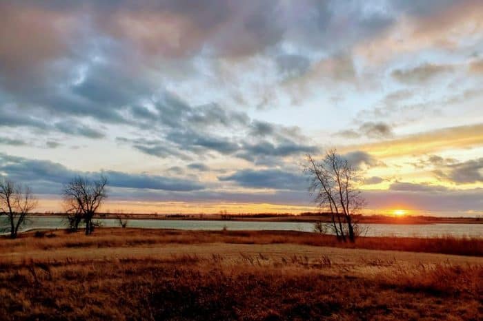
Camp among the natural rock formations of the badlands or on the banks of the great Missouri River near the state’s western border.
The most convenient possibilities for finding free North Dakota dispersed campsites for a night or two are found near I-94. However, a variety of beautiful scenery await you as you leave I-94. Spend the night tucked amid rolling hills filled with grazing buffalo, and wake up to a panorama of the vast plains.
The broad views and rolling hills provide the ideal environment for getting off the grid if you’re willing to drive. With a full tank of gas and lots of water and supplies, you may camp in perfect solitude for a week or two in some of the state’s most remote locations.
Expect to spend a lot of time behind the wheel as you travel through North Dakota in search of dispersed campsites. However, because the topography is soft, the roads are quite straightforward to navigate in an RV.
22 North West Section of Free North Dakota Camping Areas
Jump directly to the 42 North East Section of North Dakota Boondocking Spots
Jump directly to the 22 North West Section of Free North Dakota Camping Areas
Jump directly to the 27 South East Section of North Dakota Dispersed Campsites
Jump directly to the 15 South West Section of North Dakota Boondocking Sites
1. Nelson Lake Campground
Address
Center, North Dakota
GPS: 47.086277, -101.237099
Elevation: 1933′
Management: Public – State Forest (Official)
Nelson Lake offers free North Dakota boondocking spots. From the Hwy 25 & Hwy 48 junction go east two miles, then south about two miles.
2. John Moses Memorial Park
7th street
Hazen, North Dakota
GPS: 47.298058, -101.62178
Elevation: 1736′
Management: Public – City Park (Official)
There are 1-5 North Dakota camping areas at this location. Camping is free as of 2/23/18. Leaving fee schedule in place should this status change. One of Hazen’s oldest parks boasting well established evergreen and shade trees. This park is located very close to the Hazen outdoor swimming pool just east of Hazen High School. John Moses Memorial Park also provides both camping and picnic facilities. Camping fees are ($5.00 per day) or ($10.00 per day with electricity). A water filling station along with electric hookups are available
3. Killdeer Mountains WMA
Address
Unnamed Road
Killdeer, North Dakota
GPS: 47.45581, -103.00966
Elevation: 2664′
Management: Public – Fish and Wildlife
Free North Dakota dispersed campsites. First come -> first camped. No reservations are accepted.
4. Kettle Lake
Address
8196 U.S. Highway 85
Alamo, North Dakota
GPS: 48.606466, -103.625701
Elevation: 2014′
Management: Public – State Park
Kettle Lake is open all year. A little noisy from the highway, but not that many cars on the road. Beautiful birds and nice Lake with good fishing. Great, small mowed lawns for setting up. Free North Dakota boondocking spots with outhouse, no water so come prepared. Got nice and cool in the July evening. Very picturesque. Would stay here again
5. Audubon WMA
Address
Unnamed Road
Coleharbor, North Dakota
GPS: 47.62574, -101.186278
Elevation: 1854′
Management: Public – Fish and Wildlife
Free North Dakota camping areas. First come -> first camped. No reservations are accepted. It is quiet and secluded no bathrooms no real shade to speak of. Still a good little spot.
6. Steinke Bay
Address
38th Avenue Northwest
Garrison, North Dakota
GPS: 47.621255, -101.354558
Elevation: 1864′
Management: Public – County Park
Free North Dakota dispersed campsites. First come -> first camped. No reservations are accepted. Nice place right on the lake. A dozen non designated sites around the area. Toilets that may be open in one spot.
7. Douglas Creek
Address
Unnamed Road
Garrison, North Dakota
GPS: 47.578242, -101.574641
Elevation: 1860′
Management: Public – Corp of Engineers
North Dakota boondocking spots located within the Corp of Engineers Northwestern Division’s Omaha District. The camping area is near Lake Sakakawea. One of the best boondocking sites we have come across. Picnic tables and fire rings and all Free on the shores of Lake Sakakawea. 3 bars of 4G Verizon but NO drinking water that we could find. We have two barrels and can go get water and bring it back so no big deal. Went to the COE campground to get water at the dam.
8. Beaver Creek WMA
Address
Unnamed Road
Golden Valley, North Dakota
GPS: 47.498667, -101.944508
Elevation: 1903′
Management: Public – Fish and Wildlife
Free North Dakota camping areas. This campsite does not use a reservation system. First come, first served.
Editor’s Note: It says “camping prohibited on Tuesdays and Wednesdays.” It’s OK the rest of the week.
9. Iverson Dam</h3
Address
56th Street Northwest
Tioga, North Dakota
GPS: 48.22622, -102.946089
Elevation: 2172′
Management: Public – State Park
Iverson Dam is open all year. Free North Dakota dispersed campsites. First come -> First Camped. Reservations not accepted.
10. Skunk Creek Bay – Three Affiliated Tribes
Address
Mandaree, North Dakota
GPS: 47.740896, -102.432879
Elevation: 1916′
Management: Private – Indian Reserve
ND Tent, RV North Dakota boondocking spots No water No toilets Fee: Unknown
11. Deep Water
Address
72nd Avenue Northwest
Parshall, North Dakota
GPS: 47.733486, -102.129644
Elevation: 1860′
Management: Public – Corp of Engineers
Deep Water is open Apr-Sep. Free North Dakota camping areas located within the Corp of Engineers Northwestern Division’s Omaha District.
12. Hiddenwood Lake
Address
373rd Avenue Southwest
Ryder, North Dakota
GPS: 47.846646, -101.802019
Elevation: 2146′
Management: Public – State Park
Hiddenwood Lake is open all year. Free North Dakota dispersed campsites.. First come -> first camped. No reservations are accepted.
13. Makoti Lake – South Ramp
Address
338th Street Southwest
Makoti, North Dakota
GPS: 47.869177, -101.808088
Elevation: 2133′
Management: Public – State Park
Makoti Lake – South Ramp is open all year. Free North Dakota boondocking spots. No reservations. First come, first served.
14. North Carlson Lake
Address
Douglas, North Dakota
GPS: 47.921023, -101.470419
Elevation: 2041′
Management: Public – County Park (Official)
The road in is Gravel. There are 6-15 Free North Dakota camping areas at this location and the maximum RV length is 45 feet. 9 mile West of US 83 on ND 22
15. Makoti Lake – North Ramp
Address
33178-33258 331st Avenue Southwest
Ryder, North Dakota
GPS: 47.891061, -101.795388
Elevation: 2126′
Management: Public – State Park
Makoti Lake – North Ramp is open all year. Free North Dakota dispersed campsites. First come -> first camped. No reservations are accepted.
16. Makoti Lake – Center Ramp
Address
338th Street Southwest
Ryder, North Dakota
GPS: 47.876487, -101.807306
Elevation: 2133′
Management: Public – State Park
Makoti Lake – Center Ramp is open all year. North Dakota boondocking spots.
17. Antler Memorial
Address
10878-10898 26th Avenue Northwest
Antler, North Dakota
GPS: 48.991756, -101.278122
Elevation: 1526′
Management: Public – City Park
Antler Memorial is open May-Nov. Nice Campground, horse ring & stables, electric hookups, 2 pavilions, 25+/-(didn’t count) North Dakota camping areas. Got Directions from the only bar in town 😉 probably 1 miles(ish)from the center of town. However it is not free(at least not during summer) it is $15 a night or $50 a week.1 bar with Verizon Wireless could send text but calls drop after a couple of seconds. Several very large 5th wheels, a couple normal sized pull behind campers & of course tents. Not crowded at all, maybe 25 campers.
18. Flaxton Water Tower
Address
101-151 Southeast 1st Street
Flaxton, North Dakota
GPS: 48.899367, -102.392718
Elevation: 1939′
Management: Public – City Park
No off-street parking, no bathroom, 1 picnic table, no BBQ, no hookups, and I doubt a tent would be welcome. I slept in my car, parallel parked on the street and was woken up numerous times by the train horn as they come clattered past. I gave up on sleeping after 6 hours and continued down the road. North Dakota dispersed campsites.
19. Summit Campground
Address
Watford City, ND
Grassy Butte, North Dakota
GPS: 47.540359, -103.241776
Elevation: 2513′
Management: Public – Forest Service
The road in is Dirt and .2 miles from a paved road. There are 1-5 North Dakota boondocking spots at this location. There are two walk-in tent sites with picnic tables and fire grates. There are also two picnic areas with shelters and pull through camping units for RV’s and other vehicles. The campground has a handicap accessible vault toilet.A 100 yd hiking trail leading west from the campgrounds gives a scenic view of underlying valley.
20. Leland Dam
Address
Unnamed Road
Sidney, North Dakota
GPS: 47.559123, -103.798668
Elevation: 2198′
Management: Public – State Park
Leland Dam is open all year. Free North Dakota camping areas. No reservations. First come, first served.
21. Little Muddy River
Address
944-1164 20th Avenue East
Williston, North Dakota
GPS: 48.152277, -103.59346
Elevation: 1867′
Management: Public – State Park
Little Muddy River is open all year. North Dakota dispersed campsites.
North Dakota Dispersed Campsites
A small lake about 12 miles north of Bismarck, along I-94, appears insignificant for a state, so off the beaten path for most Americans, but it offers some excellent RV boondocking that all RVers should mark on their maps.
Morton County’s Department of Parks and Campgrounds manages Sweet Briar Lake. It’s still large enough to house a couple dozen RVs, if not more, with 886 acres of lake, grass, and campgrounds.
Each campground is separated from the others by a considerable distance, yet some are large enough to accommodate a couple 40-foot fifth wheels or Class A coaches. Each campsite contains a fire ring, picnic tables, and pit toilets in most cases. The lake is totally surrounded by free North Dakota camping areas.
27 South East Section of North Dakota Dispersed Campsites
Jump directly to the 42 North East Section of North Dakota Boondocking Spots
Jump directly to the 22 North West Section of Free North Dakota Camping Areas
Jump directly to the 27 South East Section of North Dakota Dispersed Campsites
Jump directly to the 15 South West Section of North Dakota Boondocking Sites
1. Hoskins Lake</h3
Address
Ashley, North Dakota
GPS: 46.035, -99.461227
Elevation: 1982′
Management: Public – Fish and Wildlife Service (Official)
The road in is Paved. Hoskins Lake is open May 1 to October 31. There are 1-5 North Dakota boondocking spots at this location. You may stay 29 at Hoskins Lake. Lake Hoskins Park and Campground
2. Rice Lake
Address
96th Street Southeast
Hague, North Dakota
GPS: 46.029205, -100.091968
Elevation: 1798′
Management: Public – State Park
Rice Lake is open all year. Free North Dakota camping areas. No reservations. First come, first served.
3. Nieuwsma Dam
Address
101st Street Southeast
Hague, North Dakota
GPS: 45.970054, -100.045827
Elevation: 1785′
Management: Public – State Park
Nieuwsma Dam is open all year. Free North Dakota dispersed campsites. First come -> first camped. No reservations are accepted.
4. Fort Yates RA – Sioux Tribe
Address
Unnamed Road
Fort Yates, North Dakota
GPS: 46.102508, -100.629135
Elevation: 1621′
Management: Public – Indian Reserve
Tents primitive camping Parking lot. North Dakota boondocking spots.
5. Cattail Bay
Address
91st Street Southwest
Linton, North Dakota
GPS: 46.094618, -100.59196
Elevation: 1614′
Management: Public – Corp of Engineers
Free North Dakota camping areas located within the Corp of Engineers Northwestern Division’s Omaha District. The camping area is near Lake Oahe.
6. Fort Rice Recreation Area
Address
Cannon Ball, North Dakota
GPS: 46.513485, -100.586235
Elevation: 1639′
Management: Public – County Park (Official)
There are 16-29 North Dakota dispersed campsites at this location. 10 campsites with electricity. High and low water boat ramp, fish cleaning stations, pets welcome. There may be free overnight spots at the boat ramp area.
7. Braddock City Park
Address
South Mitchell Street
Braddock, North Dakota
GPS: 46.566696, -100.090184
Elevation: 1867′
Management: Public – County Park (Official)
The road in is Paved. Braddock City Park is open Year Round. There are 30 or more North Dakota boondocking spots at this location and the maximum RV length is 35 feet. You may stay 7 days at Braddock City Park. In the city of Braddock Population 33 they have a wonderful campground in their city park. It has 2 plug ins a space for 6 rvs and 20 tents. They have a water spicket and a bathroom. The local town has a bar/resturant that opens at 1 pm everyday. If you dont use the power its free and $10 if use the power.
8. West Lake Napoleon
Address
63rd Street Southeast
Napoleon, North Dakota
GPS: 46.501152, -99.788208
Elevation: 1939′
Management: Public – State Park
West Lake Napoleon is open all year. Free North Dakota camping areas. First come -> First Camped. Reservations not accepted.
9. Rudolph Lake
Address
Unnamed Road
Wishek, North Dakota
GPS: 46.503505, -99.508158
Elevation: 1903′
Management: Public – State Park
Rudolph Lake is open all year. Free North Dakota dispersed campsites. No reservations. First come, first served.
10. Kimball Bottom
Address
11360-11498 Desert Road
Bismarck, North Dakota
GPS: 46.679292, -100.733344
Elevation: 1627′
Management: Public – Corp of Engineers
This is a recreational off-roading area. Free North Dakota boondocking spots anywhere you’d like. The area is owned by the Army Corps of Engineers. There is usually lots of trash around the area, so please, to keep this place useable, pack out any trash you see. It does get kind of rowdy on weekends, but if you camp by the boat ramp, it isn’t too bad. There is a huge sandy beach in the back that has really soft sand, so be careful.
11. Mckenzie Slough
Address
Bismarck, North Dakota
GPS: 46.80662, -100.415
Elevation: 1706′
Management: Public – Fish and Wildlife Service (Unofficial)
The road in is Dirt and 1 miles from a paved road. There are 1-5 North Dakota camping areas at this location and the maximum RV length is unlimited. You may stay 10 days at Mckenzie Slough. A dirt road on south side of North Dakota State Wildlige Refuge. Camping for longer than 10 consecutive days on any wildlife management area is prohibited. Trailers, campers, motor homes, or tents may not be left on any wildlife management area unless used for daily lodging.
12. Veterans Memorial Park
Address
Steele, North Dakota
GPS: 46.855552, -99.915054
Elevation: 1857′
Management: Public – City Park
Small city park right along the railroad tracks. The Sheriff’s Department and Courthouse is across the street. Good idea to check with Sheriff\’s Dept before staying, but probably not necessary. There are no signs saying parking is okay, but street signs in Steele say “24 hour parking limit.” Steele is about 40 miles east of Bismarck on I-94. To reach the park take exit 200 and go south for about half a mile. At the RR tracks turn left into the parking lot. Expect train noise at night. North Dakota dispersed campsites.
13. Jamestown Walmart
Address
Jamestown, North Dakota
GPS: 46.879966, -98.72226
Elevation: 1480′
Get Directions
Public – Parking Lot (Official)
The road in is Paved. Jamestown Walmart is open year round. There are 30 or more North Dakota boondocking spots at this location and the maximum RV length is unlimited. You may stay overnight at Jamestown Walmart.
14. Moon Lake
Address
109th Avenue Southeast
Valley City, North Dakota
GPS: 46.860472, -98.164841
Elevation: 1476′
Management: Public – State Park
Moon Lake is open all year. Free North Dakota camping areas. First come -> first camped. No reservations are accepted. Great campsite! Although its hard to find a level spot. Its beautiful. Thecother free campsite down the road isnt real. It brings you to someones house. Any size RV will work here!
15. Schlenker (Lehr) Dam
Address
Unnamed Road
Jud, North Dakota
GPS: 46.624485, -98.930693
Elevation: 1742′
Management: Public – State Park
Schlenker (Lehr) Dam is open all year. Free North Dakota dispersed campsites. Reservations are not accepted at this campsite.
16. Schlecht – Weixel Dam
Address
66th Street Southeast
Jud, North Dakota
GPS: 46.458085, -98.899805
Elevation: 1824′
Management: Public – State Park
Schlecht – Weixel Dam is open all year. Free North Dakota boondocking spots. First come -> first served. No reservations accepted.
17. Barney City
Address
298 Park Street
Barney, North Dakota
GPS: 46.268401, -96.998993
Elevation: 1033′
Management: Public – City Park
Barney City is open all year. City Park in a nice neighborhood with community grill, basketball, tennis courts, vault toilets, community drill water. No hookups/ electric…no fee. Free North Dakota camping areas.
18. Schlecht – Thom Dam
Address
76th Avenue Southeast
Edgeley, North Dakota
GPS: 46.363709, -98.829934
Elevation: 1745′
Management: Public – State Park
Schlecht – Thom Dam is open all year. Free North Dakota dispersed campsites. First come -> first served. No reservations accepted.
19. Kulm – Edgeley Dam
Address
75th Street Southeast
Edgeley, North Dakota
GPS: 46.32875, -98.81908
Elevation: 1732′
Management: Public – State Park
Free North Dakota boondocking spots at Kulm – Edgeley Dam is open all year. First come -> first served. No reservations accepted.
20. Wilson Dam
Address
78th Avenue Southeast
Edgeley, North Dakota
GPS: 46.174788, -98.752335
Elevation: 1617′
Management: Public – State Park
Wilson Dam is open all year. Free North Dakota camping areas. First come -> first camped. No reservations are accepted.
21. Heinrich – Martin Dam
Address
5681-5699 90th Avenue Southeast
Montpelier, North Dakota
GPS: 46.594554, -98.536549
Elevation: 1421′
Management: Public – State Park
Heinrich – Martin Dam is open all year.Free North Dakota dispersed campsites. First come -> first camped. No reservations are accepted.
22. Limesand – Seefeldt Dam
Address
64th Street Southeast
Dickey, North Dakota
GPS: 46.486882, -98.38271
Elevation: 1404′
Management: Public – State Park
Limesand – Seefeldt Dam is open all year. Free North Dakota boondocking spots. No reservations. First come, first served. Very nice peaceful primitive campsite did not see another person while I was here very easy to find saw lots of different kind of birds and waterfowl and lots of different kinds of wildflowers stayed for multiple days I will definitely come back here again have a great day God bless
23. Twin Lake
Address
10200-10212 68th Street Southeast
LaMoure, North Dakota
GPS: 46.421126, -98.285168
Elevation: 1391′
Management: Public – State Park
Twin Lake is open all year. Free North Dakota camping areas. First come -> first served. No reservations accepted.
24. Pheasant Lake County
Address
28 Lake Drive East
Ellendale, North Dakota
GPS: 46.004188, -98.670277
Elevation: 1493′
Management: Public – County Park
Free North Dakota dispersed campsites. First come -> First Camped. Reservations not accepted. This is the boat launch on the Lake. The dam is ND 11. There is a picnic table to the north side of the vault toilet behind the bushes.
25. Wilson Dam
Address
78th Avenue Southeast
Edgeley, North Dakota
GPS: 46.174788, -98.752335
Elevation: 1617′
Management: Public – State Park
Wilson Dam is open all year. Free North Dakota boondocking spots. First come -> first camped. No reservations are accepted.
26. Sprague Lake – North Ramp
Address
West Lake Road
Havana, North Dakota
GPS: 46.02144, -97.549776
Elevation: 1217′
Management: Public – State Park
Sprague Lake – North Ramp is open all year. Free North Dakota camping areas. This campsite does not use a reservation system. First come, first served. Rolled in expecting to have free camping but noticed a no camping sign. Camped anyway. Nobody ever came around. Very very quiet. Fishing is phenomenal. Walleye and northern pike everywhere. Lots of birds to watch. Some skeeters at night but daytime was good. Vault toilet was good. No stink. This for tent campers, vans or truck campers. To small for anything else
27. Bisek Slough
Address
15405-15477 90th Street Southeast
Lidgerwood, North Dakota
GPS: 46.110007, -97.167555
Elevation: 1083′
Management: Public – State Park
North Dakota dispersed campsites about 2 mi north of Lidgerwood on HWY 18 and .5 mi west on dirt from HWY 18. There is a boat ramp that is rarely used here and an old picnic table maybe a trashcan. Nobody will bother you if you camp here although I’m not sure if it is meant for camping or just “recreation”. Its fine if your looking for a primitive camping situation.
It’s a small area so like 1 camping group at a time. Safe place to let your dog stretch and run around. If you keep following the two-track dirt road across the water past the boat ramp/camping area, it will only take you to fenced in private land, there is no other water access back there. I have full cell service out here.
North Dakota Boondocking Sites
The Roughrider State, a wide plains dotted with small, rugged oases, may be as harsh as it is beautiful. Throughout the summer, fierce winds and rising temperatures drive campers to the few remaining woodland free camping spots. The shoulder seasons bring with them more pleasant weather and plenty of quiet.
Teddy Roosevelt, the president who effectively created the United States National Parks, came here to experience the rough and tumble Wild West, and millions of visitors do so today.
The major attractions in this park, which is named after our country’s 26th president, are bison and feral horses. The dramatic difference in landscape from all of the Great Plains surrounding it, not to mention the lovely tiny tourist town of Medora, make this the state’s most popular destination.
15 South West Section of North Dakota Boondocking Sites
Jump directly to the 42 North East Section of North Dakota Boondocking Spots
Jump directly to the 22 North West Section of Free North Dakota Camping Areas
Jump directly to the 27 South East Section of North Dakota Dispersed Campsites
Jump directly to the 15 South West Section of North Dakota Boondocking Sites
1. Patterson Lake
Address
8th Street Southwest
Dickinson, North Dakota
GPS: 46.862759, -102.845317
Elevation: 2438′
Management: Public – State Park
Patterson Lake is open all year. Free North Dakota boondocking spots. First come -> First Camped. Reservations not accepted.
2. Danzig Dam and Storm Creek
Address
Judson, North Dakota
GPS: 46.894424, -101.605423
Elevation: 2113′
Management: Public – County Park (Official)
Tent Sites, up to Medium Trailers, Number of North Dakota camping areas unkown, Pit or Vault Toilets, Picnic Area, Boat Ramp, Lake, Fishing (I-94, Exit 120 by Almont)- Public boat ramp- Public boat dock- Parking lot- Primitive camping- Small picnic area- Vault toilet- Northern Pike, Yellow Perch, Crappie, Bluegill fishing I-94 Exit 120 or 4 miles N on CR 85.
3. New Salem/Hailstone Creek Rest Area – West Bound
Address
New Salem, North Dakota
GPS: 46.862656, -101.591349
Elevation: 2119′
Management: Public – Rest Area
The road in is Paved. New Salem/Hailstone Creek Rest Area – West Bound is open all year. You may stay a coupe of hours at New Salem/Hailstone Creek Rest Area – West Bound. Overnight RV parking. No camping. Nice modern rest area with ample parking and several picnic shelters. Scenic view overlooks prairie land. Close to historic indian villages. Free Wi-Fi inside the visitor building, which is open 24/7. No grills or fire rings, though. North Dakota dispersed campsites.
4. Sweetbriar Lake Recreation Area
Address
New Salem, North Dakota
GPS: 46.870796, -101.273239
Elevation: 1972′
Management: Public – County Park (Official)
North Dakota boondocking spots, fishing, boat ramps, picnic shelters, pets welcome.Tent Sites, up to Medium Trailers, Number of sites unkown, Pit or Vault Toilets, Picnic Table , Picnic Area, Boat Ramp (I-94, Exit 134) – Interstate 94 Scenic Area- Morton County’s Second Most Popular Park- 2 Public boat ramps- 2 Boat docks- 6 Picnic shelters- Picnic shelter reservations available- 3 Fishing piers.
5. Fish Creek Dam
Address
Judson, North Dakota
GPS: 46.729801, -101.236893
Elevation: 1870′
Management: Public – County Park (Official)
(I-94, Exit 134 by Judson)- Nice Scenic Area. 2 Public boat ramps- 1 public boat dock- NO WAKE SPEED FOR BOATS- 2 foot bridges- 4 Picnic Shelters- Vault toilets- North Dakota camping areas – Fishing Pier-Trout, Bass, Crappie, Bluegill fishing
6. Nygren Dam
Address
Flasher, North Dakota
GPS: 46.587505, -101.208443
Elevation: 2001′
Management: Public – Corps of Engineers (Unofficial)
Tent Sites, up to Medium Trailers, Number of sites unknown, Pit or Vault Toilets, Boat Ramp, Lake, Fishing. (6 miles North, 1 mile East, 3 miles North of Flasher)- Primitive camping available- Vault toilet- No picnic facilities currently available due to vandalism- Boat ramp- NO WAKE SPEED FOR BOATS- Trout, Yellow Perch, Crappie, Bluegill, Bass fishing- NO ICE FISHING ALLOWED! North Dakota dispersed campsites.
7. Heart Butte Res – Schelle’s Point
Address
Unnamed Road
Glen Ullin, North Dakota
GPS: 46.619078, -101.927739
Elevation: 2080′
Management: Public – State Park
Heart Butte Res – Schelle’s Point is open Mar-Nov. We followed Google Maps directions to North Dakota boondocking spots right next to the water. A nice breeze is keeping the bugs at bay, and we’re the only ones around.
8. Heart Butte Res – Kahlers Point
Address
71st Avenue
Glen Ullin, North Dakota
GPS: 46.612321, -101.907528
Elevation: 2070′
Management: Public – State Park
Heart Butte Res – Kahlers Point is open Mar-Nov. Long bumpy ride. Very quiet. Solitude. Sitting camperside watching momma deer with her twins, eat and play. The lake water was super low. We usually like to get our feet wet, it was mostly muck- couldn’t get to the water. Besides the muck, it was what we were hoping for. North Dakota camping areas.
9. Heart Butte Res – Schatz’s Point
Address
Unnamed Road
Elgin, North Dakota
GPS: 46.604402, -101.870715
Elevation: 2083′
Management: Public – State Park
Heart Butte Res – Schatz’s Point is open Mar-Nov. North Dakota dispersed campsites First come -> first served. No reservations accepted.
10. Sheep Creek Dam SRA
Address
7495 68th Ave. SW
Elgin, North Dakota
GPS: 46.338059, -101.848801
Elevation: 2251′
Management: Public – State Recreation Area (Official)
The road in is Dirt and 5 miles from a paved road. Sheep Creek Dam SRA is open May – October. There are 1-5 North Dakota boondocking spots at this location and the maximum RV length is unlimited. You may stay 5 days at Sheep Creek Dam SRA. Free camping but donations welcome/expected. 7495 68th Ave. SW, Elgin, ND, No charge for 5 consecutive days in 14 day per year limit. Donations welcome. Water, some electric (30, 50A). Some sites have covered picnic tables. At least one site has a concrete pad. Note, Google maps finds the address correctly, Bing maps does not.
11. Mott Watershed Dam
Address
Brown Avenue
Mott, North Dakota
GPS: 46.381442, -102.324593
Elevation: 2418′
Management: Public – State Park
Mott Watershed Dam is open all year. I saw no real way to get to the place noted on this site’s map. I drove along the west cemetery road and walked across a hay field to a fence that said the area was ND Fish and Game land and no vehicles beyond the gate (which was locked). I parked along the cemetery road for the night which worked out fine. I’m giving this site two stars because of the apparent lack of access to the lake. North Dakota camping areas.
12. Dogtown WMA
Address
Mott, North Dakota
GPS: 46.164106, -102.370517
Elevation: 2493′
Management: Public – State Park (Official)
The maximum RV length at Dogtown WMA is unlimited. You may stay 10 Days at Dogtown WMA. North Dakota dispersed campsites free for up to 10 consecutive days. Best camping is in SW corner so you don’t have to go over the barbed wire fence. I have camped there in 2015 and 2016. Locals are friendly, area is managed/policed by ND Game & Fish. There are no facilities. The prairie dog town that inspired this park no longer exists.
13. Indian Creek Dam
Address
74th Street Southwest
Regent, North Dakota
GPS: 46.340482, -102.629677
Elevation: 2582′
Management: Public – State Park
Indian Creek Dam is open all year. North Dakota boondocking spots. It does have power at some spots which cost ten dollars per night. They do ask for a contribution for maintenance. Very quiet place. I was here on Monday night. I would stay here again.
14. Cedar Creek Dam
Address
Scranton, North Dakota
GPS: 46.292332, -102.96756
Elevation: 2697′
Management: Public – Fish and Wildlife Service (Unofficial)
The road in is Gravel and 6 miles from a paved road. Cedar Creek Dam is open year around. There are 1-5 North Dakota camping areas at this location and the maximum RV length is any. Several campsites available beside dam on small lake. Vault toilet.
15. Gascoyne Lake
Address
Scranton, North Dakota
GPS: 46.127434, -103.091049
Elevation: 2748′
Management: Public – County Park (Unofficial)
The road in is Gravel and 1/8 miles from a paved road. Gascoyne Lake is open year around. There are 6-15 North Dakota dispersed campsites at this location and the maximum RV length is any. You may stay any at Gascoyne Lake.
You May Want to Join Our Boondocking Group on Facebook For More Information
You May Want to Join Our Campfire Recipes Group on Facebook For More Information
Check Out Our Pictures On Instagram – Our Big Escape.