Minnesota boondocking areas has numerous free campgrounds and woodlands that are open to boondockers. You’ll find one of these wonderful places if you look in almost any direction.
Jump directly to the 44 North East Minnesota Boondocking Areas
Jump directly to the 31 North West Minnesota Dispersed Campsites
Jump directly to the 10 South Minnesota Boondocking Sites
North East Minnesota Boondocking Areas
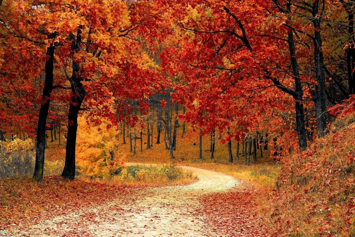
The northeastern region of Minnesota is covered in forest, with 3.9 million acres of it, providing lots of opportunities to choose the ideal Minnesota boondocking sites.
You’ll want to visit different parts of the Land of 10,000 Lakes because there are so many great Minnesota boondocking areas to explore. Voyageurs National Park, with its fantastic canoeing and incredible history, is a great place to visit in the North Woods.
About an hour and a half north of Minneapolis, you may find free, rustic camping along the Saint Croix National Scenic Riverway. As you travel north, you’ll find more opportunities for free RV camping, as well as more natural beauty, thanks to Minnesota’s enormous State Forests.
When it comes to boondocking, Minnesota is a rather laid-back state. It is totally lawful to sleep in your car at rest stops and is not subject to the time limits that many other states impose. In most regions, dry camping in private parking lots is allowed, with some exclusions in the Minneapolis-St. Paul area.
check out our video
Want more ideas to round-out your trip to the North-Central States?
► Iowa, Minnesota, Nebraska, North Dakota, South Dakota ◄
- 38 Top Iowa Boondocking Campsites With Maps
- 85 Awesome Minnesota Boondocking Areas Plus Maps
- 153 Free Nebraska Boondocking Sites Including Maps
- 106 Best North Dakota Boondocking Spots Along With Maps
- 67 Amazing South Dakota Boondocking Spaces And Maps
44 North East Minnesota Boondocking Areas
Jump directly to the 31 North West Minnesota Dispersed Campsites
Jump directly to the 10 South Minnesota Boondocking Sites
1. Pug Hole Lake
Address
Grand Rapids, Minnesota
GPS: 47.411144, -93.592017
Elevation: 1351′
Management: Public
Minnesota boondocking areas open all year. Spaces for self-contained RVs at wayside park.
2. Orange Lake Campsite (hike in)
Address
Deer River, Minnesota
GPS: 47.450081, -93.627978
Elevation: 1404′
Management: Public – Forest Service (Official)
Orange lake has a walk-in single campsite with a ranger box nearby. Minnesota dispersed campsites located on the Northwest corner of the lake and is accessed through a trail and small parking area off of Orange Lake Road. There is a carry in canoe access onto Orange Lake as well. Fire ring and picnic table also at campsite.
3. Crooked Lake
Address
County Road 49
Marcell, Minnesota
GPS: 47.56611, -93.575681
Elevation: 1391′
Management: Public – County Park (Official)
The road in is Dirt. There are 1-5 Minnesota boondocking sites at this location. You may stay 14 days at Crooked Lake. Currently there are 3 sites located on the lake, with the first site being next to the access. Two additional sites are located further north on an old logging road. These two sites are best suited for tent camping.
4. Nickel Lake
Address
County Road 45
Bigfork, Minnesota
GPS: 47.6059, -93.4612
Elevation: 1381′
Management:
There are 1-5 Minnesota boondocking areas at this location and the maximum RV length is 15 feet. You may stay 14 days at Nickel Lake. This site offers one tenting site with parking at the public access. (Please do not block the turn around). This is a designated trout lake.
5. Scooty Lake
Address
E Scooty Lake Drive
Bigfork, Minnesota
GPS: 47.574687, -93.306938
Elevation: 1362′
Management: Public – County Park (Official)
The road in is Dirt. There are 1-5 Minnesota dispersed campsites at this location. You may stay 14 days at Scooty Lake. The Park System asks that all refuse and supplies be carried out. Please leave the site in better shape than you found it.
6. Wolf Lake
Address
County Road 53
Nashwauk, Minnesota
GPS: 47.561658, -93.262968
Elevation: 1339′
Management: Public – County Park (Official)
You may stay 14 days at Wolf Lake. This site offers 3 individual Minnesota boondocking sites that are designed to handle small to medium sized campers.
7. Sherry Lake
Address
48198 Minnesota 65
Nashwauk, Minnesota
GPS: 47.633663, -93.163817
Elevation: 1401′
Management: Public – Forest Service
Minnesota boondocking areas. First come -> first camped.
8. Camp Troyboy
Address
Duluth, Minnesota
GPS: 47.067096, -92.232392
Elevation: 1438′
Management: Public – State Forest (Unofficial)
The road in is Gravel and 10 Miles miles from a paved road. Camp Troyboy is open All year. weather permiting. There are 1-5 Minnesota dispersed campsites at this location and the maximum RV length is unlimited. You may stay None at Camp Troyboy. 10 miles back of the pavement is a turn a round used for logging trucks from prevous log out. T
I stayed there for 3 years and the DNR who I stopped to ask questions were really nice. Good hunting area. There is a few cabins threw out the acreage that lease a little chunk. You can camp anywhere along the 10 mile road. I use all the old logging sites. This is remote so watch out for the wild life.
9. US Hockey Hall of Fame
Address
Eveleth, Minnesota
GPS: 47.47189, -92.52877
Elevation: 1663′
Management: Private – attraction (Unofficial)
The road in is Paved. Minnesota boondocking sites at US Hockey Hall of Fame is open year round. You may stay overnight at US Hockey Hall of Fame. just a parking lot I called and asked for myself. They said sure, but nothing official.
10. Big Rice Lake
Address
Forest Route 247
Virginia, Minnesota
GPS: 47.704227, -92.498814
Elevation: 1450′
Management: Public – Forest Service
Big Rice Lake is a large, shallow lake- 1870 acres, maximum depth 5 feet. For 2000 years and continuing today, wild rice has been harvested from the lake. The area offers a drive-in rustic campground with 3 Minnesota boondocking areas, duck hunting, a boat launch for small boats and some fishing.
11. Little American Falls
Address
Ut-360
Effie, Minnesota
GPS: 47.920652, -93.620234
Elevation: 1329′
Management: Public – County Park
Minnesota dispersed campsites. First come -> first camped. No reservations are accepted. It’s decent and free…. Busy for it’s location. Saw a group doing drugs at their campsite. Must be a good place for that
12. Erskine Lake
Address
State Highway 1
Cook, Minnesota
GPS: 47.801691, -93.384758
Elevation: 1388′
Management: Public – City Park
The road in is Dirt. There are 1-5 Minnesota boondocking sites at this location and the maximum RV length is 15 feet. You may stay 14 days at Erskine Lake. This site offers one tenting site with parking at the public access. (Please do not block the turn around). This is a designated trout lake. The Park System asks that all refuse and supplies be carried out. Please leave the site in better shape than you found it.
13. Sucker Lake
Address
State Hwy 1
Cook, Minnesota
GPS: 47.801964, -93.393123
Elevation: 1388′
Management: Public – County Park (Official)
The road in is Gravel and aproxamenty 3 miles miles from a paved road. There are 1-5 Minnesota boondocking areas at this location and the maximum RV length is 15 feet. You may stay 14 at Sucker Lake. This is a dispersment site. This site offers one tenting or small camper site at the public access. (Please do not block the turn around). There is a pit toilet on the hill. Lake side it’s awesome.
14. Myrtle Lake
Address
8947 Orr Buyck Road
Orr, Minnesota
GPS: 48.089961, -92.678518
Elevation: 1319′
Management: Public – Forest Service
Myrtle Lake is open May-Sep. Myrtle Lake is a small lake with 3 backcountry Minnesota dispersed campsites. The 2 sites on the northwest shoreline are located on nice sandy beaches. Directions: Myrtle Lake is located 8 miles east of Orr, MN. From Orr, turn right on County Rd 23 for 8 miles. Turn left on Myrtle Lake Rd for 1/2 mile to boat launch.
15. Elephant Lake Public
Address
Near Orr, MN
Orr, Minnesota
GPS: 48.182055, -92.735038
Elevation: 1308′
Management: Public – State Forest (Official)
The road in is Dirt and 10 miles from a paved road. Elephant Lake Public is open Year Round. There are 1-5 Minnesota boondocking sites at this location. You may stay Unlimited at Elephant Lake Public. This an open sand patch near the road. There is room for an RV I’m not sure how long. Sandy beach across the road to beach your boat. First Come First Serverd
16. Forest Overlook
Address
Orr, Minnesota
GPS: 48.40742, -92.8406
Elevation: 1224′
Management: Public – National Park Service (Unofficial)
The road in is Paved. There are 1-5 Minnesota boondocking areas at this location and the maximum RV length is 15 feet. Paved parking lot, with vault toilet and 2 picnic tables. Nobody was there all night. Short 1/2 mile hiking trail there as well. Its your first turn on the right when heading to Ash River Visitor center. There are no signs that say you cant camp or park over night.
17. Carrol Truck Trail
Address
Duluth, Minnesota
GPS: 47.115533, -92.025041
Elevation: 1421′
Management: Public – State Forest
Free Minnesota dispersed campsites along dirt road, completely primitive, no amenities. The dirt road in is well maintained, any vehicle can get down. The campsites are off this road, you have to keep an eye out for pull offs on dirt roads that are not as well maintained, so having 4 wheel drive would probably work best. The spot on put on gps is at the end of the road and well used. The road in to that spot is a little rough, and half under water, but there are several obvious other spots to pull into along this road.
18. Sand Lake
Address
Sand Lake Road
Isabella, Minnesota
GPS: 47.581454, -91.66371
Elevation: 1729′
Management: Public – Forest Service
There are 3 Minnesota boondocking sites and one outhouse right on Sand Lake. Really thick with trees and busy during hunting season. Tough turnaround with huge RVs. I got there at 4 pm and the 2 RVs didn’t look like they’d welcome a tenter, so I stayed just 100 m down the lane on a minnow pond. Just off a beautiful paved road. Really quiet, no water, no cell service, moose visiting.
19. Silver Bay RV Parking
Address
24 City Shop Road
Silver Bay, Minnesota
GPS: 47.291079, -91.266347
Elevation: 925′
Management: Public – City Park
For RV’s – Small lot with not much room for turn around – if more than 2-3 people here you would have to back in to lot (unless you’re small). Paved roads convenient to Hwy. 61. Good open area for solar. I was able to get some antenna tv and radio from Duluth and cell reception. Not much in the little town so mostly just a pass through spot. Minnesota boondocking areas.
20. Eighteen Lake Rustic Campground
Address
Isabella, Minnesota
GPS: 47.643823, -91.344282
Elevation: 1955′
Management: Public – USDA Forest Service
There are 1-5 Minnesota dispersed campsites at this location. Eighteen Lake Rustic Campground provides three campsites and a picnic area under red pines on the shore of Eighteen Lake. A trail around the lake and a carry down boat access make this a wonderful spot to spend a weekend in the woods.
21. Section 29 Lake Rustic Campground
Address
Isabella, Minnesota
GPS: 47.741338, -91.241822
Elevation: 1631′
Management: Public – USDA Forest Service
There are 1-5 Minnesota boondocking sites at this location. This small three site campground is on the shore of Section 29 Lake, which is of course located in section 29 of a township. While it doesn’t have the most romantic of names, this lake does have a boat ramp and walleyes and northern pike. It is also only a short drive to several other small lakes, most with carry down access.
22. Kawishiwi Lake Rustic Campground
Address
Ely, Minnesota
GPS: 47.838741, -91.102853
Elevation: 1657′
Management: Public – USDA Forest Service
There are 1-5 Minnesota boondocking areas at this location. Kawishiwi Lake is a lovely campground in a birch stand on the edge of the Boundary Waters Canoe Area Wilderness. It provides an excellent campsite for people entering or exiting the BWCAW via the Kawishiwi Lake Entry Point. The BWCAW boundary is the shore of the lake, so motors are not allowed on the lake and if you plan on putting a canoe in the water at all, you will need a day use permit available at a kiosk at the access point.
23. Hogback Lake Rustic Campground & Backcountry Sites
Address
Finland, Minnesota
GPS: 47.644582, -91.135077
Elevation: 1772′
Management: Public – USDA Forest Service
There are 1-5 Minnesota dispersed campsites at this location. The Hogback Lake Area has a rustic campground with 3 sites, a 5 mile trail system passing 6 lakes with several different loops, and 5 backcountry campsites along the trail. There is also a boat launch and an accessible fishing pier.
24. Harriet Lake Rustic Campground
Address
County Road 7
Finland, Minnesota
GPS: 47.6578, -91.118692
Elevation: 1775′
Management: Public – Forest Service (Official)
The road in is Gravel and ? ? miles from a paved road. The maximum RV length at Harriet Lake Rustic Campground is 25 feet. Minnesota boondocking sites part of Superior National Forest. Campground sites but also a large field accessible for RV parking. Did not stay here but ranger (Tofte ranger station) said this would be Excellent rv location and roads were Gravel but good. Sites are pull-in and not specifically designed for RVs. Four of the six sites are longer than 21 feet and may accommodate an RV.
25. Windy Lake Rustic Campground & Backcountry Sites
Address
Finland, Minnesota
GPS: 47.743581, -91.087176
Elevation: 1667′
Management: Public – Forest Service
Windy Lake is an easily accessed, but remote, lake near several other lakes which all provide camping and fishing opportunities. Windy Lake Rustic Campground offers 1 site accessible by car. On the shore of the lake are an additional 3 backcountry Minnesota boondocking areas accessible by boat.
26. Whitefish Lake
Address
Forest Route 348
Finland, Minnesota
GPS: 47.719132, -91.045338
Elevation: 1683′
Management – Forest Service
This free Minnesota dispersed campsites located within the Superior National Forest’s Tofte Ranger District.
27. Toohey Lake Rustic Campground
Address
Grand Marais, Minnesota
GPS: 47.71292, -90.953135
Elevation: 1686′
Management: Public – USDA Forest Service
There are 6-15 Minnesota boondocking sites at this location. Toohey Lake Rustic Campground is a five site campground with a boat launch and trailer parking for trailers. It is an easily accessed lake on a well maintained gravel road which follows the grade of an old railroad. It is right off of a well traveled forest road, making for easy access.
28. Fourmile Lake – Rustic Campground & Backcountry Sites
Address
Grand Marais, Minnesota
GPS: 47.701965, -90.963748
Elevation: 1673′
Management: Public – USDA Forest Service
Fourmile Lake Rustic Campground offers four Minnesota boondocking areas accessible by car. On the shore of the lake are an additional two backcountry campsites accessible by boat. At the campground is a boat ramp and dock as well as parking for trailers and people using the backcountry sites. Directions: Fourmile Lake Rustic Campground is located about 12 miles northwest of Tofte
29. Sawbill 1206
Address
Tofte, Minnesota
GPS: 47.607668, -90.862263
Management: Public – Forest Service (Official)
Little climb up a hill off the sawbill for an average Minnesota dispersed campsites with a fire grate. No complaints!
30. Superior Trailhead Parking Lot
Address
Tofte, Minnesota
GPS: 47.627926, -90.784963
Elevation: 1220′
Management: Public – Forest Service (Official)
The road in is Gravel and 2 miles from a paved road. There are 1-5 Minnesota boondocking sites at this location and the maximum RV length is unlimited. You may stay one night at Superior Trailhead parking lot. I checked in at the Tofte ranger station and was approved (if not posted) and the morning ranger drive through did not bother us. 2 mile good gravel road up the hill to trailhead – Onion River Rd. FR 336 – just off Hwy. 61 south of Lutson.
31. NFD campsite
Address
Tofte, Minnesota
GPS: 47.633354, -90.856022
Elevation: 1283′
Management: Public – Forest Service (Unofficial)
The road in is Dirt. There are 1-5 Minnesota boondocking areas at this location. Found this site by chance. Very primitive camping off a dirt road, about 4-5 sites with picnic table and fire ring, no other amenities. The road is fairly easy for dirt.
32. Oxbow Tofte Ranger District Superior Nat’l Forest
Address
Tofte, Minnesota
GPS: 47.640504, -90.847144
Management: Public – Forest Service (Official)
The road in is Paved. There are 1-5 Minnesota dispersed campsites at this location and the maximum RV length is 15 feet. You may stay 14 at Oxbow Tofte Ranger District Superior Nat’l Forest.Little more than a turnarou d -No designated Parkspots – Very soft ground (Got stuck! As did others) -two outhouses – Hiker shelter – one picnic table One fire ring (for hiker shelter) – Near road
33. White Pine Lake
Address
Lutsen, Minnesota
GPS: 47.739842, -90.752991
Elevation: 1603′
Management: Public – Forest Service (USDA) (Unofficial)
The road in is Gravel and 3 miles from a paved road. There are 1-5 Minnesota boondocking sites at this location and the maximum RV length is 20ft?. You may stay 14 days at White Pine Lake. Superior National Forest rustic campground. Wheel chair accessible outhouse. Suitable for small rvs perhaps up to 20 ft. Picnic table, fire ring/grate. No water or garbage disposal. Fishing for Walleye, Northern Pike, and Perch.
34. Poplar River
Address
Lutsen, Minnesota
GPS: 47.73814, -90.777885
Elevation: 1551′
Management: Public – Forest Service (USDA) (Unofficial)
The road in is Gravel and 2 miles from a paved road. There are 1-5 Minnesota boondocking areas at this location. You may stay 14 days at Poplar River. USFS rustic campground, no fees. Trout stream. 4 sites. Tables, fire rings, outhouse. Small rvs, about 20ft. max.
35. Clara Lake Rustic Campground
Address
Lutsen, Minnesota
GPS: 47.774341, -90.751719
Elevation: 1699′
Management: Public – Forest Service (Official)
There are 1-5 Minnesota dispersed campsites at this location. You may stay 14 days at Clara Lake Rustic Campground. Clara Lake Rustic Campground is on the shore of Clara Lake in a stand of pines. It is close to other lakes as well, so it is a great campground for a weekend of fishing, or just relaxing near the water. Directions:From MN 61 just north of Lutsen:Turn north on Co 4 (Caribou Trail) and drive about 8 miles to FR 340.
36. Baker Lake Rustic Campground
Address
Grand Marais, Minnesota
GPS: 47.845212, -90.816877
Management: Public – National Park Service
Minnesota boondocking sites located in a stand of red pine on the shore of Baker Lake. Unlike most other rustic campgrounds, there is a solar powered faucet for drinking water. It is an excellent first or last night site for people who are using the Baker Lake Entry Point to the Boundary Waters Canoe Area Wilderness. Directions:From Highway 61 in Tofte:Turn left at Co 2 (Sawbill Trail), and drive approximately 16 miles to FR 170.Turn right on FR 170, drive 6 miles.Turn left on FR 1272 to Baker Lake Rustic Campground. A turn off of 1272 slightly before the campground leads to an additional camping site away from the lake.
37. Cascade River Rustic Campground
Address
Forest Road 158
Grand Marais, Minnesota
GPS: 47.832155, -90.529924
Elevation: 1594′
Management: Public – USDA Forest Service
The road in is Gravel. There are 1-5 Minnesota boondocking areas at this location. Cascade River Rustic Campground is a small camping area particularly suited to people who are planning to fish in the Cascade River or are looking for a remote place to camp. There are not tables at the campsites, so be prepared to prepare and eat meals like you were backpacking. Fishing requires a valid license from the Minnesota Dept of Natural Resources, and trout fishing requires an additional stamp.
38. Lichen Lake Camp
Address
The Grade
Grand Marais, Minnesota
GPS: 47.850423, -90.712595
Elevation: 1804′
Management: Public – Forest Service
Lichen Lake Camp is open May-Sep. This free Minnesota dispersed campsites located within the Superior National Forest’s Tofte Ranger District.
39. Loon Lake Minnesota (hike/boat in)
Address
Grand Marais, Minnesota
GPS: 48.07495, -90.72148
Elevation: 1745′
Management: Public – Forest Service (Official)
Loon Lake backcountry campsite is a National Forest campsite accessible by canoe or hiking from the Loon Lake boat access off the Gunflint Trail. Minnesota boondocking sites with campfire ring, two large spots for tents, a latrine and in right on the water. No fee for camping there and for the plentiful mosquitoes.
40. Cascade River Rustic Campground
Address
Forest Road 158
Grand Marais, Minnesota
GPS: 47.832155, -90.529924
Elevation: 1594′
Management: Public – USDA Forest Service
The road in is Gravel. There are 1-5 Minnesota boondocking areas at this location. Cascade River Rustic Campground is a small camping area particularly suited to people who are planning to fish in the Cascade River or are looking for a remote place to camp. There are not tables at the campsites, so be prepared to prepare and eat meals like you were backpacking. Fishing requires a valid license from the Minnesota Dept of Natural Resources, and trout fishing requires an additional stamp.
41. Superior #1
Address
789 Forest Route 140
Grand Marais, Minnesota
GPS: 47.881169, -90.234307
Elevation: 1913′
Management: Public – Forest Service
Did not stay at this location but would consider it. Minnesota dispersed campsites directions to what I think is the correct campground, since google does not route there, is to take the trail out of Grand Marais to trout lake road then turn right on 140C just before Kimball Lake. It is a short drive on 140C which is a two track with pretty tight overhanging trees.
42. Flour Lake
Address
Grand Marais, Minnesota
GPS: 48.04831, -90.41785
Elevation: 1772′
Management: Public – Forest Service (Unofficial)
Dirt turnaround. Narrow, dirt access road. Minnesota boondocking sites are secluded, no services.
43. Ester Lake
Address
Hovland, Minnesota
GPS: 47.98119, -90.108147
Elevation: 1959′
Management: Public – State Forest (Unofficial)
The road in is Gravel and 18 miles from a paved road. There are 1-5 Minnesota boondocking areas at this location and the maximum RV length is no limit. You may stay 14 at Ester Lake. Free State Forest campground on beautiful trout lake. Three sites, two on the lake, vault toilet only, picnic tables, fire grates and boat launch and dock. No other facilities. Some limited hiking trails in area.
44. Devilfish Campground
Address
Grand Marais, Minnesota
GPS: 47.99133, -90.09568
Elevation: 1890′
Management: Public – Forest Service
About 5 or 6 free Minnesota dispersed campsites on Devilfish lake. There is a vault toilet but no other amenities, bring your own water and other supplies. Lots of bass to be caught, and the campsites were clean and well kept. Bring your bug spray, even late in the year. It’s a wet marshy area and the mosquitos thrive there. They were big and plenty of them, but with some good bug spray and a decent fire, it was manageable. The campsites were clean, spacious and dry. Not many trails to walk, though you can walk any of the logging/forest service roads without hesitation. Plenty of other lakes within walking distance.
North West Minnesota Dispersed Campsites
Minnesota is a camper’s paradise, with beautiful forests, wide-open spaces outside of cities, and plenty of crystal clear water to swim and paddle in. Minnesota’s nickname, “Land of 10,000 Lakes,” is no laughing matter. You’re never far from a lovely lakefront no matter where you travel.
There are also numerous Minnesota dispersed campsites along Lake Superior in the Superior National Forest. The 310-mile Superior Hiking Trail, which follows much of the lake’s shoreline, is also located here.
As summer approaches, practically every Minnesotan seems to be talking about their vacation cabin up north. Voyageurs National Park and the Boundary Waters Canoe Area Wilderness, both popular with anglers, paddlers, and anyone who enjoys being out on the water, are two of the most well-known places up north.
31 North West Minnesota Dispersed Campsites
Jump directly to the 44 North East Minnesota Boondocking Areas
Jump directly to the 10 South Minnesota Boondocking Sites
1. Sand Dunes State Forest (Dispersed Camping)
Address
Big Lake, Minnesota
GPS: 45.410167, -93.664553
Elevation: 971′
Management: Public – State Forest (Official)
The road in is Paved. Sand Dunes State Forest (Dispersed Camping) is open Always. There are 1-5 Minnesota boondocking areas at this location and the maximum RV length is 25 feet. You may stay None at Sand Dunes State Forest (Dispersed Camping). Quiet state forest near the Twin Cities with several options for paid and dispersed camping. Some of the pull-offs have overhanging trees which did drag on our high-top van. Nice pine forest, and there are multiple spots to tent camp closer to the lake. Great spot for wildlife viewing and fishing. Trails: 4 miles x-county skiing 4 miles hiking 29 miles horseback 23 miles snowmobiling
2. Rum River Dispersed Camping
Address
Ogilvie, Minnesota
GPS: 45.950338, -93.570472
Elevation: 1253′
Management: Public – State Forest (Official)
The road in is Gravel. There are 30 or more Minnesota dispersed campsites at this location. I placed the marker at the entrance of Rum River State Forest. If you go down that gravel road you can camp anywhere in side of the forest. There are several parking areas that you could park an RV and I have seen many RVs parked back there. There are several off shoots off the main road that lead to cul de sacs that you can park and set up a tent anywhere near by.
3. Lake Pepin Public Access
Address
Swanville, Minnesota
GPS: 45.9138, -94.6444
Elevation: 1171′
Management: Public – County Park (Official)
Minnesota boondocking sites. No electricity, but there is a portable bathroom on site. Easy access for large rigs. City owned.
4. Hog’s Back Beach Camping
Address
Aitkin, Minnesota
GPS: 46.365906, -93.586226
Elevation: 1266′
Management: Public – Rest Area (Official)
The road in is 4×4. There are 1-5 Minnesota boondocking areas at this location. On south west edge of Deer Creek. Has one 30 amp out let. Editor’s Note: Submtted with these coordinates: 46.392056, -95.317297
5. Badoura
Address
Minnesota 64
Akeley, Minnesota
GPS: 46.867644, -94.725149
Elevation: 1424′
Management: Public – State Park
Minnesota dispersed campsites. First come -> First Camped. Reservations not accepted.
6. Foothills State Forest
Address
ATV Trail
Pine River, Minnesota
GPS: 46.72179, -94.618339
Elevation: 1417′
Management: Public – State Park
Nice Minnesota boondocking sites half hour from Brainerd. Easy to find. I have verizon and I got one bar there. I didn’t go to far into the forest but I saw 3 sites which were prettt nice and private, one by the lake. A lot of ATVs but very private. Bugs weren’t as bad as we thought either. Definitely would stay here again.
7. Baker Lake and White Oaks Lake (Land o Lakes State Park)
Address
Minnesota
GPS: 46.900732, -93.877376
Management: Public – State Forest (Official)
Minnesota boondocking areas Off hwy 6 east on gravel road Baker White Oak Lakes about 3 miles. Where lakes are on both sides of road there is a path a car can go down on both sides and there is one campsite one each side. There is a primitive outhouse and campsite right on the lake; very isolated. If they were full there are a few clearings along road with picnic tables to camp but no lake, nice isolated place in land o lakes state forest. It is probably crowded during hunting season.
8. Foothills State Forest
Address
ATV Trail
Pine River, Minnesota
GPS: 46.72179, -94.618339
Elevation: 1417′
Management State Park
Nice campsite half hour from Brainerd. Easy to find. I have verizon and I got one bar there. I didn’t go to far into the forest but I saw 3 Minnesota dispersed campsites which were pretty nice and private, one by the lake. A lot of ATVs but very private. Bugs weren’t as bad as we thought eaither. Definitely would stay here again.
9. Shingobee RA
Address
6250 Minnesota 34
Akeley, Minnesota
GPS: 47.036812, -94.643308
Elevation: 1440′
Management: Public – Forest Service
Shingobee RA is open all year. There were no defined campsites but the road was wide with several level spots to pull to the side. There was little traffic noise from the nearby highway at night. It was adequate Minnesota boondocking sites that was convenient for us while we were passing through. We only wanted a place to make dinner and rest for the night.
10. Long Lake Boat Launch
Address
Akeley, Minnesota
GPS: 47.070005, -94.607005
Elevation: 1381′
Management: Public – Forest Service (Official)
The road in is Dirt and 4 miles from a paved road. There are 1-5 Minnesota boondocking areas at this location and the maximum RV length is 35 feet. Great spot for boondocking on west side of long lake. Primarily a boat launch site for small fishing boats, there is plenty of space for 2-3 RVs. Dirt road in forest about 100 feet from lake with dock and bench at the launch point.
11. Diamond Lake
Address
Unnamed Road
Hackensack, Minnesota
GPS: 46.996638, -94.454549
Elevation: 1404′
Management: Public – State Park
We stayed two weeknights in late September. Minnesota dispersed campsites very quiet and peaceful. Aside from some fishermen over at the boat put in we were all alone. One truck drove back into the loop and turned around after remarking that they were impressed that we drive our bus back there. The drive in is narrow but pretty smooth right up to the last little bit past the boat put in. We did it in a 26 footer. be careful if you try anything bigger.
12. 30th Woodtick Rd
Address
Walker, Minnesota
GPS: 46.996083, -94.433514
Elevation: 1388′
Management: Public – Forest Service (Official)
Minnesota boondocking sites off wood tick at 30th about 200 ft from woodtick, it is a tire path but shortway to campsite on a small lake fished from shore and caught small bass an perch
13. Moccasin Lake
Address
1330 Woodtick Trail
Hackensack, Minnesota
GPS: 46.992297, -94.356057
Elevation: 1371′
Management: Public – State Park
Minnesota boondocking areas. First come -> First Camped. Reservations not accepted. this is a boat landing there is a sign that says day use only but i dont think thr\ere would be a prob if you stayed there a night, could fish from landing
14. Six Mile Lake
Address
Bena, Minnesota
GPS: 47.311755, -94.125634
Elevation: 1303′
Management: Public – Forest Service (Official)
The road in is Dirt and 2 miles from a paved road. There are 6-15 Minnesota dispersed campsites at this location and the maximum RV length is 45 feet. You may stay 14 at Six Mile Lake. This is an official Forest Service Dispersed Camping Area. Free, with a 14 day limit. It is along the shore of Six Mile Lake a couple miles down Six Mile Lake Road (Forest Service Road 2127) about 5 miles east of Bena, MN.
15. Lake Winnibigoshish Lakeside D29
Address
Deer River, Minnesota
GPS: 47.479045, -94.077823
Elevation: 1309′
Management: Public – Forest Service (Official)
The road in is Gravel and 4 miles from a paved road. Lake Winnibigoshish Lakeside D29 is open All year. There are 1-5 Minnesota boondocking sites at this location and the maximum RV length is 15 feet. You may stay 14 days at Lake Winnibigoshish Lakeside D29. Quiet lakeside single vehicle site near Bena, Minnesota. Plenty of firewood and a nice fire ring. No toilet or drinking water.
16. Middle Pigeon Lake
Address
County Highway 33
Squaw Lake, Minnesota
GPS: 47.586759, -94.166101
Elevation: 1355′
Management: Public – Forest Service
Minnesota boondocking areas located within the Chippewa National Forest’s Deer River Ranger District.
17. Little White Fish Lake
Address
County Road 127
Spring Lake, Minnesota
GPS: 47.673195, -93.986211
Elevation: 1342′
Management: Public – County Park (Official)
There are 1-5 Minnesota dispersed campsites at this location. You may stay 14 days at Little White Fish Lake. This site offers one tenting site with parking at the public access. (Please do not block the turn around). The Park System asks that all refuse and supplies be carried out. Please leave the site in better shape than you found it.
18. Pine Island State Forest
Address
Mizpah, Minnesota
GPS: 48.00869, -94.1045
Elevation: 1329′
Management
Public – State Forest (Official)
Minnesota boondocking sites in Pine Island State forest is open year round. You may stay 21 days at Pine Island State forest. Minnesota allows free dispersed camping on all state forest lands 100yds from trails and roads. This is a heavily forested area with no amenities. Open year round. Gets a lot of snow in the winter with quite cold temperatures. It is Minnesota’s largest state forest, lying just east of the Red Lakes. There is a ranger station over near Big Falls. The forest does have more traditional camp grounds, though there is a fee.
19. Nelson Park
Address
10367 Town Road
Baudette, Minnesota
GPS: 48.64387, -94.101943
Elevation: 1070′
Management: Public – State Park
Minnesota boondocking areas. First come -> First Camped. Reservations not accepted. Drove in tonight at 10pm on a Tuesday. All 16 or so sites occupied and only 2 sites with people present. So we had no choice but to camp in boat parking which is not allowed. Would be nice if they made it a requirement that can can’t park a trailer unless you are spending the night in it.
20. Smokey Hills State Forest
Address
Osage, Minnesota
GPS: 46.92146, -95.40618
Elevation: 1581′
Management: Public – State Forest
The road in is Dirt. Minnesota dispersed campsites in State Forest
21. Frontier Landing
Address
Frontier Landing
Baudette, Minnesota
GPS: 48.656128, -94.252558
Elevation: 1066′
Management: Public – County Park
Minnesota boondocking sites. Reservations are not accepted at this campsite.
22. Lost River
Address
38001-40999 Minnesota 310
Roseau, Minnesota
GPS: 48.978304, -95.768367
Elevation: 1043′
Management: Public – State Park
Minnesota boondocking areas. No reservations. First come, first served.
23. Skull Lake WMA
Address
Unnamed Road
Lancaster, Minnesota
GPS: 48.918042, -96.700119
Elevation: 984′
Management: Public – Fish and Wildlife
Minnesota dispersed campsites. First come -> First Camped. Reservations not accepted. This is a lovely little spot. lots and lots of ticks. no one was there when i was there. very quiet. google takes you right there.
24. Beaches Lake WMA
Address
Unnamed Road
Lancaster, Minnesota
GPS: 48.89174, -96.547279
Elevation: 1004′
Management: Public – Fish and Wildlife
Minnesota boondocking sites. This campsite does not use a reservation system. First come, first served. Do not go to this location. It is fenced off for cattle. You will find yourself at a dead end with no turn around.
25. Palmville WMA
Address
37001 460th Street Northeast
Middle River, Minnesota
GPS: 48.543908, -95.819192
Elevation: 1171′
Management: Public – Fish and Wildlife
Minnesota boondocking areas No reservations. First come, first served.
26. East Park WMA
Address
12660-13250 410th Street Northwest
Strathcona, Minnesota
GPS: 48.472209, -96.322543
Elevation: 1106′
Management: Public – Fish and Wildlife
Minnesota dispersed campsites This campsite does not use a reservation system. First come, first served.
27. Florian WMA
Address
Unnamed Road
Strandquist, Minnesota
GPS: 48.419431, -96.553477
Elevation: 1017′
Management: Public – Fish and Wildlife
Minnesota boondocking sites. This campsite does not use a reservation system. First come, first served.
28. Elm Lake WMA
Address
19001-22999 270th Street Northeast
Goodridge, Minnesota
GPS: 48.26573, -95.98091
Management: Public – Fish and Wildlife
Minnesota boondocking areas. This campsite does not use a reservation system. First come, first served. I came to a nice spot where the road makes a jog. (48.2657263, -95.9807400). There are two or three sites there if they are your friends. Only one site if not your friends. Very nice and quiet. Just birds and frogs, very little bug action but the ticks are plentiful. The rating dropped a star due to those little buggers. Had two bar cell service on AT&T.
29. Old Crossing Treaty Park
Address
County Road 104
Red Lake Falls, Minnesota
GPS: 47.871219, -96.415572
Elevation: 896′
Management: Public – County Park (Official)
Red Lake County Park, no reservations, no electric or dump. Minnesota dispersed campsites with picnic tables and fire pits, garbage cans, potable water.
30. Old Crossing Treaty County Park
Address
Crookston, Minnesota
GPS: 47.861736, -96.425978
Elevation: 896′
Management: Public – County Park (Unofficial)
Red Lake County Minnesota park, spacious. Minnesota boondocking sites with vault toilets and water. Boat access to Red Lake River.
31. Hendrum Campground
Address
Hendrum, Minnesota
GPS: 47.26759, -96.795265
Elevation: 869′
Management: Public – City Park
Minnesota boondocking areas in Hendrum Campground is open May 15th thru October 31st, weather permitting. Fees -Only the first night is free, after that it’s $15 per night for hookups and $7 for tents. Camping Info: Campsites with electrical hookups, flush toilets, water hookups. RV hookups. Site Features: There is a boat launch on the Red River with groceries, restaurant, gas and fuel stations nearby. (Hendrum is noted for catfish fishing on the Red River of the North just west of the city, and other species in the Red and Wild Rice rivers north and east of the city).
South Minnesota Boondocking Sites
Minnesota is a camper’s paradise, with beautiful forests, wide-open spaces outside of cities, and plenty of crystal clear water to swim and paddle in. Minnesota’s nickname, “Land of 10,000 Lakes,” is no laughing matter. You’re never far from a lovely lakefront no matter where you travel.
There are also numerous Minnesota dispersed campsites along Lake Superior in the Superior National Forest. The 310-mile Superior Hiking Trail, which follows much of the lake’s shoreline, is also located here.
As summer approaches, practically every Minnesotan seems to be talking about their vacation cabin up north. Voyageurs National Park and the Boundary Waters Canoe Area Wilderness, both popular with anglers, paddlers, and anyone who enjoys being out on the water, are two of the most well-known places up north.
10 South Minnesota Boondocking Sites
Jump directly to the 44 North East Minnesota Boondocking Areas
Jump directly to the 31 North West Minnesota Dispersed Campsites
1. Zumbro Bottoms
Address
Wabasha, Minnesota
GPS: 44.339411, -92.076279
Elevation: 774′
Management: Public – State Forest (Unofficial)
Located outside Wabasha, MN. Camping fees ($14//night) are required at the campground, however, there is an obscure parking lot on top of the bluff with a trailhead that takes you to two bluff view points with idle Minnesota boondocking areas that require no payment.
2. Zumbro Bottoms State Forest
Address
Wabasha, Minnesota
GPS: 44.32037, -92.12761
Elevation: 722′
Management: Public – State Forest
The road in is Gravel and 1 miles from a paved road. There are 30 or more Minnesota dispersed campsites at this location and the maximum RV length is 25 feet. You may stay 14(21 Sept-May) at Zumbro Bottoms State Forest. There are several developed campgrounds that you can pay $14 but dispersed is FREE. Stayed in the fall in a 144″ Sprinter. Per Minnesota DNR: If you enjoy camping far from others and with no amenities at all, dispersed camping is for you. With dispersed camping, you may camp outside of designated campsites and campgrounds on state forest land. First-come, first-served.
3. Buckman Coulee Wayside Park
Address
Zumbro Falls, Minnesota
GPS: 44.280516, -92.423264
Management: Public – Rest Area (Unofficial)
Minnesota boondocking sites in gravel lot next to Zumbro river. Limited parking. Recommended for smaller RVs. Zumbro Falls MN is a small town located in a river valley. Quiet at night.
4. Milan Lions Park
Address
Milan, Minnesota
GPS: 45.11322, -95.911808
Elevation: 1001′
Management: Public – Rest Area (Unofficial)
The road in is Gravel and On highway 7 miles from a paved road.This is a roadside rest stop, on the edge of Milan, MN. We did not stay overnight, however there are no signs saying it is prohibited. Even though it is right on highway, there wasn’t too much traffic Minnesota boondocking areas with 110 electric outlet & a water hydrant close by. A portapotty is onsite. A small trash receptacle. A covered picnic area with 4 picnic tables.
5. Lac qui Parle County Park
Address
2299 337th Avenue
Dawson, Minnesota
GPS: 44.9932, -95.9665
Management: Public – County Park (Official)
The road in is Gravel and 5 miles from a paved road. There are 6-15 Minnesota dispersed campsites at this location and the maximum RV length is unlimited. This is really nice primitive park and campground. Great hiking trails in the north section. Has small playground and shelter for picnic style events.
6. Franklin City Campground – Landing
Address
64999 County Road 5
Franklin, Minnesota
GPS: 44.518341, -94.884657
Elevation: 837′
Management: Public – City Park
Franklin City Campground – Landing is open May-Oct. One route to this campsite is down about 7 miles of dirt road, but we navigated it fine in my Kia. Minnesota boondocking sites right by the road but nobody bothered us. Plenty of tent spots along with a picnic table and shelter. Very buggy but otherwise a great site.
7. Clear Lake Park
Address
33150 615 Ave
Gibbon, Minnesota
GPS: 44.460922, -94.510246
Elevation: 1024′
Management: Public – County Park (Official)
Paper camping permits are not required for Minnesota boondocking areas in Clear Lake County Park. However, you MUST call the Sibley County Sheriff’s office at 507-237-4330 to obtain permission for overnight camping. Access to the park is from the west. It is most easily reached by traveling south from Gibbon on CSAH 2 for 3.5 miles, then turning on CSAH 8 for about a mile when the park entrance signs will be evident.
8. High Island Creek Park
Address
Henderson, Minnesota
GPS: 44.575932, -93.949997
Elevation: 988′
Management: Public – County Park (Official)
Paper camping permits are no longer required by Sibley County. However, you MUST call the Sibley County Sheriff’s Office at 507-237-4330 to obtain permission for overnight camping. Access to the park is from the north. It may be reached by traveling east on CSAH 12 from it’s junction with State Highway 5 (1/2 mile north of Arlington) for approximately 6 miles (watch for park signs). Also by traveling north from Henderson on CSAH 6 to CSAH 12 (approximately 2.5 miles north of Henderson) and then west on CSAH 12 for approximately 3 miles (watch for park signs). Minnesota dispersed campsites.
9. Des Moines River Rest Area
Address
Jackson, Minnesota
GPS: 43.640664, -95.020982
Elevation: 1434′
Management – Public Rest Area
Rest area on 90 that allows overnight parking. Strictly parking no spot for tents. Minnesota boondocking sites with room for 10+ rvs or trucks. No hookups.
10. South Heron Lake Overnight
Address
Lakefield, Minnesota
GPS: 43.706646, -95.210074
Elevation: 1410′
Management: Public
Minnesota boondocking areas if you head north on 86 out of Lakefield. Take a left on 16. You will approach the lake and right after the road turns to dirt there is a little pull-out where boats can put in. No signs that say no camping and no boats on the lake. Nice soft grass to pitch a tent.
You May Want to Join Our Boondocking Group on Facebook For More Information
You May Want to Join Our Campfire Recipes Group on Facebook For More Information
Check Out Our Pictures On Instagram – Our Big Escape.