Using Boondocking campsites in Oregon allows you to stay close to, or even within, some of Oregon’s most beautiful natural attractions. If you don’t mind foregoing certain conveniences like as flush toilets and readily available drinking water, you can even find Oregon free camping locations.
| These Boondocking Areas & Free Campsites are concentrated in the South West part of Oregon |
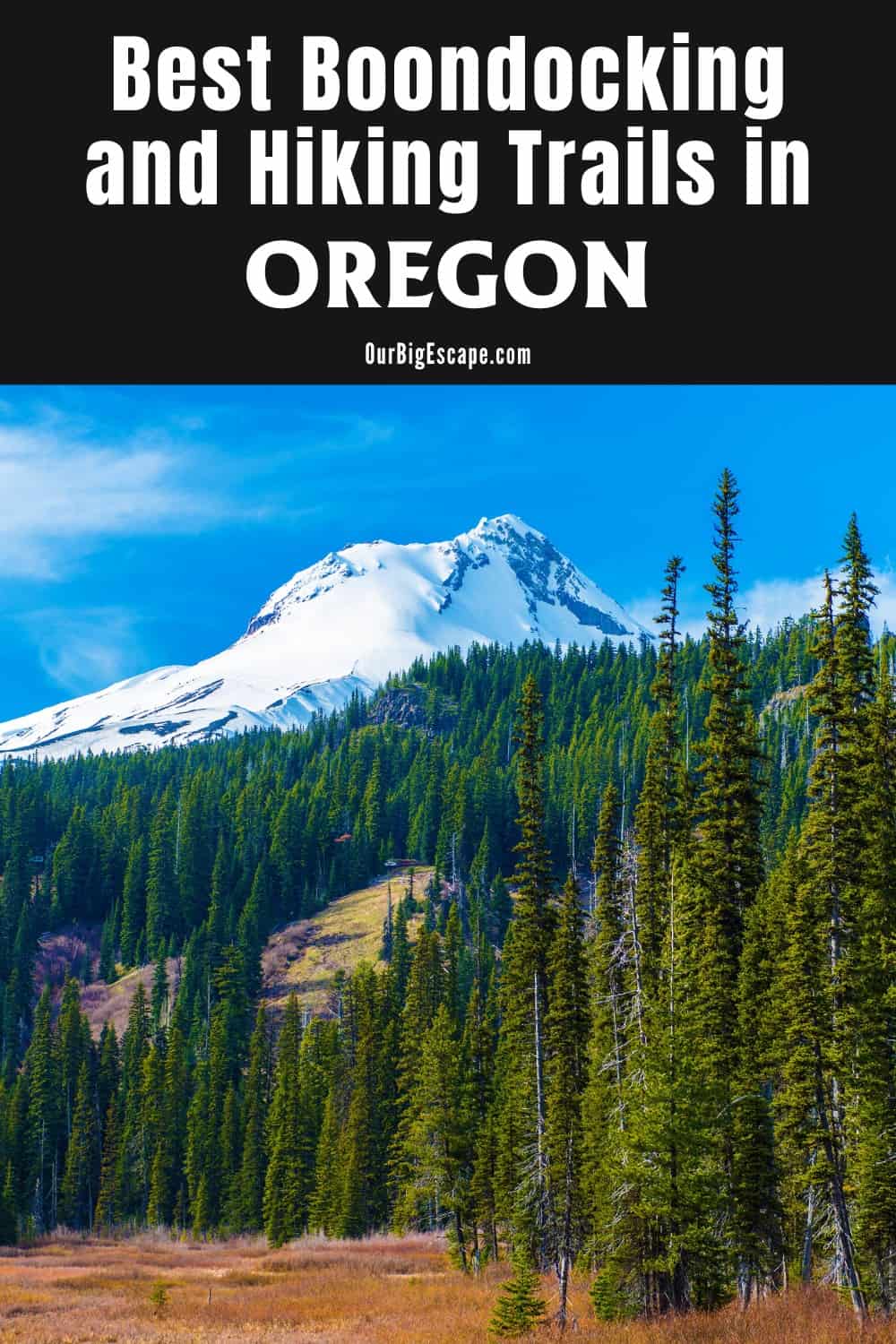
Boondocking Campsites in Oregon
Camping is one of the most popular and cost-effective ways to explore the Pacific Northwest, particularly Oregon. According to a recent research, more than 2.9 million people camped in Oregon in 2018, an all-time record.
It’s definitely possible to have an epic journey that doesn’t necessarily cost more than staying at home if you already have the equipment, tent camping gear or an RV, and some extra cash for gas and food.
If you’re looking for a location to go free camping in Oregon, go no further than the twenty-one campgrounds and camping areas listed below. Read up on best practices for free camping, such as how to leave no trace and, if you’re an RVer, how to go boondocking, before venturing out to these free locations in Oregon.
Want more ideas to round-out your trip to the North-Western States?
► Idaho, Montana, Oregon, Washington, Wyoming ◄
- 66 Free Central Idaho Boondocking – RV Parking & Camping Spots
- 78 Free Northern Idaho Boondocking – Camping & RV Parking
- 60 Free SE Idaho Boondocking – RV Parking & Camping Sites
- 40 Free SW Idaho Boondocking – RV Parking & Camping
- 198 Amazing Montana Boondocking Sites Including Maps
- 54 Free NE Oregon Boondocking Locations With Maps – North East Section
- 104 Free Boondocking Spots in NW Oregon With Maps – North West Section
- 308 Awesome Washington Boondocking Spaces With Maps
- 38 Free Boondocking Locations in Wyoming With Maps – North East Section
- 49 Free Wyoming Boondocking Campsites With Maps – North West Section
- 44 Free Boondocking Campsites In Wyoming With Maps – South East Section
- 66 Free Boondocking Spots in Wyoming With Maps – South West Section
86 Free Boondocking Campsites in SW Oregon With Maps
check out our video
1. Lost Forest RNA – Road 6121
Address
Unnamed Road
Oregon
GPS: 43.394329, -120.26056
Elevation: 4603′
Management: Public – Bureau of Land Management
Boondocking campsites in Oregon in the Bureau of Land Management: Lakeview District. No reservations. First come, first served.
2. Lost Forest RNA – Road 6141A
Address
Unnamed Road
Oregon
GPS: 43.393558, -120.305432
Elevation: 4547′
Management: Public – Bureau of Land Management
Free Dispersed camping in the Bureau of Land Management: Lakeview District. First come -> first served. Oregon free camping sites and No reservations accepted.
3. Christmas Valley Sand Dunes Lost Forest
Address
Christmas Valley, Oregon
GPS: 43.3818, -120.3179
Elevation: 4544′
Management: Public – Bureau of Land Management: (Official)
Boondocking campsites in Oregon in the Bureau of Land Management: Lakeview District. First come -> first served. No reservations accepted. You need to call first to the BLM district office and make sure the dirt road out there is well packed. It seems like if there had been a bunch of rain recently, there could’ve been a risk of us getting stuck.
4. Lost Forest RNA – Road 6141
Address
Unnamed Road
Christmas Valley, Oregon
GPS: 43.380775, -120.363888
Elevation: 4478′
Management: Public – Bureau of Land Management
Free Dispersed camping in the Bureau of Land Management: Lakeview District. First come -> first served. Oregon free camping sites and No reservations accepted.
5. Lost Forest RNA – Road 6151 East
Address
BLM Road 6151-0-00
Christmas Valley, Oregon
GPS: 43.363128, -120.281797
Elevation: 4613′
Management: Public – Bureau of Land Management
Boondocking campsites in Oregon in the Bureau of Land Management: Lakeview District. This campsite does not use a reservation system. First come, first served.
6. Lost Forest RNA – Road 6121
Address
BLM Road 6121-0-00
Christmas Valley, Oregon
GPS: 43.342472, -120.308794
Elevation: 4501′
Management: Public – Bureau of Land Management
Free Dispersed camping in the Bureau of Land Management: Lakeview District. Oregon free camping sites need No reservations. First come, first served.
7. Lost Forest RNA – Road 6151 West
Address
BLM Road 6151
Christmas Valley, Oregon
GPS: 43.35988, -120.370584
Elevation: 4321′
Management: Public – Bureau of Land Management
Boondocking campsites in Oregon in the Bureau of Land Management: Lakeview District. No reservations. First come, first served.
8. Lost Forest RNA – North Dunes 1
Address
Unnamed Road
Christmas Valley, Oregon
GPS: 43.345925, -120.367676
Elevation: 4314′
Management: Public – Bureau of Land Management
Free Dispersed camping in the Bureau of Land Management: Lakeview District. First come -> first camped. Oregon free camping sites and No reservations are accepted.
9. Lost Forest RNA – North Dunes 2
Address
Lost Forest Lane
Christmas Valley, Oregon
GPS: 43.354586, -120.384991
Elevation: 4314′
Management: Public – Bureau of Land Management
Boondocking campsites in Oregon in the Bureau of Land Management: Lakeview District. First come -> first camped. No reservations are accepted.
10. Christmas Valley Sand Dunes – Junipers
Address
Lost Forest Lane
Christmas Valley, Oregon
GPS: 43.352779, -120.451822
Elevation: 4304′
Management: Public – Bureau of Land Management
Free Dispersed camping in the Bureau of Land Management: Lakeview District. First come -> first served. Oregon free camping sites and No reservations accepted.
11. Christmas Valley Sand Dunes – Green Mt
Address
Unnamed Road
Silver Lake, Oregon
GPS: 43.385989, -120.722476
Elevation: 5118′
Management: Public – Bureau of Land Management
Boondocking campsites in Oregon in the Bureau of Land Management: Lakeview District. This campsite does not use a reservation system. First come, first served. To reach this camping area, 4 wheel drive and high clearance are suggested.
12. Juniper Knoll Road / Wagontire BLM
Address
Juniper Knoll Road
Wagontire, Oregon
GPS: 43.177548, -119.917188
Elevation: 4551′
Management: Public – Bureau of Land Management: (Unofficial)
The road in is Dirt and 0.5 miles from a paved road. There are 1-5 Oregon free camping sites at this location and the maximum RV length is 25 feet. You may stay 14 at Juniper Knoll Road / Wagontire BLM. This was nothing but a wide spot along a dirt road that was about 1/2 mile off of 395. It is near a dot on the map named Wagontire and about 60 miles southwest of Burns, Oregon. The road is suitable for a 2 wheel-drive van or truck camper under 25′ but not a trailer.
13. Old Lake Rd and Hwy 31
Address
Silver Lake, Oregon
GPS: 43.116021, -120.862139
Management: Public – Probably road maintenance (Unofficial)
The road in is Paved. Boondocking campsites in Oregon at Old Lake Rd and Hwy 31 is open year round. The maximum RV length at Old Lake Rd and Hwy 31 is unlimited. You may stay overnight at Old Lake Rd and Hwy 31. This is just a big pull out at the junction. Not for setting up camp but a good place to park for the night. It is gravel but fairly level.very quiet on a Friday night.
14. Mill Beach
Address
Brookings, Oregon
GPS: 42.049438, -124.292417
Elevation: 20′
Management: Public – State Park
The road in is Paved. Mill Beach is open all year. There are 6-15 Oregon free camping sites at this location. Per City of Brookings website: The Oregon coast is known as “the People’s Coast”. When bicycling into Brookings, you are invited to camp overnight on any of our public beaches. Mill beach is our favorites.
15. Summer Lake SWA – CG 1
Address
Unnamed Road
Summer Lake, Oregon
GPS: 42.950312, -120.763208
Elevation: 4157′
Management: Public – State Park
Summer Lake SWA – CG 1 is open all year. Boondocking campsites in Oregon need No reservations. First come, first served.
16. Summer Lake Campground
Address
Hwy 31
Summer Lake, Oregon
GPS: 42.928272, -120.767212
Elevation: 4153′
Management: Public – Fish and Wildlife Service (Official)
The road in is Gravel and 3 miles from a paved road. Summer Lake Campground is open Year Round. There are 6-15 Oregon free camping sites at this location and the maximum RV length is No Limit. Wide open spaces in this cg that’s inside the Summer Lake Wildlife Area. You bet there are lots of birds & the errant Pronghorn Antelope.
17. Summer Lake SWA – CG 3
Address
Unnamed Road
Summer Lake, Oregon
GPS: 42.946665, -120.742457
Elevation: 4160′
Management: Public – State Park
Summer Lake SWA – CG 3 is open all year. This is a free dispersed campsite. First come -> first served. Boondocking campsites in Oregon where No reservations accepted.
18. Summer Lake SWA – CG 4
Address
County Highway 4-17
Summer Lake, Oregon
GPS: 42.961359, -120.724834
Elevation: 4167′
Management: Public – State Park
Summer Lake SWA – CG 4 is open all year. This is a free dispersed campsite. First come -> first camped. Oregon free camping sites and No reservations are accepted. Perfect spot to stop with the kids for a two night on our way to Salem, OR from Winnemucca, NV.
19. Pike’s Crossing
Address
National Forest Development Road 3312
Paisley, Oregon
GPS: 42.69794, -120.933025
Elevation: 5666′
Management: Public – Forest Service
Pike’s Crossing is open May-Oct. Pikes Crossing Forest Camp is adjacent to Paradise Creek and the Sycan Wild and Scenic River. This rustic area offers boondocking campsites in Oregon in a quiet and secluded setting.
20. Dry Lake Bed
Address
Paisley, Oregon
GPS: 42.612467, -120.40472
Elevation: 4334′
Management: Public – Bureau of Land Management: (Unofficial)
Small hard lake bed dry. First come -> first camped. Oregon free camping sites and No reservations are accepted.
21. Gravel Pit
Address
Paisley, Oregon
GPS: 42.6045, -120.40642
Elevation: 4334′
Management: Public – Bureau of Land Management: (Unofficial)
First come -> first camped. Boondocking campsites in Oregon and No reservations are accepted.
22. Lake Albert Pull Out
Address
Highway 395
Lakeview, Oregon
GPS: 42.62479, -120.18416
Elevation: 4295′
Management: Public – Rest Area (Unofficial)
The road in is Paved. Lake Albert Pull Out is open weather pemitting. There are 1-5 Oregon free camping sites at this location and the maximum RV length is unlimited. You may stay 1 night at Lake Albert Pull Out. This is a just a little gravel pullout that allows you to be a good distance off of highway 395. We stayed here in the first week of October 2016. While the lake is beautiful and teaming with birds.
23. Sunstone Collection Area
Address
Unnamed Road
Plush, Oregon
GPS: 42.723821, -119.860465
Elevation: 4623′
Management: Public – Bureau of Land Management
Boondocking campsites in Oregon in Sunstone Collection Area is open year-round. The Oregon Sunstone Public Collection Area allows visitors to enjoy collecting these rare and beautiful gems in their natural setting. The boundaries of the collection area are marked by orange plastic posts and corners are marked with large Bureau of Land Management: triangles on wooden posts.
24. Two Rivers
Address
Crescent, Oregon
GPS: 43.36086, -121.82822
Elevation: 4734′
Management: Public – Forest Service (Official)
The road in is Dirt and 1 miles from a paved road. Two Rivers is open snowmelt to snowfall. There are 1-5 Oregon free camping sites at this location and the maximum RV length is 25 feet. You may stay 14 at Two Rivers. Bare dirt circle with big Ponderosa in the center next to the Little Deschutes River. From Hwy 58, take USFS Road 5825 west (or south). Cross the RR tracks at 1.5 miles, go left onto 2 Rivers Road (AKA 5830) where the road straight ahead is blocked just past the tracks.
25. Boundary Spring
Address
National Forest Development Road 400
Crescent, Oregon
GPS: 43.393528, -121.642899
Elevation: 4439′
Management: Public – Forest Service
A quiet campground dominated by beautiful lodgepole and ponderosa pine trees and predominantly used by the ATV and hunting communities. Boondocking campsites in Oregon are located on the southeast edge of the district, bordered by state land.
26. Millsite
Address
Rte 138 Lemolo Lake Sand Sheds
Oregon
GPS: 43.31625, -122.1927
Elevation: 4147′
Management: Public – Forest Service (Official)
There are 6-15 Oregon free camping sites at this location and the maximum RV length is 25 feet. You may stay 14days at Millsite. Lemolo Lake Sand Sheds. Site is adjacent to Sand Sheds. Has no signage. Enter the forest that is adjacent
27. Sand Shed
Address
Oregon
GPS: 43.25594, -122.17346
Elevation: 4547′
Management: Public – Forest Service (Official)
Boondocking campsites in Oregon discovered when the Forest Service staged us during a recent forest fire. Campsite has one composting toilet with some picnic tables. Drive towards rock shed and bear left. You will see several dirt roads leading into the trees.
28. Windingo Pass
Address
Windingo Pass Road (FSR060)
Oregon
GPS: 43.2537, -122.15997
Elevation: 4557′
Management: Public – Forest Service
The road in is Paved. There are 6-15 Oregon free camping sites at this location and the maximum RV length is 35 feet. About the hundred yards North of Highway 138 On Windingo pass road (aka Forest rd 60). Nice asphalt Pull-out That will accommodate six or eight RVs if everybody backs in.
29. Three Lakes Sno-Park
Address
National Forest Development Road 3703
Medford, Oregon
GPS: 43.107071, -122.185748
Elevation: 5404′
Management: Public – Forest Service
Three Lakes Sno-Park is open all year. Boondocking campsites in Oregon in the Umpqua National Forest’s Diamond Lake Ranger District. No reservations. First come, first served. Large parking lot with plenty of space and a vaulted bathroom. Nothing special but fantastic option for close proximity to Crater Lake, Mt. Thielsen, and surround area. Typically I prefer a spot with a view but this suited my spontaneous overnight stay perfectly. Bathroom was clutch.
30. Cinnamon Butte
Address
Crescent, Oregon
GPS: 43.23275, -122.11481
Elevation: 5571′
Management: Public – Forest Service
Great campsite up a dirt road. The road is accessible in a low slung 2 wheel drive car. The parking is deep enough for 2 normal cars or a short/mid length truck and trailer setup. There’s an established fire ring and room for 2+ 2-person tents. More if you walk back 20 feet or so into the woods. ground is relatively level and dry. A couple of less ideal sites are further up the turnout. Oregon free camping sites are close to Crater Lake National Park.
31. FR 960 Dispersed Camping
Address
Crescent, Oregon
GPS: 43.09919, -122.07643
Elevation: 5955′
Management: Public – Forest Service (Unofficial)
The road in is Dirt and .5 miles from a paved road. There are 1-5 Boondocking campsites in Oregon at this location and the maximum RV length is 45 feet. You may stay 14 days at FR 960 Dispersed Camping. This isn’t the prettiest campsite but it’s at a good location, just outside the north entrance to Crater Lake NP and about 12 miles from the lake itself. FR 960 is less than a mile long and dead ends at a volcanic outcropping. There are large spaces at the end with gravel and no shade.
32. Jackson Creek Forest Camp
Address
Chiloquin, Oregon
GPS: 42.984774, -121.453039
Elevation: 4770′
Management: Public – Forest Service (Official)
The road in is Gravel and 5 miles from a paved road. There are 6-15 Oregon free camping sites at this location. You may stay 14 days at Jackson Creek Forest Camp. This is a rustic campground with few amenities. This campground borders private land. Avoid trespassing by using an up-to-date map that shows land ownership.
33. Antler TH
Address
National Forest Develop Road 3038 Road
Silver Lake, Oregon
GPS: 42.986745, -121.186716
Elevation: 5794′
Management: Public – Forest Service
Antler TH is open May-Nov. Boondocking campsites in Oregon are located within the Fremont-Winema National Forests’s Silver Lake Ranger District. Bunyard Crossing Forest Camp offers rustic campsites.
34. Bunyard Crossing
Address
National Forest Development Road 2916
Silver Lake, Oregon
GPS: 43.04197, -121.08735
Elevation: 4551′
Management: Public – Forest Service
Oregon free camping sites at Bunyard Crossing is open May-Nov.
35. North Easy Bay FWNF Border Camp
Address
Silver Lake, Oregon
GPS: 43.04647, -121.06257
Elevation: 4770′
Management: Public – Forest Service
Boondocking campsites in Oregon where there is one metal fire ring and several rock fire pits scattered amongst the trees. A sign says closed to winter camping. The pea gravel looks like it would hold up in the rain.
36. Old Lake Rd and Hwy 31
Address
Silver Lake, Oregon
GPS: 43.116021, -120.862139
Management: Public – Probably road maintenance (Unofficial)
The road in is Paved. Old Lake Rd and Hwy 31 is open year round. The maximum RV length at Old Lake Rd and Hwy 31 is unlimited. You may stay overnight at Old Lake Rd and Hwy 31. This is just a big pull out at the junction. Oregon free camping area is not for setting up camp but a good place to park for the night. It is gravel but fairly level.very quiet on a Friday night.
37. Summer Lake SWA – CG 4
Address
County Highway 4-17
Summer Lake, Oregon
GPS: 42.961359, -120.724834
Elevation: 4167′
Management: Public – State Park
Summer Lake SWA – CG 4 is open all year. This is a free dispersed campsite. First come -> first camped. Boondocking campsites in Oregon and No reservations are accepted. Perfect spot to stop with the kids for a two night on our way to Salem, OR from Winnemucca, NV.
38. Summer Lake SWA – CG 1
Address
Unnamed Road
Summer Lake, Oregon
GPS: 42.950312, -120.763208
Elevation: 4157′
Management: Public – State Park
Summer Lake SWA – CG 1 is open all year. This is a free dispersed campsite. Oregon free camping sites need No reservations. First come, first served.
39. Summer Lake Campground
Address
Hwy 31
Summer Lake, Oregon
GPS: 42.928272, -120.767212
Elevation: 4153′
Management: Public – Fish and Wildlife Service (Official)
The road in is Gravel and 3 miles from a paved road. Summer Lake Campground is open Year Round. There are 6-15 Boondocking campsites in Oregon at this location and the maximum RV length is No Limit. Wide open spaces in this cg that’s inside the Summer Lake Wildlife Area. You bet there are lots of birds (& the errant Pronghorn Antelope. Bring your Deets – the mosquitoes like to think they own this place certain times of the year.
40. Summer Lake SWA – CG 3
Address
Unnamed Road
Summer Lake, Oregon
GPS: 42.946665, -120.742457
Elevation: 4160′
Management: Public – State Park
Summer Lake SWA – CG 3 is open all year. This is a free dispersed campsite. First come -> first served. Oregon free camping sites and No reservations accepted.
41. Paisley Airport
Address
Oregon 31
Paisley, Oregon
GPS: 42.711798, -120.560775
Elevation: 4390′
Management: Public – City Park
Boondocking campsites in Oregon located less than two miles north of the small city of Paisley on OR31 it is several hundred yards off highway on flat land and large lot for the largest rigs even towing. No hookups. Being on the flats in the high desert it is cool in the evenings and watch for strong winds out of the west for awnings.
42. First Camp
Address
1836 Winchuck River Road
Brookings, Oregon
GPS: 42.01524, -124.113062
Elevation: 148′
Management: Public – Forest Service
First Camp is open May-Sep. The maximum RV length at First Camp is 20 feet. Oregon free camping in the Rogue River-Siskiyou National Forests’s Gold Beach Ranger District. First come -> First Camped. Reservations not accepted. This location is at low elevation.
43. Annie Creek Sno-Park
Address
Annie Creek Road
Fort Klamath, Oregon
GPS: 42.761717, -122.059272
Elevation: 4370′
Management: Public – Forest Service
Annie Creek Sno-Park is open all year. Boondocking campsites in Oregon in the Fremont-Winema National Forests’s Klamath Ranger District. This campsite does not use a reservation system. First come, first served.
44. Sun Pass State Forest near Fort Klamath
Address
Chiloquin, Oregon
GPS: 42.711122, -121.977518
Elevation: 4226′
Management: Public – State Forest (Unofficial)
The road in is Dirt and can find a spot very close to road miles from a paved road. Sun Pass State Forest near Fort Klamath is open year round. There are 30 or more Oregon free camping sites at this location and the maximum RV length is 25 feet. You may stay not sure at Sun Pass State Forest near Fort Klamath.
45. Agency Lookout
Address
Chiloquin, Oregon
GPS: 42.635108, -121.929532
Elevation: 4783′
Management: Public – State Forest (Unofficial)
Boondocking campsites in Oregon on Agency Hill Lookout Rd perfect for car camping with a great view.
46. Spring Creek Recreation Area
Address
Chiloquin, Oregon
GPS: 42.670627, -121.887378
Elevation: 4236′
Management: Public – Forest Service (Unofficial)
Unmaintained former Forest Service campground. Some small branches growing into roadway. Oregon free camping sites have No services. Spots are large in some areas. Not recommended for RV over 28 ft.
47. Williamson River Boondocking
Address
Forest Road 9730
Chiloquin, Oregon
GPS: 42.660207, -121.85396
Elevation: 4216′
Management: Public – National Park Service (Official)
The road in is Gravel and 2.5 miles from a paved road. Williamson River Boondocking is open Year-round. There are 6-15 Boondocking campsites in Oregon at this location and the maximum RV length is 35 feet. You may stay 14 days at Williamson River Boondocking.
48. Wright Creek Trailhead
Address
North Umpqua Village, Oregon
GPS: 43.31937, -122.81045
Elevation: 1142′
Management: Public – Forest Service (Official)
Free Dispersed camping in the Umpqua National Forest’s North Umpqua Ranger District. First come -> first served. Oregon free camping sites with No reservations accepted.
49. Emile Shelter
Address
National Forest Development Road 750
Glide, Oregon
GPS: 43.26099, -122.792469
Elevation: 4078′
Management: Public – Forest Service
Free Dispersed camping in the Umpqua National Forest’s North Umpqua Ranger District. First come -> first served. Boondocking campsites in Oregon and No reservations accepted.
50. Willow Flat
Address
National Forest Development Road 2703
Glide, Oregon
GPS: 43.246796, -122.779057
Elevation: 4104′
Management: Public – Forest Service
Free Dispersed camping in the Umpqua National Forest’s North Umpqua Ranger District. Oregon free camping sites need No reservations. First come, first served.
51. Medicine Creek Rock Shelter
Address
Oregon
GPS: 43.2956, -122.47897
Elevation: 1893′
Management: Public – Forest Service (Official)
Boondocking campsites in Oregon located just one mile from the Medicine Creek Rock Shelter trail, which is known for its Native American petroglyphs, this campsite has a picnic table, an outhouse, and plenty of space to park multiple large vehicles.
52. Lemolo Two Forebay
Address
National Forest Development Road 999
Roseburg, Oregon
GPS: 43.293961, -122.402273
Elevation: 3212′
Management: Public – Forest Service
Lemolo Two Forebay is open May-Oct. Oregon free camping sites located within the Umpqua National Forest’s Diamond Lake Ranger District.
53. Claude Lewis SnoPark
Address
Oregon
GPS: 43.064, -122.3426
Elevation: 4091′
ManagementPublic – Forest Service (Official)
The road in is Paved. Claude Lewis SnoPark is open All Year. There are 16-29 Boondocking campsites in Oregon at this location and the maximum RV length is unlimited. You may stay 14 at Claude Lewis SnoPark. This is a Rogue River Forestry Trail Head SnoPark. Large paved circular pull off with a storm shelter building and 2 pit toilets in the middle of the loop.
54. Upper Rogue river – County Line Trailhead
Address
Prospect, Oregon
GPS: 42.996009, -122.37609
Elevation: 3655′
Management: Public – Forest Service
The road in is Dirt and 1 mile miles from a paved road. There are 1-5 Oregon free camping sites at this location and the maximum RV length is 35 feet. You may stay Any at Upper Rogue river – County Line Trailhead. From Prospect, OR, take Highway 62 (Crater Lake Highway) to Highway 230 for approximately 17 miles. Turn right onto Forest Road 6530 and follow for approximately 1 mile to a parking area on the right, Forest Road 6530-070.
55. Bybee Creek
Address
Prospect, Oregon
GPS: 42.93281, -122.42321
Elevation: 3563′
Management: Public – Forest Service (Official)
The road in is Gravel. Bybee Creek is open All year. There are 6-15 Boondocking campsites in Oregon at this location. Dispersed tent camping right on the Rouge river in southern OR. 20 miles from the entrance to Crater lake np. Pack in pack out This was one of my favorite spots to camp when I lived in oregon. It’s beautiful, let’s keep it that way.
56. Casey State Park
Address
Trail, Oregon
GPS: 42.659533, -122.699336
Elevation: 1535′
Management: Public – Rest Area (Official)
Oregon free camping sites at Rest area. Sign for no overnight camping but OK for resting travelers per Oregon rest area regulations. Spent one night here on way to Crater Lake.
57. Park Creek Recreation Site
Address
Unnamed Road
Myrtle Point, Oregon
GPS: 43.245634, -123.895196
Elevation: 509′
Management: Public – Bureau of Land Management
Park Creek Recreation Site is open Jun-Sep. Boondocking campsites in Oregon are located within the Bureau of Land Management: Umpqua District.
58. Burnt Mountain (Skeeter Camp)
Address
27-10-13.3
Myrtle Point, Oregon
GPS: 43.220603, -123.83305
Elevation: 2211′
Management: Public – Bureau of Land Management
Oregon free camping sites located within the Bureau of Land Management: Umpqua District.
59. Upper Rock Creek Road
Address
Upper Rock Creek Rd.
Myrtle Point, Oregon
GPS: 42.996757, -123.847339
Management: Public – Forest Service
The road in is Paved. There are 1-5 Boondocking campsites in Oregon at this location and the maximum RV length is 45 feet. You may stay 14 Days at Upper Rock Creek Road. Surprising beauty along the creek. Sites for smaller rigs along first 2 miles of single lane paved road. Do not stay in the large gravel area. It is private property.
60. Elk River National Forest Road
Address
Port Orford, Oregon
GPS: 42.735652, -124.401737
Management: Public – Forest Service (Official)
Oregon free camping sites starting 1 or 2 miles after the fish hatchery there are numerous pullouts allowing to drive down to the river back and camp, probably not with a huge RV but we did fine in our 24 foot sprinter van.
61. Skull Creek
Address
Cow Creek Road
Wolf Creek, Oregon
GPS: 42.771927, -123.570625
Elevation: 1198′
Management: Public – Bureau of Land Management
Boondocking campsites in Oregon are located within the Bureau of Land Management: Glendale District. I drove all the way out here on April 25th. 15 miles through devastation: heartbreaking views of slash & burn logging almost all the way, with an occasional logging truck on my tail. (I’d pull over so they could rush past.) Hoped for some quiet solitude
62. Pioneer Campground
Address
National Forest Development Road 240
Powers, Oregon
GPS: 42.80681, -123.926972
Elevation: 2290′
Management: Public – Forest Service
Oregon free camping sites located within the Rogue River-Siskiyou National Forests’s Powers Ranger District. Free camp ground 18 miles northwest of Cove Palisades
63. Buck Creek
Address
National Forest Development Road 3348
Powers, Oregon
GPS: 42.774772, -123.952331
Elevation: 2274′
Management: Public – Forest Service
Boondocking campsites in Oregon are located within the Rogue River-Siskiyou National Forests’s Powers Ranger District.
64. Tucker Flat
Address
Mule Creek Road
Agness, Oregon
GPS: 42.721799, -123.881769
Elevation: 479′
Management: Public – Bureau of Land Management
Oregon free camping sites at Tucker Flat is open May-Oct. Bulletin boards are provided on site. Provides access to: Upper Rogue River Trail #1160
65. Moss Meadow Horse Camp
Address
National Forest Development Road 3510
Paisley, Oregon
GPS: 42.478985, -120.484516
Elevation: 5961′
Management: Public – Forest Service
Boondocking campsites in Oregon located 40 minutes south of Paisley this rustic horse camp affords pretty views of Steens Mountain and Mount Shasta. There is one vaulted toilet and four campsites, each with a picnic table and fire grate, and one hitching post.
66. Deming TH
Address
National Forest Development Road 3411
Bly, Oregon
GPS: 42.457732, -120.936035
Elevation: 5292′
Management: Public – Forest Service
Free Dispersed camping in the Fremont-Winema National Forests’s Bly Ranger District. Oregon free camping sites and Reservations are not accepted.
67. Drews Creek
Address
Lakeview, Oregon
GPS: 42.118785, -120.580513
Management: Public – Forest Service (Official)
The road in is Paved. Drews Creek is open year round depending on snow. There are 1-5 Boondocking campsites in Oregon at this location and the maximum RV length is 25 feet. You may stay 14 at Drews Creek.
68. Quartz Mountain Sno-Park
Address
National Forest Development Road 3715
Lakeview, Oregon
GPS: 42.325666, -120.821114
Elevation: 5509′
Management: Public – Forest Service
Quartz Mountain Sno-Park is open all year. Free Dispersed camping in the Fremont-Winema National Forests’s Bly Ranger District. First come -> first camped. Oregon free camping sites and No reservations are accepted. Followed previous posters advice. Went 3.5+ miles down paved road, found a nice pull off with valley views. Car camped. Great spot to get rest. Verizon service worked.
69. Potholes
Address
National Forest Development Road 3840
Bonanza, Oregon
GPS: 42.281922, -121.117143
Elevation: 4961′
Management: Public – Bureau of Land Management
Free Dispersed camping in the Bureau of Land Management: Klamath Falls District. These Boondocking campsites in Oregon do not use a reservation system. First come, first served.
70. Willow Valley Reservoir
Address
52600 Willow Valley Road
Bonanza, Oregon
GPS: 42.008785, -121.116592
Elevation: 4531′
Management: Public – Bureau of Land Management
Oregon free camping sites in the Bureau of Land Management: Klamath Falls District. First come -> first camped. No reservations are accepted.
71. Hagelstein County Park
Address
17301 Highway 97 N.
Klamath Falls, Oregon
GPS: 42.382694, -121.812496
Elevation: 4147′
Management: Public – County Park (Official)
The road in is Paved. Hagelstein County Park is open April through September. There are 6-15 Boondocking campsites in Oregon at this location. You may stay 14 days at Hagelstein County Park. Nice park with Bathrooms and water across the street from upper Klamath Lake. Pond as well.for fishing and it is free for 14 days. It is right off hwy 97 so a little car noise during traffic times but really a nice spot. Plenty of room for for RV’s
72. Odessa Campground
Address
Klamath Falls, Oregon
GPS: 42.428882, -122.060062
Elevation: 4208′
Management: Public – USDA Forest Service (Official)
The road in is Paved. Odessa Campground is open May 15th. There are 6-15 Oregon free camping sites at this location and the maximum RV length is 25 feet. You may stay 14 days at Odessa Campground. Odessa Campground provides a primitive setting for picnicking, camping, fishing, non-motorized boating, wildlife viewing and hunting.
73. Fremont Winema NF Four Mile Quary
Address
NFR 3651 & 3689
Klamath Falls, Oregon
GPS: 42.431503, -122.160638
Elevation: 4209′
Management: Public – Forest Service (Official)
The road in is Gravel and less than one miles from a paved road. Fremont Winema NF Four Mile Quary is open Seasonal. There are 16-29 Boondocking campsites in Oregon at this location and the maximum RV length is 45 feet. You may stay 14 out of 30 at Fremont Winema NF Four Mile Quary. Fremont Winema NF Four Mile Quary Dispersed Camping
74. Winema National Forest Dispesrsed Camping
Address
NF Rd off Dead Indian Rd, Lake of the Woods, Oregon
Klamath Falls, Oregon
GPS: 42.392467, -122.186208
Elevation: 5017′
Management: Public – Forest Service (Official)
The road in is Gravel. Winema National Forest Dispesrsed Camping is open Closed in Winter. There are 30 or more Oregon free camping sites at this location and the maximum RV length is 45 feet. You may stay any at Winema National Forest Dispesrsed
75. Clover Creek TH
Address
National Forest Development Road 3850
Klamath Falls, Oregon
GPS: 42.300013, -122.137186
Elevation: 5751′
Management: Public – Forest Service
Free Dispersed camping in the Fremont-Winema National Forests’s Klamath Ranger District. First come -> First Camped. Boondocking campsites in Oregon and Reservations not accepted.
76. Applegate River
Address
Jacksonville, Oregon
GPS: 42.00805, -123.15536
Elevation: 2047′
Management: Public – Forest Service (Official)
The road in is Gravel and .5 miles from a paved road. There are 6-15 Oregon free camping sites at this location. Several campsites on both sides of the Applegate river near the bridge.
77. Mt Ashland Campground
Address
Ashland, Oregon
GPS: 42.075042, -122.714752
Management: Public – Forest Service (Official)
Mt Ashland campground is open June through October. There are 6-15 Boondocking campsites in Oregon at this location and the maximum RV length is 25 feet. You may stay 14 days at Mt Ashland campground.
78. Wagner Butte Trailhead
Address
Talent, Oregon
GPS: 42.114261, -122.800773
Elevation: 4957′
Management: Public – Forest Service (Official)
The large trailhead parking area for Wagner Butte has a few Oregon free camping sites tucked into the trees around the edge. There are no toilets, picnic tables, or fire rings.
79. Hyatt Lake Prairie
Address
Ashland, Oregon
GPS: 42.205026, -122.444628
Elevation: 5036′
Management: Public – Bureau of Land Management
We found this place by asking a few locals for the best dispersed campsite. This is one of the most beautiful Boondocking campsites in Oregon we have been to. Has a little spring right next to it and far enough away from the road .
80. Page Mountain Sno-Park
Address
National Forest Development Road 48
Cave Junction, Oregon
GPS: 42.006708, -123.548061
Elevation: 4534′
Management: Public – Forest Service
Page Mountain Sno-Park is open all year. Free Dispersed camping in the Rogue River-Siskiyou National Forests’s Wild Rivers Ranger District. These Oregon free camping sites do not use a reservation system. First come, first served.
81. Pullouts on 8 Dollar Road
Address
Selma, Oregon
GPS: 42.23225, -123.661157
Elevation: 1362′
Management: Public – Forest Service
8 Dollar Road is a gravel road that goes west off of highway 199. Boondocking campsites in Oregon a few miles north of the town of Cave Junction. After turning off of the 199 drive for about one mile on 8 Dollar Rd and you will pass onto Forest Service land. There are numerous pullouts along the road in a scenic and quiet valley
82. Josephine Campground
Address
Selma, Oregon
GPS: 42.241354, -123.686598
Elevation: 1268′
Management: Public – Forest Service (Official)
The road in is Paved. Josephine Campground is open Spring, Summer, Fall, closed winter. There are 1-5 Oregon free camping sites at this location and the maximum RV length is 35 feet. You may stay 14 days at Josephine Campground.
83. Grassy Flats
Address
Unnamed Road
Agness, Oregon
GPS: 42.553033, -123.918967
Elevation: 4462′
Management: Public – Forest Service
Grassy Flats is open May-Oct. Boondocking campsites in Oregon in large meadow. Heavily used during hunting season.
84. Wildhorse
Address
National Forest Development Road 3318
Gold Beach, Oregon
GPS: 42.460788, -124.162797
Elevation: 3527′
Management: Public – Forest Service
Oregon free camping at Wildhorse is open May-Nov. This site offers solitude with scenic views of the mountainous areas of the Rogue River – Siskiyou National Forest, glorious starry nights and high mountain breezes.
85. Pull off
Address
Harbor, Oregon
GPS: 42.249662, -124.391391
Elevation: 292′
Management: Public – Public road (Unofficial)
The road in is Paved. Pull off is open year round. There are 1-5 Boondocking campsites in Oregon at this location. You may stay overnight at Pull off. This is a random open area off the side of a road that runs parallel to the main highway. It is partially hidden. There are also many pull-offs on the side of this road that work as well. I found these while trying to get out of ranger jurisdiction.
86. Red Mt Prairie
Address
National Forest Development Road 260
Oregon
GPS: 42.182872, -124.018953
Elevation: 3258′
Management: Public – Forest Service
Oregon free camping at Red Mt Prairie is open May-Oct. This free campsite is located within the Rogue River-Siskiyou National Forests’s Gold Beach Ranger District.
Finding Free Camping in Oregon
The majority of free camping locations in Oregon are found on public properties, such as National Forests, Bureau of Land Management (BLM) lands, and wilderness areas. Savvy campers won’t have to travel far to discover free camping on Oregon public lands. The state’s public lands make up nearly 60% of the state.
The benefit of dispersed camping, aside from the fact that it is free, is that you will not need to make reservations. Almost all of these free Oregon campgrounds operate on a first-come, first-served basis. Furthermore, because camping on public lands is rarely crowded, Oregon free camping has the potential to provide beautiful isolation and welcome peace and quiet amid stunning natural surroundings.
Oregon Coast
Along this wind-swept shoreline, which is home to soaring sand dunes, scenic state parks, and lively harbors, thoughts melt away. This area is the epitome of coastal living. All 363 miles of Oregon’s coastline are free and open to the public, owing to a groundbreaking beach bill. That means you can search for agates or glass floats, catch your own Dungeness crab or razor clam, watch for whales, seals, and puffins, leave footprints in the sand, or simply be enchanted by a winter storm from the Boondocking campsites in Oregon.
SW Oregon
Gold rush cities and natural beauties retain their allure even centuries later. Discover an area where the past is celebrated with new treasures such as wine and culinary trails, and world-renowned theaters and galleries. Explore free Oregon camping locations near wild and Scenic Rivers, and vibrant vistas that appear to have been painted. Snowshoeing across America’s deepest lake, trout and steelhead fishing, mountain biking huge forest paths, and experiencing a surreal festival of lights are all possibilities in the fall and winter. There’s adventure around every corner in Southern Oregon.
Crater Lake
Crater Lake: The deepest lake in America, formed by the collapse of an ancient volcano, Mt. Mazama. Crater Lake awes everyone who visit its waters. The lake can be viewed in a variety of ways. You can set up in boondocking campsites in Oregon. Next while hiking in Oregon, you can trek up to the top of a fire lookout tower or down to the water below by biking or driving the 33-mile rim road.
In the summer in Oregon, you may take a boat tour of the lake, and in the winter, you can cross-country ski or snowshoe your way around the rim. A walk down to the water’s edge unveils unexpected delights. It’s no wonder that the water is so blue and so deep. It’s the deepest lake in America and one of the deepest on the planet.
Crater Lake is surrounded by rocks about 2,000 feet high and has a lovely island with a violent volcanic background. Hiking in Oregon in old-growth forest and cross-country skiing tours are available in the winter months. During the winter, many of the roads and services close, but the park remains open and accessible all year.
Tips on Free Camping in Oregon
Keep in mind that free camping is rustic and offers little to no amenities. Before continuing, if you’re inexperienced with boondocking (also known as free camping), make sure you have everything you’ll need to be safe while you’re out there.
Bring enough food and drink to last the duration of your trip. Make sure your RV home batteries are charged if you require power. Energy is provided by a generator and solar panels, allowing for longer stays. These free campsites’ accessibility and availability are subject to change at any time. Before you arrive, conduct your own thorough study.
Finally, always take any trash out with you when you leave. We must respect and maintain the land if we want to keep these areas attractive and available for us to camp in. We don’t want to be the ones who wreck it for the rest of the group.
You May Want to Join Our Boondocking Group on Facebook For More Information
You May Want to Join Our Campfire Recipes Group on Facebook For More Information
Check Out Our Pictures On Instagram – Our Big Escape.