
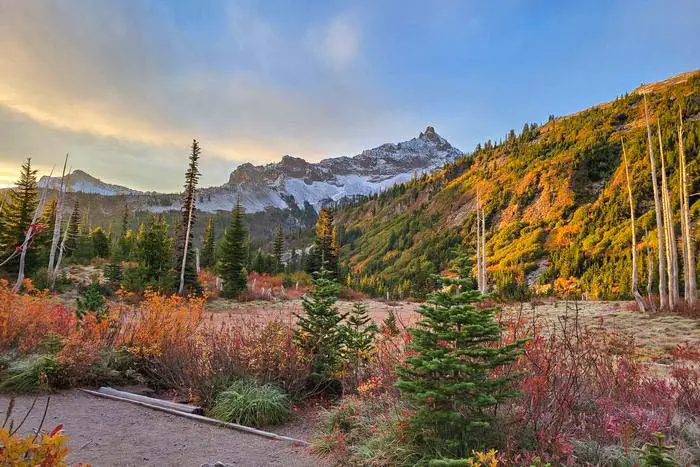
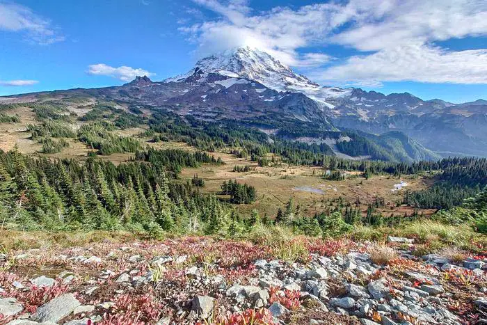
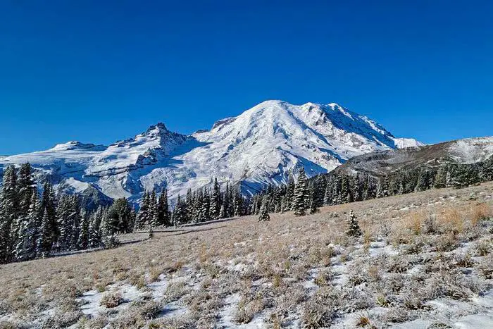
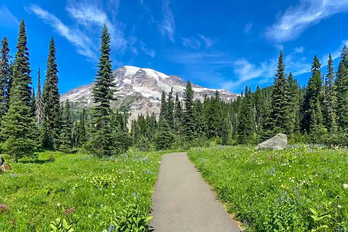
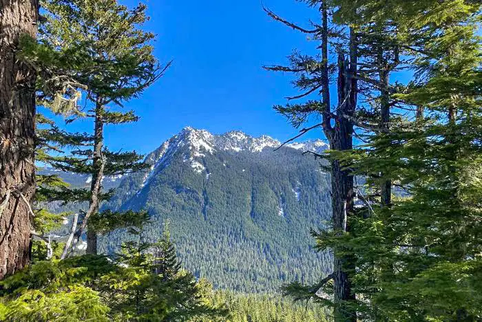
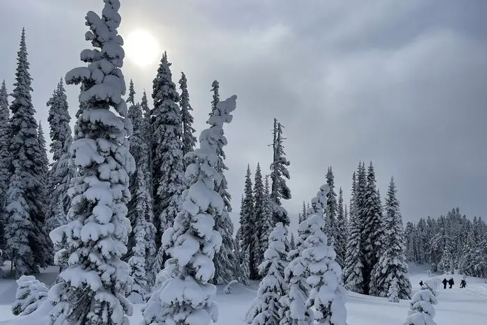
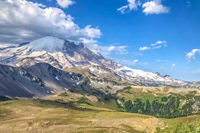
Today, we’d like to share some of our favorite Mt. Rainier hiking places with you. The park has over 150 designated paths, and we’ve trekked most of them. These are the top 25 hiking spots on Mt. Rainier that we enjoyed the best. Mount Rainier National Park is an iconic environment of breathtaking nature in Washington State, located in the northeast and southeast of Lewis County. Given its elevation of almost 14,000 feet, Mount Rainier looks to be the most prominent landmark. A visit to this site would be a once-in-a-lifetime event because to the snowfields and glaciers that carpet the wonder route.
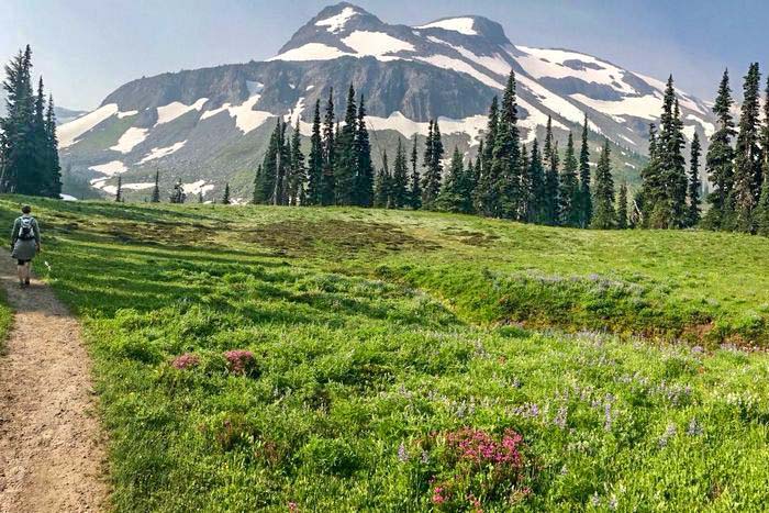
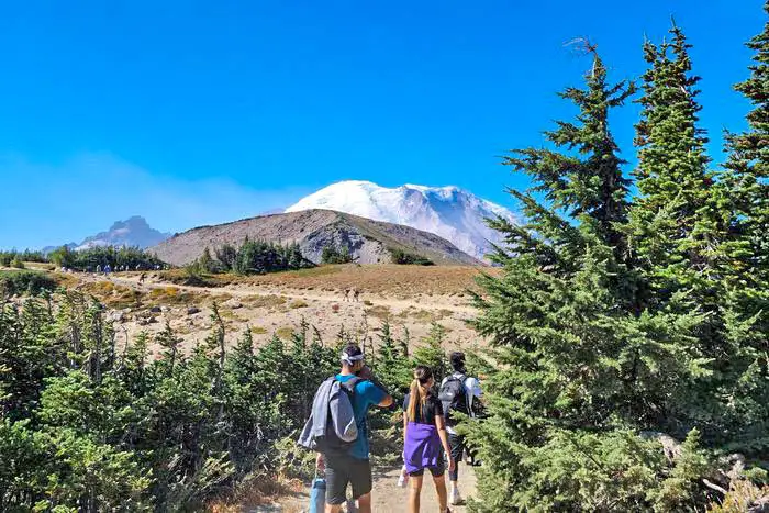
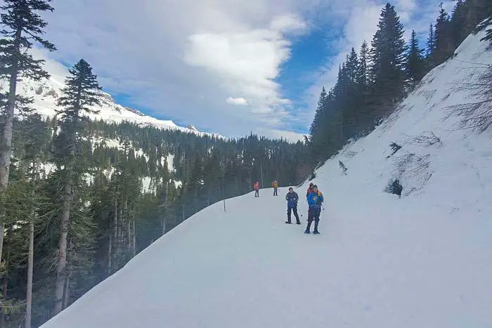
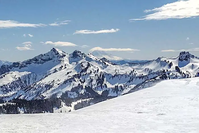
The 93-mile Wonderland Trail, which around Mount Rainier in Washington, is one of the park’s top Mt. Rainier hiking spots for a reason.
Hikers who have never completed the circuit around the Lower 48’s third-highest peak, however, may have reservations about the trip.
Keep reading to learn why you should climb the Wonderland Track in its entirety or in parts, as well as some fun facts about this famous and challenging track that we think is one of the top Mt. Rainier hiking spots in the park.
The Wonderland Trail is deserving of inclusion on any list of America’s best hiking trails, and I say this as someone who has hiked many of them (many of them multiple times) over the years.
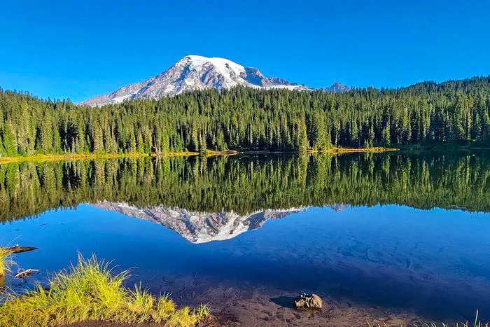
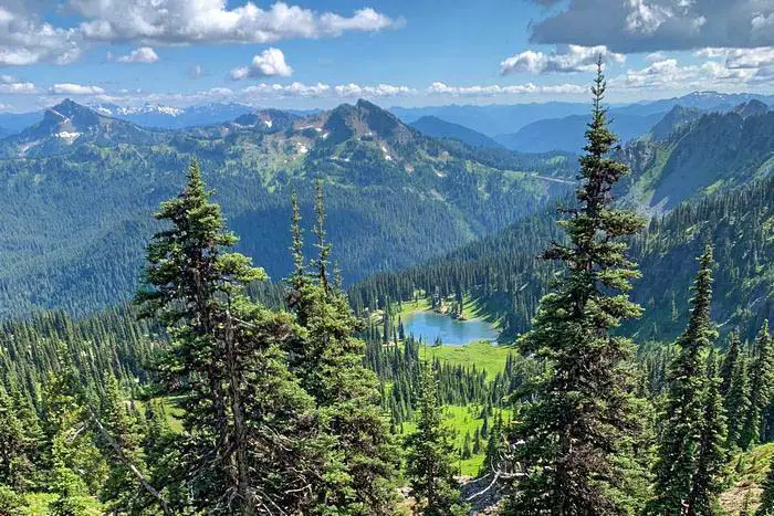
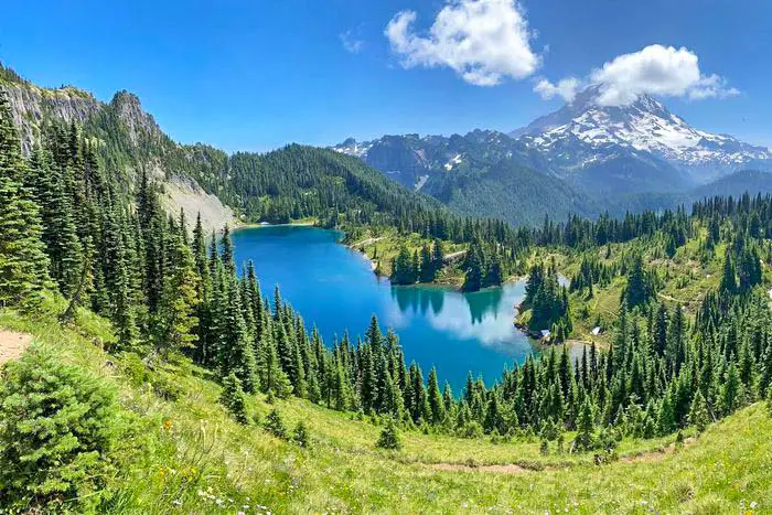
Perhaps it’s because the Wonderland has practically all of the features that make for a spectacular multi-day trip, most notably the countless vistas, from all angles, of Mount Rainier, the Lower 48’s most extensively glaciated peak, a sight that inspires beyond all expectations.
Try this trail and you’ll see why we think it’s one of the top Mt. Rainier hiking destinations in the national park.
Indeed, at the end of my most recent visit, which included a 77-mile hike along the majority of the Wonderland Trail, Laurel and I—both experienced backpackers who have traveled extensively—agreed that we had come to Mt. Rainier with high expectations for the Wonderland, and the hike had exceeded them. That is quite a compliment.
Want more ideas to round-out your trip to Washington?
A lot of great ideas are in these posts!
- 14 Boondocking Olympic National Park (Updated 2022)
- 28 Mount Rainier National Park Boondocking (Update 2022)
- 14 Hells Gate State Park Boondocking Locations
- 18 Awesome North Cascades National Park Boondocking Sites
- 308 Awesome Washington Boondocking Spaces With Maps

History of the Park
A series of debates over access, industrial usage, control, and preservation have influenced the park’s history throughout the years. It was the first national park established from the national forest, and by 1899, President William McKinley had signed the fifth national park act, allowing it to be established. It was after the bill had passed the House of Representatives.
As the migration into the Oregon Trail progressed, Americans’ interest in Mount Rainier grew rapidly in 1840. The Americans made progress by signing the Oregon Treaty in 1846, which gave them control of the territory. The mountain is regarded as a sacred site by the Native Americans. Many people were deterred from ascending the peak because of these people’s shady stories. People have come to assume that only those who have climbed the mountain are deserving of spiritual journeys as a result of these superstitious beliefs.
The park’s tourism began in 1883, when a climber named James Longmire discovered natural springs. In the year 1884. After completing the terminus line to Tacoma, the Northern Pacific railway company assisted Longmire in promoting tourism by establishing a large Tacoma hotel. In 1887, Longmire developed the springs and built bungalows for passing guests, and by 1890, he had constructed a tourist hotel.
Climbers, entrepreneurs, scientists, and visitors have joined together to launch a new national park campaign. The scientist’s mission was to protect the ecosystem. The remaining people saw continuous land usage as a major contributor to environmental degradation. They lobbied for the federal government’s action to safeguard areas like the Paradise Meadow through associations like the Appalachian Mountain Club.
25 Best Mt. Rainier Hiking Places
Below is detailed information on the physical appearance of our top trails of Mount Rainier National Park.
check out our video
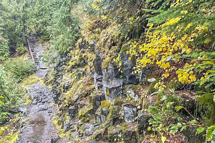
Glacier National Park Hiking Places #1. Silver Falls Trail
Mt. Rainier Camping and Backpacking, Mt. Rainier Camping and Hiking, Mt. Rainier Hiking, Kid friendly, Hiking, Running, Forest, Hot springs, River, Views, Waterfall, Wildflowers, Wildlife, Backcountry Camping
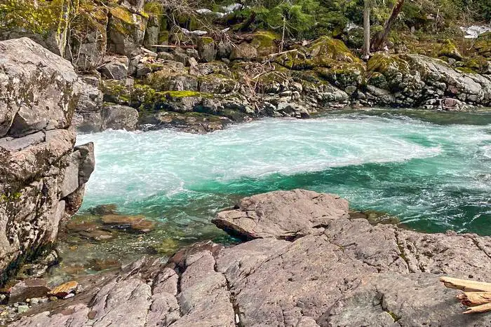
This trail begins at Ohanapecosh campground on a 3-mile trip around round. The track is relatively easy to hike since it is flat ground that leads to the silver falls. It is a trail primarily popular among people who bring their families to hiking. In short, it is suitable for everybody.
Visitors can take either of the two shorter trails. On the west side of route 123, one is approximately 2.0 miles from Ohanapecosh Visitor Center, while the other is 1.0 miles from Stevens Canyon Road. It starts from Stevens Canyon from the western side, moving through from the Grove of the Patriarchs.
Length: 4.0 mi
Elevation gain: 705 ft
Route type: Loop

Best Mt. Rainier Hiking Places #2. Grove Of the Patriarch’s Nature Trail
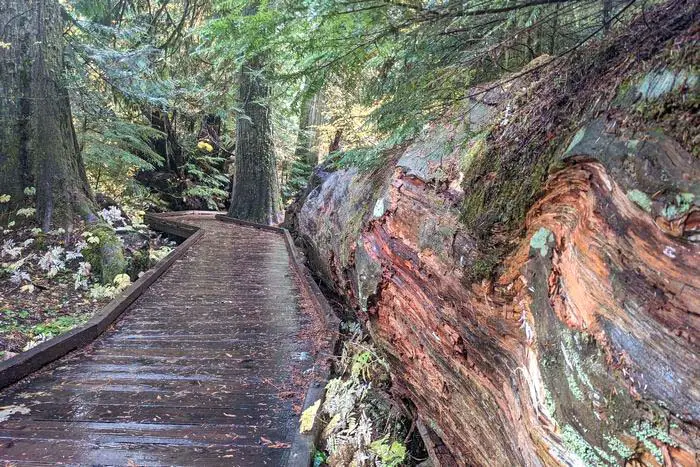
The trail is located on Stevens canyons Road just after the entrance of the Stevens canyon. The glowing nature of this part is a wonderland of bustling beauty. It is a 1.1-mile hike trip loop, completely safe as it is a nature trail that is self-guided.
Located less than a mile from the park entrance and directly opposite the visitor center, it’s a perfect area for a picnic or small gathering. The place is occupied based on a first-come, first-serve when open.
Length: 1.1 mi
Elevation gain: 52 ft
Route type: Out & back
Mt. Rainier Camping and Backpacking, Mt. Rainier Camping and Hiking, Mt. Rainier Hiking, Kid friendly, Hiking, Forest, River, Views, Wildflowers, Wildlife, Backcountry Camping
Glacier National Park Hiking Places #3. Bench and Snow Lakes Trail
The trail is located on the eastern side of the reflection lake parking lot 1.5miles from the south side of the road. The long ridges might make hiking in this area unpleasant since the movement across it is accompanied by short climbing and down-walking.
Many species of vibrantly looking flowers and other plants thrive in abundance during the mid-summer. Visible ahead is the silver forest where bears reside. There are possibilities of seeing a bear on a clear day.
Length: 2.2 mi
Elevation gain: 446 ft
Route type: Out & back
Kid friendly, Hiking, Walking, Running, Forest, Lake, Views, Waterfall, Wildflowers, Wildlife
Best Mt. Rainier Hiking Places #4. Spray Park Trail to Mount Pleasant
The trailhead is found at the far end on the Road of Mowich Lake, as I am moving towards the southeastern side of Mowich lake near the campground. Mount Pleasant is approximately 6.9 miles, with the backtrail located near the carbonado. This trail is most commonly used for hiking but predominantly for nature walks.
Length: 6.9 mi
Elevation gain: 2,198 ft
Route type: Out & back
Hiking, Snowshoeing, Running, Forest, Lake, Views, Waterfall, Wildflowers, Wildlife, Rocky
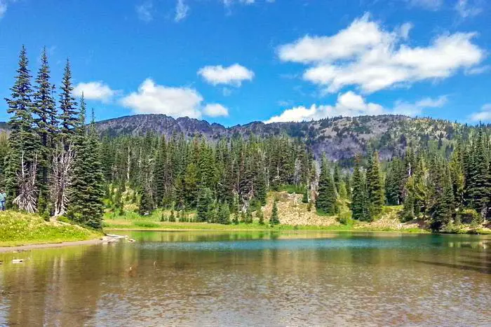
Glacier National Park Hiking Places #5. Frozen Lake via Sourdough Ridge Trail
The trail mostly being exposed gave me a better view of mountain goats at a distance as the setting sun had its rays reflecting majestically on the surface, making it look like a crescent-shaped moon at the banks. Disappointments were the bugs and the dusty terrain. The trail is usually trafficked more during the weekend than the weekdays.
Length: 2.9 mi
Elevation gain: 557 ft
Route type: Out & back
Kid friendly, Hiking, Running, Forest, Lake, Views, Wildflowers, Wildlife
Best Mt. Rainier Hiking Places #6. Pinnacle Peak Trail
At the center of Tatoosh Range, at the height of 1,423 feet high, sits the pinnacle peak trail. The trailhead of the route is located from the eastern side of Longmire and Paradise along the Stevens Canyon. I moved to the parking area to the Reflection Lakes on the southeastern side of the Road. Paradise and Mount Rainier are on the northern side, while Mount S.t Helens and Mount Adams are to the south.
Length: 2.8 mi
Elevation gain: 1,423 ft
Route type: Out & back
Hiking, Walking, Forest, Lake, Views, Wildflowers, Wildlife, Rocky
Glacier National Park Hiking Places #7. Wonderland Trail to Camp Summerland and Lake
This trail led me to a campsite offering group shelter. Summerland is a great place for relaxing and passing the time. Small water streams and meadows surround the trail. Black bears and Marmots are not a daily phenomenon, and I got lucky seeing a black bear.
Length: 10.1 mi
Elevation gain: 2,595 ft
Route type: Out & back
Mt. Rainier Camping and Backpacking, Mt. Rainier Camping and Hiking, Mt. Rainier Hiking, Backpacking, Hiking, Walking, Forest, Lake, Views, Wildflowers, Backcountry Camping
Best Mt. Rainier Hiking Places #8. Glacier Basin Trail – Mt. Rainier Hiking
The trail was once a copper ore mining area during the late 19th century. Before coming across the glacier ocean, I followed the white river it follows for 7.8 miles. I was moving through a series of ascending and steeply descending small terrain a mile across the trailhead. The Emmons Moraine trail was situated. You will certainly need a day hiking pack and light hiking boots.
Beautiful and well-kept route. There are a few steps near the end of the walk, but nothing too difficult. We took the side trail to see the lake early in the morning when we started the trail and late in the afternoon when we returned, so we could see it in two distinct lights. On the way back, someone in front of us came across a bear crossing the route to the other side. We didn’t do it. There aren’t any mountain goats either. It was a fantastic day to hike this trek, and the lake was stunning!
Length: 7.8 mi
Elevation gain: 2,194 ft
Route type: Out & back
Mt. Rainier Camping and Backpacking, Mt. Rainier Camping and Hiking, Mt. Rainier Hiking, Backpacking, Hiking, Forest, Lake, River, Views, Waterfall, Wildflowers, Wildlife, Rocky, Backcountry Camping
Glacier National Park Hiking Places #9. Nisqually Vista Trail
The stone steps led me to a paved way that is a 3-way joint located on the non-visitor center from the parking area. To the left is where I came across the terrain. As I moved along the stem of the landscape, I came across a variety of rich wildflowers. The terrain has a rocky mound located on its northern side.
Length: 1.1 mi
Elevation gain: 180 ft
Route type: Loop
Wheelchair friendly, Kid friendly, Stroller friendly, Hiking, Snowshoeing, Walking, Forest, Paved, Views, Wildflowers, Wildlife,
Best Mt. Rainier Hiking Places #10. Narada Falls Trail
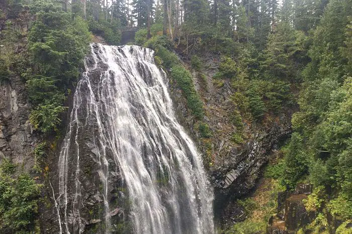
It is located 17 miles from the Nisqually entrance and a mile from Paradise on the northeastern side. The fall is the largest waterfall accessible by car in the entire park as it sits 150 feet from the Road. Access the bathrooms from across the steep trails; moving underneath the waterfall was so convenient. At the far end of the track, the entire 168-foot-tall waterfall was visible from here.
Length: 2.4 mi
Elevation gain: 862 ft
Route type: Out & back
Kid friendly, Hiking, Snowshoeing, Forest, Waterfall, Rocky,
Glacier National Park Hiking Places #11. Sunrise Rim Trail
A series of glaciers inhabit the Sunrise Rim area. The fun in hiking on this trail is the presence of a there-and-back trail, which means that hikers can choose their return point depending on the level of hiking complexity choice.
Length: 5.5 mi
Elevation gain: 1,115 ft
Route type: Loop
Mt. Rainier Camping and Backpacking, Mt. Rainier Camping and Hiking, Mt. Rainier Hiking, Kid friendly, Hiking, Walking, Running, Forest, Views, Wildflowers, Wildlife, Backcountry Camping
Best Mt. Rainier Hiking Places #12. Reflection Lake to Narada Falls
Across the Stevens Canyons Road – a distance of 3.6 miles-, I took the trail on the opposite side of the road. With the lake’s trail at the junction, I took a turn to the first bend of the corner. The largest of the reflection lake spanning 1.5 miles was in front of me. The trail goes on for three more turns before coming to Nerada falls.
Length: 3.6 mi
Elevation gain: 931 ft
Route type: Out & back
Kid friendly, Hiking, Forest, Lake, River, Views, Waterfall, Wildlife, Rocky
Glacier National Park Hiking Places #13. Rampart Ridge Loop Trail
The loop trail passes through the woods with vistas. The ridge is one of the remains of lava flow originally coming from Mount Rainier. I began moving west of the end of the trail to connect to the trailhead. Walking through the forest, I noticed the Nisqually river valley at a slightly high elevation.
Length: 4.8 mi
Elevation gain: 1,417 ft
Route type: Loop
Hiking, Snowshoeing, Forest, River, Views, Wildlife
Best Mt. Rainier Hiking Places #14. Green Lake Trail
With a partial but magnificent view of Tolmie Park towards the south, It was phenomenally a serene place for relaxing as the quiet environment was peaceful. The green lake route leaves the highway to ranger creek from the Carbon Road.
Length: 9.1 mi
Elevation gain: 1,469 ft
Route type: Out & back
Hiking, Beach, Forest, Lake, Views, Waterfall, Wildflowers, Wildlife
Glacier National Park Hiking Places #15. Skyline, Glacier Vista upper Skyline, and Golden Loop
The hike in this part of the park was quite steep. On a hot day, one is bound to be dehydrated since it gets scorching. On a rainy or cloudy day, the mist in the surrounding tends to move up to 100%. The area is located at a distance of 4.9 mi from beginning to end. With a partial but magnificent view of Tolmie Park towards the south, It was phenomenally a serene place for relaxing as the quiet environment was peaceful. The green lake route leaves the highway to ranger creek from the Carbon Road.
Length: 4.9 mi
Elevation gain: 1,643 ft
Route type: Loop
Hiking, Running, River, Views, Waterfall, Wildlife Paradise
Best Mt. Rainier Hiking Places #16. Crystal Lakes Trail to Sourdough Gap
Located near Greenwater, the trail spans 7.4 miles and has an elevation gain of 887m. The disadvantage of hiking on this trail was the bugs around the lake. The trail leads to a gorgeous meadow after moving out of the forest.
In conclusion, the fact remains that the visitor experience of this park is priceless. This Paradise on earth indicates phenomenal and harmonious co-existence between animals and plants of all kinds. Hotels and lodges present within and around the park are for ensuring a safe and comfortable stay. But still, nothing outmatches the beautiful physical appearance of Mount Rainier Park.
Length: 7.4 mi
Elevation gain: 2,910 ft
Route type: Out & back
Hiking, Forest, Lake, Views, Wildflowers, Wildlife
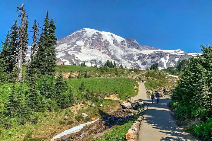
Glacier National Park Hiking Places #17. Skyline Trail Loop
Near the Jackson visitor center’s entrances at Paradise is the location of the trail loop marked by rocks and stone steps. The trail stretches approximately 2 miles before reaching Panorama point. Past this point, I was advised to use a high skyline trail to avoid non-melting dangerous icy slopes when my hiking direction was clockwise.
During my hike on the skyline in the anticlockwise direction, the entire time, Mount Rainier was In front of me. The climb up to the pebble creek trail is longer, but I enjoyed the view, especially during the evening on a sunset. Once I started walking back downhill to Paradise, I noticed Mount Rainier behind me.
Length: 6.2 mi
Elevation gain: 1,788 ft
Route type: Loop
Mt. Rainier Camping and Backpacking, Mt. Rainier Camping and Hiking, Mt. Rainier Hiking, Backpacking, Hiking, Forest, Partially paved, River, Views, Waterfall, Wildflowers, Wildlife, Rocky, Backcountry Camping
Best Mt. Rainier Hiking Places #18. Tolmie Peak Trail
This place is named after Dr. William Tolmie when he collected herbs for medicine on an assignment. On the northern side of Mowich lake is where the trail starts. It stretches up to 1.25 miles to a trail junction through the woods. The trail junction leads 1.0 miles uphill to mighty glittering Eunice Lake.
Since the Tolmie peak is closed early in the evening, I had to take pictures and enjoy sunrise sunset early in the morning and late in the evening. If I ever have to hike in this place again, my starting point will be the Mowich Campground located in the parking area.
Length: 5.6 mi
Elevation gain: 1,541 ft
Route type: Out & back
Hiking, Forest, Lake, Views, Wildflowers, Wildlife
Glacier National Park Hiking Places #19. Mount Fremont Lookout Trail
Located on an open knoll spanning 7,180 feet on the rocky mount Fremont, it appears to be the highest structure in the park’s history. Starting my hiking expedition as early as sunrise made the whole experience feasible.
The trailhead’s elevation begins at 6,400 feet, moderately climbing a shorter distance to the blanket ridge. I Followed the ridge trail to a 5-way intersection at a frozen lake. I then proceeded with the leading trail to Mount Fremont from this point to the western side of the rocky ridge (a distance of 1.3 miles).
Camping in this place is highly restricted unless you have a camping permit. Fires and pets aren’t allowed on the trails, plus it is advisable to treat drinking water. The spectacular view of Mount Rainier, the Olympic Mountain, and the grand park to the north was magnificently breathtaking.
Length: 5.7 mi
Elevation gain: 1,118 ft
Route type: Out & back
Hiking, Running, Lake, Views, Wildflowers, Wildlife, Rocky
Best Mt. Rainier Hiking Places #20. Naches Peak Loop Trail
Hiking in the clockwise direction, it’s easy to notice the Naches peak loop trails beginning at Tipsoo lake parking lot to chinook pass adjoining to the pacific crest trail before setting foot to the ancient historic footbridge that hangs near the pass SR 410.
At a junction, the pacific crest trail leads down to Dowey lake while the path leading to the loop heads back to Tipsoo Lake, going to Mount Rainier National Park. Continuing along the western side of the Horizon, the trail loop leads downwards to the west of Naches peak ridge.
Length: 3.3 mi
Elevation gain: 636 ft
Route type: Loop
Kid friendly, Hiking, Forest, Lake, Views, Wildflowers, Wildlife, Rocky
Glacier National Park Hiking Places #21. Comet and Cristine Falls
Just 4.5 miles west of Longmire and comet falls parking area by the road leading to Paradise, I came across comet Christine falls. Like most places, this part of the park also serves as a historic structure and district landmark. I used one of the pullouts located on both sides of the bridge to view the falls below.
I walked down to have a better view, following a short trail to the overlook underneath the stone bridge. The historic arch bridge is the frame upon which the Christine falls plunges its water to 60 feet fall. During the winter, the path can be dangerous and icy, though.
Length: 3.2 mi
Elevation gain: 1,279 ft
Route type: Out & back
Hiking, Walking, Forest, River, Views, Waterfall, Wildflowers, Wildlife, Rocky
Best Mt. Rainier Hiking Places #22. Burroughs Mountain Loop Trail
Burroughs mountain trail routes an elevated height of 7,402 feet. The mountain is highly maintained, with lesser hiking activities more than any mountain in the park. The 3.0-mile hiking distance up the Burroughs Mountain is accompanied by the spectacular view of the eastern side of Mount Rainier.
Hiking down is approximately 2,000 feet to the glacier basin. The trail continues a distance of 1.5 miles on a rugged path, moving up 400 feet to the subsequent overlook. On returning, I looped my trail by taking the sunrise rim trail, which had a beautiful view of Mount Rainier National Park. Surprisingly the sunrise rim hike is approximately the same distance through the sourdough ridge approach.
Length: 9.4 mi
Elevation gain: 2,562 ft
Route type: Loop
Mt. Rainier Camping and Backpacking, Mt. Rainier Camping and Hiking, Mt. Rainier Hiking, Backpacking, Hiking, Forest, Lake, Views, Wildflowers, Wildlife, Rocky, Backcountry Camping
Glacier National Park Hiking Places #23. Myrtle Falls Viewpoint via Skyline Trail
Myrtle Falls is located around the Paradise area. Signs leading to the Golden gate or skyline trail play the role of ensuring you are on the right trail track. This route which is 0.4 miles, leads to a shorter spur pathway to the spectacular view of the falls.
From the skyline trail, the elevated angle enhances the magnificent and breathtaking scenic view of the waterfalls from this point. New hikers not used to the high view might find it difficult, but it improves over time.
Length: 0.8 mi
Elevation gain: 150 ft
Route type: Out & back
Wheelchair friendly, Kid friendly, Stroller friendly, Hiking, Snowshoeing, Walking, Running, Forest, Paved, Views, Waterfall, Wildflowers, Wildlife
Glacier National Park Hiking Places #24. Camp Muir Route via Skyline Trail
At Paradise on the skyline, the trail is where the hiking starts. Moving along the skyline trail full of rocks, snow, and ice with plenty of wildflowers towards the pebble creek junction lies the starting point of the camp Muir route.
View of the Camp Muir route via the skyline trail shows how it is heavily trafficked. The course is used for camping and backpacking. Otherwise, a route featuring a waterfall near the paradise inn is usable for hikers with high-level hiking skills.
Length: 8.4 mi
Elevation gain: 4,606 ft
Route type: Out & back
Mt. Rainier Camping and Backpacking, Mt. Rainier Camping and Hiking, Mt. Rainier Hiking, Backpacking, Hiking, Snowshoeing, Forest, River, Views, Waterfall, Wildflowers, Wildlife, Rocky, Backcountry Camping
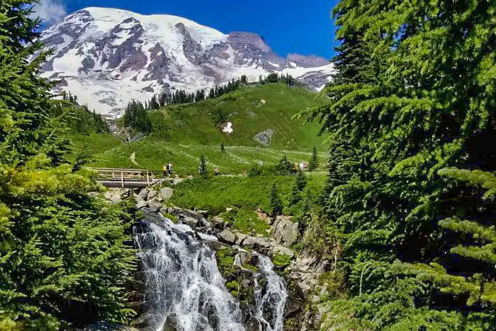
Best Mt. Rainier Hiking Places #25. Panorama Point from Paradise Inn
Panorama Point is a place highly inhabited by snow during the winter season. In other periods it is profoundly filled with gorgeous flowers, tree plants, and chipmunks. The hike to the panorama point begins near the Visitor Center from the stone’s steps, moving a bit uphill to a collection of successive junctions. The view of the point from Paradise inn is visible from all directions. The animals are wondering and moving about as the flowers appear to be the beautiful decoration of the place.
Length: 4.1 mi
Elevation gain: 1,263 ft
Route type: Out & back
Hiking, Skiing, Snowshoeing, Walking, Forest, Views, Waterfall, Wildflowers, Wildlife
You May Want to Join Our Boondocking Group on Facebook For More Information
You May Want to Join Our Campfire Recipes Group on Facebook For More Information
Check Out Our Pictures On Instagram – Our Big Escape.