Death Valley National Park is not a typical vacation but does offer 23 great boondocking spots nearby. Although it is beautiful, it is also a location filled with soaring temperatures that also drop to freezing. There are many different things to see and do but always be aware of your surroundings in Death Valley National Park.
Want more ideas to round-out your trip to California?
A lot of great ideas are in these posts!
- 18 Free Devils Postpile National Monument Boondocking Locations
- 15 Great Berryessa Snow Mountain National Monument Boondocking Locations
- 20 Free Sequoia National Park RV & Camping Locations
- 14 Castle Mountains National Monument Boondocking Locations
- 23 Best Boondocking Spots Near Death Valley National Park
- 27 Top Joshua Tree National Park Boondocking Spots
- 14 Free Sequoia National Monument Boondocking Locations
- 15 Great Lake Tahoe Boondocking Locations (Updated 2022)
The first group to discover Death Valley National Park were gold prospectors in 1849. They knew the Donner Party suffered a horrible fate and chose the Spanish Trail instead. In the beginning, their trip through Death Valley National Park was uneventful and began to get treacherous. It took them almost three months to reach their original destination.
The area was set aside by President Hoover in 1933 as a National Monument, Death Valley National Park wasn’t wholly recognized in its current state of 1.3 million protected acres until 1994’s Desert Protection Act was passed, and today these lands preserve some of the globes most fascinating flora and fauna.
Now on to some really interesting information about the 49ers and the gold rush times that made Death Valley famous.
check out our video
The Story of the 49ers
In 1848, gold was found at Sutter’s Mill in California and individuals from everywhere the United States stuffed their possessions in wagons and started to venture out by cart, wagon, horseback and even walking. to what they trusted would be new and better life. Since a large portion of these pioneers started their departure to California in 1849, they are for the most part alluded to as ’49ers.
One of the places to get prepared on provisions along the path was Salt Lake City, where pioneers ready for the long excursion across the Great Basin desert prior to moving over the Sierra Nevada to the gold fields of California to begin their trip. It was critical to leave Salt Lake City and cross the desert before snow started to fall on the Sierra Nevada, making them impassible.
Several years prior to, a gathering of pioneers called the Donner Party was caught by a white out storm that became one of the best human fiascos of that day and age. The narratives of the Donner Party were still new at the forefront of everybody’s thoughts when a gathering of carts started their excursion from Salt Lake City in October of 1849. This was excessively late to attempt to cross the Sierra Nevada securely, and it appeared as though these carts must stand by out the colder time of year in Salt Lake City. It was then that they caught wind of the Old Spanish Trail, a course that circumvented the south finish of the Sierra Nevada and was protected to go in the colder time of year.
The issues were that no pioneer cart trains had crossed it and they could just discover one individual around who knew the course and would consent to lead them. As they began their excursion from Salt Lake City, nobody realized that this cart train—the San Joaquin Company—would turn into an account of human experiencing basic to the historical backdrop of the spot they named Death Valley.
The 20 Mule Teams
For some individuals, nothing represents Death Valley more than the popular Twenty Mule Teams. These “enormous groups” pulled monstrous wagons containing borax from the Harmony Borax Works close to Furnace Creek to the railhead close to Mojave, a tiresome 165 mile, ten day trek across rutted roads. Albeit the groups just ran for six years- – 1883 to 1889- – they have established a suffering connection of the Old West.
This is fundamentally because of an effective publicizing effort advancing 20-Mule-Team Borax Soap and the long-running Death Valley Days radio and TV program. Today the twenty donkey groups are just an affectionate memory, however you might see two of the final carts here in Death Valley. One is before the Furnace Creek Ranch and the other is at Harmony Borax Works.
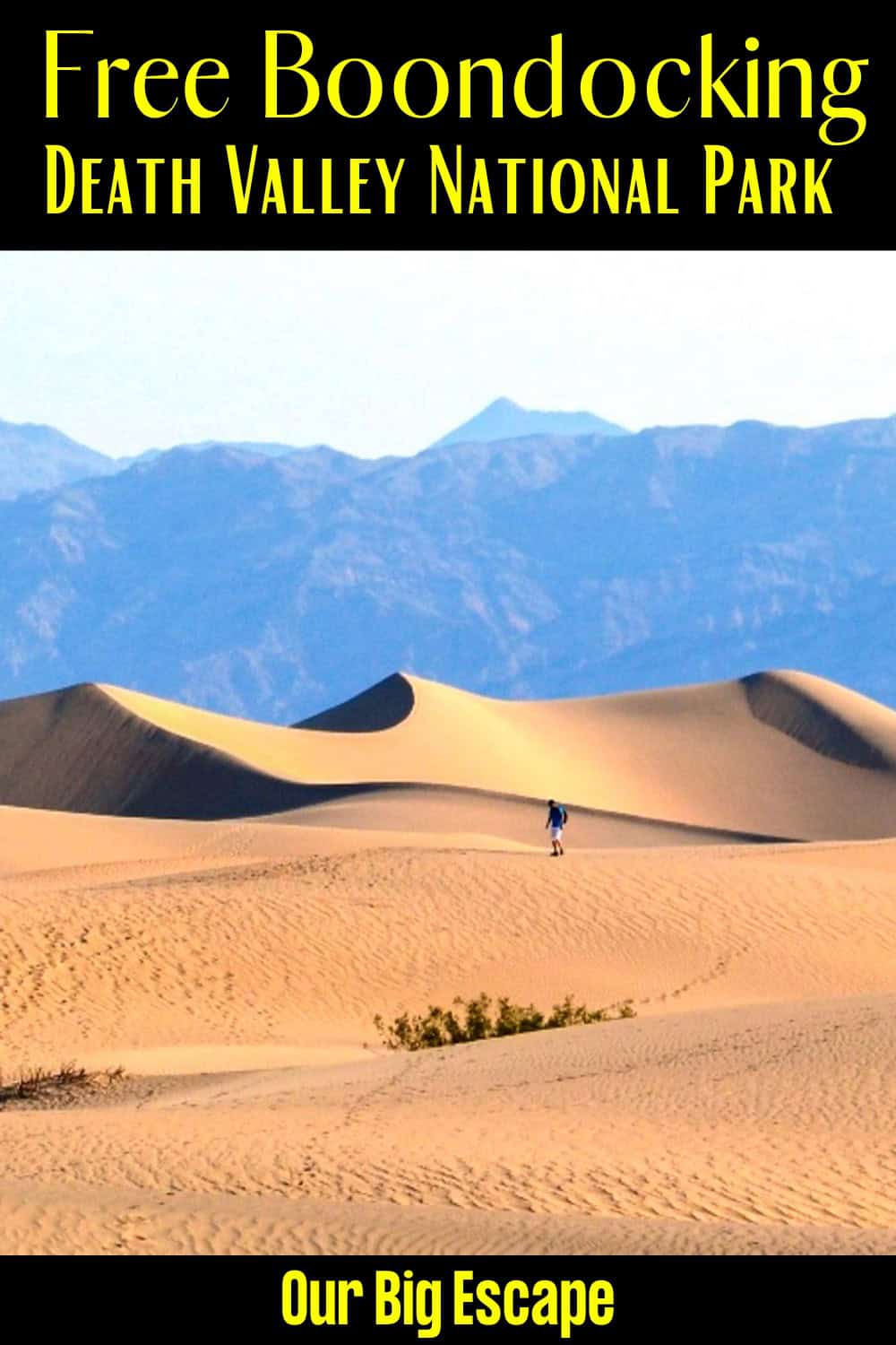
23 Best Boondocking Spots Near Death Valley National Park
1. Death Valley National Park Boondocking Spots – Death Valley NP – Emigrant
Address
California 190
Death Valley, California
GPS: 36.496587, -117.227489
Elevation: 2169′
Management: National Park Service
Death Valley NP – Emigrant is open all year.
Amenities:
Drinking Water
Restrooms
Best Review:
Stayed here for 5 nights in April. We ended up staying here longer than expected because we loved the spot so much. There are only about 10-12 campsites in total. There are washrooms nearby and a water station in the campground – the park ranger told us that the water is great to drink. The corner spot is the biggest and we would say the best because you get an unobstructed view and it is the furthest away from the entrance. Make sure to anchor your tent and sun shades down with rocks because the wind can pick up unexpectedly.

2. Death Valley National Park Boondocking Locations – Death Valley NP – Trail Canyon (backcountry)
Address
Furnace Creek, California
GPS: 36.3062, -116.93821
Elevation: 679′
Management: National Park Service
The road in is Dirt and It’s about 5 miles off the main road, then then 3 miles off the gravel road miles from a paved road.
Best Review:
This site is beautiful and remote with a 360 view. I will say that we visited in early April and it was very hot. If you are visiting Death Valley in the late spring I would recommend a site at a higher elevation with more wind rather than this site. It does not cool down much until the middle of the night. It was also quite buggy in the morning. Nevertheless I would absolutely return to this site in the winter. The road was bumpy, but no big holes or rocks. We watched a Nissan sedan drive up, so you can do it too! Just take it slow.
3. Death Valley National Park Boondocking Spots – Wildrose Campground
Address
California
GPS: 36.266131, -117.188508
Elevation: 4134′
Management: National Park Service
The road in is Paved. The maximum RV length at Wildrose Campground is 25 feet. There was campfire rings, picnic tables a few water spigot with well water and all toilet was well maintained in about 30 spots at least for any size camper or motorhome.
Amenities:
Restrooms
Trash Cans
Best Review:
This spot was great a little farther up the mountain a lot of trails 7 miles up the road there was Kim’s with a great view met some amazing people from New Zealand there was campfire rings, picnic tables a few water spigot with well water of all toilet was well maintained in about 30 spots at least for any size camper or motorhome and the 10th spots are up top would definitely stay here again was here on February 1st 2018 safe travels happy campers and can you find the painted Rock
4. Death Valley National Park Boondocking Locations – Death Valley NP – Wildrose
Address
24 Wood Canyon Road
California
GPS: 36.265895, -117.188276
Elevation: 4134′
Management: National Park Service
Death Valley NP – Wildrose is open all year. Great to have a free campsite within a national park! It was packed though and requires driving into the mountains. We arrived just after sunset and got what seemed to be the last spot.
Best Review:
We did not actually camp at Wildrose but was tempted. Instead I continued up the road past the Charcoal Kilns to Mahogany Flats Campground at 8100+ feet elevation, overlooking death valley and within sight of Telescope Peak. There should be a free campsites entry for Mahogany Flats campground and Thorndike campground which you pass to get to Mahogany Flats. I had a fantastic camping experience at Mahogany Flats, even though temperature got down to 24F on April 1, 2016. It was so cold, my water bag froze solid. The good part about that is that there were no bugs and no rowdy camper neighbors.
5. Death Valley National Park Boondocking Spots – Mahogany Flats Campground
Address
California
GPS: 36.229886, -117.067978
Elevation: 8133′
Management: National Park Service
The road in is 4×4. Mahogany Flats Campground is open Nov-Mar. There are 6-15 campsites at this location. You may stay 14 Days at Mahogany Flats Campground. Mahogany Flats Campground is about 30 miles from Hwy 190 on Emigrant Canyon road. Paved road turns to gravel after about 24 miles. The last 2 miles is a steep climb. Signs recommend 4×4 high clearance vehicles only, no trailers.
Amenities:
Fire Ring
Picnic Tables
Restrooms
Best Review:
You pass two other free campgrounds on your way up there. This is the only one that requires 4wd and somewhat high clearance. Kinda popular because of the beautiful views. A little windy since you’re camping on a ridge. Picnic tables at the sites and a pit toilet but no water. Hiking trails to the mountain peaks nearby. You can see the lights from Las Vegas but they don’t effect the night sky too much. You pass the historic charcoal kilns on the way up there. Very far from gas and groceries. Surreal deserted landscape on the way there. I would definitely tent here again.
6. Death Valley National Park Boondocking Locations – Bliss
Address
Ryan, California
GPS: 36.358184, -116.652909
Elevation: 2766′
Management: Bureau of Land Management
The road in is 4×4. Bliss is open year round. You may stay 14 days at Bliss. Just east of death Valley and before the “pad” The site is off the dirt road far enough that headlights don’t hate your campground. With stunning views of the surrounding mountains and a fire ring, there are hills to back your car up against to reduce the wind.
Best Review:
Secluded, beautiful views and not that difficult to get into. You will need something more capable than a crossover SUV but if that’s what you camp from this site is a real gem. Stayed one night on the way into death Valley. Got there at night and was pleasantly surprised at sunrise by the scenery. The trail in has sharp rocks so good off road tires are a must
7. Death Valley National Park Boondocking Spots – Homestake Dry Camp
Address
Lippincott Road
California
GPS: 36.637536, -117.57401
Elevation: 3773′
Management: National Park Service
The road in is 4×4 and 30 miles from a paved road. There are 1-5 campsites at this location. This is a very remote location with no amenities aside from a toilet which is typically onsite. This is the only approved camping location for the Racetrack Playa area.
Best Review:
None
8. Death Valley National Park Boondocking Locations – Death Valley – Campsites
Address
Death Valley, California
GPS: 36.25518, -116.65477
Elevation: 3333′
Management: National Park Service
Free dispersed camping.
Best Review:
None
9. Death Valley National Park Boondocking Spots – The Pads (I WOULD NOT GO HERE)
Address
Ryan, California
GPS: 36.339178, -116.600926
Elevation: 3037′
Management – Unknown
Known as “The Pads”, this location’s ownership is in question. It is said that the police patrol it and Boondockers are not hassled. It was possibly a company town belonging to the 20-mule team people, Rio Tinto Borax. For now, there are no facilities. It’s just a bunch of old slabs. While the sewer connections can be enticing, they are not functional.
Best Review:
Not exactly private, very primitive, but plenty of room to spread out and have a fire and look at the stars. Got lucky to catch the Gemenids meteor shower in mid December with a new moon. Won’t soon forget it! For a place that likely gets a lot of traffic, it was clean. Make sure you’re prepared with supplies and it will get cold at night in winter. Saw the sunrise at Dante’s Peak nearby. Highly recommend.
10. Death Valley National Park Boondocking Locations – Death Valley NP – Lee Flat
Address
White Mountain Talc Road
California
GPS: 36.487419, -117.641786
Elevation: 5364′
Management: National Park Service
Death Valley NP – Lee Flat is open all year. This is a free dispersed campsite. No reservations. First come, first served.
Best Review:
None
11. Death Valley National Park Boondocking Spots – Death Valley NP – Teakettle Jct.
Address
Racetrack Valley Road
California
GPS: 36.760224, -117.541884
Elevation: 4147′
Management: National Park Service
This is a free dispersed campsite. First come -> First Camped. Reservations not accepted.
Best Review:
None
12. Death Valley National Park Boondocking Locations – Ballarat Ghost Town
Address
Ballarat, California
GPS: 36.047621, -117.225842
Elevation: 1066′
Management: Private
Private land with a few residents that welcome travelers, artists, and partier alike (Official)
Best Review:
This is a privately owned ghost town with a rich history. It has a small general store and a couple of permanent residents that live out of RVs but the majority of the town is composed of falling apart buildings of decades and even centuries past. It is down a bumpy dirt road right out of Death Valley (technically but it still feels like Death Valley here) at the foot of a mountain range.
A sign the local residents put up specifies that it is a free camping area/artistic space and even encourages movie making. Highly recommend
13. Vanderbilt Road
Address
Nevada Highway 95 & Vanderbilt Road
Beatty, Nevada
GPS: 36.882299, -116.754551
Elevation: 3218′
Management: Bureau of Land Management
The road in is Dirt and 1 miles from a paved road. The pond @ Beatty, NV is open Year round.. There are 1-5 campsites at this location. You may stay 14 days at The pond @ Beatty, NV.
Best Review:
Overall, this probably isn’t a place you would want to camp for any length of time, but it makes a great place to spend the night as you are wandering thru NV (which is what I did. The local librarians told me about this spot).
14. Death Valley National Park Boondocking Locations – Bull Frog
Address
Unnamed Road
Beatty, Nevada
GPS: 36.906889, -116.792462
Elevation: 3622′
Management: Bureau of Land Management
Free Dispersed camping in the Bureau of Land Management N/A District. First come first camped. No reservations are accepted. Easy to find with many places to camp. Give yourself some time and drive/hike around to find a great view.
Best Review:
I myself had the place to myself since Friday afternoon 3-6- 18. Within 24 hours only one truck has driven in and up the hill and back out. The sites are however very littered with glass and cans and various objects that have been shot. The further back you get, the cleaner it is. I stayed fairly close to the road and attached is the photo of The View. I gave this only three stars because of the abundance of trash.
15. Death Valley National Park Boondocking Spots – Casino
Address
Amargosa Valley, Nevada
GPS: 36.41308, -116.42305
Elevation: 2165′
Management: Casino
Casino is open year round. You may stay overnight at Casino.
Best Review:
None
16. Death Valley National Park Boondocking Locations – Amargosa Valley Rest Area
Address
Amargosa Valley, Nevada
GPS: 36.643101, -116.399582
Elevation: 2661′
Management: Rest Area
Rest area at the intersection of US 95 and Highway 373. There’s room on the edges of the rest area for RV parking. The rest area itself is very well maintained.
Amenities:
Drinking Water
Picnic Tables
Restrooms
Best Review:
Nice free camp site. Rest rooms are clean. A bit on the tight side depending on number of people using it. In addition it is right next to a store that has trucks stopping at times so can get a bit noisy but mostly quit other than the highway noise. Directly across the road is a truck parking area but never really heard any trucks from there. Nevada does allow a stay up to 18 hours.
17. Death Valley National Park Boondocking Spots – Route 267
Address
123 Scotty’s Castle Road
Goldfield, Nevada
GPS: 37.07591, -117.267886
Elevation: 4140′
Management: Bureau of Land Management
Free Dispersed camping in the Bureau of Land Management N/A District. First come -> First Camped. Reservations not accepted.
Best Review:
None
18. Death Valley National Park Boondocking Locations – Bonnie Claire Lakebed
Address
Scotty’s Castle Road
Las Vegas, Nevada
GPS: 37.167306, -117.155102
Elevation: 4019′
Management: Bureau of Land Management
Free Dispersed camping in the Bureau of Land Management N/A District. First come -> First Camped. Reservations not accepted.
Best Review:
None
19. Death Valley National Park Boondocking Spots – South Ashford Junction Death Valley NP
Address
California
GPS: 35.89482, -116.6483
Elevation: 72′
Management: National Park Service
Free Dispersed camping in the National Park Service area. First come -> First Camped. Reservations not accepted.
Best Review:
Ideal for tent. This is allowed to camp after one mile south of the Ashford Junction. There is a sign at the beginning of the gravel road to explain this. The gravel road going to the south is straight. You need to park on the roadside there is no area to park beside the road with a car or a campervan. Nevertheless there are many flat land that enable us to put our tent beside the road. The area is 50 km south of Badwater Basin. It is inside the national park
20. Death Valley National Park Boondocking Locations – Scotty’s Junction Dispersed Camping
Address
Scotty’s Junction, Nevada
GPS: 37.206268, -117.123871
Elevation: 4256′
Management: Unknown
Dispersed camping available along 267 between Hwy 95 and Death Valley National Park. Large mostly level parking areas just off paved 267. Most are in the form of gravel “parking lots”. Typical high-desert camping with no shade and open, flat terrain. Lots of Apache Tears along both sides of 267.
Best Review:
Long road with pullouts on both sides. We kept going in for a good mile or two before seeing a long road on the right. Turning onto this road, there was an immediate additional turn off to the right again, which had nice flat space to camp under the stars
21. Death Valley National Park Boondocking Locations – Haystack Mountain
Address
Lone Pine, California
GPS: 36.598767, -117.994617
Elevation: 3675′
Management: Unknown
Free Dispersed camping. First come -> First Camped. Reservations not accepted.
Best Review:
From Lone Pine head north on Hwy 395 and turn right on Lone Pine Narrow Gauge Road. Drive 3.3 miles then turn right on Owenyo Lone Pine Road. Head southeast for 2.3 miles to the dry lake bed on the left, south of Haystack Mountain.
22. Death Valley National Park Boondocking Spots – Coming or Going to Death Valley
Address
Shoshone, California
GPS: 35.992234, -116.323591
Elevation: 2064′
Management: Bureau of Land Management
The road in is Gravel. There are 1-5 campsites at this location and the maximum RV length is unlimited. You may stay quick stop at Coming or going to Death Valley.
Best Review:
This is a gravel DOT lot just outside of the eastern boundary of Death Valley. Just west of Shoshone. There are two entrances/exits so pull through would work. Right side of road heading towards Shoshone and coming out of Death Valley. If you miss the first entrance.
23. Death Valley National Park Boondocking Locations – Coso Junction Ranch Store
Address
Unknown
Olancha, California
GPS: 36.050007, -117.946388
Elevation: 3381′
Management: Retail Store
Retail store near Death Valley NP.
Best Review:
I own a 29ft Class A rig and I have worked here for a long time. There are 3 acres of parking to the side of the building as well as hundred of acres of BLM land right next door. Overnight camping is welcome.
Top Trails to Hike at the Death Valley National Park
1. Golden Canyon
Golden Canyon is a 0.8 mile heavily trafficked out and back trail located near Death Valley, California that offers scenic views and is rated as moderate. The trail is primarily used for hiking and walking and is best used from October until March.
This is one of the most visited Death Valley National Park trails, a three-mile round trip hike. If you are a Star Wars fan, it’s a must-see because it was where several scenes were filmed.
Length: 0.8 mi
Elevation gain: 118 ft
Route type: Out & back
Wheelchair friendly, Stroller friendly, Hiking, Walking, Views, Fee, No dogs
2. Mesquite Flats Sand Dunes
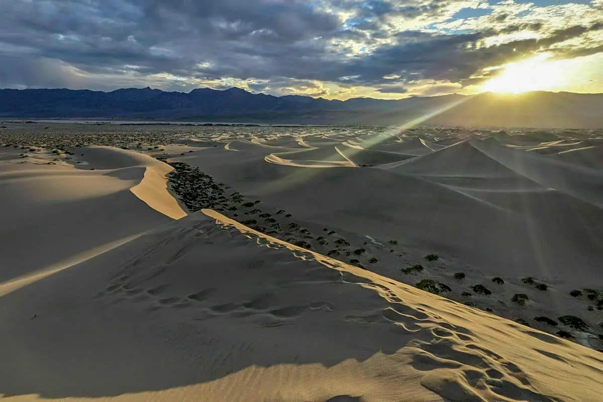
Mesquite Flat Sand Dunes Trail is a 2.8 mile heavily trafficked out and back trail located near Death Valley, California that features beautiful wild flowers and is good for all skill levels. The trail is primarily used for hikng and walking and is best used from November until March.
Death Valley National Park has many different trails, however, this is one of the best-known hikes. It is two miles round trip and will take approximately an hour and a half. Sunrise or sunset is the best time to visit because you will see the location in its entire splendor.
Lovely stand-out trail. It has worked out going either at the beginning of the day or later nearer to evening, to work around that temperature. Climbing in a cooler time permits you to try your toes in the sand. On our final visit a few campers told us that the dunes are supposed to take on a golden glow. We wre able to catch a couple falling stars. One climb I’ll never mind doing again and again.
Length: 2.8 mi
Elevation gain: 206 ft
Route type: Out & back
Kid friendly, Hiking, Walking, Views, Wildflowers, Wildlife, Fee, No dogs
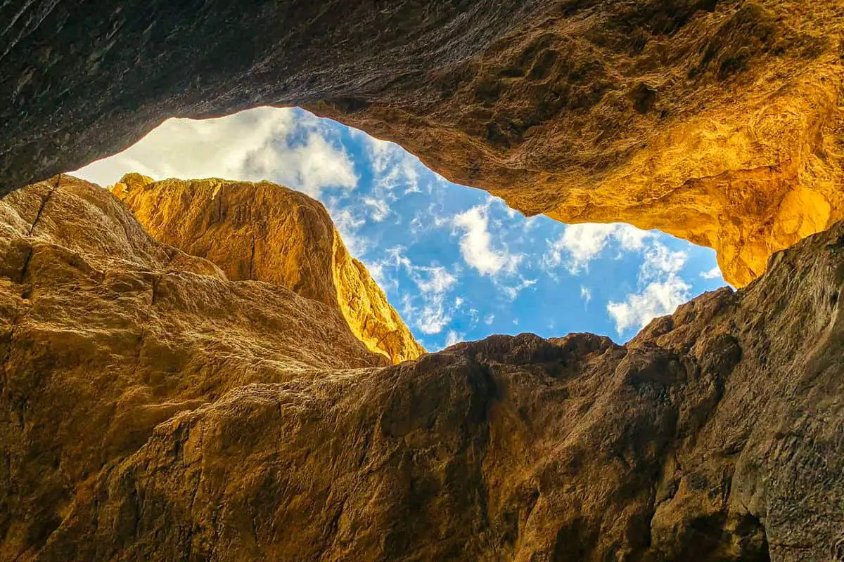
3. Darwin Falls Via Old Toll Road
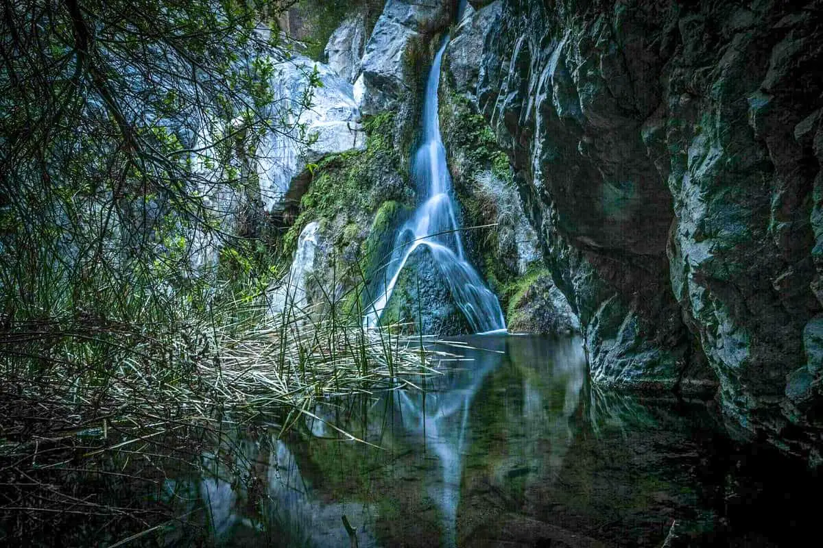
Darwin Falls Trail via Old Toll Road is a 1.9 mile heavily trafficked out and back trail located near Darwin, California that features a waterfall and is good for all skill levels. The trail is primarily used for hiking.
This is a fantastic hike because it is one to a waterfall in the middle of a desert. Another great thing about this hike is that it is one of the few trails that has shade. Once you walk through the canyon, you will find a true oasis in the middle of a desert.
Access is off 190 on the left after Panamint Springs where the trail is beginning to start up. The path into the falls is along the bed of a wash which becomes narrow as you stroll in. As the sides of the gorge close in the vegetation becomes denser and the last little trek to find the falls requires some looking through willows and reeds and scrambling over rocks.
While some might be disappointed by the amount of water to me the astonishing thing about them isn’t the volume of stream or the length of the drop, however the way that they exist at all in such a climate and flow all year! I was extremely shocked at how much water was actually in the falls during summer.
Certainly worth a visit to a disengaged desert garden.
Length: 1.9 mi
Elevation gain: 232 ft
Route type: Out & back
Kid friendly, Hiking, River, Views, Waterfall, Wildflowers, Wildlife, Rocky, Scramble, Fee, No dogs,
4. Mosaic Canyon Trail
Mosaic Canyon Trail is a 3.6 mile heavily trafficked out and back trail located near Death Valley, California that offers the chance to see wildlife and is rated as moderate. The trail is primarily used for hiking and walking and is best used from October until April.
This trail is a three-and-a-half-mile-long hike where you will see a lot of the wildlife who call Death Valley home. The best months to try this trail is moderate trail and is best in October through April.
Gorgeous hike. We only made it about a mile in since it was the end of a long and incredibly hot day and I didn’t want to leave the shady portion of the hike. Other people that the trail only gets better, I’m a little sad I didn’t see the whole thing. Will definitely be my first stop if I make it back to Death Valley.
Length: 3.6 mi
Elevation gain: 1,076 ft
Route type: Out & back
Wheelchair friendly, Kid friendly, Hiking, Walking, Views, Wildlife, Rocky, Fee, No dogs
5. Telescope Peak Trail
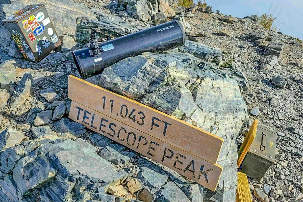
Telescope Peak Trail is a 12.7 mile moderately trafficked out and back trail located near Death Valley, California that features a great forest setting and is rated as difficult. The trail is primarily used for hiking and is best used from June until October.
At twelve and a half miles long, it’s best attempted by experienced hikers. It stands out because instead of having a typical desert feel, it’s a trek through mountains.
Hiked from Mahogany Flat Campsite. The road to the trailhead is pretty steep but it is part of the service road to Rogers Peak so it is in good condition. The first 2 miles are definitely a grind, but there is some shade in the trees and the views are spectacular.
Length: 12.7 mi
Elevation gain: 3,323 ft
Route type: Out & back
Hiking, Forest, Views, Rocky, Scramble, No shade, Fee, No dogs
6. Badwater Basin Salt Flats Trail
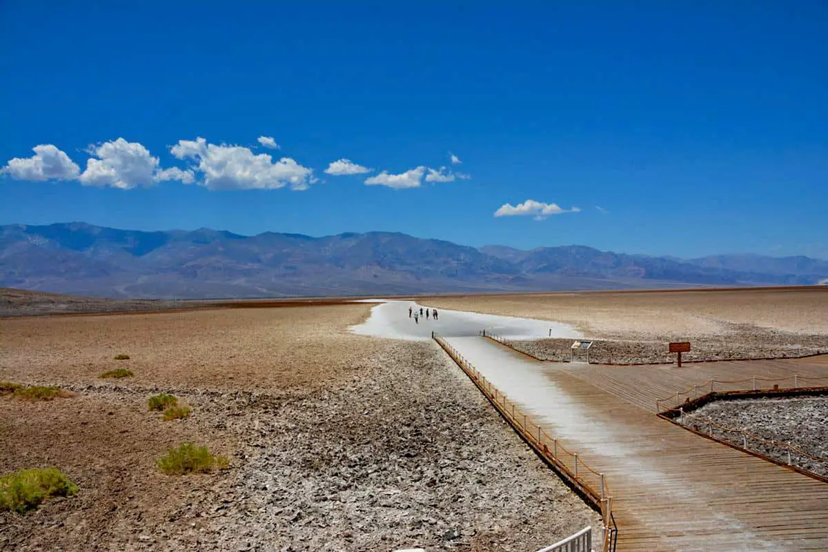
Badwater Basin Salt Flats Trail is a 1.9 mile heavily trafficked out and back trail located near Death Valley, California that offers scenic views and is good for all skill levels. The trail is primarily used for hiking and is best used from October until March.
This is obviously a must do at Death Valley. Super cool and well worth the time no matter how hot. I walked out about half a mile on a day when temps hit 123 at Furnace Creek about 20 minutes later. It was hot which I thought added to the fun. Stay hydrated and wear a big hat and slather on the sun screen.
Length: 1.9 mi
Elevation gain: 6 ft
Route type: Out & back
Wheelchair friendly, Kid friendly, Stroller friendly, Hiking, Views, Fee, No dogs
7. Wildrose Peak Trail
Wildrose Peak Trail is a 7.8 mile moderately trafficked out and back trail located near Death Valley, California that offers scenic views and is rated as moderate. The trail is primarily used for hiking and is accessible year-round.
We happened to be the only people on this trail today. It has no shade and pretty hot the first mile or so and then you have a lot more shade options and the air get cooler as you go up. I would bring at least 2 liters of fluid and some snacks. I would bring hiking poles. The hard part is going up, not coming down. The free air conditioning from the altitude at the top was great. The views were awesome but Dante’s point does have a better view of Death Valley.
Length: 7.8 mi
Elevation gain: 2,486 ft
Route type: Out & back
Hiking, Views, Rocky, Historic site, Fee, No dogs
8. Ubehebe and Little Hebe Crater Trail
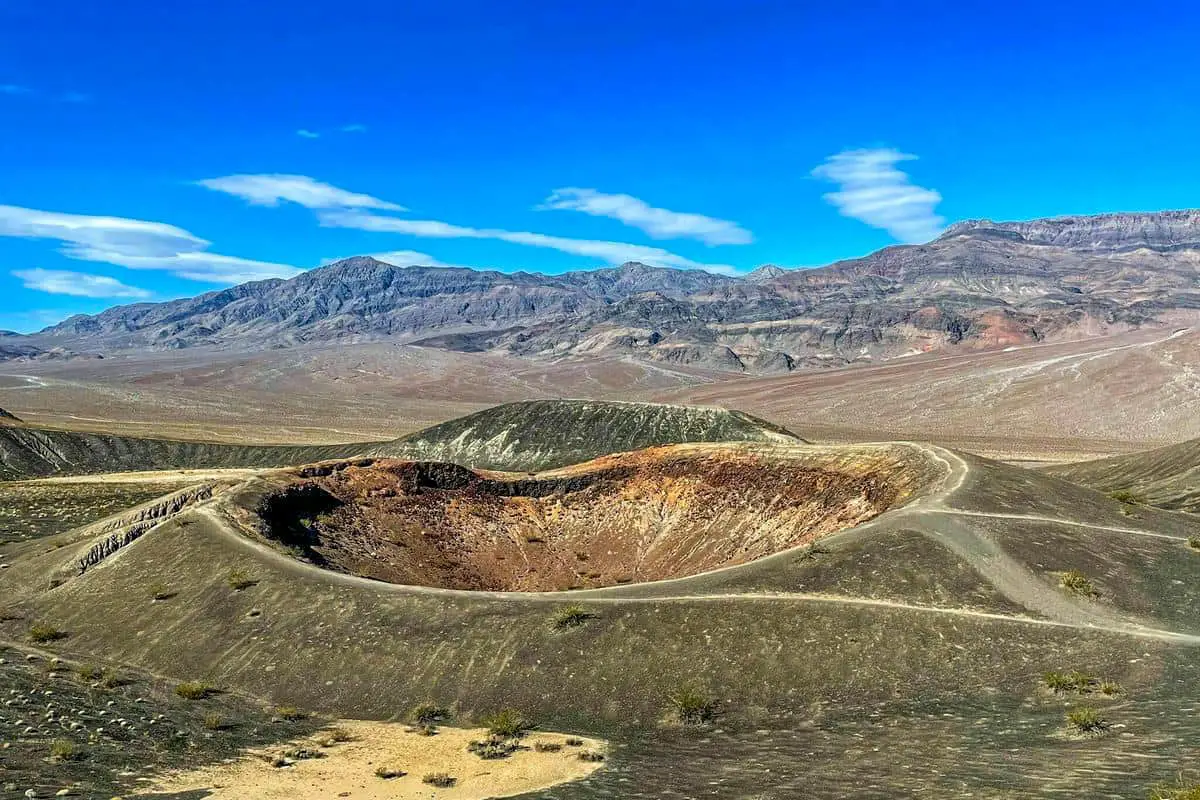
Ubehebe and Little Hebe Crater Trail is a 1.8 mile heavily trafficked loop trail located near Death Valley, California that offers scenic views and is rated as moderate. The trail is primarily used for hiking and walking and is best used from October until April.
Pretty from the rim. Be VERY cautious if you go to the bottom of the crater. It can be very hard to get back up the trail. They all have small rocks that slide under your feet and it gets pretty steep.
Length: 1.8 mi
Elevation gain: 364 ft
Route type: Loop
Kid friendly, Hiking, Walking, Views, Fee, No dogs
9. Devil’s Golf Course
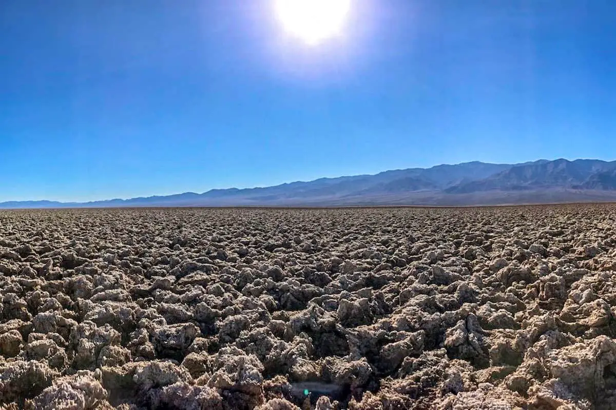
Devil’s Golf Course is a 2.6 mile moderately trafficked out and back trail located near Death Valley, California that features beautiful wild flowers and is good for all skill levels. The trail is primarily used for walking and scenic driving and is best used from November until April.
Like a lot of the roadside stuff in Death Valley, this isn’t really a hike. Drive to the end of the road and then walk around wherever you want. No reason to spend a whole lot of time here. All that said, this place is bonkers cool – never seen anything else remotely like it anywhere. And for that reason, five stars is an easy calla.
Length: 2.6 mi
Elevation gain: 72 ft
Route type: Out & back
Scenic driving, Walking, Views, Wildflowers, Rocky, No shade, Fee, No dogs
10. Grotto Canyon
Grotto Canyon is a 2.1 mile lightly trafficked out and back trail located near Death Valley, California that offers the chance to see wildlife and is rated as moderate. The trail is primarily used for hiking and rock climbing and is best used from October until April.
This is not a great slot canyon hike. However it is a fabulous scrambling hike. We needed two straps and used our packs to extend. Two people working together was necessary on the slippery worn marble. It was awesome, but only if you go in with a fun technical scramble in mind.
Length: 2.1 mi
Elevation gain: 672 ft
Route type: Out & back
Hiking, Rock climbing, Wildlife, Rocky, Scramble, Fee, No dogs
Paid Accommodations and Dining Near the Death Valley National Park
Corkscrew Saloon-This pizza parlor is located in Furnace Creek in Death Valley National Park.
Last Works Saloon- This Death Valley National Park restaurant is a favored place for people visiting Death Valley since it feels like you are dining on the set of a classic old Hollywood western.
What to Pack For Your Visit To the Death Valley National Park
One of the essential things to pack when visiting Death Valley National Park is water, even more than you think you need. Here are a few others you may want to take as well. Once again plenty of water and as light as possible.
Water—at least one gallon per person per day
Food—more than you think you’ll need
Ice and ice chest
Sun hat and sunscreen
Sunglasses
Layers of light clothing
Sturdy footwear
Trekking poles
Daypack or Camelbak
How to Get To the Death Valley National Park
Death Valley National Park is located in a remote part of California near the Nevada border. It’s approximately 149 miles from Las Vegas and 186 miles away from Los Angeles. Death Valley National Park extends 124 miles from the northernmost to the southernmost borders and is 12 miles east to west.
The highway connects California’s Death Valley National Park from east to west. from north to south, connecting roads are accessible at Scotty’s Junction (SR 267), Beatty (SR 374), and Lathrop Wells (State Route 373). I-15 connects Los Angeles and Las Vegas, South of the park. State Route 127 links Baker to Shoshone and Death Valley Junction and connects to California Highway 190 through Shoshone and Death Valley Junction.
Costs and Camping For Death Valley
At over 3 million acres, Death Valley National Park is the largest national park in the united states. In addition, there are 1,000 miles of paved and dirt roads that lead to remote areas. It is one of the few places that encourage boondocking. There are several things to remember, stay one mile off any paved road.
Many spots have free places to boondock. The price to camp in Death Valley National Park is typical $15 a day. A truck or RV is charged $20.People on foot are $10. If you are on a vehicle like a motorcycle, you’ll have an extra charge of $10 a person.
Places and Things to Do and See with Descriptions
1. Amargosa Opera House
It is located on the outskirts of Death Valley National Park, is historical and haunted. They do various productions each month.
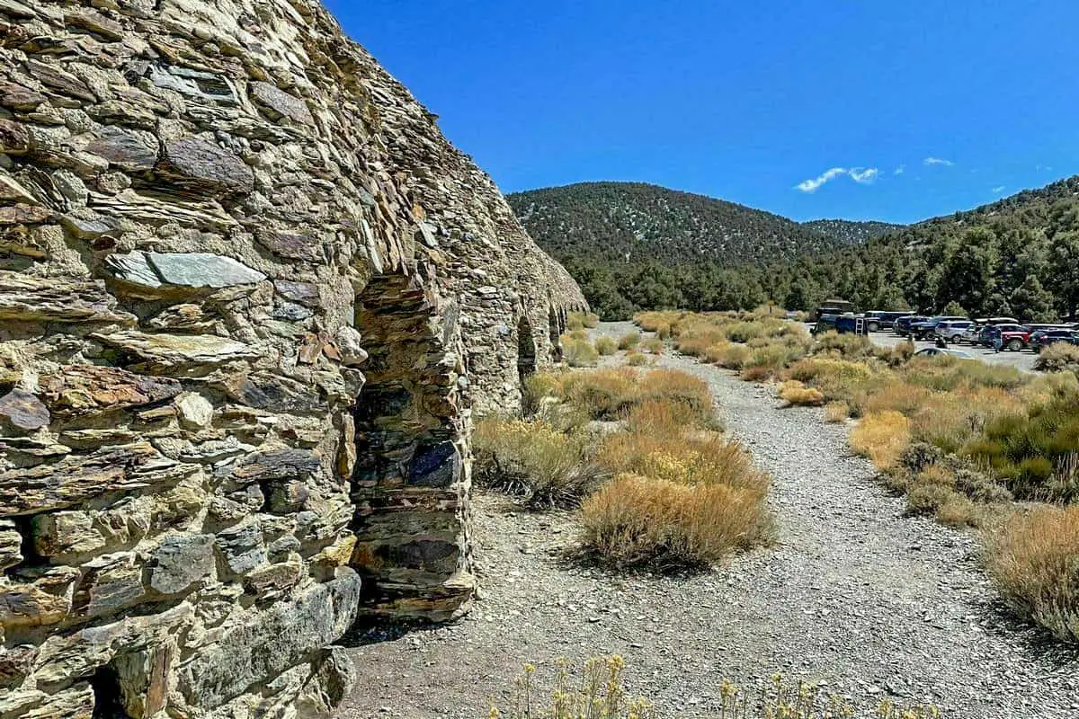
2. Harmony Borax Works
The park has a storied history. This location is dedicated to the mining industry and features archeological finds and the remains of the mine.
Death Valley National Park
Things to Do at the Death Valley National Park
Dante’s View
The scenic spot is the lowest point in North America and looks over the Badwater.
Mesquite Dunes
This is a beautiful place to see a sunrise in Death Valley National Park.
Zabriskie Point
This Death Valley National Park locale is right off a parking lot down a path that leads to one of the best places to watch a sunset.
Badwater Basin
This location has the distinction of being the lowest point in the Western Hemisphere, 277 feet below Sea level. The basin stays hot all year round, with water levels that fluctuate during different seasons.
You May Want to Join Our Boondocking Group on Facebook For More Information
You May Want to Join Our Campfire Recipes Group on Facebook For More Information