
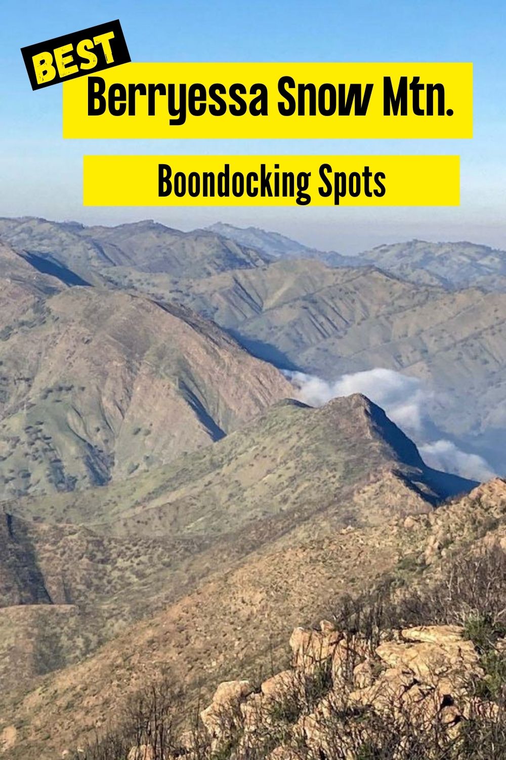
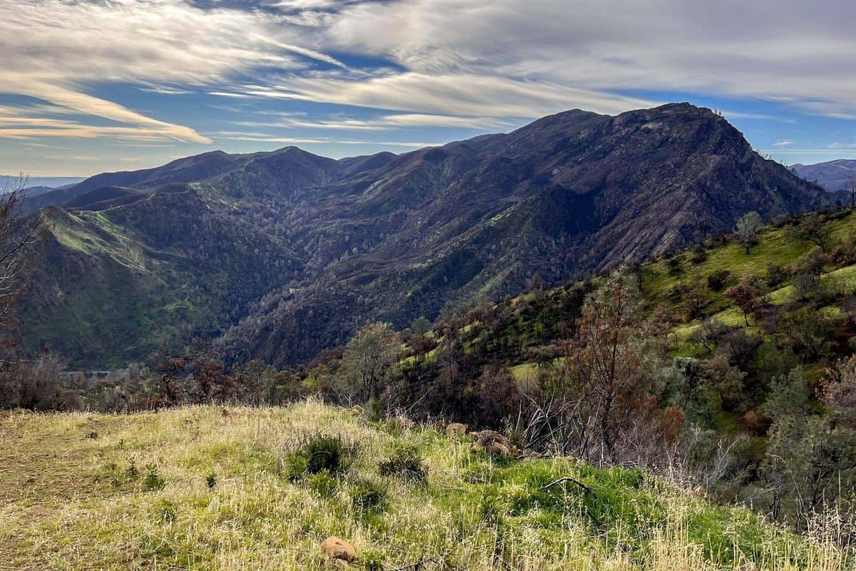
When we visited the Berryessa Snow Mountain National Monument we were met with beautiful scenery. it wasn’t quite like anything I’ve seen before. I saw mountains that were likely several thousands of feet in the air, covered with berries, and with a few different trails throughout the national monument.
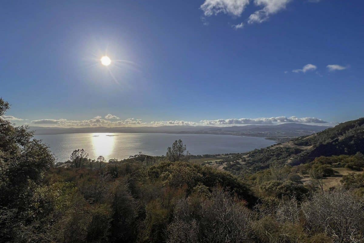
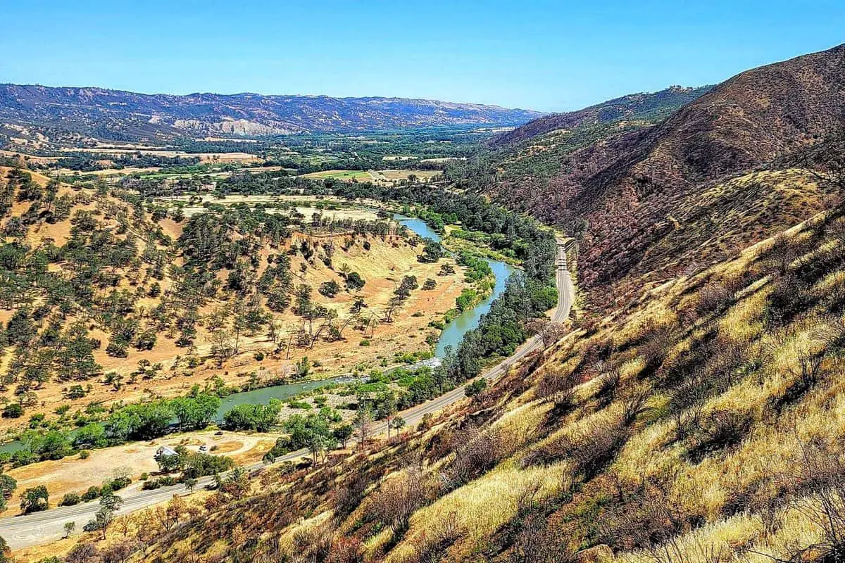
We traveled to northern California near Clearlake, which is where the monument is located. I had done some research and learned a few different key things about the national monument which is what I will discuss further in the article. I found that the national Monument extends through over 300,000 acres. It extends out from Lake Berryessa to other surrounding counties within the northern region of California. Berryessa Snow Mountain National Monument has rocky and barren terrain to travel on at the higher elevations
Want more ideas to round-out your National Parks and Monuments?
A lot of great ideas are in these posts!
- 6 Top Pinnacles National Park Boondocking Locations
- 14 Redwood National Park Boondocking (Updated 2022)
- 18 Kings Canyon National Park Boondocking (Updated 2022)
- 15 Yosemite National Park Camping Spots (Updated 2022)
- 5 Death Valley Salt Flats Boondocking (Updated 2022)
- 419 Awesome California Boondocking Campsites And Maps
- Our Top 25 Yosemite Hikes For All Ages
- 5 Best Hiking Trail Bonita Falls Photos Hot Spots
- 8 Places to Visit in Sequoia National Park
Visiting the Berryessa Snow Mountain National Monument Boondocking Locations will give you a ban inside look at the natural world. There are so many different species of plants and animals within the national monument you will never get bored. I could see a bald eagle flying directly above me, while also seeing a black bear with her cubs. Snow Mountain has an elevation of over 7,000 feet at the highest point! Snow Mountain is home to over 100 different species of wildlife and over 500 different species of plants.
The History of Berryessa Snow Mountain National Monument
History is something that intrigues me. Sure, give anyone a breathtaking view and many would love it. But when it comes to history, that’s my main reason for visiting many different places. The Berryessa Snow Mountain National Monument is a protected land like any national park or monument and was declared a national monument by Barack Obama in 2015,as well as Bear Ears and Grand Staircase both in Utah. The national monument has a history of having Native American settlements, such as the Yuki or Wintum tribes, and has been inhabited by these tribes for thousands of years.
Congress passed a wilderness act in 1984 to protect many different lands within California and the United State, along with over 20 different wilderness areas within California. In 2001, a fire burned over 20,000 acres of land in Snow Mountain, coating 12,000,000 dollars in damages trying to contain the blaze, which was a human-caused fire.
15 Boondocking Locations for Berryessa Snow Mountain
check out our video
1. Berryessa Snow Mountain National Monument Boondocking – Pinnacle Rock
Address
Clearlake Oaks, California
GPS: 39.14776, -122.76577
Elevation: 4511′
Management: National Forest Service
The road in is Dirt and ~5 miles from a paved road. There are 1-5 campsites at this location and the maximum RV length is 25 feet.
Amenities:
Fire Ring
Pets Welcome
Best Review:
Dispersed camping area at the end of the road at Pinnacle Rock. Looks like this may be a decommissioned forest service site as there are well made cut rock steps to the top of Pinnacle Rock but it is not identified on any current Mendocino NF maps. Great views from the top of the rock. Stayed here summer of 2018 and the last bit of dirt road had a couple tricky spots but could still make it in a minivan. This area may still be closed though, from the Ranch Fire in late summer 2018.

2. Berryessa Snow Mountain National Monument Boondocking – Lakeview
Address
7097 High Valley Road
Lucerne, California
GPS: 39.104074, -122.760585
Elevation: 3169′
Management: National Forest Service
Lakeview is open all year. This free campsite is located within the Mendocino National Forest’s Upper Lake Ranger District. Reservations are not accepted at this campsite.
Best Review:
Very bare site not even sure if I was allowed to stay there. Road leading up to the site is dirt and gravel. There are a lot of downed trees there. There is a small fire out on top of the hill. But on top of the small rock formation is a beautiful view of the lake. And a lot of gun shells on the ground. You also get decent cell phone reception
3. Berryessa Snow Mountain National Monument Boondocking – Cedar Camp
Address
Goat Mountain Road
Stonyford, California
GPS: 39.264338, -122.698619
Elevation: 4347′
Management: National Forest Service
Cedar Camp is open May-Nov. Located in a timber area of mature fir and pine. Access up Trough Ridge or Little Stony Road is not recommended for trailers.
Amenities:
Restrooms
Best Review:
Located 19 miles southwest of Stonyford on Goat Mountain Road. Stayed here with a passenger vehicle and a tent.
4. Berryessa Snow Mountain National Monument Boondocking – Indian Valley Reservoir – North Ramp
Address
19639 Bartlett Springs Road
Lucerne, California
GPS: 39.153937, -122.548135
Elevation: 1519′
Management: State Park
This is a free dispersed campsite. This campsite does not use a reservation system. First come, first served.
Best Review:
Beautiful. No one was there. Flush toilets and a communal shower. Boats are required to have a mussel inspection sticker to launch there. I didn’t have one so I backtracked and stayed at the free camping nearby. No cell service (ATT).
5. Berryessa Snow Mountain National Monument Boondocking – Old Mill
Address
Trough Springs Ridge
Stonyford, California
GPS: 39.308354, -122.645496
Elevation: 3668′
Management: National Forest Service
Old Mill is open May-Sep. The maximum RV length at Old Mill is 20 feet. Located 10 miles west of Stonyford on Road M-5.
Amenities:
Restrooms
Best Review:
None
6. Berryessa Snow Mountain National Monument Boondocking – Robinson Rancheria Casino
Address
Nice, California
GPS: 39.142969, -122.88197
Elevation: 1447′
Management: Casino
No Description
Best Review:
Casino parking lot stayed here several times in a small RV.
7. Berryessa Snow Mountain National Monument Boondocking – Wintun
Address
5365 Walker Ridge
Clearlake Oaks, California
GPS: 39.099768, -122.497741
Elevation: 3025′
Management: Bureau of Land Management
The road in is Dirt and 10 miles from a paved road. There are 1-5 campsites at this location. You may stay 14 at Wintun. Secluded, about a 0.8 mile drive from Bartlett Springs Rd.
Best Review:
This location is nice because it is shaded by two trees in an otherwise barren landscape. I believe the BLM folks must have come around recently for a clean-a-thon or something, as the location is fairly clean. Some of the other similar pads on Walker Ridge have also been cleared of junk present earlier this year. The view is quite good, though not as spectacular as the ridge-top ones nearby.
8. Berryessa Snow Mountain National Monument Boondocking – Blue Oaks BLM
Address
Indian valley reservoir road
Clearlake, California
GPS: 39.072304, -122.516141
Elevation: 1735′
Management: Bureau of Land Management
The road in is Gravel and 5 miles from a paved road. There are 6-15 campsites at this location and the maximum RV length is 25 feet. You may stay 14 at Blue Oaks BLM.Amenities:
Fire Ring
Near Water
Picnic Tables
Restrooms
Best Review:
This campsite is a BLM Free camping area in the Indian Valley Reservoir Recreational Are, Lake County, CA just prior to the Blue Oak Campground. Good Verizon LTE signal. Very beautiful views!!
9. Berryessa Snow Mountain National Monument Boondocking – Walker Ridgetop
Address
Walker Ridge road
Clearlake Oaks, California
GPS: 39.065021, -122.511833
Elevation: 2302′
Management: Bureau of Land Management
The road in is Gravel and 5 miles from a paved road. Walker Ridgetop is open Year Round. There are 1-5 campsites at this location and the maximum RV length is unlimited. You may stay 14 Days at Walker Ridgetop.
Best Review:
10. Berryessa Snow Mountain National Monument Boondocking – Running Creek Casino
Address
635 State Hwy 20, Upper Lake, CA 95485
Upper Lake, California
GPS: 39.16088, -122.90382
Elevation: 1339′
Management: Casino
The road in is Paved. There are 6-15 campsites at this location and the maximum RV length is unlimited. You may stay 3 at Running Creek Casino.
Best Review:
None
11. Berryessa Snow Mountain National Monument Boondocking – Bear Creek Campground – Mendocino NF
Address
Mendocino National Forest
Upper Lake, California
GPS: 39.31984, -122.839859
Elevation: 2275′
Management: National Forest Service
The road in is Dirt and 9 miles from a paved road. Bear Creek Campground – Mendocino NF is open open all year. There are 16-29 campsites at this location. You may stay 14 days at Bear Creek Campground – Mendocino NF.
Amenities:
Fire Ring
Near Water
Picnic Tables
Restrooms
Best Review:
Great campsite. Only downside was the drive in. We drove in on forest road M10 which was over an hour of very tough road. Having a lofted 4wd was definitely needed. However once there it was a great site situated near the river. Didn’t see any fish but wasn’t really looking. My son had a great time riding his bike up and down the roads and playing near the water. Dogs had a great time as well. We stayed in a Rooftop tent atop a Toyota Landcruiser.
12. Berryessa Snow Mountain National Monument Boondocking – West Crockett
Address
27597 North Ridge Trail
Upper Lake, California
GPS: 39.436234, -122.781851
Elevation: 5010′
Management: National Forest Service
Free Dispersed camping in the Mendocino National Forest’s Grindstone Ranger District. First come -> First Camped. Reservations not accepted.
Best Review:
None
13. Berryessa Snow Mountain National Monument Boondocking – Lower Nye
Address
Forest Route 18N04
Upper Lake, California
GPS: 39.443062, -122.826541
Elevation: 3255′
Management: National Forest Service
Lower Nye Dispersed Camping. Open year round but not accessible when creek is too high to ford. No tables, fire rings or services.
None
14. Berryessa Snow Mountain National Monument Boondocking – Cow Mt RA – Buckhorn
Address
Buckhorn Road
Ukiah, California
GPS: 39.038434, -123.039226
Elevation: 2881′
Management: Bureau of Land Management
This free campsite is located within the Bureau of Land Management Ukiah District.
Amenities:
Restrooms
Best Review:
Personally never made it to the site and camped in the nearby national forest instead, but thought I’d add the relevant information about accessing the site.
15. Berryessa Snow Mountain National Monument Boondocking – Cow Mt RA – Bushy
Address
Old Road
Ukiah, California
GPS: 39.05609, -123.050164
Elevation: 3035′
Management: Bureau of Land Management
Free Dispersed camping in the Bureau of Land Management Ukiah District. No reservations. First come, first served.
Best Review:
None
Things to do in Berryessa Snow Mountain
Of course, when visiting any national monument, or any national park, there are things to do. Obviously, the first being is to explore. I got to see many different places and also meet a few fellow explorers, people who shared the history and facts about the Berryessa Snow Mountain National Monument.
Everything to do in Berryessa is tilted toward backpacking, hiking, horseback riding etc. There are a few places to camp inside the monument with access to a vault toilet and the rest of the park is open to dispersed camping but nothing with services.
One unique thing near the monument you may want to visit if your visit coincides is the Cache Creek Lavender Festival. In case you’re setting up camp on the BLM terrains of the Berryessa Snow Mountain National Monument toward the start of June, make a visit to the Cache Creek Lavender Festival. The celebration is a two-day occasion that takes place on a lavender homestead and promotes everything lavender. Pick lavender from the fields, taste food items enhanced with lavender, engage in lavender arranged studios, and find out with regards to the plant’s remedial characteristics while appreciating day-long unrecorded music. It’s a fun, fascinating, and altogether different family day out.
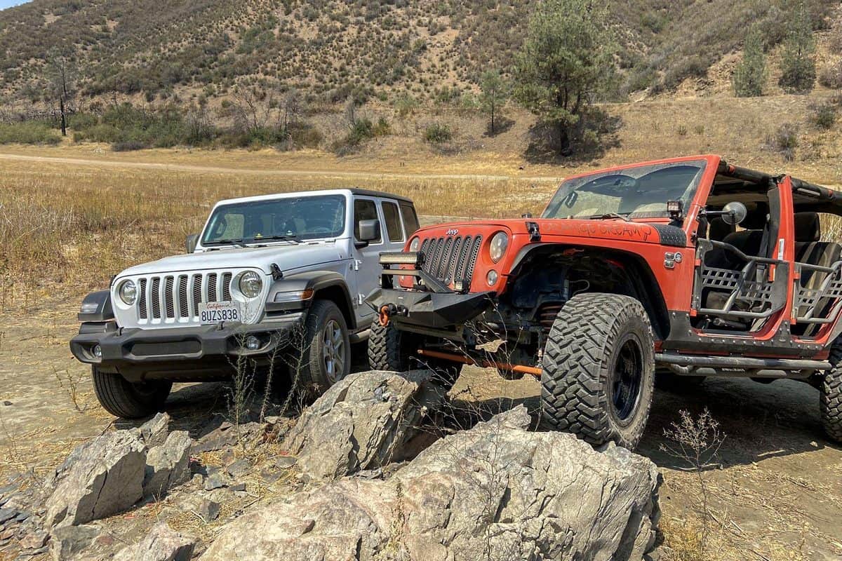
An Off Roaders Paradise
The Berryessa Snow Mountain National Monument is a heaven on earth for going off road. In case that is the thing that you’re planning your visit to these BLM lands for, you’ll need to head into the Knoxville Recreation Area. There you’ll have the option to ride or drive more than 51 miles of trails going through numerous various landscapes in an aggregate of 24 thousand sections of land.
More path can be gotten to from the Wolf Creek Visitor Center, and there is a broad organization of trails for going romping in the Mendocino National Forest.
4 Trails in Berryessa Snow Mountain National Monument
I went on the different trails that were available in the monument. The trails can offer miles of exploring and many different areas to be seen within the Berryessa Snow Mountain National Monument. There wasn’t an abundance of them, but each trail offered something different with exploring the national monument. Each of them were beautiful in their own way and offered many different sights. I got lucky however and was able to find a few just by asking around and exploring the place. I went on a total of four different trails and will list out my experiences on each of them, in no particular order.
1. Valley Vista Trail
The Valley Vista Trail is one of the trails I went on. The trail goes up a steep hillside and is a very narrow trail. It was very tricky for me to navigate some parts of it and can make for good exercise. If you do ever visit, please be aware that it can be dangerous if your foot slips because of how steep the trail can be. I traveled it alone as well and the trail can be very slick making it a little on the dangerous side.
I actually almost fell a few times navigating the trail, which is why I mentioned that the trail is difficult to navigate. The wildfires from last year have also left some of the vegetation scarred but it seems as if nature is taking back control after the fires. There was also some steam traveling down the trail as well, making it clearly evident that wildfires took place here. I also didn’t see much in wildlife, outside of a few birds flying above me.
After traveling on the trail for so long you will see a wider road further up that crosses a bridge. At the top of the trail, there is a picnic table which could be a good place to eat at or just to take a break and take in the scenery. I decided to have lunch there and take in the scenery of the trail. Eventually, I decided to loop back to the start of the trail and try other trails that I hoped were easier to navigate.
Length: 4.8 mi
Elevation gain: 1,811 ft
Route type: Out & back
Hiking, Running, Views, Wildflowers, Wildlife2. Glascock Mountain Trail
2. The Glascock Mountain Trail
The Glascock Mountain Trail was also another trail I went on. And boy, if I thought the Valley Vista Trail was difficult to climb, I was in for a shock with the Glascock trail. The trail was extremely steep and definitely harder to navigate than the former trail. There wasn’t much shade on this trail either, making hotter days on this trail a nightmare. First, you need to go through a gate to access it, which is a property of one of the counties near the trail.
They make it evident on a sign that it is against the rules to hunt on this trail. When I mentioned it was steep, I also should mention that some of the dirt is very loose on the trail as well, making it easy to either get stuck or slip on the trail, making it impossible to navigate if it is a rainy day. However, if you do want to hike this trail I recommend using poles.
When I first went through this trial, that is something I did not do. I eventually gave up on this trail and went on to another. I might come back to this one when it is either easier to navigate or when I have the correct equipment.
Length: 5.2 mi
Elevation gain: 2,240 ft
Route type: Out & back
Hiking, Views, Wildflowers, 3. Berryessa Peak Trail
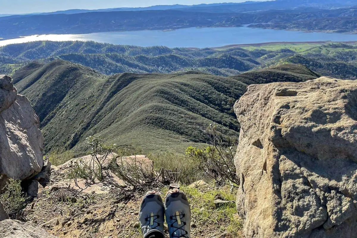
The Berryessa Peak Trail is another trail I went on. This trail was fun to travel on, especially since there was no one in sight when I went on it. It is a pretty straightforward trail, meaning that you will know when you’re on the trail and when you’re not on the trail, judging by the metal postings in the ground that lead you in the direction of where the trail is supposed to go. Eventually, I was lead to a steep hillside that went only up for several miles. near the end of the trail I was met with a gravel path that only lead up to a peak of one of the mountains. At the peak, I had a nice view of things that were far below me and could basically see everything in the surrounding area. Although it was a nice view, this wouldn’t be recommended for someone easily afraid of heights.
Length: 14.7 mi
Elevation gain: 3,507 ft
Route type: Out & back
Dogs on leash, Hiking, Nature trips, Bird watching, Running, Forest, River, Views, Waterfall, Wildflowers, Wildlife,
Rocky
4. Bartlett Springs OHV Road
This is actually a trail that you don’t walk on but drive on instead. Though I suppose you could walk on it. But I wouldn’t recommend it as it is pretty narrow and having to guide your way around other vehicles. When I drove on this trail it was a bit rainy out, as it was the final trail and the rain had started picking up again. I could see some puddles forming on the trail but overall it was safe to traverse with a vehicle.
I noticed there was some work equipment on the road and surrounding area, but nothing a vehicle couldn’t pass by. It seemed like they were in the process of improving the road. There are many different things to do but I decided to go to the reservoir. The reservoir offered some decent scenery and by the time I got there it had stopped raining.
Length: 30.3 mi
Elevation gain: 4,340 ft
Route type: Point to point
Dogs on leash, Nature trips, OHV/Off-road driving, Scenic driving, Forest, Lake, Views, Wildlife, Muddy
Final Thoughts
Overall, the Berryessa Snow Mountain National Monument was a nice place to visit. It offered pretty unique scenery alongside having some decent trails to traverse. I would recommend visiting if you’re interested in scenery, trails or even the history like I was, which was the initial visit but I was left with more amazement and wonder after traveling some of the trails.
You May Want to Join Our Boondocking Group on Facebook For More Information
You May Want to Join Our Campfire Recipes Group on Facebook For More Information