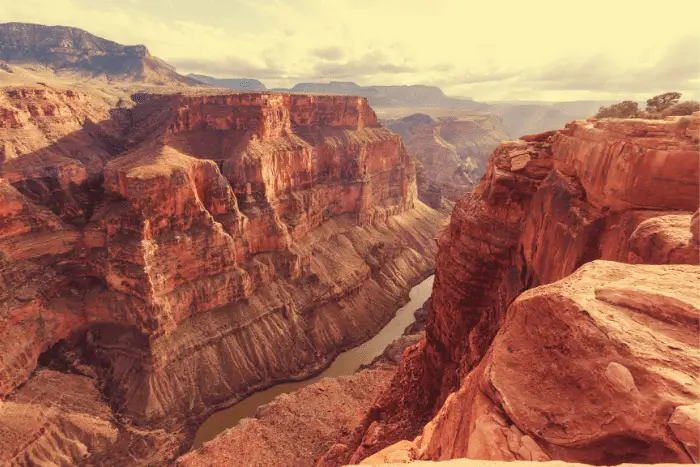
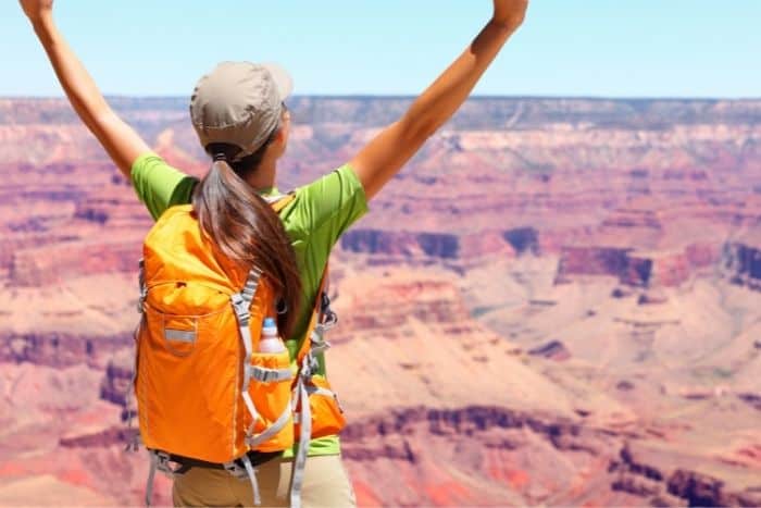
These Grand Canyon rim to rim day hikes will make you feel rejuvenated and refreshed than spending time in the wilderness. Nature has unique ways of making you release endorphin hormones, feel happy chemicals, and take a breath of fresh air away from noisy cities and you will get all of them when you take an easy Grand Canyon hiking trail. Hiking and backpacking are some of the few best outdoor activities you can do in the wilderness.
Want more ideas to round-out your trip to Arizona?
A lot of great ideas are in these posts!
- Our 15 Best Hikes in Saguaro National Park (Updated 2022)
- 15 Hard Saguaro National Park Hiking Areas
- 12 Tucson Boondocking & Tucson Free Camping for Rodeo Week
- 14 Amazing Sedona Free Boondocking Spots Plus UFO Thrills
- 23 Flagstaff Free Boondocking Locations and Free Camping Areas
- 14 Bullhead City Free Boondocking Locations for Cold Winter (Updated 2022)
- 15 Yuma Free Boondocking Locations for Snowbirds (Updated 2022)
- Grand Canyon National Park 20 Amazing Places
Hiking or Backpacking
People often think the two terms mean the same things, but there is a slight distinction. Hiking is a day’s walk along a trail, while backpacking is a hiking activity with individuals carrying camping gear such as tents, sleeping bags, foods, and toiletries that they may need for several days in the bush. With these choices of the Grand Canyon best day hikes you get the advantage of both.
The two activities are fun, and they will surely give you the adventure of a lifetime. But for hiking and backpacking to be memorable, the selected place and timing of each activity are paramount. This article reviews why the Grand Canyon National Park rim to rim is a terrific place for hikers and backpackers and one of the World’s Seven Wonders.
Grand Canyon North Rim Trails
check out our video
1. Grand Canyon Rim to Rim North – North Bass Trail
This 22.3-mile out-and-back trail is located in North Rim, Arizona. It takes an average of 12 hours and 15 minutes to accomplish this trip, which is rated difficult. This trail is ideal for trekking, birding, and camping, and you won’t see many other people while exploring it. The months of May through October are ideal for hiking this trek.
Swamp Point is the starting point for the North Bass path. At the end of Swamp Ridge Road sits Swamp Point. Though the trailhead is accessible from the North Rim Village through the Point Sublime and Kanabownits Roads, it should be emphasized that access from the west via Forest Service Roads is significantly easier. A map of the North Kaibab National Forest is required to hike the Grand Canyon Rim to Rim.
Length: 22.3 mi
Elevation gain: 7,109 ft
Route type: Out & back
Grand Canyon backpacking hikes, Grand Canyon best day hikes, Backpacking, Camping, Hiking, Bird watching, Running, Views, Wildflowers, Wildlife, Rocky, Scramble, Fee, No dogs, Grand Canyon Rim to Rim
2. Grand Canyon Best Day Hikes – Powell Plateau Trail
A short but difficult descent to the saddle, followed by a short but difficult climb to Powell Plateau. Even though we started early, the climb back up to the trailhead was a grind. On the Plateau, the walk passes through a lovely old growth forest. We were looking for Dutton Point, but we never found it. Because the edge of the plateau is heavily vegetated and difficult to approach, we recommend downloading the satellite basemap. Unless you go all the way to the Powell Plateau’s southern point, the views don’t fully open out.
Length: 8.2 mi
Elevation gain: 1,968 ft
Route type: Out & back
Grand Canyon backpacking hikes, Grand Canyon best day hikes, Kid friendly, Hiking, Running, Views, Wildflowers, Wildlife, Rocky, Fee, No dogs
3. Easy Grand Canyon Hiking – Upper Tapeats and Lower Tapeats Trail via Thunder River
The Thunder River trail continues to meander across the Esplanade after connecting up with the Bill Hall trail, working its way gently south and westward towards the Redwall break that will lead you down into Surprise Valley. As long as you keep an eye out for the cairns, the track is not difficult to follow through this portion. One issue is that there is a lot of dispersed rock in the region, and it can be difficult to distinguish between two boulders that are sitting on top of one other and a legitimate marker.
Length: 4.2 mi
Elevation gain: 774 ft
Route type: Out & back
Grand Canyon backpacking hikes, Grand Canyon best day hikes, Hiking, Views, Wildlife
4. Grand Canyon Rim to Rim North – Middle Lookout Trail
The bottom of Pratt Canyon is traversed by Lookout Canyon Trail #121 and one of our favorite Grand Canyon Rim to Rim hikes. Pratt Canyon is a narrow canyon containing ponderosa pine, spruce, fir, and aspen trees, as well as few small grassy meadows. During the summer, the route provides a pleasant place to hike or ride, as well as a beautiful display of fall color when it is in season.
Length: 5.1 mi
Elevation gain: 544 ft
Route type: Out & back
Grand Canyon backpacking hikes, Grand Canyon best day hikes, Hiking, Forest, Views, Wildflowers, Rocky, Grand Canyon Rim to Rim
5. Grand Canyon Best Day Hikes – Bill Hall Trail
This trail is classified as easy, although I’m not sure why. This is a challenging hike with steep ascents and descents. The downhills are challenging with perilous footing due to shifting rocks, sand, and scree. There are roughly 40 short, steep switchbacks, as well as some BIG steps and a short period of hand and foot climbing where rope a big pack down is a good idea. After a 5-night stay at Tapeats and Deer Creek, we hiked back up this trail. With 8 hours of strenuous trekking, we left Deer Creek campground at 5:45 a.m. and arrived at Bill Hall at 5:30 p.m. The Bill Hall path was a spectacular challenge and a rewarding conclusion to a fantastic and difficult adventure!
Length: 5.1 mi
Elevation gain: 2,027 ft
Route type: Out & back
Grand Canyon backpacking hikes, Grand Canyon best day hikes, Backpacking, Camping, Hiking, Walking, Bird watching, Running, Views, Wildflowers, Wildlife, No shade, Fee, No dogs, Grand Canyon Rim to Rim
6. Easy Grand Canyon Hiking – Thunder Creek to Deer Creek and Thunder Falls
The massive amounts of water at Thunder River, Tapeats Spring, and Deer Spring have captivated visitors since ancient times, and this small section of the Grand Canyon is now extremely popular among those seeking the extraordinary. Streams of sparkling water erupt like gifts from hidden tunnels, transforming the rough desert of the interior canyon into an impossibly lovely green oasis complete with the music of water cascading into cool pools. Access to the trailhead might be difficult, if not impossible, and the approach march can be lengthy, hot, and dry, but for those who make the journey, these sites exemplify canyon perfection.
Length: 29.0 mi
Elevation gain: 7,263 ft
Route type: Loop
Grand Canyon backpacking hikes, Grand Canyon best day hikes, Backpacking, Camping, Hiking, Bird watching, Running, River, Views, Waterfall, Wildlife, Rocky, Scramble, Fee, No dogs, Grand Canyon Rim to Rim
7. Grand Canyon Rim to Rim North – Coconino Overlook
An simple Grand Canyon hike can be had by taking the North Kaibab Trail to Coconino Overlook. This hike leads to a viewpoint with views of Roaring Springs Canyon and the cream-colored Coconino Sandstone after meandering through a few switchbacks. Because there is very little shade on this climb, carry plenty of water!
Length: 1.3 mi
Elevation gain: 469 ft
Route type: Out & back
Grand Canyon backpacking hikes, Grand Canyon best day hikes, Kid friendly, Hiking, Walking, Views, Fee
8. Grand Canyon Best Day Hikes – Uncle Jim Trail
We had a wonderful experience! Almost the entire Trail is in the woods. We were astonished to find so little wildlife, only a few lizards and a few birds. Make sure you make it all the way to the lookout point! You’ll get a terrific perspective of much of the North Kaibab Trail, as well as spectacular vistas of the canyon as a whole. It was a little depressing to see so many charred trees, but things appear to be improving. We covered 5.2 miles and gained 804 feet in just over 3 hours, according to our AllTrails log. Along the trip, we spent a lot of time snapping pictures.
Length: 4.7 mi
Elevation gain: 731 ft
Route type: Loop
Grand Canyon backpacking hikes, Grand Canyon best day hikes, Kid friendly, Backpacking, Camping, Hiking, Horseback riding, Walking, Bird watching, Running, Forest, Views, Wildflowers, Wildlife, Rocky, Fee, No dogs, Grand Canyon Rim to Rim
9. Easy Grand Canyon Hiking – North Kaibab to Grand Canyon Village
It was the most difficult hike I’ve ever done, and we just made it out with a little luck. The final 4.5 miles of the trek need a lot of effort and dedication. The R3 requires planning and preparation – a meal plan, a water plan, knowing what to expect on each leg, and keeping an eye on your pace so you don’t run out of gas at the end. We had our share of problems, but we were able to overcome them.
We left the gear we didn’t need to walk up and down NK in a cottonwood camp sight locker (well labelled) and picked it up on the way back down. It was a chance, but the people at the site we chose were courteous and interested in our experience. It’s a fantastic bucket-list achievement.
Length: 24.0 mi
Elevation gain: 5,150 ft
Route type: Point to point
Grand Canyon backpacking hikes, Grand Canyon best day hikes, Backpacking, Camping, Hiking, Horseback riding, Running, River, Views, Wildflowers, Wildlife, Rocky, Scramble, Fee, No dogs
10. Grand Canyon Rim to Rim North – Cape Royal Trail
At the end of the harrowing scenic drive, Cape Royal is definitely an impressive reward. A short hike along a paved path from the parking area brings you past Angel’s Window to stunning panoramic views of the Grand Canyon, including Grandview Point across the river.
This trail is well-paved and flat, making it ideal for most people to access the breathtaking vistas! Railings provide a sense of security to those who are afraid of heights. The section of the trail that leads to the top of the Angels Window is a little tight (my family refused to join me because of their fear of heights), but it is also very safe. This stretch of the North Rim has my favorite feature: no crowds!
Length: 1.0 mi
Elevation gain: 65 ft
Route type: Out & back
Grand Canyon backpacking hikes, Grand Canyon best day hikes, Wheelchair friendly, Kid friendly, Stroller friendly, Walking, Forest, Paved, Views, Wildflowers, Wildlife, Fee, No dogs, Grand Canyon Rim to Rim
10 Grand Canyon South Rim Trails
1. Grand Canyon Rim to Rim South – Plateau Point Trail via Bright Angel Trail
The trail is accessed by the Bright Angel Trail, at Indian Garden.
Here on our Bright Angel Trek, the trail starts at Indian Garden, 4.5 kilometers from the summit. The route travels northeast from Indian Garden’s 24-hour area, following the Tonto Trail for about 0.75 mile until splitting off and heading north to Plateau Point. The trail finally ends at the point 0.75 miles from the intersection.
Between Pipe Creek Canyon and Monument Canyon, Plateau Point looks out across the Granite Gorge. Even while 3,000 feet underneath the south rim, it affords a glimpse of the Colorado River from around 1,300 feet above.
Whenever the water is switched on, there is water at Indian Garden and towards the end of the route.
We intended to trek to Indian Garden and then return, but we chose to continue 1.5 kilometers farther to plateau point, and amazing! It was well worth the effort. From there, you can see the Colorado River in all its glory. The trek back up was difficult, particularly the final mile, but it was an amazingly beautiful hike.
Length: 13.3 mi
Elevation gain: 3,402 ft
Route type: Out & back
Grand Canyon backpacking hikes, Grand Canyon best day hikes, Hiking, River, Views, Rocky, No shade, Fee, No dogs
2. Grand Canyon Best Day Hikes – Indian Garden Campground via Bright Angel Trail
To say the very least, the Grand Canyon is a difficult place to beat when it comes to hiking. Bright Angel Trail, the most famous path in the canyon, leads to Indian Garden Campground on this trail. Remember that this trip is only one way; if you want to journey to the campgrounds and return, you’ll have to be prepared for a lot of elevation gain . The rise of 0 meters solely applies to the journey from South rim to the campsite. While it’s a great hike for intermediate hikers and up, novices may tire out on the return trip up to the rim.
This route begins at Grand Canyon Village on the South Rim of the Canyon, which is where the majority of people arrive. Bring poles, decent boots, snacks, and lots of water with you. If you want to camp at Indian Garden, you’ll need to make a reservation in advance.
Length: 4.5 mi
Elevation gain: 0 ft
Route type: Point to point
Grand Canyon backpacking hikes, Grand Canyon best day hikes, Backpacking, Camping, Hiking, River, Views, No shade, Fee, No dogs
3. Easy Grand Canyon Hiking – 3 Mile Resthouse via Bright Angel Trail
The trek to 3 Mile Resthouse is 6 miles long and includes 2,100 feet of elevation gain, making it a difficult hike. However, because the route is well-kept and there is periodic water, you can still get away with wearing workout gear on this trek if the weather cooperates. In general, bring two liters of water and some munchies. Water station outages do occur from time to time, so check the warnings page before going.
This short tour can be ideal if you want to get a taste of hiking down and up the magnificent Grand Canyon. The 3-mile-resthouse offers breathtaking views of the canyon, as well as the opportunity to refill your water and chill off in the shade before continuing your journey. Keep in mind that there is a significant amount of elevation to contend with. Hiking down is always simple, but what goes down must be resurrected.
Length: 6.0 mi
Elevation gain: 2,112 ft
Route type: Out & back
Grand Canyon backpacking hikes, Grand Canyon best day hikes, Hiking, River, Views, Rocky, Scramble, Fee, No dogs
4. Grand Canyon Rim to Rim South – Hopi Point Trail
We hiked to Hopi Point after taking a free Grand Canyon National Park bus to Trailview Point and hiked the Canyon Rim Trail to Maricopa Point and Powell Point.
Along Hermit Road, Hopi Point is THE place to be. It juts out farther north into the canyon than any other spectacular viewpoint on the Grand Canyon’s South Rim and provides the most breathtaking vistas.
Dana Butte, 2,000 feet underneath the viewpoint, the Shiva Temple and Zoroaster Temple rocks, as well as Isis Temple, Horus Temple, and Osiris Temple on the North Rim, can all be seen from Hopi Point. Since the Colorado River meanders northwards, it’s also the first spectacular overlook where you can see entire western Grand Canyon, all the up to Havasupai Point and the Great Scenic Divide.
Length: 3.8 mi
Elevation gain: 383 ft
Route type: Out & back
Grand Canyon backpacking hikes, Grand Canyon best day hikes, Kid friendly, Hiking, Views, Wildlife, Rocky, Historic site
5. Grand Canyon Best Day Hikes – Tanner Trail
Tanner Trail is located 23 miles east of Grand Canyon Village in the Grand Canyon National Park. The spectacular Unkar Rapid and the skewed layers of rock known as the Grand Canyon Supergroup may be seen from the route. The National Park Service does not maintain it on a regular basis, and there are portions of rock slides where path finding abilities are required.
The trail descends steeply into one of the park’s largest and most colorful regions. The Colorado River is roughly 9 kilometers from the trailhead. The Escalante Trail, which runs west, and the Beamer Trail, which runs east, are two primitive routes that intersect with Tanner Trail. The Tanner Trail is ideal for travelling deep into the canyon on fantastic and unusual terrain. Tanner Trail’s vistas like an image on an old postcard, with wide-open views and layers of exposed rock not seen in many other areas.
Some of the nicest vistas in Grand Canyon National Park may be seen here.
Length: 16.9 mi
Elevation gain: 5,482 ft
Route type: Out & back
Grand Canyon backpacking hikes, Grand Canyon best day hikes, ackpacking, Camping, Hiking, Running, Beach, River, Views, Wildlife, Rocky, Scramble, No shade, Fee, No dogs
6. Easy Grand Canyon Hiking – Walhalla Overlook
The Walhalla Overlook is located on the Grand Canyon’s North Rim’s Walhalla Plateau. It’s about a mile before Angel’s Window, near the end of the Cape Royal road. At the North Entrance to Grand Canyon National Park, take Highway 67 south to the Visitor Center, but turn left towards Point Imperial and continue the highway to the Cape Royal Road intersection. Turn right along Cape Royal Road and continue until you reach the Walhalla Overlook signage.
Length: 0.1 mi
Elevation gain: 0 ft
Route type: Out & back
Grand Canyon backpacking hikes, Grand Canyon best day hikes, Wheelchair friendly, Kid friendly, Stroller friendly, Walking, Views, Wildlife, Fee, No dogs
7. Grand Canyon Rim to Rim South – Escalante Route in Grand Canyon National Park
The 32-mile Escalante Route in Grand Canyon National Park is a difficult but scenic one-way hike. The hike begins and ends on the Grand Canyon’s South Rim, and involves nearly 10 miles of trekking all along Colorado River’s Escalante Trail. SeventyMile Creek and Slot Canyon, Nevills and Hance Rapids, ascending the Papago Wall, Red Canyon, and totally open panoramas of the Colorado River and Grand Canyon are among the features. This hike is best suited to experienced backpackers because it includes some difficult, open paths and requires scrambling and trail searching in a few parts. The Tanner Trail is used to access the canyon, while the Tonto and Grandview Trails are used to escape.
Length: 34.8 mi
Elevation gain: 9,455 ft
Route type: Out & back
Grand Canyon backpacking hikes, Grand Canyon best day hikes, ackpacking, Camping, Hiking, Beach, River, Views, Wildflowers, Wildlife, Rocky, Scramble, Fee, No dogs
8. Grand Canyon Best Day Hikes – Horseshoe Mesa Circular via Grandview Trail
The Horseshoe Mesa Circular via Grandview Trail is a difficult 19.6-kilometer loop trip off the Grand Canyon’s South Rim. This trail follows a hillside out to Horseshoe Mesa, around the mesa, and back. The vistas are breathtaking, and the route isn’t as busy as Bright Angel or South Kaibab. As a result, you should expect a challenging ascent with little access to clean drinking water and some exposed stretches. While this trek may be completed in a single day, staying at Horseshoe Mesa Camp for the night is suggested.
Length: 16.4 mi
Elevation gain: 3,540 ft
Route type: Out & back
Grand Canyon backpacking hikes, Grand Canyon best day hikes, Backpacking, Camping, Hiking, River, Views, Wildlife, Fee
9. Easy Grand Canyon Hiking – Greenway Biking Trail
The park offers a 4.4-mile east–west path from the Grand Canyon Village’s Village Loop Drive and Hermit Road intersection to the South Kaibab Trailhead (off Yaki Point Road). An further 6.6 miles of paved greenway trail runs south from the Grand Canyon Visitor Center to the park’s gateway village of Tusayan, nearly at its midway. This north–south trail has an uphill grade as you journey north from Tusayan to the park; because the South Rim is at such a high altitude (7,000 feet), the extra work of this ascent may be difficult for inexperienced riders.
Length: 13.1 mi
Elevation gain: 984 ft
Route type: Point to point
Grand Canyon backpacking hikes, Grand Canyon best day hikes, Dogs on leash, Wheelchair friendly, Kid friendly, Stroller friendly, Hiking, Road biking, Walking, Running, Forest, Paved, Views, Wildflowers, Wildlife, Fee
10. Grand Canyon Rim to Rim South – Tonto Trail From Grandview Point
Across its 27-mile length from Hance Rapid to Garnet Canyon, the Tonto Trail gently rolls in and out of apparently endless drainages. The Tonto Platform, located deep inside the canyon, rises 1200 vertical feet above the river’s level, yet a series of springs allow visitors to travel the length of the trail, which runs nearly parallel to the river.
Because it is so long, it is not usually completed in one go. With amazing sweeping vistas, peaceful desert streams, and a chance for seclusion in a most wild and beautiful area, the Tonto Trail between the Grandview and South Kaibab Trails provides experienced trekkers with an outstanding introduction to the magic of the Grand Canyon. (Because to the high exposure to the sun, this hike is not suggested from May to September.)
Length: 27.2 mi
Elevation gain: 5,216 ft
Route type: Point to point
Grand Canyon backpacking hikes, Grand Canyon best day hikes, Backpacking, Camping, Hiking, Bird watching, Running, Views, Wildflowers, Wildlife, Rocky, Fee
5 Remarkable Places to Visit in Grand Canyon Rim to Rim
1. Grand Canyon Village
Located on the south rim of the Grand Canyon, it gives you a magical view and resolution of the Grand Canyon. The village is the transportation hub for visitors on the south rim of the Grand Canyon, making it easy to access. The best time to visit the village is during summer when temperatures are moderate, and clouds are thin to allow optimal viewing. March-May and September-November are recommended seasons.
2. Desert View
Desert, the view is a settlement on the south rim, near the eastern edge and 23 miles from the Grand Canyon village. At Desert View, you can have a good view of the fascinating Grand Canyon. The iconic 277 miles of Colorado River and Canyon geology are also visible from desert views giving you the ultimate adventure. Visit desert view when the weather is clear, and the ideal time is April and September through October.
3. Remote Tuweep
Remote Tuweep is located on the north side and below the enigmatic Grand Canyon. The area is rarely visited, making it uncrowded. Visiting this area can be very rewarding. You get a rustic and silent experience you probably have never known while overlooking 3000 feet Colorado River above. You will experience a less crowded, remote, and rustic experience. The trails are challenging, and it is recommended to visit Remote Tuweep in April.
4. The Yavapai Geological museum
The simple yet mesmerizing stone building is the hikers’ and backpackers’ information center. It is located at the high top of the cliff facing the Grand Canyon. The site allows you to get acquainted with the canyon’s shape and see each type of rock in the Grand Canyon. March through May is recommended time to visit this place.
5. The Bright Angel Hiking Trail
Bright Angel hiking is the most popular trail that departs from the Grand Canyon village. It is ideal for beginners and experienced hikers. It is mainly accessed from South Rim, but the trail starts west of Bright Angel Lodge. Complete hiking along the trail takes about two days though most people only hike for a few miles to experience the trail. Hiking is best during spring, fall, and winter, but you need guides because you may get lost.
5 Remarkable Places to Stay in Grand Canyon Rim to Rim
1. Best Western Premier Grand Canyon Square Inn
It is a property at the Grand Canyon just a few minutes away from the south rim entrance. The property has access t amenities such as pools, Free parking, and Wi-Fi. You have restaurants that serve lunch, breakfast, supper, and additional activities such as horse riding. Pets are not allowed.
2. Yavapai Lodge
Yavapai Lodge is located about a mile walk from the south rim of the Grand Canyon. The lodge is family-friendly and pet friendly and is the perfect place to start your adventure. The lodge has a casual eatery, and the rooms have TVs and minifridges.
3. Navajoland Hotels
The hotel is an excellent area for relaxation and unwinding. It is located near great restaurants and has a family-friendly environment.
4. Maswik Lodge
Maswik Lodge is located one mile from the Grand Canyon South Rim. It has a contemporary style, and you can access the park’s shuttle from the lodge entrance. Maswik has additional amenities such as pubs and a cafeteria. The rooms have coffee makers and minifridges.
5. Kachina Lodge
It is located only 0.6 miles from the Canyon South Rim. This lodge has free Wi-Fi, a pool, and a parking space. It is suitable for visitors who are looking for a more recent experience.
5 Remarkable Campgrounds to Visit in Grand Canyon Rim to Rim
1. Kaibab Camper’s Village
It is located on the North Rim of the Grand Canyon; the campsite offers visitors an exceptional camping experience. The location is secluded and only 40 miles drive away from the North rim parkway. Kaibab is the only campsite near the North Grand Canyon with RV hookups. The environment in the camp is serene, with many tall, beautiful pine trees giving pleasant shade.
2. DeMotte Campground
DeMotte is located only seven miles near the northern entrance of the Grand Canyon. This campsite will enable you to see wildlife such as squirrels. DeMotte is pet friendly, and you might enjoy some bird-watching activities. The camp has over 30 campsites that can accommodate tents and tiny motor homes; the campsites have cooking grills and tables.
3. Ten-X Campground
Ten-X is located near the south rim of the Grand Canyon National Park and has an open camping campsite. Ten-X camp is more peaceful and relaxing. Additionally, the campsites have free parking and are pet friendly. Nearby attractions include Grand Canyon Desert View Watchtower.
4. Desert View Campgrounds
The camp is located on the south rim of the camp, 23 miles east of the Grand Canyon village. The campground has restrooms, and you can make same-day reservations through the website. The entrance is wheelchair accessible. The camp has about 50 campsites that can accommodate tents and vehicles with travel trailers- the campsites don’t have showers.
5. Green Leaf Canyon
Green Leaf Canyon campground has 16 campsites located 46 km away from the Grand Canyon. The campsite offers direct access to the Grand Canyon, and it is pet friendly. The camp offers free private parking and a seating area. Some of the activities you can indulge in while at the camp include skiing and cycling.
Grand Canyon Rim to Rim Questions
1. How do I get a Grand Canyon Trail map?
Grand Canyon brochures, maps, and trail guides are available online, and you can always view or download them online for free. Additionally, you can get park newspapers that have all the necessary information you may require while hiking. Maps are invaluable additions when you want to explore, and they enable visitors to hike the Grand Canyon without a guide.
2. Can I take a dog hiking in Grand Canyon?
You can take your dog hiking in Grand Canyon on the rim and the Greenway trails at the South Rim. However, there are restrictions put in place. Your dog has to remain leashed during the hike, and the leash should not be longer than 6 feet. Additionally, the dog can only hike along paved trails because it is easy for hikers to hike too deep into the Grand Canyon and on intensive hikes, which dogs cannot withstand.
3. Which Grand Canyon entrance is best?
The Grand Canyon has entry points at the North-south, and West rims, With the South and West Rims being the most popular. Which is the best rim when hiking and backpacking in the Grand Canyon?
The west rim happens to be the best because you will enjoy less congestion and have a more enjoyable experience at the canyon- with the magnificent views and many places and activities to explore. The weather is warm throughout the year, perfect for outdoor activities.
4. What is the best time of the year to hike the Grand Canyon?
Fortunately, there is no definite wrong time to hike in the Grand Canyon; it is a matter of preference- The Grand Canyon is magnificent and has plenty to offer at different times. However, fall is the best time for hiking in the Grand Canyon because you will experience smaller crowds, and the weather is more favorable.
5. Do I need hiking shoes for Grand Canyon?
Yes, it would help if you had hiking shoes for the Grand Canyon. There are a few guidelines for footwear- you require supportive hiking boots because the terrain can be rough. Running shoes with good tread or sports sandals can also do.
6. When does Grand Canyon open?
At the South Rim, the Grand Canyon is open 24 hours a day, all year round. The North rim opens from mid-May to mid-October. The Grand Canyon West is also open every day of the year- 24 hours a day, seven days a week.
7. Are there stores or restaurants inside the park?
There are restaurants in the park, such as the El Tovar Dining room, which offers visitors breakfast, lunch, and dinner. The restaurants also provide takeout.
8. How many hiking trails are in Grand Canyon National Park?
The Grand Canyon has 125 trails suitable for biking, running, and hiking. The north rim and the south rim provide trail hikes with spectacular views. The most popular trail is the Brigit Angel Trail to Plateau.
9. Is it safe to hike in Grand Canyon?
It is relatively safe to hike in the Grand Canyon, provided you stay on the designated trails and keep a safe distance from the edge of the rim- at least two meters from the edge of the rim. Falling is the most common danger to visitors.
10. Are there bears at Grand Canyon?
Yes, some hikers and backpackers reported Black bears at the North Rim of the Great Canyon. A few black bears have been sighted at the south rim. Though bears are rare at Grand Canyon, there are chances of encountering them especially on the Northern rims because the conifer trees.
You May Want to Join Our Boondocking Group on Facebook For More Information
You May Want to Join Our Campfire Recipes Group on Facebook For More Information
Check Out Our Pictures On Instagram – Our Big Escape.