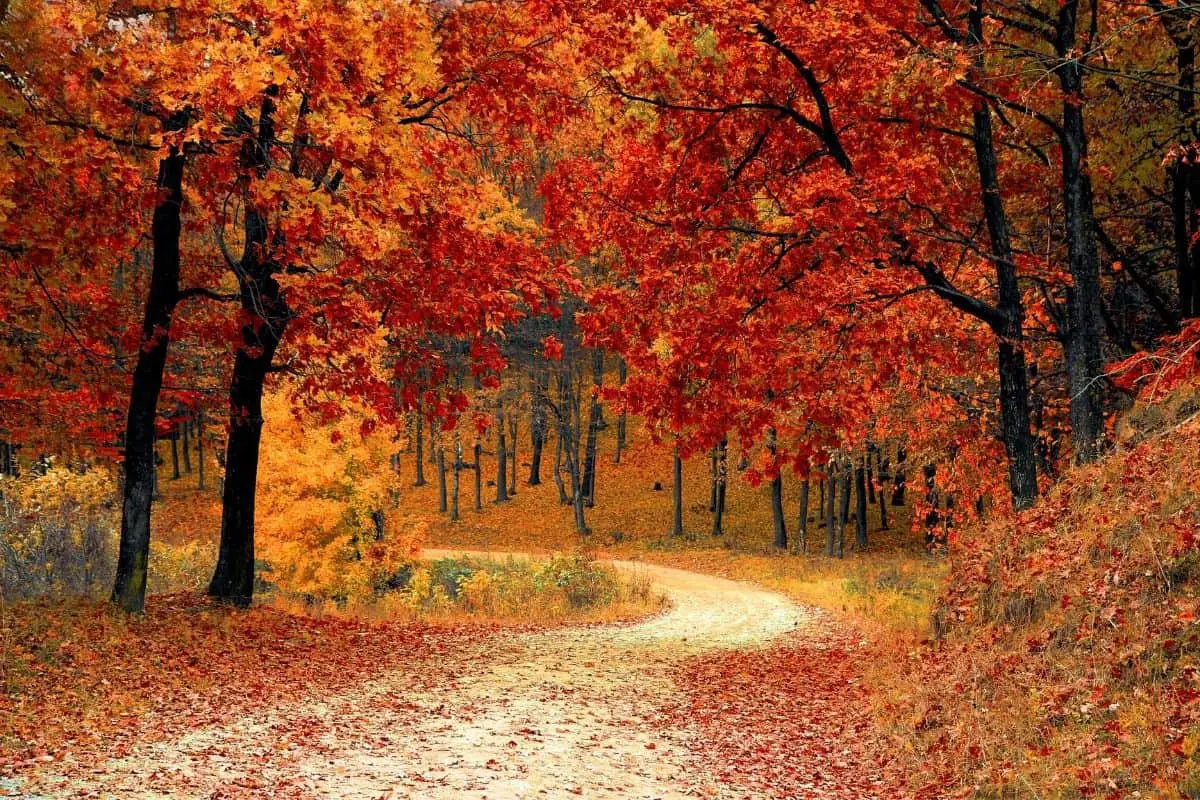
Utilizing Free boondocking spots in Oregon is one of the most popular and cost-effective ways to explore the Pacific Northwest, particularly Oregon. According to a recent report, more than 2.9 million people went camping in Oregon in 2018, an all-time high. Camping allows you to stay close to, or even within, some of Oregon’s most beautiful natural attractions.
| These Boondocking locations are concentrated in the North-West part of Oregon |
Free Boondocking Spots in Oregon
If you don’t mind foregoing basic conveniences like flush toilets and readily available drinking water, you can even find Oregon free campsites. It’s definitely possible to have an epic journey that doesn’t necessarily cost more than staying at home if you already have the equipment, tent camping gear or an RV, and some extra cash for gas and food.
The majority of free camping locations in Oregon are found on public properties, such as National Forests, Bureau of Land Management (BLM) lands, and wilderness areas. Savvy campers won’t have to travel far to discover free camping in Oregon public lands—the state’s public lands make up more than half of the state.
The benefit of dispersed camping, aside from the fact that it is free, is that you will not need to make reservations. Almost all of these campgrounds operate on a first-come, first-served basis. Furthermore, because camping on public lands is rarely crowded, Oregon free camping has the potential to provide beautiful isolation and welcome peace and quiet amid stunning natural surroundings.
Want more ideas to round-out your trip to the North-Western States?
► Idaho, Montana, Oregon, Washington, Wyoming ◄
- 66 Free Central Idaho Boondocking – RV Parking & Camping Spots
- 78 Free Northern Idaho Boondocking – Camping & RV Parking
- 60 Free SE Idaho Boondocking – RV Parking & Camping Sites
- 40 Free SW Idaho Boondocking – RV Parking & Camping
- 198 Amazing Montana Boondocking Sites Including Maps
- 54 Free NE Oregon Boondocking Locations With Maps – North East Section
- 104 Free Boondocking Spots in NW Oregon With Maps – North West Section
- 308 Awesome Washington Boondocking Spaces With Maps
- 38 Free Boondocking Locations in Wyoming With Maps – North East Section
- 49 Free Wyoming Boondocking Campsites With Maps – North West Section
- 44 Free Boondocking Campsites In Wyoming With Maps – South East Section
- 66 Free Boondocking Spots in Wyoming With Maps – South West Section
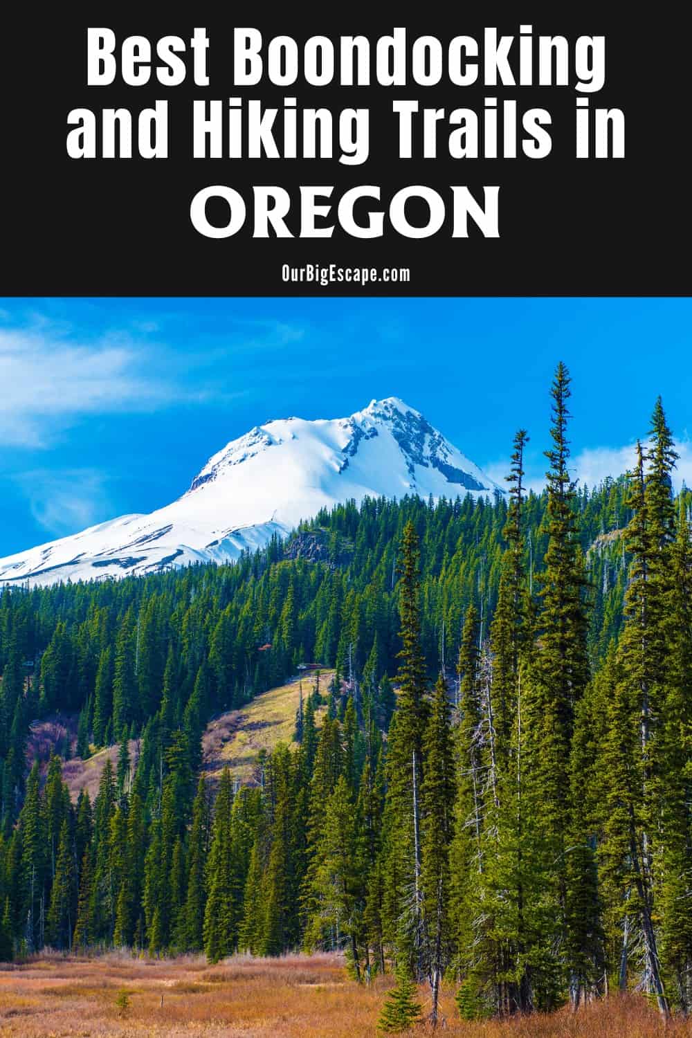
104 Free Boondocking Spots in NW Oregon With Maps
check out our video
1. Hidden Springs
Address
Service Creek-Mitchell Highway
Mitchell, Oregon
GPS: 44.630551, -120.103378
Elevation: 3602′
Management: Public – Bureau of Land Management
Free boondocking spots in Oregon in the Bureau of Land Management Central Oregon District. First come -> first camped. No reservations are accepted. No trouble getting in on my motorcycle but this is a small place and the entrance is badly washed out. Big ruts. Nice view but high clearance 4×4. Too small for anything much bigger than a passenger vehicle in my opinion. GPS coordinates are correct.
2. Just outside Painted Hills Park
Address
Mitchell, Oregon
GPS: 44.63662, -120.295888
Elevation: 2211′
Management: Public – National Park Service (Official)
The road in is Dirt and 3 miles from a paved road. Just outside Painted Hills park is open 08/24/2021. There are 6-15 Oregon free campsites at this location and the maximum RV length is unlimited. Multiple spots with stone fire rings available. Large rigs OK. This place was quiet, just outside of the Painted Hills park limits.
3. Painted Hills NM – Red Hill
Address
Red Hill Trail
Mitchell, Oregon
GPS: 44.633513, -120.291589
Elevation: 2251′
Management: Public – Bureau of Land Management
Free boondocking spots in Oregon in the Bureau of Land Management Central Oregon District. First come -> First Camped. Reservations not accepted.
4. Bridge Creek
Address
34189-34781 Bridge Creek Road
Mitchell, Oregon
GPS: 44.612933, -120.210445
Elevation: 2244′
Management: Public – Bureau of Land Management
Oregon free campsites in the Bureau of Land Management Central Oregon District. Reservations are not accepted at this campsite. Wonderful camping site for Any size camper although caution when wet. Mostly a dirt area so when rain would be a muddy mess. We stayed 5 days and left when rain was forecast – didn’t want to get stuck! Excellent access to John Day National Monument, the painted hills are right here
5. Old Logging Road
Address
Unnamed Road
Mitchell, Oregon
GPS: 44.606228, -120.185928
Elevation: 2881′
Management: Public – Bureau of Land Management
Free boondocking spots in Oregon in the Bureau of Land Management Central Oregon District. No reservations. First come, first served. We found no public access to the road that would lead to these coordinates.
6. Allen Creek Horse Camp
Address
National Forest Development Road 22
Prineville, Oregon
GPS: 44.398283, -120.171986
Elevation: 4810′
Management: Public – Forest Service
Allen Creek Horse Camp is open May-Sep. Located south of Bridge Creek Wilderness, Allen Creek Horse Camp sits among large ponderosa pine trees and along the creek that feeds Allen Creek Reservoir. There are 5 Oregon free campsites which are currently maintained and several corrals on site. There are no manure pits at this campground so the Forest Service requests that you pack out waste from your horses.
7. Rocky Butte
Address
Prineville, Oregon
GPS: 44.393448, -120.573678
Elevation: 4685′
Management: Public – Forest Service (Unofficial)
The road in is Gravel and 3 miles from a paved road. Free boondocking spots in Oregon located in Ochoco National Forest, up a gravel forest road. Large clearing with a couple fire pits and lots of room for tents. Not an official cammpground, but you might run into other campers on the weekends.
8. Ochoco Forest, Near Madas
Address
Prineville, Oregon
GPS: 44.389871, -120.549616
Elevation: 4177′
Management: Public – Forest Service (Unofficial)
Oregon free campsites in the Ochoco Forest, on a dirt road, and easy to find. There were other pullouts. I did not go to the end of the road where a nearby review suggested, as I was traveling in a Class B RV, and the road became steep and very rugged. So I turned around and camped in this particular place.
9. Big Summit Prairie
Address
Prineville, Oregon
GPS: 44.354481, -120.302971
Elevation: 4767′
Management: Public – Forest Service (USDA) (Unofficial)
From Prineville: Jct. of US Hwy. 26 and State Hwy. 27 (Main St.) Travel east on Hwy. 26 for 16.1 miles to County Road 123, turn east onto County Road 123 for 8.5 miles to Forest Road 42, turn Southeast onto Forest Road 42 for 9.5 miles to Forest Road 4210 junction and start of viewing site. Free boondocking spots in Oregon located in Big Summit Prairie.
10. Lower Crooked River
Address
Chimney Rock Trail
Prineville, Oregon
GPS: 44.135103, -120.813072
Elevation: 3041′
Management: Public – Bureau of Land Management
Oregon free campsites located within the Bureau of Land Management Deschutes District. Beautiful campsite and area. This is on a specially designated Wild Scenic River corridor with special protections. Camping is only allowed on designated sites (Campgrounds) only. All the campgrounds are fee (pay sites).
11. Prineville Reservoir WA – Combs Flat – ODFW
Address
Prineville Lake Access Road
Prineville, Oregon
GPS: 44.176775, -120.63182
Elevation: 3238′
Management: Public – State Park
Prineville Reservoir WA – Combs Flat – ODFW is open Apr-Nov. Free boondocking spots in Oregon – No reservations. First come, first served. We left a two star review and need to up it. Decided since we got turned around to just park right therr and not unhook. Worked great for that. Not a place for a large RV to unhook. But there is a small road off to the south that something smaller could set up a nice camp.
12. Prineville Reservoir WA – Owl Creek 2 – ODFW
Address
Prineville Lake Access Road
Prineville, Oregon
GPS: 44.152405, -120.684384
Elevation: 3258′
Management: Public – State Park
Prineville Reservoir WA – Owl Creek 2 – ODFW is open Apr-Nov. These are Oregon free campsites. First come -> first camped. No reservations are accepted.
13. Prineville Reservoir
Address
Prineville, Oregon
GPS: 44.121754, -120.716797
Elevation: 3283′
Management: Public – Bureau of Land Managment (Unofficial)
The road in is Dirt and 10 miles from a paved road. Free boondocking spots in Oregon located in Prineville Reservoir.
14. Four Corners OHV Staging Area
Address
S. Reservoir Road
Prineville, Oregon
GPS: 44.061631, -120.916259
Elevation: 3478′
Management: Public – Bureau of Land Management (Official)
Oregon free campsites – a pretty good site with a bit of dusty soil, we were in a tent and some atvs came by early in the morning which wasn’t great but the camp was safe and spaced out with about 7/8 picnic tables and a some nice juniper trees.
15. Millican Valley OHV – Alfalfa Curves
Address
Alfalfa Curves OHV Staging Area
Bend, Oregon
GPS: 44.06675, -120.948696
Elevation: 3402′
Management: Public – Bureau of Land Management
Free boondocking spots in Oregon in the Bureau of Land Management Deschutes District. First come -> First Camped. Reservations not accepted. Was ok – Just a dirt parking lot off the highway – with a port-a john – Usual highway noise – other then that was ok –
16. Swamp Wells
Address
National Forest Development Road 1816
La Pine, Oregon
GPS: 43.853169, -121.21811
Elevation: 5423′
Management: Public – Forest Service
Located at Swamp Wells, the horse camp offers access to three northbound trails and one southbound trail. Oregon free campsites 4 miles south of Bend, take China Hat Road (18) 6 miles southeast to Bessie Butte, then 6 miles south on Forest Road 1810, and then 3 miles east on Forest Road 1816. Last mile of road is rough and may be difficult for larger trailers.
17. South Millican OHV – Evan Wells
Address
County Highway 2016
Bend, Oregon
GPS: 43.83215, -121.016695
Elevation: 4367′
Management: Public – Forest Service
South Millican OHV – Evan Wells is open all year. Free boondocking spots in Oregon that does not use a reservation system. First come, first served.
18. South Millican OHV – Ford Road
Address
Ford Road
Bend, Oregon
GPS: 43.874086, -120.987046
Elevation: 4226′
Management: Public – Forest Service
Oregon free campsites at South Millican OHV – Ford Road is open all year. This free campsite needs to be updated badly. There really is nothing there, no restrooms no fire rings, etc. you just get to the end of the road and there is a white spot that could hold maybe two or three RVs. It’s a great spot for overnighting but nothing else to keep you there for a sustained amount of time.
19. Oregon Badlands dispersed camping
Address
Bend, Oregon
GPS: 43.949727, -121.017459
Elevation: 3593′
Management: Public – Bureau of Land Management
The road in is Dirt. There are 16-29 free boondocking spots in Oregon at this location and the maximum RV length is 35 feet. You may stay 14 days at Oregon Badlands dispersed camping. Dispersed camping in the Oregon Badlands. Dessert with lava rock. Pretty cool. Saw one other camper down here. The coordinates is just for the start of the road. We found a spot down the way a bit and there was more farther down the road. The road is dirt but it’s not too bad.
20. Alfalfa Mkt Trailhead
Address
Bend, Oregon
GPS: 44.06638, -121.189702
Elevation: 3494′
Management: Public – Bureau of Land Management (Unofficial)
Oregon free campsites near Alfalfa Mkt Trailhead. Have stayed here a couple times over the years with my 34ft Class A coach. Locals park here to walk their dogs, walk or run the various trails or geocaching. There’s a small irrigation canal (like a small creek) to cool weary feet or fido. Max stay is 14 days and expect to have a (mostly friendly) reminder of this stuck to your window around day 10. It’s a little tight getting in and out, I would not recommend a larger vehicle (or trailer combo) as the turn around space is only about 50 ft.
21. Mayfield Pond
Address
Unnamed Road
Bend, Oregon
GPS: 44.083357, -121.130532
Elevation: 3307′
Management: Public – Bureau of Land Management
Free boondocking spots in Oregon in the Bureau of Land Management Deschutes District. First come -> first served. No reservations accepted.
As far as I can tell, this is a place where people get drunk and shoot guns. Nothing wrong with that but beware because it doesn’t make for a peaceful night. The sounds of gunshots are everywhere.
22. Government Owned Training and Firing Range
Address
Redmond, Oregon
GPS: 44.259764, -121.118113
Elevation: 3038′
Management: Public – Government training area (Unofficial)
There is a gate as you come into these Oregon free campsites, but there is nothing saying no camping. There have been several campers here. There is a stream right next to it that gets warm in warm weather and is pretty secluded plus you can practice shooting in this area a little farther down. Was very calm besides a few people driving in every once in awhile. We stayed in a 35ft rv
23. Cyrus Springs Horse Camp
Address
Hagman Rd (Forest Service Road 5750)
Culver, Oregon
GPS: 44.448482, -121.102916
Elevation: 3350′
Management: Public – Forest Service (Official)
You may stay 14 days at Cyrus Springs Horse Camp. Free boondocking spots in Oregon located inside of the Crooked River National Grassland. In 1992 this high desert horse camp was constructed with the help of volunteers amidst the remnants of an old homestead and orchard just a short distance from Haystack Reservoir. The facility is available for horse camping, standard camping, and RV camping opportunities.
24. FR 9710 Dispersed Camping
Address
Bend, Oregon
GPS: 43.92266, -121.34688
Elevation: 4442′
Management: Public – Forest Service (Unofficial)
The road in is Gravel and .3 miles miles from a paved road. There are 1-5 Oregon free campsites at this location and the maximum RV length is 35 feet. You may stay 14 days at FR 9710 Dispersed Camping. Dispersed camping in Deschutes National Forest. The trees are spaced widely apart. There’s little undergrowth and a thick covering of pine needles. It’s only about 1/2 mile from US 97 so expect traffic noise. Very little traffic along FR 9710.
25. Near Lava Land
Address
Bend, Oregon
GPS: 43.911287, -121.388028
Elevation: 4295′
Management: Public – Forest Service (Unofficial)
The road in is Dirt and Less than mile, rough road miles from a paved road. There are 6-15 free boondocking spots in Oregon at this location and the maximum RV length is 25 feet. You may stay 14 days at Near lava land. Take NF 9702 west from Rte 97, using the exit to the Lava Lands Visitor Center, where you will see signs for the Newberry Volcanic National Momument. Follow the signs to the Benham Falls East Trailhead.
26. Benham Falls Dispersed
Address
Sunriver, Oregon
GPS: 43.905651, -121.385238
Elevation: 4357′
Management: Public – Forest Service (Unofficial)
The road in is Dirt and .5 miles from a paved road. There are 1-5 Oregon free campsites at this location. Nothing spectacular, but there are a handful of dispersed sites off NF-9702 on the way to Benham Falls trailhead. There is an unmarked dirt road on the left with several level spots to park. The first couple sites are within 1/10 of a mile from the pushed road and the dirt road is in good condition. No trouble in my station wagon, and would feel comfortable bringing a 20-30 ft rig back here.
27. Lava Cinder Quarry
Address
Sunriver, Oregon
GPS: 43.8657, -121.39272
Elevation: 4524′
Management: Public – Forest Service (Official)
This area is near a Lava gravel pit. Only a half mile off of highway 97 on a paved road. At exit 153 head East a half a mile and you will see the turn in. It is very quiet with a few car driving by. Free boondocking spots in Oregon located in Lava Cinder Quarry. We would stay here again.
28. Deschutes River – Bull Bend Dispersed
Address
La Pine, Oregon
GPS: 43.726645, -121.626988
Elevation: 4285′
Management: Public – Forest Service (Official)
Oregon free campsites on National Forest land along the gorgeous Deschutes River right outside Bend ,Oregon.
29. Wickiup Lakeside
Address
La Pine, Oregon
GPS: 43.72337, -121.78326
Elevation: 4344′
Management: Public – Forest Service (Official)
You may stay 14 days at Wickiup Lakeside. Free boondocking spots in Oregon located along the Deschutes River outside of Bend Oregon where the river dumps in to Wickiup Reservoir.
30. SW Little Hebo Rd
Address
Beaver, Oregon
GPS: 45.16888, -123.72711
Elevation: 1532′
Management: Public – Forest Service (Unofficial)
The road in is Gravel and 2 miles from a paved road. There are 1-5 Oregon free campsites at this location and the maximum RV length is 35 feet. You may stay unlimited at SW Little Hebo Rd.
31. Brown’s Creek
Address
La Pine, Oregon
GPS: 43.72539, -121.81759
Elevation: 4426′
Management: Public – Forest Service (Official)
Two sites very near a busy road that look like they get heavy use. Free boondocking spots in Oregon located less than a mile from its junction with the Cascade Lakes Scenic Byway, turn south from USFS Road 42 (aka South Century Drive) onto an unmarked dirt road and follow it for less than 1/4 mile.
32. Crane Praire Resovior 1
Address
Bend, Oregon
GPS: 43.761166, -121.825714
Elevation: 4451′
Management: Public – Forest Service (USDA) (Unofficial)
The road in is Dirt. You may stay 30 nights in a year at Crane Praire Resovior 1. Crane Prairie is a 4,940-acre reservoir located in the Cascade Mountains. There are 24 miles of shoreline for the Oregon free campsites.
33. Taylor Guard Station
Address
Bend, Oregon
GPS: 43.8146, -122.03586
Elevation: 5167′
Management: Public – Forest Service (Official)
Primitive sites at the end of a primitive road. Free boondocking spots in Oregon located near Taylor Guard Station.
34. Irish and Taylor
Address
National Forest Development Road 600
Bend, Oregon
GPS: 43.809459, -121.959484
Elevation: 5551′
Management: Public – Forest Service
Oregon free campsites in the Deschutes National Forest’s Bend/Fort Rock Ranger District. First come -> First Camped. Reservations not accepted. I’ve been coming here on and off for the past 15 years. Not much has changed except the road keeps getting worse and worse. Do NOT attempt it without high clearance (and ideally 4wd). I did it this past weekend in an Xterra and had to take a second run at one of the rutted hills on the road.
35. Elk Lake Trailhead
Address
Elk Lake Resort Loop
Oregon
GPS: 43.98302, -121.811286
Elevation: 4974′
Management: Public – Forest Service (Official)
The road in is Gravel and <1 miles from a paved road. Elk Lake Trailhead is open May 31-Oct 1. There are 1-5 free boondocking spots in Oregon at this location and the maximum RV length is 35 feet. A loop road at a trailhead. One established campsite with logs for sitting and a huge fire pit. Parking for most sized rigs, but very low clearance vehicles not recommended. Pit toilets. Wilderness hiking access; no OHVs. The road name (Elk Lake Resort Loop) might be confusing. Don’t head to the resort. Make sure to turn West when leaving the highway.
36. Sparks Lake
Address
Bend, Oregon
GPS: 44.016745, -121.733274
Elevation: 5447′
Management: Public – Forest Service (Official)
The road in is Dirt. There are 6-15 Oregon free campsites at this location and the maximum RV length is 15 feet. The road to the boat ramp is a forest road and has at least 7 established sites
37. Edison Butte Sno-Park
Address
National Forest Development Road 45
Bend, Oregon
GPS: 43.932583, -121.598826
Elevation: 5033′
Management: Public – Forest Service
Edison Butte Sno-Park is open all year. Free boondocking spots in Oregon in the Deschutes National Forest’s Bend/Fort Rock Ranger District. No reservations. First come, first served.
38. Deschutes National Forest
Address
Bend, Oregon
GPS: 44.004526, -121.390404
ManagementPublic – Forest Service
Oregon free campsites in Deschutes National Forest is open seasonally. 10 min from Bend. Lots of space. Fire rings. Trees. Flat spots. Can’t beat it!
39. Skyliners Road & NF 4610
Address
Bend, Oregon
GPS: 44.037442, -121.419406
Elevation: 4150′
Management: Public – Forest Service (Official)
Free boondocking spots in Oregon located in the National Forest, so camping is allowed for up to 14 days. There are lots of roads off Skyliners, but this one had somewhat established camp sites and pull offs. The road is dirt and the further you go, the rougher it gets. There are 3 pull off areas within the first 1/4 mile that are the easiest to get to. One is good for up to 26′, the other I saw a Class A parked.
40. Deschutes Dispersed site
Address
Bend, Oregon
GPS: 44.06489, -121.41173
Elevation: 3924′
Management: Public – Forest Service
Oregon free campsites about a quarter mile off the main Forest road just within the Forest boundary. Close to biking trails. Accessible to most vehicles.
41. Blue River Campsite
Address
Oregon
GPS: 44.2179, -122.264
Elevation: 1430′
Management: Public – Forest Service (Official)
The road in is Dirt. There are 1-5 free boondocking spots in Oregon at this location. You may stay 14 days at Blue River Campsite. Free dispersed camping in the McKenzie ranger district. Here we found 4 or 5 sites along the Blue River on unnamed loop roads off NF 15. Unpaved roads may be washed out in the winter but were fine for a small car in spring. No one was around. Fire pits were available.
42. Blue River Resevoir
Address
Rainbow, Oregon
GPS: 44.191498, -122.25862
Elevation: 1375′
Management: Public – Forest Service (Unofficial)
The road in is Paved. There are 1-5 Oregon free campsites at this location. We spent the day here. There was more space and solitude than we knew what to do with. Though we didn’t get the chance to stay over night, there was evidence of other campers and we intend to return, gear in hand.
43. Near Cougar Hot Springs
Address
FR 1985
Rainbow, Oregon
GPS: 44.065475, -122.242271
Elevation: 2461′
Management: Public – Forest Service
Free boondocking spots in Oregon 2 miles from Cougar Hot Springs….travel appx 1 mile past Cougar Hot Springs and take a right on FS road 1985. Go for appx 1 mile and one campsite is in a small clearing on your right….one additional campsite on your left about 50 yards up FS road….
44. East Fork McDuff Foothills Campsite
Address
Oregon
GPS: 44.111978, -122.175439
Elevation: 2392′
Management: Public – Forest Service (Official)
The road in is Dirt. There are 1-5 Oregon free campsites at this location. Beautiful dispersed campsite off NF 1993 in McKenzie River North Ranger District. nice big flat site with lots of places for tents, located high above the East Fork South Fork McCenzie and just south of McDuff Mtn. Two fire pits on two different levels of the campsite, would be good for two groups of people or large groups of friends.
45. Willamette National Forest FR 220
Address
Oregon
GPS: 44.171086, -122.037522
Elevation: 1814′
Management: Public – Forest Service (Official)
The road in is Dirt and 1 miles from a paved road. There are 1-5 free boondocking spots in Oregon at this location. You may stay 14 days at Willamette National Forest FR 220. There are many free dispersed camping options in the beautiful Willamette National Forest…This exact location has 3 large sites right off highway 242. With the large trees and lost creek running near the sites it is very peaceful. Close to some hot springs, the ranger station, and many great hiking/mountain biking options.
46. Alder Springs Campground
Address
Sisters, Oregon
GPS: 44.177723, -121.911484
Elevation: 3671′
Management: Public – Forest Service (Official)
The road in is Paved. There are 6-15 Oregon free campsites at this location. Located on historic McKenzie Pass Highway, surrounded by towering Douglas Fir trees, this is a perfect spot to be on a warm day. Access to Linton Lake Trailhead in the Three Sisters Wilderness is immediately across the highway from the campground.
47. Upper Three Creek Sno-Park
Address
National Forest Development Road 16
Sisters, Oregon
GPS: 44.160252, -121.638082
Elevation: 5164′
Management: Public – Forest Service
Upper Three Creek Sno-Park is open all year. Free boondocking spots in Oregon in the Deschutes National Forest’s Sisters Ranger District. No reservations. First come, first served.
48. Lower Three Creek Sno-Park
Address
Three Creeks Lake Road
Sisters, Oregon
GPS: 44.17765, -121.622568
Elevation: 4820′
Management: Public – Forest Service
Oregon free campsites near Lower Three Creek Sno-Park is open all year. Enjoyed staying at this site last night. It was a Saturday and we had it all to ourselves which was a little surprising, but enjoyable. There is no water but has a pit toilet.
49. Black Pine Springs
Address
Three Creeks Lake Road
Sisters, Oregon
GPS: 44.196232, -121.616603
Elevation: 4367′
Management: Public – Forest Service
Free boondocking spots in Oregon in the Deschutes National Forest’s Sisters Ranger District. Reservations are not accepted at this campsite.
50. Sisters Oregon Dispersed Camping
Address
Bend, Oregon
GPS: 44.24851, -121.49715
Elevation: 3232′
Management: Public – Forest Service
Really like it here, plenty of room. Oregon free campsites with enough room for over 50 campers. Very quiet very clean. Have to go to town for everything – water, dumping but very nice place. We’ll be coming back. Northeast corner of Peterson and Harrington.
51. By the Sisters
Address
Sisters, Oregon
GPS: 44.255508, -121.50233
Elevation: 3232′
Management: Public – Forest Service (Official)
Take the contestant entrance by the Sisters Rodeo grounds. USFS free 14 days. Rings. Large RVs no problem. Free boondocking spots in Oregon By The Sisters.
52. Craig Lake
Address
Old McKenzie Highway
Sisters, Oregon
GPS: 44.249512, -121.837136
Elevation: 5112′
Management: Public – Forest Service
Oregon free campsites in the Willamette National Forest’s McKenzie River Ranger District. First come -> first camped. No reservations are accepted.
53. Sisters Cow Horse Camp
Address
National Forest Development Road 060
Sisters, Oregon
GPS: 44.274241, -121.615033
Elevation: 3409′
Management: Public – Forest Service
Sisters Cow Horse Camp is open Apr-Oct. The maximum RV length at Sisters Cow Horse Camp is 40 feet. Horse campgrounds have been designed to accommodate people who need to corral their horses. We have a limited number of these kinds of campgrounds and ask, out of courtesy and safety for you and the horses, to please consider camping elsewhere if you do not have a horse. We have free boondocking spots in Oregon near Sisters Cow Horse Camp.
54. Willamette National Forest
Address
Sisters, Oregon
GPS: 44.284674, -121.580942
Management: Public – National Park Service (Official)
Road in is dirt two track off main gravel. Oregon free campsites are suitable for high clearance rigs up to 25 ft. I took a mid length bus in. 2 miles from Sisters Oregon. At&t cell service was excellent. I was there 14 days only saw one family in a holiday weekend. Had Mule deer come right through my camp.
55. BLM Boondockle Camping
Address
Redmond, Oregon
GPS: 44.36676, -121.26978
Management: Public – Bureau of Land Management
The road in is Dirt. There are 6-15 free boondocking spots in Oregon at this location. Overlooking/along Deschutes River…no facilities. Complete off grid. Gorgeous views, great water to fish and play.
56. Sisters Boulders
Address
Sisters, Oregon
GPS: 44.369328, -121.452139
Elevation: 2914′
Management: Public (Unofficial)
The road in is Dirt. Oregon free campsites are excellent bouldering spots near Sisters, OR. Dirt parking lot with areas for tents. There used to be fire rings but there are fire bans usually in the summer and into the fall so check before having a campfire.
57. Cold Springs Cutoff
Address
Cold Springs Cutoff
Sisters, Oregon
GPS: 44.341593, -121.602673
Elevation: 3251′
Management: Public – Forest Service (Official)
The road in is Gravel and less than 1 miles from a paved road. There are 1-5 free boondocking spots in Oregon at this location and the maximum RV length is unlimited. You may stay 14 at Cold Springs Cutoff. Dispersed primitive boondocking in Deshutes National Forest. BIG PINES pretty gravel road off the 20 between mile marker 96…forest service market 1012
58. Dollar 9 Lake
Address
Sisters, Oregon
GPS: 44.3946, -121.80475
Elevation: 4446′
Management: Public – Forest Service (Official)
Oregon free campsites among a number of small lakes; numerous wild campsites in the area
59. Ray Benson Sno-Park
Address
National Forest Development Road 2690
Sisters, Oregon
GPS: 44.40435, -121.859526
Elevation: 4783′
Management: Public – Forest Service
Ray Benson Sno-Park is open all year. Free boondocking spots in Oregon in the Willamette National Forest’s McKenzie River Ranger District. Reservations are not accepted at this campsite.
60. Little Nash Sno-Park
Address
13000 U.S. 20
Sisters, Oregon
GPS: 44.43296, -121.958204
Elevation: 3714′
Management: Public – Forest Service
Little Nash Sno-Park is open all year. Oregon free campsites in the Willamette National Forest’s Sweet Home Ranger District. No reservations. First come, first served.
61. Jack Creek Dispersed Site
Address
Camp Sherman, Oregon
GPS: 44.48807, -121.69806
Elevation: 3084′
Management: Public – Forest Service (Official)
Free boondocking spots in Oregon on the north side of Road 1230, opposite the entrance to the formal Jack Creek Campground. Jack Creek flows near this site. Suitable for RVs. Picnic table present. Site is open and visible to the road so privacy is limited.
62. Marion Forks Group Tent Site
Address
Oregon
GPS: 44.476115, -122.017606
Management: Public – Bureau of Land Management (Official)
Oregon free campsites just a short walk from the Marion Forks RV site this campground can accommodate several tent campers (we have had groups as large as 10 tents) close to the creek. Some makeshift fire pits. Room for 3-4 cars (larger RVs will not fit but there is one lower area campsite for 1-2 trailers) 14 day stays allowed,
63. Marion Forks Dispersed Camping
Address
Oregon
GPS: 44.482116, -122.022996
Management: Public – Forest Service (Official)
Marion Forks free boondocking spots in Oregon is open year round. You may stay 14 days at Marion Forks Dispersed Camping. Have stayed here many times for an overnight or week. 14 days free camping, road and camp area can accommodate several large RVs at once. Local waterways can provide fishing for small trout however it is overgrown in many areas, getting to the water can be challenging.
64. Alma Hill
Address
Veneta, Oregon
GPS: 43.91412, -123.41477
Elevation: 1762′
Management: Public (Unofficial)
Oregon free campsites on Hilltop with a great view of sunrise and sunset. It’s pretty windy up top, but nice and quiet with the exception of gunshots from target shooters. It’s a steep climb, but I made it up with a 2wd vehicle. The campsite itself is sort of ugly with littered shotgun shells and burnt tree stumps, but the view is incredible.
65. Vincent Creek Campground
Address
28185 Lower Smith River Road
Reedsport, Oregon
GPS: 43.792752, -123.777338
Elevation: 190′
Management: Public – Bureau of Land Management
Vincent Creek Campground is open May-Sep. These free boondocking spots in Oregon are located within the Bureau of Land Management Umpqua District. This location is at low elevation.
66. Smith River Falls
Address
27023 Lower Smith River Road
Reedsport, Oregon
GPS: 43.784532, -123.814232
Elevation: 105′
Management: Public – Bureau of Land Management
Smith River Falls is open May-Sep. The maximum RV length at Smith River Falls is 20 feet. These Oregon free campsites are located within the Bureau of Land Management Umpqua District. This location is at low elevation.
67. Fawn Creek
Address
27277-27279 Lower Smith River Road
Reedsport, Oregon
GPS: 43.784128, -123.829698
Elevation: 72′
Management: Public – Bureau of Land Management
Fawn Creek is open Jun-Sep. Free boondocking spots in Oregon in the Bureau of Land Management Umpqua District. First come -> first camped. No reservations are accepted. This location is at low elevation.
as previously stated only two sites.
68. Round Lake Campground
Address
Estacada, Oregon
GPS: 44.87611, -121.968613
Elevation: 3613′
Management: Public – Forest Service (USDA) (Official)
Round Lake Campground is open May 18 – Oct 1. There are 6-15 Oregon free campsites at this location and the maximum RV length is small. Free camping for small rigs in the Mt. Hood National Forest. Elevation 3500′. Located on the east end of Round Lake. 6 campsites. Light usage. Two pit toilets. No other services.
69. Siuslaw Power Lines
Address
Oregon
GPS: 43.853421, -124.033524
Elevation: 787′
Management: Public – Forest Service (Official)
According to the Sliusaw National Forest motor vehicle use map on Avenza, free boondocking spots in Oregon is allowed at the “end” of this NFS road (the road continues past a closed gate, the site is at the furthest point you can drive down the road). There is a turnaround, but with such deep ruts that it’s not really usable.
70. Thors Well
Address
Yachats, Oregon
GPS: 44.278415, -124.113525
Management: Public – Forest Service (Unofficial)
Parking lot for Thors well – came around sunset and happily spent the evening alone enjoying the sounds of the waves. Oregon free campsites are not too trafficked at night but some of the large trucks are loud. Beyond that, beautiful spot for sunset and sunrise – with day use areas all around to extend your trip. We saw a couple RV’s parked up and down 101 in turnoffs – none were marked “No Parking”.
71. Gwynn Creek Pullout
Address
Dunes City, Oregon
GPS: 44.26943, -124.10807
Elevation: 30′
Management: Public (Unofficial)
The road in is Paved. Gwynn Creek Pullout is open year round. There are 1-5 free boondocking spots in Oregon at this location. You may stay overnight at Gwynn Creek Pullout.
72. Walker Mountain (ODF/BLM area)
Address
Walton, Oregon
GPS: 44.08703, -123.615898
Elevation: 1178′
Management: Public – Bureau of Land Management (Official)
Oregon free campsites in a beautiful location and views from this pull off on an old logging road. It’s a bit of a haul yo get to, definitely need 4×4 in the rainy season. Pretty steep gravel roads but I made it up with a 4 ton rig (4runner and 12′ trailer). Posting so others can enjoy this beautiful site. No water nearby, beautiful views of the sunset.
73. Lake Creek Falls Wayside
Address
Blachly, Oregon
GPS: 44.15959, -123.57231
Elevation: 689′
Management: Public – Rest Area (Official)
This is a rest stop along Highway 36 just past Triangle Lake on the way to Florence. Free boondocking spots in Oregon located at the Lake Creek Falls Wayside. The vault toilets were dirty and there were signs of gang activity. We spoke with a local showing his mom around the morning after our overnight stay. He was packing s gun and affirmed the gang activity.
74. Upper Lake Creek
Address
Horton, Oregon
GPS: 44.241184, -123.495369
Elevation: 804′
Management: Public – Bureau of Land Managment (Official)
The road in is Paved. Oregon free campsites at Upper Lake Creek is open Year-round. Camp near Hult Reservior, where you can spend the afternoon canoeing, warm water fishing, or explore many miles of forest roads. Then, wander through the surrounding mountains to find the Salem District’s Alsea Recreation Area and Back Country Byway. OHV use is limited to open, existing roads.
75. Hubert Mcbee Memorial Campground
Address
Alsea, Oregon
GPS: 44.331446, -123.502797
Elevation: 758′
Management: Public – Hull Oakes Lumber Mill
Free boondocking spots in Oregon with 9 sites I think. It’s along a large creek with hikes to 2 different waterfalls. Alsea Falls and Green Peak falls. This is a reservation campground only but it is free and has open spots regularly. You do have to travel through one of the campsites to get to the Green Peak trailhead but most people are aware if camped in that spot and kind while traveling through.
76. HWY 101 – Sand Castle Beach Pullout
Address
Waldport, Oregon
GPS: 44.40433, -124.08549
Elevation: 43′
Management: Public (Unofficial)
The road in is Paved. Oregon free campsites at HWY 101- Sand Castle Beach Pullout is open year round. You may stay overnight at HWY 101 – Sand Castle Beach Pullout. Pullout with beach view and access. Stayed one night.
77. Hidden Springs
Address
Service Creek-Mitchell Highway
Mitchell, Oregon
GPS: 44.630551, -120.103378
Elevation: 3602′
Management: Public – Bureau of Land Management
Free boondocking spots in Oregon in the Bureau of Land Management Central Oregon District. First come -> first camped. No reservations are accepted. Stayed here on 6-2018. No trouble getting in on my motorcycle but this is a small place and the entrance is badly washed out. Big ruts. Nice view but high clearance 4×4.
78. Old Logging Road
Address
Unnamed Road
Mitchell, Oregon
GPS: 44.606228, -120.185928
Elevation: 2881′
Management: Public – Bureau of Land Management
Oregon free campsites in the Bureau of Land Management Central Oregon District. No reservations. First come, first served.
79. Bridge Creek
Address
34189-34781 Bridge Creek Road
Mitchell, Oregon
GPS: 44.612933, -120.210445
Elevation: 2244′
Management: Public – Bureau of Land Management
Free boondocking spots in Oregon in the Bureau of Land Management Central Oregon District. Reservations are not accepted at this campsite. Wonderful camping site for Any size camper although caution when wet. Mostly a dirt area so when rain would be a muddy mess. We stayed 5 days and left when rain was forecast – didn’t want to get stuck! Excellent access to John Day National Monument.
80. Painted Hills NM – Red Hill
Address
Red Hill Trail
Mitchell, Oregon
GPS: 44.633513, -120.291589
Elevation: 2251′
Management: Public – Bureau of Land Management
Oregon free campsites in the Bureau of Land Management Central Oregon District. First come -> First Camped. Reservations not accepted. We stayed at a spot on 5/23 Memorial Day weekend. We reached the gate so we turned around and just as we were about to give up we found a camp ring just outside of the barbed wire fence and we made that our camp. It was awesome and we just walked into the park.
81. Burnt Ranch Dispersed
Address
43027-43865 Bridge Creek Road
Mitchell, Oregon
GPS: 44.742771, -120.361178
Elevation: 1453′
Management: Public – Bureau of Land Management
Free boondocking spots in Oregon in the Bureau of Land Management Central Oregon District. First come -> first camped. No reservations are accepted.
82. Dispersed Siuslaw Rd Camping
Address
Mitchell, Oregon
GPS: 44.878006, -120.193356
Elevation: 3871′
Management: Public – Forest Service (Official)
Oregon free campsites along Siuslaw road before you get to Whittaker campground in the national forest. Near the Siuslaw creek and in a level, clean thick forest setting. The road at night becomes quiet. You are at least 200 feet back anyhow.
83. BLM On the John Day River Overlook.
Address
Mitchell, Oregon
GPS: 44.8906, -120.43698
Elevation: 1306′
Management: Public – Bureau of Land Management (Unofficial)
Found BLM land just Down the road from John Day fossil National monument at clarno units. This BLM land was on Clarno Road about a mile south of rte 218. There was a pull off along the road and other than a couple of cars there was no other traffic for the entire night as I overlooked the John Day River, gorgeous mountains, a working farm, and croaking bullfrogs in middle of July. Free boondocking spots in Oregon near the John Day River Overlook. A perfect place to spend the night.
84. Shaniko Ghost Town
Address
Maupin, Oregon
GPS: 45.003841, -120.75372
Elevation: 3340′
Management: Public – City Park
Shaniko is an Old West Style “Ghost Town” that Welcomes you to camp for a fee days and explore their Town! We camped for a couple nights last summer and really enjoyed it! It was hot! However we explored in morning and evening, enjoyed ice cream at the Ice Cream Parlor in the afternoon. We were even able to fill up our camper water tanks in town! We enjoyed the Oregon free campsites and the history and lots of old cars!
85. Deschutes River – Basalt
Address
E-130 Road
Madras, Oregon
GPS: 44.801415, -121.121994
Elevation: 1316′
Management: Public – Bureau of Land Management
Free boondocking spots in Oregon in the Bureau of Land Management Deschutes District. No reservations. First come, first served. This area is on private land and is gated off. The farthest you van go down this road is to Trout Creek Campground, which is not a free campsite.
86. DeschutesRiver – Wingdam
Address
Warm Springs Road
Madras, Oregon
GPS: 44.90181, -121.068564
Elevation: 1220′
Management: Public – Bureau of Land Management
Oregon free campsites in the Bureau of Land Management Deschutes District. This campsite does not use a reservation system. First come, first served.
87. Deschutes River – North Jct
Address
BLM Access Road
Maupin, Oregon
GPS: 44.973566, -121.069462
Elevation: 1093′
Management: Public – Bureau of Land Management
Free boondocking spots in Oregon in the Bureau of Land Management Deschutes District. First come -> First Camped. Reservations not accepted.
88. Keeps Mill Campground
Address
Maupin, Oregon
GPS: 45.15395, -121.5204
Elevation: 2536′
Management: Public – Forest Service (Official)
Oregon free campsites located on the Wild and Scenic White River. Note – the road is pretty rocky and requires a high clearance vehicle.
89. Clear Lake Dispersed Campsites
Address
Government Camp, Oregon
GPS: 45.18363, -121.70416
Elevation: 3497′
Management: Public – Forest Service (Official)
The road in is Dirt and 1 miles from a paved road. There are 16-29 free boondocking spots in Oregon at this location and the maximum RV length is 25 feet. You may stay 14 days at Clear Lake Dispersed Campsites. Turn at Clear Lake Campsite sign off Hwy 26, and proceed towards regular campsites (not free). Turn right about 1/4 mile before these paid campsites at sign saying Clear Lake campsite 1/4 mile ahead.
90. Celilo
Address
Celilo Park Road
The Dalles, Oregon
GPS: 45.650482, -120.960982
Elevation: 177′
Management: Public – Corp of Engineers (Official)
The road in is Paved. Celilo is open year round. You may stay 14 days at Celilo. A pretty little picnic and camping area located along the Columbia River. These Oregon free campsites are located within the Corp of Engineers Northwestern Division’s Portland District. The camping area is near Lake Celilo.
91. Below John Day Dam
Address
Rufus, Oregon
GPS: 45.693352, -120.755364
Elevation: 179′
Management: Public – Bureau of Reclamation (Official)
The road in is Gravel and 1 mile from a paved road. There are 16-29 free boondocking spots in Oregon at this location and the maximum RV length is Unlimited. You may stay 7 days at Below John Day Dam . Fishermans access on Columbia River just below the John Day Dam. Pit toilets in several places on the land. Nice views of the river. A little close to I-84, but there is a berm that blocks most of the traffic noise.
92. Giles French Park
Address
Unknown
Rufus, Oregon
GPS: 45.703075, -120.723419
Elevation: 184′
Management: Public – Corps of Engineers
Oregon free campsites – No fees, 14-day use limit. First-come, first-serve availability; no reservations.
93. Minto-Bingham Gravel Pit
Address
Marion Forks, Oregon
GPS: 44.62834, -121.93677
Elevation: 2507′
Management: Public – Forest Service (Official)
The road in is Gravel and 0.5 miles from a paved road. Minto-Bingham Gravel pit is open snowmelt to snowfall. There are 30 or more free boondocking spots in Oregon at this location and the maximum RV length is unlimited. You may stay 14 days at Minto-Bingham Gravel pit.
94. McCoy Staging Area
Address
Idanha, Oregon
GPS: 44.69184, -122.04126
Elevation: 1900′
Management: Public – Forest Service (Official)
The road in is Paved. McCoy Staging Area is open When clear of snow. There are 30 or more Oregon free campsites at this location and the maximum RV length is unlimited. You may stay 14 days at McCoy Staging Area.
95. Molalla River RA – Red Dog
Address
Table Rock Road
Molalla, Oregon
GPS: 44.980766, -122.387449
Elevation: 1480′
Management: Public – Bureau of Land Management
These free boondocking spots in Oregon are located within the Bureau of Land Management Cascades District.
96. ZigZag Falls Pull Off
Address
Mount Hood, Oregon
GPS: 45.31456, -121.808967
Elevation: 2907′
Management: Public – Forest Service (Unofficial)
The road in is Paved. There are 1-5 Oregon free campsites at this location and the maximum RV length is 25 feet. One of the many pull off sites along Road 39. There is parking for 2 or 3 vehicles and a secluded camping spot with fire pits above the river.
97. Mount Hood Hwy 26
Address
Rhododendron, Oregon
GPS: 45.307128, -121.847558
Elevation: 2326′
Management: Public – Forest Service (Unofficial)
The road in is Gravel and .25 miles from a paved road. There are 1-5 free boondocking spots in Oregon at this location and the maximum RV length is 25 feet. Just off the hwy tucked in the woods, several dispersed campsites. Can hear trucks going by on hwy but pretty quiet otherwise.
98. Snow Bunny Sno Park
Address
Mount Hood Village, Oregon
GPS: 45.35108, -121.97536
Elevation: 1283′
Management: Public – Forest Service (Official)
The road in is Paved. There are 1-5 Oregon free campsites at this location and the maximum RV length is unlimited. You may stay 14 at Snow Bunny Sno Park.
99. Blue Heron French Cheese
Address
2001 Blue Heron Rd
Tillamook, Oregon
GPS: 45.46712, -123.84245
Elevation: 16′
Management: Private – Retail Store (Official)
The road in is Paved. Blue Heron French Cheese is open All year.. There are 1-5 free boondocking spots in Oregon at this location and the maximum RV length is unlimited. You may stay one night at Blue Heron French Cheese.
100. Trask River Dispersed Campsites
Address
Tillamook, Oregon
GPS: 45.410275, -123.612089
Elevation: 453′
Management: Public – State Forest (Official)
Tillamook State Forest, South Fork Dispersed. Designated Oregon free campsites all along Trask River Road. Great spot right by the river. If you go to the Tillamook State Forest website, there are many areas like this. OHV trails. Some logging traffic on the road. Overall a great clean spot.
101. Spirit Mountain
Address
27100 S.W. Salmon River Hwy
Grand Ronde, Oregon
GPS: 45.059425, -123.579323
Elevation: 306′
Management: Private – Casino (Official)
The road in is Paved. Spirit Mountain is open year around. There are 30 or more free boondocking spots in Oregon at this location.
102. Mt Hebo
Address
National Forest Development Road 14
Beaver, Oregon
GPS: 45.221316, -123.72842
Elevation: 3058′
Management: Public – Forest Service
There are a few Oregon free campsites on the road on your way up the mountain. We stayed about 5-6 miles up. It was not a terrible drive in our camper van (an old Chevy G20) just went very slow as it is gravel. It was quiet, for the most part.
103. South Lake
Address
National Forest Development Road 1428
Beaver, Oregon
GPS: 45.20163, -123.722933
Elevation: 2297′
Management: Public – Forest Service
South Lake is open all year. Free boondocking spots in Oregon in the Siuslaw National Forest’s Hebo Ranger District. Reservations are not accepted at this campsite. Nice site!! Beautiful small lake (stocked with fish) with a boat ramp for small non motorized boats. The road on the way in is well maintained loose gravel and pretty steep in some cases… we have a 2 wheel drive high clearance and never had issues with potholes or mud.
104. Big Buck Campground
Address
Agency Creek Rd, Grand Ronde, OR
Midway, Oregon
GPS: 45.1517, -123.6879
Elevation: 781′
Management: Private – Tribal Land (Official)
The road in is Gravel and 0.5 miles from a paved road. Big Buck Campground is open April to October. There are 6-15 Oregon free campsites at this location and the maximum RV length is 25 feet. You may stay 10 Days at Big Buck Campground.
Oregon Free Campsites – US Forest Service and BLM Lands
On the US Forest Service website, go to the Oregon page. Click on the map to learn more about particular national forests and other federally protected sites in Oregon. Sort by location and activity on the Bureau of Land Management website (camping). Look through the results to find your ideal free camping spots in Oregon.
If you already know where you want to travel, stopping by a visitor center or ranger station and speaking with a ranger is an excellent idea. They are the best source of information in the area for fantastic free, dispersed camping.
Free campsites in Oregon are generally found along service roads. U.S. Forest Service roads are denoted by the letters NF-## on maps, whereas roads that go through BLM lands frequently offer multiple free camping alternatives alongside them.
Oregon Coast
There are many free boondocking spots in Oregon along this wind-swept coastline, which is home to soaring sand dunes, gorgeous state parks, and bustling harbors, thoughts melt away. This area is as close to the sea as you can get. All 363 miles of Oregon’s coastline are open to the public, owing to a groundbreaking beach bill. That means you can search for agates or glass floats, catch your own Dungeness crab or razor clam, watch for whales, seals, and puffins, leave footprints in the sand, or simply be enthralled by a winter storm from the comfort of a seaside resort. The Oregon Coast is a revitalizing escape no matter what time of year you visit.
Mt. Hood & Columbia River Gorge
Here in a region where Oregon’s tallest mountain meets the mightiest river, inspiration comes in full force. While enjoying Oregon hiking along towering trees and waterfalls, after farm-fresh feasts showcasing the season, on cozy cabin getaways where the only to-do is snowshoeing, or atop a chairlift admiring the winter wonderland below. Mt. Hood is home to six ski areas and the nation’s longest ski season. The Gorge’s vistas just might take your breath away while enjoying one of the many Oregon free campsites. Whatever your interests, Mt. Hood and the Columbia River Gorge is ready for you.
Camping in the Mt. Hood National Forest
There really isn’t a bad place to camp in the Mt. Hood National Forest. If you don’t like crowds, the Lost Creek Campground off Lolo Pass Road would be a good option for you. It’s near many Oregon hiking trails, such as the ever popular Ramona Falls. Another option is the Green Canyon Campground on the Salmon River.
It does get pretty busy, but there are lots of spots you can hike in to next to the river and camp, and some beautiful trails in the area. While wildly popular, and usually crowded on a sunny weekend, our favorite spot to camp is one of the many Oregon free campsites around Timothy Lake. The forest has many campgrounds. Visit mid-week to avoid crowds. Campgrounds are available by reservation or on a first-come, first-served basis.
Columbia River Gorge
The Columbia River Gorge was designated a National Scenic Area (the largest in America) for good reason. You’d be hard-pressed to find vistas as stunning as these. Oregon free campsites at the western end of the Gorge, the view from Crown Point is a front-row seat to the mighty Columbia as its unfurls and cuts through the Cascade mountains. From there dozens of awe-inspiring waterfalls spill from basalt cliffs, lining the Historic Columbia River Highway, like the famous Multnomah, Bridal Veil and Latourell falls. The landscape seems to grow bigger, grander and brighter as it rolls east.
Bring your sense of adventure because the Oregon free campsites of the Gorge is made for exploring. Walk along a waterfront, discover hidden waterfalls, follow the wildflowers at Rowena Crest or challenge yourself with a trek up Dog Mountain. Cycle the roads around The Dalles or in the Post Canyon mountain bike network. And it’s hard to resist water sports on the Columbia, especially when Hood River is known as the windsurfing capital of the world.
But the Columbia River Gorge isn’t just spectacular scenery. There’s plenty of hand-crafted beer and farm-fresh dining too. Thanks to its unique geography, the Gorge boasts a world of wine – from pinot noir and chardonnay in the cool western hills, to tempranillo and syrah in the drier, sunnier east.
See the Oregon free campsites of the Columbia River Gorge for yourself, and then you’ll understand all the hype.
Smith Rock
At Smith Rock, towers of volcanic ash rise like the spires of a cathedral out of the sage and dust of the high desert at the birthplace of American sport climbing. Whether you come for the climb or come to unwind, you’ll see why Smith Rock is one of the 7 Wonders of Oregon.
Thousands of routes attract climbers from every part of the globe, including more than a thousand bolted routes. Cliffs of tuff and basalt are ideal for rock climbing of all difficulty levels. There is sport climbing, traditional climbing and bouldering. Oregon Hiking and mountain biking and opportunities to spot golden eagles, prairie falcons, river otter and beaver in the park attract even those who don’t come for the climb.
Situated in Central Oregon, home to 300 days of sun a year, Smith Rock is located in an outdoor adventurer’s playground. Golfing, caving, paddle boarding on the Deschutes and skiing Mt. Bachelor are all close by. Mountain bikers can hit Phil’s Trail, while cyclists can take their pick of five scenic bikeways with names like Madras Mountain Views and Sisters to Smith Rock. Hikers will want to explore the obsidian lava flows at Newberry Crater National Volcanic Monument, where astronauts trained to walk on the moon. And craft beer fans, you have your pick of 24 breweries and counting in Central Oregon – 17 in Bend alone.
Smith Rock is a popular attraction and parking can be challenging, especially during the peak season and weekends. Beat the crowds and visit Smith Rock on a weekday. Respect the uniqueness and fragility of this natural wonder and stay on marked trails. Take photographs and leave only footprints.
You May Want to Join Our Boondocking Group on Facebook For More Information
You May Want to Join Our Campfire Recipes Group on Facebook For More Information
Check Out Our Pictures On Instagram – Our Big Escape.