If you have not heard about or visited the Vermilion Cliffs National Monument boondocking locations, you need to do so. The Monument sits in northern Arizona as well as the Paria Canyon-Vermilion Cliffs Wilderness that stretches up and over the southern border of Utah. It is located a short distance from the Arches, Grand Canyon, Bryce Canyon, Zion, Lake Forest, and Petrified National Forest. The views are all incredible, but the Cliffs offer visitors the feeling that they have been swept into a Dr. Seuss illustration. Three dinosaur tracks and also available.
Want more ideas to round-out your trip to Arizona?
A lot of great ideas are in these posts!
- 12 Tucson Boondocking & Tucson Free Camping for Rodeo Week
- 14 Amazing Sedona Free Boondocking Spots Plus UFO Thrills
- 23 Flagstaff Free Boondocking Locations and Free Camping Areas
- 14 Bullhead City Free Boondocking Locations for Cold Winter (Updated 2022)
- 15 Yuma Free Boondocking Locations for Snowbirds (Updated 2022)
- Grand Canyon National Park 20 Amazing Places
- 20 Great Grand Canyon Rim to Rim Best Day Hikes
- Our 15 Best Hikes in Saguaro National Park (Updated 2022)
- 15 Hard Saguaro National Park Hiking Areas
- 249 Amazing Arizona Boondocking Locations With Maps
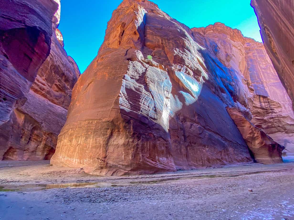
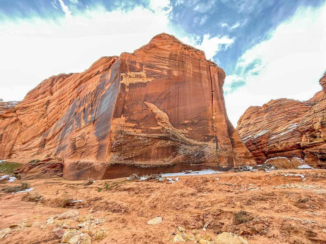
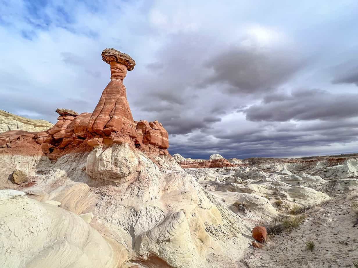
The Vermilion Cliffs are reputed for their white and red swirls of intricately layered Navajo sandstone from the Jurassic period. It obtains its distinct aesthetic for the iron-rich oxide colors within the rocks. Over time, the rocks have been exposed by dinosaurs and erosion. The monument appears Mars-like and is accessorized with endangered California condors. The Cliffs have breathtaking vistas although it has not benefited much from a public reputation as its neighbors.
How to visit Vermilion Cliffs National Monument is one of our most often asked questions. The answer is quite simple, there is free camping in and around the monument, the roads at the monument are easy to navigate and can be done in any vehicle. Just be sure and visit in a month that offers cooler temps. Hiking or visiting in the late spring through early fall are hot and not the optimal time for most visitors.
The Bureaus of Land Management (BLM) oversees the Vermilion Cliffs National Monument, which sprawl across 280,000 acres in the Colorado Plateau at the Utah-Arizona border. The wave unfurls inside a striated mix of gold, rust, and red across the desert floor. The most popular activity is hiking, but people visiting the area also enjoy photography, camping, and wildlife viewing.
History of the Vermilion Cliffs National Monument
People started settling in the region beginning 12,000 years ago and hundreds of Native American pueblos are spread across the monument. The remains of the native’; villages with granaries, homes, and associated homes are found there. The monument also has a large number of rock art sites in the nationally protected area.
People believe that most petroglyphs are the oldest in the U.S.A. Spanish missionaries and explorers from the Dominguez-Escalante expedition that happened in 1776 were the first people to explore the region. Later, Mormon explorers searched the region during the 1860s and some of them settled on the land, which is now inside the monument. In 1871, the explorers built one of the initial ferry crossings on the Colorado River. In that year, John Wesley Powell ventured through the region during the scientific operations of the Colorado River plateau. The same year, John Wesley Powell ventured through the region during the scientific explorations of Colorado’s River plateau.
Beneath the Vermilion cliff, there is a historic Honeymoon Trail. It is a wagon route for Mormons who visited the area to get their marriages sealed inside the temple at St. George, Utah, and then to return. The area that surrounds the monument is generally unspoiled with virtually zero permanent residents remaining and few roads.
The national monument was founded in the year 2000 and it covers 1,186 square kilometers (458) square miles. It has range elevations of 3,100 to 7,100 feet.
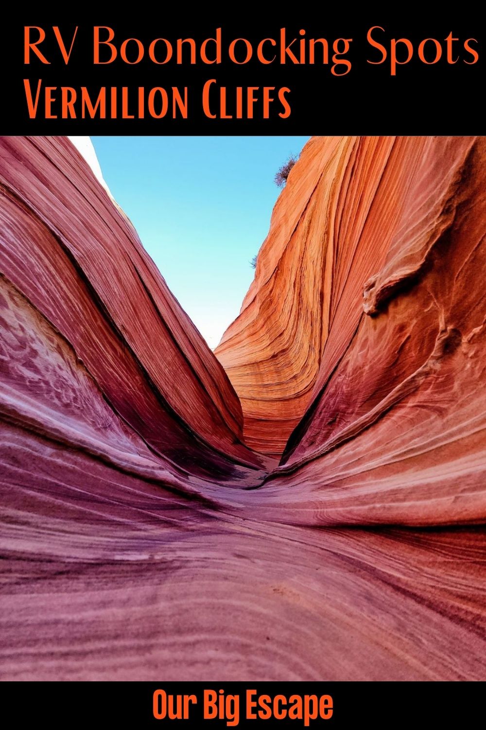
18 Great Vermilion Cliffs National Monument Boondocking Locations
check out our video
1. Vermilion Cliffs National Monument Monument Boondocking Locations – White Pocket Campground
Address
Marble Canyon, Arizona
GPS: 36.954567, -111.893695
Elevation: 5679′
Management: Bureau of Land Management
White Pocket Campground is open All year. Extremely hard-to-reach primitive campsite which requires 4WD and an hour of driving through deep sand. If wet, road is impassable. Campfire is allowed. The road into this Vermillion Cliffs National Monument free campsite area is dirt
Best Reviews:
None

2. Vermilion Cliffs National Monument Boondocking Sites – Burma Creek Road
Address
North Rim, Arizona
GPS: 36.709911, -112.101284
Elevation: 6617′
Management: Bureau of Land Management
The road into this Vermillion Cliffs National Monument boondocking area is dirt and 3 miles from a paved road. There are 6-15 campsites at this location. You may stay 14 at Burma Creek Road.
Best Reviews:
Large designated BLM campsites with spectacular views off Burma Creek Road. Each site is large. I found multiple fire rings at the site I picked. The sites are in a burn area, so there is lots of standing firewood. No services. Pack in pack out.
Dirt service road, that requires high clearance and 4×4 once beyond a few hundred yards from the paved highway. Larger rigs can stay in the area immediately off the paved highway, but shouldn’t proceed beyond that. I would only go further in a truck camper with high clearance, 4×4, and dry road conditions. No cell coverage with Verizon or TMobiles, even with a booster.
3. Vermilion Cliffs National Monument Boondocking Spots – Stateline BLM CG
Address
House Rock Valley Rd
Kanab, Utah
GPS: 37.001373, -112.035271
Elevation: 4994′
Management: Bureau of Land Management
The road into this Vermillion Cliffs National Monument free campsite area is dirt and 9 miles from a paved road. Stateline BLM CG is open Year-round. There are 1-5 campsites at this location. From Page, AZ, drive west on Highway 89 for 34 miles (55 kilometers).
Best Reviews:
Drive past the BLM Contact Station and the road to the White House trailhead. Turn left onto House Rock Valley Road. This road is compacted dirt. The Stateline Campground is 9.3 miles (14.9 kilometers) down this dirt road, which can be impassable when wet. It is one mile south of the Wire pass Trailhead.
4. Vermilion Cliffs National Monument Boondocking Locations – Wire Pass TH
Address
House Rock Valley Road
Kanab, Utah
GPS:37.019219, -112.025083
Elevation: 4875′
Management: Bureau of Land Management
Free Dispersed camping in the Bureau of Land Management N/A District. First come -> first camped. No reservations are accepted. The road into this Vermillion Cliffs National Monument boondocking area is dirt.
Best Reviews:
None
5. Vermilion Cliffs National Monument Boondocking Sites – Kaibab Forest
Address
Forest Service Road 225, Kaibab National Forest, AZ
Kaibab National Forest, Arizona
GPS: 36.726663, -112.174015
Elevation: 7725′
Management: State Forest
The road into this Vermillion Cliffs National Monument free campsite area is dirt and 2 miles from a paved road. There are 1-5 campsites at this location and the maximum RV length is 35 feet. Unofficial sites, found several of them, fireplaces etc. so i guess camping is tolerated. Hidden from the main road, but close and very good dirt road.
Best Reviews:
Great site. Packed dirt road made for easy access in our truck. 4×4 not needed. Nice open area camp sites with fire pits. Very peaceful. Tall pines make for plenty of shade. Also believe we passed another 4 or 5 blm roads that would have lead to spots just as nice in either direction.
6. Vermilion Cliffs National Monument Boondocking Spots – FSR 258A
Address
Jacob Lake, Arizona
GPS: 36.731555, -112.181293
Elevation: 7653′
Management: National Forest Service
The road into this Vermillion Cliffs National Monument boondocking area is dirt and .1 miles from a paved road. There are 1-5 campsites at this location and the maximum RV length is 35 feet.
The road in is Paved. ET Highway Rest Area is open year round. The maximum RV length at ET Highway Rest Area is unlimited. You may stay overnight at ET Highway Rest Area. 2.5 mi. east of Kaibab Plateau Visitor Center on Hwy 89A. On right hand side. A pull off and unmarked forest service road.
Best Reviews:
None
7. Vermilion Cliffs National Monument Boondocking Locations – NF Road 482 Jacob Lake, AZ
Address
Arizona
GPS: 36.734933, -112.199533
Elevation: 7694′
Management: National Forest Service
The road into this Vermillion Cliffs National Monument free campsite area is dirt and 1 miles from a paved road. NF Road 482 Jacob Lake, AZ is open All Year. There are 1-5 campsites at this location and the maximum RV length is unlimited. You may stay 14 at NF Road 482 Jacob Lake, AZ.
Best Reviews:
Great place to boon dock in the National Forest only 1 hour from the North Rim of Grand Canyon. The Jacob Lake Inn is very helpful and can both accept trash and supply water for a fee you decide yourself. The Kaibab Camper Village have a dump site for $12.
8. Vermilion Cliffs National Monument Boondocking Sites – Vermilion Cliffs /Soap Creek
Address
Marble Canyon, Arizona
GPS: 36.75014, -111.71654
Elevation: 4052′
Management: Bureau of Land Management
The road into this Vermillion Cliffs National Monument boondocking area is dirt and .5 miles from a paved road. Unmarked dirt road into BLM land just east of where Hwy 89-Alt crosses Soap Creek. The gate is not locked but there are cattle in the area so keep it closed. The dirt road forks south of the gate… left is 4WD, right is 2WD.
Best Reviews:
Stayed in October 20 , the only sketchy spot is just inside the gate 1000 ft or so . Walk around the bend before comitting. May not be passable if it has rained recently. I filled a couple of putts with local rocks and made it with 24ft Leisure Van , 12,000lbs without 4WD . the rest wasn’t problematic at all , solid and amazing. Stay right and follow the wild horse path all the way to the Canyon. beautiful , clean , private plenty of room , flat.
9. Vermilion Cliffs National Monument Boondocking Spots – Buckskin Gulch Trailhead
Address
House Rock Valley Road
Kanab, Utah
GPS: 37.067022, -112.000565
Elevation: 4846′
Management: Bureau of Land Management
Free Dispersed camping in the Bureau of Land Management Kanab District. First come -> first camped. No reservations are accepted. The road into this Vermillion Cliffs National Monument free campsite area is dirt.
Best Reviews:
None
10. Vermilion Cliffs National Monument Boondocking Locations – Jacob Lake Dispersed Camping
Address
Forest Service Road 461, Arizona
Fredonia, Arizona
GPS: 36.708215, -112.236567
Elevation: 7936′
Management: National Forest Service
The road into this Vermillion Cliffs National Monument boondocking area is Gravel and 2 miles from a paved road. There are 6-15 campsites at this location.
Best Reviews:
We were recommended by some rangers in the Forest Service Office to some dispersed campsites just southwest of Jacob Lake in the Kaibab National Forest. Go South out of Jacob Lake along 67 and turn right (West) on 461, following signs for the “Kaibab Camp R Village.” Go past the RV village and into the Forest Land, and look for open, flat campsites with rock fire rings.
11. Vermilion Cliffs National Monument Boondocking Sites – Badger Creek Campground
Address
Marble Canyon, Arizona
GPS: 36.77642, -111.659206
Elevation: 3886′
Management: Bureau of Land Management
The road into this Vermillion Cliffs National Monument free campsite area is dirt 4×4 and 3 miles from a paved road. There are 6-15 campsites at this location. Primitive Campsite overlooking Badger Creek Rapids on the Colorado River. Free, unmaintained.
Best Reviews:
This campsite is seriously amazing. I drove here in a Ford Fusion and made it all of the way to the end so don’t worry about your car not being able to make it. I camped at the end but walked along near all of the other sites and you can’t go wrong wherever you want to go. Incredible views, feels remote and overall great experience. Cell service was also perfect for AT&T users.
12. Vermilion Cliffs National Monument Boondocking Spots – Paria River off HWY 89
Address
Kanab, Utah
GPS: 37.105995, -111.903359
Elevation: 4389′
Management: Bureau of Land Management
Free BLM camping in large gravel pit overlooking Paria River. No facilities. The road into this Vermillion Cliffs National Monument boondocking area is dirt and 1 miles from a paved road. The maximum RV length at Paria River off HWY 89 is any. You may stay 14 Nights at Paria River off HWY 89.
Best Reviews:
Awesome site! Camped here mid June,2021. Huge gravel lot with maybe 4 or 5 fairly level spots but plenty if room for any size rig. Stayed here 11 days. Page is 30 miles, anything you need is there. Don’t miss Horseshoe Bend and the Toadstools trail. Many other trails in the area too, ask at the BLM office. A trail a local told me about is a must see and not far from camp.
13. Vermilion Cliffs National Monument Monument Boondocking Locations – FR 212 Dispersed
Address
Unnamed Road
Fredonia, Arizona
GPS: 36.617361, -112.245416
Elevation: 8248′
Management: National Forest Service
Free Dispersed camping in the Kaibab National Forest’s North Kaibab Ranger District. First come -> first camped. No reservations are accepted. This is a high elevation location. The road into this Vermillion Cliffs National Monument free campsite area is dirt.
Best Reviews:
Lots of space and was fairly quiet while we were there, and that was over Memorial Day Weekend.
14. Vermilion Cliffs National Monument Boondocking Sites – FSR 241 Kaibab National Forest
Address
North Rim, Arizona
GPS: 36.556214, -112.145452
Elevation: 8559′
Management: National Forest Service
Free campsites all along the forest service roads of the Kaibab National Forest- not just road 241. The road into this Vermillion Cliffs National Monument boondocking area is dirt.
Best Reviews:
Stop by the Forest Service visitor center at Jacob Lake to get a free paper map of the Forest Service roads. The road in is Dirt and varies miles from a paved road. FSR 241 Kaibab National Forest is open Highway 67 (paved) is closed in winter (Nov-May 15). There are 30 or more campsites at this location and the maximum RV length is 15 feet. You may stay unknown at FSR 241 Kaibab National Forest.
15. Vermilion Cliffs National Monument Boondocking Spots – Waterline Rd.
Address
Kanab, Utah
GPS: 37.09795, -112.18751
Elevation: 5778′
Management: Bureau of Land Management
Primitive spots, no amenities, flat and spacious. Great cell service. A couple of miles of easy dirt road away from the highway. The road into this Vermillion Cliffs National Monument free campsite area is dirt.
Best Reviews:
Great camp among ancient cedars, fabulous views all around. I would not attempt the road in wet conditions.
16. Vermilion Cliffs National Monument Boondocking Locations – Grand Staircase Escalante NM – Kitchen Corral Wash
Address
508
Kanab, Utah
GPS: 37.140144, -112.091635
Elevation: 5358′
Management: Bureau of Land Management
Free Dispersed camping in the Bureau of Land Management N/A District. Reservations are not accepted at this campsite. The road into this Vermillion Cliffs National Monument boondocking area is dirt.
Best Reviews:
This place is awesome. Very exposed, but the wide open space is beautiful. Gazing up at the stars while playing my guitar was just what I needed! Very level ground. My sons were able to ride bikes and fly the drone.
17. Vermilion Cliffs National Monument Boondocking Sites – Glen Canyon NRA West AZ (MUST CAMP 300 FEET FROM CORALS OR YOU WILL BE EVICTED)
Address
Page, Arizona
GPS: 36.994201, -111.60102
Elevation: 4176′
Management: National Park Service
The road into this Vermillion Cliffs National Monument free campsite area is dirt. There are 1-5 campsites at this location. A couple of free, dispersed campsites along a dirt road on Glen Canyon National Recreation land just west of Lake Powell. No facilities provided nor reservations accepted.
Best Reviews:
This site is 10 miles from Page, AZ and has easy access. Room for about 6 rigs in the main area. There are more spots for tents or vans. This site has some awesome views and areas to hike and explore. Cell service very bad unless you have a booster and then still is not very good. The site we were in had broken glass, and some barbed wire.
18. Vermilion Cliffs National Monument Boondocking Spots – Paria Townsite
Address
Paria, Utah
GPS: 37.18595, -111.99542
Elevation: 5338′
Management: National Forest Service
Hwy 89, approximately MP 30.5 Utah, North side of roadway. Large gravel parking area, fairly level. Quiet place to park overnight or leave your large RV and drive north on dirt road to townsite area for hiking or scenic photo opportunity. The road into this Vermillion Cliffs National Monument boondocking area is dirt.
Best Reviews:
It’s pretty noisy, being so close to the highway, but it wasn’t all-night long noisy. Another car pulled next to me during the night, so it must be a well-used spot. Elk were squeaking the next morning, that was pretty cool.
The Top 7 Hiking Trails Near the Vermillion Cliffs National Monument
There are no marked trails in Vermilion Cliffs as much as the areas that hikers love, and you need a Vermilion Cliffs National Monument permit to hike in many of them. Based on where you wish to hike, you need to enter a lottery in person or online. You may also buy a permit if you scan a QR code at the trailhead. There are however a number of Vermilion Cliffs National Monument hikes that are free.
On the day you intend to hike, carry a gallon of water and ensure that every member drinks the entire gallon, even during the winter. This is a hiker’s paradise. Therefore, bring the sturdiest shoes you have since most iconic sights can only be accessed by foot. When traversing any desert plain, it is essential to carry extra food, gasoline, water, and sunscreen. The best time to visit Vermilion Cliffs National Monument are the cooler months like September, October and April and May.
If you are visiting the monument as a group, it would help if you knew the physical limits of every group member and avoid pushing them beyond what they can do. There have been reports of people dying as they hike in the Vermilion Cliffs wilderness, usually from dehydration and heat exhaustion. The top 10 trails to hike include:
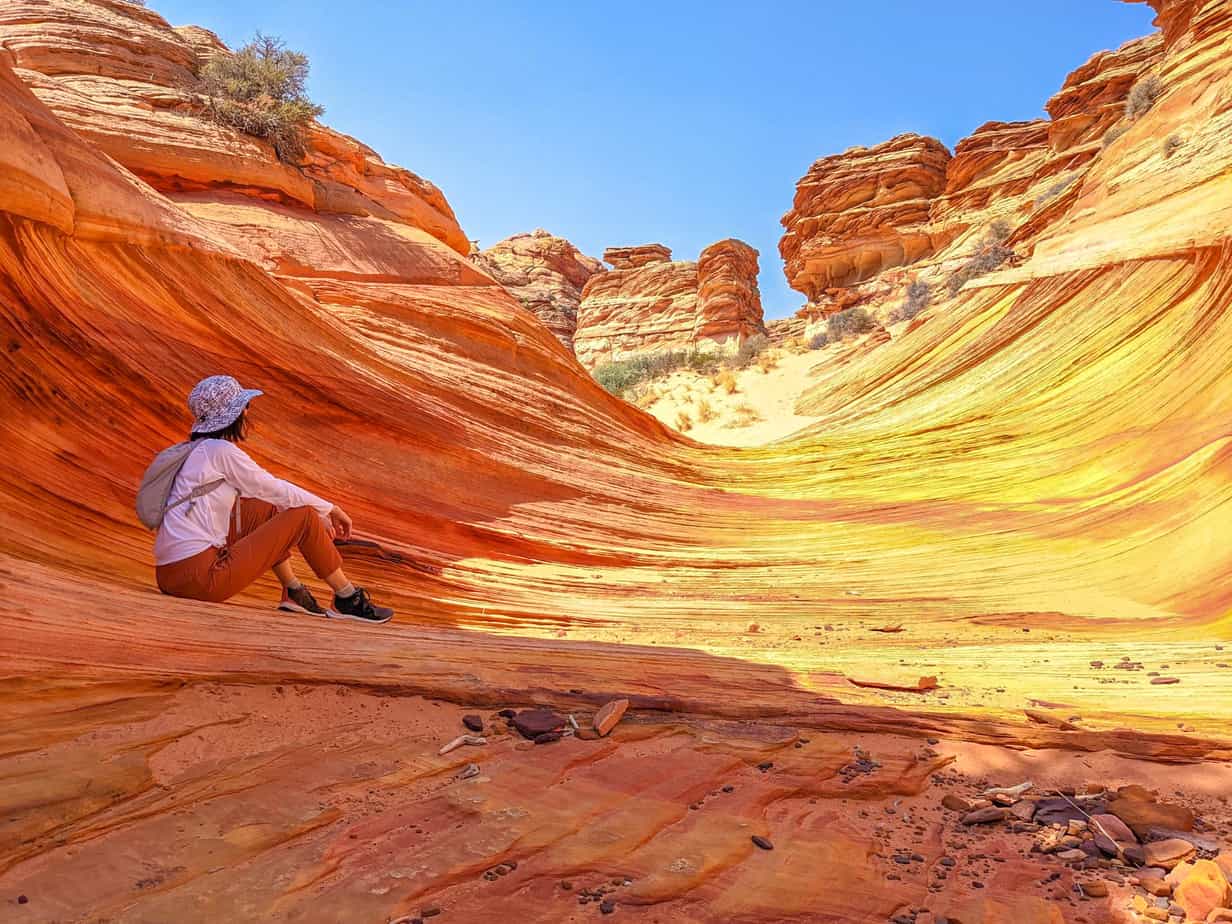
Vermillion Cliffs National Monument Hiking Trail #1. Coyote Buttes North (The Wave)
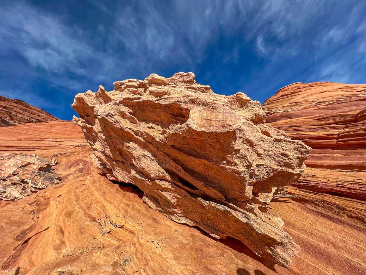
This is a strenuous, 6.4-mile roundtrip hike that starts at a riverbed and passes across a challenging train. Directional markers or marked trails do not exist. Therefore, it is necessary to have a compass and map to find your way. After getting to the wave, you can continue to a second wave formation, dinosaur tracks, petroglyphs, and natural arches.
This trail is an unmarked route in the northern Coyote Buttes and is a portion of the Paria Canyon. It is the biggest draw at the Vermilion Cliffs. The wave is small and the hike starts at a designated parking area along a rough dirt road, near Highway 89 in Utah. This trail follows an arroyo for a short distance, heading south across the colorful desert. You need a hiking permit from the Bureau of Land Management or apply for it through the lottery application.
Length: 6.7 mi
Elevation gain: 1,233 ft
Route type: Out & back
Hiking, Dog friendly, Views, Wildflowers, Rocky
Vermillion Cliffs National Monument Hiking Trail #2. Coyote Buttes South
To manage your way, you need great navigation skills to get around the area since no marked trails exist. Furthermore, you need a high clearance, 4-wheel drive car because the roads leading into the permitted area cuts through the deep sand. Each year, unprepared, inexperienced drivers become stranded on these roads.
Length: 25.0 mi:
Elevation gain: 1,384 ft
Route type: Loop
Dogs on leash, Hiking, OHV/Off-road driving, Wildlife, Off trail, No shade
Vermillion Cliffs National Monument Hiking Trail #3. Paria Canyon
Hikers need to follow the Paria River, walk on the trails along it or through the water. You may get wet even while using the trails. You may also go as far as you need. Experienced backpackers can even make a five-day trip to the Paria Canyon. You can get permits through a lottery to get an overnight stay.
Length: 14.9 mi
Elevation gain: 905 ft
Route type: Out & back
Backpacking, Camping, Hiking, Dog friendly, River, Views, Wildflowers, Wildlife
Vermillion Cliffs National Monument Hiking Trail #4 White Pocket
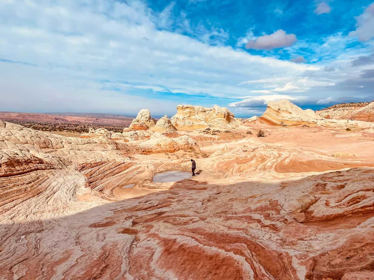
No marked trails exist to see the whitish-grey sandstone formations. Therefore, you need sturdy wayfinding skills to get to them, and a 4-wheel drive, high clearance vehicle. Visiting this unique landscape is worth it.
Length: 1.5 mi
Elevation gain: 160 ft
Route type: Loop
Kid friendly, Hiking, Nature trips, OHV/Off-road driving, Walking, Dog friendly, Views, Off trail, No shade
Vermillion Cliffs National Monument Hiking Trail #5 Buckskin Gulch
This is a 20-mile hike that one can complete after a few days. The trail navigates through the deepest and longest slot canyon, in the American Southwest. Be ready for obstacles, including pools, rocks, possible flash floods, and escapable quicksand. You also need to bring some ropes for some of the tricky spots.
Length: 11.2 mi
Elevation gain: 1,246 ft
Route type: Out & back
Hiking, Nature trips, Dog friendly, River, Views, Wildflowers, Wildlife, Rocky, Off trail, No shade, Fee
Vermillion Cliffs National Monument Hiking Trail #6. Coyote Wash Trail
This is an 8.0-kilometer trail, which is lightly trafficked out and back situated close to the Marble Canyon, Arizona, featuring a river and is excellent for all skill levels. This trail is mainly used for walking, hiking, bird watching, and nature trips.
Length: 5.0 mi
Elevation gain: 426 ft
Route type: Out & back
Hiking, Nature trips, Walking, Bird watching, River, Views, Wildlife, No shade
Vermillion Cliffs National Monument Hiking Trail #7. Toadstool Hoodoos
Technically, the spot is slightly over the border close to the Grand Staircase-Escalante National Monument. However, it is there, and mentioning it is not too fun. You can tackle the hoodoos in an easy 1.5-mile hike. Throughout the Vermilion Cliffs exploration, get the joy of exploring it in a non-destructive, responsible manner. The serendipity of exploring and stumbling on things indicating evidence of past life includes small little burrows of organisms, root structures.
Length: 1.8 mi
Elevation gain: 141 ft
Route type: Out & back
Dogs on leash, Kid friendly, Hiking, Nature trips, Walking, Bird watching, Running, Views, Rocky, No shade
Things to Do At Vermilion Cliffs National Monument
This desolate landscape consists of steep eroded portions of sandstone, the Vermilion Cliffs, shale, and limestone. The erosion process lasts for millions of years and it reveals hundreds of colorful layers. The remote wilderness consists of steep mesas, canyons, and waves.
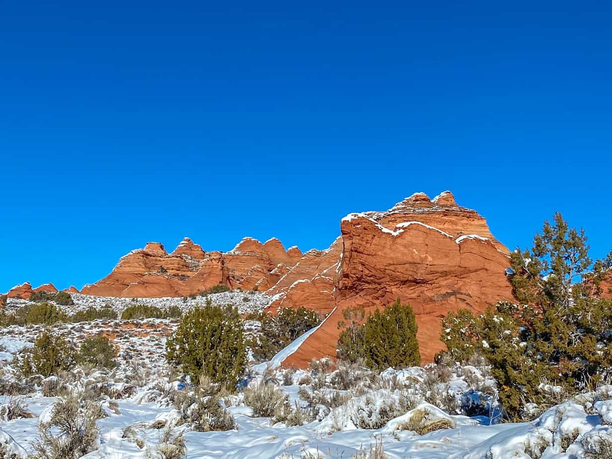
Apart from seeing the attractive sites, you can hike at several hiking sites. The hiking trails are undeveloped, and you should therefore be skilled in navigating them with a compass and map. During the summer, temperatures may exceed 120 degrees F, and during the winter, there usually is snow on the ground. The most appropriate months to visit include April, May, September, and October.
There are no scenic drives or visitor centers at the Vermilion Cliffs. However, the geologic chest treasures at this monument offer some of the weirdest landscapes in the world. It has swirling sandstone formations, shapes, and spectacular colors.
The other activity you can engage in at the Vermilion Cliffs is camping and or boondocking. Some of the greatest options include the various campgrounds surrounding the National Monument. On the side of the border near Arizona, you can camp in the Lees Ferry Campground that provides basic amenities such as water and toilets.
On the park’s other side, there is Condor viewing in the monument’s campground. You can camp there. The place has toilets, freshwater, and a large binocular to observe endangered California Condor, which lives inside the national monument.
Another place to camp is the Stateline Campground. This is a rudimentary free campground that has a pavilion, clean bathrooms, and picnic table across the border close to Kanab.
You May Want to Join Our Boondocking Group on Facebook For More Information
You May Want to Join Our Campfire Recipes Group on Facebook For More Information