
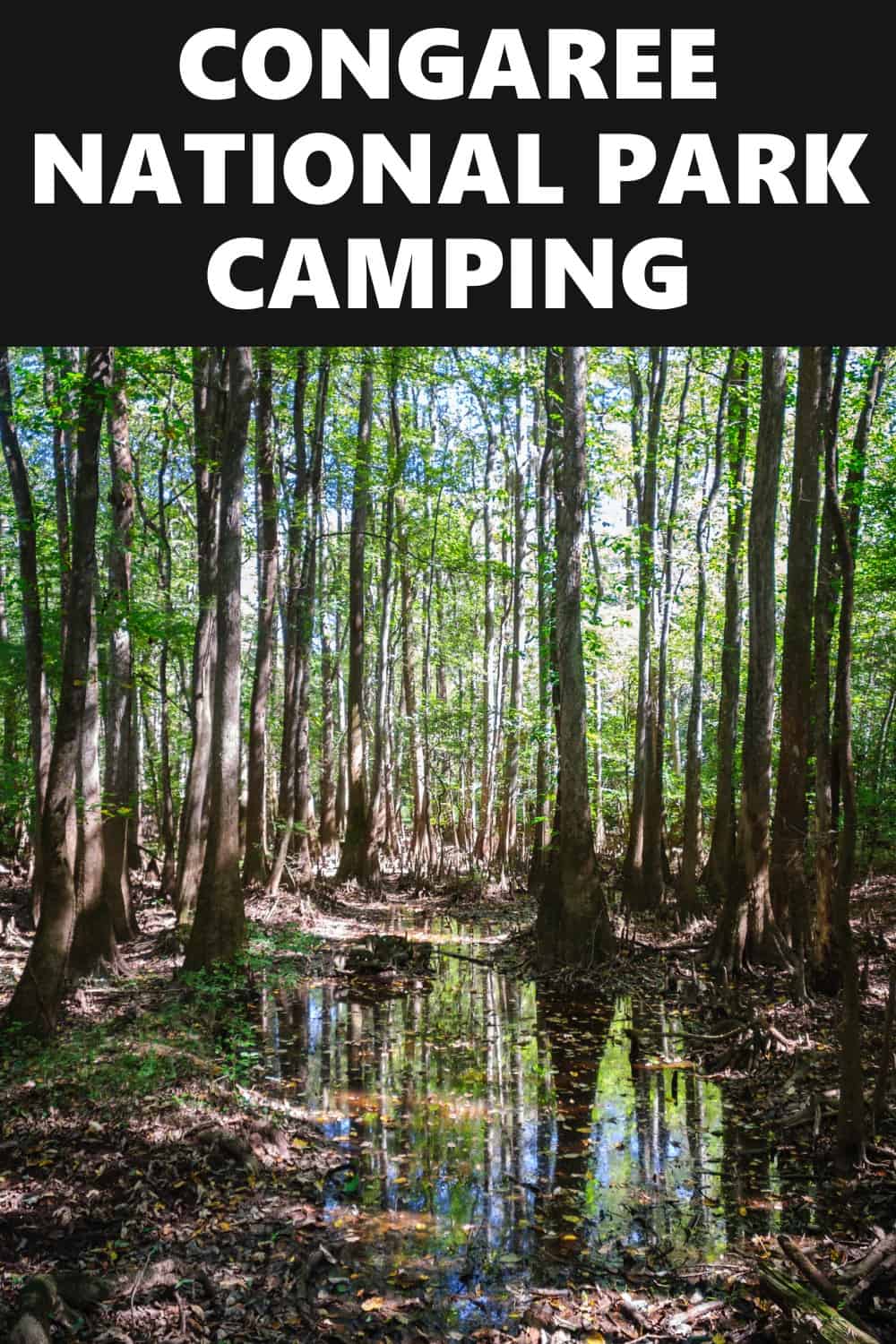
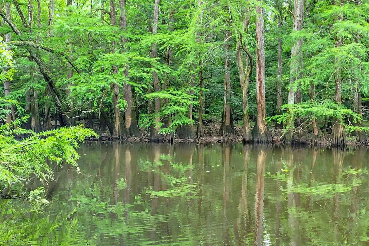
I experienced an unbelievable adventure into Congaree National Park, and encountered some incredible stuff. Some of America’s ancient oaks can be spotted there, sheltered, and preserved. Beautiful old pine trees that are taller and wider than you can conceive sleep calmly in the woods and swamp. Congaree respects these extraordinary inhabitants in great reverence and ensures their safety.
Want more ideas to round-out your trip to South Carolina?
A lot of great ideas are in these posts!
- 18 Congaree National Park Boondocking (Updated 2022)
- 26 Free South Carolina Boondocking Spots – RV Parking & Camping
There are so many fantastic things to see and do in the National Park, and this article will make sure you are aware of all that awaits you inside. It is a habitat of great biodiversity and the biggest undisturbed area of ancient shallow root hardwood woodland existing in the Southeastern United States.
This is sufficient to make you want to go to the park and see the beautiful scenery for yourself. Whereas the area is navigable throughout the year, I recommend visiting in the fall and spring when conditions are at their best and insects are often absent. It is vital to come equipped with appropriate apparel and shoes when touring the park.
History of the Congaree National Park
Congaree began life as a historical site, gaining that classification in October 1976, and was later named an International Biosphere Reserve by the United Nations Educational, Scientific, and Cultural Organization in 1983. Congaree was designated as a federal park on November 10, 2003, earning it the 57th state park in the United States.
Despite being one of the most cramped national parks in terms of area, Congaree contains a wealth of human and environmental antiquity. Before European adventurers emerged on the continent, the valley was inhabited by the Congaree Indians.
18 Prime Boondocking Spots Near The Congaree National Park
check out our video
1. Congaree National Park Boondocking Locations – Cracker Barrel Orangeburg
Address
Orangeburg, South Carolina
GPS: 33.555615, -80.823508
Elevation: 322′
Management: Retail Business
Typical Cracker Barrel parking lot. Plenty of room for our rig on the back edge of the parking lot. Was able to put out the slides and run our inverter generator all night. It is pretty noisy since it is right beside the interstate and the roads near the lot are pretty busy at night. Be aware that they empty the dumpsters at about 3am in the morning and that large bang can scare you! We ate breakfast inside and the service was slow as they are understaffed. They are also still using the limited COVID menu. Our biscuits were very stale/hard. The phone was just constantly ringing and nobody was answering it. The road into this Congaree National Park free campsite area is paved.
Best Review:
None

2. Congaree National Park Boondocking Sites – Walmart Orangeburg
Address
2795 North Rd
Orangeburg, South Carolina
GPS: 33.52496, -80.88996
Elevation: 200′
Management: Retail Business
The road into this Congaree National Park boondocking area is Paved. There are 6-15 campsites at this location and the maximum RV length is unlimited.
Best Review:
Asked inside, permission granted, after considerable discussion, by a delightfully ragtag group of cashiers who eventually decided I should park “out by the gas station”, which I did. Entire lot very well lit and reasonably quiet. No security seen, no one moving about lot that I saw, and no sweeper.
3. Congaree National Park Boondocking Spots – Walmart Supercenter #4379
Address
Columbia, South Carolina
GPS: 34.030131, -81.107781
Elevation: 213′
Management: Retail Business
The road in is Paved. Walmart Supercenter #4379 is open year round. There are 30 or more campsites at this location and the maximum RV length is unlimited. You may stay overnight at Walmart Supercenter #4379. Walmart Supercenter.
Best Review:
Trucks and RVs regularly overnight here. This particular store is currently conducting a “Going out of Business” sale (everything is 50% off as of 04 FEB 21), so uncertain what will become of the property when the store finally closes. The road into this Congaree National Park free campsite area is paved.
4. Congaree National Park Free Campsites – Walmart
Address
2010 Paxville Hwy
Manning, South Carolina
GPS: 33.700019, -80.22707
Elevation: 125′
Management: Retail Business
The road into this Congaree National Park boondocking area is paved.
Best Review:
None
5. Congaree National Park Boondocking Locations – Bob Cat Boat Landing
Address
Bamberg, South Carolina
GPS: 33.336903, -81.020401
Elevation: 142′
Management: State Forest
The road into this Congaree National Park free campsite area is paved.
Best Review:
Stayed here in October of 2021 ..nice level parking lot. A lot of locals come through here but they dont seem to bother much. I have had a few stop and talk but mostly they just pull in and out. Cops do cruise the area once or twice daily but did not stop to speak with me. Town a few miles a way. No bathrooms or water for drinking. Be a nice swimming place as there are swings and a ladder doing up a tree I assume to jump into the water. If you like in city camping it would be a good spot.
6. Congaree National Park Boondocking Sites – Palmetto Trail – Alston
Address
Alston Road
Peak, South Carolina
GPS: 34.24324, -81.316734
Elevation: 238′
Management: County Park
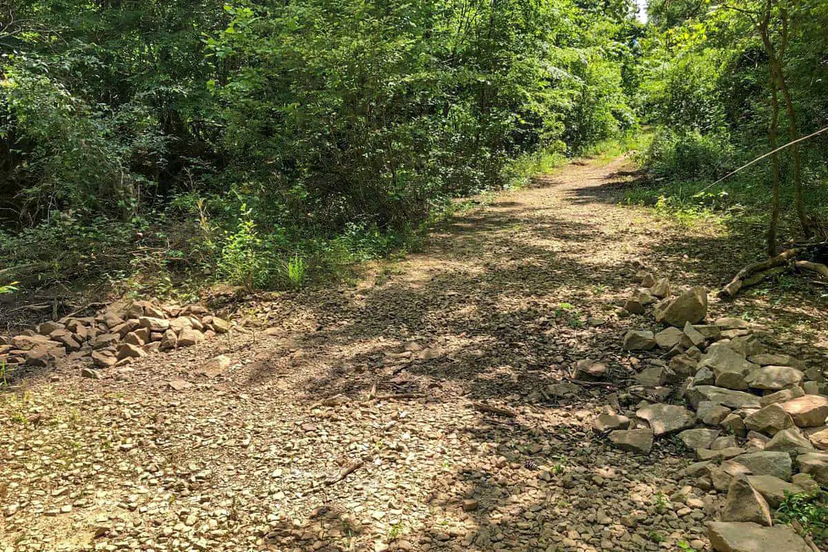
The road into this Congaree National Park boondocking area is Gravel. There are 1-5 campsites at this location.
Best Review:
Tent site has level gravel smooth pad with brick fire pit, completely wooded, but you must park out front and walk into the campground which isn’t bad, very nice and right next to the trailhead to mountain bike.
7. Congaree National Park Boondocking Spots – Palmetto trail (hike-in)
Address
Little Mountain, South Carolina
GPS: 34.241688, -81.332267
Management: State Forest
Free boondocking -> no reservations. The road into this Congaree National Park free campsite area is dirt.
Best Review:
I stayed at the head of the trail my first night. But this spot is definitely better. I was truck camping but a small RV might fit. Picnic tables and some benches, probably room for 3 cars. There is one private driveway nearby, make sure you don’t park in front of it. Entrance isn’t marked and kind of hard to find, lookup on a map beforehand. Also it is a good hiking trail. GPS Coordinates I used are N34degrees14’28.6″ W081degrees19’58.2″
8. Congaree National Park Free Campsites – SCE&G Boat Ramp #4
Address
Batesburg-Leesville, South Carolina
GPS: 34.0801, -81.52065
Elevation: 417′
Management: Public Boat Ramp
Free camping by tent allowed here for 7 days before having to move as posted. The road into this Congaree National Park boondocking area is paved.
Best Review:
Not sure how welcoming they are for RV’s. You can not put up a tent within 50 feet of the boat ramp, in fact recommended to pitch away from it as the sounds of boats being launched can be loud. Quite a large area to put a tent by the water with plenty of areas and if you willing to walk a few 100 feet, you can be away from the parking lot and boat ramp. Services including a 24/7 bathroom. No drinkable water here so bring in your own. Area sometimes can be busy from cars and boats and occasional loud parties from houses across the lake. Excellent place to view a sunset or sunrise. Ants can be a nuisance as well as no see ums here. There are no fees of any kind here.
9. Congaree National Park Boondocking Locations – Florence Walmart/Sams
Address
Florence, South Carolina
GPS: 34.19283, -79.82174
Elevation: 135′
Management: Retail Business
Basic Walmart layout, get permission.
Best Review:
Stayed one night. Came in around 10pm. Huge parking lot. There were about 7 to 8 semi trucks parked for the night In the back. Just your standard night at Walmart. The road into this Congaree National Park free campsite area is paved.
10. Congaree National Park Boondocking Sites – Rest area I-77
Address
Lando, South Carolina
GPS: 34.7639, -81.03535
Elevation: 528′
Management: Rest Area
The road in is The road into this Congaree National Park boondocking area is Paved. Rest area I-77 is open All year. There are 30 or more campsites at this location and the maximum RV length is unlimited. You may stay 1 night at Rest area I-77. Rest areas on both north and south bound sides of I-77 Not much listed in this area, it’s okay for a rest area.
Best Review:
None
11. Congaree National Park Boondocking Spots – Marsh Wildlife Management Area
Address
Murray Road
Gresham, South Carolina
GPS: 33.983033, -79.4709
Elevation: 47′
Management: Fish and Wildlife Service
The road into this Congaree National Park free campsite area is Dirt and 3.65 miles from a paved road. There are 1-5 campsites at this location. You may stay 4 days at Marsh Wildlife Management Area.
Best Review:
This place is awesome! We’re the only ones here, no hook ups of any kind but since we’re all alone we hooked up the generator for the evening. 2 Best Things: Seclusion and Open space for kids to play. 2 Negatives: Road coming in was all dirt and some nifty potholes, there is a minimal amount of garbage in old campfire spots. Biggest surprise was the stack of free firewood by each of the fire pits.
12. Congaree National Park Free Campsites – Clinton Pilot Station
Address
12818 Highway 56 North
Clinton, South Carolina
GPS: 34.50859, -81.8578
Elevation: 630′
Management: Truck Stop
The road into this Congaree National Park boondocking area is Paved. Clinton Pilot Station is open all year. There are 1-5 campsites at this location and the maximum RV length is 35 feet.
Best Review:
You may stay a few hours at Clinton Pilot Station. Overnight RVparking at a truck stop. There is a parking lot on the south side where you can take up two spaces if needed. There is a small road system off of the parking lot where you can walk a pet, but it is heavily littered.
13. Congaree National Park Boondocking Locations – Wambaw ORV Area / Campsite
Address
Shulerville, South Carolina
GPS: 33.13913, -79.63445
Elevation: 49′
Management: National Forest servcie
Wambaw ORV Area / Campsite is open year round. There are 1-5 campsites at this location and the maximum RV length is 45 feet. You may stay 14 days at Wambaw ORV Area / Campsite. The road into this Congaree National Park free campsite area is dirt.
Best Review:
Friendly host. Camping is free. Several campsites with room for trailers. Campsites are pretty well furnished with a table and benches. Has pit toilets. Pack your trash out. It is an OHV facility with very limited camping for riders. People ride the trails 24/7 and camp spaces are next to the trail so not camper friendly, for those seeking a campground.
14. Congaree National Park Boondocking Sites – Oaks at South Point Parking Lot
Address
Yemassee, South Carolina
GPS: 32.630097, -80.879363
Elevation: 16′
Management: Public
The road into this Congaree National Park boondocking area is Paved. The maximum RV length at Oaks at south point parking lot is unlimited. Easy to find, right off highway 17.
Best Review:
Wendy’s, McDonalds, subway, waffle house all close by. Some highway noise and sirens throughout the night. One other RV was there when we got there but plenty of room for multiple rigs. It’s nothing fancy but it works for a quick overnight and back on the highway in the morning.
15. Congaree National Park Boondocking Spots – Halfway Creek Trail Camp
Address
Halfway Creek Road
Huger, South Carolina
GPS: 33.056686, -79.696588
Elevation: 46′
Management: National Forest Service
The road into this Congaree National Park free campsite area is dirt. There are 1-5 campsites at this location. You may stay 14 nights at Halfway Creek Trail Camp.
Best Review:
Very nice, very quiet, other campers were friendly and polite, very nice trail system, very nice sites that are flat, perfect for hiking and mountain biking.
16. Congaree National Park Free Campsites – Honey Hill Campground
Address
Jamestown, South Carolina
GPS: 33.174488, -79.561241
Elevation: 33′
Management: National Forest Service
The road into this Congaree National Park boondocking area is Gravel and 1/4 miles from a paved road. Honey Hill Campground is open Year Round. There are 6-15 campsites at this location. You may stay 14 Days at Honey Hill Campground.
Best Review:
Stayed in 38′ class A motorhome. No problem getting in or out. Was pretty quiet, but I suppose it depends on other people that are there. Sherriff drove by everyday.
17. Congaree National Park Boondocking Locations – Woodbury WMA
Address
Woodbury Road
Gresham, South Carolina
GPS: 33.85934, -79.332878
Elevation: 23′
Management: Fish and Wildlife Service
There are 1-5 campsites at this location. You may stay 4 days at Woodbury WMA. The road into this Congaree National Park free campsite area is dirt.
Best Review:
Primitive camping is available at boat ramps located within the property’s boundaries. These include Sampson Landing, Sanders Landing and Parker Landing located on the tributaries of the Little Pee Dee River and Tanyard Landing located on the Great Pee Dee River. No facilities. Nothing other than space is provided. Pack it in, pack it out. When it comes to poo: Bury it, or carry it out when you leave.
18. Congaree National Park Boondocking Sites – Elmwood Recreation Area
Address
McClellanville, South Carolina
GPS: 33.198958, -79.470065
Elevation: 71′
Management: National Forest Service
The road into this Congaree National Park boondocking area is Paved. Elmwood Recreation Area is open Year Round. You may stay 14 Days at Elmwood Recreation Area. There is a vault toilet and water to use.
Best Review:
The camp spots are along a cul-de-sac and there is a police officer that drove through once a day. We loved this place not just for the campsite but for the activity around it. About two miles down the road is a little place called BJ’s. Ben and Shirley are the owners and the place was amazing. Also about a mile past that is an old plantation house that was a complete surprise. It was amazing to see all of the history this place had. George Washington even visited while touring the south. All in all it was a great place to camp close enough to my. Pleasant and Charleston. We would highly recommend!
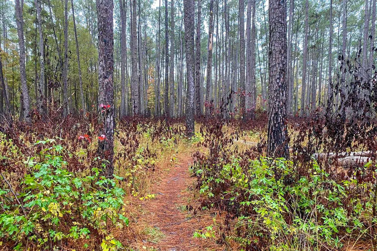
9 Great Congaree National Park Hiking Trails
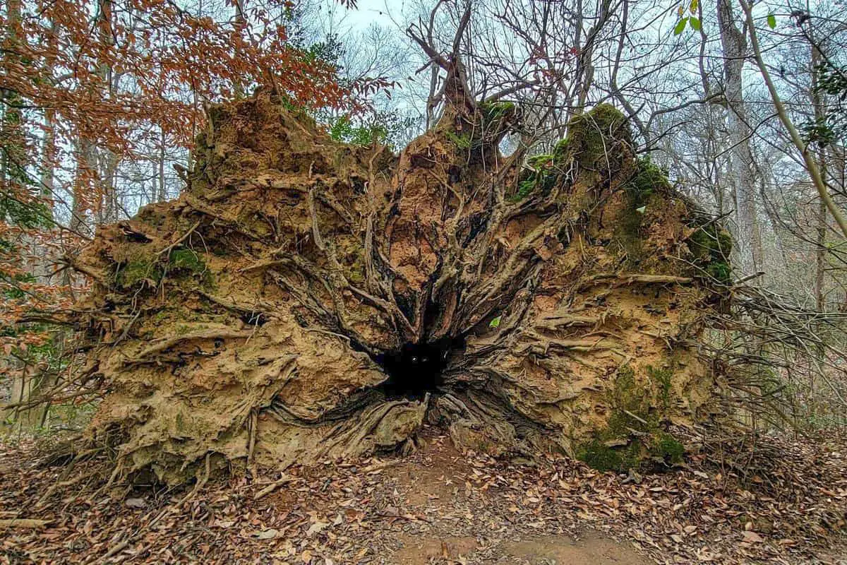
Congaree National Park has eight great hiking routes (and one for kayaking) to choose from. The park is open for you and maintains its attractiveness throughout the year. Make a point of going, getting outside, and absorbing as much outdoors as you possibly can.
Congaree National Park Hiking Trail #1 – Oak Ridge Trail
One of the greatest spots to see animals in the area is on the 6.3 mile Oak Ridge Trail. Because it is a less frequently traveled track, you are more likely to have the location to yourself. Such a beautiful and interesting hike! The oak ridge (and most hikes) begin along the boardwalk, which is 2 miles long and fascinating.
Length: 6.3 mi
Elevation gain: 19 ft
Route type: Loop
Dogs on leash, Kid friendly, Hiking, Bird watching, Running, Forest, River, Views, Wildlife, Over grown
Congaree National Park Hiking Trail #2 – Kingsnake Trail
An 7.8 mile Kingsnake track is Congaree National Park’s largest hiking path. It starts about 6 miles as from park entrance, at the Cedar Creek Canoe Launch park lot. The track is the finest for birdwatching in the national park due to the lack of regular trekkers and bushes in this area. It is one of the park’s most tranquil hikes.
Length: 7.8 mi
Elevation gain: 22 ft
Route type: Out & back
Dogs on leash, Kid friendly, Hiking, Walking, Bird watching, Running, Forest, River, Views, Wildlife
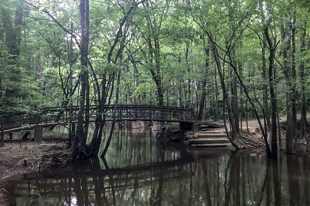
Congaree National Park Hiking Trail #3 – Boardwalk Trail
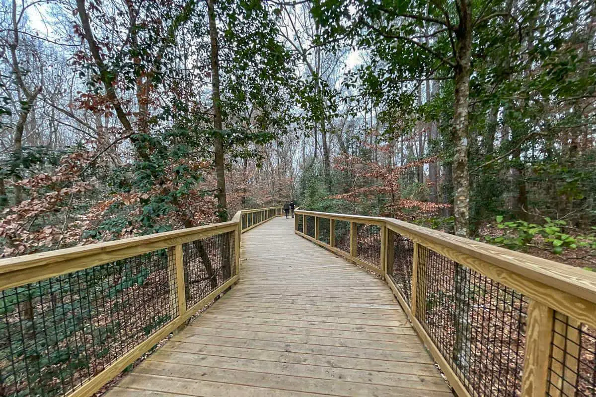
This 2 mile Boardwalk track is Congaree National Park’s best beautiful and attractive hiking path. It starts on an overhead stretch before splitting. All along, there are seats every several 100 feet. This trail is raised nearly 6 feet above the forest floor, the elevated boardwalk winds through a diverse old-growth forest. Use the self-guided brochure and listen for woodpeckers hammering away in the tall trees above.
Length: 2.0 mi
Elevation gain: 9 ft
Route type: Loop
Dogs on leash, Wheelchair friendly, Kid friendly, Stroller friendly, Camping, Nature trips, Walking, Bird watching, Forest, Lake, Paved, River, Views, Wildflowers, Wildlife
Congaree National Park Hiking Trail #4 – Sims Trail
The simplest trekking route in Congaree National Park is this 2.4 mile hike. The walk is wide and flat since it parallels an old dirt road, albeit the gravel driveways have long ago disappeared.
Length: 2.4 mi
Elevation gain: 9 ft
Route type: Out & back
Dogs on leash, Kid friendly, Hiking, Nature trips, Walking, Bird watching, Forest, Views, Wildflowers, Wildlife, Bugs
Congaree National Park Hiking Trail #5 – Bluff Trail
The Harry Hampton Visitor Center is surrounded by the 2.1 mile Bluff trail. It starts at the visitor center’s rear, traverses the park entrance road, leads to the Bluff Campground, and then returns along a small stretch of the elevated Boardwalk trail. When you are looking for a short and simple hike in the national park, this is the place to go.
Length: 2.1 mi
Elevation gain: 19 ft
Route type: Loop
Dogs on leash, Kid friendly, Hiking, Forest, Views, Wildflowers, Wildlife
Congaree National Park Hiking Trail #6 – Weston Lake Trail
The 4.6 mile trail starts and terminates at the Boardwalk trail’s opposite ends. On this trail, I have met a lot of trekkers and photographers. It is also said to be a good path to trek if you are preparing for a 10 km since it is 6.3 miles long when you include the Bluff trail it adds up to 10 kilometers.
Length: 4.6 mi
Elevation gain: 16 ft
Route type: Loop
Dogs on leash, Kid friendly, Hiking, Walking, Bird watching, Running, Forest, Lake, Views, Wildflowers, Wildlife
Congaree National Park Hiking Trail #7 – River Trail
The River route starts at Cedar Creek on the Weston Lake trail and meanders through the ancient forest eventually branching into a curve and ultimately reaching the Congaree River. The path then returns to Cedar Creek, where it began. River Trail is a 9.9 mile moderately trafficked loop trail located near St. Matthews, South Carolina that features a river and is good for all skill levels. The trail offers a number of activity options and is accessible year-round.
Length: 9.9 mi
Elevation gain: 52 ft
Route type: Loop
Dogs on leash, Backpacking, Camping, Hiking, Nature trips, Running, Forest, River, Wildflowers, Wildlife, Blowdown,
Bugs, Muddy
Congaree National Park Hiking Trail #8 – Bates Ferry Trail
This 2.3 mile circuit hike traces a historic path that formerly led to a Congaree River ferry connection. It is the simplest hike in the park. The tourist center is around 15 kilometers from the car park, which is located on Highway 601.
Length: 2.3 mi
Elevation gain: 6 ft
Route type: Out & back
Kid friendly, Hiking, Nature trips, Walking, Bird watching, Running, Forest, River, Views, Over grown
Congaree National Park Hiking Trail #9 – Congaree River Blue Trail
This is a long distance kayaking route, not a hiking trail. This 46.8 mile lightly trafficked point-to-point trail located near Columbia, South Carolina that features a river and is rated as moderate. The trail is primarily used for fishing. Users may encounter rattle snakes and wild-boar in this area.
Length: 46.8 mi
Elevation gain: 6 ft
Route type: Point to point
Fishing, Paddle sports, Beach, Forest, River, Views
Places to See and Things to Do in Congaree National Park
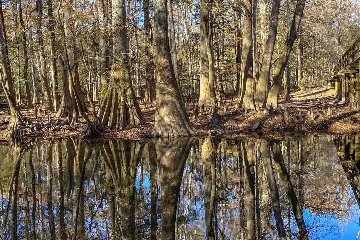
● The Weston Lake Loop is a great place to start. This circular place is around 5 miles in length and is among the most frequented sites in the park. That is the ideal entrance to the park’s enormous trees, streams, and an opportunity to see and enjoy a few of the park’s famed flooding, natural vegetation, and some wildlife.
● It offers a spectacular view of synchronized fireflies and is a once-in-a-lifetime opportunity. Throughout the breeding season, these fireflies will glow in tandem. It only happens from May through June, so prepare your plans accordingly.
● Kayaking is a great way to get a more in-depth look at the park. One can view so much of the park this way than you would on foot. There are miles of waterways to tour, and you will have the opportunity to view turtles, otters, crocodiles, and uncommon aquatic birds along the way.
● Make a point of stopping by the Harry Hampton Visitor Center, which is chock-full of information, instructional materials, and movies, as well as a tribute to the person that made it all conceivable.
● Trek the Boardwalk trail, which is the most favorite trek. Its 2.1 mile length includes several of the park’s best notable features, such as magnificent trees, spectacular plants, and far more.
You May Want to Join Our Boondocking Group on Facebook For More Information
You May Want to Join Our Campfire Recipes Group on Facebook For More Information