We wanted a place with natural beauty and the Chiricahua National Monument provided just that We had wondered where to visit and unwind from the hustle and bustle of the city and heard about the Chiricahua National Monument so that became a destination.
A friend of mine recommended the Chiricahua National Monument, and we loved it so much we decided to write about my experience and share our videos and photos as well.
Want more ideas to round-out your trip to Arizona?
A lot of great ideas are in these posts!
- 18 Saguaro National Park Boondocking (Update 2022)
- Top 10 Chiricahua National Monument Boondocking Locations
- 18 Great Vermilion Cliffs National Monument Boondocking Locations
- 17 Free Canyon de Chelly National Monument Boondocking Spots
- 16 Casa Grande Ruins National Monument Free Camping and Boondocking Spots
- 91 Free Northern Arizona Boondocking Locations
- 15 Grand Canyon Parashant National Monument Boondocking (Updated 2022)
- 8 Ironwood Forest Monument Boondocking (Updated 2022)
- 12 Free Organ Pipe Cactus Monument Boondocking (Updated 2022)
- 17 Agua Fria National Monument Boondocking (Updated 2022)
- 10 Great Monument Valley Boondocking (Updated 2022)
- 11 Awesome Catalina State Park Boondocking Locations
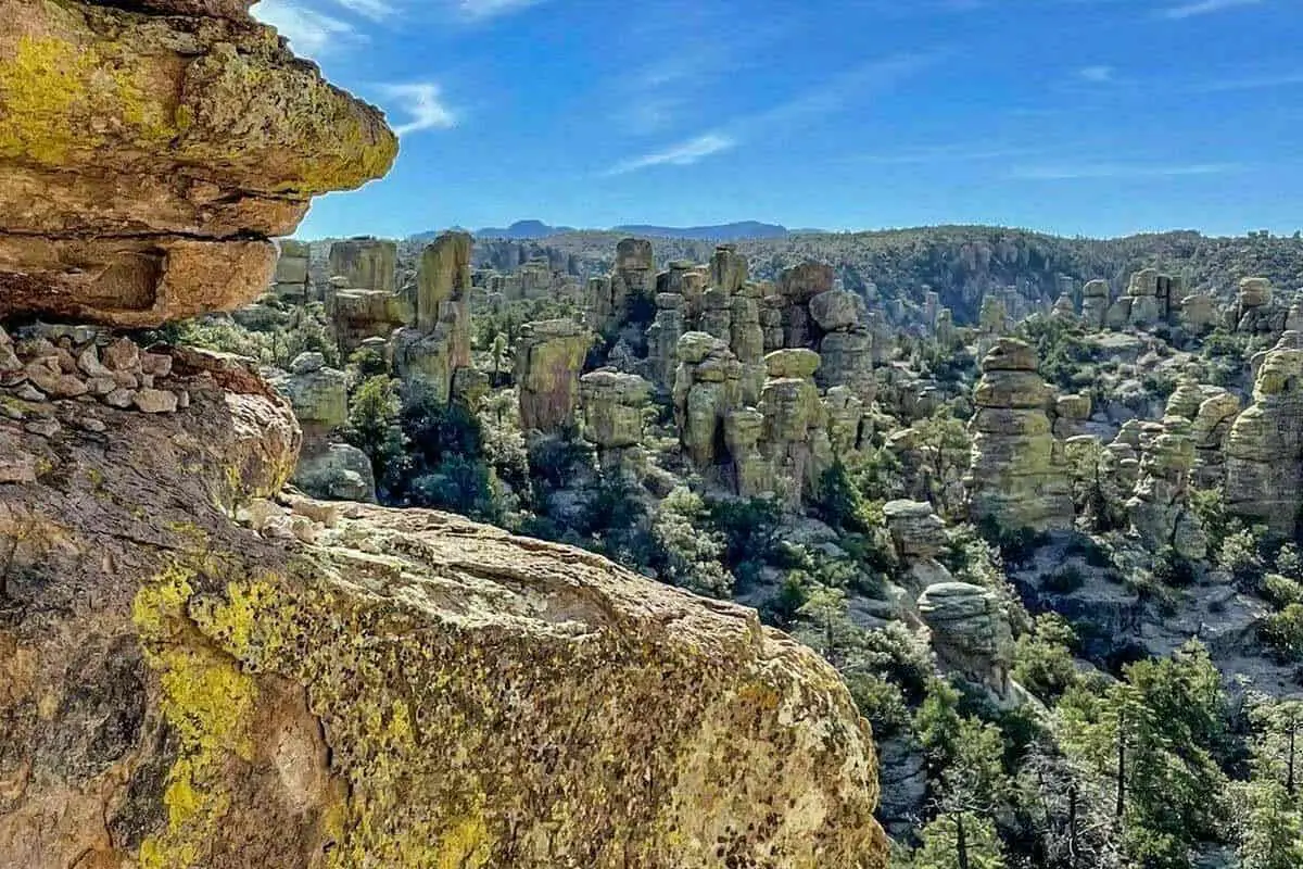
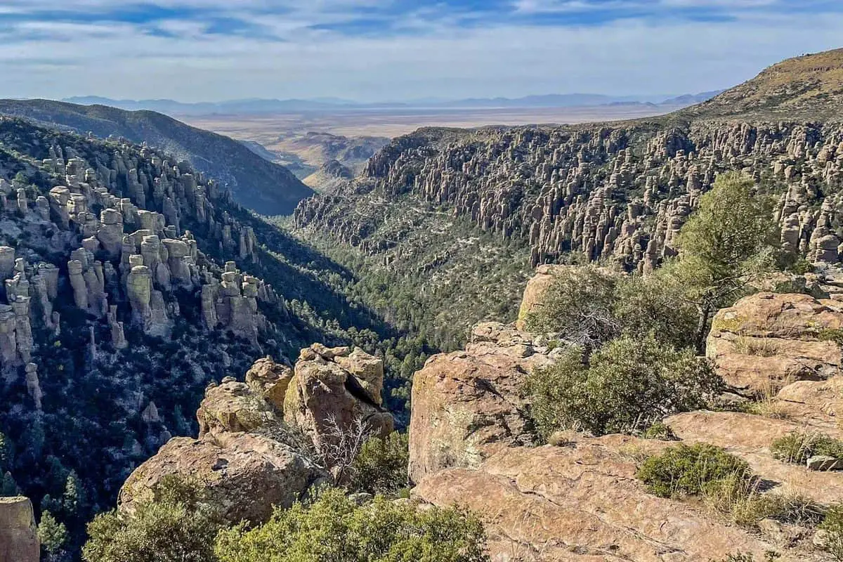
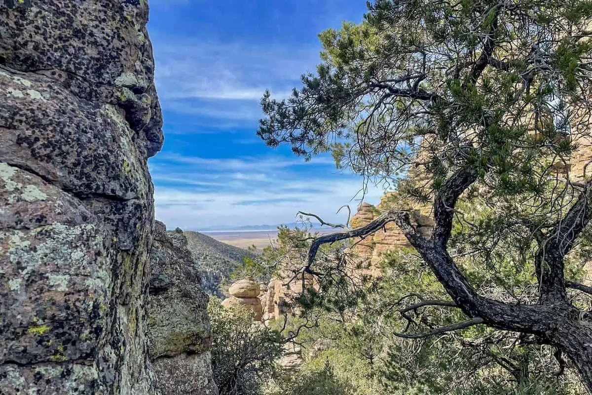
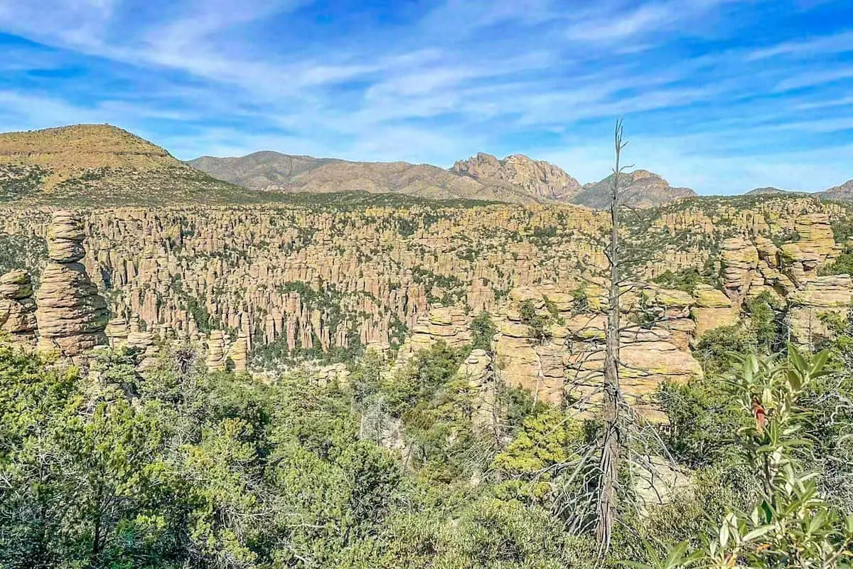
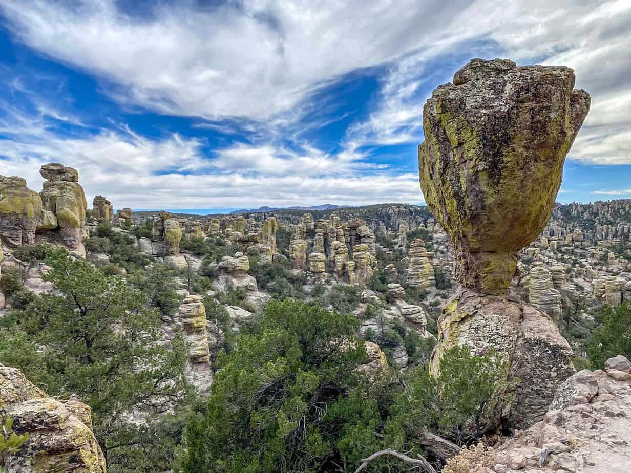
This destination is a must-visit because you will not be the same after a few days there. You drive about 37 miles from the interstate, and at the end, you are welcomed by remarkably balanced rocks, a mountain wonderland of trees, and charismatic wildlife. I was awed by the towering pinnacles, and I got to explore many places and hike on different beautiful trails. If you are planning an adventure, then this is the place to start.
Chiricahua National Monument is a national monument located in Southeastern Arizona in the Chiricahua Mountains. I learned that it was established on April 18 the year 1924 and that helped protect the balancing rocks and extensive hoodoos. There is also a ranch known as the Faraway ranch preserved by the Monument but was once owned by Swedish immigrants. The Chiricahua National Wilderness protects up to 85% of the Monument.
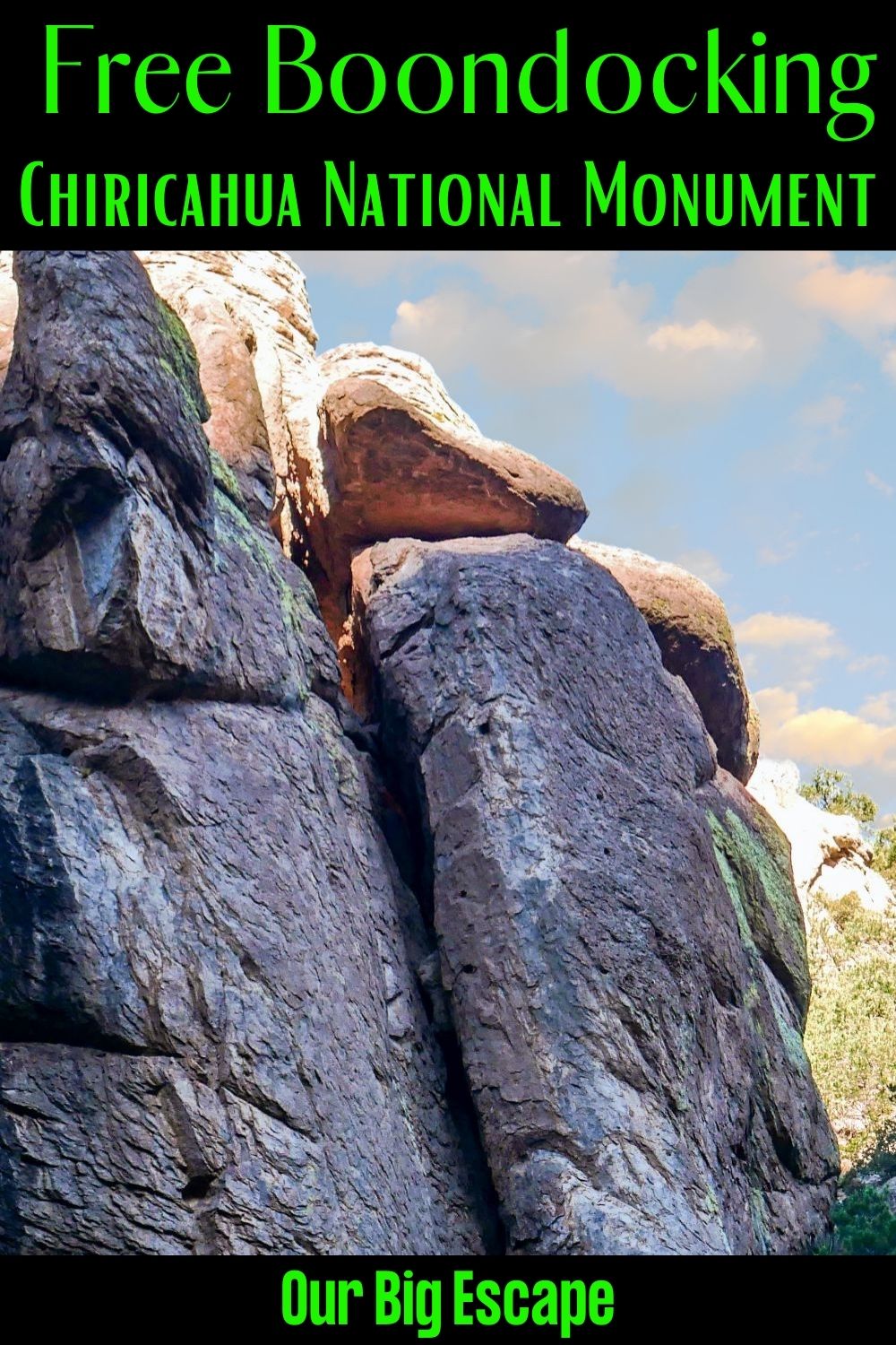
Top 10 Chiricahua National Monument Boondocking Locations
check out our video
1. Chiricahua National Monument Boondocking Locations – Outside Chiricahua National Monument
Address
Willcox, Arizona
GPS: 32.006203, -109.38913
Elevation: 5146′
Management: National Forest Service
The road into this Chiricahua National Monument free campsite is Paved. There are 1-5 campsites at this location and the maximum RV length is Any.
Best Review:
This rig was parked here at least 2 days. I’m not sure how long you could get away with it, but I think it’s the closest free camping spot to Chiricahua you can get. It’s less than 100 yards from the entrance!

2. Chiricahua National Monument Boondocking Locations – Outside Chiricahua National Monument
Address
Pinery Canyon Road
Willcox, Arizona
GPS: 31.979858, -109.36499
Elevation: 5388′
Management: National Forest Service
The road into this Chiricahua National Monument free campsite is Dirt and 5+ miles from a paved road. Pinery Canyon Road is open Year Round. There are 6-15 campsites at this location and the maximum RV length is 41′. You may stay 14 Days at Pinery Canyon Road.
Best Review:
We were there 11-10-2021 and I have to warn you that this is a terrible road in for anything other than a solo 4 wheel drive unit. The road is so badly wash boarded that it is a really tough drive. The spots are there and are nice but if you go stay on the edge of the road and take it slow.
3. Chiricahua National Monument Boondocking Locations – West Turkey Creek
Address
13114 East Turkey Creek Road
Douglas, Arizona
GPS: 31.864595, -109.359273
Elevation: 5909′
Management: National Forest Service
West Turkey Creek is a dispersed campsite for Tents Only.
Best Review:
This small, The road into this Chiricahua National Monument free campsite is located on the banks of West Turkey Creek, a sprightly stream flowing from the Chiricahua high country, which supports healthy populations of silver-barked Arizona sycamores. Rocky, flat-topped peaks form the rim of the canyon here, and Forest trails branch off from the road to follow the side canyons. All of those trails are just a short drive away.
4. Chiricahua National Monument Boondocking Locations – Fort Bowie
Address
Willcox, Arizona
GPS: 32.156612, -109.461052
Elevation: 4874′
Management: National Park Service
The road into this Chiricahua National Monument free campsite is Dirt and 5+ miles from a paved road. Fort Bowie is open Year Round. There are 1-5 campsites at this location and the maximum RV length is Any. Fort Bowie National Historic Site is 8 miles from highway 186. The primary draw to the area is an interpretive trail (1.5 miles one way).
Best Review:
The trailhead is signed no camping, as are most of the pullouts that would be suitable for camping. There is one nice pullout that is not signed and another that is not quite as nice. Camped overnight here with no problems. I’m sure they’ll get around to putting up more signs someday.
5. Chiricahua National Monument Boondocking Locations – Herb Martyr
Address
West Herb Martyr Road
San Simon, Arizona
GPS: 31.872267, -109.234686
Elevation: 5814′
Management: National Forest Service
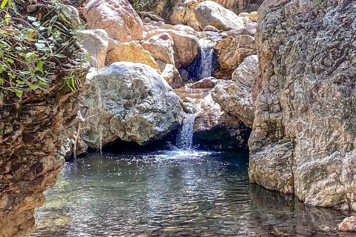
Herb Martyr is open all year. This small streamside dispersed site is located on the banks of Cave Creek at the end of the road that leads into Cave Creek Canyon. Nearby is a small dam built in 1935 (that has since filled in with sediment and debris). During construction of the dam, a worker named Herb Martyr was killed, hence the name of the dam and campground.
Best Review:
The campground has been made a dispersed camping site recently, so no vehicles are allowed in the campground proper. Visitors may park above the campground and carry their camping gear in. There are no garbage cans, so visitors must pack out all trash. All sites are sheltered in the shade of oaks and other streamside trees. The upper site is on the banks of the stream, while the lower sites are on a bench above Cave Creek, which offers a good view of the waterfall formed by Herb Martyr Dam and some smaller natural cascades below it.
6. Chiricahua National Monument Boondocking Locations – John Hands Waterfall
Address
42A Forest Road
San Simon, Arizona
GPS: 31.878019, -109.221981
Elevation: 5630′
Management: National Forest Service
John Hands is open all year. The campground has been made a dispersed camping site recently, so no vehicles are allowed in the campground proper. Visitors may park above the campground and carry their camping gear in. There are no garbage cans, so visitors must pack out all trash. All sites are sheltered in the shade of oaks and other streamside trees.
Best Review:
This camping area is a nice, free option for camping in the area, if you’re fine with walking down with all of your equipment. There is one parking area, which is not that large, and all the sites are “walk in”. No garbage or bathrooms… beautiful waterfall at the end of the sites.
7. Chiricahua National Monument Boondocking Locations – Kuykendall Cutoff (Coronado National Forest)
Address
Willcox, Arizona
GPS: 31.817806, -109.463051
Elevation: 5210′
Management: National Forest Service
The road into this Chiricahua National Monument free campsite is Dirt and 5+ miles from a paved road. Kuykendall Cutoff (Coronado National Forest) is open Year Round. There are 30 or more campsites at this location and the maximum RV length is Any. You may stay 14 Days at Kuykendall Cutoff (Coronado National Forest).
Best Review:
What a great find near Chiricahua NM! The road to the pull off into the spot (national forest) is a little rough. I had no issues though with a 4runner stock and travel trailer. The last spot before it get real rough, as stated in the description is what you want. After your initial cattle gate (entrance) and the 2nd cattle gate, but right at the 3rd gate, take a left into the prarie grass. Do not go into the 3rd gate. You will see a small hill down into the spot with a fire pit. The hill down is a bit rough.
8. Chiricahua National Monument Boondocking Locations – Rucker Canyon Rd
Address
East Rucker Canyon Road
Douglas, Arizona
GPS: 31.76914, -109.340359
Elevation: 5889′
Management: National Forest Service
Free Dispersed camping in the Coronado National Forest’s Douglas Ranger District at this The road into this Chiricahua National Monument free campsite . Reservations are not accepted at this campsite.
Best Review:
This is one of my favorite places to camp. I’d give it three thumbs up but I only have two. Nonetheless, one of the best places for us to camp.
9. Chiricahua National Monument Boondocking Locations – Indian Bread Rocks
Address
Happy Camp Canyon Road
Bowie, Arizona
GPS: 32.238617, -109.500099
Elevation: 4183′
Management: Bureau of Land Management
The road in is Dirt. Indian Bread Rocks is open year-round. There are 1-5 campsites at this location and the maximum RV length is 35′. You may stay 14 nights at Indian Bread Rocks. Indian Bread Rocks.
Best Review:
One of the nicer dispersed camping sites we have found. Many sites open, one or two of the side roads are washed out a bit but we got our camper up one of the worse so unless you brought the whole house the place is totally accessible as far as we have explored. The main road in is fine, only minor wash boarding and firm packed sand so should be ok even if it rains.
10. Chiricahua National Monument Boondocking Locations – Rucker Canyon Road (Coronado National Forest)
Address
Douglas, Arizona
GPS: 31.693525, -109.329323
Elevation: 5416′
Management: National Forest Service
The road in is Dirt and 7+ miles from a paved road. Rucker Canyon Road (Coronado National Forest) is open Year Round. There are 30 or more campsites at this location and the maximum RV length is Any. You may stay 14 Days at Rucker Canyon Road (Coronado National Forest).
Best Review:
None
Top 10 Trails to Hike at Chiricahua National Monument
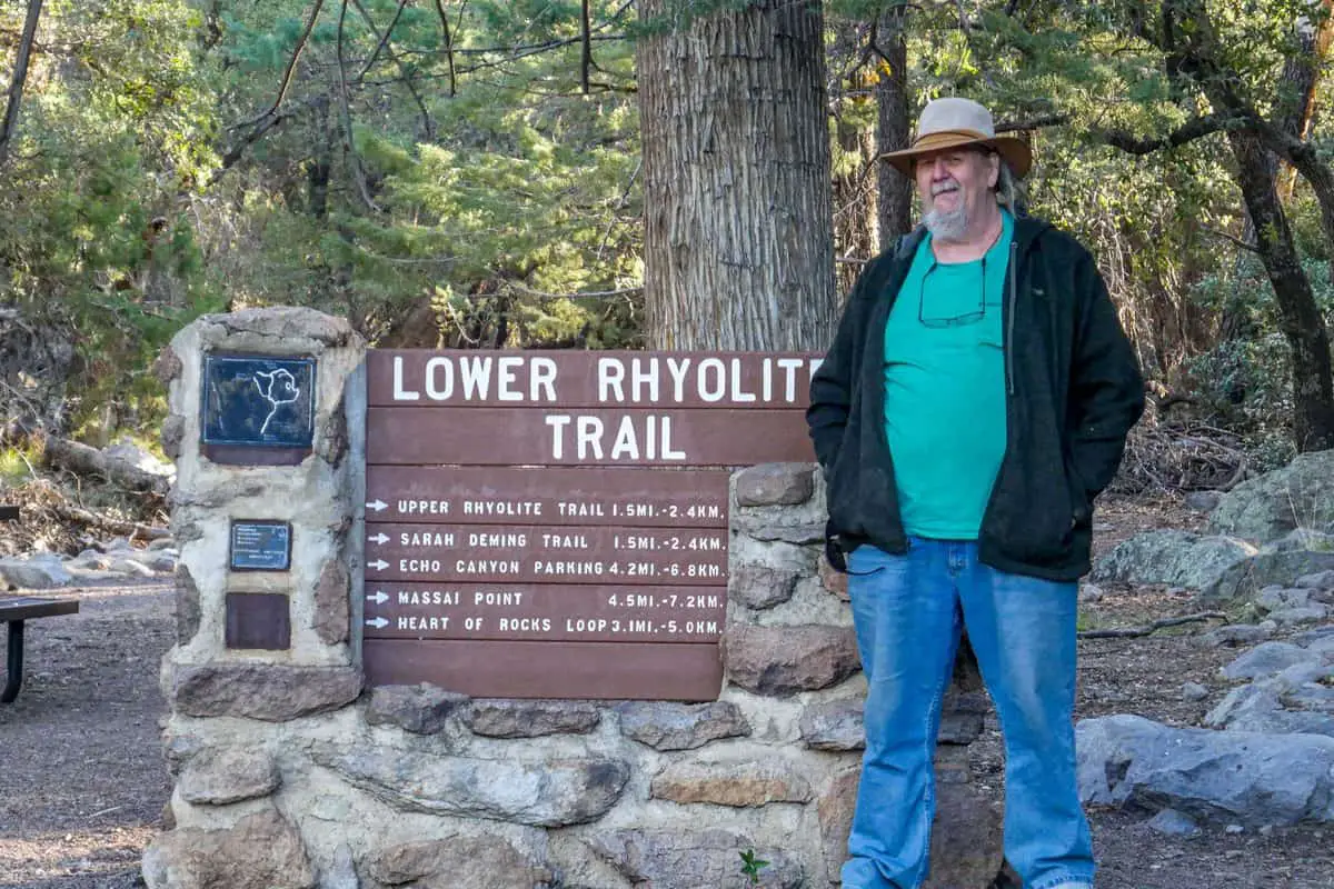
Throughout my visit To Chiricahua National Monument, I got to hike on several trails that I loved a lot. The Monument has over 23 trails, and they are all worth trying out. Just get a map at the visitors center or online and get to enjoy the excellent views. Below are the top 10 trails that I loved the most and ones that you should try out. I have rated them from easy, moderate, and challenging.
Throughout my visit To Chiricahua National Monument, I got to hike on several trails that I loved a lot. The Monument has over 23 trails, and they are all worth trying out. Just get a map at the visitors center or online and get to enjoy the excellent views. Below are the top 10 trails that I loved the most and ones that you should try out. I have rated them from easy, moderate, and challenging.
Chiricahua National Monument Hiking Trail #1. Echo Canyon Loop
This trail I rate moderate not only because it is 4 miles long but because of the sweat. It is located near Wilcox, Arizona, and is heavily trafficked. You can use it to watch birds, for running or hiking, you will enjoy all three. The great thing is that this trail is accessible all year round to visit it when you are free. It is a bit challenging but worth it. We found running water on our way, and it was also very forested halfway up. You will love the scenery.
A great loop trail, or connect to longer hikes up or down Rhyolite Canyon. And kudos to the National Park for excellent trail building and maintenance — let’s all remember how hard they work for us and make sure they have the support they deserve.
Length: 4.0 mi
Elevation gain: 593 ft
Route type: Loop
Kid friendly, Hiking, Bird watching, Running, Cave, Forest, Views, Wildlife, Rocky, No dogs
Chiricahua National Monument Hiking Trail #2. The Big Loop
The big loop is one of the most challenging trails that I tried out. It is 13.2 miles long and heavily trafficked. I got to enjoy the stunning wildflowers, and the rest of the view was also fantastic. The trail is well maintained, which I like a lot, and well signed to avoid getting lost. We hiked at a slow rate, but we still made it in time. There were a few places with shade where we could rest, but most of the trail was exposed. Try this trail if you are adventurous but if not, look for a more accessible trail.
It was pretty beautiful, the trail was very well-maintained and easy to navigate through. Overall the hike was fantastic with some pretty amazing views. I would not recommend going in the summer months unless you’re starting earlier than 7 AM as there are some parks with very little shade.
Length: 13.2 mi
Elevation gain: 2,837 ft
Route type: Loop
Hiking, Nature trips, Bird watching, Views, Wildflowers, Wildlife, No shade, No dogs
Chiricahua National Monument Hiking Trail #3. Heart of Rocks Loop
This trail is also pretty hard; it is 6.5 mile long and located next to San Simon, Arizona. I got the chance to see some wildlife, and I would recommend it. With this trail, you will fall in love with the outdoors and want to go back again. If you are a seasoned hiker, this trail will be a breeze for you. There are excellent views that will make you want to come back again.
This is wilderness is such a gem. Did trail work and restoration work here a few years back. If you want to be amazed and fall in love with the great outdoors this is the place
Length: 6.5 mi
Elevation gain:
1,614 ft
Route type: Loop
Hiking, Views, Wildlife, Rocky, No dogs
Chiricahua National Monument Hiking Trail #4. Heart of Rocks Loop from Echo Canyon Trailhead
For me, this trail was moderate, and that means anyone can try it out. It features lovely flowers, and you can even use it as a nature trail. The trail is also opened all year round, making it convenient for everyone. A storm caught us on our way up, but there were several rock shelters where we took cover. We only saw two other groups, which made the trail very secluded and peaceful. There were several rock formations that I found interesting, and the overall experience was great.
Absolutely beautiful. There were sporadic storms, so we kept an eye out for rock shelters which were interspersed throughout the trail. We also encountered a baby rattlesnake near the top of the Heart of Rocks trail. Watch out for them, especially on sunny, rocky outcrops.
Length: 6.9 mi
Elevation gain: 1,574 ft
Route type: Out & back
Hiking, Views, Wildflowers, Rocky, Snow, No shade, No dogs
Chiricahua National Monument Hiking Trail #5. Natural Bridge
This Natural Bridge trail measures 4 mile long and can be rated as moderate. It is near Bowie, which is located in Arizona. It features a magnificent river, and you can use it for a nature trip or hiking. Much of the trail was exposed, so be prepared to sweat if you hike on a hot day. There was also a small natural bridge where people were not allowed not to get destroyed. Overall, the hike was pretty great, and I enjoyed it a lot.
About 4.8 miles. Much of the trail is very exposed so it can be quite hot. The natural bridge is beautiful and small and appropriately protected from people climbing on and destroying it. Great hike.
Length: 4.0 mi
Elevation gain: 1,010 ft
Route type: Out & back
Hiking, Nature trips, Forest, River, Wildflowers, Wildlife, Rocky, No dogs
Chiricahua National Monument Hiking Trail #6. Sugarloaf Mountain
This trail was easy to navigate, measures 1.8 miles and is located near Bowie, Arizona. I had a chance to see several wildlife, and you can use it for walking, hiking and even for running. There were some small, complex paths up, but it was worth it. The day was a bit hot, but there was some wind which did help. The trail was excellently maintained, and they also had great bathrooms, which was a plus.
This was our third trail of the day (echo loop and the little Massai nature trail earlier). It was worth doing. Nice views. There was a strong wind which kept it from being too hot. Like the entire park, this trail is well marked and maintained and there were good bathrooms.
Length: 1.8 mi
Elevation gain: 482 ft
Route type: Out & back
Kid friendly, Hiking, Walking, Running, Views, Wildlife, Rocky, No dogs
Chiricahua National Monument Hiking Trail #7. Massai Point Overlook
This trail can be rated as easy, and it is 0.6 km long and moderately trafficked. We had to see several wildlife which we enjoyed a lot so carry your good camera. It is also open all year round, which is a definite plus when it comes to convenience. That day was a bit windy, but overall the whole experience was great. The information signs also helped a lot, and we did not get lost.
Easy trail, but you get phenomenal views! Definitely the highlight of my time in Chiricahua National Monument!
Length: 0.4 mi
Elevation gain: 52 ft
Route type: Loop
Wheelchair friendly, Kid friendly, Stroller friendly, Hiking, Nature trips, Walking, Partially paved, Views, Wildlife, No dogs
Chiricahua National Monument Hiking Trail #8. Bonita Canyon Scenic Drive
The Bonita Canyon Scenic Drive is also one of the best trails in Chiricahua National Monument. It is 12.6 km long and locates next to San Simon, which is in Arizona. The trail is open all year round and is excellent for bird watching. We hiked in late June, and the weather was great and very comfortable. The trail was well maintained and very easy so that anyone could manage it.
Length: 7.8 mi
Elevation gain: 1,801 ft
Route type: Point to point
Kid friendly, Nature trips, Scenic driving, Bird watching, Forest, Paved, Views, Wildlife
Chiricahua National Monument Hiking Trail #9. South Fork Trail #243
This was also one of the most accessible trails I had the chance to go up. It is 6.6 km long and is located near Rodeo, New Mexico. It is accessible all year round, and we got to see some people with their dogs which means you can come with your whole family. The trail was well maintained and marked, and the slope was gentle. It is very shaded, so you will have many places to relax and enjoy the view.
Well-marked and maintained trail with a gentle slope that should be good for all abilities. Nearly 100% shaded. A few spots had new rock in place to stop trail deterioration, which the pup didn’t like but it didn’t stop her. Plenty of parking at the trailhead, which is where the port-a-potties are located. Went Fourth of July weekend and only saw two other hikers using the trail.
Length: 4.1 mi
Elevation gain: 419 ft
Route type: Out & back
Kid friendly, Hiking, Nature trips, Walking, Bird watching, Running, Dog friendly, Forest, River, Views, Waterfall, Wildlife, Rocky, Washed out
Chiricahua National Monument Hiking Trail #10. Rhyolite Canyon Trail
This trail was straightforward to navigate, and I recommend it to people who have never hiked before. It features lovely flowers, and you can use it for running, hiking, or bird watching if you love birds. It was easy to go in and out hence lovely for the whole family. The first half was shaded, but the rest of the way up was exposed. Great experience overall, definitely recommend.
Returned to Chiricahua after visiting years ago, and it’s still magical. Parked at the visitor center and hiked up Rhyolite Canyon to heart of the rocks. Shaded almost the entire way and very quite. Heart of the Rocks is so awesome! The Duck!
Length: 4.8 mi
Elevation gain: 1,007 ft
Route type: Out & back
Kid friendly, Hiking, Bird watching, Running, Wildflowers, Wildlife, No dogs
Conclusion
The experience we had at Chiricahua National Monument was great, and will certainly go back again. Most of it is open all year round, so that makes it very convenient. If it is your first time hiking, go for the easy trails; try out the moderate trails if you feel adventurous. If you have some time and love the outdoors, then the Chiricahua National Monument is a must-visit.
Places and Things to Do and See in Chiricahua National Monument
Chiricahua National Monument is known to be a wonderland of rocks that is great for exploration. There is an 8-mile pavement where you can drive through and experience different scenes if you prefer driving. There are also different trails for those who love to hike and many other things to do. We loved ourbvisit there and shared some of the activities I participated in and the most views. We only had one day to spend in the monument and will be back for a longer stay next time.
Hiking
Whether you love hiking or not, hiking is very beneficial to your health. The Chiricahua National Monument has a lot of beautiful trails that you can choose to hike or run. You also earn a pin called I hike for health when you hike on one of the trails. The trails were beautiful, but some were hard, and you had to be active to reach the top and back.
Bonita Canyon Campground
Yes, I got the chance to camp; after a whole day of hiking and site seeing, we got a great place to pitch a tent and rest. We had made reservations earlier, so if you are interested in camping, you have to make sure that you reserve earlier on through the system.
Ranger-guided Programs
Chiricahua National Monument also offers several ranger-guided programs where the ranger teaches you as you go on a trail. It was a great way to learn more about the Monument and all its history and culture. You also have to check the calendar and see the available programs before making a reservation if you want to take the tour.
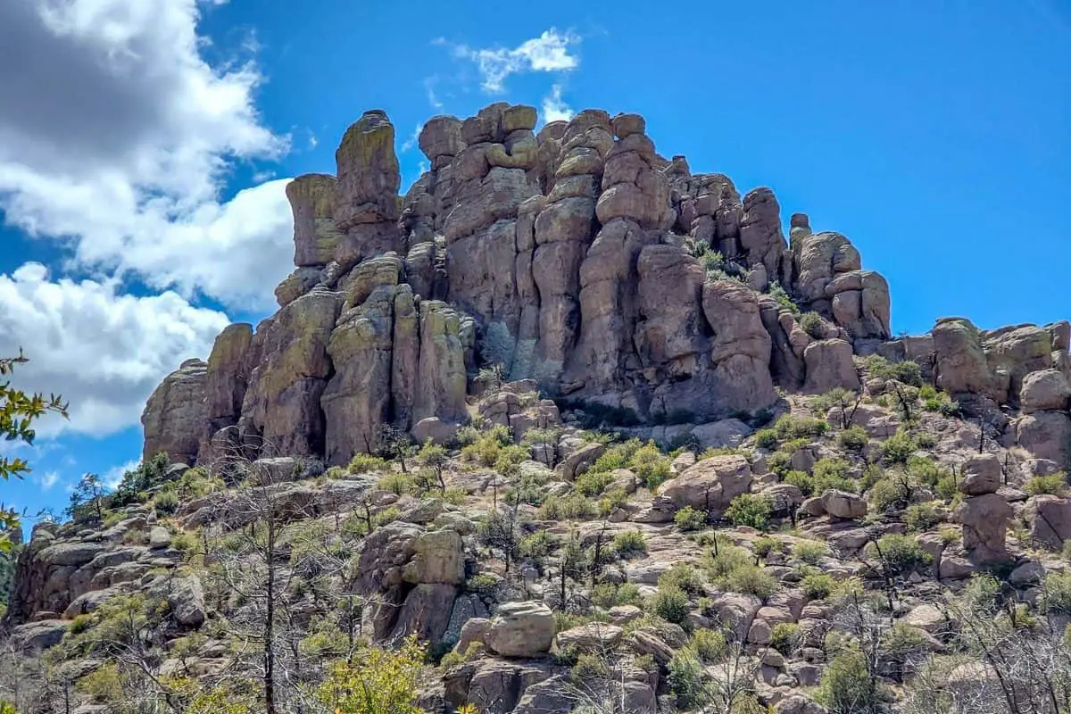
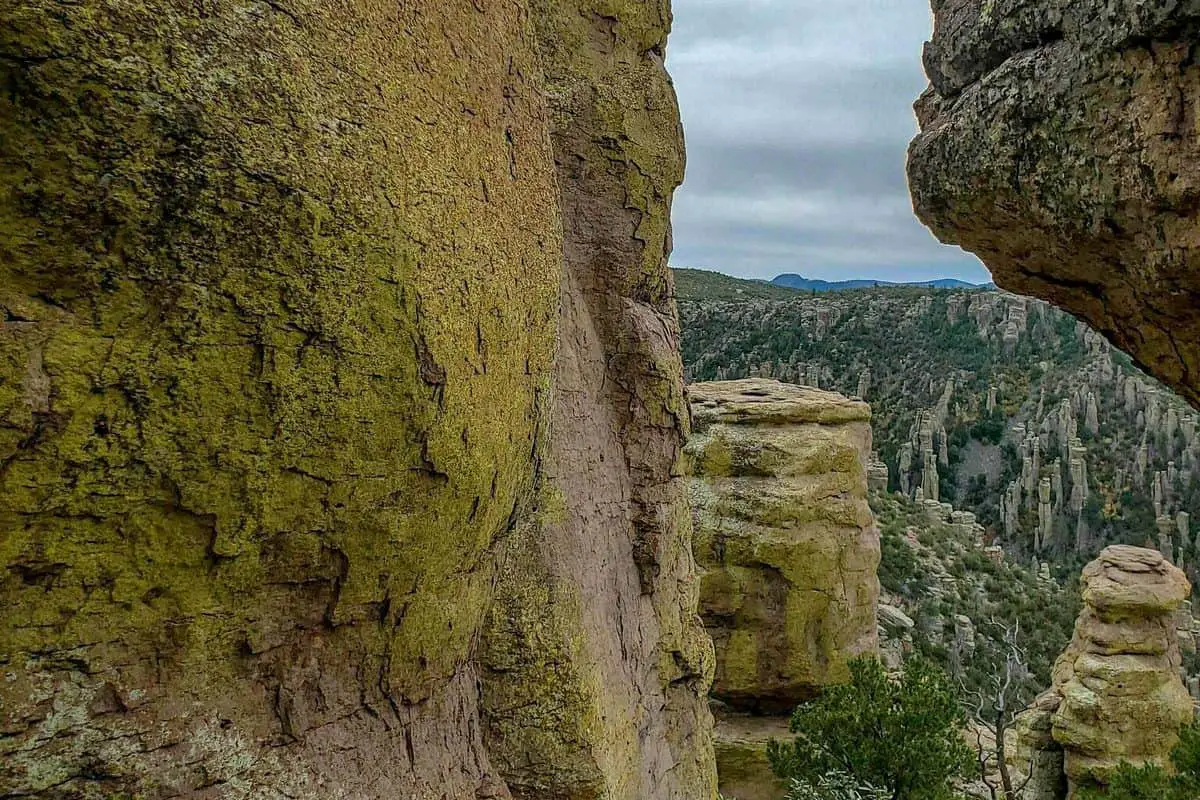
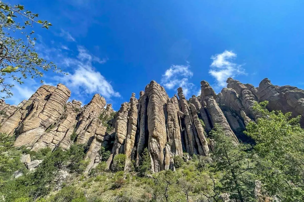
Geologic Formations
This is one of the main reasons you should visit the Chiricahua National Monument. It is a very noticeable feature that you will love. Some features include faults, shallow caves, ancient lava flows, giant volcanic caldera, and mountain formations. I got to enjoy all of these features and would recommend the Monument to someone else.
Birds
As someone who loves bird watching, I like that Chiricahua National Monument had many birds that call the place home. The area has even been recognized as an important bird area, and I got to see some of the Endangered and threatened species of the birds.
Animals
The Chiricahua National Monument is also home to different animals. I got to see a black bear, a western box turtle, and even the cactus wren. Some of the other animals I got the chance to see included a goshawk and a white-tailed deer.
History and Culture
I loved the history and culture of the place. There are stories of people who lived there for thousands of years, and they have a rich history in the place. I also got to learn about how the rocks were formed. Even historical photos helped get the whole concept and understand the area even more.
You May Want to Join Our Boondocking Group on Facebook For More Information
You May Want to Join Our Campfire Recipes Group on Facebook For More Information