The share link has been copied to clipboard

Things To Do When Visiting Mount Charleston Nevada

visibility 27K views calendar_month Jan 26, 2023
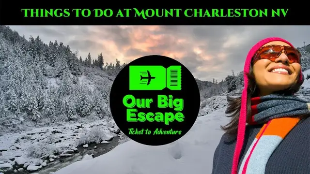
EXPLORE MOUNT CHARLESTON HIKING, CAMPING, & MUCH MORE! Over 50 miles of maintained trails wind through the Spring Mountains National Recreation Area, along with 4 campgrounds, 7 picnic areas, and remote areas for dispersed camping. Picnic area hours vary by site and season. ✅ Explore Super Mount Charleston Nevada Camping Stops https://ourbigescape.com/9-super-mount-charleston-nevada-camping-stops/ ✅ Learn more about 3 Fun Days Creating This Mount Charleston Video https://ourbigescape.com/3-fun-days-creating-this-mount-charleston-video/ 🔴 Subscribe to Our Big Escape Channel for more videos just like this: https://www.youtube.com/channel/UCui8qQuvNXnj5ssL5Y9nDuA?sub_confirmation=1 History of Mount Charleston Nevada It was named after the town of Charleston in South Carolina, one of the US' oldest settler towns, in 1869. This was the home of a member of the US Army Corps of Engineers who passed the mountain as part of a surveying trip to prepare the area for railroad construction. Where is Mount Charleston Located The distance between Las Vegas and Mount Charleston is 29 miles. The road distance is 39.1 miles. Mount Charleston Nevada Directions The Spring Mountains Scenic Drive, also known as the Mt. Charleston Loop, is a paved forty-one mile drive that leads up into the high elevations of the Spring Mountains that are located to the northwest of Las Vegas. The drive has significant elevation changes. WHAT TO DO AT MOUNT CHARLESTON Mount Charleston Nevada Hiking Trails: Maintained trails wind through the area, most starting at over 6000ft in elevation and some culminating at the 11,916ft Charleston Peak. Hikers should be prepared for increased sun exposure and avoid dehydration due to the high elevation, and prepare to turn around or shelter in place for mountain lightning storms in summer. 1. EAGLES NEST - Easy, 2.7 miles (round-trip loop). 2. BRISTLECONE LOOP - Moderate, 6.3 miles (round-trip loop). 3. SAWMILL TRAILHEAD - Easy, 2.6 miles. 4. DESERT VIEW OVERLOOK - Easy, 0.4 miles (round-trip). 5. MAHOGANY GROVE - Easy, 0.1 mile 6. ROBBER’S ROOST - Moderate, 0.4 miles (round trip). 7. MT CHARLESTON SOUTH LOOP TRAIL - Most Difficult, 8.5 miles to Charleston Peak 8. CATHEDRAL ROCK TRAIL - More Difficult, 2.8 miles. 9. MARY JANE FALLS - More difficult, 3.2 miles (round trip). 10. TRAIL CANYON - More Difficult, 4.4 miles (round trip). 11. ACASTUS TRAIL - Easy/Moderate, 3 miles (round trip). 12. PACK RAT ROUTE - More Difficult, 1.4 miles (round trip). Mount Charleston Nevada Cabin Rentals There are rentals near popular attractions in Mount Charleston, or you can choose a more remote option if you're looking for relaxation. Visitors like the top-notch restaurants and mountain landscape in Mount Charleston. Mount Charleston Nevada Wildlife Fans of flying mammals will discover more than 18 species of bats spending time in the Spring Mountains over the cycles of seasons. Rabbits and rodents are very well represented in the Wilderness. Mule deer, desert bighorn sheep, pronghorn, and an occasional elk my be spotted in the Spring Mountains. Are There bears in Mount Charleston Nevada Did you know that there are no bears in the Spring Mountains? Although our grand cliffs, towering trees, and bushes filled with berries may look like the perfect habitat, bears have never lived here! Mount Charleston Nevada Ski Resort One of the most popular things to do at Mount Charleston is to play in the snow. Visitors of all ages can enjoy everything from skiing and snowboarding to sledding and tubing. Mount Charleston Nevada Snow Tubing Snowshoeing, sledding, building snowmen, making snow angels, and winter wildlife watching are just a few of the things you can do in the winter. Adventurous visitors can go tubing, ski, and snowboard at the Lee Canyon Ski & Snowboard Resort in Lee Canyon. Remember, sudden snow is possible from fall through spring, and in the winter all trails may become impassible with snow and ice. Hikers should always watch the weather and check for flood, lightning, and avalanche warnings. ~~~ Social Media ~~~ 👥 Facebook: https://www.facebook.com/ARoadtoTravel/ 🐦 Twitter: https://twitter.com/aroadtotravel 📸 Instagram: https://www.instagram.com/ourbigescape/ P Pinterest: https://www.pinterest.com/ourbigescape
Show More keyboard_arrow_down
sell
#Tourist Destinations
Recommended Videos
loading text loading

loading text loading

loading text loading

loading text loading

loading text loading

loading text loading

loading text loading

loading text loading

loading text loading

loading text loading

loading text loading

loading text loading

loading text loading

loading text loading

loading text loading

loading text loading